
Federal motorway 7
| Bundesautobahn 7 in Germany | |||||||||||||||||||||||||||||||||||||||||||||||||||||||||||||||||||||||||||||||||||||||||||||||||||||||||||||||||||||||||||||||||||||||||||||||||||||||||||||||||||||||||||||||||||||||||||||||||||||||||||||||||||||||||||||||||||||||||||||||||||||||||||||||||||||||||||||||||||||||||||||||||||||||||||||||||||||||||||||||||||||||||||||||||||||||||||||||||||||||||||||||||||||||||||||||||||||||||||||||||||||||||||||||||||||||||||||||||||||||||||||||||||||||||||||||||||||||||||||||||||||||||||||||||||||||||||||||||||||||||||||||||||||||||||||||||||||||||||||||||||||||||||||||||||||||||||||||||||||||||||||||||||||||||||||||||||||||||||||||||||||||||||||||||||||||||||||||||||||||||||||||||||||||||||||||||||||||||||||||||||||||||||||||||||||||||||||||||||||||||||||||||||||||||||||||||||||||||||||||||||||||||||||||||||||||||||||||||||||||||||||||||||||||||||||||||||||||||||||||||||||||||||||||||||||||||||||||||||||||||||||||||||||||||||||||||||||||||||||||||||||||||||||||||||||||||||||||||||||||

|
|||||||||||||||||||||||||||||||||||||||||||||||||||||||||||||||||||||||||||||||||||||||||||||||||||||||||||||||||||||||||||||||||||||||||||||||||||||||||||||||||||||||||||||||||||||||||||||||||||||||||||||||||||||||||||||||||||||||||||||||||||||||||||||||||||||||||||||||||||||||||||||||||||||||||||||||||||||||||||||||||||||||||||||||||||||||||||||||||||||||||||||||||||||||||||||||||||||||||||||||||||||||||||||||||||||||||||||||||||||||||||||||||||||||||||||||||||||||||||||||||||||||||||||||||||||||||||||||||||||||||||||||||||||||||||||||||||||||||||||||||||||||||||||||||||||||||||||||||||||||||||||||||||||||||||||||||||||||||||||||||||||||||||||||||||||||||||||||||||||||||||||||||||||||||||||||||||||||||||||||||||||||||||||||||||||||||||||||||||||||||||||||||||||||||||||||||||||||||||||||||||||||||||||||||||||||||||||||||||||||||||||||||||||||||||||||||||||||||||||||||||||||||||||||||||||||||||||||||||||||||||||||||||||||||||||||||||||||||||||||||||||||||||||||||||||||||||||||||||||||
|
|
|||||||||||||||||||||||||||||||||||||||||||||||||||||||||||||||||||||||||||||||||||||||||||||||||||||||||||||||||||||||||||||||||||||||||||||||||||||||||||||||||||||||||||||||||||||||||||||||||||||||||||||||||||||||||||||||||||||||||||||||||||||||||||||||||||||||||||||||||||||||||||||||||||||||||||||||||||||||||||||||||||||||||||||||||||||||||||||||||||||||||||||||||||||||||||||||||||||||||||||||||||||||||||||||||||||||||||||||||||||||||||||||||||||||||||||||||||||||||||||||||||||||||||||||||||||||||||||||||||||||||||||||||||||||||||||||||||||||||||||||||||||||||||||||||||||||||||||||||||||||||||||||||||||||||||||||||||||||||||||||||||||||||||||||||||||||||||||||||||||||||||||||||||||||||||||||||||||||||||||||||||||||||||||||||||||||||||||||||||||||||||||||||||||||||||||||||||||||||||||||||||||||||||||||||||||||||||||||||||||||||||||||||||||||||||||||||||||||||||||||||||||||||||||||||||||||||||||||||||||||||||||||||||||||||||||||||||||||||||||||||||||||||||||||||||||||||||||||||||||||
| map | |||||||||||||||||||||||||||||||||||||||||||||||||||||||||||||||||||||||||||||||||||||||||||||||||||||||||||||||||||||||||||||||||||||||||||||||||||||||||||||||||||||||||||||||||||||||||||||||||||||||||||||||||||||||||||||||||||||||||||||||||||||||||||||||||||||||||||||||||||||||||||||||||||||||||||||||||||||||||||||||||||||||||||||||||||||||||||||||||||||||||||||||||||||||||||||||||||||||||||||||||||||||||||||||||||||||||||||||||||||||||||||||||||||||||||||||||||||||||||||||||||||||||||||||||||||||||||||||||||||||||||||||||||||||||||||||||||||||||||||||||||||||||||||||||||||||||||||||||||||||||||||||||||||||||||||||||||||||||||||||||||||||||||||||||||||||||||||||||||||||||||||||||||||||||||||||||||||||||||||||||||||||||||||||||||||||||||||||||||||||||||||||||||||||||||||||||||||||||||||||||||||||||||||||||||||||||||||||||||||||||||||||||||||||||||||||||||||||||||||||||||||||||||||||||||||||||||||||||||||||||||||||||||||||||||||||||||||||||||||||||||||||||||||||||||||||||||||||||||||||
 |
|||||||||||||||||||||||||||||||||||||||||||||||||||||||||||||||||||||||||||||||||||||||||||||||||||||||||||||||||||||||||||||||||||||||||||||||||||||||||||||||||||||||||||||||||||||||||||||||||||||||||||||||||||||||||||||||||||||||||||||||||||||||||||||||||||||||||||||||||||||||||||||||||||||||||||||||||||||||||||||||||||||||||||||||||||||||||||||||||||||||||||||||||||||||||||||||||||||||||||||||||||||||||||||||||||||||||||||||||||||||||||||||||||||||||||||||||||||||||||||||||||||||||||||||||||||||||||||||||||||||||||||||||||||||||||||||||||||||||||||||||||||||||||||||||||||||||||||||||||||||||||||||||||||||||||||||||||||||||||||||||||||||||||||||||||||||||||||||||||||||||||||||||||||||||||||||||||||||||||||||||||||||||||||||||||||||||||||||||||||||||||||||||||||||||||||||||||||||||||||||||||||||||||||||||||||||||||||||||||||||||||||||||||||||||||||||||||||||||||||||||||||||||||||||||||||||||||||||||||||||||||||||||||||||||||||||||||||||||||||||||||||||||||||||||||||||||||||||||||||||
| Basic data | |||||||||||||||||||||||||||||||||||||||||||||||||||||||||||||||||||||||||||||||||||||||||||||||||||||||||||||||||||||||||||||||||||||||||||||||||||||||||||||||||||||||||||||||||||||||||||||||||||||||||||||||||||||||||||||||||||||||||||||||||||||||||||||||||||||||||||||||||||||||||||||||||||||||||||||||||||||||||||||||||||||||||||||||||||||||||||||||||||||||||||||||||||||||||||||||||||||||||||||||||||||||||||||||||||||||||||||||||||||||||||||||||||||||||||||||||||||||||||||||||||||||||||||||||||||||||||||||||||||||||||||||||||||||||||||||||||||||||||||||||||||||||||||||||||||||||||||||||||||||||||||||||||||||||||||||||||||||||||||||||||||||||||||||||||||||||||||||||||||||||||||||||||||||||||||||||||||||||||||||||||||||||||||||||||||||||||||||||||||||||||||||||||||||||||||||||||||||||||||||||||||||||||||||||||||||||||||||||||||||||||||||||||||||||||||||||||||||||||||||||||||||||||||||||||||||||||||||||||||||||||||||||||||||||||||||||||||||||||||||||||||||||||||||||||||||||||||||||||||||
| Operator: |
|
||||||||||||||||||||||||||||||||||||||||||||||||||||||||||||||||||||||||||||||||||||||||||||||||||||||||||||||||||||||||||||||||||||||||||||||||||||||||||||||||||||||||||||||||||||||||||||||||||||||||||||||||||||||||||||||||||||||||||||||||||||||||||||||||||||||||||||||||||||||||||||||||||||||||||||||||||||||||||||||||||||||||||||||||||||||||||||||||||||||||||||||||||||||||||||||||||||||||||||||||||||||||||||||||||||||||||||||||||||||||||||||||||||||||||||||||||||||||||||||||||||||||||||||||||||||||||||||||||||||||||||||||||||||||||||||||||||||||||||||||||||||||||||||||||||||||||||||||||||||||||||||||||||||||||||||||||||||||||||||||||||||||||||||||||||||||||||||||||||||||||||||||||||||||||||||||||||||||||||||||||||||||||||||||||||||||||||||||||||||||||||||||||||||||||||||||||||||||||||||||||||||||||||||||||||||||||||||||||||||||||||||||||||||||||||||||||||||||||||||||||||||||||||||||||||||||||||||||||||||||||||||||||||||||||||||||||||||||||||||||||||||||||||||||||||||||||||||||||||||
| further operator: | Via Solutions Nord (between AD Bordesholm and AD Hamburg-Nordwest) Via Niedersachsen (between Bockenem and Göttingen) |
||||||||||||||||||||||||||||||||||||||||||||||||||||||||||||||||||||||||||||||||||||||||||||||||||||||||||||||||||||||||||||||||||||||||||||||||||||||||||||||||||||||||||||||||||||||||||||||||||||||||||||||||||||||||||||||||||||||||||||||||||||||||||||||||||||||||||||||||||||||||||||||||||||||||||||||||||||||||||||||||||||||||||||||||||||||||||||||||||||||||||||||||||||||||||||||||||||||||||||||||||||||||||||||||||||||||||||||||||||||||||||||||||||||||||||||||||||||||||||||||||||||||||||||||||||||||||||||||||||||||||||||||||||||||||||||||||||||||||||||||||||||||||||||||||||||||||||||||||||||||||||||||||||||||||||||||||||||||||||||||||||||||||||||||||||||||||||||||||||||||||||||||||||||||||||||||||||||||||||||||||||||||||||||||||||||||||||||||||||||||||||||||||||||||||||||||||||||||||||||||||||||||||||||||||||||||||||||||||||||||||||||||||||||||||||||||||||||||||||||||||||||||||||||||||||||||||||||||||||||||||||||||||||||||||||||||||||||||||||||||||||||||||||||||||||||||||||||||||||||
| Start of the street: |
Handewitt ( 54 ° 48 ′ 21 ″ N , 9 ° 19 ′ 41 ″ E ) |
||||||||||||||||||||||||||||||||||||||||||||||||||||||||||||||||||||||||||||||||||||||||||||||||||||||||||||||||||||||||||||||||||||||||||||||||||||||||||||||||||||||||||||||||||||||||||||||||||||||||||||||||||||||||||||||||||||||||||||||||||||||||||||||||||||||||||||||||||||||||||||||||||||||||||||||||||||||||||||||||||||||||||||||||||||||||||||||||||||||||||||||||||||||||||||||||||||||||||||||||||||||||||||||||||||||||||||||||||||||||||||||||||||||||||||||||||||||||||||||||||||||||||||||||||||||||||||||||||||||||||||||||||||||||||||||||||||||||||||||||||||||||||||||||||||||||||||||||||||||||||||||||||||||||||||||||||||||||||||||||||||||||||||||||||||||||||||||||||||||||||||||||||||||||||||||||||||||||||||||||||||||||||||||||||||||||||||||||||||||||||||||||||||||||||||||||||||||||||||||||||||||||||||||||||||||||||||||||||||||||||||||||||||||||||||||||||||||||||||||||||||||||||||||||||||||||||||||||||||||||||||||||||||||||||||||||||||||||||||||||||||||||||||||||||||||||||||||||||||||
| End of street: |
Füssen ( 47 ° 33 ′ 33 ″ N , 10 ° 39 ′ 23 ″ E ) |
||||||||||||||||||||||||||||||||||||||||||||||||||||||||||||||||||||||||||||||||||||||||||||||||||||||||||||||||||||||||||||||||||||||||||||||||||||||||||||||||||||||||||||||||||||||||||||||||||||||||||||||||||||||||||||||||||||||||||||||||||||||||||||||||||||||||||||||||||||||||||||||||||||||||||||||||||||||||||||||||||||||||||||||||||||||||||||||||||||||||||||||||||||||||||||||||||||||||||||||||||||||||||||||||||||||||||||||||||||||||||||||||||||||||||||||||||||||||||||||||||||||||||||||||||||||||||||||||||||||||||||||||||||||||||||||||||||||||||||||||||||||||||||||||||||||||||||||||||||||||||||||||||||||||||||||||||||||||||||||||||||||||||||||||||||||||||||||||||||||||||||||||||||||||||||||||||||||||||||||||||||||||||||||||||||||||||||||||||||||||||||||||||||||||||||||||||||||||||||||||||||||||||||||||||||||||||||||||||||||||||||||||||||||||||||||||||||||||||||||||||||||||||||||||||||||||||||||||||||||||||||||||||||||||||||||||||||||||||||||||||||||||||||||||||||||||||||||||||||||
| Overall length: | 962.2 km | ||||||||||||||||||||||||||||||||||||||||||||||||||||||||||||||||||||||||||||||||||||||||||||||||||||||||||||||||||||||||||||||||||||||||||||||||||||||||||||||||||||||||||||||||||||||||||||||||||||||||||||||||||||||||||||||||||||||||||||||||||||||||||||||||||||||||||||||||||||||||||||||||||||||||||||||||||||||||||||||||||||||||||||||||||||||||||||||||||||||||||||||||||||||||||||||||||||||||||||||||||||||||||||||||||||||||||||||||||||||||||||||||||||||||||||||||||||||||||||||||||||||||||||||||||||||||||||||||||||||||||||||||||||||||||||||||||||||||||||||||||||||||||||||||||||||||||||||||||||||||||||||||||||||||||||||||||||||||||||||||||||||||||||||||||||||||||||||||||||||||||||||||||||||||||||||||||||||||||||||||||||||||||||||||||||||||||||||||||||||||||||||||||||||||||||||||||||||||||||||||||||||||||||||||||||||||||||||||||||||||||||||||||||||||||||||||||||||||||||||||||||||||||||||||||||||||||||||||||||||||||||||||||||||||||||||||||||||||||||||||||||||||||||||||||||||||||||||||||||||
|
State : |
|||||||||||||||||||||||||||||||||||||||||||||||||||||||||||||||||||||||||||||||||||||||||||||||||||||||||||||||||||||||||||||||||||||||||||||||||||||||||||||||||||||||||||||||||||||||||||||||||||||||||||||||||||||||||||||||||||||||||||||||||||||||||||||||||||||||||||||||||||||||||||||||||||||||||||||||||||||||||||||||||||||||||||||||||||||||||||||||||||||||||||||||||||||||||||||||||||||||||||||||||||||||||||||||||||||||||||||||||||||||||||||||||||||||||||||||||||||||||||||||||||||||||||||||||||||||||||||||||||||||||||||||||||||||||||||||||||||||||||||||||||||||||||||||||||||||||||||||||||||||||||||||||||||||||||||||||||||||||||||||||||||||||||||||||||||||||||||||||||||||||||||||||||||||||||||||||||||||||||||||||||||||||||||||||||||||||||||||||||||||||||||||||||||||||||||||||||||||||||||||||||||||||||||||||||||||||||||||||||||||||||||||||||||||||||||||||||||||||||||||||||||||||||||||||||||||||||||||||||||||||||||||||||||||||||||||||||||||||||||||||||||||||||||||||||||||||||||||||||||||
| Development condition: | 2 × 2, 2 × 3, 2 × 4 lanes | ||||||||||||||||||||||||||||||||||||||||||||||||||||||||||||||||||||||||||||||||||||||||||||||||||||||||||||||||||||||||||||||||||||||||||||||||||||||||||||||||||||||||||||||||||||||||||||||||||||||||||||||||||||||||||||||||||||||||||||||||||||||||||||||||||||||||||||||||||||||||||||||||||||||||||||||||||||||||||||||||||||||||||||||||||||||||||||||||||||||||||||||||||||||||||||||||||||||||||||||||||||||||||||||||||||||||||||||||||||||||||||||||||||||||||||||||||||||||||||||||||||||||||||||||||||||||||||||||||||||||||||||||||||||||||||||||||||||||||||||||||||||||||||||||||||||||||||||||||||||||||||||||||||||||||||||||||||||||||||||||||||||||||||||||||||||||||||||||||||||||||||||||||||||||||||||||||||||||||||||||||||||||||||||||||||||||||||||||||||||||||||||||||||||||||||||||||||||||||||||||||||||||||||||||||||||||||||||||||||||||||||||||||||||||||||||||||||||||||||||||||||||||||||||||||||||||||||||||||||||||||||||||||||||||||||||||||||||||||||||||||||||||||||||||||||||||||||||||||||||
 |
|||||||||||||||||||||||||||||||||||||||||||||||||||||||||||||||||||||||||||||||||||||||||||||||||||||||||||||||||||||||||||||||||||||||||||||||||||||||||||||||||||||||||||||||||||||||||||||||||||||||||||||||||||||||||||||||||||||||||||||||||||||||||||||||||||||||||||||||||||||||||||||||||||||||||||||||||||||||||||||||||||||||||||||||||||||||||||||||||||||||||||||||||||||||||||||||||||||||||||||||||||||||||||||||||||||||||||||||||||||||||||||||||||||||||||||||||||||||||||||||||||||||||||||||||||||||||||||||||||||||||||||||||||||||||||||||||||||||||||||||||||||||||||||||||||||||||||||||||||||||||||||||||||||||||||||||||||||||||||||||||||||||||||||||||||||||||||||||||||||||||||||||||||||||||||||||||||||||||||||||||||||||||||||||||||||||||||||||||||||||||||||||||||||||||||||||||||||||||||||||||||||||||||||||||||||||||||||||||||||||||||||||||||||||||||||||||||||||||||||||||||||||||||||||||||||||||||||||||||||||||||||||||||||||||||||||||||||||||||||||||||||||||||||||||||||||||||||||||||||||
| Federal motorway 7 near Dietmannsried | |||||||||||||||||||||||||||||||||||||||||||||||||||||||||||||||||||||||||||||||||||||||||||||||||||||||||||||||||||||||||||||||||||||||||||||||||||||||||||||||||||||||||||||||||||||||||||||||||||||||||||||||||||||||||||||||||||||||||||||||||||||||||||||||||||||||||||||||||||||||||||||||||||||||||||||||||||||||||||||||||||||||||||||||||||||||||||||||||||||||||||||||||||||||||||||||||||||||||||||||||||||||||||||||||||||||||||||||||||||||||||||||||||||||||||||||||||||||||||||||||||||||||||||||||||||||||||||||||||||||||||||||||||||||||||||||||||||||||||||||||||||||||||||||||||||||||||||||||||||||||||||||||||||||||||||||||||||||||||||||||||||||||||||||||||||||||||||||||||||||||||||||||||||||||||||||||||||||||||||||||||||||||||||||||||||||||||||||||||||||||||||||||||||||||||||||||||||||||||||||||||||||||||||||||||||||||||||||||||||||||||||||||||||||||||||||||||||||||||||||||||||||||||||||||||||||||||||||||||||||||||||||||||||||||||||||||||||||||||||||||||||||||||||||||||||||||||||||||||||||
|
Course of the road
|
|||||||||||||||||||||||||||||||||||||||||||||||||||||||||||||||||||||||||||||||||||||||||||||||||||||||||||||||||||||||||||||||||||||||||||||||||||||||||||||||||||||||||||||||||||||||||||||||||||||||||||||||||||||||||||||||||||||||||||||||||||||||||||||||||||||||||||||||||||||||||||||||||||||||||||||||||||||||||||||||||||||||||||||||||||||||||||||||||||||||||||||||||||||||||||||||||||||||||||||||||||||||||||||||||||||||||||||||||||||||||||||||||||||||||||||||||||||||||||||||||||||||||||||||||||||||||||||||||||||||||||||||||||||||||||||||||||||||||||||||||||||||||||||||||||||||||||||||||||||||||||||||||||||||||||||||||||||||||||||||||||||||||||||||||||||||||||||||||||||||||||||||||||||||||||||||||||||||||||||||||||||||||||||||||||||||||||||||||||||||||||||||||||||||||||||||||||||||||||||||||||||||||||||||||||||||||||||||||||||||||||||||||||||||||||||||||||||||||||||||||||||||||||||||||||||||||||||||||||||||||||||||||||||||||||||||||||||||||||||||||||||||||||||||||||||||||||||||||||||||
The federal autobahn 7 (also BAB 7, autobahn 7, A 7 ) is the longest German autobahn at 962.2 kilometers and the second longest continuous national autobahn in Europe after the Spanish Autovía A-7 . As a north-south axis, it runs from the Danish border in Ellund through Schleswig-Holstein , Hamburg , Lower Saxony and Hesse , alternates several times between Bavaria and Baden-Württemberg and ends at the Austrian border near Füssen .
course
Schleswig-Holstein
The motorway begins at the German-Danish border crossing at Ellund near Flensburg as a four-lane continuation of the Danish motorway designated as E 45 , which comes from Kolding . The city of Flensburg is connected with two junctions and the A 7 runs through the flat to slightly hilly geest landscape past Schleswig . Shortly before Rendsburg , the Kiel Canal is crossed on the Rader Hochbrücke and then the A 210 (Rendsburg– Kiel ) is crossed. The A 215 coming from Kiel then joins Bordesholm . The motorway triangle is designed as a fork and can only be reached in the north.
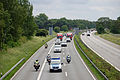
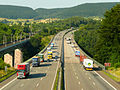
The next 65 kilometers to Hamburg are characterized by a high volume of traffic, which is why the motorway here was expanded from four to six lanes between 2014 and 2018. First, Neumünster is bypassed and connected with three connection points, then the first northern suburbs of Hamburg are reached. Hamburg Airport can be reached via the first connection point in the Hanseatic city ( HH-Schnelsen-Nord ) .

High bridge over the Kiel Canal
Shortly before the Hamburg city limits near Bönningstedt

Border crossing Ellund towards Denmark


Hamburg
In the Hamburg district of Schnelsen , the motorway leads through a noise protection tunnel more than 500 meters long, as this is the first time that densely populated, closed urban areas are reached. Immediately afterwards the A 23 west coast motorway from Heide joins the A 7 at the Hamburg-Nordwest triangle . In the opposite north direction, the A 23 offers the fastest road connection to the Schleswig-Holstein North Sea coast with the North Frisian Islands . Then, south of the junction to the A 23, there is another, almost 900-meter-long noise protection tunnel on the A 7, which will, however, still be under construction in 2020. At the same time, the motorway will be expanded from six to eight lanes from here to the Elbe tunnel. In the Stellingen district , the tracks to the Hamburg-Altona train station will be crossed on a longer bridge and the Altona Volkspark will be connected with the Volksparkstadion .
After crossing Bahrenfeld , a 2.3 kilometer long noise protection tunnel is planned, the A 7 reaches the northern portal of the New Elbe Tunnel . The 3.1 kilometer long tunnel structure, equipped with four tubes, crosses the Elbe , which is heavily influenced by shipping, and forms the last fixed river crossing before it flows into the North Sea. On the southern side of the Elbe, it then leads to the more than 4-kilometer-long Elbmarsch elevated road , which was the longest road bridge in Germany until the Saale-Elster valley bridge was completed and runs right through the middle of the Hamburg port area . The container terminals Burchardkai and Eurogate border directly on the motorway . The Hamburg-Waltershof junction connects not only a large number of industrial companies but also the Köhlbrand Bridge to the east . Since February 2021, the federal highway 3, interrupted by the A7 in Schneverdingen, has started again here and leads over the Köhlbrand bridge. The aim of the measure is to finance the replacement of the Köhlbrand crossing, which is planned by 2030, from federal funds.
After leaving the port area, the motorway climbs up into the Harburg mountains . At the Hamburg-Südwest triangle , the A 261 , which is only a few kilometers long, branches off and connects to the A 1 to Bremen . After leaving the Harburg mountains, the now four-lane A 7 changes to Lower Saxony .
Further renovation and protection measures were implemented on the A 1 in the Hamburg area in 2019 and 2020 so that the A 1 could serve as an alternative route to the major construction work on the A 7 from 2020.

Route at Stellingen

North of the Elbe tunnel

Elbe Tunnel: North ...

... and the south portal
Elevated road in the port area
In the Harburg mountains


.jpg)


Lower Saxony
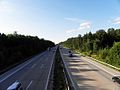
On Maschener Cross begins A 39 to Lüneburg and immediately afterwards is the Horster triangle connects to the A1 . This junction essentially consists of two motorway triangles, at which the A 7 changes from the carriageway coming from Flensburg to the one from Hamburg-Veddel on the south and leads south on it in six lanes. The densely populated region around Hamburg is left and the wooded, slightly hilly and sparsely populated Lüneburg Heath is reached.
Shortly before Soltau , the Lüneburg Heath Nature Park is located immediately to the west of the route, which then leads directly past the Bergen military training area. The section from Soltau to Bad Fallingbostel is currently the only one between Hamburg and Hanover that does not have six lanes. Instead, in the case of high traffic volumes, the hard shoulder can theoretically be released as an additional lane via a traffic control system. On triangle Walsrode which opens A 27 of Cuxhaven and Bremen her seventh in the A case Schwarmstedt is All crosses and the Hannover-North branches, the A 352 from which a corner connection to the A2 towards Dortmund and a connection to Hanover Airport enables. The Hanover region is reached and the landscape is more densely populated again.
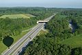
In Altwarmbüchener Moor there are two motorway junctions that connect the A 37 ( Burgdorf - Hanover ) and the A 2 ( Dortmund - Berlin ). This is followed by the eastern bypass of the Hanover city area. In the district of Anderten , the federal highway 65 will be connected, in Sehnde immediately east of the hannöversch-Anderter area the Mittelland Canal will be crossed. The southern part of the A 37, the Messeschnellweg , ends at the Hanover-Süd triangle and can only be reached or exited there from or in a southerly direction. Then it goes through the flat and agriculturally used border landscape to Hildesheim , which is connected with two connection points; Another third junction is planned north of the city. In the south-eastern part of the city, the low mountain range threshold is reached with a distinctive incline on the forewood . In the Innerstetal , the A 39 from Braunschweig ends at the Salzgitter triangle .
The following route to Göttingen is currently (2021) being expanded to six lanes and is characterized by the hilly landscape on both sides of the Leinetal between the Solling in the west and the Harz in the east. After the bypass of Göttingen, the A 38 branches off to Leipzig south of the university town . The A 7 then follows an unusually steep and complex combination of curves, leading to Hann. Münden down into the Werra valley and crosses the river on a 60 meter high bridge . The subsequent incline, with which the Kaufunger Wald is crossed, has a longitudinal incline of up to 8 percent and is considered to be the focus of the accident. On the south sloping side near Staufenberg there is a panorama over the city of Kassel . Shortly before reaching the North Hessian city, the autobahn changes to Hesse in this area .

Between Hamburg and Walsrode
East of Hanover

Another four-lane section at Echte

Near Göttingen
Werra Valley Bridge


.jpg)

Hesse
Upon reaching the Kassel urban area, the Lossetal is reached, through which the currently planned A 44 is to lead to Eisenach . Between the future Lossetal triangle , today's Kassel-Ost junction , and the Kassel-Mitte junction , the A 7 will be expanded to eight lanes due to the associated increase in traffic. At the Kassel-Mitte junction, where the A 49 towards Marburg and into Kassel city center begins, there is a large truck stop on Lohfeldener Rüssel and a large rest area to the south. The following triangle Kassel-Süd marks the eastern end point of the section of the A 44 between Dortmund and Kassel.
After leaving the Kassel city area, another steep and winding route, known as the Kassel Mountains, follows , first along the Fulda , then through the Knüllgebirge into the Aula Valley down to the Kirchheimer Dreieck , where the A 4 to Erfurt and on via Dresden to the Polish border branches off. A few kilometers to the south, after climbing out of the Aula valley at the Hattenbacher Dreieck, the A 5 begins in the direction of Frankfurt and continues to the Swiss border near Basel . The section of the A 7 between the two triangles, which is only about four kilometers long, forms an important link in the German motorway network, from which all major German metropolitan regions (Hamburg, Berlin , Rhine - Ruhr , Frankfurt, Nuremberg , Stuttgart , Munich ) can be reached directly can be.
At the Hattenbacher Dreieck, the A 7 changes lanes - the continuous driving relationship continues on the first laid out route onto the A 5, the branching off route of the A 7 has four lanes from here. At Niederaula the Aula valley is crossed again, then the route follows the western edge of the Rhön to Fulda . South of Fulda, in Eichenzell , the A 66 branches off to Hanau , which since its continuous completion in 2014 has been an alternative route coming from the north into the Rhine-Main area. Then the motorway reaches the Rhön and crosses the valley of the Kleine Sinn on the Grenzwaldbrücke and thus the state border with Bavaria .
View from the north of Kassel

Near Malsfeld

Descent from the Knüllgebirge into the Aula valley near Kirchheim

Traffic jam near Fulda


.jpg)
Bavaria and Baden-Württemberg
On the Bavarian side, the A 7 first leads past Bad Brückenau , then continues on a winding route through the Rhön, over the Franconian Saale and reaches Schweinfurt . There the A 70 branches off to Bamberg and Bayreuth , which from the south with the connection to the A 71 forms an alternative north-south route to central and eastern Germany. The motorway then crosses the Gramschatzer Forest and at Estenfeld has a connection to the Würzburg city area via the B 19 . Then the A 3 ( Emmerich - Frankfurt - Nuremberg - Passau ) crosses near Biebelried , which also starts traffic to Stuttgart via the A 81 .
The A 7 crosses the Main between Kitzingen and Ochsenfurt and runs across the flat landscape of the Ochsenfurt Gau . To the north of Rothenburg ob der Tauber it reaches the Frankenhöhe and the landscape becomes hilly again. In Wörnitztal at Feuchtwangen crosses the A 6 ( Saarbrücken - Heilbronn -Nürnberg- Waidhaus ) and the A 7 rises in the eastern region of the Schwäbischen Alb up. At Fichtenau it changes to Baden-Württemberg and crosses under the Virngrund near Ellwangen in a 470 meter long tunnel . After crossing the Jagst valley , another ascent follows with another tunnel structure, the 700 meter long Agnesburg tunnel and the motorway reaches the Härtsfeld . Past Heidenheim , the route then drops into the Danube Valley and reaches the region around Ulm . At the Ulm / Elchingen junction, it crosses the A 8 ( Karlsruhe –Stuttgart – Munich), changes back to Bavaria and crosses the Danube. Via the Hittistetten triangle , the motorway-like B 28 forms a connection to Ulm city center.
The further course of the A 7 runs along the Iller and changes the state border between Baden-Württemberg and Bavaria several times. Shortly before Memmingen she finally changes to Bavaria and crosses the A 96 ( Lindau –München), which opens up the Lake Constance region . As far as Kempten , the motorway continues parallel to the Iller and reaches the Allgäu , south of the city the A 980 branches off to Waltenhofen , which is just a few kilometers long and connects to Oberstdorf and Sonthofen . Originally it was part of the planned pre-alpine motorway A 98 , but its construction is no longer planned today.
Behind Kempten, the route climbs up from the Illertal into the hilly foothills of the Alps and reaches its highest point at Nesselwang , at 914 m above sea level. NN , this is also the highest point in the German motorway network. At the Hopfensee , the route turns from east to south and leads through the 645-meter-long Reinertshoftunnel . After the last junction in Germany, Füssen , only one directional carriageway has been completed and leads into the single-tube, approximately 1.3-kilometer-long Füssen border tunnel , which forms the border with Austria. The continuation on the Austrian side is the Fernpassstraße B 179 to Reutte in Tyrol .

Grenzwaldbrücke and Rhön near Bad Brückenau

Main crossing at Marktbreit

Alb ascent near Aalen

In the Illertal north of Memmingen

View of the Alps north of Kempten

Entrance to the Füssen border tunnel


story
predecessor
As a long-distance connection, the autobahn replaced the imperial and federal highways 76 , 77 , 205 and 4 (Flensburg – Hamburg), 3 (Hamburg – Kassel) and 27 (Göttingen – Würzburg), which in turn went back to medieval forerunners. On the route between Flensburg and Hamburg, for example, it follows the historic Ochsenweg and can be described as its successor in terms of its importance as a trade route from Scandinavia to the south. There were plans for an expressway from Hamburg to the south as part of the HaFraBa from 1926. This project is considered to be the forerunner of the BAB 7 between Hamburg and the Hattenbacher Dreieck.
The construction of the section from the Hattenbacher Dreieck to Würzburg began as route 46 during the Nazi era. But the route was never completed. The motorway, which was built in the 1960s, was built on a new route with less steep inclines and declines for most of the route. In the 1970s and 1980s, the extension from Würzburg to the south via Ulm into the Allgäu was carried out , followed by the last stretch to Füssen on the Austrian border in 2009 .
1934 to 1943 - Reichsautobahn construction
Göttingen – Bad Hersfeld (1934 to 1942)


In the course of the ever advancing motorization in the 1920s, demands arose to build roads that should be reserved exclusively for motorized individual traffic. From 1926 concrete plans were carried out, primarily by the HaFraBa association ( association for the construction of a road for high-speed motor vehicle traffic from Hamburg via Frankfurt am Main to Basel ) under Robert Otzen , who runs a road from Hamburg via Frankfurt am Main projected to the Swiss border near Basel . In May 1928, the association was renamed the Association for the Preparation of the Hanseatic Cities – Frankfurt – Basel Motorway in order to include the Hanseatic cities of Bremen and Lübeck in the road planning. A short time later, an all-German basic network of trunk roads was worked out, which contained many connections that were realized later.
Although at that time, during the Weimar Republic , the NSDAP was opposed to these plans and ridiculed them as “luxury streets of the rich”, they were a central component of one of the first projects that the National Socialists implemented after Hitler came to power on January 30, 1933. Allegedly in order to counteract the then relatively high unemployment , the National Socialists took the largely ready-to-build network plans of the HaFraBa, renamed GEZUVOR ("Society for the preparation of the Reichsautobahn "), and expected a realization of 1000 kilometers of passable Reichsautobahn per year. On September 23, 1933, the groundbreaking ceremony was held on the Frankfurt – Darmstadt section . To illustrate the highway construction as alleged invention Adolf Hitler ( "Street of the leader"), which a year earlier by the mayor of Cologne was Konrad Adenauer opened the first motor transport reserved road in Germany between Cologne and Bonn , under the specially devised name highway was opened , downgraded to the state road .
On September 11, 1934, at that time numerous Reichsautobahn routes were already under construction, the construction of the Göttingen – Kassel section began with the groundbreaking at the northern end near Göttingen . This was also part of the original HaFraBa planning, but the route - as is usual for Reichsautobahn - has been adapted to the mountainous landscape with tight curves, long straights and steep inclines and slopes. The so-called “car hike” was part of National Socialist propaganda due to the mountain panoramas resulting from the route and was intended to emphasize the “German homeland”. The most outstanding structure in this area was the 416 meter long and 61 meter high Werra Valley Bridge near Hedemünden . One year later, in the summer of 1935, the motorway was extended to the south from Kassel to Homberg (Efze) .
The entire section of the autobahn from Göttingen to Kassel was opened on June 20, 1937 with a ceremony by the Hessian Gauleiter , before the section from Kassel to Homberg was opened to traffic on November 17, 1937. It is noticeable that with this route one of the first real highways was built in the sparsely populated and low-traffic area of Northern Hesse . The building was justified by the poor accessibility of Kassel and the northern Hessian area by rail. Numerous photos from the time of the opening therefore show a completely empty motorway, so that traffic even had to be arranged for the opening event.
The section from Homberg to Neuenstein - Aua (today Bad Hersfeld-West ) was opened on July 2, 1938 and, similar to north of Kassel, has a very mountainous and winding course. The highest point is in the Knüllgebirge on the Pommer mountain at around 450 m above sea level. NN . By the end of 1938, the continuation from Bad Hersfeld via Alsfeld to Gießen was completed, which in turn connected to the existing Reichsautobahn Gießen-Frankfurt-Darmstadt-Mannheim / Heidelberg . Thus there was a continuous motorway connection from Göttingen to Heidelberg, with which large parts of the HaFraBa project were implemented. Most of this route behind Bad Hersfeld is now part of the A 5 .
North of Göttingen, after the outbreak of World War II, construction continued on the planned motorway route to Hanover , but until August 1942 only the Göttingen – Nörten-Hardenberg section could be released without public notice. The building of the Reichsautobahn was no longer a priority at that time, as raw materials and finances flowed into military armament. With the use of forced labor, some lines were built until 1943, after which construction work in the entire network, including on the line to Hanover and on to Hamburg , came to a standstill and was no longer tackled.
Unfinished Reichsautobahn sections
Bad Hersfeld – Würzburg (1937 to 1939)

Even during the Weimar Republic, an expressway connection between Kassel and Würzburg was included in the expanded HaFraBa network plan. The construction of this line between Niederaula and Würzburg began in 1937. Construction work took place over a distance of about 70 kilometers, in the Spessart between Bad Brückenau and Gräfendorf the earthworks were completed and the construction of some bridge structures began. Here too, due to the Second World War, work was initially postponed from 1939 and later stopped entirely. The motorway implemented after the war largely follows the route already planned in the Hessian part, while a route further east was chosen in Bavarian territory. The half-finished structures of the Reichsautobahn exist to this day and are under monument protection .
Hamburg – Hanover – Göttingen (1938 to 1939)
Robert Otzen's HaFraBa plans from 1927 provided for a route parallel to the long-distance road at that time (today's B 3 ). With the establishment of the Supreme Construction Management Reichsautobahn (OBR) Hanover, the National Socialists changed the plans in 1935, as this route was too far away from larger cities in the region. A plan drawn up in 1936 showed a route from Hamburg via Peine , Braunschweig and Salzgitter , which aimed in particular at the very strong industry (steelworks) and their connections in these cities. In any case, the simultaneous establishment of the Bergen military training area and the Wietzenbruch air base near Celle prevented the HaFraBa plans from being implemented. Fritz Todt , as general inspector for roads, the highest construction manager of the Reichsautobahnen, finally determined a variant that provided for two north-south autobahns, of which the western one passes Hanover and connects with Bremen with a branch , while the eastern one opens up the industrial region around Braunschweig . At Maschen and Seesen , the route, which served as a northern continuation of the already realized motorway from Göttingen via Kassel to the south, should branch out for this.
After the detailed planning had been worked out by September 1938 and had been examined by the state police by February 1939, work began in mid-1938 between Hamburg and a planned junction with the Ruhr area-Berlin route near Garbsen west of Hanover. From August 1938 to July 1939, however, there was already a construction freeze, in order to withdraw the workers employed in the construction of this motorway and to use them for the construction of the west wall . In the area between Bad Fallingbostel and west of Hanover, the earthworks were relatively advanced due to the use of heavy equipment, as was the construction of overpasses and underpasses. The line from Hamburg-Veddel to Horst (Seevetal) , on the other hand, was completed in 1939 together with the Reichsautobahn Bremen-Hamburg (now part of the A 1 ) and was already designed so that the line coming from Hamburg continued southwards and the The route to Bremen forms a branch from this, the Horster triangle .
From October 1939, when the Second World War broke out, construction was suspended for all north-south routes and work continued on the east-west routes until, in 1940, the further construction of the Hamburg – Hanover route was abandoned entirely. To the northwest of Hanover, the route and some of the ongoing structures on the unfinished motorway are still visible at Wedemark . The route between Horst and Schwarmstedt lay idle for many years, but was included in the construction of today's A 7 from the 1950s onwards, before it was then implemented further east of Hanover.
Hamburg – Göttingen (1953 to 1962)
The completion of the Hamburg – Hanover – Göttingen route was followed up with the completion of the regional planning report in 1950. For reasons of cost, he planned to build only a single route instead of the division into two parallel highways planned before the war. Due to the work that was already well advanced before the construction stop, the motorway between Horst (connection to the Hamburg – Bremen motorway) and Schwarmstedt was to be completed on the existing pre-war road. A dispute broke out about the route between Schwarmstedt and Nörten-Hardenberg . From several investigated plans that concerned the Hanover bypass, it was decided to run east of the city with the junction of the Ruhrgebiet – Berlin motorway northwest of Lehrte .
The Declaration on the Construction of Main International Traffic Arteries of the UN Economic Commission of September 16, 1950, with which the network of European roads was established, established the Hamburg-Bordeaux connection as one of the three most important European long-distance connections. In addition, the traffic between Kassel, Hanover and Hamburg continued to increase, so that the old trunk road with its numerous through traffic became the focus of accidents due to the congestion. Between July 1951 and 1952, almost a third of all traffic accidents in Lower Saxony occurred on this road.
The new building from Göttingen began in a northerly direction. First, in 1953, the 8.7-kilometer route from Nörten-Hardenberg to the Northeim -West junction went into operation with a one-way carriageway, and in 1954 it was extended by 4.8 kilometers to Northeim-Nord. The second carriageway was also completed two years later.
The autobahn was opened to traffic in seven sections between Hamburg and Hanover between 1956 and 1962. First of all, the 11 kilometers between Horst and Thieshope were created . At the intersection with the Hamburg – Bremen motorway, which runs from the south to the west, a motorway triangle with a steep curve was created , the Horster triangle . The Hamburg – Hanover route forms the continuous driving relationship. In the same year, the 17-kilometer section from Soltau- Süd to Fallingbostel opened , which in 1957 was extended by 7 kilometers to the north to Soltau-Ost and 8 kilometers to the south to Westenholz . In 1958, the 39 kilometer long gap between Thieshope and Soltau was closed and the 18 kilometers from Westenholz to Berkhof opened . In 1960 the 21 kilometers from Berkhof to Kirchhorst followed shortly before Hanover.
At the same time, the motorway was also being built from the south to close the gap step by step - in 1958 the 9 kilometers from Northeim to Echte , on November 14, 1959 a further 12 kilometers to Seesen . The 40-kilometer stretch from Seesen to Hildesheim was officially opened to traffic on December 15, 1960 by Federal Transport Minister Hans-Christoph Seebohm .
With the completion of the 35 km long Kirchhorst – Hildesheim section in 1962, the entire stretch of the autobahn was continuously passable, which means that at this point in time most of the trunk road from Hamburg via Frankfurt to Basel planned by HaFraBa in the 1920s had been realized. The high number of connection points in the sparsely populated area of the Lüneburg Heath between Hamburg and Soltau is striking - this is where Federal Transport Minister Seebohm had his constituency in the districts of Harburg and Soltau .
Bad Hersfeld – Würzburg (1965 to 1968)
From 1948 the federal states of Hesse and Bavaria initiated the resumption of construction work on the Bad Hersfeld – Würzburg connection, with which some sections were under construction from 1937 to 1939 under the name Route 46 . This route was and is also called Rhön motorway or Rhön line after the low mountain range it traversed . Since a large amount of earthworks had already been carried out on the Hessian side and the agricultural areas were allocated accordingly, it was obvious to continue using this route for the new construction. Only the motorway triangle originally planned as a trumpet with the Hamburg – Frankfurt motorway near Hattenbach was to be designed as a triangle with direct connection ramps due to the expected increase in traffic. The already determined eastern bypass of Fulda should also serve to relieve the urban area of through traffic on the federal roads 27 and 254 . Only between Fulda and the state border with Bavaria did the route deviate from the Reichsautobahn planning, as a reservoir was planned here in Döllbachtal, which was not realized later. The motorway was therefore relocated to the eastern edge of the valley, which made two valley bridges necessary.
Due to the steep longitudinal inclination of more than 6 percent (instead of the maximum permitted 4 percent) and the tight curve radii, Federal Transport Minister Hans-Christoph Seebohm decided when determining the route for the motorway that the Reichsautobahn route would no longer be used. In addition, it was far away from larger towns and the zone border with the Soviet Occupation Zone , which later became the GDR , that emerged after the war . The new route was therefore intended to open up the border area on the one hand, and the city of Schweinfurt on the other . The junction with the Frankfurt – Nuremberg autobahn, which was planned to be west of Würzburg in the 1930s, was laid out to the east of Würzburg near Biebelried due to the new route . In order not to damage the fertile soil between Schweinfurt and Würzburg, the motorway was relocated a few kilometers to the west on the edge of the Gramschatzer Forest .
The route for the Bavarian section was established on November 9, 1960 and for the Hessian section on March 17, 1961. Construction work began in the first section near Würzburg in 1962, with the last from Bad Kissingen to Werneck in 1966. The motorway was then built in four sections within six years and gradually opened to traffic. It was passable between Estenfeld and the Biebelried triangle from July 28, 1965, the 11-kilometer Fulda bypass was opened to traffic from September 28, 1966, and the extension from Estenfeld to Werneck on November 7, 1966 southernmost section of the 31-kilometer motorway completed.
The completion of the two remaining sections (Hattenbach to Fulda-Nord and Fulda-Süd to Werneck) was swiftly pushed forward by 1968, especially in the Bavarian part, as a result of the changed line layout, numerous large viaducts had to be built, including the 96-meter-high Grenzwaldbrücke in the area the Hessian-Bavarian border. Protests arose in Lower Saxony, Hamburg and Schleswig-Holstein against the opening date for both sections of the route and thus the entire 142-kilometer route, which was scheduled for the end of August 1968. Since the summer holidays in the federal states began between July 15 and 18, the federal states and the ADAC pushed for an opening in the first half of July of the same year to avoid traffic jams in the course of travel to the south on the pass roads of the Rhön and the congested motorways around Avoid Frankfurt. Since not all work had been completed at this point in time, including crash barriers and lane markings, the handover of traffic could not take place on time, but nevertheless one month earlier than planned on July 30, 1968.
At the opening ceremony, Federal Transport Minister Georg Leber described the Rhön motorway as "[one of] the most difficult German motorway routes in terms of construction technology". It shortened the distance from Hamburg to Munich by 120 kilometers and bypassed the busy Rhine-Main area with the Frankfurter Kreuz . In addition, it was hoped that the economically weak region in northern Bavaria would develop.
Flensburg – Hamburg (1969 to 1978)
.jpg)

On behalf of the Nazi regime, the architect Konstanty Gutschow planned a gigantic renovation of large parts of Hamburg as an expression of the “ capital of German shipping ”. In addition to wide parade streets and a 250-meter-high Gauhochhaus, a suspension bridge over the Elbe with 160-meter-high pylons, the design of which was based on the Brooklyn Bridge in New York City , was planned. It should form the heart of a Reichsautobahn planned from 1935/36, which should represent a western bypass of Hamburg. Preparatory construction work for the bridge began in 1939, due to the unfavorable soil on the banks of the Elbe, which was absolutely unsuitable for a bridge of such dimensions, as well as the Second World War, this project, like the other structures for Nazi propaganda, was not continued tracked.
From 1950 the city of Hamburg planned a bypass road in the western parts of the city, taking into account plans from the Nazi era. Instead of a suspension bridge, a tunnel was now planned to cross the Elbe, especially since the river is also used by ocean-going ships in this section. From 1961 to 1963 the first almost 3 kilometer long section of this road was built near Eidelstedt and opened to traffic on April 26, 1963 as part of federal highway 4 . The continuation of the bypass road from Eidelstedt south to Harburg was decided by the Senate on July 10, 1964. From Eidelstedt to the northern outskirts of Hamburg in Schnelsen , the line was completed on November 2nd, 1967. On January 1, 1968, the Eidelstedt bypass was rededicated as a motorway without any structural changes.
Construction of the New Elbe Tunnel began on June 19, 1968. In 1972 the section from Heimfeld to Marmstorf and in 1973 the section from Eidelstedt to Bahrenfeld was completed. After almost seven years of construction, the Elbe Tunnel was opened on January 10, 1975 by the then Federal Chancellor Helmut Schmidt , closing the gap in the Hamburg city area. At the same time, the section from Marmstorf to Seevetal was completed. The motorway was connected to the Hamburg – Hanover route south of the Horster triangle , which had existed since the 1950s, with a fork. The steep curve for the Hanover – Bremen route was abandoned in favor of a loop from the newly built line. Only a few years after it was upgraded to a motorway, the section in the Hamburg city area was provided with noise barriers from 1978 to 1979 and street lighting in 1980.
The line from Hamburg to the Danish border, the so-called north axis , was built in nine construction phases in the late 1960s and 1970s and opened between 1969 and 1978. The main reason for its construction, in addition to a 1964 agreement between the governments of Germany and Denmark treaty which strove for a highway link between the two countries, the 1965 decision taken by the International Olympic Committee , the Olympic Games in 1972 to deregister in Germany. In addition to Munich as the main venue, the sailing competitions should take place in Kiel . At first it was called Europastraße 3 , with the introduction of the numbering system for motorways that is still valid today in 1975, then as Federal Motorway 7 .
The construction of the north axis began in 1965. The first twelve-kilometer section from the Neumünster -Nord junction to Großenaspe was opened to traffic on November 24, 1969. Next, in 1970, the 11-kilometer stretch from Quickborn to Hamburg- Schnelsen was completed, which connects to the existing section in the Hamburg city area, one year later, in 1971, then the northern continuation first to Bad Bramstedt and then to Neumünster.
The 43-kilometer section from the Schleswig / Jagel junction to Bordesholm leads near Rendsburg on the almost 1.5-kilometer-long Rader Hochbrücke , at that time the longest motorway bridge in Germany, over the Kiel Canal and was built from 1969 to 1972. On August 4, 1972, four weeks before the start of the Olympic Games, it was opened to traffic together with the junction to Kiel, today's A 215 . This made Kiel the last West German state capital to be connected to the motorway network. The 14-kilometer section from the Flensburg / Harrislee junction to Tarp was built between 1972 and 1976 . This was inaugurated on July 13, 1976 by Ernst Haar, the parliamentary state secretary of the Federal Ministry of Transport, and Schleswig-Holstein's Minister of the Interior, Rudolf Titzck .
By 1977, the 8 kilometers of the Schleswig bypass (Schleswig / Schuby – Schleswig / Jagel) had been completed. The connection to Flensburg ( B 200 ) was expanded like a motorway and was run as the A 205 for a few years . A crossbar from Flensburg via Handewitt to the west - the so-called Sylt feeder - was no longer built.
The last two remaining sections between Hamburg and Denmark were opened to traffic in 1978. From 1976 to 1978 the border crossing Ellund / Frøslev was built with the four kilometer long section to the then northern end of the motorway at Harrislee. The largest and most important border crossing to Denmark was officially opened on June 13, 1978 by Federal President Walter Scheel , accompanied by Prime Minister Gerhard Stoltenberg and Flensburg City President Ingrid Gross , and Queen Margrethe II . At 10.55 a.m. they officially opened the motorway and passport control, at 12.32 p.m. the first car rolled through the new border crossing. This was the first visit by a Danish monarch to Schleswig-Holstein since the end of the German-Danish War and the cession of Schleswig to the German Empire in 1864. The Deutsche Bundespost also created a special cancellation for this event. Ellund developed into the most important transit point for German-Danish border traffic. In 1979, 3.2 million travelers passed the checkpoints; by 1997 the number had more than quintupled to 16.7 million.
The last remaining section, the 14-kilometer stretch from Tarp to Schleswig / Schuby, was released a few days later. This created a continuous connection from Denmark through all of Schleswig-Holstein to Hamburg, as well as a continuous north-south connection through Germany to southern Italy, which formed the basis for the later European route 45 .
Würzburg – Ulm (1979–1987)
In the preliminary to an automobile road network in Germany the Research Association for Automotive Road (Stufa) of 1926, a highway was Würzburg- Ulm - Lindau provided. Even during the construction of the Reichsautobahn at the time of National Socialism , a motorway was planned to be built in this area from 1935 onwards. A route was planned from the planned route Würzburg - Heilbronn near Bad Mergentheim via Rothenburg , Dinkelsbühl , Nördlingen and Donauwörth to Augsburg , where it should meet the existing Karlsruhe - Munich motorway. This 170-kilometer route was called the Imperial City Line and was commissioned to the Supreme Construction Management in Stuttgart, Nuremberg and Munich. In 1939, this route design was officially added to the Reichsautobahn network as a supplementary route.
Since the Wuerttemberg side wanted to better connect Ulm to the motorway network by means of a north-south connection, the route design was changed so that in October 1941 the motorway behind Nördlingen was not via Donauwörth, but via Dillingen to the Karlsruhe-Munich motorway near Zusmarshausen and further on led south to Kempten . The planned Lindau – Munich autobahn should connect to them there. As with all Reichsautobahn under construction, the construction work in the course of the Second World War was initially partially stopped and in 1942 completely.
The new construction of a federal road between Ulm and Lindau was included in the expansion plan for the federal highways in 1957. At the beginning of the 1960s, the plans for opening up the region between Würzburg and Ulm with a north-south motorway were resumed. Since it was recognized that the planned pre-war road along the B 25 was not suitable for the development of the industrialized eastern Württemberg and the relief of the federal highways there, the route was changed in the southern part to Ulm and the route was led via Aalen and Heidenheim . In Ulm, a continuous continuation to the planned federal road to Lindau would have been possible. In addition, the Baden-Württemberg Ministry of the Interior commissioned a traffic analysis to clarify a suitable route.
The route in the Baden-Württemberg part between Ellwangen and Ulm was established in 1962 by Baden-Württemberg and Bavaria. In the northern part between Würzburg and Feuchtwangen , it was unclear until 1969 whether the route should run through the Hohenlohe area around Weikersheim and Creglingen in Baden-Württemberg or on the Bavarian side on the route that is currently in existence. The transport economic study came to the result that despite the 14 km longer route, the variant on the Bavarian side was more advantageous in terms of construction and transport. Between Feuchtwangen and Ellwangen, on the one hand, a motorway connection to the cities of Crailsheim , Dinkelsbühl and Feuchtwangen and, on the other hand, a suitable connection for a (unrealized) expressway to Donauwörth was planned.
The final draft of the route for the northern section was presented to the Federal Minister of Transport in August 1969, who approved it on September 5, 1969. The following were now set:
- Continuation of the Kassel – Würzburg motorway ( Rhön line ) from Biebelried
- Main crossing south of Kitzingen
- Eastern bypass of Rothenburg
- Branch of a federal motorway to Donauwörth west of Dinkelsbühl
The detailed planning for this new line ( line determination method ) was the section of Neustädtlein (now Dinkelsbühl / Fichtenau ) to Langenau today junction Ulm / Elchingen completed on 14 January 1971 for the section of Biebelried to Neustädtlein August 6 1,973th Construction began soon under the designation A 24 when parts of this line were entered in the 3rd four-year plan for 1967–1970, each under urgency level I and II. With the introduction of the numbering system for federal motorways, this project became part of Federal Motorway 7.
Because of the unclear financing that occurred as a result of the cut in funds for the construction of the trunk road, construction work did not begin until the late 1970s. In particular, the petition submitted by over 150,000 citizens from the surrounding region to the Federal Ministry of Transport, which demanded a speedy start of construction on the motorway, had an impact, so that construction work began. First, the 19-kilometer southern section from Niederstotzingen to the Ulm / Elchingen junction and on to Nersingen , where the motorway had been in operation since 1977, was completed. This was opened to traffic on May 23, 1979 and December 3, 1979.
The 16-kilometer section from Heidenheim to Niederstotzingen was released on October 30, 1981, the 35 kilometers from Biebelried to Uffenheim on December 13 of the same year. When the Rhön route was built in the 1960s, the junction near Biebelried had already been provided with preliminary work for a later southern extension. The largest structure in this area is the 928 meter long Main Bridge near Marktbreit .
In the mid-1980s, the entire rest of the line was under construction, after the funds for the construction financing of this project were increased in 1983 in order to aim for completion in 1987. While the 42 kilometer long section from Uffenheim to Feuchtwangen was completed in 1985, the 60 kilometer long gap from Feuchtwangen to Heidenheim also went into operation in time for the scheduled date in 1987. From the Danish border to the Allgäu near Oy-Mittelberg , the BAB 7 was thus continuously passable and represented a trunk road that ran through almost the entire country from north to south.
Due to the hilly landscape of the Eastern Alb , the southern, most recently completed section in particular has numerous engineering structures. In addition to many valley bridges, for example over Jagst , Brenz and Lone , two tunnels were also built to cross under the Virngrund near Ellwangen and a ridge during the ascent of the Alb near Aalen . With construction costs of around 600 million marks, including 150 million marks for the construction of the Alb ascent near Aalen, the 60-kilometer section from Feuchtwangen to Heidenheim was the largest and most expensive motorway construction site in Germany.
Ulm – Kempten (1972 to 1978)

In contrast to the section between Würzburg and Ulm, construction work for the motorway between Ulm and Kempten began as early as the late 1960s. The route, which essentially follows the course of the Iller , changes several times north of Memmingen between the federal states of Bavaria and Baden-Württemberg. Together with the BAB 7, which has been known as the BAB 7 since 1975, some preliminary work was made for planned, crossing east-west motorways southeast of Ulm, near Memmingen and south of Kempten.
The first section opened on November 17, 1972 between the junctions Dettingen an der Iller and Memmingen-Süd with a length of around 17 km. A little more than three years later, in February 1976, the 10 km long section from Illertissen to Altenstadt followed. The first almost 8 km long section south of Memmingen from the Kempten-Leubas junction to the Allgäu motorway junction was released in December 1976. Simultaneously with this, a short section of the planned pre-alpine motorway BAB 98 was built (since March 1983 BAB 980 ). During construction of the highway in this section occurred on 30 April 1974 collapse of Leuba viaduct under construction.
With the completion of the 11 km long section between Hittistetten – Illertissen triangle in April 1977, a first short section of the BAB 80 to the Senden junction was created . Although the BAB 80 was downgraded to the B 28 in April 1982 , it is still provided with blue signs for motorways, but without the route numbering listed. The Ulm / Elchingen motorway junction with the BAB 8 will be built by May 1977 together with the section of the BAB 7 to the Nersingen junction (4 km).
Between Memmingen and Kempten, the Memmingen-Süd– Bad Grönenbach section opened on December 14, 1978 . On the same day, a short, still single-lane section of the BAB 96 opens from the Memmingen junction to just before Aitrach . One year later, in December 1979, the continuation from Bad Grönenbach to Dietmannsried was completed.
Kempten – Füssen (1992 to 2010)
In 1992 the A 7 was extended by another 4.9 kilometers to Nesselwang . A few meters west of the junction of the same name is Germany's highest motorway point : “ 914.081 m above sea level. NN " .
In July 1999 the border tunnel from Füssen to Tyrol was opened with one tube and two lanes. The tunnel is primarily intended to relieve the surrounding communities from the high volume of traffic during vacation times. In 2005 the first carriageway to the north was opened up to the district road near Gunzenberg. Until September 2009, traffic from the end of the autobahn near Nesselwang was routed via various routes for cars and trucks to the border tunnel, which often led to traffic jams there.
On September 1, 2009, the official inauguration of the last 15-kilometer section, which was released more than a year later, took place. The Enzenstetten Viaduct was initially only accessible via one lane, as the construction work group was unable to complete it on time. The second half of the bridge went into operation in December 2010.
List of traffic clearances
| section | year | km | Remarks |
|---|---|---|---|
| Danish border - AS Flensburg / Harrislee | 1978 | 3.5 km | |
| AS Flensburg / Harrislee - AS Tarp | 1976 | 14.3 km | |
| AS Tarp - AS Schleswig / Schuby | 1978 | 14.4 km | |
| AS Schleswig / Schuby - AS Schleswig / Jagel | 1977 | 7.6 km | |
| AS Schleswig / Jagel - AS Bordesholm | 1972 | 43.1 km | |
| AS Bordesholm - AS Neumünster-Nord | |||
| AS Neumünster-Nord - AS Großenaspe | 1969 | 15.0 km | |
| AS Großenaspe - AS Kaltenkirchen | 1971 | 24.3 km | |
| AS Kaltenkirchen - AS Quickborn | |||
| AS Quickborn - AS HH-Schnelsen | 1970 | 11.0 km | |
| AS HH-Schnelsen - AS HH-Eidelstedt | 1968 | 3.0 km | |
| AS HH-Eidelstedt - AS HH-Bahrenfeld | 1973 | 6.0 km | |
| AS HH-Bahrenfeld - AS HH-Heimfeld | 1975, 2002 | 11.0 km | Elbe Tunnel initially three directional lanes (one tube per direction of travel and one tube in alternating traffic), since 2002 four directional lanes (two tubes per direction of travel) |
| AS HH-Heimfeld - AS HH-Marmstorf | 1972 | 4.3 km | |
| HH-Marmstorf - Horster triangle | 1975 | 7.3 km | |
| Horster Dreieck - AS Thieshope | 1956 | 11.0 km | |
| AS Thieshope - AS Soltau-Ost | 1958 | 39.0 km | |
| AS Soltau-Ost - AS Soltau-Süd | 1957 | 7.0 km | |
| AS Soltau-Süd - AS Fallingbostel | 1956 | 17.0 km | |
| AS Fallingbostel - AS Westenholz | 1957 | 8.0 km | |
| AS Westenholz - AS Berkhof | 1958 | 18.0 km | |
| AS Berkhof - AK Hannover / Kirchhorst | 1960 | 21.0 km | |
| AK Hannover / Kirchhorst - AS Hildesheim | 1962 | 35.0 km | |
| AS Hildesheim - AS Seesen | 1960 | 40.0 km | |
| AS Seesen - AS Echte | 1959 | 12.0 km | |
| AS Echte - AS Northeim-Nord | 1958 | 9.0 km | |
| AS Northeim-Nord - AS Northeim-West | 1954, 1956 | 4.8 km | Initially only one directional lane |
| AS Northeim-West - AS Nörten-Hardenberg | 1953, 1955 | 8.7 km | Initially only one directional lane |
| AS Nörten-Hardenberg - AS Göttingen | 1942 | 13.1 km | Initially only one directional lane in sections |
| AS Göttingen - AS Homberg / Efze | 1937 | 77.0 km | |
| AS Homberg / Efze - Hattenbacher Dreieck (- AS Fernwald) | 1938 | 28.0 km | 28 km today's BAB 7, section to AS Fernwald today BAB 5 |
| Hattenbacher Dreieck - AS Fulda-Nord | 1968 | 32.0 km | |
| AS Fulda-Nord - AS Fulda-Süd | 1966 | 14.8 km | |
| AS Fulda-Süd - AS Schweinfurt / Werneck | 1968 | 68.0 km | |
| AS Schweinfurt / Werneck - AS Würzburg / Estenfeld | 1966 | 20.7 km | |
| AS Würzburg / Estenfeld - AK Biebelried | 1965 | 10.9 km | |
| AK Biebelried - AS Uffenheim-Langensteinach | 1981 | 34.7 km | |
| AS Uffenheim-Langensteinach - AS Feuchtwangen-West | 1985 | 42.1 km | |
| AS Feuchtwangen-West - AS Heidenheim | 1987 | 59.6 km | |
| AS Heidenheim - AS Niederstotzingen | 1981 | 15.7 km | |
| AS Niederstotzingen - AS Nersingen | 1979 | 19.0 km | |
| AS Nersingen - AS Illertissen | 1977 | 25.1 km | |
| AS Illertissen - AS Altenstadt | 1976 | 8.5 km | |
| AS Altenstadt - AS Dettingen an der Iller | |||
| AS Dettingen an der Iller - AS Memmingen-Süd | 1972 | 17.0 km | |
| AS Memmingen-Süd - AS Bad Grönenbach | 1978 | 8.5 km | |
| AS Bad Grönenbach - AS Kempten-Leubas | 1972, 1979 | 27.1 km | Initially only one directional lane |
| AS Kempten-Leubas - Bodelsberg (connection St 2520) | 1976 | 13.1 km | |
| Bodelsberg (connection St 2520) - AS Oy-Mittelberg | 1986 | 6.8 km | |
| AS Oy-Mittelberg - AS Nesselwang | 1992 | 4.9 km | |
| AS Nesselwang - AS Füssen | 2009 | 14.6 km | |
| AS Füssen - Austrian border | 1999 | 1.9 km | Only one lane in the border tunnel in Füssen |
Sections as a European route
The following European roads run along the BAB 7:
- E 40 : Kirchheimer Dreieck – Hattenbacher Dreieck
- E 43 : Biebelried motorway junction - Memmingen motorway junction
- E 45 : Ellund – Biebelried motorway junction
- E 532 : motorway junction Memmingen – Füssen
Traffic volume
Between Hamburg and Hattenbacher Dreieck, where the A 5 continues to Basel and the Gotthard route to Italy , the A 7 is one of the most important north-south connections in Europe. For this reason, it is being continuously expanded from four to at least six lanes.
Between the Hattenbacher Dreieck and the Austrian border, the A 7 is one of several south German north-south motorways and has a much lower volume of traffic than the parallel federal motorways 5 and 9 . Since the A 7 connects two very important holiday regions with the German and Danish North and Baltic Sea coasts in the north and the Alps in the south, long traffic jams form, especially during the summer and winter holidays.
| section | DTV | Counting station number |
Heavy traffic share |
Year source |
|---|---|---|---|---|
| Triangle HH-Northwest - HH-Stellingen | 101,300 | |||
| HH-Othmarschen - HH-Waltershof | 107,600 | |||
| HH-Waltershof - HH-Moorburg | 103,900 | |||
| Owschlag | 44,941 | 15231107 | 16.6% | 2018 |
| Schuby | 39,540 | 14221189 | 17.3% | 2018 |
| Hüttener Mountains | 45,579 | 16241263 | 16.6% | 2018 |
Current state of development
Denmark to Hamburg
The section from the Danish border to the triangle Hamburg-Nordwest was originally four-lane, from there to the triangle Hamburg-Südwest six lanes and then again four lanes to the Horster triangle . The route in the Hamburg city area was already equipped with six lanes when it was built in the 1970s. From 1995 to 2002, the Elbe Tunnel was expanded by a fourth tube, which means that four lanes are passable in both directions between HH-Othmarschen and HH-Waltershof.
Since the end of 2014 and the beginning of 2015, the section from the Bordesholm triangle to the Hamburg-Nordwest triangle has been expanded from four to six and between the Hamburg-Nordwest triangle and HH-Volkspark from six to eight lanes. The expansion in Hamburg should be completed by the end of 2020. The completed construction phase in Schleswig-Holstein was approved on December 18, 2018.
Hamburg to Hildesheim
Between the Horster Dreieck and the Hildesheim junction, the A 7 is almost continuously developed to have six lanes - only the approximately 40-kilometer section between the Soltau-Ost and Bad Fallingbostel junctions is still four-lane, although it has been provided with a temporary hard shoulder release since 2005. Between Bad Fallingbostel and the Walsrode triangle, the autobahn was expanded from August 2016 to August 2019 to a length of 8 kilometers from four to six lanes.
In the course of the Expo 2000 in Hanover, the previously four-lane section between Altwarmbüchen and the Hannover-Ost junction was provisionally redesigned with six lanes, dispensing with the hard shoulder. From March 2011 to the end of 2013, with the construction of the bridge structure at the Hannover-Ost junction, the roadway in this section was widened, creating a full-fledged six-lane roadway with hard shoulder.
Hildesheim to Nörten-Hardenberg
The originally continuous four-lane route from Hildesheim to Nörten-Hardenberg north of Göttingen has been expanded in several sections since 2011 .
The 12-kilometer section between the Salzgitter triangle and south of the Bockenem junction was expanded from May 2011 to May 2014. The 13-kilometer section from Bockenem to Seesen to the south was completed in November 2016.
The 29-kilometer section from Seesen to Nörten-Hardenberg has been expanded from four to six lanes since 2017 as part of a public-private partnership (PPP). Contrary to the usual practice of dividing the construction site into several construction lots, no more than 10 kilometers long, when extending longer motorway sections, a continuous road construction site was set up here over the entire length. After completion, the operating company Via Niedersachsen will also receive the 60-kilometer stretch from Bockenem to Göttingen.
Nörten-Hardenberg to Bad Hersfeld
The originally four-lane section between Nörten-Hardenberg and the Hattenbacher Dreieck has now been expanded to six lanes throughout. As the last bottleneck between Göttingen and Hattenbacher Dreieck, the Werra Valley Bridge was supplemented by a second parallel structure from 1987 to 1993, making six lanes available here as well.
Between Nörten-Hardenberg and Göttingen-Nord, the motorway was expanded to six lanes between 2009 and October 2012.
To the south of the Kassel-Süd motorway triangle and between the Kirchheimer Dreieck and the Hattenbacher Dreieck there is an additional fourth lane on inclined roads in the south direction. Because of the steep ascents and descents, this pre-war section of the motorway in the Kassel Mountains is considered by drivers to be particularly challenging for trucks and caravan teams.
Bad Hersfeld to Austria
The A 7 has four lanes throughout the southern course. Only a few sections in the Rhön, near Aalen and Altenstadt are provided with more than two strips per directional lane due to the incline. Since September 1, 2009, the motorway has ended at the Füssen border tunnel . This only includes one tube with one lane in each direction. In the area of the Enzenstetten viaduct, the A 7 was only accessible on two lanes until the second bridge was completed in December 2010.
particularities


- There are 47 managed and 158 unmanaged rest areas along the A 7 . It is crossed by 1074 bridges and has 140 entrances and exits.
- The kilometers of the A 7 have several peculiarities. The count starting with 0 at the Danish border runs through Schleswig-Holstein and Hamburg to km 173.1 and is then only resumed shortly before the Kirchheim triangle at km 521.5. In between there are three different kilometrages: First, from the Hamburg-Lower Saxony border, a countdown starts at kilometer 9.7 and runs backwards to the south, which already reaches the Horster triangle (due to a change in planning) at kilometer 1.8. This is followed by kilometrage branching off from the counting of the A 1, which begins at kilometer 18.0 and reaches the Hannover Ost motorway junction at kilometer 142.5. Here again, a kilometer calculation, which was also calculated by Hamburg and established in 1939, begins; it assumed that the north-south motorway ran west of Hanover, which would have resulted in a longer route, so that in the 1950s, the actually built route required a skip of 8 kilometers and the count is now 142.5 kilometers jumps to 150.5. This new count continues to the south, for decades it ended at the Kirchheimer Dreieck, where at km 368.2 it reached almost the same height as the mileage of the A4 (km 367.4) calculated from the Potsdam motorway triangle on the Berliner Ring , which leads to the Hattenbacher Dreieck continued - and from there still continues on the A 5 in the direction of Frankfurt. The confusing duplication of a few tenths of a kilometer has now been eliminated by the fact that shortly before the Kirchheimer Dreieck the count coming from Hanover ends at kilometer 366.4 and changes over to kilometer 521.5 calculated from Flensburg.
- Between the junction of Tarp and Owschlag , two sections of the motorway have been developed as a temporary motorway airport for military purposes.
- The former Catalan regional president Carles Puigdemont was arrested on March 25, 2018 by officers of the Schleswig-Holstein motorway police at the Jalm rest area on the A 7. He was then taken to the Schuby police highway at the Schleswig / Schuby junction for a short time .
- At Rendsburg , the Kiel Canal is crossed on the 1498 meter long Rader Hochbrücke , the second longest German road bridge made of steel .
- On September 6, 1971, the Hasloh plane crash occurred on the A 7 .
- Between the state border of Hamburg and Kaltenkirchen as well as between Neumünster-Süd and the Bordesholmer Dreieck, the hard shoulder could be temporarily opened as a third lane with the help of a traffic control system in the north direction . This was mainly used on summer weekends to avoid traffic jams due to travel to Denmark. Since May 2014, the A 7 has been expanded to three lanes in each direction in this area, which is why the temporary shared hard shoulder can no longer be activated.
- The route between the triangle Hamburg-Nordwest and Hamburg-Stellingen is the section with the highest traffic density with an average of 140,000 vehicles per day.
- In Hamburg, the Elbe is crossed in the New Elbe Tunnel, which, despite its four tunnels with a total of eight lanes, is often the bottleneck. Due to renovation measures, a tube with two lanes each is virtually permanently closed. The traffic is monitored and controlled in an area up to 20 kilometers in front of the respective tunnel entrances by the tunnel operations center, which is manned around the clock. Directly adjacent to the Elbe crosses the highway in six to eight meters high on the longest with 4258 meters road bridge in Germany, the high street Elbmarsch , the port of Hamburg until something further south the rising Harburg Hills reached.
- A diversion route was set up in July 2017 between the Soltau-Süd and Westenholz junctions , some of which leads over the Bergen military training area. If necessary, a tank road on the edge of the site is opened for public traffic to relieve the surrounding towns. The clearance can only take place if there are no exercises taking place in the restricted military area.
- Between Bad Windsheim and Feuchtwangen, the A 7 crosses the western area of the Frankenhöhe and between Aalen and Ulm the eastern area of the Swabian Alb . Two tunnels were built between the Dinkelsbühl / Fichtenau and Ellwangen junctions with the Virngrund tunnel and between Aalen / Westhausen and Aalen / Oberkochen with the Agnesburg tunnel. The Agnesburgtunnel is followed by the several kilometer long Albaufstieg , the construction of which was extremely complex due to the low mountain range, the costs for the tunnel and the ascent amounted to 150 million DM, around 77 million euros.
- At Nietheim between Aalen / Oberkochen and Heidenheim, a 45 meter wide green bridge was inaugurated on December 20, 2011 . The construction funded by the economic stimulus package II cost 2.85 million euros and took a year. According to a representative of the Stuttgart regional council, the green bridge is located on a migratory corridor for large mammals between Switzerland and the Czech Republic.
- In 2013, Langenau was the most frequently used emergency telephone on a German motorway.
- A special case is the connection to the federal highway 28 , which is realized via the Hittistetten motorway triangle . From the triangle to Ulm, the B 28 is completely signposted as a motorway and built as a motorway. Although the connection from the A 7 to the federal road would have to be a junction, this junction has officially been called the Autobahn triangle.
- About 15 kilometers north of the Memmingen motorway junction , in the direction of Ulm, is the Illertal Ost service station , currently Germany's only art service station. It was designed by Herbert Maierhofer from Birkfeld .
-
Highest motorway point in Germany:
Since 1992, when a section of the motorway near Nesselwang was completed, the highest point of all motorways in Germany has been a few meters west of the Nesselwang junction: at A 7-km 944.144 a height of 914.081 m above sea level is located. NN reached. For this purpose, small signs were placed on the right-hand side of the lane on both lanes.
Further expansion
Six-lane expansion of the "north axis"
The A 7 will be expanded from four to six strips over 65 kilometers from the Bordesholm motorway triangle to the Hamburg-Nordwest motorway triangle. This measure is being implemented through a public-private partnership and is expected to cost a total of 600 million euros. The official starting shot for the major project in Schleswig-Holstein was on September 1, 2014. Preparations began in May, especially in Hamburg. The expansion should take place by 2018. On December 16, 2016, Prime Minister Torsten Albig cleared the first section of the six-lane A 7 between the Bordesholm and Neumünster-Nord motorway triangle. It has been agreed that the operating company will carry out the remaining work on the six-kilometer section between Neumünster and Bordesholm and then hand it over to the State of Schleswig-Holstein. The company will operate and maintain the remaining 59 kilometers until 2044. A 9.9-kilometer section near Großenaspe has been expanded to include six lanes since March. On April 7, 2017, another expanded section was approved by Prime Minister Albig. It is 10 kilometers between the Kaltenkirchen and Quickborn junctions. On December 18, 2018, Prime Minister Daniel Günther approved the almost 60-kilometer extension to the state border with Hamburg. The project can be expected to be completed by the end of the decade. Another planned project of the A 7 is the expansion south of the Elbe tunnel as part of the renovation and expansion of the Elbmarsch elevated road .
Overlaps in the Hamburg city area
.jpg)
As part of the eight-lane expansion of the A 7, three covers are planned for the motorway north of the Elbe tunnel in Schnelsen, Stellingen, Othmarschen and Bahrenfeld. The allotment gardens, which have existed for 90 years in the surrounding area, are to be "relocated" to these, thus ensuring that the districts separated by the motorway grow together again. In addition to 25 hectares of green space, 3,000 apartments are also to be built. The planning approval decision for the six-lane expansion between the triangle Hamburg-Nordwest and Schnelsen was issued on December 15, 2012. After the end of the current construction work, the cover should have a total length of 3.8 kilometers. In addition to 240 million euros from the federal government, 160 to 240 million euros will flow into the noise protection measures for the city of Hamburg. On June 23, 2018, the first part of the 'Schnelsen Tunnel' was opened to traffic. Both directions of travel initially shared the western tube on two lanes each, until the eastern tube was also completed in 2019.
Six- or eight-lane expansion from Soltau to Hanover
As a further requirement with planning rights , the six-lane expansion of the A 7 beyond the Soltau -Ost junction to the Walsrode triangle was planned. On March 30, 2012, the federal government began planning the six-lane expansion. The expansion is divided into three sections: Triangle Walsrode to Bad Fallingbostel , Bad Fallingbostel to Dorfmark and Dorfmark to Soltau-Ost. For the section between Walsrode triangle and Bad Fallingbostel, the planning approval decision was issued on August 4, 2015. Building permits for this section have been in place since the end of October. For this purpose, 58 million euros were released in December 2015. Preparatory work began at the beginning of 2016, construction began in August 2016. On October 2, 2019, the completion of the section was celebrated. The draft planning is in progress for the other two sections.
The six-lane expansion of the sections from Soltau-Ost to Fallingbostel has been classified as urgent since 2016. The further eight-lane expansion up to the Hanover-North triangle is only in further need .
The planning approval procedure was initiated on January 29, 2016 for the expansion of the Allertal gas station and rest area and the construction of the Allertal junction.
Six-lane expansion from Hildesheim to Göttingen
The short, still four-lane section north of the Salzgitter triangle with the A 39 was upgraded in 2016 with the amendment of the Act to Expand the Trunk Road to Urgent Need - Elimination of Bottlenecks . The continuation as far as Göttingen has been finalized, with the exception of the sections between Seesen and Nörten-Hardenberg, which has already been completed with six lanes and is in the status of ongoing and fixed according to the law on the expansion of the trunk road.
Before the planned expansion of the section north of the Wöhlertal bridge to the south of AD Salzgitter (VKE 2), several bridges need to be renewed: Completion of the Wöhlertal bridge and the Innerstetal bridges is planned for 2022, the Salzgitter triangle will become a fully-fledged motorway triangle from 2019 to 2020 expanded. [obsolete] If there are no delays in the preparatory phase, the six-lane extension of this section could take place from 2023 to 2026.
The history of the expansion from the Salzgitter triangle to the Drammetal triangle up to May 2017 in detail:
- The planning approval decision for the 12-kilometer section between the Salzgitter triangle and south of Bockenem was issued on September 30, 2008. Construction began on May 23, 2011. The informal traffic release took place on May 28, 2014.
- For the 13-kilometer section south of Bockenem to south of AS Seesen, the planning approval decision was issued on July 30, 2010 and the expansion began on August 21, 2012. The southern section from the Harz fuel station and rest area to the Seesen junction was completed on February 14, 2015, the entire section was completed on November 17, 2016.
- The official start of construction for the following three sections was on September 12, 2017:
- The planning approval procedure for the 12-kilometer section south of Seesen to south of Echte began on August 22, 2012. The planning approval decision was issued on December 30, 2014 and has been final since July 21, 2015.
- The planning approval process for the 11-kilometer stretch south of Echte to south of Northeim-Nord has been in progress since May 23, 2011. The planning approval decision was issued on August 30, 2013 and has been final since November 29, 2013.
- For the section south of Northeim-Nord to north of AS Nörten-Hardenberg (6 kilometers), the planning approval procedure has been running since March 7, 2012. The planning approval decision was issued on April 17, 2014 and has been final since June 20, 2014.
- The section north of Nörten-Hardenberg to south of Göttingen consists of two sections and has already been completed.
- For the northern, 7 kilometer long section, the planning approval decision was issued on December 8, 2006. Construction began in June 2009 and the section was opened to traffic on October 9, 2012. However, the installation of the noise protection walls took until November 20, 2012.
- For the southern section of 10 kilometers in length, the planning approval decision was issued on May 20, 2003. Construction began in April 2007; the section was largely completed on April 6, 2011.
- In the 9-kilometer section south of Göttingen to the Drammetal triangle, the six-lane expansion was completed on December 1, 2005 after a three-year construction period.
A public-private partnership was examined from June 2012 to June 2013 for the expansion of the line between Seesen and Nörten-Hardenberg. According to this audit report by the Federal Audit Office, the expansion in a PPP would not be cheaper, but rather 12.8 million euros more expensive. With the start of the contract on May 1, 2017, the project was awarded to the Via Niedersachsen consortium with the shareholders Vinci Concessions Germany and Meridiam Investments.
“The project volume for the roughly 60-kilometer section of the motorway will be around 1 billion euros over the 30-year project period. The PPP project includes: the six-lane expansion of 29 kilometers between Göttingen and Bockenem. The expansion should be completed by the end of 2020. [...] The contract includes construction, operation and maintenance. "
The contract is based on the availability model (V-model), which means in principle that the concessionaire benefits from keeping the motorway available as permanently and without restrictions as possible. He has to bear any costs for increased use with increasing traffic, but has no risk from a decrease in traffic volume.
The planning approval procedure was initiated on August 26, 2015 for the renovation and expansion of the Göttingen gas station and rest area with the new construction of the Rosdorf junction.
Eight-lane expansion near Kassel
The section between the future Kassel-Ost triangle and the Kassel-Süd triangle is being expanded to eight lanes, as all traffic on the A 7 and A 44 uses this route together. Construction work began in autumn 2011 and is expected to be completed in 2022. First of all, the noise protection will be expanded. The additional lanes are created by making the lanes and median strips narrower. In the course of the expansion, the Kassel gas station and rest area was and will be dismantled and rebuilt at the Kassel-Ost rest area between 2016 and 2018.
Further planning
Junction with the A 20
The A 20 is to be connected to the A 7 at a motorway junction near Bad Bramstedt.
Eight-lane expansion near Hamburg

South of the Hamburg Elbe Tunnel , the autobahn is to be expanded to eight lanes with the federal autobahn 26 to the planned junction Hamburg-Süderelbe . This should be implemented by 2022. The Hamburg-Moorburg junction was renamed Hamburg-Hausbruch on March 4, 2018, as a junction is to be built directly in Moorburg on the A26 in the future .
Crossing with the A 26
Current plans by the Federal Ministry of Transport envisage a junction of the A 26 at the future Hamburg-Süderelbe motorway junction south of the Elbe, with it then going east through Wilhelmsburg as a so-called port passage to the A 1 with a Hamburg-Stillhorn motorway triangle. In May 2011 the Federal Ministry of Transport decided on the financing.
Six-lane expansion from Schweinfurt to Würzburg
Between the Schweinfurt / Werneck junction and the Biebelried junction , an expansion to six strips is classified as required with planning rights . During the construction of the viaduct Schraudenbach at Schraudenbach the crashed on June 15, 2016 shoring during concreting of a superstructure section one. The accident cost a construction worker his life. There were also 14 injuries, some of them life-threatening.
Six-lane expansion in the Neu-Ulm district
The six-lane expansion of the A 7 in the section between the triangle Hittistetten and Illertissen was included in the Federal Transport Infrastructure Plan 2030 and the Federal Highway Expansion Act as an urgent requirement , the further expansion up to the Memmingen-Süd junction is included as a further requirement with planning rights .
Operations service
As of January 1, 2016, the responsibilities for the A 7 were as follows:
- in the area of the Ellund border crossing to the Rendsburg / Büdelsdorf junction at the Schuby motorway maintenance facility
- between Rendsburg / Büdelsdorf and Neumünster-Mitte at the Neumünster motorway maintenance facility
- between Bad Brückenau-Volkers and Marktbreit at the Erbshausen / Oberthulba motorway maintenance depot
- between Marktbreit and Feuchtwangen-West at the Neusitz motorway maintenance facility
- between Feuchtwangen-West and Niederstotzingen at the Heidenheim motorway maintenance facility
Musical review
In 1997, the Wolfhagener melodic punk rock band Swoons released the song A 7 on the album Hart but cordially (Hulk Räckorz) .
The song A7 (I walk through every desert) can be found on the 1993 debut album Scandal by the north German rock band Illegal 2001 .
See also
- List of European roads
- List of federal motorways in Germany
- List of information boards on the A 7
- Energy Alley A 7
literature
- Klaus Schefold, Alois Neher, on behalf of the Baden-Wuerttemberg motorway office : 50 years of motorways in Baden-Wuerttemberg. 1986.
Web links
- Detailed route description of the federal motorway 7
- Report in the one day section on Spiegel Online
Individual evidence
- ↑ Via Solutions Nord website , accessed March 25, 2018.
- ^ Website of Via Niedersachsen , accessed on March 30, 2018.
- ↑ Nico Binde: A1 becomes a permanent construction site - the most important work. March 22, 2019, accessed April 1, 2019 (German).
- ↑ Matthias Popien: A 1, A 7, new A 26: The large construction site overview for Hamburg in 2020. January 8, 2020, accessed on January 20, 2020 (German).
- ↑ Hamburger Lid - Expansion A 7. Accessed April 1, 2019 .
- ^ Road information bank Lower Saxony, Lower Saxony. State authority for road construction and traffic. Retrieved December 13, 2020 .
- ↑ Marion Hombach, Joachim Telgenbüscher: Das Märchen von der Autobahn, p. 85. (No longer available online.) In: Geo Epoch No. 57 - 10/12 - Germany under the swastika - Part 1 . September 27, 2012, archived from the original on November 9, 2012 ; accessed on July 26, 2018 .
- ↑ Göttingen motorway maintenance office: Werratalbrücke. Retrieved September 28, 2018 .
- ^ A b Richard Vahrenkamp : The central location of Kassel. Transport policy and motorway construction in Northern Hesse 1920 to 2000. (PDF; 2.9 MB) (No longer available online.) June 12, 2007, p. 19 , archived from the original on July 8, 2007 ; accessed on January 22, 2017 .
- ↑ a b c d geschichtsspuren.de: The forgotten motorway near Hanover. Retrieved September 28, 2018 .
- ↑ Der Spiegel: Bundes-Mord-Straße. Retrieved October 8, 2018 .
- ↑ Heimatverein Egestorf: 2018 - 60 years of motorway connections Egestorf and Evendorf. Retrieved October 8, 2018 .
- ↑ a b c d autobahn-online.de: History of the A 7 between Bad Hersfeld and Würzburg. Retrieved October 10, 2018 .
- ↑ Die Zeit : Dispute over an appointment. July 12, 1968. Retrieved October 10, 2018 .
- ↑ Main-Post: World famous since the bridge was blown and one of the most difficult German autobahn routes in terms of construction - the Rhön autobahn. July 30, 2018, accessed October 10, 2018 .
- ↑ osthessen-zeitung.de: 50 years of the Rhön line - general release of the A 7 from Hersfeld to Würzburg. July 23, 2018, accessed October 10, 2018 .
- ↑ neuesstellingen.de: history of the A7 motorway in Stellingen and Hamburg's west. Retrieved October 18, 2018 .
- ↑ a b shz.de: A 7 opening: This is how Schleswig-Holstein's “Highway” came about. Retrieved October 18, 2018 .
- ^ Troels Fink: Dronningen i Sydslesvig 1978. (PDF) Danmarks Dronning i Sydslesvig June 13 and 14, 1978. In: Grænseforeningens årbog 1979. Grænseforeningen , 1979, pp. 4-7 , accessed on July 16, 2017 (Danish).
- ↑ shz.de: A 7 to Denmark: The north finds the connection. Retrieved October 18, 2018 .
- ↑ Jan Kirschner: A 7 to Denmark: The north finds the connection. Flensburger Tageblatt , October 11, 2015, accessed on July 16, 2017.
- ↑ a b autobahn-online.de: History of the A 7 Würzburg - Ulm. Retrieved October 22, 2016 .
- ↑ a b Schwäbische Post : Lifeline of the Ostalb district. Retrieved October 22, 2016 .
- ↑ hans-ebert.de: A 7 Würzburg - Ulm. Retrieved October 22, 2016 .
- ^ Archives for Autobahn and Road History: Events of 1972. Retrieved January 5, 2020 .
- ^ Archives for Motorway and Road History: Events of 1976. Retrieved January 5, 2020 .
- ^ Archives for Autobahn and Road History: Events of 1977. Retrieved January 5, 2020 .
- ^ Archives for Autobahn and Road History: Events of 1978. Retrieved January 5, 2020 .
- ↑ Autobahn Directorate South Bavaria, Kempten Office: Press Release No. 13, December 14, 2007 (PDF file; 243 kB)
- ↑ List of traffic clearances
- ↑ a b c Sections with an average daily traffic (DTV) of more than 100,000: Report by the Federal Highway Research Institute. (PDF file)
- ↑ a b c ltsh.de Drucksache 19/1469 19th electoral period 19-05-20
- ↑ Hamburger Lid - Expansion A 7.hamburg.de, accessed on March 28, 2019 .
- ↑ a b A 7 - six-lane expansion between Bordesholm and Hamburg. (PDF) Ministry of Economics, Labor, Transport and Technology Schleswig-Holstein, accessed on May 14, 2017 .
- ↑ Prime Minister Günther on the approval of the A 7: “After four years of construction, our country finally has a powerful north-south traffic axis again”. Via Solutions Nord, accessed November 26, 2019 .
- ↑ Six-lane expansion of the A 7 from the Bad Fallingbostel junction to the Walsrode triangle. Nds. State Authority for Road Construction and Transport, accessed on September 27, 2019 .
- ↑ Millions botched during the expansion of the 7. Hannoversche Allgemeine Autobahn , February 16, 2015, accessed on November 24, 2018 .
- ↑ Six-lane expansion of the A 7: Another section in Lower Saxony completed. Federal Ministry of Transport and Digital Infrastructure , November 17, 2016, accessed on November 24, 2018 .
- ↑ Göttinger Tageblatt: 60 kilometers of privately owned autobahn. June 8, 2018, accessed November 24, 2018 .
- ↑ Six-lane A7 officially released. StadtRadio Göttingen, October 9, 2012, accessed on November 24, 2018 .
- ↑ Numbering of the motorways. (No longer available online.) Arbeitsgemeinschaft Autobahngeschichte, archived from the original on February 22, 2014 ; Retrieved March 25, 2016 .
- ↑ All figures according to route A 7 on autobahnatlas-online.de
- ↑ Arrest in SH: Carles Puigdemont is apparently considering applying for asylum in Germany. Flensburger Tageblatt , March 25, 2018, accessed on April 2, 2018 .
- ^ Full A 7: Bundeswehr releases military road. ndr.de, July 7, 2017, accessed April 18, 2018 .
- ↑ Wild surely changes sides. Gmünder Tagespost of December 21, 2011.
- ↑ Emergency call box despite smartphone - the most frequently used one is on the A7 - always strange inquiries. Allgemeine Zeitung Mainz from April 23, 2014; P. 32.
- ↑ Sign, highest BAB point (of all motorways in Germany; BAB = federal motorway ): Height “ 914.081 m above sea level. NN "
- ↑ A7 expansion: to begin this year. shz.de
- ↑ A7 expansion in the north. shz.de
- ↑ A7 expansion begins this year. shz.de
- ↑ The first section of the A 7 is ready: traffic runs on six lanes between Bordesholmer Dreieck and Neumünster Nord - construction work is on schedule. State portal Schleswig-Holstein, accessed on December 16, 2016 .
- ↑ Prime Minister Günther on the approval of the A 7: “After four years of construction, our country finally has a powerful north-south traffic axis again”. via-solutions-nord.de, December 18, 2018.
- ↑ The citizenry wants the long motorway cover. ndr.de, February 10, 2016, accessed on March 16, 2016 .
- ↑ Schnelsen tunnel completed. Retrieved January 20, 2020 .
- ↑ Preparatory work for the 6-lane expansion of the A 7 between the Walsrode motorway triangle and the Bad Fallingbostel junction begins. bmvi.de, accessed on December 21, 2015 .
- ↑ Between Walsrode and Soltau - 58 million for the expansion of the A 7. Hannoversche Allgemeine Zeitung, accessed on December 21, 2015 (The “first section” is obviously the first section to be built, designated in the plans as “section 3” between Bad Fallingbostel and Walsrode.).
- ↑ Six-lane expansion of the A 7 from the Bad Fallingbostel junction to the Walsrode triangle. Official completion ceremony on October 2, 2019. Lower Saxony State Authority for Road Construction and Transport, Hanover, accessed on September 13, 2020 .
- ↑ a b Federal Law Gazette. (PDF) Retrieved May 3, 2017 .
- ↑ A 7: Expansion of the Allertal gas station and rest area and new construction of the Allertal junction. Nds. State authority for road construction and traffic, accessed on October 28, 2017 .
- ↑ A 7 / A 39: Reconstruction of the Salzgitter motorway triangle | Nds. State authority for road construction and traffic. Retrieved September 13, 2020 .
- ↑ A 7: Six-lane expansion between the Hildesheim junction and the Salzgitter triangle (A 39) | Nds. State authority for road construction and traffic. Retrieved September 13, 2020 .
- ↑ Six-lane expansion of Autobahn 7 from the Salzgitter triangle to the Drammetal triangle. strassenbau.niedersachsen.de.
- ↑ Resistance to private A-7 expansion is growing. (No longer available online.) Ndr.de, June 4, 2013, archived from the original on June 20, 2013 ; accessed on January 2, 2014 .
- ↑ Press release - 022/2017 Dobrindt: A 7 is being further expanded with private participation
- ↑ A 7: Six-lane expansion, maintenance and operation between Bockenem and Göttingen as a PPP project. Nds. State authority for road construction and traffic, accessed on May 3, 2017 .
- ↑ The V-model (availability model). BMVI, accessed on May 3, 2017 .
- ↑ A7: Soon eight strips near Niestetal? hna.de, accessed on January 21, 2016 .
- ↑ Hessen Mobil, Road and Traffic Management : VKE 01 - Eight-lane expansion of the A 7 ( Memento from April 5, 2013 in the Internet Archive )
- ↑ construction phases. (No longer available online.) Hessen Mobil, archived from the original on January 21, 2016 ; accessed on May 16, 2016 .
- ↑ Projects under construction. Hessen Mobil, accessed on January 21, 2016 .
- ↑ The A-7 exit Moorburg becomes exit Hausbruch. Hamburger Abendblatt, accessed on February 6, 2018 .
- ↑ Decision for Südtrasse. Harbor crossbar. (No longer available online.) HAN-online, March 7, 2011, archived from the original on September 25, 2011 ; Retrieved on June 19, 2011 (plans by the Federal Ministry of Transport for the port cross-clip).
- ↑ Ministry of Transport gives the green light for A26. Expansion of the Drochtersen-Hamburg motorway. Hamburger Abendblatt, May 7, 2011, accessed on June 19, 2011 .
- ↑ Ralf Ruppert: Accident on A7 near Werneck: Mystery of the collapse of the Schraudenbach bridge. mainpost.de, June 16, 2016.
- ↑ Federal Law Gazette . (PDF) Retrieved May 9, 2017 .
- ↑ Dossier. bvwp-projekte.de, accessed on May 9, 2017 .
- ↑ Supreme building authority in the Bavarian State Ministry of the Interior, for construction and transport: Free State of Bavaria - Road overview map - Responsibilities of the motorway maintenance authorities. baysis.bayern.de, January 1, 2016, accessed on September 17, 2016 (PDF file)
- ↑ Frank Ehrlacher: Scandal | Illegal 2001 | CD album | 1993 | cd-lexikon.de. Retrieved September 6, 2021 .

AK Rendsburg | AD Bordesholm | AD Hamburg-Northwest | AD Hamburg-Südwest | Mesh cross | Horster triangle | AD Walsrode | AD Hanover-North | AK Hannover / Kirchhorst | AK Hannover-Ost | AD Hannover-Süd | AD Salzgitter | AD Drammetal | AK Kassel-Mitte | AD Kassel-Süd | Kirchheim triangle | Hattenbacher triangle | AD Fulda | AK Schweinfurt / Werneck | AK Biebelried | AK Feuchtwangen / Crailsheim | AK Ulm / Elchingen | AK Memmingen | AD Allgäu