Hattenbacher triangle
| Hattenbacher triangle | |
|---|---|
|
|
|
| map | |
| location | |
| Country: | Germany |
| State : | Hesse |
| Coordinates: | 50 ° 48 '23 " N , 9 ° 31' 53" E |
| Height: | 350 m above sea level NN |
| Basic data | |
| Design type: | Complete triangle |
| Bridges: | 3 (motorway) |
| Construction year: | 1968 |
| seen from the air direction Frankfurt and south | |
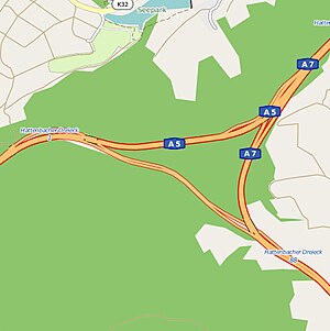
The Hattenbacher Dreieck is a motorway triangle in Hessen near Bad Hersfeld . This is where the A 5 (Hattenbacher Dreieck - Frankfurt am Main - Basel ) running in the south-west begins on the A 7 ( Flensburg - Hamburg - Kassel - Füssen ) running in the north-south direction . Only around 4 kilometers north of the Hattenbacher Dreieck branches off at the Kirchheimer Dreieck from the A 7 to the A 4 to Thuringia and Saxony .
geography
The motorway triangle is named after the district of Hattenbach , which belongs to the Niederaula community . The surrounding communities are Kirchheim , Oberaula and Breitenbach am Herzberg . It is located about 55 kilometers south of Kassel, about 105 kilometers west of Erfurt and about 30 kilometers north of Fulda .
The two neighboring motorway triangles in the middle of Germany became internationally important after the fall of the Berlin Wall and the opening of the inner-German border in 1989 through the west-east connection of the A 4: since then, the highways on the routes Hamburg - Frankfurt, Hamburg - Munich, Frankfurt have met here - Berlin, Frankfurt - Dresden and Cologne - Dresden.
The motorway triangle is number 1 on the A 5 and number 88 on the A 7.
history
Originally a motorway junction was planned instead of the triangle , whereby the gap between the eastern part of the A 4 and its western part should be closed by a connection Hattenbach - Olpe ; however, this section has not yet been implemented.
Design
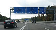
The triangle is not laid out in the usual trumpet shape, e.g. B. the Kirchheimer Dreieck, instead there are direct connections to the branching off direction of travel, without the usual loops and curves. The junction in the direction of Frankfurt on the A 5 and in the direction of Würzburg to the A 7 takes place on an uphill stretch with a four-lane directional lane for traffic to the south, which leads out of the Aula valley . In order to relieve this section, which is considered to be the focus of accidents, the Hattenbach triangle was expanded from June 2007 with a separate lane for truck traffic to Frankfurt and dynamic traffic management. The traffic sign gantries are controlled by the Hessen traffic control center in Frankfurt as part of the Hessen 2015 traffic jam-free project .
Traffic volume
As the central traffic junction in the German motorway network, the Hattenbacher Dreieck is one of the busiest in Germany outside of metropolitan areas with around 90,000 vehicles a day.
| From | To | Average daily traffic volume |
|---|---|---|
| Hattenbacher triangle | AS Alsfeld-Ost (A 5) | 53,500 vehicles (number from 2010 traffic census) |
| AS Kirchheim (A 7) | Hattenbacher triangle | 90,900 vehicles |
| Hattenbacher triangle | AS Niederaula (A 7) | 45,900 vehicles |
Individual evidence
- ^ Hattenbacher triangle. (No longer available online.) In: Autobahnkreuze & Autobahnreiecke in Germany. 2011, formerly in the original ; Retrieved November 24, 2012 . ( Page no longer available , search in web archives ) Info: The link was automatically marked as defective. Please check the link according to the instructions and then remove this notice.
- ↑ Extra lane for trucks . In: Hersfelder Zeitung . June 2, 2007.
- ↑ Claus Peter Müller: 30 percent discount at the motorway triangle. In: Frankfurter Allgemeine Zeitung . February 23, 2009. Retrieved February 26, 2009 .
- ↑ Manual traffic census BAB 2015. BASt Statistics, 2015, accessed on August 18, 2017 . (PDF file)


