Kassel-Süd motorway triangle
| Kassel-Süd motorway triangle | |
|---|---|
|
|
|
| map | |
| location | |
| Country: | Germany |
| State : | Hesse |
| Coordinates: | 51 ° 15 ′ 38 ″ N , 9 ° 31 ′ 0 ″ E |
| Height: | 213 m above sea level NN |
| Basic data | |
| Design type: | right-handed trumpet |
| Bridges: | 1 (motorway) / 3 (other) |
| Construction year: | 1968 |
| Last modification: | 1999 |
| The A7 at the AD Kassel-Süd in the direction of Würzburg | |
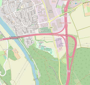
The Kassel-Süd motorway triangle (abbreviation: AD Kassel-Süd ; short form: Kassel-Süd triangle , until 2003 Kasseler Kreuz ) is a motorway triangle in Hesse near Kassel . It connects the federal highway 7 ( Flensburg - Hanover - Füssen ; E 45 ) with the federal highway 44 ( Aachen - Kassel; E 331 ).
geography
The triangle lies on the municipal areas of Fuldabrück , Lohfelden and Söhrewald in the Kassel district . The closest districts are Bergshausen , Dennhausen and Dittershausen (all part of Fuldabrück) and Crumbach , which belongs to Lohfelden. It is located about 7 km south of Kassel city center, about 145 km east of Dortmund and about 45 km northwest of Bad Hersfeld .
Not far from the triangle is the Fulda , which is crossed by the A 44 through the Fuldatalbrücke Bergshausen .
It is located on the western edge of the Frau-Holle-Land Geo-Nature Park (Werratal.Meißner.Kaufunger Wald) .
The Kassel-Süd motorway triangle has junction number 80 on the A 7 and number 70 on the A 44.
history
The original plans included a motorway junction in the form of a double trumpet . Contrary to these plans, the A 44 was not extended in an easterly direction here, but only about seven kilometers north at the Kassel-Ost junction. The bridge structures of the southern trumpet, which had already been built for this reason, were dismantled and finally demolished in 1999.
Design and state of development
The A 44 has four lanes, the A 7 has six lanes in the south. From 2016 to 2018 [obsolete] the A 7 in the north direction has been extended from six to eight lanes. The connecting ramp from the A 7-Nord to the A 44 is single-lane, the remaining connecting ramps are two-lane.
The motorway triangle was designed as a right-hand trumpet .
Traffic volume
Around 100,000 vehicles drive through the triangle every day.
| From | To | Average daily traffic volume |
Share of heavy goods traffic |
|---|---|---|---|
| AK Kassel-Mitte | AD Kassel-Süd (A 7) | 77,900 | 18.0% |
| AD Kassel-Süd | AS Guxhagen (A 7) | 73,500 | 19.7% |
| AK Kassel-West (A 44) | AD Kassel-Süd | 48,300 | 23.9% |
Individual evidence
- ↑ BI pro A 44 protests against the renaming of the Kasseler Kreuz and worries about the realization of the A 44 south. (PDF; 86 KB) (No longer available online.) Citizens' Initiative Pro A 44 eV, February 21, 2004, archived from the original on September 23, 2007 ; Retrieved November 30, 2013 . Info: The archive link was inserted automatically and has not yet been checked. Please check the original and archive link according to the instructions and then remove this notice.
- ^ AD Kassel-Süd. Motorway junctions and triangles in Germany, 2011, accessed on November 30, 2013 .
- ↑ https://www.hna.de/kassel/kreis-kassel/autobahn-a7-sti231737/a7-ausbau-beginnt-juni-acht-streifen- between- kassel-ost-sued- 6304467.html
- ↑ Manual traffic census BAB 2015. (PDF) BASt Statistics, 2015, accessed on August 29, 2017 .

