
Federal motorway 44
| Bundesautobahn 44 in Germany | |||||||||||||||||||||||||||||||||||||||||||||||||||||||||||||||||||||||||||||||||||||||||||||||||||||||||||||||||||||||||||||||||||||||||||||||||||||||||||||||||||||||||||||||||||||||||||||||||||||||||||||||||||||||||||||||||||||||||||||||||||||||||||||||||||||||||||||||||||||||||||||||||||||||||||||||||||||||||||||||||||||||||||||||||||||||||||||||||||||||||||||||||||||||||||||||||||||||||||||||||||||||||||||||||||||||||||||||||||||||||||||||||||||||||||||||||||||||||||||||||||||||||||||||||||||||||||||||||||||||||||||||||||||||||||||||||||||||||||||||||||||||||||||||||||||||||||||||||||||||||||||||||||||||||||||||||||||||||||||||||||||||||||||||||||||||||||||||||||||||||||||||||||||||||||||||||||||||||||||||||||||||||||||||||||||||||||||||

|
|||||||||||||||||||||||||||||||||||||||||||||||||||||||||||||||||||||||||||||||||||||||||||||||||||||||||||||||||||||||||||||||||||||||||||||||||||||||||||||||||||||||||||||||||||||||||||||||||||||||||||||||||||||||||||||||||||||||||||||||||||||||||||||||||||||||||||||||||||||||||||||||||||||||||||||||||||||||||||||||||||||||||||||||||||||||||||||||||||||||||||||||||||||||||||||||||||||||||||||||||||||||||||||||||||||||||||||||||||||||||||||||||||||||||||||||||||||||||||||||||||||||||||||||||||||||||||||||||||||||||||||||||||||||||||||||||||||||||||||||||||||||||||||||||||||||||||||||||||||||||||||||||||||||||||||||||||||||||||||||||||||||||||||||||||||||||||||||||||||||||||||||||||||||||||||||||||||||||||||||||||||||||||||||||||||||||||||||
| |
|||||||||||||||||||||||||||||||||||||||||||||||||||||||||||||||||||||||||||||||||||||||||||||||||||||||||||||||||||||||||||||||||||||||||||||||||||||||||||||||||||||||||||||||||||||||||||||||||||||||||||||||||||||||||||||||||||||||||||||||||||||||||||||||||||||||||||||||||||||||||||||||||||||||||||||||||||||||||||||||||||||||||||||||||||||||||||||||||||||||||||||||||||||||||||||||||||||||||||||||||||||||||||||||||||||||||||||||||||||||||||||||||||||||||||||||||||||||||||||||||||||||||||||||||||||||||||||||||||||||||||||||||||||||||||||||||||||||||||||||||||||||||||||||||||||||||||||||||||||||||||||||||||||||||||||||||||||||||||||||||||||||||||||||||||||||||||||||||||||||||||||||||||||||||||||||||||||||||||||||||||||||||||||||||||||||||||||||
| map | |||||||||||||||||||||||||||||||||||||||||||||||||||||||||||||||||||||||||||||||||||||||||||||||||||||||||||||||||||||||||||||||||||||||||||||||||||||||||||||||||||||||||||||||||||||||||||||||||||||||||||||||||||||||||||||||||||||||||||||||||||||||||||||||||||||||||||||||||||||||||||||||||||||||||||||||||||||||||||||||||||||||||||||||||||||||||||||||||||||||||||||||||||||||||||||||||||||||||||||||||||||||||||||||||||||||||||||||||||||||||||||||||||||||||||||||||||||||||||||||||||||||||||||||||||||||||||||||||||||||||||||||||||||||||||||||||||||||||||||||||||||||||||||||||||||||||||||||||||||||||||||||||||||||||||||||||||||||||||||||||||||||||||||||||||||||||||||||||||||||||||||||||||||||||||||||||||||||||||||||||||||||||||||||||||||||||||||||
 |
|||||||||||||||||||||||||||||||||||||||||||||||||||||||||||||||||||||||||||||||||||||||||||||||||||||||||||||||||||||||||||||||||||||||||||||||||||||||||||||||||||||||||||||||||||||||||||||||||||||||||||||||||||||||||||||||||||||||||||||||||||||||||||||||||||||||||||||||||||||||||||||||||||||||||||||||||||||||||||||||||||||||||||||||||||||||||||||||||||||||||||||||||||||||||||||||||||||||||||||||||||||||||||||||||||||||||||||||||||||||||||||||||||||||||||||||||||||||||||||||||||||||||||||||||||||||||||||||||||||||||||||||||||||||||||||||||||||||||||||||||||||||||||||||||||||||||||||||||||||||||||||||||||||||||||||||||||||||||||||||||||||||||||||||||||||||||||||||||||||||||||||||||||||||||||||||||||||||||||||||||||||||||||||||||||||||||||||||
| Basic data | |||||||||||||||||||||||||||||||||||||||||||||||||||||||||||||||||||||||||||||||||||||||||||||||||||||||||||||||||||||||||||||||||||||||||||||||||||||||||||||||||||||||||||||||||||||||||||||||||||||||||||||||||||||||||||||||||||||||||||||||||||||||||||||||||||||||||||||||||||||||||||||||||||||||||||||||||||||||||||||||||||||||||||||||||||||||||||||||||||||||||||||||||||||||||||||||||||||||||||||||||||||||||||||||||||||||||||||||||||||||||||||||||||||||||||||||||||||||||||||||||||||||||||||||||||||||||||||||||||||||||||||||||||||||||||||||||||||||||||||||||||||||||||||||||||||||||||||||||||||||||||||||||||||||||||||||||||||||||||||||||||||||||||||||||||||||||||||||||||||||||||||||||||||||||||||||||||||||||||||||||||||||||||||||||||||||||||||||
| Operator: |
|
||||||||||||||||||||||||||||||||||||||||||||||||||||||||||||||||||||||||||||||||||||||||||||||||||||||||||||||||||||||||||||||||||||||||||||||||||||||||||||||||||||||||||||||||||||||||||||||||||||||||||||||||||||||||||||||||||||||||||||||||||||||||||||||||||||||||||||||||||||||||||||||||||||||||||||||||||||||||||||||||||||||||||||||||||||||||||||||||||||||||||||||||||||||||||||||||||||||||||||||||||||||||||||||||||||||||||||||||||||||||||||||||||||||||||||||||||||||||||||||||||||||||||||||||||||||||||||||||||||||||||||||||||||||||||||||||||||||||||||||||||||||||||||||||||||||||||||||||||||||||||||||||||||||||||||||||||||||||||||||||||||||||||||||||||||||||||||||||||||||||||||||||||||||||||||||||||||||||||||||||||||||||||||||||||||||||||||||
| Start of the street: |
Aachen ( 50 ° 43 ′ N , 6 ° 7 ′ E ) |
||||||||||||||||||||||||||||||||||||||||||||||||||||||||||||||||||||||||||||||||||||||||||||||||||||||||||||||||||||||||||||||||||||||||||||||||||||||||||||||||||||||||||||||||||||||||||||||||||||||||||||||||||||||||||||||||||||||||||||||||||||||||||||||||||||||||||||||||||||||||||||||||||||||||||||||||||||||||||||||||||||||||||||||||||||||||||||||||||||||||||||||||||||||||||||||||||||||||||||||||||||||||||||||||||||||||||||||||||||||||||||||||||||||||||||||||||||||||||||||||||||||||||||||||||||||||||||||||||||||||||||||||||||||||||||||||||||||||||||||||||||||||||||||||||||||||||||||||||||||||||||||||||||||||||||||||||||||||||||||||||||||||||||||||||||||||||||||||||||||||||||||||||||||||||||||||||||||||||||||||||||||||||||||||||||||||||||||
| End of street: |
Waldkappel ( 51 ° 9 ′ N , 9 ° 55 ′ E ) |
||||||||||||||||||||||||||||||||||||||||||||||||||||||||||||||||||||||||||||||||||||||||||||||||||||||||||||||||||||||||||||||||||||||||||||||||||||||||||||||||||||||||||||||||||||||||||||||||||||||||||||||||||||||||||||||||||||||||||||||||||||||||||||||||||||||||||||||||||||||||||||||||||||||||||||||||||||||||||||||||||||||||||||||||||||||||||||||||||||||||||||||||||||||||||||||||||||||||||||||||||||||||||||||||||||||||||||||||||||||||||||||||||||||||||||||||||||||||||||||||||||||||||||||||||||||||||||||||||||||||||||||||||||||||||||||||||||||||||||||||||||||||||||||||||||||||||||||||||||||||||||||||||||||||||||||||||||||||||||||||||||||||||||||||||||||||||||||||||||||||||||||||||||||||||||||||||||||||||||||||||||||||||||||||||||||||||||||
| Overall length: | 330.3 km | ||||||||||||||||||||||||||||||||||||||||||||||||||||||||||||||||||||||||||||||||||||||||||||||||||||||||||||||||||||||||||||||||||||||||||||||||||||||||||||||||||||||||||||||||||||||||||||||||||||||||||||||||||||||||||||||||||||||||||||||||||||||||||||||||||||||||||||||||||||||||||||||||||||||||||||||||||||||||||||||||||||||||||||||||||||||||||||||||||||||||||||||||||||||||||||||||||||||||||||||||||||||||||||||||||||||||||||||||||||||||||||||||||||||||||||||||||||||||||||||||||||||||||||||||||||||||||||||||||||||||||||||||||||||||||||||||||||||||||||||||||||||||||||||||||||||||||||||||||||||||||||||||||||||||||||||||||||||||||||||||||||||||||||||||||||||||||||||||||||||||||||||||||||||||||||||||||||||||||||||||||||||||||||||||||||||||||||||
| of which in operation: | 275.8 km | ||||||||||||||||||||||||||||||||||||||||||||||||||||||||||||||||||||||||||||||||||||||||||||||||||||||||||||||||||||||||||||||||||||||||||||||||||||||||||||||||||||||||||||||||||||||||||||||||||||||||||||||||||||||||||||||||||||||||||||||||||||||||||||||||||||||||||||||||||||||||||||||||||||||||||||||||||||||||||||||||||||||||||||||||||||||||||||||||||||||||||||||||||||||||||||||||||||||||||||||||||||||||||||||||||||||||||||||||||||||||||||||||||||||||||||||||||||||||||||||||||||||||||||||||||||||||||||||||||||||||||||||||||||||||||||||||||||||||||||||||||||||||||||||||||||||||||||||||||||||||||||||||||||||||||||||||||||||||||||||||||||||||||||||||||||||||||||||||||||||||||||||||||||||||||||||||||||||||||||||||||||||||||||||||||||||||||||||
| of which under construction: | 39.5 km | ||||||||||||||||||||||||||||||||||||||||||||||||||||||||||||||||||||||||||||||||||||||||||||||||||||||||||||||||||||||||||||||||||||||||||||||||||||||||||||||||||||||||||||||||||||||||||||||||||||||||||||||||||||||||||||||||||||||||||||||||||||||||||||||||||||||||||||||||||||||||||||||||||||||||||||||||||||||||||||||||||||||||||||||||||||||||||||||||||||||||||||||||||||||||||||||||||||||||||||||||||||||||||||||||||||||||||||||||||||||||||||||||||||||||||||||||||||||||||||||||||||||||||||||||||||||||||||||||||||||||||||||||||||||||||||||||||||||||||||||||||||||||||||||||||||||||||||||||||||||||||||||||||||||||||||||||||||||||||||||||||||||||||||||||||||||||||||||||||||||||||||||||||||||||||||||||||||||||||||||||||||||||||||||||||||||||||||||
| of which in planning: | 15 km | ||||||||||||||||||||||||||||||||||||||||||||||||||||||||||||||||||||||||||||||||||||||||||||||||||||||||||||||||||||||||||||||||||||||||||||||||||||||||||||||||||||||||||||||||||||||||||||||||||||||||||||||||||||||||||||||||||||||||||||||||||||||||||||||||||||||||||||||||||||||||||||||||||||||||||||||||||||||||||||||||||||||||||||||||||||||||||||||||||||||||||||||||||||||||||||||||||||||||||||||||||||||||||||||||||||||||||||||||||||||||||||||||||||||||||||||||||||||||||||||||||||||||||||||||||||||||||||||||||||||||||||||||||||||||||||||||||||||||||||||||||||||||||||||||||||||||||||||||||||||||||||||||||||||||||||||||||||||||||||||||||||||||||||||||||||||||||||||||||||||||||||||||||||||||||||||||||||||||||||||||||||||||||||||||||||||||||||||
|
State : |
|||||||||||||||||||||||||||||||||||||||||||||||||||||||||||||||||||||||||||||||||||||||||||||||||||||||||||||||||||||||||||||||||||||||||||||||||||||||||||||||||||||||||||||||||||||||||||||||||||||||||||||||||||||||||||||||||||||||||||||||||||||||||||||||||||||||||||||||||||||||||||||||||||||||||||||||||||||||||||||||||||||||||||||||||||||||||||||||||||||||||||||||||||||||||||||||||||||||||||||||||||||||||||||||||||||||||||||||||||||||||||||||||||||||||||||||||||||||||||||||||||||||||||||||||||||||||||||||||||||||||||||||||||||||||||||||||||||||||||||||||||||||||||||||||||||||||||||||||||||||||||||||||||||||||||||||||||||||||||||||||||||||||||||||||||||||||||||||||||||||||||||||||||||||||||||||||||||||||||||||||||||||||||||||||||||||||||||||
| Development condition: | 2 × 2 and 2 × 3 lanes | ||||||||||||||||||||||||||||||||||||||||||||||||||||||||||||||||||||||||||||||||||||||||||||||||||||||||||||||||||||||||||||||||||||||||||||||||||||||||||||||||||||||||||||||||||||||||||||||||||||||||||||||||||||||||||||||||||||||||||||||||||||||||||||||||||||||||||||||||||||||||||||||||||||||||||||||||||||||||||||||||||||||||||||||||||||||||||||||||||||||||||||||||||||||||||||||||||||||||||||||||||||||||||||||||||||||||||||||||||||||||||||||||||||||||||||||||||||||||||||||||||||||||||||||||||||||||||||||||||||||||||||||||||||||||||||||||||||||||||||||||||||||||||||||||||||||||||||||||||||||||||||||||||||||||||||||||||||||||||||||||||||||||||||||||||||||||||||||||||||||||||||||||||||||||||||||||||||||||||||||||||||||||||||||||||||||||||||||
 |
|||||||||||||||||||||||||||||||||||||||||||||||||||||||||||||||||||||||||||||||||||||||||||||||||||||||||||||||||||||||||||||||||||||||||||||||||||||||||||||||||||||||||||||||||||||||||||||||||||||||||||||||||||||||||||||||||||||||||||||||||||||||||||||||||||||||||||||||||||||||||||||||||||||||||||||||||||||||||||||||||||||||||||||||||||||||||||||||||||||||||||||||||||||||||||||||||||||||||||||||||||||||||||||||||||||||||||||||||||||||||||||||||||||||||||||||||||||||||||||||||||||||||||||||||||||||||||||||||||||||||||||||||||||||||||||||||||||||||||||||||||||||||||||||||||||||||||||||||||||||||||||||||||||||||||||||||||||||||||||||||||||||||||||||||||||||||||||||||||||||||||||||||||||||||||||||||||||||||||||||||||||||||||||||||||||||||||||||
| Marsberg junction | |||||||||||||||||||||||||||||||||||||||||||||||||||||||||||||||||||||||||||||||||||||||||||||||||||||||||||||||||||||||||||||||||||||||||||||||||||||||||||||||||||||||||||||||||||||||||||||||||||||||||||||||||||||||||||||||||||||||||||||||||||||||||||||||||||||||||||||||||||||||||||||||||||||||||||||||||||||||||||||||||||||||||||||||||||||||||||||||||||||||||||||||||||||||||||||||||||||||||||||||||||||||||||||||||||||||||||||||||||||||||||||||||||||||||||||||||||||||||||||||||||||||||||||||||||||||||||||||||||||||||||||||||||||||||||||||||||||||||||||||||||||||||||||||||||||||||||||||||||||||||||||||||||||||||||||||||||||||||||||||||||||||||||||||||||||||||||||||||||||||||||||||||||||||||||||||||||||||||||||||||||||||||||||||||||||||||||||||
|
Course of the road
|
|||||||||||||||||||||||||||||||||||||||||||||||||||||||||||||||||||||||||||||||||||||||||||||||||||||||||||||||||||||||||||||||||||||||||||||||||||||||||||||||||||||||||||||||||||||||||||||||||||||||||||||||||||||||||||||||||||||||||||||||||||||||||||||||||||||||||||||||||||||||||||||||||||||||||||||||||||||||||||||||||||||||||||||||||||||||||||||||||||||||||||||||||||||||||||||||||||||||||||||||||||||||||||||||||||||||||||||||||||||||||||||||||||||||||||||||||||||||||||||||||||||||||||||||||||||||||||||||||||||||||||||||||||||||||||||||||||||||||||||||||||||||||||||||||||||||||||||||||||||||||||||||||||||||||||||||||||||||||||||||||||||||||||||||||||||||||||||||||||||||||||||||||||||||||||||||||||||||||||||||||||||||||||||||||||||||||||||||
The federal autobahn 44 (abbreviation: BAB 44 ) - short form: autobahn 44 (abbreviation: A 44 ) - runs from the German - Belgian border in North Rhine-Westphalia to the northeast of Hesse . An extension to the state border of Thuringia is under construction.
The motorway consists of a western section from Aachen via Mönchengladbach and Düsseldorf to Essen and an eastern section from Dortmund via Kassel to Waldkappel . The route of the A 44 is interrupted in many places, some of the gaps are to be closed in the next few years. An originally planned middle section from Velbert via Bochum to Dortmund is no longer planned.
course
Aachen to Mönchengladbach
The federal motorway 44 begins on the border with Belgium as a continuation of the Belgian motorway 3 coming from Liège . The first section of the A 44 begins at the Lichtenbusch border crossing and runs east around Aachen to the Aachen motorway junction , where the A 4 is crossed. There is also a connection to the Aachen city motorway 544 . The route then crosses the flat plain of the Jülich-Zülpicher Börde to the Jackerath motorway junction with a junction on the A 61 .
The subsequent section to the Holz motorway junction leads through the Garzweiler open-cast lignite mine . It was excavated together with the previous Jackerath motorway junction from 2005 and rebuilt one kilometer further east by 2018. As a diversion, the newly built section also takes on the traffic of the A 61 between the Jackerath junction and the Mönchengladbach-Wanlo motorway triangle , which has since been demolished for the advancing opencast mining. At Kreuz Holz, the A 44 crosses the A 46 , shortly afterwards it ends at the south-eastern city limits of Mönchengladbach at the Odenkirchen junction , where it joins the federal highway 59 . The urban area of Mönchengladbach interrupts the motorway here, which continues about 15 km away in the east of the city. An originally planned gap closure as the eastern bypass of Mönchengladbach, only a few kilometers away from the parallel A 61, is no longer pursued today.
Mönchengladbach to Essen
The second section of the A 44 begins at the Mönchengladbach-Ost junction on the northeastern city limits. Shortly afterwards, the A 52 is crossed under the Neersen motorway junction . The motorway runs south past Krefeld and crosses the A 57 at the Meerbusch motorway junction . From here the A 44 forms the northern part of the Düsseldorf motorway ring . You through several tunnels, crosses the Rhine at the airport bridge and binds both the fair Dusseldorf and the Dusseldorf Airport on. At the Düsseldorf-Nord motorway junction , the A 52 is again crossed. A few kilometers further on, the A 44 ends at the Ratingen-Ost motorway junction on the A 3 . At the beginning of the following section there is still a gap of 4.4 kilometers. The gap is planned to close by 2024. (→ Closing the gap in Ratingen-Ost − Velbert )
The A 44 starts again at the Heiligenhaus junction and bypasses the city to the south. In Velbert it runs through the Birth tunnel and north of the city center to the Velbert-Nord motorway triangle , where the A 535 branches off. From there, the A 44 runs north through the southeastern districts of Essen . After crossing the Ruhr on the Theodor-Heuss-Brücke , the A-44 section ends at the Essen- Heisingen junction and merges into Bundesstraße 227. According to the Federal Transport Infrastructure Plan 2030 , the autobahn should last along this route in the inner-city tunnel near Ruhrallee at the Essen-Bergerhausen junction on the A 52, which in turn ends about 1.5 km further at the Essen-Ost motorway junction on the A 40 . The continuation of the A 44 is about 40 km away near Dortmund.
Bochum to Dortmund
There is a motorway connection between A 43 and A 45 , which is still signposted with "A 44". This section of the motorway belonged to the motorway 44 until the turn of the year 2016/2017 and was then attached to the newly established A 448 .
Dortmund to Kassel
The eastern section of Autobahn 44 begins as a continuation of the B1 , which is already signposted in blue from the Holzwickede junction . Only at the Dortmund / Unna motorway junction , where the A 1 is crossed, does the A 44 begin and lead more than 70 kilometers almost exactly in an easterly direction. After bypassing Unna, it crosses the A 445 at the Werl interchange . It passes south of Soest , Erwitte and Paderborn / Lippstadt Airport . At the Wünnenberg-Haaren motorway junction , it crosses the A 33 , which continues to the south as the B 480 . At Diemelstadt and Warburg , the A 44 crosses the North Rhine-Westphalian / Hessian border three times and then runs south-east to Kassel , with a series of viaducts through the hilly North Hesse . At the Kassel-West motorway junction , it first crosses under the A 49 and then crosses the Fulda on the Bergshausen Fulda bridge . At Dreieck Kassel-Süd , the A ends 44-part piece with the junction with the A 7 .
Kassel to Herleshausen
An extension of the A 44 to the Thuringian border is under construction from Kassel in a south-easterly direction. The 70-kilometer highway section is part of the German Unity Transport Project 15 and is a direct connection of A 40 and A 44 to A 4 produce so with a bit of a continuous motorway link from the Dutch border at Venlo to the Polish border near Görlitz concluded comes.
Initially, the A 44 divides the route to the northeast for seven kilometers from the Kassel-Süd motorway junction with the A 7. The expansion to eight lanes required for this is in progress (status 07/2020). At the Kassel-Ost triangle, the A 44 should pull out according to the current planning approval and run close to the B 7 to Helsa . This is followed by a section under construction through the Hirschhagen tunnel to Hessisch Lichtenau . The following 17.5 km section to Waldkappel is under traffic. The final section up to the Wommener Dreieck on the A4 near Herleshausen is currently being built by DEGES . All sections under construction are scheduled to be completed by 2025.

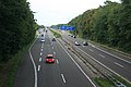
Start at the Lichtenbusch border crossing
At the Aachen motorway junction before the renovation

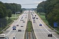
Between Krefeld and Osterath

Airport bridge over the Rhine near Düsseldorf

Velbert-Nord triangle

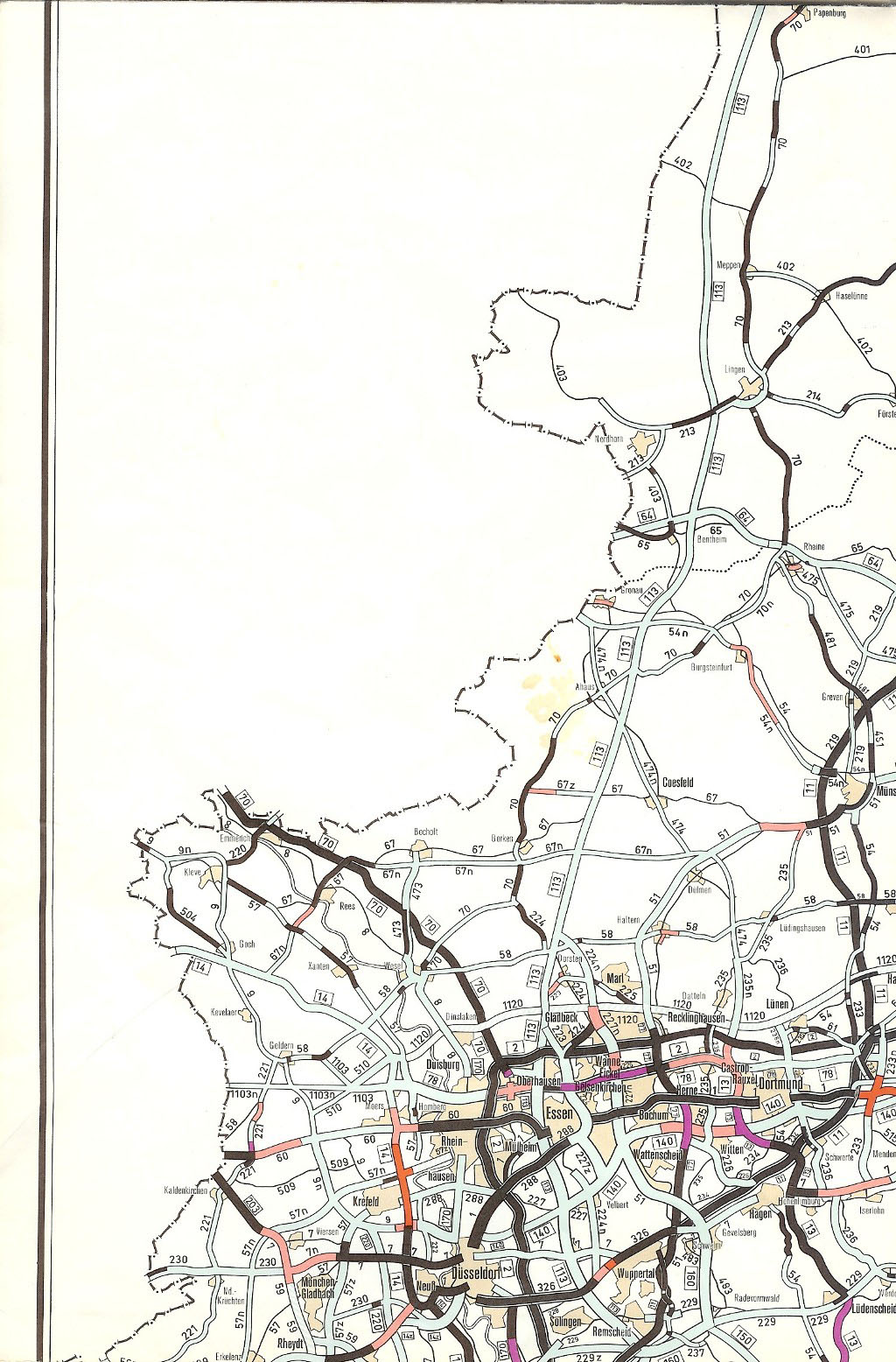
Between Dortmund and Soest
Motorway makeshift airfield near Geseke / Büren
At the Wünnenberg-Haaren cross

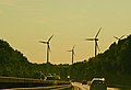
Crossing the Egge Mountains

Mountain panorama in east direction of travel

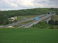
Western end of the section near Hessisch Lichtenau
Hopfenbachtalbrücke near Hessisch Lichtenau
Wehretalbrücke near Walburg


.JPG)


history
Planning and construction until 1945

The HaFraBa e. V. network plan drawn up in 1927 provided for a motorway connection from Dortmund via Kassel to Erfurt with a connection to the Frankfurt am Main - Leipzig - Dresden - Wroclaw route . The National Socialists took up the project as part of the propaganda after the seizure of power in 1933. The now planned route from the Ruhr area via Paderborn , Eisenach , Leipzig / Chemnitz , Dresden, Bautzen and Liegnitz to Breslau was included in the basic network plan as line F in September 1933. In 1934 a line was first determined that branches off today's A 2 at Hamm-Rhynern and should lead north to Soest , south to Erwitte , south to Geseke , on via Büren , Scherfede , Wettesingen near Warburg to Kassel and on to Eisenach. In addition, an extension of Hamm in the room was Ascheberg with connection to the then planned Reichsautobahn route Bremen - Muenster -Dortmund (current A 1 ) for the late 1940s envisaged. The planning between Hamm and Kassel was pushed ahead rapidly, so that construction of the first section near Hamm began as early as 1937.
Although the route was also affected by the building blocks imposed as a result of the outbreak of World War II , construction work could be resumed or continued within the framework of exceptional regulations. When the work was completely stopped in 1942, bridge structures over 7.7 kilometers in the Hamm area and the intersection structure with today's A 7 and the Fulda bridge near Kassel were partially or fully built, extensive earthworks carried out and further preparatory work in the Hamm-Erwitte section ( Reichsstraße 1 ) takes place.
The drafts were also drawn up for the connection from Kassel to Eisenach and the route was approved for construction. However, when the war broke out, the construction work had to be stopped in favor of the Eisenach– Bad Hersfeld autobahn ("Route 81", today's A 4 ), so that a bridge was only completed in the Söhrewald near Kassel and the underpasses under the today's A 4 at Herleshausen.
The planned Reichsautobahn basic network, which had grown to 7000 kilometers by 1938, also included a connection that was to branch off south of Dortmund from the Reichsautobahn Kamen - Leverkusen (today's A 1) and lead via Düsseldorf into the Aachen area. In a map published by the OLEX company in 1935 , the section between Ratingen and Witten was already marked as “under construction or released for construction”. However, work did not begin on this section or in any other section of the Aachen – Düsseldorf – Dortmund connection before the end of World War II.
The Reichsautobahn was under construction with different names: The section between Hamm-Rhynern and Warburg was called route 77 , the section Warburg-Kassel route 75 and the section Kassel-Eisenach route 78. The connection Mönchengladbach-Duisburg / Oberhausen was as route 112 and Mehren – Aachen – Mönchengladbach as route 95 in preparation. Lines 77 and 78 would have been number 57 as the operating line.
Expansion of the western section
The first ever approved section of the A 44 was the connection between Aachen- Brand and the Aachen motorway junction in 1963 . In 1964, the further connection from Aachen-Brand to the German-Belgian border was opened. In the plan for the expansion of the federal trunk roads from 1971 to 1985, the section was included under the internal designation "Autobahn 15".
Between the Aachen junction and today's Holz Autobahn triangle , construction was planned as a four-lane highway-like federal highway 1 and sections of it had already been completed. From the Holz motorway triangle to today's Neersen motorway junction , the 57z federal road was planned with the same construction standard . Between the Neersen junction and today's AS Krefeld-Forstwald, the route was already opened to traffic as a motorway-like federal road 57 . The four-lane federal highway 9 was planned from Krefeld-Forstwald to today's Düsseldorf-Stockum AS . At the last-mentioned junction, the federal highway was to merge with the Düsseldorf – Duisburg line , internally referred to as “Autobahn 170”. No connection was planned between the Düsseldorf-Stockum junction and today's Düsseldorf-Nord motorway junction . From 1973 the section from the Aachen junction to the Holz junction was designated as a federal motorway with the designation "A 201", the section from the Holz junction to Dortmund became the "A 140".
When the new network structure came into force in 1975, the section from the German-Belgian border near Lichtenbusch to the A 59 at Düsseldorf Airport was designated as the A 53 , the section from the Düsseldorf-Nord junction to Eisenach as the A 44. August 1976 to amend the law on the expansion of federal highways from 1971 to 1985, the Aachen – Düsseldorf section was also rededicated as the A 44.
In this area, the cross section Aachen – Kreuz Holz was completed in 1975. In 1976 the section Osterath - Lank-Latum followed , in 1977 the sections Dreieck Holz - Mönchengladbach - Odenkirchen and Neersen - Kreuz Neersen . In 1983 the sections Ratingen - Schwarzbach --Ratingen-Ost and Münchheide - Krefeld -forest forest followed. In 1985 a short section each followed in the north of Düsseldorf between Stockum and Düsseldorf- Messe and near Velbert between Velbert-Nord and Langenberg .
Until 1990, the A 44 between Mönchengladbach and Essen consisted of numerous very short sections that were not connected to each other. In that year, the section Krefeld-Forstwald-Osterath created the continuous connection between Neersen ( A 52 ) and Meerbusch ( A 57 ). Further construction in the north of Düsseldorf also continued to progress. In 1991 the autobahn between the Düsseldorf-Nord junction and Reichswaldallee was passable, in 1992 the gap between the Düsseldorf-Nord junction and Stockum was closed in a westerly direction. That same year she was at Ratingen-Ost on the A3 tethered. The sections from Ratingen (A 3) to the Düsseldorf exhibition center and from Lank-Latum to Mönchengladbach-Ost were now completed. The gap in this section was very expensive and time-consuming due to the numerous engineering structures and was therefore only completed in 2002. The motorway leads through two tunnels built for nature conservation reasons and on the airport bridge over the Rhine . This route, which is only about 5.9 km long, cost a total of 367 million euros. Between the Meerbusch junction and the Ratingen-Ost junction , the A 44 forms the northern part of the Düsseldorf motorway ring . It has a total of five motorway tunnels in this area, which were built primarily for reasons of noise and nature conservation.
On December 5, 2005, the federal road 227 was completed as an extension from the end of the motorway at Velbert-Langenberg to Essen - Kupferdreh . This section, which cost 32.6 million euros and is 3.5 km long, was upgraded to federal motorway 44 on January 1, 2010. The 9.3 km long gap between Ratingen and Velbert has been under construction since 2010, and one half has been completed. In the 2016 requirement plan, the construction of a tunnel under Essen's Ruhrallee to directly connect the A 44 with the A 52 was listed as a “further requirement with planning rights”.
Expansion of the middle section, construction freeze and outsourcing
Between the Düsseldorf-Nord junction, Ratingen, Velbert, Hattingen, Bochum, Dortmund and Unna, a connection was planned as a federal motorway under the internal name “Autobahn 140”. The route was to flow east of Unna into the Dortmund – Kassel – Eisenach autobahn, which was internally referred to as "Autobahn 16". After this section was assigned to the A 44, the plans in the Ruhr area were given the name “DüBoDo” in order to express the goal of a continuous motorway connection from Düsseldorf via Bochum to Dortmund south of today's A 40. These plans were not implemented. A section was built between Bochum and Dortmund in the early to mid-1970s, which runs between federal motorways 43 and 45 and connects to Witten . The extension through the south of Dortmund to Unna was abandoned in the mid-1970s, the connection between Velbert and Bochum has not been planned since 2003.
According to the plan for the expansion of the federal trunk roads from 1971 to 1985, which came into force in 1971, the autobahn from the Dortmund / Witten junction south of Dortmund - Hombruch and north of Kirchhörde , then parallel to the state road 661 north of Lücklemberg ( B 54 ) and Wellinghofen and south of Hörde , north of Berghofen ( B 236 ), south of Aplerbeck , Sölde , Holzwickede , Billmerich , Unna-Süd ( A 443 / B 233 ) to the Dortmund – Kassel line in the Siddinghausen and Ostbüren area. Construction work can still be seen at the Dortmund / Witten motorway junction.
The first law of August 5, 1976 amending the law on the expansion of federal trunk roads from 1971 to 1985 led to the cancellation of the planning of the A 44 between Unna-Süd and Siddinghausen. Instead, the A 44 should run over the later route of the A 443 or B 233 to the Unna-Ost intersection. The second law of August 25, 1980 amending the law on the expansion of federal highways from 1971 to 1985, with which the legislature waived parallel planning, no longer contained this section of the "DüBoDo" in the south of Dortmund. The third law of April 21, 1986 amending the law on the expansion of federal highways did not change anything.
With German reunification in 1990, the consequences of increasing east-west traffic for the Ruhr area were also discussed. The fourth law amending the law on the expansion of long-distance roads from November 15, 1993 therefore contained a “further requirement” for a route from the Dortmund / Witten junction through the south of Dortmund to a motorway triangle with the A1 at Holzwickede. This route was no longer included in the 2003 Federal Transport Infrastructure Plan , which was valid until 2015, nor was it in the 2030 Federal Transport Infrastructure Plan . Instead, the long-term extension of the A 40 (partly as an upgrade of the B 1) from Dortmund to the A 44 near Unna is planned.

The original plan also envisaged connecting the A 44 to the east of the Langenberg AS, which had now been built, to the federal road 227 to Essen- Kupferdreh . Behind it, the A 44 should run southeast past the Dilldorf , Essen-Kupferdreh and Essen- Byfang between Essen- Burgaltendorf and Niederwenigern . North of the Ruhr, between Bochum-Dahlhausen and Linden , it was to finally reach Oviedo-Ring near Bochum-Weitmar , today's A 448, and from there be connected to the existing section in the east of Bochum.
The section was included in the 1971 plan for the expansion of the federal trunk roads from 1971 to 1985. The first law of August 5, 1976 amending the law on the expansion of federal trunk roads from 1971 to 1985 assigned the section to urgency level 1b. The planning was politically controversial, from the beginning there was resistance to the construction of the "DüBoDo". Several citizens' initiatives became active, including Hattingen / Essen against the DüBoDo and Bochum against the DüBoDo.
With the second law of 25 August 1980 amending the law on the expansion of federal trunk roads from 1971 to 1985, the route was canceled without replacement. With the third law of April 21, 1986 amending the law on the expansion of federal highways, the section was resumed as “further planning”. The fourth law amending the law on the expansion of the trunk road of November 15, 1993 classified the entire section between Ratingen via Velbert and Bochum as an "urgent need". In the Federal Transport Infrastructure Plan 2003, which was valid until 2015, this section was again deleted. Instead, traffic management was planned further north via the A 52 and A 40. The western section of the A 44 was continued through Essen to the north in the direction of the A 52 and ends there.
From 2009 the southern Bochumer Ring was expanded from the A 40 to the new A 448 to enable a southern bypass of Bochum. This section is connected to the previous section of the A 44 between A 43 and A 45 via a short, newly built section of the motorway. After the gap has been closed, the section of the A 44 will form a continuous extension of the new motorway and was therefore separated from the A 44 on January 1, 2017 and assigned to the A 448.
Expansion of the eastern section

In 1959 and 1963, traffic reports were commissioned to check the route. In 1961 the Regional Association of Westphalia-Lippe created a “Rhynern-Kassel New Motorway Construction Office” in Soest. However, the investigations revealed that the route in the Hamm – Erwitte area had to be changed and the motorway should instead run from Dortmund south of Unna , Werl and Soest. The construction at Hamm, which had already started, was thus obsolete. While the construction of the motorway between Dortmund and Kassel was to be carried out quickly in sections from 1965, the construction of the Kassel – Eisenach line was not given priority due to the division of Germany .
The construction work between Kassel and Dortmund finally began in 1964 on the basis of the pre-war plans on the Hessian side west of Kassel. The first section from Burghasungen (near today's Zierenberg AS ) to the confluence with the Hanover – Kassel – Bad Hersfeld motorway (today Kassel-Süd ) was completed in 1968. From 1970 the motorway was extended in sections in a westerly direction, first to Breuna , 1971 to Diemelstadt and 1972 to Wünnenberg . From Dortmund, the construction of the line to the east was also pushed ahead: in 1972 the section from the Bremen – Dortmund – Cologne motorway near Unna (today's Dortmund / Unna junction) to the Soest-Ost junction was opened. This section was initially built as a southern parallel to the B 1 along the Haarstrang to relieve the B 1, which was heavily burdened by the excursion traffic of the Ruhr area people to the Sauerland and in particular to the Möhnesee south of Soest and was stowed away on weekends. The gap between the two sections was closed in 1975, and the motorway between Dortmund and Kassel has been continuously passable ever since.
A makeshift motorway airport was created between the Geseke (59) and Büren (60) junctions . The motorway here is dead straight and level, equipped with removable guard rails (concreted underneath), has recessed planting on the sides and is not spanned by obstacles (bridges or high-voltage lines). The overhead line masts directly at the western end are painted red and white as an aviation obstacle. The section was intended to serve as a makeshift landing strip for military transporters of the US Air Force , which should fly to it non-stop from the USA in the event of a conflict with the Warsaw Pact . There are large parking spaces at both ends of this section, which should then be used to unload and turn the aircraft. In 2009, the single guardrail was replaced by a normal, double guardrail, so that the makeshift landing site can no longer be used without further ado.
After the German reunification in 1990, an improved motorway connection from the Ruhr area to Thuringia and Saxony was planned as part of the German Unity Transport Project (VDE). VDE No. 15 comprised the new construction of the A 44 section from Kassel to Herleshausen, the six-lane expansion of the adjoining A 4 between Eisenach and Dresden and its continuation to Görlitz. Like all VDE projects, this should also be accelerated. While the expansion of the A 4 has almost been completed, most of the A 44 section is still in the planning and construction phase. Around a quarter of the route between Hessisch Lichtenau and Waldkappel has been completed so far.
Construction projects and planning
Expansion of Broichweiden – Alsdorf
For the 5.0 kilometer section between the Broichweiden junction and the Alsdorf junction, there are plans to expand it to six lanes. The total costs were estimated in the Federal Transport Infrastructure Plan 2030 at 53.7 million euros. The project was classified in the lowest level “further need without planning permission”, so construction work before 2030 is unlikely.
Expansion of Willich – Meerbusch
For the 13.6 kilometer section between the Neersen motorway junction and the Meerbusch motorway junction, there are plans to expand it to six lanes. The total costs were estimated in the Federal Transport Infrastructure Plan 2030 at 121.4 million euros. The project was classified in the lowest level “further need without planning permission”, so construction work before 2030 is unlikely.
Closing the gap in Ratingen-Ost-Velbert

The section of the motorway junction Ratingen-Ost -Velbert to close the last gap in the A 44 between Mönchengladbach and food as well as by Heiligenhaus and Ratingen-Hosel leading national road 227 and the national road 422 in Ratingen-Homberg relieve. Eleven bridge structures are required on the 9.8 kilometer section of the motorway, five of which are valley bridges, as well as extensive noise protection facilities. The construction costs were estimated at 222 million euros. Construction began in April 2010. The 4.6-kilometer eastern section between the Heiligenhaus-Hetterscheid junction and the new Heiligenhaus junction was completed and approved in April 2018. The second, western section between the Heiligenhaus junction and the Ratingen-Ost motorway junction is in the planning approval process. Only the most expensive structure, the viaduct over the Angerbach, began in September 2016. After delays in the delivery of prefabricated steel parts, it should be completed in mid-2021. The start of construction of the line is planned for mid-2021, the completion of the gap closure is planned for 2024.
Further construction up to the A 52 in Essen
When the decision to continue the A 44 from Velbert to the north, it was known that the additional traffic in Essen would be routed to already heavily used city streets. The A 44 merges into the B 227 at the Heisingen junction, which is built like a motorway for the next 2.5 kilometers along the Ruhr to the confluence with the Konrad-Adenauer Bridge . On the following 1.8 kilometers to the connection A 52, the B 227 is a four-lane city street under the name Ruhrallee with a steep incline over the Ruhr slope. With 64,000 vehicles per day, the existing cross-section of the road is already overloaded; expansion or bypassing is not possible due to the dense development. After the gap between Ratingen and Heiligenhaus has been closed, an additional significant increase in traffic is expected for the then continuous A 44 connection between Düsseldorf and Essen.
Tunneling under the Ruhrallee is seen as the only solution for closing a gap in the motorway between A 44 and A 52. A plan is contained in the Federal Transport Infrastructure Plan 2030 under “Additional requirements with planning rights”. The construction of a Ruhrallee tunnel would be extraordinarily expensive given the many difficult conditions. The urban area is densely built up, in the Ruhr slopes mining has been practiced for centuries near the surface, and in the Ruhr area the route lies between nature reserves. Several variants were investigated, a tunnel exclusively exactly under the Ruhrallee and a longer variant, which, detached from the city streets, takes a straight path under the residential development. The longer variant listed in the Federal Transport Infrastructure Plan is estimated there at a total cost of 363.6 million euros, more than 100,000 euros per meter of street.
In 2011, it emerged that the Landesbetrieb Straßen.NRW, which was in charge of the planning, had concealed the existence of a geological report. The report by Deutsche Montan-Technologie , which was drawn up in 2004, identified 36 registered coal mining seams in the construction area of the tunnel, as well as mining tunnels and shafts. The report assessed the risk of breakages , subsidence and subsidence as high, the effort required for the necessary exploration and securing work as high, and the subsequent expenditure as unclear. An already completed soil stabilization measure under a single house in the tunnel area took more than a year and cost over 1 million euros.
There were early protests against the construction of a Ruhrallee tunnel. In addition to the risks involved in construction, the citizens' initiatives also point to the fundamental consequences for the supra-regional traffic flows that have so far tended to bypass the Ruhr area and, given the continuous motorway connections, could be directed by navigation systems to the densely populated core areas. Due to the gradient of around 5 percent, the heavy goods traffic routed on the route would have to drive at full load in the tunnel area. The further course of the traffic has not yet been clarified: The combined traffic of a total of five lanes of the A 44 and the A 52 could only go one kilometer further in the Essen-Ost motorway triangle onto the heavily loaded A 40.
Expansion of Dortmund – Werl
After abandoning the central section through the south of the Ruhr area, the connection between the western and eastern sections of the A 44 will be established further north via the A 40. The A 40 currently ends west of Dortmund city center and merges into Bundesstraße 1 . From there to the motorway-like junction with the federal highway 236 , the B1 is a six-lane city road for 5.8 kilometers. For the next 9.9 kilometers to the transition to the A 44 at the Dortmund / Unna junction, the B 1 is built like a motorway, six-lane for around 1.5 kilometers, then four-lanes. To connect the two motorways, plans include the construction of a new motorway with two long tunnels in the inner-city area and an expansion of the motorway-like B 1 section. In addition, the A 40 and A 44 are to be expanded to six lanes all the way to the Werl motorway junction . After completion, the A 40 and the eastern section of the A 44 will form a continuous motorway from the Dutch border to the Hesse / Thuringia border.
The expansion of the B 1 to the A 40 through the densely built-up center of Dortmund with the construction of two new tunnels 1.5 and 1.6 kilometers in length would be extremely expensive, similar to the gap through Essen. In the planning data of the Federal Transport Infrastructure Plan 2030, total costs of 794.4 million euros (2014 prices) were calculated for two construction sections totaling 6.2 kilometers. The expansion of the already autobahn-like B 1 section to a six-lane autobahn was estimated to be 9.5 kilometers in length at a total cost of 96.6 million euros. The first bridge structures for this section were started in 2018.
In the extension behind the Dortmund / Unna motorway junction, the A 44 is also to be extended to six lanes. The first section from the motorway junction to the Unna-Ost junction was classified in the Federal Transport Infrastructure Plan 2030 as an “urgent need”. For an expansion length of 5.3 kilometers, total costs of 68.4 million euros were estimated. The plan approval procedure was opened in 2016, but has not yet been completed following objections. The subsequent second section to the Werl motorway junction with a length of 13.1 kilometers and an estimated total cost of 123.3 million euros was downgraded to the category of “further needs with planning rights”.
Extension Kassel – Herleshausen
planning
The Kassel – Herleshausen line was part of the 1971 plan for the expansion of federal highways from 1971 to 1985. The requirements plan of the First Law of August 5, 1976 amending the law for the expansion of federal highways from 1971 to 1985 contained the line in further requirements. With the second law of August 25, 1980 amending the law on the expansion of federal highways from 1971 to 1985, this plan was abandoned. What remained was the two-lane new construction project for the B 7n between Oetmannshausen and Herleshausen. In 1986, with the Third Act of April 21, 1986 amending the Act on the Extension of Federal Highways, this project was also deleted. With the opening of the inner-German border in 1989 and German reunification, it was predicted that the Niederrhein – Ruhrgebiet – Kassel – Erfurt – Chemnitz – Dresden line would have increased traffic requirements. The gap was closed in 1991 as Project No. 15 part of the German Unity Transport Project .
While the other VDE road construction projects were implemented quickly, the planning between Kassel and Eisenach proved difficult. As a result of a route investigation, the planning made before the Second World War was discarded. In future, the motorway will not run through the Söhre, but through the Losse and Wehre valleys, so that the motorway and bridge begun in the forest area in 1936 will only remain monuments. A citizens' initiative fought for a different route, which was essentially based on pre-war planning.
The extension of the A 44 to a total of 69.42 km in length in eleven sections is called traffic cost units (VKE), on the one hand by "Hessen Mobil Kassel" (section Kassel – Waldkappel; 39.72 km; seven VKE: VKE 01 to 33) and on the other hand planned by "Hessen Mobil Eschwege" (section Waldkappel – Herleshausen; 29.7 km; four VKE: VKE 40.1 to 60). This also includes the section VKE 01 (eight-lane expansion of the common section of the A 7 and A 44). The special cross-section 27 with two 3.5 m wide lanes and one 2.5 m wide hard shoulder per lane is planned for the new line. Among other things, 13 new tunnels with a total length of around 14 km are planned, so that the A 44 has a total of around 21 km tunnel length. (See also the tunnel section below .).
| No | VKE 1 | section | status | Length (km) |
Construction costs (million €) |
|---|---|---|---|---|---|
| 1 | 01 | AD Kassel-Süd ( A 7 ) - AD 2 Kassel -Ost 7 (A 7) | under construction (from 2010 to approx. 2022) | 6.20 | 91 |
| 2 | 11 | AD Kassel-Ost 7 (A 7) - AS 3 Helsa -Ost | in the planning approval (since mid-2006) (planned completion 2032) | 11.34 | 304 |
| 3 | 12 | AS Helsa-Ost – AS Hessisch Lichtenau -West | under construction (since May 25, 2010/31 January 2013 4 to approx. 2022 5 ) | 5.94 | 346 |
| 4th | 20th | AS 76 H. Lichtenau-West – AS 77 H. Lichtenau-Mitte | Completed (start of construction April 11, 2008, traffic opening on July 24, 2014) | 2.23 | 101 |
| 5 | 31 | AS 77 H. Lichtenau-Mitte – AS 78 H. Lichtenau-Ost | Completed (open to traffic on October 6, 2005) | 4.37 | 87 |
| 6th | 32 | AS 78 H. Lichtenau-Ost-Waldkappel- Hasselbach | Completed (start of construction September 24, 2010, traffic opening on April 13, 2018) | 4.34 | 141 |
| 7th | 33 | Waldkappel-Hasselbach – AS 79 Waldkappel | Completed (start of construction March 22, 2011, traffic opening on April 13, 2018) | 6.56 | 93 |
| 8th | 40.1 | AS 79 Waldkappel – AS Ringgau | under construction (from October 2014 to approx. 2021) | 6.7 | 388 |
| 9 | 40.2 | AS Ringgau – AS Sontra –West | under construction (from February 2017 to approx. 2024) | 5.4 | 179 |
| 10 | 50 | AS Sontra-West – Riedmühle viaduct | under construction (from June 3, 2018 to approx. 2024) | 7.7 | 436 |
| 11 | 50 | Viaduct Riedmühle-West – AS Ulfen | under construction (from August 18, 2017 to approx. 2022) | 3.3 | 62 |
| 12 | 60 | AS Ulfen – AD Herleshausen - Wommen ( A 4 ) | under construction (from August 18, 2017 to approx. 2022) | 5.8 | 171 |
| Sum in kilometers (km) (left) and million (million) euros (right): | 69.88 | 2,399 | |||
What is striking about the route planning are the numerous tunnels that were designed to protect residents and nature. These lead to high construction and maintenance costs for the motorway. For the approximately 4.2 km long Hirschhagen tunnel alone , the construction costs were estimated at 247 million euros. When completed, it will be the longest road tunnel in Hesse and the second longest in Germany.
At the two ends of the new line, two new motorway triangles will be created to connect to the existing motorway network:
- To the east of Kassel in the Losse valley, the Kassel-Ost triangle : There the A 44 will branch off from its common section with the A 7 in an easterly direction. The Kassel-Ost junction currently located there , which connects the motorway to the B 7 (Leipziger Strasse) , will be completely eliminated. Instead, a new junction will be built on the new A44 route around two kilometers further southeast between the Kaufunger districts of Niederkaufungen and Papierfabrik .
- West-northwest of Herleshausen in the Werra valley, the Wommen triangle : There the A 44 is connected to the A 4.
Political discussion and litigation
There was considerable resistance from local residents and nature conservationists to the construction of the new motorway. Among other things, the Federation for Environment and Nature Conservation Germany is involved . V. (BUND) against the building.
The tackling of the individual sections of the route was delayed due to lawsuits and necessary improvements. In a judgment of March 12, 2008, the Federal Administrative Court of Leipzig gave the green light for the existing plans of section VKE 20 and thus decided in favor of the plans of the state of Hesse and against the action of the Federal Environment and Nature Conservation (BUND), which cut through the ecological valuable Lichtenau highlands through the route and therefore wants to prevent the 1.2 billion euro project.
On October 31, 2008 the Federal Administrative Court stopped the construction of the A 44 from Kassel to Herleshausen in section VKE 32. In the decision, the judges ordered the "suspensive effect" of a lawsuit by the Hessian Association for the Environment and Nature Conservation Germany (BUND). This meant that construction between Hessisch Lichtenau-Ost and Waldkappel-Hasselbach was not allowed for the time being. The Ministry of Economics in Wiesbaden saw this decision only as a postponement of the work, but not as the end of the expansion. The decision was made on April 14, 2010. The judges stated that environmental concerns were sufficiently taken into account in this section. Thus, construction of this section can begin. This 11-kilometer section was opened on April 13, 2018.
In September 2009, the then Hessian Transport Minister Dieter Posch announced during a construction site visit that the state government's goal for the complete completion of the A 44 between Kassel and Herleshausen would remain in 2016. Of the total of 64 kilometers of the motorway to Wommen (Herleshausen), only five are finished. With an estimated cost of 2.4 billion euros, it will be one of the most expensive in the world in terms of route length.

On August 3, 2010 it was announced that the 6 km long section between Helsa and Hessisch Lichtenau in northern Hesse will become more expensive. Originally, 241 million euros was assumed, since a large part of the route has to be tunnelled. Now, for the protection of the habitat is to newts another kilometer are vertunnelt. This is associated with additional costs of 50 million euros.
The State Association of Hesse of the BUND e. V. remained unsuccessful in the last instance with its lawsuit against the construction of the section between AS Waldkappel and Hoheneiche. In its judgment of March 28, 2013, the Federal Administrative Court did not follow the nature conservation law objections that had been raised against the transport project. The planned route does not conflict with the conservation objectives of the FFH areas it touches. The protected species of the crested newt, the yellow-bellied toad, two bat and woodpecker species as well as special forest habitat types (beech forests) were the focus of the court's considerations. The judges could not see any incompatibility with the planning. The expected impairments would also be offset by imperative traffic needs, which would predominate. The court ruled that the project is in line with species protection law.
The environmental protection measures involved in the construction of the A 44 are very different. They range from simple measures such as B. fencing in streams so that they are not affected by construction activities, to extensive construction activities in the transport cost unit 33, such as laying the B 7 in order to be able to install noise barriers , or the construction of several green bridges that protect the game to be used to cross the motorway route. The green bridges should also serve to protect against irritation, so that z. B. Bats can cross the motorway at night without being disturbed by the light of the moving cars.
Gaps not taken into account in the current federal transport infrastructure plan
Eastern bypass of Mönchengladbach
In Mönchengladbach, the A 44 ends at the southeastern city limit and begins again at the northeastern city limit. A section of the motorway for the eastern bypass of the urban area was planned and assigned to urgency level I in the requirements plan of the second law of 25 August 1980 amending the law on the expansion of federal trunk roads from 1971 to 1985. The planned route would have led through the Volksgarten-Bungtwald nature reserve, in the immediate vicinity of Rheydt Castle . Therefore, the erection of very expensive protective structures such as tunnels and protective walls would have been necessary. With the third law of April 21, 1986 amending the law on the expansion of federal highways, the route was downgraded to "further planning". It was no longer included in the 2003 Federal Transport Infrastructure Plan and was not included in the requirement plan from the end of 2016.
Essen – Dortmund section
Originally, a direct connection between the western and eastern sections of the A 44 from Düsseldorf via Velbert, Essen, Bochum and Dortmund to Unna by a new motorway route south of today's A 40 was planned. The section through the south of Dortmund was deleted in 1976, the section between Velbert and Bochum in 2003, and the only section built between Bochum and Dortmund was reclassified to the newly established A 448 in 2017. Instead, it was planned to route traffic further north via the A 52, A 40 and A 448. For this purpose, the western section of the A 44 in Essen was continued north in the direction of the A 52 and ends there. After the establishment of an alternative traffic route and the reclassification of the only existing section to another motorway, a connection between the western and eastern sections of the A 44 is no longer expected in the foreseeable future.
Demolition and reconstruction of a section
The section located in the mining area of the Garzweiler II open-cast lignite mine between the Jackerath and Holz motorway junctions was finally removed from the official network plan at the beginning of November 2005 due to the advancing open-cast mine. This section was therefore no longer a federal motorway and, together with the Otzenrath junction, was closed to traffic on October 14, 2005. Before that, the federal motorway 61 between the motorway junctions Mönchengladbach-Wanlo and Jackerath was expanded to three lanes in each direction. At the Mönchengladbach-Wanlo motorway junction, the connection to and from the federal motorway 46 was also extended to two lanes, for which the junction was extensively rebuilt. The new Mönchengladbach-Wanlo junction was built for the Otzenrath junction that was no longer required .

Garzweiler II open-cast lignite mine

Demolished A 44 at the Jackerath motorway junction , September 2006

Reconstruction of the A 44, May 2017


.JPG)
After lignite mining had continued in a westerly direction, a new six-lane route on the A 44 was built from the Holz motorway junction east of the old route on May 30, 2012 to the newly built Jackerath motorway junction (located south of the previous Jackerath motorway triangle). The A44n was opened to traffic on July 1, 2018 in the north and on August 29, 2018 in the south. The A 61 between the new crosses Jackerath and Wanlo, which was closed at the same time, is then to be demolished in order to enable opencast mining in this area. After the recultivation of the open pit area in 2035, the A61 is to be rebuilt and traffic will resume.
The costs of the overall project (demolition and new construction of the A 44 including a new section south of the Jackerath triangle, extension of the now closed A 61 to six lanes, extension of the A 46 to six lanes, the renovation of today's Wanlo motorway triangle, the renovation of the Holz and the spatially relocated new building of today's Jackerath triangle) were taken over by RWE subsidiary RWE Power for around 120 million euros . The federal government contributed a further 6 million euros.
Others
Between border crossing light Busch ( Belgium ) and the junction Aachen the A 44 is part of the European route 40 , and the cross Dortmund / Unna to Dreieck Kassel-Süd the European route E331 .
The Jülich-West junction was laid out in the 1970s as a motorway junction, as the A44 was to cross here with the Rurtal motorway or federal motorway 56 planned at the time , which was to run from Bonn to Roermond. As a preliminary construction work, the corresponding concrete bridge columns were erected, which today only partially use Bundesstraße 56 and Landstraße 14, or the entrances and exits to Aachen.
From February 13, 2010 to February 15, 2010 the A 44 between its junctions Erwitte / Anröchte (58) and Diemelstadt (64) was closed on a distance of about 52 km in the direction of Kassel . The reason for this was heavy snowfall, which led to the icing of the roadway. The turnpike had at this time no road salt more and was not therefore in a position to clear the icy roadway.
A 6 km long construction site between the Soest and Werl junctions (both sides) caused a sensation in 2015: The construction company that won the contract went bankrupt , so the construction contract had to be put out to tender again . During this time, the dead construction site remained as it would have cost at least 80,000 euros to dismantle and rebuild it later. During this time, the new Werl-Süd junction was also completely closed and the speed limit of 60 km / h caused numerous traffic jams .
The two motorways 4 and 44 are expected to cross twice from 2022 . On the one hand at the Aachen motorway junction (no.4) and in the Wommen triangle (no.37a) in the north Hessian Werra-Meißner district near Herleshausen about 370 km away .
tunnel
The A 44 motorway tunnels are:
| No. | Surname | Length ( AC - He ) ( m ) |
Length (He – AC) (m) |
Location (in / under) (mountains with height in m above sea level ) |
Portal 1 | Portal 2 | Comment / s - under construction (since) - in operation - release (on) |
|---|---|---|---|---|---|---|---|
|
in, near, between localities , motorway junctions (AK), junctions (AS), motorway triangles (AD) ( geo-coordinates of the tunnel portals) |
|||||||
| 1 | Stocking | 640 | 640 | under AS Lank-Latum with L 137 (Ex- B 222 ) |
Lank-Latum ( Meerbusch ) ( AK; ⊙ ) |
Strümp ( D.-Stockum ) ( AS; ⊙ ) |
in operation |
| 2 |
Ilvericher Altrheinschlinge |
870 | 870 | under Ilverich Altrheinschlinge with Kringsgraben |
Stocking (Lank-Latum) ( AS; ⊙ ) |
Ilverich ( D. - Messe / Arena ) ( AS; ⊙ ) |
in operation |
| 3 | D. - Airport | 1,070 | 1,070 | under a green area with AS Düsseldorf Airport |
D.-Lohausen ( D. - Messe / Arena ) ( AS; ⊙ ) |
D.-Unterrath ( D.-Airport ) ( AS; ⊙ ) |
in operation |
| 4th | Schwarzbach | 150 | 158 |
Bundesautobahn 52 ( running next to nearby Schwarzbach ) |
D.- Lichtenbroich ( D. -Nord) ( AK; ⊙ ) |
Ratingen ( D. -Nord) ( AK; ⊙ ) |
in operation |
| 5 |
Reichswaldallee (Volkardey) |
695 | 725 | under the park on Reichswaldallee |
D.-Rath ( D. -Nord) ( AK; ⊙ ) |
D.-Rath (Ra.- Schwarzbach ) ( AS; ⊙ ) |
in operation (since 1991) |
| 6th | Birth | 830 | 830 | under the green on Jahnstrasse and Grünheide Street |
Birth ( Heiligenhaus - Hetterscheidt ) ( AS; ⊙ ) |
Velbert (Velbert-Nord) ( AS; ⊙ ) |
in operation |
| 7th | Ruhrallee | 2,500 | 2,500 | under Ruhrallee and Wuppertaler Straße |
Essen (E.- Bergerhausen ) ( AS ) |
Essen (E. Bergerhausen) ( AS ) |
in planning |
| 8th | Helsa | 1,425 | 1,425 | in the northeast and east flanks of the Bielstein ( 527.8 m ) |
Helsa (Helsa-West) ( AS; ⊙ ) |
Helsa (Helsa-Ost) ( AS; ⊙ ) |
in planning |
| 9 | Hirschhagen | 4,204 | 4.147 | especially with Hirschhagen ; in Bielstein - south-south-east flank, under the Losse valley and in Rohrberg - south flank ( 535.6 m ) |
Eschenstruth (Helsa-Ost) ( AS; ⊙ ) |
Hessisch Lichtenau (Hess. Lichtenau-West) ( AS; ⊙ ) |
under construction (since June 9, 2013) |
| 10 | Schulberg | 700 | 700 | in the Schulberg (approx. 425 m ; Kaufunger Wald ) |
Hessisch Lichtenau (Hess. Lichtenau-West) ( AS; ⊙ ) |
Friedrichsbrück (Hess. Lichtenau-Mitte) ( AS; ⊙ ) |
in operation (since July 24, 2014) |
| 11 | Walberg | 273 | 284 | in the Walberg ( 429.3 m ; Stölzinger Gebirge ) |
Hessisch Lichtenau (Hess. Lichtenau-Mitte) ( AS; ⊙ ) |
Walburg (Hess. Lichtenau-Ost) ( AS; ⊙ ) |
in operation (since: Oct. 6, 2005) |
| 12 | Hops mountain | 543 | 539 | in the Hopfenberg (approx. 400 m ; Stölzinger Gebirge ) |
Walburg (Hess. Lichtenau-Mitte) ( AS; ⊙ ) |
Hollstein (Hess. Lichtenau-Ost) ( AS; ⊙ ) |
in operation (since: Oct. 6, 2005) |
| 13 | Kitchens | 1.314 | 1.314 | in the north below Küchen and below the Steinbach valley |
Kitchens (Hess. Lichtenau-Ost) ( AS; ⊙ ) |
Küchen ( Waldkappel ) ( AS; ⊙ ) |
in operation (since: April 13, 2018) |
| 14th | Trimberg | 573 | 597 | under an elevation ( 253.2 m ) south of the Trimberg s ( 332.6 m ; Meißner area ) |
Oetmannshausen (Waldkappel) ( AS; ⊙ ) |
Oetmannshausen ( Eschwege ) ( AS; ⊙ ) |
under construction (since 2016) |
| 15th | Spitzberg | 626 | 626 | under the northwest flank of the Spitzenberg ; ( 422.8 m ; Schlierbachswald ) |
Oetmannshausen ( Eschwege ) ( AS; ⊙ ) |
Hoheneiche ( Ringgau ) ( AS; ⊙ ) |
under construction (since 2017) |
| 16 | Boyneburg | 1,714 | 1,682 | east bypass of Wichmannshausen north-west of the Boyneburg | Hoheneiche ( Ringgau ) ( AS; ⊙ ) |
Wichmannshausen ( Sontra- West) ( AS; ⊙ ) |
under construction (since 2019) |
| 17th | Holstein | 1,637 | 1,647 | in the north-west / west flank of the Holstein ( 462.6 m ) ( Richelsdorf Mountains ) |
Sontra (Sontra-West) ( AS; ⊙ ) |
Weißenborn (Sontra-Ost) ( AS; ⊙ ) |
under construction (since 2019) |
| 18th | Boy wheel | 686 | 686 | in the southwest flank of the Bubenrad (approx. 430 m ) ( Richelsdorf Mountains ) |
Weißenborn (Sontra-Ost) ( AS; ⊙ ) |
Lindenau ( Ulfen ) ( AS; ⊙ ) |
under construction (since 2019) |
| 19th | Badger hole | 300 | 300 | in the Solztrottenwald near the Dachslöcher | Lindenau (Sontra-Ost) ( AS; ⊙ ) |
Wölfterode (Ulfen) ( AS; ⊙ ) |
under construction (since 2019) |
| 20th | Alberberg | 270 | 290 | between the Alberberg and Großer Armsbergs , under the B 400 | Wölfterode (Ulfen) ( AS; ⊙ ) |
Unhausen ( Wommen ) ( AD; ⊙ ) |
under construction (since 2019) |
| Total: | 21,020 | 21,030 | |||||
Web links
various
- Autobahn online - the history of the A 44
- Detailed route description of the federal highway 44 , on autobahn-online.de
- Detailed route description of the section of the motorway that was previously planned as Federal Motorway 53
- Detailed route description of the section of the motorway that was previously planned as Bundesautobahn 441
- Autobahn A 44 , on structurae.de
- Planning history of "Route 77" , on geschichtsspuren.de
- Detailed treatise on motorway airfields (emergency landing sites), including the A 44 , on geschichtsspuren.de
- Photos of the demolition of the section on radio101.de
- Further construction of Autobahn 44 stopped (article on section Kassel – Herleshausen) from October 31, 2008, on faz.net
- ( Page no longer available , search in web archives: article on the lawsuits for planning approval for the section AK Ratingen-Ost-Velbert ), on derwesten.de
- Hessen Mobil, road and traffic management: ( page no longer available , search in web archives: map of the new building sections between Kassel and Herleshausen ) (PDF; 134 kB), on mobil.hessen.de
- The Autobahn 44 in North Rhine-Westphalia (Landesbetrieb Straßenbau Nordrhein-Westfalen) , on a44.nrw.de
- (Hand Made Video) Waldkappel and Hessisch Lichtenau
Initiatives
- Citizens' initiative Hattingen / Essen against DüBoDo e. V on duebodo.de
- Action group Verkehr Nordhessen against the A 44 on avn.cooltips.de
- Citizens' initiative Pro A 44 on biproa44.de
- Citizens for Dilldorf, Essen-Kupferdreh ( memento from July 24, 2012 in the web archive archive.today ), on dilldorf.net
- Paths for Essen ( memento from February 12, 2013 in the web archive archive.today ), on wege-fuer-essen.de
Individual evidence
- ↑ Aachen motorway junction. Streets of North Rhine-Westphalia, accessed on August 30, 2019 (information about the reconstruction of the cross ).
- ↑ Press release A44: Conversion of the "PWC facility Eringerfeld" to the "Tank- und Rastanlage Hellweg" in Geseke. State Office for Road Construction North Rhine-Westphalia, September 10, 2014, accessed on September 12, 2014 .
- ↑ Plan approval decision. Documents for the parking lot conversion on the A44 are available. Retrieved August 10, 2017 .
- ↑ New motorway network because of Garzweiler II. In: Rheinische Post, local edition of the district of Heinsberg. April 6, 2018, accessed January 23, 2020 .
- ↑ a b A 44: New construction of the western section, closing the gap. DEGES project description, accessed on May 23, 2020 .
- ↑ https://bvwp-projekte.de/strasse/A44-G30-NW/A44-G30-NW.html
- ↑ https://www.deges.de/projekte/projekt/vde-15-a44/
- ^ A b c Christian Kuhlmann: Route 77 - Autobahn relics between Kassel and the Ruhr area. June 2, 2008, accessed on May 10, 2013 (Internet article ).
- ^ BP Olex car map 8 - Rhineland / Westphalia. Retrieved October 28, 2016 .
- ↑ Numbering of the autobahns according to Paul Hafen: The literature on the German autobahns. Map attachment ( memento from June 30, 2013 in the web archive archive.today ), accessed on October 10, 2013.
- ↑ List of the numbering valid until 1974. Retrieved November 27, 2012 .
- ^ A b Construction work on federal trunk roads in 1972. Expansion of federal trunk roads from 1971 to 1985. Annex to road construction report 1972, map 1972-05. Federal Minister of Transport, Road Construction Department, accessed on March 31, 2013 (map excerpt).
- ↑ Construction work on federal trunk roads in 1972. Expansion of federal trunk roads from 1971 to 1985. Annex to road construction report 1972, map 1972-06. Federal Minister of Transport, Road Construction Department, accessed on March 31, 2013 (map excerpt).
- ↑ Construction work on federal trunk roads in 1972. Expansion of federal trunk roads from 1971 to 1985. Annex to road construction report 1972, map 1972-09. Federal Minister of Transport, Road Construction Department, accessed on March 31, 2013 (map excerpt).
- ↑ Network of federal motorways and federal highways, map 1976-05. Status January 1, 1976. Federal Minister of Transport, Road Construction Department, accessed on March 31, 2013 (map excerpt).
- ↑ Network of federal motorways and federal highways, map 1976-06. Status January 1, 1976. Federal Minister of Transport, Road Construction Department, accessed on March 31, 2013 (map excerpt).
- ↑ Network of federal motorways and federal highways, map 1976-09. Status January 1, 1976. Federal Minister of Transport, Road Construction Department, accessed on March 31, 2013 (map excerpt).
- ↑ Network of federal motorways and federal highways, map 1976-11. Status January 1, 1976. Federal Minister of Transport, Road Construction Department, accessed on March 31, 2013 (map excerpt).
- ↑ a b c d Federal Law Gazette (BGBl) 1976, Part I, p. 2093.
- ^ Official Journal for the Düsseldorf administrative region ; Volume 191, No. 41, October 15, 2009, p. 357f. (PDF; 178 kB).
- ↑ Article Expansion of the A 44 begins today , April 26, 2010, on rp-online.de.
- ↑ a b Federal Law Gazette (BGBL) 3345. (PDF) December 30, 2016, accessed on March 22, 2017 .
- ↑ a b c d Federal Law Gazette (BGBl) 1980, Part I, p. 1614.
- ↑ a b c d Federal Law Gazette (BGBl) 1986, Part I, p. 557.
- ↑ a b Federal Law Gazette (BGBl) 1993, Part I, p. 1877.
- ^ Motorway construction: Bad times for Dübodo. Spiegel Online, June 4, 1979, accessed on September 29, 2015 ( Der Spiegel, Issue 23/1979, pp. 65–73).
- ^ Citizens' initiative Hattingen / Essen against DÜBODO eV . Accessed on March 21, 2017 .
- ^ Project information A44-G10-NW, A 44 AS Broichweiden - AS Alsdorf. Project information system of the Federal Ministry of Transport on the Federal Transport Infrastructure Plan 2030, accessed on February 3, 2020 .
- ↑ Project information A44-G20-NW, A 44 AK Neersen (A52) - AK Meerbusch (A57). Project information system of the Federal Ministry of Transport on the Federal Transport Infrastructure Plan 2030, accessed on February 3, 2020 .
- ^ A44: Closing the gap between Ratingen-Ost and Velbert. State Office for Road Construction NRW, accessed on January 25, 2020 .
- ↑ Gap in autobahn is closed: start of construction for A44. Press release of the City of Heiligenhaus, April 27, 2010, accessed on January 25, 2020 .
- ↑ The A 44 between Velbert and Heiligenhaus has been released. Neue Ruhr Zeitung, local edition Heiligenhaus, April 13, 2018, accessed on January 25, 2020 .
- ↑ Bridge pushes itself over Angertal. Westdeutsche Zeitung , local edition Ratingen, September 28, 2019, accessed on May 23, 2020 .
- ↑ Project information A44-G30-NW, A 44 Essen-Ruhralleetunnel (L 925) - AS E.-Bergerhausen (A 52). Project information system of the Federal Ministry of Transport on the Federal Transport Infrastructure Plan 2030, accessed on February 3, 2020 .
- ^ Streets.NRW kept the A44 report under lock and key. Neue Ruhr Zeitung, Essen local edition, January 14, 2011, accessed on February 4, 2020 .
- ↑ Broad protest against the Ruhrallee tunnel. Neue Ruhr Zeitung, Essen local edition, June 8, 2010, accessed on February 4, 2020 .
- ↑ Five misconceptions about the Ruhralleetunnel. Citizens' Initiative Ways for Essen , May 27, 2010, accessed on February 4, 2020 .
- ↑ Project information A40-G70-NW, A 40 AS Dortmund (L 660) - AK Dortmund / Unna (A 1 / A 44). Project information system of the Federal Ministry of Transport on the Federal Transport Infrastructure Plan 2030, accessed on February 3, 2020 .
- ↑ Expansion of the A 40 (today's B 1) between the Dortmund-Ost junction and the Dortmund / Unna motorway junction. DEGES project description, accessed on February 3, 2020 .
- ↑ A44: Six-lane expansion from the Dortmund-Unna junction to Unna-Ost. Straßen.NRW project description, accessed on February 3, 2020 .
- ^ Project information A44-G70-NW, A 44 AK Dortmund / Unna - AK Werl. Project information system of the Federal Ministry of Transport on the Federal Transport Infrastructure Plan 2030, accessed on February 3, 2020 .
- ↑ Objectives of the citizens 'initiative pro A 44. Citizens' initiative pro A 44 e. V., archived from the original on June 4, 2015 ; accessed on January 24, 2020 .
- ↑ Hessen Mobil, Road and Traffic Management : VKE 01 - Eight-lane expansion of the A 7 ( Memento from April 5, 2013 in the Internet Archive )
- ↑ A7: Soon eight strips near Niestetal? In: hna.de. July 19, 2015, accessed November 2, 2016 .
- ↑ Construction will take place here on the motorways in Northern Hesse in 2018: Start with Bergshäuser Bridge . In: https://www.hna.de/ . March 9, 2018 ( hna.de [accessed March 9, 2018]).
- ↑ a b c d e f g h i j k l m n A44 construction is getting more and more expensive - 2.4 billion euros for 70 kilometers of motorway. In: HNA. January 5, 2020, accessed January 6, 2020 .
- ↑ Hessen Mobil, road and traffic management: Section 2 (VKE 11), motorway triangle Kassel-Ost to the Helsa-Ost exit (planning page of the State of Hessen), accessed on July 21, 2016, from mobil.hessen.de.
- ↑ Hessen Mobil, road and traffic management: VKE 12 - AS Helsa-Ost – AS Hessisch Lichtenau-West ( Memento from April 5, 2013 in the Internet Archive )
- ↑ A44-Tunnelbau Hirschhagen enters the final phase (HNA), from September 19, 2019, accessed on October 31, 2019, on hna.de.
- ↑ The rails sank: construction work on A44 tunnel takes longer (HNA), from June 29, 2015, accessed on January 11, 2015, at hna.de.
- ↑ a b Hessen Mobil, road and traffic management: VKE 20 - AS Hessisch Lichtenau-West – AS Hessisch Lichtenau-Mitte ( Memento from April 5, 2013 in the Internet Archive )
- ↑ Hessen Mobil, road and traffic management: A44: Transport Minister Florian Rentsch welcomes the judgment on the A44 ( memento of October 7, 2013 in the web archive archive.today ), of March 28, 2013.
- ↑ Autobahn 44: from the end of July traffic will roll over a new section of the route from July 16, 2014, accessed on July 16, 2014, at hna.de.
- ^ Hessen Mobil, Road and Traffic Management : VKE 31 - Hess. Lichtenau / Mitte – Hess. Lichtenau / Ost ( memento from January 5, 2013 in the web archive archive.today ), from 2013.
- ↑ Hessen Mobil, road and traffic management: VKE 32 - AS Hessisch Lichtenau / Ost – Hasselbach ( Memento from September 7, 2012 in the web archive archive.today )
- ↑ a b Traffic on the A44 between Hessisch Lichtenau-Ost and Waldkappel should run from April 13th . In: https://www.hna.de/ . March 29, 2018 ( hna.de [accessed April 9, 2018]).
- ↑ a b c A44: Current construction status and photos from above , from September 3, 2016, accessed on September 3, 2016, at hna.de.
- ↑ Hessen Mobil, road and traffic management: VKE 33 - Hasselbach – AS Waldkappel Ost ( Memento from April 5, 2013 in the Internet Archive )
- ↑ Hessen Mobil, Road and Traffic Management : Section (VKE) 40.1 AS Waldkappel – Hoheneiche ( Memento from April 5, 2013 in the Internet Archive )
- ^ Hessen Mobil, road and traffic management: VKE 40.2 - Hoheneiche – AS Sontra / West ( Memento from April 5, 2013 in the Internet Archive )
- ↑ a b Hessen Mobil, road and traffic management: Section (VKE) 50 - Sontra / West – Ulfen ( Memento from April 5, 2013 in the Internet Archive )
- ↑ Hessen Mobil, Road and Traffic Management : Section (VKE) 60 Ulfen – Herleshausen / Wommen ( Memento from September 4, 2012 in the web archive archive.today )
- ↑ Article A 44: Starting shot for the most expensive section , from May 25, 2010, accessed on February 1, 2013, on hna.de.
- ↑ a b Article 247 million euro project: Hesse's longest road tunnel , from January 31, 2013, accessed on February 27, 2013, on hna.de.
- ↑ a b A44 tunnel chipped and blessed ( memento from September 29, 2015 in the web archive archive.today ), from June 9, 2013, on hr-online.de.
- ↑ A 44 construction phases. Section 1 (VKE 01) Autobahn triangle Kassel-Süd to Lossetal Dreieck. Hessen mobil, accessed on October 19, 2018 .
- ↑ Article New Autobahn triangle: Kassel-Ost junction is no longer available, January 19, 2012, accessed on June 20, 2012, on hna.de.
- ↑ A44 - Facts for the Further Transport Policy Debate. Association for the Environment and Nature Conservation Germany V., Werra-Meißner district association, November 25, 2013, accessed on January 24, 2020 .
- ↑ Federal Administrative Court (BVerwG): Administrative dispute - JUDGMENT 9 A 5.08 , April 14, 2010.
- ↑ Finally! A 44 may continue to be built ( memento of August 15, 2015 in the archive.today web archive ), April 14, 2010, on dreambox.info.
- ↑ Autobahn 44 should be ready in 2016. In: hna.de. September 5, 2009, archived from the original on September 12, 2009 ; accessed on September 29, 2015 .
- ↑ Article Drastic increase in costs: A 44 will be 300 million euros more expensive than planned , from October 27, 2011, accessed on February 1, 2013, on hna.de.
- ↑ Article Federal Administrative Court pronounces judgment on the further construction of A44 , from March 28, 2013, on hna.de.
- ↑ Article Start of construction for new A 44n , from May 31, 2012, accessed on May 31, 2012, on rp-online.de.
- ↑ UPDATE: A44n: Approval of the north direction between the motorway junctions Jackerath and Holz , accessed on June 30, 2018.
- ↑ Invitation for journalists: Ceremonial opening of the A44n to traffic , accessed on August 29, 2018.
- ↑ Grand opening of the motorway. RWE AG, accessed on November 9, 2018 .
- ↑ Guido Jansen: The motorway junction that passed Jülich - the West Junction is oversized because it was originally intended to connect two motorways ; in Jülich newspaper; from April 30, 2019; P. 13 E.
- ↑ Too slippery - Autobahn A 44 partially closed due to slipperiness. Spiegel Online, February 13, 2010, accessed February 14, 2010 .
- ↑ Dismantling would be too expensive ( Memento from July 28, 2015 in the web archive archive.today ), WDR (Studio Siegen), from July 27, 2015, accessed on July 28, 2015, on wdr.de.
- ↑ Joachim Karpa: The renovation of the A44 is stalling - drivers are unnecessarily stuck in traffic. In: derwesten.de. July 8, 2015, accessed September 27, 2015 .
- ↑ Second section of the A 44 open to traffic ( memento from July 29, 2014 in the web archive archive.today ), Hessen Mobil, from July 29, 2014.
- ↑ Announcement of the ARGE A 44 Spitzenbergtunnel , dated January 26, 2017, accessed on February 2, 2017, on stutz-bau.de.
- ↑ A 44 grows to the east: Before the next tunnel is built, a mighty bang. In: www.faz.net. March 27, 2019, accessed March 27, 2019 .

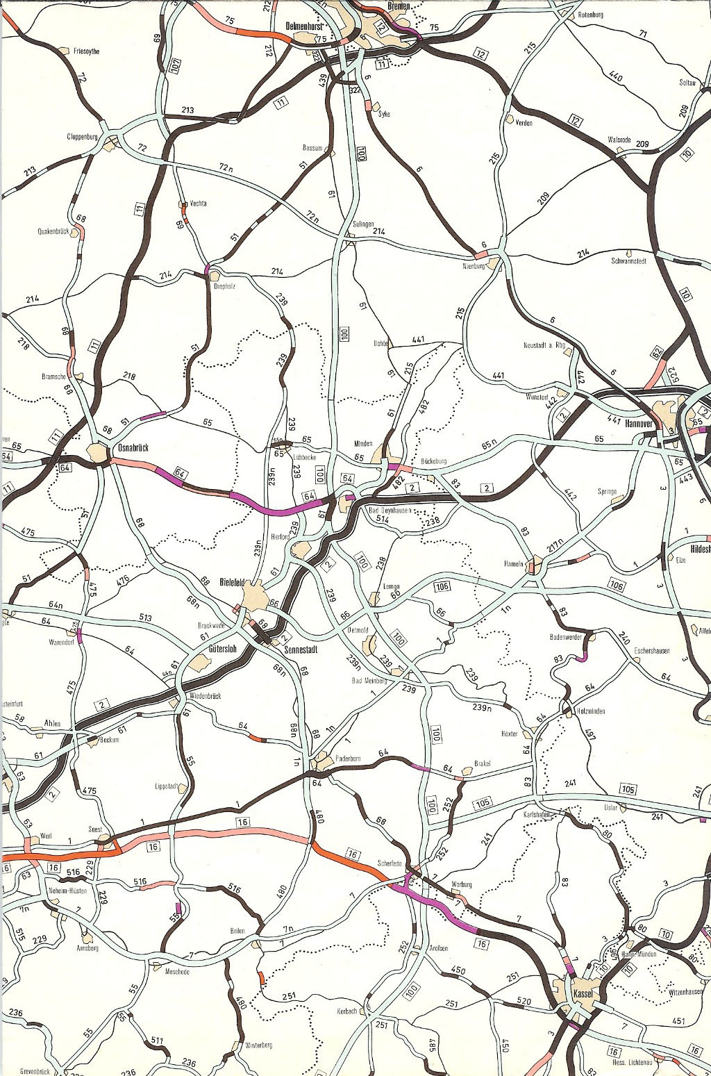
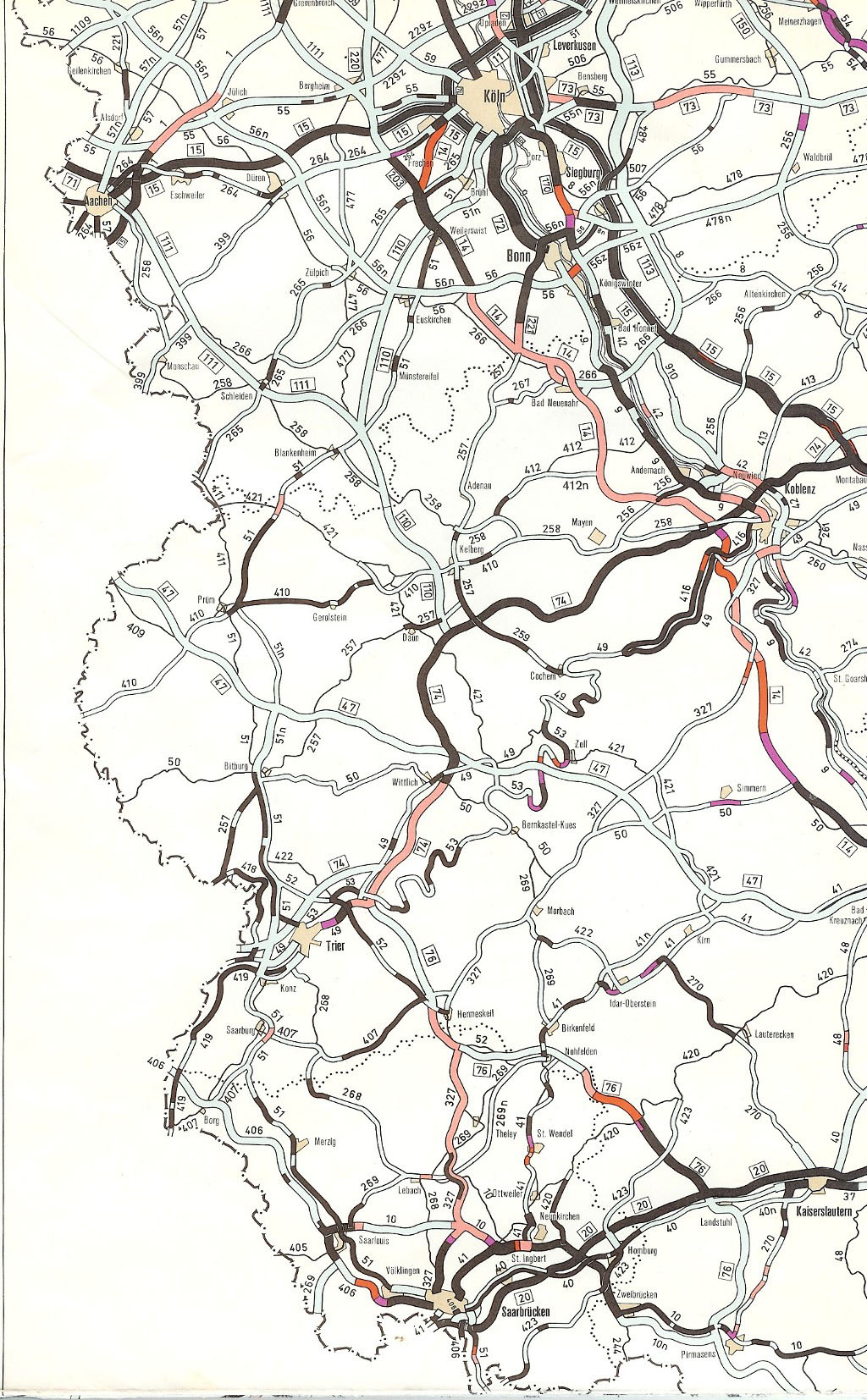
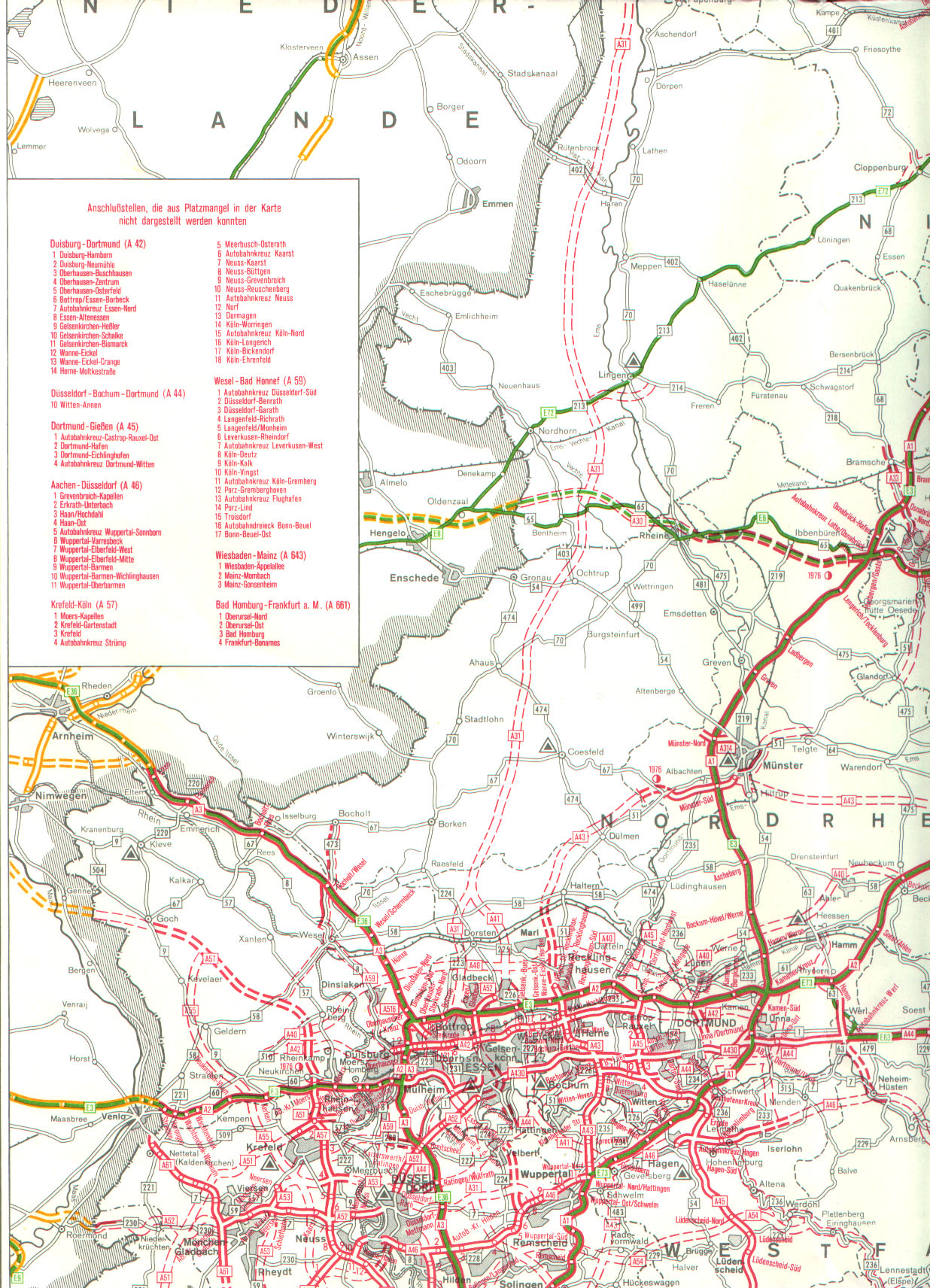
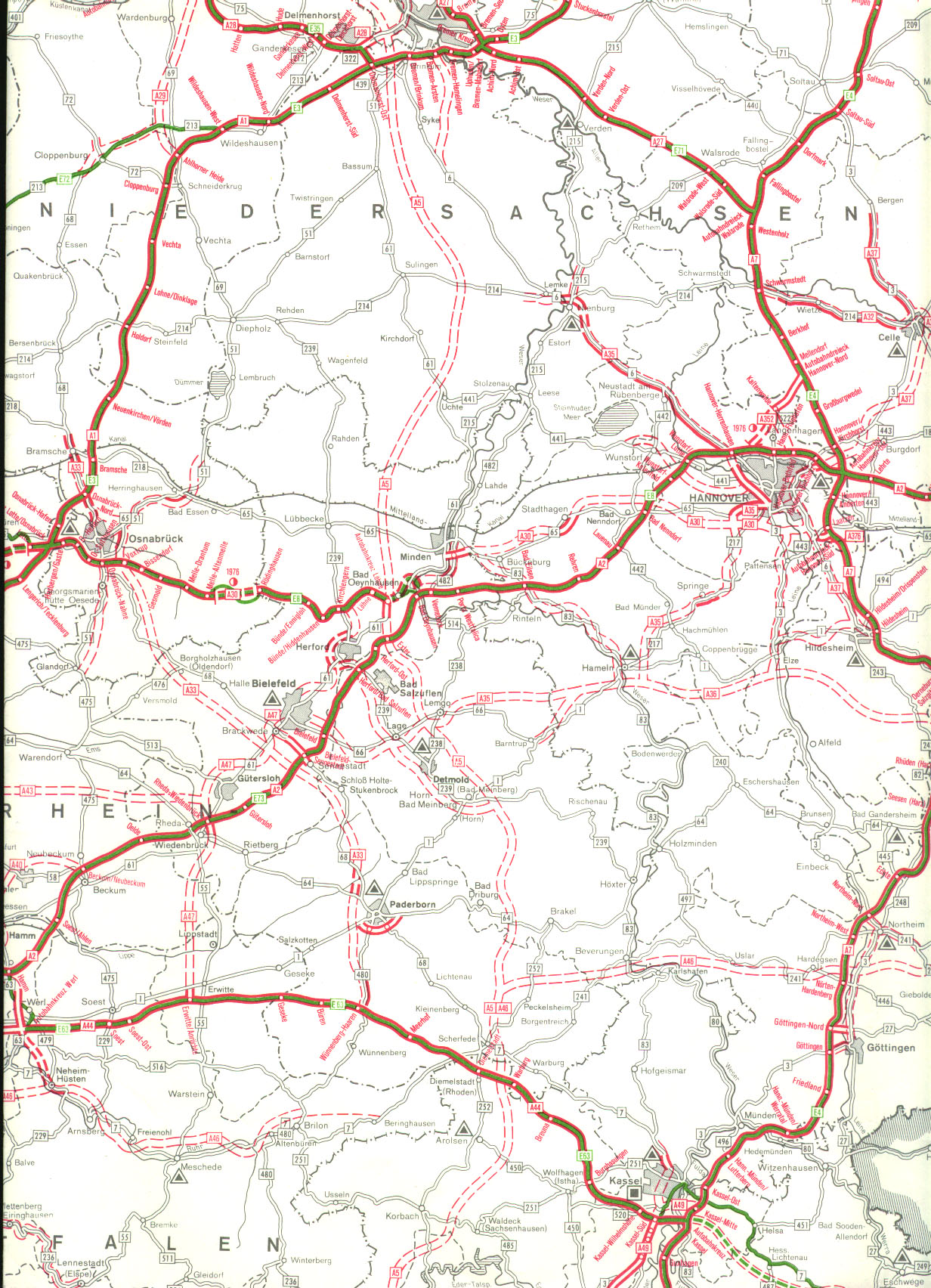
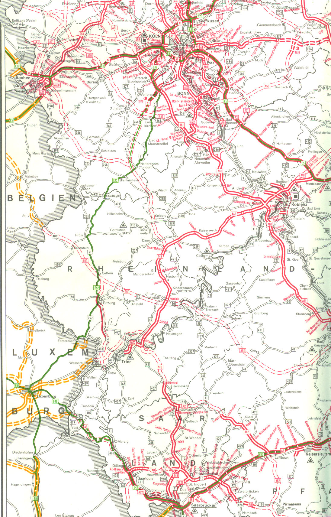
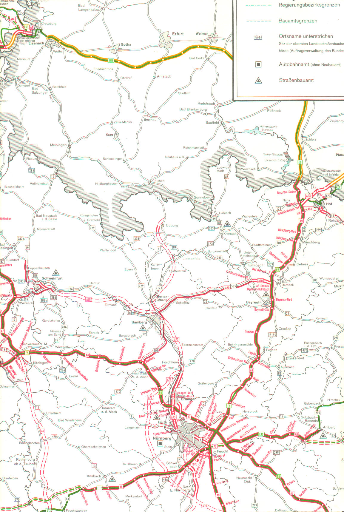
AK Aachen | AD Jackerath | AK wood | AK Neersen | AK Meerbusch | AK Düsseldorf-Nord | AK Ratingen-Ost | AD Velbert-Nord | AD Essen-Bergerhausen (planned) | AK Dortmund / Unna | AK Werl | AK Wünnenberg-Haaren | AK Kassel-West | AD Kassel-Süd