
Federal motorway 49
| Bundesautobahn 49 in Germany | |||||||||||||||||||||||||||||||||||||||||||||||||||||||||||||||||||||||||||||||||||||||||||||||||||||||||||||||||||||||||||||||||||||||||||||||||||||||||||||

|
|||||||||||||||||||||||||||||||||||||||||||||||||||||||||||||||||||||||||||||||||||||||||||||||||||||||||||||||||||||||||||||||||||||||||||||||||||||||||||||
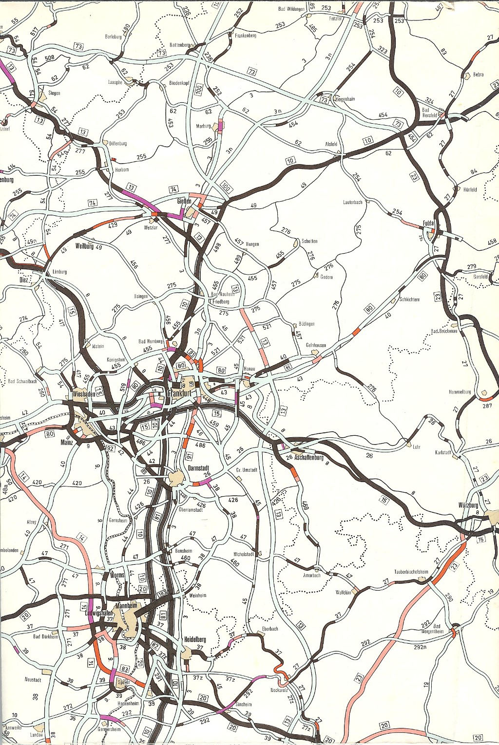
| map | |||||||||||||||||||||||||||||||||||||||||||||||||||||||||||||||||||||||||||||||||||||||||||||||||||||||||||||||||||||||||||||||||||||||||||||||||||||||||||||
 |
|||||||||||||||||||||||||||||||||||||||||||||||||||||||||||||||||||||||||||||||||||||||||||||||||||||||||||||||||||||||||||||||||||||||||||||||||||||||||||||
| Basic data | |||||||||||||||||||||||||||||||||||||||||||||||||||||||||||||||||||||||||||||||||||||||||||||||||||||||||||||||||||||||||||||||||||||||||||||||||||||||||||||
| Operator: |
|
||||||||||||||||||||||||||||||||||||||||||||||||||||||||||||||||||||||||||||||||||||||||||||||||||||||||||||||||||||||||||||||||||||||||||||||||||||||||||||
| Start of the street: |
Kassel ( 51 ° 16 ′ N , 9 ° 32 ′ E ) |
||||||||||||||||||||||||||||||||||||||||||||||||||||||||||||||||||||||||||||||||||||||||||||||||||||||||||||||||||||||||||||||||||||||||||||||||||||||||||||
| End of street: |
Neuental ( 51 ° 0 ′ N , 9 ° 12 ′ E ) |
||||||||||||||||||||||||||||||||||||||||||||||||||||||||||||||||||||||||||||||||||||||||||||||||||||||||||||||||||||||||||||||||||||||||||||||||||||||||||||
| Overall length: | 87.7 km | ||||||||||||||||||||||||||||||||||||||||||||||||||||||||||||||||||||||||||||||||||||||||||||||||||||||||||||||||||||||||||||||||||||||||||||||||||||||||||||
| of which in operation: | 45.1 km | ||||||||||||||||||||||||||||||||||||||||||||||||||||||||||||||||||||||||||||||||||||||||||||||||||||||||||||||||||||||||||||||||||||||||||||||||||||||||||||
| of which under construction: | 11.8 km | ||||||||||||||||||||||||||||||||||||||||||||||||||||||||||||||||||||||||||||||||||||||||||||||||||||||||||||||||||||||||||||||||||||||||||||||||||||||||||||
| of which in planning: | 30.8 km | ||||||||||||||||||||||||||||||||||||||||||||||||||||||||||||||||||||||||||||||||||||||||||||||||||||||||||||||||||||||||||||||||||||||||||||||||||||||||||||
|
State : |
|||||||||||||||||||||||||||||||||||||||||||||||||||||||||||||||||||||||||||||||||||||||||||||||||||||||||||||||||||||||||||||||||||||||||||||||||||||||||||||
|
Course of the road
|
|||||||||||||||||||||||||||||||||||||||||||||||||||||||||||||||||||||||||||||||||||||||||||||||||||||||||||||||||||||||||||||||||||||||||||||||||||||||||||||

The federal autobahn 49 (abbreviation: BAB 49 ) - short form: autobahn 49 (abbreviation: A 49 ) - is a federal autobahn running through northern Hesse . It connects Kassel with the Schwalm-Eder district , where it ends in Neuental . A continuation to Gemünden (Felda) with a connection to the A 5 is planned and partly under construction .
Routing
The A 49 branches off from the A 7 at the Kassel-Mitte motorway junction and is used as a city motorway in the area of the cities of Kassel, where it crosses the Fulda , and Baunatal . In the further course it crosses the area of the communities of Edermünde , Gudensberg , Fritzlar , Wabern , Borken and Neuental in the Schwalm-Eder district . On this route there are, among other things, the valley bridges over the Ems , Eder and Schwalm , the latter being bridged twice.
At its current end in Neuental 49 opens the A in the national road 3074. Because this is not designed to receive the motorway traffic, the 8.5 km long section of motorway between the junction Borken, where a connection to the B 3 in the direction Marburg is , and the end of the autobahn in Neuental completely closed to heavy traffic.
Planning history and construction
Originally the A 49 was supposed to run from Kassel via Fritzlar , Schwalmstadt , Stadtallendorf , Kirchhain , Staufenberg to Gießen and then via Butzbach , Bad Nauheim and Friedberg to Frankfurt am Main . From today's Preungesheim triangle, the A 49 would have been on the route of the current A 661 and would have run via Offenbach am Main and Egelsbach to Darmstadt , where a connection to the A 5 was to be reached south of the city.
Section Kassel – Giessen

The further construction of a 42.5 km long stretch of the A 49 from Neuental to the south in order to connect the two regional centers Kassel and Giessen by the shortest route has been planned and controversial for decades .
Initially, incoherent projects were considered in the 1960s, which were later to be included in the route that was designated as the A 49 from January 1, 1975. In 1967/68, for example, a four-lane arterial road from Kassel- Niederzwehren to the Felsberg junction was completed without initially considering a continuation of the route to Gießen. Between Marburg and Gießen, on the other hand, there were already plans for a new motorway-like construction of the B 3. At the beginning of the 1970s, a four-lane, motorway-like new construction of the B 3 from Kassel via Gießen to Frankfurt was included in the planning for the expansion of the federal highways until 1985. In 1973 the maps showed a line from Lohfelden - southern bypass Kassel - Baunatal - Edermünde - Gudensberg - Fritzlar - Kleinenglis - Neuental - Schwalmstadt - Stadtallendorf - Kirchhain - Hassenhausen south of Marburg, where the route should meet the Marburg - Gießen route . In 1976 the planning between Kirchhain and Gießen was changed: The route was now to run from Ebsdorf via Ilschhausen to Odenhausen , where a cross with the A5 was planned. A year later, the connection between Kirchhain and Odenhausen disappeared completely from the plans. Instead, the A 49 at Kirchhain was to flow into a new variant of the A 5, which was to be led from the Wetter area via Kirchhain, Homberg (Ohm) to the A 48 at Lumda . In 1979 the route of the A5 from Wetter via Kirchhain to Lumda was deleted from the maps. Instead, the planning between Kirchhain and Lumda for the A 49 has now been taken up. The Marburg – Gießen connection was designated as the A 485 . In the second law of August 25, 1980 amending the law on the expansion of federal trunk roads from 1971 to 1985, this route was included in urgency level I. With the third law of April 21, 1986 amending the law on the expansion of federal highways, this variant remained, whereby the section between the B 454 near Kirchhain and the A 5 was only planned for further planning. The further construction of the motorway initially came to a complete standstill with the completion of a section in December 1994. However, Hessen resumed planning to close the gap in the 2000s. The route between Neustadt (Hessen) and Homberg (Ohm) was changed again. The motorway should run east of Stadtallendorf and Homberg (Ohm) and reach the A 5 in the Gießen – Alsfeld area at Rülfenrod or Gemünden (Felda) .
So far the following sections have been completed:
| section | year | km | Remarks |
|---|---|---|---|
| Kassel-Niederzwehren - Felsberg junction ( B 254 ) | 1967/1968 | 8 kilometers | initially dedicated as B 3, upgraded to federal motorway: early 1970s |
| AS Felsberg – AS Gudensberg | 1974 | 4.5 km | |
| AS Gudensberg – AS Fritzlar | 1975 | 6.5 km | |
| AS Fritzlar – AS Borken | 1980 | 1st lane, 11.3 km | |
| AK Kassel-Mitte – AS Kassel-Niederzwehren | 1980 | 6.3 km | |
| AS Fritzlar – AS Borken | 1980 | 2nd lane, 11.3 km | |
| AS Borken-Neuental / Bischhausen | 1994 | 8.3 km |
Planned extension of Neuental – Gemünden (Felda)
| VKE | section | length | status |
|---|---|---|---|
| - | AS Borken (Hessen) - AS Neuental |
Completed (December 1994) | |
| 20th | AS Neuental - AS Schwalmstadt |
11.78 km | Under construction (preliminary measures since Feb. 2010; construction since March 15, 2011) |
| 30th | AS Schwalmstadt - AS Stadtallendorf North |
13.34 km | Plan approval decision issued (January 4, 2012) |
| 40 | AS Stadtallendorf North - AD Ohmtal |
17.45 km | Plan approval decision issued (May 30, 2012) |

The plan approval procedure for the third to last section from the current end of expansion near Neuental to Schwalmstadt was completed in September 2007 with the signing of the plan approval decision. In January 2008, the BUND brought an action against the planned expansion before the Federal Administrative Court in Leipzig . However, the further construction of the A 49 was declared immediately enforceable by federal law, which is why the lawsuit could not have delayed the start of construction. In April 2009, the BUND withdrew the lawsuit against this section. The construction of the section between Neuental and Schwalmstadt began in 2010 with the start of preliminary measures after the federal government had received a funding commitment that had previously been pending for several years despite the planning approval. A traffic release as far as Schwalmstadt is expected in 2022 despite the tunnel near Frankenhain, which was completed in 2015 . On July 16, 2015, Federal Transport Minister Alexander Dobrindt gave his commitment to 120 million euros, which means that this section is now fully financed. In October 2015, construction work began on the extension at the previous end of the motorway in Neuental.
The planning approval decision for the penultimate section between Schwalmstadt and Stadtallendorf Nord was signed on January 4, 2012 by the then Hessian Minister of Economics and Transport, Posch. In May 2012 the Naturschutzbund Hessen sued this section because of the supposed inadequate protection of bats, but withdrew this suit in June 2013 because of the reduced chances of success. The penultimate section is to be financed in a public-private project (PPP) with funds from companies. These donors usually operate the routes and in return receive the revenue from the truck toll for decades . On July 2, 2020, certain DEGES the STRABAG infrastructure project GmbH as a PPP partner.
The planning approval procedure for the last section between Stadtallendorf Nord and federal motorway 5 was originally supposed to be completed in 2004; first of all, the A 49 should run through the middle of the Herrenwald forest east of Stadtallendorf. In 2003, the Gießen Regional Council proposed the Herrenwald as a European fauna-flora-habitat protection area ( FFH area ) because of its many rare habitats and animal species - among other things there is a population of crested newts there . In 2004 the recognition took place. The then Hessian Transport Minister Alois Rhiel (CDU) therefore presented an alternative route in autumn 2005 that is closer to Stadtallendorf, but only marginally cuts through the Herrenwald. This should now be realized. The planning approval decision for the last section was issued on May 30, 2012. A lawsuit by two nature conservation associations against the planning approval decision was dismissed by the Federal Administrative Court in Leipzig on April 23, 2014. The last section is also to be financed in a public-private project (PPP), also with STRABAG. The last three lawsuits were dismissed on June 23 and July 2.
Due to the financing commitment, the A 49 was expected to be completed in 2021 in mid-2015. At the beginning of the clearing season on October 1, 2019, tree houses were built on the route in the area of the Dannenröder forest to prevent further construction. In 2020, the A 49 from Kassel to the A 5 was expected to be completed in 2024.
Gießen – Frankfurt am Main section
Since the mid-1960s there were plans to build a new federal highway between Marburg and Langgöns and between Bad Nauheim and Friedberg (Hesse). However, a coherent planning was only made at the beginning of the 1970s. The plan for the expansion of the federal highways in the years 1971 to 1985 provided for a four-lane federal highway 3 or 3n between Marburg and Frankfurt am Main. The route train designated on January 1, 1975 as A 49 took up these plans. At the Kassel – Staufenberg section, the A 5 should cross at Staufenberg, the A 48 south of Lollar, the A 45 at Linden and the A 5 at Butzbach, before finally meeting the A 661 at the Preungesheimer Dreieck.
.jpg)
In the second half of the 1960s, construction of the Giessen eastern bypass began. By the mid-1970s, the motorway between Gießener Nordkreuz and Langgöns was completed - partly still single-lane. In 1978, less than three years after the new motorway numbering came into force, the Marburg – Gießen – Langgöns route was renamed the A 485 . This change was related to the re-planning of the A 49 in the first section. The plan to continue the motorway from Langgöns to Preungesheim initially still existed, but this also changed in 1980. With the second law of August 25, 1980 amending the law on the expansion of federal highways from 1971 to 1985, the motorway planning between Langgöns and Preungesheim was abandoned. The background was new considerations that led to a review of the plans in the Federal Transport Infrastructure Plan. The Federal Government's 1980 Road Construction Report states that the projects must be “adapted to the changed conditions, in particular to the current and future financial framework”. Priorities are now to take greater account of environmental and energy policy goals, intensify the dialogue with citizens, avoid parallel planning, give priority to investments to maintain the substance and modernize the existing network, including increasing security, rather than building new ones. The planned route of the A 49 between Langgöns and the Preungesheim triangle should only run a few kilometers parallel to the A 5. In the requirements plan for the second law of August 25, 1980 amending the law on the expansion of federal highways from 1971 to 1985, the line north of Bad Nauheim – Friedberg (Hesse) –Bad Vilbel was planned as a new two-lane federal road, the Bad line Vilbel – Preungesheim in Stage I as a new four-lane federal road. The Pohlgöns – Butzbach – north of Bad Nauheim route was assigned to urgency level 2 as a two-lane new construction. The four-lane expansion between Okarben and Bad Vilbel was also in stage 2. The third law of April 21, 1986 amending the law on the expansion of federal highways classified the section south of Friedberg (Hessen) –Karben as further planning. On the other hand, the OU Bad Nauheim, the OU Friedberg (Hessen) and the Karben – Bad Vilbel route (each with two lanes) and Bad Vilbel – Preungesheim (four lanes) remained the priority. The four-lane expansion between Okarben and Bad Vilbel was also included in the further planning. With the exception of a short section between Butzbach and Bad Nauheim, all other sections of this section have currently been implemented or can be found in the Federal Transport Infrastructure Plan 2030.
So far the following sections have been completed:
| section | year | km | Remarks |
|---|---|---|---|
| AS Fronhausen / Bellnhausen and AS Staufenberg-Nord | 1994 | 5.9 km | four lanes, dedicated as Bundesstrasse 3 |
| AS Staufenberg-Nord – Gießener Nordkreuz | 1980 | 4.2 km | four lanes, dedicated as Bundesstrasse 3 |
| Gießener Nordkreuz ( A 480 ) –AS Gießen-Grünberger Straße | 1975 | 4.5 km | Dedicated as A 485 |
| AS Gießen-Grünberger Straße – AS Gießen-Schiffenberger Tal | 1972 | 2.5 km | Dedicated as A 485 |
| AS Gießen-Schiffenberger Tal – AS Linden | 1974 | 5.3 km | Dedicated as A 485 |
| AS Linden – AS Langgöns | 1968 | 6.3 km | Upgraded to federal motorway 485 : 1972 |
| AS Langgöns - Pohlgöns | 1962-1965 | 4.5 km | z. Partly single lane as federal highway 3 |
| OU Bad Nauheim, 1st construction phase (AS Rödger Weg to AS Frankfurter Straße) | 1989 | 1.2 km | single lane, dedicated as Bundesstraße 3 |
| OU Bad Nauheim, 2nd construction phase | 1995 | 6.6 km | single-lane, dedicated as federal highway 3 , of which about 3 km on the originally planned A 49 route |
| OU Friedberg (Hesse) | 2009 | 6.0 km | single lane, dedicated as Bundesstraße 3 |
| OU Nieder- and Ober-Wöllstadt | Open to traffic on August 14, 2017 | 6.6 km | two lanes, dedicated as Bundesstraße 3 |
| Kloppenheim – Bad Vilbel | 1990 | 5.3 km | single lane, dedicated as Bundesstraße 3 |
| Bad Vilbel – Preungesheimer Dreieck ( A 661 ) | 1990 | 3.6 km | four lanes, dedicated as Bundesstrasse 3 |
The Federal Transport Infrastructure Plan 2030 includes the following routes:
- OU Karben / Kloppenheim: two-lane new building (1.7 km, urgent need)
- OU Karben / Okarben: two-lane new building (3.4 km, urgent need)
- OU Butzbach (A 5 – Windhof): two-lane new building (4.3 km, urgent need)
Section Frankfurt am Main – Darmstadt
The planning of an efficient bypass to the east of the city of Frankfurt am Main, which was later included in the route that was designated as the A 49 from January 1, 1975, goes back to Frankfurt's general road plans from 1934 and 1938. In 1934, only the construction of a new Main Bridge as an extension of the Ratsweg to Offenbach-Taunusring and the continuation of this new connection as a southern bypass from Offenbach to today's B 448 were considered. In 1938 the plan was to establish a connection to the Ratswegbrücke and the extension of the Ratsweg from the Bad Homburg motorway feeder via Eckenheim, Preungesheim and Seckbach. After the Second World War , these plans were taken up again and culminated in the design of the B 3a / B 456 from Oberursel via Bonames, Preungesheim, Bornheim, Offenbach to the B 46 at the beginning of the 1960s . In the second half of the 1960s, the project finally emerged, this federal highway as a motorway via Sprendlingen , Dreieichenhain , Langen , Egelsbach , Wixhausen , east Darmstadt-Arheilgen or west Darmstadt-Kranichstein , Darmstadt-Ost and south Darmstadt-Bessungen and Darmstadt-West or north of Ludwigshöhe Darmstadt to the A 5 near Darmstadt-Eberstadt (Dreieck Darmstadt-Süd). From 1971, the motorway from Oberursel through the east of Frankfurt to Darmstadt was included in the expansion plan for the federal highways for the years 1971 to 1985 under the internal name “Autobahn 91”. In the mid-1970s, the plans for motorway-like federal highways or federal highways between Kassel and Gießen as well as Gießen and Frankfurt am Main were merged with the planning of the "Autobahn 91" under the new numbering as A 49. In 1978, however, the entire connection was designated as A 661. In addition, the route in the Darmstadt area was changed. The route near Darmstadt between Egelsbach and the B 26 with the planned intersection with the A 680 was abandoned and instead a connection to the A 680 west of Roßdorf in the form of a motorway triangle was considered. The southern bypass of Darmstadt, on the other hand, was to be implemented unchanged, so that the motorway junction planned in the east of Darmstadt was redesigned to become a motorway triangle. With the second law of 25 August 1980 amending the law on the expansion of federal trunk roads from 1971 to 1985, the planning of the A 49 or A 661 between the AS Egelsbach and the AD Darmstadt-Süd was also deleted in this section . Only a partial bypass south of Darmstadt between the B 449 and Darmstadt-Eberstadt and a partial bypass east of Darmstadt between the state road 3094 (Darmstadt-Dieburg) and the B 26, each as two-lane new federal roads in urgency level I. April 1986 for the amendment of the law on the expansion of the federal highways only provided for a connection between Roßdorf-West (B 26n) and the B 3 north of Darmstadt as a new two-lane federal road in stage I, but its route in no section with that of the A 49 was identical. The continuation of the A 661 south of the Egelsbach junction was not included in the demand plan again. This was not without effects on the completed sections of the A 661, because the importance of the motorway south of the Offenbacher Kreuz no longer corresponded to the expectations when it was built. A tank and rest area near Dreieich was demolished . The section AS Egelsbach – AD Darmstadt-Süd is also not included in the 2003 Federal Transport Infrastructure Plan. The 2nd lane between AS Frankfurt-Seckbach and AS Frankfurt-Hanauer Landstrasse is set as a priority in the federal traffic route plan. The extension is to take place in connection with the construction of the AD Erlenbruch and the Riederwald tunnel on the A 66 .
So far the following sections have been completed (all dedicated as A 661):
| section | year | km | Remarks |
|---|---|---|---|
| Kaiserleibrücke (Main Bridge) | 1964 | 0.2 km | |
| AS Dreieich to AS Egelsbach | 1972 | 9.7 km | |
| Kaiserleibrücke to AS Offenbach-Taunusring | 1972 | 1.8 km | including high-street Strahlenberger roundabout (in Offenbach generally Kaiserlei gyros called) / AS Offenbach-Kaiserlei 0.6 km in length |
| AS Taunusring – AS Sprendlingen | 1974-1976 | 7.4 km | single lane: 1974; Completion of the Offenbach Cross in 1975; 2nd lane: 1976 |
| AS Frankfurt-Eckenheim to AS Frankfurt-Seckbach | 1985 | 2.4 km | |
| prov. AS Riederwald to Kaiserleibrücke | 1986 | 1.4 km | |
| AS Frankfurt-Seckbach – AS Frankfurt-Hanauer Landstrasse | 1995 | 3.3 km | single-lane, but four-lane |
Trivia
As part of the Bundeswehr Day in Fritzlar, the section between the Gudensberg and Neuental junctions was completely closed on June 13, 2015, making it the longest car park in Germany.
An accident on the A 49 led to one of the first judgments by the Kassel District Court as to whether or not the recording of a dashcam may be used as evidence in court.
Individual evidence
- ^ A b Der Große Shell-Atlas, Mairs Geographischer Verlag, 14th edition, Stuttgart 1968/69, Bl. 34 and 43.
- ↑ a b Construction work on federal trunk roads in 1972. Expansion of federal trunk roads from 1971 to 1985. Annex to road construction report 1972. Federal Minister of Transport, Road Construction Department, accessed on April 27, 2013 (map excerpt).
- ↑ a b c The Great Shell Atlas, Mairs Geographischer Verlag, Stuttgart 1976/77, p. 43.
- ↑ a b c d Federal Law Gazette 1980, Part I, p. 1614.
- ↑ a b c BGBl. 1986, Part I, p. 557.
- ↑ List of traffic clearances (A 49) .
- ↑ Kassel-Eisenach: BUND continues to sue the construction of the A44 ( Memento from August 6, 2009 in the Internet Archive )
- ↑ Construction of the Frankenhain motorway tunnel. Retrieved February 18, 2014 .
- ↑ Federal and state governments agree on further construction of the A49 ( Memento of December 15, 2013 in the Internet Archive )
- ↑ Hessen Mobil press release
- ↑ a b c d Closing the gap by 2021? Private investors should save A49 ( Memento from August 27, 2015 in the Internet Archive )
- ↑ a b c A49: Construction work at the Neuental junction begins October 13, 2015, accessed on October 26, 2015.
- ↑ a b Press release: Transport Minister Dieter Posch today signed the planning approval decision for the last section that was still missing. ( Memento from January 18, 2014 in the Internet Archive )
- ↑ Insufficient protection of bats: Nabu is suing A49 section
- ↑ NABU Hessen withdraws a lawsuit against A 49 ( Memento from April 7, 2014 in the Internet Archive )
- ↑ a b DEGES awards the contract for the construction and operation of the A 49. Accessed on July 16, 2020 (German).
- ^ Judgment of the Federal Administrative Court of April 23, 2014, BVerwG 9 A December 25
- ↑ Press release No. 37/2020 | Federal Administrative Court. Retrieved July 16, 2020 .
- ↑ Press release No. 40/2020 | Federal Administrative Court. Retrieved July 16, 2020 .
- ↑ hessenschau de, Frankfurt Germany: The A49 is supposed to bring together a region, but it divides it. October 8, 2019, accessed on October 9, 2019 (German).
- ↑ A 49: AS Fritzlar - Ohmtal-Dreieck (A 5 / A 49). Retrieved on July 16, 2020 (German).
- ^ Information from the Federal Government. Road construction report 1978. Bundestag printed paper 8/3116. (PDF 2.9 MB) German Bundestag, 8th electoral term, August 15, 1979, accessed on April 28, 2013 (PDF file).
- ^ Information from the Federal Government. Road construction report 1980. Bundestag printed paper 9/812, p. 4. (PDF 5.5 MB) German Bundestag, 9th electoral period, September 15, 1981, accessed on April 13, 2013 (PDF file).
- ↑ List of traffic clearances
- ↑ a b Wolfgang Jäger: The history of the federal motorway A 661 east bypass Frankfurt. Henning Maruhn, March 19, 2006, accessed on May 1, 2013 (Internet article ).
- ↑ Der Große Shell-Atlas, Mairs Geographischer Verlag, 14th edition, Stuttgart 1968/69, pp. 53 and 209.
- ↑ Construction work on federal trunk roads in 1972. Expansion of federal trunk roads from 1971 to 1985. Annex to road construction report 1972. Federal Minister of Transport, Road Construction Department, accessed on April 27, 2013 (map excerpt).
- ↑ The Great Shell Atlas, Mairs Geographischer Verlag, Stuttgart 1978/79, p. 215.
- ^ Completion of the A 661 - Osttangente Frankfurt. In: A 66 / A 661 construction of the Riederwald tunnel. Hessen Mobil Road and Traffic Management, accessed on October 7, 2017 (Internet article ).
- ↑ List of traffic clearances
- ↑ It's getting tight on the Kaiserleibrücke. faz-archiv.de, May 25, 2011, accessed on September 8, 2013 .
- ↑ Hessen: Autobahn becomes a parking lot , Spiegel Online, April 15, 2015.
- ^ AG Kassel on the admissibility of recording a dashcam as evidence. Retrieved February 20, 2018 .
