Bundesstrasse 46
| Bundesstrasse 46 in Germany | |||||||||||||||||||||||||

|
|||||||||||||||||||||||||
| map | |||||||||||||||||||||||||
| Basic data | |||||||||||||||||||||||||
| Operator: |
|
||||||||||||||||||||||||
| Start of the street: |
Offenbach ( 50 ° 5 ′ N , 8 ° 45 ′ E ) |
||||||||||||||||||||||||
| End of street: |
Dreieich ( 50 ° 2 ′ N , 8 ° 43 ′ E ) |
||||||||||||||||||||||||
| Overall length: | 7.5 km | ||||||||||||||||||||||||
|
State : |
|||||||||||||||||||||||||
| Development condition: | two-lane | ||||||||||||||||||||||||
| Local map | |||||||||||||||||||||||||
|
Course of the road
|
|||||||||||||||||||||||||
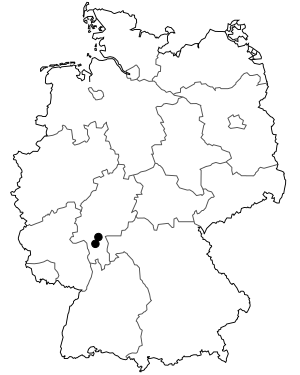
The federal highway 46 (abbreviation: B 46) was a federal highway in Hesse . It led from Offenbach am Main to Dreieich - Sprendlingen .
Originally the federal highway 46 led as an eleven kilometer long federal highway from the city center of Offenbach, where it branched off from the federal highway 43 , to the city center in Sprendlingen, where it merged into the federal highway 3 . With the construction of the federal highway 661 , this federal road lost its importance and was downgraded from a federal road to a state road on December 31, 2009.
history
The road from Offenbach to Sprendlingen was built around 1820 by the Grand Duchy of Hesse to avoid the area of the then Free City of Frankfurt .
See also
literature
- A. Kurt: On the history of roads and traffic in the country between the Rhine and Main. Dissertation at the University of Frankfurt in 1956.
Web links
Commons : Bundesstrasse 46 - Collection of pictures, videos and audio files
Individual evidence
- ↑ in the Offenbach urban area with four lanes

