
Bundesstrasse 172
| Bundesstrasse 172 in Germany | |||||||||||||||||||||||||||||||||||||||||||||||||||||||||||||||||||||||||||||||||||||||||||||||||||||||

|
|||||||||||||||||||||||||||||||||||||||||||||||||||||||||||||||||||||||||||||||||||||||||||||||||||||||
| map | |||||||||||||||||||||||||||||||||||||||||||||||||||||||||||||||||||||||||||||||||||||||||||||||||||||||
 |
|||||||||||||||||||||||||||||||||||||||||||||||||||||||||||||||||||||||||||||||||||||||||||||||||||||||
| Basic data | |||||||||||||||||||||||||||||||||||||||||||||||||||||||||||||||||||||||||||||||||||||||||||||||||||||||
| Operator: |
|
||||||||||||||||||||||||||||||||||||||||||||||||||||||||||||||||||||||||||||||||||||||||||||||||||||||
| Start of the street: |
Pirna ( 50 ° 58 ′ N , 13 ° 55 ′ E ) |
||||||||||||||||||||||||||||||||||||||||||||||||||||||||||||||||||||||||||||||||||||||||||||||||||||||
| End of street: |
Bad Schandau ( 50 ° 53 ′ N , 14 ° 14 ′ E ) |
||||||||||||||||||||||||||||||||||||||||||||||||||||||||||||||||||||||||||||||||||||||||||||||||||||||
| Overall length: | 27 km | ||||||||||||||||||||||||||||||||||||||||||||||||||||||||||||||||||||||||||||||||||||||||||||||||||||||
| of which in planning: | 0.5 km | ||||||||||||||||||||||||||||||||||||||||||||||||||||||||||||||||||||||||||||||||||||||||||||||||||||||
|
State : |
|||||||||||||||||||||||||||||||||||||||||||||||||||||||||||||||||||||||||||||||||||||||||||||||||||||||
| Development condition: | two lanes west of Königstein three lanes; Pirna partially four-lane | ||||||||||||||||||||||||||||||||||||||||||||||||||||||||||||||||||||||||||||||||||||||||||||||||||||||
 |
|||||||||||||||||||||||||||||||||||||||||||||||||||||||||||||||||||||||||||||||||||||||||||||||||||||||
| Bundesstrasse 172 as the through-town Bad Schandau | |||||||||||||||||||||||||||||||||||||||||||||||||||||||||||||||||||||||||||||||||||||||||||||||||||||||
|
Course of the road
|
|||||||||||||||||||||||||||||||||||||||||||||||||||||||||||||||||||||||||||||||||||||||||||||||||||||||
The federal highway 172 (abbreviation: B 172 ) is a 27 km long German federal highway in the Free State of Saxony . It begins in Pirna and ends at the border crossing to the Czech Republic in Schmilka (Saxon Switzerland).
Course and history
The federal road begins in Pirna , at the ( Sachsenbrücke ) at the junction of the B 172a and S 177 , where it is partially developed with four lanes. The road overcomes the step to the Sonnenstein district via two hairpin bends and runs on the flat plain of Struppen to Königstein / Saxon Switzerland . Below the Königstein Fortress , the road leads back down into the Elbe Valley. The narrow town through Königstein is one of the main bottlenecks in the current route. In Bad Schandau , the Carolabrücke has been a fixed Elbe crossing since 1877. However, the further stretch of the right Elbe road to Schmilka was not completed until 1909. The increasing traffic load and the electrification of the Elbe Valley Railway made it necessary to build a new Elbe bridge in 1977 . Until the mid-1930s the street ended in Schmilka. The gap closure along the Elbe via Hřensko (Herrnskretschen) to Děčín (Tetschen) (today Silnice I / 62 ) was not completed until 1936-39. Until then, traffic ran from Pirna over the Struppener flatness to Hermsdorf , crossed the Biela and continued via Rosenthal and Maxičky (Maxdorf) to Děčín (Tetschen).
The start of the B 172 in Dresden was on Georgplatz in Dresden until January 1, 2015, and the connection to Pirna was downgraded to a state road, as supra-regional traffic is now routed from Dresden to Pirna via the A 17 and the B 172a .
expansion
As the main traffic artery, the B 172 is very important for the development of the Elbe Sandstone Mountains . Until 1990 the route was considered a "route of high traffic safety" . This changed with the sudden increase in traffic in the early 1990s.
Relieving the load on the section east of Pirna turns out to be difficult, as the cramped urban planning situations in Königstein and Bad Schandau in particular leave little room for necessary expansion measures. The town crossings are no longer able to cope with the increased traffic volume, especially on weekends, although international freight traffic is not allowed to pass the Schmilka border crossing. In 2007, the border crossing was frequented by an average of 3,700 vehicles per day.
Current plans include the following expansion measures for the route:
- Pirna: Construction of a southern bypass planned as federal highway 172n (planning: DEGES , plan approval 2015, start of construction 2017, completion expected in 2022)
- Königstein: Expansion in the Bahnhofstrasse area (February 2009 demolition of the hillside buildings)
gallery
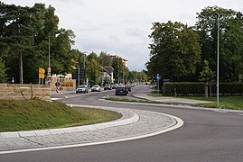
Roundabout in Pirna

B 172 southeast, Pirna-Krietzschwitz, with a view of Lilienstein and Königstein in winter


See also
Web links
Individual evidence
- ^ The federal road is being degraded , Sächsische Zeitung (Pirna edition) of September 12, 2014
- ↑ Traffic utilization Schmilka - Hřensko (Herrnskretschen). (No longer available online.) In: sachsen.de. State Ministry for Economics, Labor and Transport Saxony, archived from the original on June 19, 2010 ; accessed on April 3, 2012 (official traffic figures).