Bundesstrasse 202

from Wikipedia, the free encyclopedia
Template: Infobox high-ranking street / Maintenance / DE-B
Bundesstrasse 202 in Germany
Bundesstrasse 202
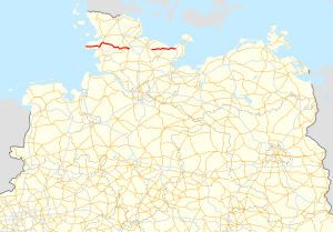
map
Course of the B 202
Basic data
Operator: GermanyGermany Federal Republic of Germany
Start of the street: Sankt Peter-Ording
( 54 ° 19 ′  N , 8 ° 37 ′  E )
End of street: Oldenburg in Holstein
( 54 ° 17 ′  N , 10 ° 52 ′  E )
Overall length: 135 km

State :

Development condition: see below
Course of the road
State of Schleswig-Holstein
North Friesland district
Locality Sankt Peter-Ording
Bypass Tating bypass
Locality Tating
Locality Garding
Locality Katharinenheerd
Locality Kotzenbüll
parking spot Symbol: leftSymbol: left parking spot
Bypass Tönning bypass  B5
node B5
crossing Koldenbüttel
flow Treene
Locality Friedrichstadt
Locality Seeth
Schleswig-Flensburg district
Locality Norderstapel
parking spot Symbol: leftSymbol: left parking spot
Locality Invent
parking spot Symbol: rightSymbol: right parking spot
flow Concern
Locality Meggerdorf OT Meggerholm
District of Rendsburg-Eckernförde
Locality Christiansholm
Locality Friedrichsholm
Locality Sophienhamm OT Oha
Locality Derision
Locality Fockbek B203
Locality Rendsburg B203
Start of expressway Beginning of the motor road
Junction Rendsburg-West / Fockbek B77
Template: AB / Maintenance / Empty together with B77direction Rendsburg-Süd
flow Eider
Junction Rendsburg-Mitte
flow Kiel Canal (Rendsburg Tunnel 720 m)
Template: AB / Maintenance / Empty together with B77direction Fockbek
Junction Rendsburg-South B77
Expressway end End of the highway
Bypass Osterrönfeld bypass 
Autobahn beginning replaced by A210
Start of expressway replaced by B76
Plön district
Locality Schwentinental OT Raisdorf B76
flow Schwentine ( Rosensee )
Locality Rastorf OT Rastorfer Passau
Locality Martensrade OT Wittenberger Passau
Locality Selent
Locality Lammershagen OT Bellin
park Rest Symbol: rightSymbol: right Rest stop
Bypass Lütjenburg bypass  B430
flow Kossau
flow Mühlenau
Locality Blekendorf OT Kaköhl
Ostholstein district
Locality Wangels OT Hohenstein
Junction (11)  Oldenburg in Holstein -SouthA1 E47
  • Under construction
  • In planning
  • Traffic control system
  • The federal road 202 (abbreviation: B 202 ) is located in Schleswig-Holstein and runs from Sankt Peter-Ording via Friedrichstadt , Rendsburg , Kiel and Lütjenburg to Oldenburg in Holstein to the A1 ( bird flight line ).

    history

    The road from Rendsburg to Friedrichstadt was expanded into a Chaussee in 1872 . In 1877 the road connection from Garding to St. Peter-Ording was completed. The Rastorfer Passau - Selent -Seekrug section was expanded between 1929 and 1930. The section between Kiel and Osterrönfeld near Rendsburg, which branches off the Altona-Kieler Chaussee in Kiel- Hassee , was downgraded to a district road in 1989 and replaced by the parallel one A 210 replaced.

    Specialty

    Near the Rastorfer Kreuz in the Plön district there are two electronic game warning systems , which were installed there in 2011 as part of a pilot project. These recognize changing game and then warn road users with variable message signs . As a result, the number of accidents involving wildlife in this area was reduced to around a fifth compared to a pure game protection fence, or even to around a tenth compared to the time before it was erected. At the same time, it is again possible for the animals to use their historical wild hiking axes: the road no longer separates their habitats.

    Scenic sections of the route

    State of development

    The development of the B 202 is structured as follows:

    section Stripes Dividing strip comment
    L 33 Sankt Peter-Ording -B77Rendsburg 2 No  
    B77Rendsburg - B77Rendsburg-Süd 4th Yes motorway-like
    B77Rendsburg-Süd - A210Osterrönfeld 2 No crossing free
    B76Schwentinental-Raisdorf - A1AS Oldenburg in Holstein-Süd 2 No  

    See also

    Web links

    Commons : Bundesstrasse 202  - Collection of pictures, videos and audio files