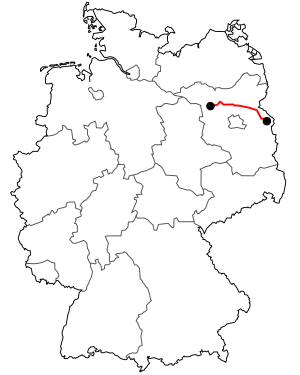
Bundesstrasse 167
The national highway 167 (abbreviation: B 167 ) is a German federal highway in the state of Brandenburg .
history
origin
The section between Bad Freienwalde (Oder) and Wriezen was expanded into a road between 1824 and 1833 .
Previous routes and names

The 105 km long Reichsstraße 167 between Müncheberg and Schwiebus was introduced around 1937. It branched off from Reichsstrasse 1 in Müncheberg and led via Frankfurt (Oder) , Reppen (Polish: Rzepin ) and Sternberg (Polish: Torzym ) to Schwiebus (Polish: Swiebodzin ). In this city the Reichsstraße R 97 and R 113 crossed . The section from Müncheberg to Frankfurt (Oder) had previously (since 1932) been part of Fernverkehrsstrasse 5 or Reichsstrasse 5, which ran from Bückwitz via Eberswalde and Prötzel and Müncheberg to Frankfurt (Oder), but now between Eberswalde and Frankfurt (Oder) received a different course via Seelow and Lebus .
In 1940/41 there was another, larger route exchange west of Frankfurt (Oder) with Reichsstraße 5 . From this point in time the now 257.3 km long Reichsstraße 167 led from Bückwitz via Eberswalde and Frankfurt (Oder) to Schwiebus. In return, the previous route of the R 167 from Frankfurt (Oder) to Müncheberg was included again in the R 5, but now continuing west of Müncheberg in joint management with Reichsstraße 1 to Berlin.
The R 167 was interrupted by the Oder-Neisse border in 1945; the part that remained in the GDR was designated as Fernverkehrsstrasse 167 (abbreviation F 167 ).
History / other
Originally there were plans to run what was then Reichsstrasse 167 instead of Reichsstrasse 5 through Berlin . Hence the offset near Frankfurt and the common course with the B 112.
In the years 2000 to 2004, 167 new bypasses were built around numerous cities along the federal highway, so that these cities are only touched by the federal highway in their outskirts. The eastern section of the federal road is now part of the Oder-Lausitz-Straße .
In the Altfriedland area , the road leads through the largest artificial and fishing pond area in Brandenburg on the Kietzer See .
See also
Web links
Individual evidence
- ↑ DDAC road map of Germany. (No longer available online.) In: landkartenarchiv.de. The German Automobile Club e. V., 1938, archived from the original on October 4, 2013 ; accessed on March 30, 2012 (road map scale 1: 1,100,000).
- ^ DDAC road map of Germany. Membership issue. (No longer available online.) In: landkartenarchiv.de. The German Automobile Club e. V., 1941, archived from the original on March 4, 2016 ; accessed on March 30, 2012 (road map scale 1: 2,500,000).


