Bundesstrasse 63
| Bundesstrasse 63 in Germany | |||||||||||||||||||||||||||||||||||||||||||||||||||||||||||||

|
|||||||||||||||||||||||||||||||||||||||||||||||||||||||||||||
| map | |||||||||||||||||||||||||||||||||||||||||||||||||||||||||||||
| Basic data | |||||||||||||||||||||||||||||||||||||||||||||||||||||||||||||
| Operator: |
|
||||||||||||||||||||||||||||||||||||||||||||||||||||||||||||
| Start of the street: |
Drensteinfurt ( 51 ° 48 ′ N , 7 ° 45 ′ E ) |
||||||||||||||||||||||||||||||||||||||||||||||||||||||||||||
| End of street: |
Wickede ( 51 ° 29 ′ N , 7 ° 51 ′ E ) |
||||||||||||||||||||||||||||||||||||||||||||||||||||||||||||
| Overall length: | 41 km | ||||||||||||||||||||||||||||||||||||||||||||||||||||||||||||
|
State : |
|||||||||||||||||||||||||||||||||||||||||||||||||||||||||||||
|
Course of the road
|
|||||||||||||||||||||||||||||||||||||||||||||||||||||||||||||
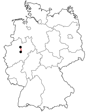
The federal highway 63 (abbreviation: B 63 ) in North Rhine-Westphalia is relatively short with a total length of 41 km. It leads in a north-south direction from Drensteinfurt via Hamm and Werl to Wickede (Ruhr) and ends at Wimbern on federal road 7 . The B 63 between the Werl-Nord junction and the Wickede (Ruhr) junction is interrupted and will be replaced by the 445 motorway.
history
The section between Hamm and Werl was built in 1826/27. For this purpose, stones from the demolition of the old Werler Castle were used.
See also
Web links
Commons : Bundesstrasse 63 - Collection of pictures, videos and audio files
