Bundesstrasse 419
| Bundesstrasse 419 in Germany | ||||||||||||||||||||||||||||||||||||||||||||||

|
||||||||||||||||||||||||||||||||||||||||||||||
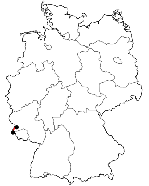
| map | ||||||||||||||||||||||||||||||||||||||||||||||
| Basic data | ||||||||||||||||||||||||||||||||||||||||||||||
| Operator: |
|
|||||||||||||||||||||||||||||||||||||||||||||
| Overall length: | 40 km | |||||||||||||||||||||||||||||||||||||||||||||
|
State : |
||||||||||||||||||||||||||||||||||||||||||||||
|
Course of the road
|
||||||||||||||||||||||||||||||||||||||||||||||
The federal road 419 (abbreviation: B 419 ) is a federal road along the German side of the Upper Moselle . It is part of the connecting line Trier - Thionville ( France ) and runs in the district of Trier-Saarburg ( Rhineland-Palatinate ) and in the district of Merzig-Wadern ( Saarland ).
course
The B 419 begins in Konz as a continuation of the B 51 . It then leads across the Saar along the Upper Moselle past the towns of Wasserliesch , Wellen and Wincheringen to Palzem . Before Palzem, the B 419 leaves the (at this point relatively narrow) Moselle valley, which it reaches again before the border between Rhineland-Palatinate and Saarland .
Following the Moselle, the B 419 crosses the B 406 in Nennig and the A 8 near Perl . There the B 419 ends at the border crossing to France and is continued by the French D 654 .
The B 419 is connected to the Grand Duchy of Luxembourg via the bridges in Wellen (Mosel) , Wincheringen , Nennig and Perl , and via the A 8 .
