
Bundesstrasse 1
| Bundesstrasse 1 in Germany | ||||||||||||||||||||||||||||||||||||||||||||||||||||||||||||||||||||||||||||||||||||||||||||||||||||||||||||||||||||||||||||||||||||||||||||||||||||||||||||||||||||||||||||||||||||||||||||||||||||||||||||||||||||||||||||||||||||||||||||||||||||||||||||||||||||||||||||||||||||||||||||||||||||||||||||||||||||||||||||||||||||||||||||||||||||||||||||||||||||||||||||||||||||||||||||||||||||||||||||||||||||||||||||||||||||||||||||||||||||||||||||||||||||||||||||||||||||||||||||||||||||||||||||||||||||||||||||||||||||||||||||||||||||||||||||||||||||||||||||||||||||||||||||||||||||||||||||||||||||||||||||||||||||||||||||||||||||||||||||||||||||||||||||||||||||||||||||||||||||||||||||||||||||||||||||||||||||||||||||||||||||||||||||||||

|
||||||||||||||||||||||||||||||||||||||||||||||||||||||||||||||||||||||||||||||||||||||||||||||||||||||||||||||||||||||||||||||||||||||||||||||||||||||||||||||||||||||||||||||||||||||||||||||||||||||||||||||||||||||||||||||||||||||||||||||||||||||||||||||||||||||||||||||||||||||||||||||||||||||||||||||||||||||||||||||||||||||||||||||||||||||||||||||||||||||||||||||||||||||||||||||||||||||||||||||||||||||||||||||||||||||||||||||||||||||||||||||||||||||||||||||||||||||||||||||||||||||||||||||||||||||||||||||||||||||||||||||||||||||||||||||||||||||||||||||||||||||||||||||||||||||||||||||||||||||||||||||||||||||||||||||||||||||||||||||||||||||||||||||||||||||||||||||||||||||||||||||||||||||||||||||||||||||||||||||||||||||||||||||||
| |
||||||||||||||||||||||||||||||||||||||||||||||||||||||||||||||||||||||||||||||||||||||||||||||||||||||||||||||||||||||||||||||||||||||||||||||||||||||||||||||||||||||||||||||||||||||||||||||||||||||||||||||||||||||||||||||||||||||||||||||||||||||||||||||||||||||||||||||||||||||||||||||||||||||||||||||||||||||||||||||||||||||||||||||||||||||||||||||||||||||||||||||||||||||||||||||||||||||||||||||||||||||||||||||||||||||||||||||||||||||||||||||||||||||||||||||||||||||||||||||||||||||||||||||||||||||||||||||||||||||||||||||||||||||||||||||||||||||||||||||||||||||||||||||||||||||||||||||||||||||||||||||||||||||||||||||||||||||||||||||||||||||||||||||||||||||||||||||||||||||||||||||||||||||||||||||||||||||||||||||||||||||||||||||||
| map | ||||||||||||||||||||||||||||||||||||||||||||||||||||||||||||||||||||||||||||||||||||||||||||||||||||||||||||||||||||||||||||||||||||||||||||||||||||||||||||||||||||||||||||||||||||||||||||||||||||||||||||||||||||||||||||||||||||||||||||||||||||||||||||||||||||||||||||||||||||||||||||||||||||||||||||||||||||||||||||||||||||||||||||||||||||||||||||||||||||||||||||||||||||||||||||||||||||||||||||||||||||||||||||||||||||||||||||||||||||||||||||||||||||||||||||||||||||||||||||||||||||||||||||||||||||||||||||||||||||||||||||||||||||||||||||||||||||||||||||||||||||||||||||||||||||||||||||||||||||||||||||||||||||||||||||||||||||||||||||||||||||||||||||||||||||||||||||||||||||||||||||||||||||||||||||||||||||||||||||||||||||||||||||||||
 |
||||||||||||||||||||||||||||||||||||||||||||||||||||||||||||||||||||||||||||||||||||||||||||||||||||||||||||||||||||||||||||||||||||||||||||||||||||||||||||||||||||||||||||||||||||||||||||||||||||||||||||||||||||||||||||||||||||||||||||||||||||||||||||||||||||||||||||||||||||||||||||||||||||||||||||||||||||||||||||||||||||||||||||||||||||||||||||||||||||||||||||||||||||||||||||||||||||||||||||||||||||||||||||||||||||||||||||||||||||||||||||||||||||||||||||||||||||||||||||||||||||||||||||||||||||||||||||||||||||||||||||||||||||||||||||||||||||||||||||||||||||||||||||||||||||||||||||||||||||||||||||||||||||||||||||||||||||||||||||||||||||||||||||||||||||||||||||||||||||||||||||||||||||||||||||||||||||||||||||||||||||||||||||||||
| Basic data | ||||||||||||||||||||||||||||||||||||||||||||||||||||||||||||||||||||||||||||||||||||||||||||||||||||||||||||||||||||||||||||||||||||||||||||||||||||||||||||||||||||||||||||||||||||||||||||||||||||||||||||||||||||||||||||||||||||||||||||||||||||||||||||||||||||||||||||||||||||||||||||||||||||||||||||||||||||||||||||||||||||||||||||||||||||||||||||||||||||||||||||||||||||||||||||||||||||||||||||||||||||||||||||||||||||||||||||||||||||||||||||||||||||||||||||||||||||||||||||||||||||||||||||||||||||||||||||||||||||||||||||||||||||||||||||||||||||||||||||||||||||||||||||||||||||||||||||||||||||||||||||||||||||||||||||||||||||||||||||||||||||||||||||||||||||||||||||||||||||||||||||||||||||||||||||||||||||||||||||||||||||||||||||||||
| Operator: |
|
|||||||||||||||||||||||||||||||||||||||||||||||||||||||||||||||||||||||||||||||||||||||||||||||||||||||||||||||||||||||||||||||||||||||||||||||||||||||||||||||||||||||||||||||||||||||||||||||||||||||||||||||||||||||||||||||||||||||||||||||||||||||||||||||||||||||||||||||||||||||||||||||||||||||||||||||||||||||||||||||||||||||||||||||||||||||||||||||||||||||||||||||||||||||||||||||||||||||||||||||||||||||||||||||||||||||||||||||||||||||||||||||||||||||||||||||||||||||||||||||||||||||||||||||||||||||||||||||||||||||||||||||||||||||||||||||||||||||||||||||||||||||||||||||||||||||||||||||||||||||||||||||||||||||||||||||||||||||||||||||||||||||||||||||||||||||||||||||||||||||||||||||||||||||||||||||||||||||||||||||||||||||||||||||
| Start of the street: |
Aachen ( 50 ° 46 ′ N , 6 ° 2 ′ E ) |
|||||||||||||||||||||||||||||||||||||||||||||||||||||||||||||||||||||||||||||||||||||||||||||||||||||||||||||||||||||||||||||||||||||||||||||||||||||||||||||||||||||||||||||||||||||||||||||||||||||||||||||||||||||||||||||||||||||||||||||||||||||||||||||||||||||||||||||||||||||||||||||||||||||||||||||||||||||||||||||||||||||||||||||||||||||||||||||||||||||||||||||||||||||||||||||||||||||||||||||||||||||||||||||||||||||||||||||||||||||||||||||||||||||||||||||||||||||||||||||||||||||||||||||||||||||||||||||||||||||||||||||||||||||||||||||||||||||||||||||||||||||||||||||||||||||||||||||||||||||||||||||||||||||||||||||||||||||||||||||||||||||||||||||||||||||||||||||||||||||||||||||||||||||||||||||||||||||||||||||||||||||||||||||||
| End of street: |
Küstriner Vorland ( 52 ° 35 ′ N , 14 ° 38 ′ E ) |
|||||||||||||||||||||||||||||||||||||||||||||||||||||||||||||||||||||||||||||||||||||||||||||||||||||||||||||||||||||||||||||||||||||||||||||||||||||||||||||||||||||||||||||||||||||||||||||||||||||||||||||||||||||||||||||||||||||||||||||||||||||||||||||||||||||||||||||||||||||||||||||||||||||||||||||||||||||||||||||||||||||||||||||||||||||||||||||||||||||||||||||||||||||||||||||||||||||||||||||||||||||||||||||||||||||||||||||||||||||||||||||||||||||||||||||||||||||||||||||||||||||||||||||||||||||||||||||||||||||||||||||||||||||||||||||||||||||||||||||||||||||||||||||||||||||||||||||||||||||||||||||||||||||||||||||||||||||||||||||||||||||||||||||||||||||||||||||||||||||||||||||||||||||||||||||||||||||||||||||||||||||||||||||||
| Overall length: | 778 km | |||||||||||||||||||||||||||||||||||||||||||||||||||||||||||||||||||||||||||||||||||||||||||||||||||||||||||||||||||||||||||||||||||||||||||||||||||||||||||||||||||||||||||||||||||||||||||||||||||||||||||||||||||||||||||||||||||||||||||||||||||||||||||||||||||||||||||||||||||||||||||||||||||||||||||||||||||||||||||||||||||||||||||||||||||||||||||||||||||||||||||||||||||||||||||||||||||||||||||||||||||||||||||||||||||||||||||||||||||||||||||||||||||||||||||||||||||||||||||||||||||||||||||||||||||||||||||||||||||||||||||||||||||||||||||||||||||||||||||||||||||||||||||||||||||||||||||||||||||||||||||||||||||||||||||||||||||||||||||||||||||||||||||||||||||||||||||||||||||||||||||||||||||||||||||||||||||||||||||||||||||||||||||||||
|
State : |
||||||||||||||||||||||||||||||||||||||||||||||||||||||||||||||||||||||||||||||||||||||||||||||||||||||||||||||||||||||||||||||||||||||||||||||||||||||||||||||||||||||||||||||||||||||||||||||||||||||||||||||||||||||||||||||||||||||||||||||||||||||||||||||||||||||||||||||||||||||||||||||||||||||||||||||||||||||||||||||||||||||||||||||||||||||||||||||||||||||||||||||||||||||||||||||||||||||||||||||||||||||||||||||||||||||||||||||||||||||||||||||||||||||||||||||||||||||||||||||||||||||||||||||||||||||||||||||||||||||||||||||||||||||||||||||||||||||||||||||||||||||||||||||||||||||||||||||||||||||||||||||||||||||||||||||||||||||||||||||||||||||||||||||||||||||||||||||||||||||||||||||||||||||||||||||||||||||||||||||||||||||||||||||||
| Development condition: | differently | |||||||||||||||||||||||||||||||||||||||||||||||||||||||||||||||||||||||||||||||||||||||||||||||||||||||||||||||||||||||||||||||||||||||||||||||||||||||||||||||||||||||||||||||||||||||||||||||||||||||||||||||||||||||||||||||||||||||||||||||||||||||||||||||||||||||||||||||||||||||||||||||||||||||||||||||||||||||||||||||||||||||||||||||||||||||||||||||||||||||||||||||||||||||||||||||||||||||||||||||||||||||||||||||||||||||||||||||||||||||||||||||||||||||||||||||||||||||||||||||||||||||||||||||||||||||||||||||||||||||||||||||||||||||||||||||||||||||||||||||||||||||||||||||||||||||||||||||||||||||||||||||||||||||||||||||||||||||||||||||||||||||||||||||||||||||||||||||||||||||||||||||||||||||||||||||||||||||||||||||||||||||||||||||
 |
||||||||||||||||||||||||||||||||||||||||||||||||||||||||||||||||||||||||||||||||||||||||||||||||||||||||||||||||||||||||||||||||||||||||||||||||||||||||||||||||||||||||||||||||||||||||||||||||||||||||||||||||||||||||||||||||||||||||||||||||||||||||||||||||||||||||||||||||||||||||||||||||||||||||||||||||||||||||||||||||||||||||||||||||||||||||||||||||||||||||||||||||||||||||||||||||||||||||||||||||||||||||||||||||||||||||||||||||||||||||||||||||||||||||||||||||||||||||||||||||||||||||||||||||||||||||||||||||||||||||||||||||||||||||||||||||||||||||||||||||||||||||||||||||||||||||||||||||||||||||||||||||||||||||||||||||||||||||||||||||||||||||||||||||||||||||||||||||||||||||||||||||||||||||||||||||||||||||||||||||||||||||||||||||
| Bundesstrasse 1 in Berlin ( Leipziger Platz ) | ||||||||||||||||||||||||||||||||||||||||||||||||||||||||||||||||||||||||||||||||||||||||||||||||||||||||||||||||||||||||||||||||||||||||||||||||||||||||||||||||||||||||||||||||||||||||||||||||||||||||||||||||||||||||||||||||||||||||||||||||||||||||||||||||||||||||||||||||||||||||||||||||||||||||||||||||||||||||||||||||||||||||||||||||||||||||||||||||||||||||||||||||||||||||||||||||||||||||||||||||||||||||||||||||||||||||||||||||||||||||||||||||||||||||||||||||||||||||||||||||||||||||||||||||||||||||||||||||||||||||||||||||||||||||||||||||||||||||||||||||||||||||||||||||||||||||||||||||||||||||||||||||||||||||||||||||||||||||||||||||||||||||||||||||||||||||||||||||||||||||||||||||||||||||||||||||||||||||||||||||||||||||||||||||
|
Course of the road
|
||||||||||||||||||||||||||||||||||||||||||||||||||||||||||||||||||||||||||||||||||||||||||||||||||||||||||||||||||||||||||||||||||||||||||||||||||||||||||||||||||||||||||||||||||||||||||||||||||||||||||||||||||||||||||||||||||||||||||||||||||||||||||||||||||||||||||||||||||||||||||||||||||||||||||||||||||||||||||||||||||||||||||||||||||||||||||||||||||||||||||||||||||||||||||||||||||||||||||||||||||||||||||||||||||||||||||||||||||||||||||||||||||||||||||||||||||||||||||||||||||||||||||||||||||||||||||||||||||||||||||||||||||||||||||||||||||||||||||||||||||||||||||||||||||||||||||||||||||||||||||||||||||||||||||||||||||||||||||||||||||||||||||||||||||||||||||||||||||||||||||||||||||||||||||||||||||||||||||||||||||||||||||||||||
The Federal Highway 1 (abbreviation: B 1 ) is a federal road in Germany and extends from the Dutch border at Aachen in the west to the Polish border in Küstriner foothills of the Oder in the east. From the AS Holzwickede to the Dortmund / Unna junction , the B 1 is a short stretch of the European route 331 , which begins there and runs to Kassel .
The best-known sections today are the Rheinufertunnel in Düsseldorf , the Ruhrschnellweg (A 40), with 155,000 vehicles per day one of the busiest routes in Germany, the historic Glienicke Bridge as a border bridge at the time of German division and the road layout in Berlin , which covers large parts of the east and west represented West German history.
The road developed from an old trading route at the turn of the century over the Hellweg and the Via Regia to the 1,392 kilometer long former Reichsstraße 1 , which ran from the German-Dutch border in front of Aachen via the Ruhr coal district, Magdeburg , Berlin and Königsberg to the German- Lithuanian border and was thus the longest German road ever to exist. At the time of the GDR it was called trunk road 1 or F 1 for short .
history
Federal highway 1 largely follows the course of an ancient trade route that led from the Belgian North Sea coast near the former port of Bruges to the Russian city of Novgorod . Trade was carried out on this route 2000 years ago. The Greek mathematician, geographer and astronomer Ptolemy (100–175) mentions the road in his " Earth Description " as an old military and trade route.
The trade goods that were important at that time, such as salt and agricultural products, helped determine the course of the road. The most fertile arable soils in Germany lay north of the Haarstrang in the Soest Börde as well as northwest of Magdeburg . Also salt pans were on this route, such as in Unna / Bad Königsborn , Werl and Bad Sassendorf in Soest . The widespread distribution of the products via this route helped the residents to achieve relative prosperity. Names such as " Hellweg ", "Handelsweg" or "Salzhandelsweg" testify to this .
Around the year 1000 AD the road developed into the “ Via Regia ”, the Ottonian royal road from Aachen to Magdeburg , which in the Rhenish-Westphalian area goes back to the even older “Hellweg”. Thus the construction of the later Reichsstrasse 1 adhered to old trade routes.
Reichsstrasse 1
The Reichsstraße 1 (R 1) in the network of the Reichsstraßen led over 1392 kilometers from Aachen via Jülich , Düsseldorf , Essen , Bochum , Dortmund , Unna , Werl , Soest , Paderborn , Hameln , Hildesheim , Braunschweig , Magdeburg , Potsdam , Berlin , Altlandsberg , Küstrin , Landsberg an der Warthe , Konitz , Dirschau , Elbing , Braunsberg , Königsberg , Insterburg and Gumbinnen to Eydtkuhnen on the then German- Lithuanian border. It was the longest German road that ever existed.
The Reichsstrasse network and thus also the R 1 was based on the cobbled streets, called Chausseen , that had been created two centuries earlier . Their long construction phase was based on the fact that the route ran through areas of different planning sovereignty with different interests. The road at the western end between Aachen and Jülich was paved as early as the middle of the 18th century. The road between Unna and Hörde in the Prussian county of Mark was started in 1788. Here, Freiherr vom Stein , who favored road construction over other means of transport , was able to prevail. Two years later, through a contract with the prince abbess of Essen, the construction of the Chaussee through the monastery territory could be started in order to connect the coal mining areas with the Prussian duchy of Kleve .
On the other hand, Friedrich II in Brandenburg initially relied on the expansion of the canal system. Therefore the construction of the highway only followed after the Napoleonic Wars . Only the section of road between Berlin and Potsdam was built in 1792 under Friedrich Wilhelm II of Prussia , and another stretch to Brandenburg in 1799 under his son Friedrich Wilhelm III. completed. Road construction between Berlin and Magdeburg was not completed until 1824. Since 1828 the road led to Königsberg. From 1831 construction was continued in the direction of Insterburg and completed in 1835 to the eastern end at Gumbinnen .
In the west, road construction continued with the section between Unna and Werl, completed in 1818, to the east. At that time, today's Bundesstraße 7 via Hagen, Wuppertal and Düsseldorf was a preferred east-west connection and was completed 30 years earlier. It ran as an "alternative route" to the road in the direction of Essen through the areas of early industrialization in the Duchy of Berg .
The Ruhrschnellweg via Essen , built between 1926 and 1932, replaced the historical route via Ratingen , Kettwig , Werden , Steele , Höntrop , Lütgendortmund and Asseln .
On January 17, 1932, the most important highways were numbered to improve orientation in the German Reich . Since 1934, the yellow number plate with black letters, which is still used today for federal roads, has marked these streets. At this time, the construction of the Reichsautobahn began , which made it necessary to reorganize the Reichsstrasse and Reichsstrasse 1 between 1936 and 1938. In Continental -Atlas of 1934, nor the national highway network is in its inception version as a network of highways . There the R 1 is drawn via Hanover, the route from Hameln via Hildesheim to Braunschweig as Reichsstraße 78. After the Reichsautobahn 6 (today A 2 ) between Berlin, Magdeburg and Hanover was completed in early 1937 , the R 1 now ran in the section between Hameln and Braunschweig no longer via Hanover, but via Hildesheim. The section via Hanover was divided into Reichsstrasse 217 and 65 . This defined the course of Reichsstrasse 1 from 1945 and largely also today's Bundesstrasse 1.
Development after 1945


.jpg)
After the Second World War , the system of Reichsstrasse numbering was retained. After the formation of the Federal Republic of Germany (including West Berlin ), however, the West German roads were given a “B” for federal highway in front of their number, whereas the GDR replaced the “R” with the old “F” for long-distance traffic after the repeal of all Nazi laws. The R 1 from Aachen to East Prussia became the B 1 from Aachen to Helmstedt and from the Glienicker Bridge in Berlin to Potsdamer Platz in the west , and in the GDR the F 1 from Morsleben to the Potsdam / West Berlin border and beyond from Potsdamer Platz in East Berlin to Kietz . The old numbering system was also retained in the GDR, so that after the political change , the F-streets could simply become B-streets.
From 1945 until German reunification in 1990, the former Reichsstraße 1 in the section between Helmstedt and Morsleben was divided by the inner German border . When the inner German border was sealed off by the GDR in 1952, the road became a dead end on both sides . On the West German side, a little to the north, the roughly two-kilometer long and no longer named Bundesstraße 1a was built to connect the Bundesautobahn 2 and the western handling facilities of the Helmstedt autobahn border crossing to the federal road network. The section between Helmstedt and Morsleben was initially provisionally reopened on November 18, 1989.
Between 1961 and 1989 the street in Berlin was interrupted by the wall both at Glienicke Bridge and between Potsdamer Platz and Leipziger Platz . The border at Glienicke Bridge was reopened on November 10, 1989 and at Potsdamer Platz on November 12, 1989.
In East Berlin, the F 1 was the most important "gateway" from the east into the city and one of the most important streets in the city center ( Karl-Marx-Allee ). It was used as a “propaganda mile” on which demonstrations and military parades took place on May 1st and on Republic Day on October 7th .
From 1954 to 1963 the Ruhrschnellweg was expanded into a four-lane expressway and the A 430 (today: A 40 ). The route between Aachen and Neuss has been relocated to the A 544 , A 44 , A 46 and A 57 federal motorways .
However, the important function of east-west traffic in the area of the B1 is now taken by the A2 , which leads from the Ruhr area via Hanover to Berlin .
In the former German eastern areas in Poland , Russia and Lithuania , the remnants of the old R 1, like the rest of the old German road network, are still in use today. Since the streets are still predominantly in their original state, the peculiarities of German road construction before the 20th century - such as the arched paved surface and later green side fortifications (the so-called banquets ) - can still be recognized today.
Compact route
In the info box at the top right there is a traffic-functional route with connections to motorways and other federal roads, as well as the road's own structures, such as bridges and tunnels. In addition, in the next section there is a detailed, regional course with the names of the local streets, special features and sights that can be seen from the street. This section, on the other hand, only contains a concise, supra-regional route for a rough orientation:
Bundesstraße 1 begins today as a continuation of the Dutch N 278 in the Aachen district of Vaalserquartier on the German-Dutch border. The section between Aachen and Neuss runs on the A 544 , the A 44 and the A 46 and A 57 . It crosses the Rhine between Neuss and Düsseldorf , runs through the Rheinufertunnel , then briefly joins the B 7 and B 8 , and then leaves the city as the A 52 north-east. The B 1 leaves it again at Kreuz Breitscheid, crosses the Ruhr in Mülheim an der Ruhr and forms the so-called “Ruhrschnellweg” from Mülheim-Heißen as the A 40 , with 155,000 vehicles per day one of the busiest roads in Germany. The A 40 ends at the “Dortmund Hombruch” junction, the “Ruhrschnellweg” now crosses again as the B 1 Dortmund via Rheinlanddamm and Westfalendamm .
From Holzwickede the B 1 runs on country and city roads through Unna , Werl , Paderborn , Hameln with crossing the Weser , Hildesheim and Braunschweig . It continues via Helmstedt , Magdeburg with Elbe crossing , Brandenburg an der Havel to Potsdam . There it runs over the historic Glienicke Bridge to Berlin , where it was expanded from Steglitz to Schöneberg to form the A 103 . In the center of Berlin, the B 1 leads over Potsdamer Platz , Leipziger Platz and Alexanderplatz , from where the route to Müncheberg is identical to Bundesstraße 5 . There the B 1 branches off and ends as a crossing of the Oder at the border crossing to Poland near Küstrin . On the Polish side it is continued as DK 22 .
Detailed route
Bundesstraße 1 has always been one of the most important connecting roads. It takes on a central main street function in most of the towns and cities it crosses. Therefore, as part of the relief of inner cities, it is affected by a relocation to a bypass route in many places.
This means that - in the city or in the open countryside - it is led past important points that are worth seeing today or have important functions. Below is a selection that can be seen from the street. The assumed street names of the B 1 are also often melodious and significant.
North Rhine-Westphalia
Starting at the Dutch border, the B1 runs across the entire state of North Rhine-Westphalia to Lower Saxony . Even in the areas in which it does not run over motorways, the road is characterized by a largely motorway-like character and is almost entirely laid out with at least four lanes.
Aachen

The B 1 begins at the city limits of Aachen to Vaals and the state border with the Netherlands, then on the Dutch Provinciale Weg 278 . From there, take Vaalser Strasse towards the city center, the Aachen University Hospital is within sight on the left. The city center of Aachen is bypassed by the B 1 north ( B 1a ) and south (B 1) on the Alleenring . The Marschiertor , Aachen Central Station and the Burtscheider Viaduct are located on the B1 . The Audimax of the RWTH Aachen , the Ponttor , the Lousberg and the Eurogress congress center are located on the B 1a . At Blücherplatz , the B 1 branches off from the original route in the direction of Europaplatz , where the A 544 begins.
- Street names:
- B 1: Vaalser Strasse, An der Schanz, Boxgraben, Lagerhausstrasse, Römerstrasse, Kurbrunnenstrasse, Wilhelmstrasse, Heinrichsallee, Hansemannplatz, Jülicher Strasse, Blücherplatz, Europaplatz (start of the A 544)
- B 1a: At the Schanz, Junkerstraße, Turmstraße, Pontwall, Saarstraße, Ludwigsallee, Monheimsallee, Hansemannplatz
Aachen to Neuss

The section between Aachen and Neuss has been replaced by the A 544 , A 44 , A 46 and A 57 motorways . The A 44 in the area between Kreuz Jackerath and Kreuz Holz had to give way to the Garzweiler 2 open-cast lignite mine and was demolished. On July 1, 2018, the rebuilt route was opened to the north; in a southerly direction on August 29, 2018.
Nevertheless, the old road over the B 1 is clearly visible when the road user in Aachen on Blücherplatz the Jülich street pursued instead of going towards the motorway. This follows straight ahead the course of the B 1, through Haaren , Würselen- Broichweiden , the Alsdorf districts Mariadorf and Hoengen and through Aldenhoven- Schleiden past Aldenhoven, reaches as Aachener Landstrasse Jülich, there is called Große Rurstrasse and continues as Neusser Strasse through Mersch and Titz past Jackerath, where it then meets the Garzweiler 2 opencast mine and ends there at a lookout point.
Beyond the opencast mine, the route runs as Jülicher Strasse and Düsseldorfer Strasse through Grevenbroich . A piece of the A 46 continues on the former route of the B 1 and has been expanded to a motorway junction at the Neuss-West junction since the mid-2000s (previously the A 46 turned into a motor vehicle at the Neuss-Holzheim junction (15) , which ended with a set of traffic lights at the Neuss-West junction of the A 57). From today's traffic routing via the A 57, the former course of the B 1 branches off here, which formerly led via today's Jülich Landstrasse through the city center of Neuss to the Josef-Kardinal-Frings-Brücke .
Dusseldorf


The course of the federal highway 1 in Düsseldorf has at least four lanes in its entirety and in some cases has a motorway-like character . As a so-called “project of the century”, the B 1 as Rheinuferstraße has undergone major structural changes since the mid-1980s. You and your skyline have become an identifying postcard and showcase that has almost overtaken the world-famous Königsallee .
Historically, Düsseldorf was founded on what is now Bundesstrasse 1. Even today, the city's oldest street continues on the route - which has never been changed since it was founded - over the site of the former Düsseldorf Castle , of which only the castle tower remains today.
The B 1 leaves the A 57 in Neuss city area at the Neuss-Hafen junction , turns right onto the Josef-Kardinal-Frings-Brücke , also known as the “Südbrücke” in local parlance, and crosses the Rhine. It leaves the Hammer railway bridge on the left downstream and leads into the state capital of North Rhine-Westphalia Düsseldorf with its district of Hamm . It follows the Südring for about one kilometer and then left onto Völklinger Straße, which passes under the station of the same name on the S-Bahn lines S8 , S11 and S28 in the Gladbacher Straße tunnel, which means that it is now in the Unterbilk district.
Coming out of this tunnel, the street approaches the bank of the Rhine and passes the right flank of the Düsseldorf Media Harbor with the high-rise buildings designed by the architect Frank Gehry, known as "dancing office towers" . The entrance of the B 1 into the inner city area marks a high-rise in the form of a gate - the Düsseldorf city gate . The two-kilometer-long Rheinufer tunnel begins underneath, and as a special feature also forms the foundation of the city gate. Since 55,000 vehicles per day now travel underground, the above-ground part of the road has been considerably calmed. Here on the so-called “ Rheinuferpromenade ”, the street is initially flanked to the left by the 240-meter-high Rhine Tower and the North Rhine-Westphalia State Parliament before it crosses under the ramp of the Rheinkniebrücke .
In the Carlstadt district , the street is now called Mannesmannufer . Because of the hostile takeover at the time, this name is no longer associated with the “ Mannesmannhochhaus ”, which has mutated into the “ Vodafone high-rise ” , which rises to the right and is then followed by the Mannesmann-Haus . The street name continues to change to the Rathausufer . Behind the historical level clock on the left, the town hall and the Burgplatz are opposite . The street is now in the Düsseldorf-Altstadt district with many historical buildings and passes "the longest bar in the world". The Schlossturm and the St. Lambertus Basilica join the street name Schloßufer on the right , which is almost 1000 years old and is the oldest building in Düsseldorf. Shortly before the Oberkasseler Bridge , the so-called Hofgarten ramp is now crossed under, the Rheinufer tunnel ends. Under the name of Joseph-Beuys -Ufer , Bundesstrasse 1 then passes an important cultural center in the state capital at the courtyard of honor , which is particularly noticeable in terms of structure through the Tonhalle and the Kunstpalast .
In the Pempelfort district , the B 1 after Joseph-Beuys-Ufer is Cecilienallee, a quiet parallel to the banks of the Rhine, lined by the Rheinpark Golzheim , and goes just behind the imposing palaces of the Düsseldorf district government and the Düsseldorf Higher Regional Court at Klever Strasse in the Golzheim district over. It moves away from the Rhine as Homberger Strasse and Kennedydamm . At the Lastring , it turns right into the Derendorf district , meets the B 7 and B 8 coming from the Theodor-Heuss-Brücke and takes on the names Johannstraße, Heinrich-Erhardt-Straße and Grashofstraße with you. As Heinrich-Erhardt-Brücke at Derendorf station , it crosses the Cologne – Duisburg line operated by Deutsche Bahn between the main train station and the airport long-distance station , as well as the S-Bahn lines S1 , S6 and S11 . In the Mörsenbroich district at the so-called " Mörsenbroicher Ei ", the B 1 gets rid of the two federal highways by turning left onto the northern feeder. To the right of the curve is the ARAG Tower, Düsseldorf's tallest skyscraper.
To the northeast, the road leaves the city via the A 52 . She leaves Düsseldorf Airport on the left and now passes the city of Ratingen and the unusual mill-shaped Breitscheid cross in the Mettmann district . At its Breitscheid junction , it leaves the autobahn and crosses the border to Mülheim an der Ruhr as Kölner Strasse . From 1967 to 1992 there was access to a miniature park called Minidomm , in which the most famous buildings in the world were reproduced on a 1:25 scale.
Mülheim an der Ruhr


In Mülheim, the B 1 is initially rural. It first leads through grassland and then turns into a real sight: Europe's largest and most impressive road to caravans . More than 25 dealers sell to the right and left of the B1 mobile homes , mobile homes , garden houses, caravans and related items for recreational activities.
There are more and more car dealers on the slopes down to the Ruhr Valley, and there are also some special features on this topic: Among other things, dealers who specialize in vintage vehicles in Saarn (a little to the left) .
Before the main road reaches the Ruhr valley, you can see the Saarn monastery , located immediately to the right of the road , a former Cistercian monastery , which was founded in 1200. The visit is worth it.
Before the Ruhr bridge is a recommended detour to the south towards Kettwig. In Mülheim- Mintard , the well-known Ruhrtalbrücke Mülheim is crossed by the A 52, Germany's first motorway bridge, which was built in an arch in plan (a point that causes some people a particular problem: you can drive over a straight bridge without problems, but as soon as it look under a bridge in a curve , they get anxious).
On the right of the Ruhr, directly after the bridge, the B 1 crosses another connection between Kettwig and Mülheim city center. On the right is the old city nursery, which today houses a clock workshop and a wine depot. This is followed by a long winding serpentine past Mülheim's most sought-after residential area and the Witthausbusch city park south of the city center, past a hill, there over an intersection with a road leading south to Essen-Mülheim Airport and on to Essen-Werden. Germany's only airships were at home at the airport for the 1970s and 1980s . One of the largest traffic training areas in the republic is located there, near the exit to the A 52.
The B 1 performs again through a wooded area downhill, crosses the Rumbach , a small tributary der Ruhr, over an old bridge Ruhr sandstone and then winds again winds up until they arrive in Mülheim Hot with the A 40, the notorious " Ruhrschleichweg “connects. Shortly before the city limits of Essen, road users can follow the signs to the “ RheinRuhrZentrum ”, Germany's first fully covered shopping center on a green meadow, a former colliery site. This shopping center can then also be seen on the right-hand side immediately before the Essen city limits (eastern Ruhrhöhe at the driveway onto the Ruhrschnellweg A 40 ).
- Street names: Kölner Strasse, Untere Saarlandstrasse, Obere Saarlandstrasse, Essener Strasse, Ruhrschnellweg.
eat


A 40 on the route of B 1 extends in food centrally through the densely populated areas Frohnhausen , Holsterhausen , Südviertel , Südostviertel , Huttrop , Frillendorf , Kray and Leithe . Due to the building history as a former city street, four-storey rows of houses are mostly in perimeter block development directly on the motorway.
The expansion into an expressway was carried out from the Essen-Frohnhausen junction to the Ruhrschnellweg tunnel, from the Essen-Huttrop junction to the Essen-Ost motorway triangle and in Essen-Kray in a trough location in order to be able to keep the numerous connected and crossing city streets at the same level. During the construction, two tram lines were retained on separate tracks between the directional lanes. Between the junctions at Mülheim-Heißen and Essen-Zentrum, the route of the standard-gauge U18 light rail line runs in the trough of the motorway. A meter-gauge tram line was retained between the Essen-Huttrop and Essen-Kray junctions . This route was converted into a route made of concrete elements for track buses in 1985 as part of a pilot project .
At the Essen-Holsterhausen terminus is the Widia factory, where the Krupp Group started production of the recently patented carbide in 1926 . In the city center, the Ruhrschnellweg tunnel, opened in 1970, runs between the main train station and the subway in the city center and Essen's high-rise district in the southern district. This is where Evonik Industries AG (formerly Ruhrkohle AG ), RWE AG , Evonik Steag GmbH , Hochtief AG and MAN Ferrostaal AG have their head offices. The Osram-Haus from 1929, the Rheinstahl-Hochhaus from 1961, the RWE-Hochhaus from 1961 and the Postscheckamt from 1967 are now listed as historical monuments. The miners' memorial " Steeplager " is located above the eastern tunnel exit .
At the Essen-Huttrop junction is the listed water tower on Steeler Berg , which is known as an important scene of the Ruhr uprising in 1920 and, more recently, as the seat of the nationally respected Essener Tafel . Shortly afterwards the Autobahn 52 joins the Essen-Ost motorway triangle from Düsseldorf . Aldi Nord's head office is located in Kray directly on the motorway . There are three curiosities when naming junction points: The "Essen-Huttrop" junction is actually in the southeast quarter, the "Essen-Frillendorf" junction built in 2020 for the direction of Dortmund in the Kray district and the "Gelsenkirchen-Süd" junction around one kilometer from Gelsenkirchen exactly on the city limits of Essen-Leithe to Bochum-Leithe .
The A 40 in Essen is one of the German motorways with the highest volume of traffic. In the ADAC traffic jam balance, the A 40 between Essen and Dortmund is the section of the autobahn with the most jam kilometers per kilometer in Germany.
- Street names: Ruhrschnellweg - A 40 , above the Ruhrschnellweg tunnel: Kruppstraße.
Bochum


In Bochum , the A 40 on the former B 1 route mostly runs through slightly less densely populated areas and is led around the city center a few kilometers away to the north. It crosses the districts of Leithe , Wattenscheid-Mitte , Westenfeld , Hamme , Hofstede , Grumme , Harpen and Werne .
The Bochum-Wattenscheid junction is located directly at the Wattenscheid train station . Shortly behind at the Bochum-Dückerweg exit, a North American F-86 jet fighter stands on steel supports , which the car accessories company D&W has set up as an eye-catcher in front of their building. This is followed for more than two kilometers by the huge steelworks that was operated by the Bochumer Verein for over a century and is now part of Thyssenkrupp .
At the Bochum-West motorway triangle , the new motorway 448 , which was built in 2015 and runs as a counterpart to the A 40 south around Bochum city center, branches off . The A 40 swings to the north and passes under the federal road 226 in the trough . The VfL Bochum football stadium from which it is named , the RuhrCongress Hall and the Starlight Express Theater are located at the Bochum Stadium junction , where the most successful musical in the world has been staged at one location since 1988 with more than 16 million visitors (as of 2016). At the Bochum junction , the A 40 crosses under the 43 motorway . This is where the Ruhr Park shopping center is located, which opened in 1964 as one of the first German shopping centers and is now the third largest shopping center in Germany in terms of sales area .
- Street names: Ruhrschnellweg - A 40 .
Dortmund


In the far west of the urban area, the route of the B 1 through Dortmund begins at the Dortmund-Lütgendortmund exit to the B 235 (Provinzialstraße) . The area of the disused " Brinkhoff Brewery ", which operated under its historical name " Ritter Brewery " until July 2002, is located south of this exit . Opposite the brewery, directly visible from the B1, is the factory premises of the former Tönshoff machine tool factory , behind which the Bochum city area is crossed again for a few meters. The next exit, Dortmund-Kley , leads to a large industrial area, the Indupark with a large retail area.
This is followed by the Dortmund-West motorway junction , which connects the B 1 / A 40 with the A 45 , the "Sauerland line". From here on, the B 1 was generously expanded to six lanes by October 2009. On this section is the Dortmund-Dorstfeld / Universität exit , where a very large technology center has been established on the western ridge of the Emschertal next to the university. On the northern side you can see the DASA - Working World Exhibition , one of the largest technical museums in Germany, and the Dorstfeld Hannibal . Behind the long slope and the newly established Dortmund-Barop exit follows the Schnettker Bridge over the Emscher , which was completed on May 31, 2012 after six and a half years of construction . Up to this point the road has six lanes and is signposted as the A 40 motorway .
Immediately following the Schnettker from the branch to Hombruch and Kreuzviertel the B 1 is recorded with the yellow signs for highways and out six lanes on narrowed lanes (further details are under the headings Rheinlanddamm and Westfalendamm explained), while the federal highway 54 crosses (planned A 40 designation: Dortmund center ). Here you will find other sights such as the Westfalenstadion , the Westfalenhallen , the Westfalenpark with the Florian Tower and the Telekom skyscraper , as well as the Westfalentower , the youngest office skyscraper on the B1. The Bundesstraße 1 has a daily traffic volume of more than 140,000 Vehicles and there have been plans for a long time to lead the route through the densely populated Dortmund garden city in a tunnel between the Dortmund-Märkische Straße junction and the federal highway 236 . The current draft provides for the replacement of the current traffic light crossings with an intersection-free connection point Dortmund-Hörde / Dortmund-Körne . The five-year construction work for the 2.2-kilometer-long tunnel was supposed to start in 2009 after the planning approval procedure , but is currently on hold due to procedural errors determined by the court until the proceedings are restarted.
Behind the Westfalendamm and the motorway-like cross with the B 236 (planned name Dortmund-Ost ) are the two high-rise buildings of the tax office Dortmund-Ost / Dortmund-Unna and the racecourse on the north side . On the southern side, in Schürener Feld, on the former barracks of the British Rhine Army, there is a newly built technology and residential area (Stadtkrone Ost), the most distinctive building of which is the ADAC branch . Opposite on the northern side is the “Autozentrum Wambel ”, a commercial area made up of car dealerships. Behind the junction Stadtkrone Ost , which has been converted so that there are no intersections , is the elongated area of the main cemetery in Dortmund , while on the south side you can see the construction site of the largest and most modern branch of the Bundesbank in Germany , the material testing office of North Rhine-Westphalia and, immediately after the Marsbruchstrasse exit, the LWL Clinic Dortmund are. This is where the U47 light rail line, which runs parallel to the B 1 from the underpass Westfalendamm / Märkische Straße on a median between the directional lanes, crossed the road in a southerly direction to Aplerbeck . The route was lowered behind the newly designed “Hauptfriedhof” stop along the B 1 and led south under the carriageway. Since November 2016, traffic no longer has to be stopped by traffic lights . In the course of the planned expansion of the B 1 to the BAB 40, the Marsbruchstrasse exit was closed and the road connected to the Gottesacker / Stadtkrone Ost junction.
The petrol station at the former exit is followed by a stretch of four-lane motorway - like construction as early as 1963 , which leads over the Dortmunder Ridge - a ridge that takes on the typical rural edge character in the east of Dortmund - out of the Dortmund urban area, with the Dortmund-Aplerbeck / Dortmund-Brackel exit , over a 60-meter-long bridge that spans the small district of Neuasseln , and with the Dortmund-Sölde / Dortmund-Asseln exits as well as to Holzwickede , a municipality in the Unna district , and to Dortmund Airport in Dortmund-Wickede . The historic route of the former Reichsstraße 1 crosses under the B 1 in Sölde, then runs parallel to it as a " Chaussee " north above the slope directly at the airport on the city limits to the municipality of Holzwickede. On the northern slope below the airport, shortly before the exit, you can see an architecturally interesting all-roof house by Porsche .
On July 19, 2008, the second Love Parade in the Ruhr area took place on Bundesstrasse 1 in the city of Dortmund under the motto “Highway to Love” . It was the first time in the history of the B1 that it was closed to road traffic for such a major event in the city. According to the organizers and the police, 1.6 million people took part in the event on a two-kilometer section of the Rhineland dam. On July 18, 2010, the Rhineland dam was closed to motor vehicle traffic as part of the Still-Leben Ruhrschnellweg campaign . For the celebrations for the Bundesliga championship of Borussia Dortmund , in which around 400,000 celebrants took part, the section was again closed to road traffic from May 14th to 15th.
- Street names: Ruhrschnellweg, partly A 40 , Rheinlanddamm , Westfalendamm , B 1.
Unna
Between Holzwickede and the Dortmund / Unna motorway junction , the signposted route and the dedication of the B1 or the parallel route differ . After the signs, the B 1 leaves the A 44 starting here at the Holzwickede junction , turns left at Nordstraße under the A 44 and leads to Dortmund Airport . Before this it turns right and leads as a road and from the junction with the Ölpfad as a provincial road parallel to the A 44 north of this to the east. According to the dedication, the B 1 runs a few hundred meters to the east after the Holzwickede junction and then “jumps” to the parallel route marked as B 1 at the level of the junction from Provinzialstraße to Massen . Only at this "jump point" does the A 44 officially begin. At the Dortmund / Unna junction, the B 1 connects to the A 1 to Cologne and Bremen and again to the A 44 via the Unna junction (formerly: Unna-Zentrum) .
The four-lane bypass road in the west and the following avenue of the "old B 1" in the east of Unna were heavily loaded with traffic before the construction of the A 44 motorway to Kassel . The construction of the motorway changed the situation; Nowadays, “car hike” and also cycling along the old B1 is a relaxed affair.
It is worth taking a short excursion on federal highway 233 south up to the ridge of the Haarstrang mountain range . From the height, around three kilometers south of the B1, you have a good view of Unna and the eastern Ruhr area.
The large number of rural road vendors of food is striking in the rural areas east of Unna: the Hellwegbörden starting here is one of the most fertile arable landscapes in Germany. The B 1 leads past the villages of Mühlhausen, which belong to Unna (sight: Mühlenturm on the eastern arterial road) and Lünern to the south and crosses the southern part of Hemmerde . From Mühlhausen you can see the old surveyor's technique : The road leads straight from the top of the church tower to the top of the church tower, only to swing gently to the side in front of the towns and thus avoid the village centers, a development that began in the 1950s and 1960s. The avenue leads south past a small farming hamlet "Steinen", in which one of the tributaries of the Lippe , the Seseke , rises on a hilltop .
- Street names: Nordstraße, Chaussee, Provinzialstraße, Bundesstraße 1, Werler Straße.
Werl
The federal road leads to Werl in the Soest district . To the right and left of the street you will find a number of farms that sell potatoes, vegetables and fruit on the farm. The B1 crosses Holtum , then Büderich, both of which are now western districts of Werl. In the industrial area in the north of Büderich, in addition to the furniture industry, concrete works and construction suppliers, there is a large furniture store that is among the top 15 in the list of furniture stores in Germany.
In the western area of the Werl city center is the Werl-Zentrum motorway exit to the A 445 , which leads west around Werl and ends at the B 63 to Hamm, and in the south leads towards Arnsberg into the Sauerland. The B 1 is interrupted behind the motorway crossing in an easterly direction and only starts again after Erwitte in an easterly direction.
However, the former B 1 leads in a long curve around the western residential area of Werl.
The new part of the Werl bypass (it was opened to traffic on December 4, 2003) leads in a semicircle south around Werl. To the southeast, the new bypass passes a striking windmill from the 16th century. At this intersection, the former B1 meets the B 516 , which goes up to the southeast at the level of the Haar and continues at the apex of the Haar to Brilon .
The further course of the former B 1 through the Bördeland leads through the Werler suburb of Westönnen, which is known for the sauerkraut produced there in several factories . After a few kilometers of country road past the Werler suburb of Mawicke, you approach the western suburbs of Soest. Every year the largest New Year's Eve run in Germany runs on this route over a distance of 15 kilometers from Werler Stadthalle to Soest market square - the majority of the run is on the former B 1.
In the entire area of Unna, Werl and Soest, after the introduction of the motorway toll for trucks, "toll avoidance traffic" became unpleasantly noticeable due to the convenient parallel location of the B1 and the former B1 to the A44 . Due to some very restrictive construction measures (for example in Werl-Büderich tight swings and parking bays) it was difficult for trucks to drive on the B1. On January 1, 2015, the B1 in the area between Werl and Soest was downgraded to Landesstraße 969.
- Street names: Holtumer Bundesstrasse, Büdericher Bundesstrasse, Soester Strasse, Westönner Bundesstrasse, Mawicker Bundesstrasse.
Soest district
The B 1 used to cross Soest and has now been downgraded to a state road between the Werl-Zentrum and Erwitte motorway junction .
The B1 crossed the cities of Erwitte and Geseke again as a straight connecting highway . In Erwitte the B 1 intersects the federal road 55 , so that there is a mighty federal road intersection in the city center, which Erwitte divides into four districts. The district between the B 1 towards Geseke / Paderborn and the B 55 towards Lippstadt is well worth seeing . Here is the Erwitter Castle and there is the market square. Geseke cannot come up with a castle in the city center, but in the 1960s it was decided to route the B1 in a wide arc around the medieval city center. In this way, the developed medieval town center (town charter from 1216) was saved from the fate of Erwitter. Similar to Soest, there are a number of interesting and listed half-timbered buildings in Geseke as well as two mighty thousand-year-old churches.
In the entire Hellweg area of the B1, the road runs in such a way that you drive “from church tower to church tower”: in the rearview mirror you can see the church tower of the city you left in the middle of the street, while in the middle of the street in front of one of the Next town's church tower appears. This makes it clear that the course of the road is much older than the main road itself. In the Middle Ages , people oriented themselves to landmarks , such as church towers.
Since the downgrade of the road between Erwitte and Soest (since January 1, 2014) and later between Werl and Soest (January 1, 2015), the city of Soest is no longer on the B1.
- Street names in Erwitte: Soester Strasse, Hellweg , Geseker Strasse
- Street names in Geseke: Erwitter Strasse, Südring, Salzkottener Strasse.
Paderborn and Lippe districts

In the Paderborn district , the B 1 runs in a north-westerly direction, initially as Geseker Strasse and as Lange Strasse through the city center of Salzkotten . There it takes the name Paderborner Straße . Between Paderborn and Salzkotten, the L 776 becomes the B 1, the street name of which is Salzkottener Straße . There was an intersection there at the time, which was converted into a driveway in 2012. The further part in the direction of Paderborn was also rebuilt. The B 1 continues past Wewer in the direction of Paderborn city center, although it does not go through it. From the Paderborn-Zentrum motorway junction to the next Paderborn- Elsen junction, it runs north on the A 33 . From the point at which the B 1 leaves the motorway, it runs in a 2-to-1 system again in a north-easterly direction to Neuhaus Castle , on Lake Padersee, the fish ponds and the Tallesee to Marienloh from the Paderborn city area, runs through Bad Lippspringe , between the airfield there in the north and the urban area of Bad Lippspringe in the south, and changes to the Lippe district in the southeast of the Senne . In the community of Schlangen , it leads between the core town and the districts of Oesterholz-Haustenbeck and Kohlstädt to the steeply sloping southeastern part of the Teutoburg Forest . The B 1 passes the Externsteine, a little more than a kilometer northwest, and the Velmerstot , the highest peak of the Egge Mountains , two kilometers southeast . The B 1 Horn-Bad Meinberg and Blomberg passes mostly away from through-town traffic .
Lower Saxony
Coming from North Rhine-Westphalia , the B 1 continues in a west-east direction through the state of Lower Saxony .

Hameln-Pyrmont district
The town of Aerzen was divided from the road until the bypass was put into operation (in the south of the core town of Aerzen) on November 21, 2013. In the municipality of Aerzen and the city of Hameln, the B1 crosses some Aerzen and Hameln districts (villages). At Hameln , the federal road 1 crosses the Weser and today, as part of the city ring, runs around the old town with the Pied Piper House monument along the former city fortifications . In the Middle Ages, the Hellweg led over the bridge directly into the Münsterkirchhof and into the Alte Marktstrasse through the center of Hameln as the first street. The pied piper is said to have gone east on Hellweg with the children. At the “Green Rider”, Bundesstraße 1 then follows Deisterallee out of town. At Berliner Platz there is a milestone with the information that it is 350 kilometers from here to Berlin and an inscription over the Hellweg from Aachen to Königsberg .
- Street names: Wangelister Straße, Fort Luise, Pyrmonter Straße, Münsterbrücke, Münsterwall, Ostertorwall, Deisterallee, Deisterstraße, Berliner Platz, Tunnelstraße, Hastenbecker Weg.

At the end of the Hastenbecker Weg , the hamlet of Afferde begins.
At Coppenbrügge , the B1 passes the gate that separates the Ith low mountain range and the Osterwald . Construction of the Coppenbrügge / Marienau bypass in the course of Bundesstraße 1 began on January 7, 2016. As part of this bypass, the construction of a new bridge over the B 442 began in 2020.
Then federal highway 1 follows the scenic Saale valley via Hemmendorf, Oldendorf into the Hildesheim district .
Hildesheim district


This is where the B 1 in the Elz urban area is the first to reach Mehle , where it has passed north since the bypass road was completed in November 2011. Then it originally crossed the B 3 in Elze , now the routes cross west of Elze. Below the Poppenburg in the Nordstemmer district of Burgstemmen , it crosses the Leine on a Leine flood bridge built in 1927. Since the fall of 2016, traffic has been routed in two lanes under traffic lights due to the bridge's insufficient load-bearing capacity. A temporary bridge is to be planned and built within a few years to partially replace the old bridge. Later, a completely new building is to be erected elsewhere. The law on the expansion of trunk roads contains several bypasses of the B 1 between Elze and Hildesheim as additional requirements with planning rights.
After passing through Burgstemmen and Mahlerten , the B 1 leads past Heyersum , Klein Escherde and Groß Escherde - since 1451 the Nobiskrug Inn has been right on the road here. It then crosses the high-speed line Hanover-Würzburg and the Sorsum curve on a four-lane dam bridge section near Giesener district Emmerke and then leads, again with two lanes, to Hildesheim .
In the city of Hildesheim, the current course of the B 1 differs from that of the trade routes during the Hellweg . Presumably as early as pre-Franconian times - but certainly around the year 815 - the road ran over the Dammtor, at which there was a safe ford through the innermost for travelers at the time , and further over the Steinweg - which is still reminiscent of the street name Am Steine and which roughly corresponds to the footpath in front of the Roemer- und Pelizaeus-Museum - through the still existing Paulstor into the Domburg , the center of old Hildesheim. Directly past the north side of the cathedral , the route continued through the (no longer existing) Peter Gate to the east. It is believed that the course of the road then led directly over the place where the Kreuzkirche stands today.
Within the city limits of Hildesheim, the B 1 is now continuously expanded to four lanes and today runs further north than the original Hellweg. First, the B 243 joins from the south in the Schützenwiese area, about two kilometers further east (in the east of the city center, between the Hildesheim job center, the Hildesheim fire brigade ( Lower Saxony fire brigade ), the former Sülte and the Volksbank Hildesheim-Lehrte-Pattensen ) the Kennedydamm the connection to the B 494 direction Peine. To the east of Hildesheim B 1 first crosses the Berlin roundabout in the B 6 , then about one kilometer to the east, the A 7 , one of the most important German north-south connections.
- Street names: Bückebergstraße, Schützenallee, Kaiserstraße, Bismarckstraße, Bismarckplatz, Berliner Straße, Alte Heerstraße.
After the B 1 has left Hildesheim, it runs through the towns of Einum and Bettmar for which a northern bypass is envisaged as an urgent need in the Road Expansion Act of 2016 (implementation by 2030), then continues through Kemme , Schellerten , Garmissen-Garbolzum and Feldbergen. The striking Messeberg is crossed between Feldbergen and Hoheneggelsen . In Hoheneggelsen the federal highway 444 joins. At Steinbrück, the B 1 leaves the Hildesheim district with the B 444.
District of Peine
In Groß Lafferde , the B 444 branches off to Peine . The B 1 has been running through Bettmar since August 13, 2009 on a bypass road around Vechelde - where it takes up the B 65 coming from Osnabrück via Hanover - Peine - Sierße . Denstorf and Klein Gleidingen follow .
Braunschweig

.JPG)

At the height of the Gleidinger Holz , the B 1 reaches the urban area of Braunschweig , on which it follows the Hannoversche Strasse through Lehndorf from the Repturm to the junction BS-Lehndorf of the A 391 . Due to the gradation, the B 1 is no longer routed through Braunschweig, but traffic is routed south via the A 391 to the Braunschweig-Südwest motorway triangle and then via the A 39 to the Cremlingen junction in Wolfenbüttel.
The former course was: In the Western Ring area from the rye mill Lehndorf the Hildesheimerstraße following, she reached the Rudolfplatz, on the them on the Neustadtring abknickte. In the northern part of the city , Bundesstraße 1 followed the further course of the northern section of the Wilhelminischer Ring via Wendenring and Rebenring. There she passed the largest student dormitory in Braunschweig, the “Affenfelsen” apartment complex at the geographical center of Braunschweig, the older part of the area around the Technical University with the building complex of the Natural History Museum , the former Kant University and the House of Science (the university library within sight and the old TU building) as well as the site of the former National-Jürgens-Brewery .
Shortly thereafter, the B 1 met the B 248 coming from the east and both of them bent southwards, first as Hagenring, then as Altewiekring . On this eastern section of the Wilhelminischer Ring, the two federal highways led on one route through the eastern ring area with the Mars-la-Tour barracks .
At the intersection with Helmstedter Straße, the B 1 branched off in a south-easterly direction towards the city center and reached the Marienstift via Leonhardstraße . In the further course the road led through Viewegsgarten-Bebelhof , crossed under the railway line Hanover - Magdeburg - Berlin and led past the International School Braunschweig-Wolfsburg and the Evangelical Main Cemetery . After crossing the tracks of the marshalling yard, the B 1 reached the Südstadt-Rautheim-Mascherode district at the level of the BS-Rautheim junction of the A 39 , which it crossed on its northern edge to the Schöppenstedter Tower until it left the urban area.
Wolfenbüttel district
In the Wolfenbüttel district , the B 1 only crosses the municipality of Cremlingen . Up to the graduation starting at the Schöppenstedter Tower it ran through the districts of Klein-Schöppenstedt and Cremlingen, where it was moved from the through-town to a bypass route. Shortly before Cremlingen, the B 1 crossed the A 39.
Today the B 1 continues at the Cremlingen junction to where it was replaced by the A 39 and finally passes the Abbenrode district , where the old, renovated post mill is noticeable.
District of Helmstedt

On the stretch from Abbenrode via Bornum am Elm , a district of Königslutter , and partly to Königslutter, you drive through the Helmstedt district and have a good view of Wolfsburg on the left and the Elm on the right. Even before Königslutter , users of the B1 will notice the Kaiserdom . In the city center, the B 1 leads along the remains of the old city wall and finally through the district of Sunstedt past the monastery Hagenhof to Süpplingen and Helmstedt.
Helmstedt
Originally, the B1 ran through the center of Helmstedt , which was surrounded by medieval city fortifications and ramparts : it passed under the former city gate, the Hausmannsturm , and then formed the town's historic main street, Neumärker Straße. When this street was declared a pedestrian zone , the B 1 also had to be relocated: It continued to touch the city center and was an important artery of the city, but it now ran beyond the historic ramparts.
Since a southern bypass was completed and released in 2005, the B 1 has been running from the west on this new line south of the city in the direction of Magdeburg, where it crosses the B 244 ; the urban area is no longer affected. Immediately before Helmstedt on the left side there are well worth seeing barrows (the Lübbensteine ). In the further course of the bypass, interesting views of the adjacent (former) opencast mine are possible before the Lappwald is crossed. Along the B 1 nothing can be seen of the former inner-German border . But if you want to get an insight, turn off the B 1 following the signs onto the Helmstedt / Ost motorway junction and after about 500 meters you will reach the former Helmstedt-Marienborn border crossing . During the division of Germany, the B 1 ended at the barriers immediately behind Helmstedt; it was only possible to cross the border on the A 2 .
- Street names (original route of the B 1): Braunschweiger Tor, Harsleber Torstrasse, Neumärker Strasse, Papenberg, Magdeburger Strasse, Magdeburger Tor.
- Street names (course of the B 1 until 2005): Braunschweiger Tor, Henkestrasse, Wilhelmstrasse, Poststrasse, Magdeburger Tor.
Saxony-Anhalt
After the B 1 crosses under the federal motorway 2 behind Helmstedt , it changes from Lower Saxony to the state of Saxony-Anhalt and now runs a short distance north of the motorway to around Bornstedt .
Borde district

Morsleben (part of the municipality Ingersleben ) with its almost 350 inhabitants is the first village in Saxony-Anhalt and in the district of Börde directly on the eastern foothills of the Lappwald. Coming from the west, the B1 leads directly to the repository for radioactive waste , which is located north of the B1 in front of the center of Morsleben.
- Street names: Straße der Jugend, Magdeburger Straße.
South of Morsleben are in this order:
- the A 2 motorway ,
- the former motorway border crossing point Marienborn with the memorial "Deutsche Teilung Marienborn" ,
- the former railway border crossing point Marienborn with today's Marienborn station,
- the village of Marienborn .
Behind Morsleben, the B 1 runs through the Magdeburg Börde , which has been Germany's most fertile arable land since the 1920s. Here the B 1 crosses the villages of Alleringersleben , Eimersleben , Erxleben , Bornstedt , Eichenbarleben , Irxleben and on to Magdeburg, where it crosses the parallel A 2 twice. In many places time seems to have stood still here. At some intersections you can still see the old yellow signs for the B1 in the original typography , as they were in western Germany until the 1960s.
Magdeburg


The B 1, which traverses Magdeburg for almost 12.5 kilometers , is of great importance for inner-city traffic because it is the city's most important east-west connection. A large part of the main road in Magdeburg has already been expanded to four lanes, the rest is in the planning phase, only Albert-Vater-Strasse will remain two lanes for the foreseeable future due to the limited space available.
Coming from the west, the B 1 meets Magdeburg's urban area from the A 14 (exit Magdeburg-Stadtfeld) south of the Olvenstedt district . Via the New Renneweg , which was built in the early 1990s , the road continues onto Olvenstedter Chaussee. In: this area there is also a tram route on a side route. At the intersection Europaring past is Olvenstedter highway exit, and B 1 is now under the name of Father Albert Street continued. The north of Stadtfeld is crossed before the road on Magdeburger Ring ( B 71 , B 81 , B 189 ) meets the north of Magdeburg city center.
At Universitätsplatz, the B1 meets an important north-south connection with tram traffic as Walter-Rathenau-Straße . To improve the flow of traffic, a tunnel for east-west traffic was created here in 2005, so that the federal road passes this area without crossing.

A tram line runs for almost 300 meters directly in the street (Gustav-Adolf-Straße / Askanischer Platz). Behind the square, the B 1 meets the Elbe as Markgrafenstraße . The main arm of the river, the Stromelbe, is spanned by the Jerusalem bridges (one bridge in each direction of travel). The B 1 then crosses the Werder district between the Elbarmen and then the Alte Elbe over the Friedensbrücken bridges (also here one bridge in each direction of travel). In the Werder area, the lanes for both directions are up to 90 meters apart.
In the east of Magdeburg, the B1 crosses the Brückfeld district as Jerichower Strasse . This is where the Elbauenpark , the GETEC Arena and the Magdeburg Stadium, the MDCC Arena, are located . Bundesstraße 1 takes on an important feeder function for these event locations as a powerful connection to the west, because most of Magdeburg is on the western side of the Elbe.
The B1 then swings onto Berliner Chaussee and crosses the district of the same name for three kilometers in a straight line to the east . This section in the direction of the town exit is the only area on which a higher speed is permitted due to the sparse population in town. Shortly before leaving the town, the B 1 widens again to four lanes in order to cross the flood canal on two bridges (two lanes in each direction, they will replace the one existing bridge in 2009 and 2010) and to reach the Heyrothsberge district, which already belongs to Biederitz .
The route of the B 1 through Magdeburg has changed several times over the years, most recently in the 1990s.
District of Jerichower Land

Immediately at the intersection with Bundesstraße 184 , the B 1 turns northeast in Heyrothsberge in the direction of Burg and leads through the towns of Biederitz , Gerwisch and Möser . Then Schermen will be completely bypassed at the Burg-Zentrum junction of the A 2 . The district town of Burg of the district of Jerichower Land is reached after four kilometers, the city center is bypassed today at the Am Ring junction to the southwest. If you follow your historical route through the city, you will see why the castle is also known as the “city of towers”. It is characteristic of the current course of the B 1 in Burg that there are few residential developments directly on the street. Here, too, it bears the name Berliner Chaussee again.
- Street names: Magdeburger Chaussee, Conrad-Tack-Ring, Wasserstraße, Berliner Chaussee.
Further north-east via Reesen , the first village after Burg, Hohenseeden and Parchen , you get to Genthin with the B 107 . With the renewed tangent of an urban area, the course of the road now follows four lanes as a local relief and crosses the railway line Magdeburg - Berlin . Shortly before the Elbe-Havel Canal , the B 1 branches off to the east, while the B 107 continues north across the canal. This is also where the expansion of the B 1 in the urban area ends. Shortly before leaving the village, which also forms the border with Brandenburg, the Elbe-Havel Canal is also crossed.
- Street names: Magdeburger Strasse, Geschwister-Scholl-Strasse, Berliner Chaussee.
Brandenburg / Berlin
The state of Brandenburg can be reached from the B 1 from Saxony-Anhalt north of the former Kader lock on the Elbe-Havel Canal . She continues in an easterly direction only about six kilometers through the Potsdam-Mittelmark , then Brandenburg reach. It crosses the city on the Havel and leads from the Gollwitz district through Potsdam-Mittelmark to the city limits of the independent city of Potsdam. From there it crosses the city of Potsdam to the Glienicker Bridge and then the city and the state of Berlin on towards the Polish border.
Brandenburg on the Havel

The B 1 reaches the independent city of Brandenburg an der Havel from the west in the Plaue district . The road was rebuilt in the early 2000s as a bypass north of the village, including a Havel bridge (Westhavelland bridge). Until then it ran through the entire district. Behind Plaue it is essentially an avenue and leads past the Brandenburg penal institution, the former Brandenburg prison . Shortly behind the place it is four lanes and leads to the Quenzbrücke the stadium on frequency , the Steel Palace and at the industrial site of the former steel and rolling mill Brandenburg over. The older steel and rolling mill north of the B 1, which was closed after the fall of the Wall, now houses the Brandenburg an der Havel Industrial Museum in part of the large hall , in which the last surviving Siemens-Martin furnace in Western Europe and the impressive large-scale technology for steel production can be viewed. A little further south of the B1 there is a more modern steel and rolling mill, which is part of the Italian Riva group , at the same height .
After the bridge over the Brandenburg city railway at Brandenburg-Altstadt station, the route of the B 1 connects with the B 102 . Both streets run in four lanes as a bypass to the west and south of the city center, past the Brandenburg University of Technology and the main train station with a road bridge over the Berlin – Magdeburg railway line to Neuschmerzke. There the B 1 branches off to the east and leaves the city past the Wust district.
The old route of the B 1 continued from the Brandenburg-Altstadt station on Magdeburger Strasse to Nicolaiplatz. From there it led over Plauer Strasse and Ritterstrasse to the Millennium Bridge over the Havel into the city center. It followed the main street, which had meanwhile been redesigned as a pedestrian zone, and reached the Neustadt market . From here it is not far to the Brandenburg Cathedral and other important cultural monuments. Behind the Neustädtischer Markt, the old route of the B 1 led over Sankt-Annen-Strasse , crossed the Brandenburg city canal on Sankt-Annen-Brücke and continued along Potsdamer Strasse over the Berlin – Magdeburg railway to the junction with Berliner Strasse. The old course of Potsdamer Straße with the crossing of the railway line was abandoned in the 1970s in favor of a new overpass. The old traffic route is partially preserved on the city side (north of the railway) as Alte Potsdamer Straße and east of it (south of the railway) as Potsdamer Landstraße as a residential street .
- Street names: Chausseestrasse, Plauer Landstrasse, Magdeburger Landstrasse, Zanderstrasse, Otto-Sidow-Strasse, Am Hauptbahnhof, Am Güterbahnhof, Potsdamer Strasse, Berliner Strasse.
Potsdam-Mittelmark district


Coming from Brandenburg, the B 1 runs south past Gollwitz and crosses the Emster Canal . The B 1 continues through the smaller towns of Jeserig, Groß-Kreutz and Derwitz (district of Werder / Havel). In Derwitz at the former post office to the flying horse , the hiking trail branches off to the Lilienthaldenkmal . It is reminiscent of the flight attempts of the pioneer Otto Lilienthal on the Spitzberg there. It thus reaches the fruit growing areas near Werder. Between Derwitz and Neu Plötzin, the Berliner Ring is crossed under at junction 22 Groß Kreutz .
The B 1 runs straight towards Werder and first passes the Plessower Eck, where it meets an important road connection from Bad Belzig and Lehnin . Shortly afterwards, the Werderan district of Glindow - particularly known for its brickworks museum - is passed on its northern edge. After a narrow land bridge between the Großer Plessower See and the Glindowsee , the route branches off to the southeast. While it leads past Werder to the south, the Werderaner Wachtelberg , a vineyard , can be seen. It is located at the 52nd degree of latitude in the northern hemisphere and is registered as the northernmost wine-growing region in Europe. Shortly before passing the Strengbrücke over the Strenggraben, it touches the largest shopping center in Werder in the Werder-Park industrial park .
Before Geltow the highway crosses 1 on the Baumgarten bridge the Havel , to turn to the northeast, to pass around the village and the forest Pirschheide. Then the well-known wildlife park , a former royal hunting ground, is driven through towards Potsdam.
- Street names: Chausseestrasse, Potsdamer Landstrasse, Brandenburger Strasse, Potsdamer Strasse, Brandenburger Chaussee, Glindower Chaussee, Berliner Strasse, Berliner Chaussee, Hauffstrasse, Chausseestrasse
Potsdam


The Bundesstraße 1 leads in Potsdam through the middle of the Brandenburg state capital and leaves the city over the Glienicke Bridge to Berlin.
From the west it runs as a four-lane Zeppelinstraße towards the historic city center. The Zeppelinstraße got its name after the "Zeppelin works" that were built here during the First World War . Today the Olympic base and the airship port are located on their premises on the nearby Havel . The UNESCO - World Heritage sites of Sanssouci Park with the castles Sanssouci , New Palace , the New Chambers and the Charlottenhof Palace are located a few hundred meters north of the main road first
Then the B 1 runs together with the B 2 in an easterly direction as Breite Straße, also with four lanes , into the historic center of the city. The Breite Strasse was a popular parade street in imperial Germany . The mosque-like steam engine house on the Neustädter Havelbucht and the former large military orphanage with its monopteros on the roof and the garrison church are remarkable . It was badly damaged during the Second World War and its ruins were blown up in 1968 on the instructions of Walter Ulbricht . Reconstruction efforts have been ongoing since the 1990s at the latest. In 2017, the reconstruction of the tower with earth drilling for the foundation was initiated.
At the eastern end of the Breite Straße is the city palace , which was rebuilt in the form of a historicizing but modern building for the Brandenburg state parliament and is intended to form the center of the new center of Potsdam.

The B 1 crosses the Havel with the Friendship Island on the Long Bridge , at the level of the main train station the routes of the federal highways 1 and 2 separate. The B 1 runs along the railroad tracks over the Friedrich-List-Straße, and then over the motorized road , four-lane Nuthestrasse to reach the Berlin suburb of Potsdam. Here it runs as Berliner Straße to the city limits. To the north of the Berlin suburb is the New Garden as part of the world cultural heritage with the famous Cecilienhof palaces (site of the Potsdam Conference in 1945), the Marble Palace on the Holy See and the Alte Meierei on the Jungfernsee . It leads past Schiffbauergasse, the new culture and science location in the state capital with the new Hans Otto Theater , the headquarters of the software manufacturer Oracle in Potsdam and the VW Design Center.
Berliner Straße ends at Glienicker Brücke and the B1 reaches Berlin exactly in the middle of the bridge . From 1961 to 1989, the border between the GDR and West Berlin ran on Glienicke Bridge . The bridge became internationally known during the time of the division of Germany through the mutual exchange of agents and dissidents .
- Street names: Zeppelinstrasse, Breite Strasse, Lange Brücke, Friedrich-List-Strasse, Nuthestrasse, Berliner Strasse
Berlin

Coming from Potsdam B 1 crosses on the Glienicke Bridge , the Havel and the city limits of Berlin . As Königstraße it passes the Volkspark Glienicke with the Glienicke Palace , then leads through the Berlin Forest with the Schäferberg and arrives at the center of Wannsee . There it leads over the Wannsee bridge and shortly afterwards crosses under the railway bridge at Wannsee station . It now leads over Potsdamer Chaussee , has a connection to the A 115 at the “Zehlendorfer Kreuz” and passes the Waldfriedhof Zehlendorf , where the former ruling mayors of Berlin Ernst Reuter and Willy Brandt (later Federal Chancellor from 1969 to 1974) are buried , to the center of Zehlendorf .
In Zehlendorf it first runs over Potsdamer Straße and from the intersection with Clayallee / Teltower Damm ("Zehlendorf Eiche") to the intersection Thielallee / Dahlemer Weg over Berliner Straße. Then it follows the street Unter den Eichen and leads past the villa colony of Lichterfelde-West and the botanical garden to Steglitz . A four-lane underpass was built at the intersection with Drakestrasse. Other planned road tunnels such as B. in the center of Zehlendorf were not built because the tunnel ramps in particular would have interfered too much with the grown structures.
Originally, Bundesstraße 1 continued here in a north-easterly direction across the districts of Steglitz and Friedenau : from the Steglitz roundabout to Walther-Schreiber-Platz via Schloßstraße , from there to Breslauer Platz via Rheinstraße and then via Hauptstraße . Since the 1970s, the B 1 has been swiveled onto the parallel city motorway A 103 (west bypass) in order to relieve the districts of Friedenau and Steglitz from through traffic.
From the end of the A 103 it runs a short distance over Sachsendamm and Dominicusstraße and then northwards over the main road . From Kleistpark it follows Potsdamer Straße and now leads through northern Schöneberg and the Tiergarten district to the Potsdamer Bridge over the Landwehr Canal . Behind the canal, it crosses the Kulturforum and leads between the Sony Center and the Cinemaxx cinema (main location of the Berlinale ) as well as the Bahn Tower and Kollhoff Tower to Potsdamer Platz . Before the Stresemann - / Ebertstrasse intersection , it passes the former strip of the wall .
The Potsdamer Platz quarter (formerly: Quartier Daimler , including the Atrium Tower and the Potsdamer Platz Arkaden shopping center ) is located southwest of Potsdamer Platz. Until the construction of the Potsdamer Strasse building of the Berlin State Library at the end of the 1960s, the B 1 ran through the area along what is now Alte Potsdamer Strasse .

Before the Second World War, Potsdamer Platz was considered the busiest square in Europe. Several important streets met here with a variety of tram lines . To the south of the square was Potsdamer Bahnhof with its two suburban stations, which were later added , since 1838 , and there has been an underground station here since 1902 . The increasing road traffic was the reason to put the traffic tower with the first traffic lights in Germany into operation on December 15, 1924 . A replica is now back here in the square area. Numerous hotels, restaurants and especially the Haus Vaterland shaped the reputation of this area as an entertainment district. In addition, many offices and banks as well as government institutions (including the old and the new Reich Chancellery ) were in the immediate vicinity.
After the Second World War, Potsdamer Platz was one of the most important Berlin scenes of the East-West conflict . So it came here in the context of the popular uprising in the GDR on June 17, 1953 to serious clashes. On August 13, 1961, when the border between the eastern sector and the western sectors of Berlin was closed, traffic was also interrupted at Potsdamer Platz. Since then, this square has been on the outskirts of the city - and in contrast to the pre-war period, it has become one of the places with the least traffic in Berlin. For visitors and tourists, a large viewing platform was built in front of the Berlin Wall on the west side . Potsdamer Platz was often the destination of state visits on this site .


_-_west.jpg)
In Berlin-Mitte , Potsdamer Platz merges into Leipziger Platz . From here the B 1 follows Leipziger Straße . The Federal Council is located here in the Prussian manor house and the Federal Ministry of Finance in the Detlev-Rohwedder-Haus . After crossing the Spittelmarkt , the B 1 is called Gertraudenstrasse for a short distance from the Gertraudenbrücke and leads past Petriplatz with the archaeological center . The central square of the medieval city of Cölln was once located here . After Mühlendamm and Molkenmarkt , the B 1 becomes Grunerstraße . The old town house , the red town hall and the ruins of the Franciscan monastery church are worth mentioning here. The street now crosses under the tram route . Between Alexanderplatz, about 30 meters away, and the teacher's house , it bears the name Alexanderstraße for a short stretch before it bends to the east and is now called Karl-Marx-Allee (1949–1961: Stalinallee ).
At this bend it joins with the federal highway 5 . It surrounds Strausberger Platz and runs from here through Friedrichshain . In the section between Strausbergerplatz and crossing Proskauer / Niederbarnimstraße the road is lined with residential buildings from the first half of the 1950s in the style of Stalinist architecture ( "gingerbread style") that compete with the modern buildings in the former West Berlin emerged and should underpin East Berlin's claim to capital . The construction sites in what was then Stalinallee were the starting point for the popular uprising of June 17, 1953 . Starting at Frankfurter Tor , the street bears the name Frankfurter Allee .
From the S-Bahn and U-Bahn station Frankfurter Allee and passing under the Berlin Ringbahn it leads through Lichtenberg . It crosses the Lichtenberger Brücke and is now called Alt-Friedrichsfelde when you reach the Friedrichsfelde district . Because at the end of the Second World War the Red Army advanced from the east into the capital during the Battle of Berlin , the section of the road between 1975 and 1992 was called the Road of Liberation , marking the 30th anniversary of liberation on May 8, 1975 with the liberation from National Socialism was remembered. The intersection with Rhinstrasse / Am Tierpark passes below in a road tunnel built around 1984.
From Märkische Allee in the Marzahn-Hellersdorf district , it bears the name Alt-Biesdorf , splits on the village green and passes Biesdorf Castle and the Biesdorfer Höhe with the Wuhletal landscape park . From the bridge over the Wuhle , the border river between the districts of Biesdorf and Kaulsdorf , it is called Alt-Kaulsdorf. The path now climbs gently up the Barnim , and from Mahlsdorf it is called Alt-Mahlsdorf up to the city limits . On the border between Kaulsdorf and Mahlsdorf, on the heights of the " Berlin Balcony " there is a view to the south as far as the Müggelberge .
Overview of street names (bold), the special sights in short form (indented) and the Berlin districts (in brackets):
|
|
|
- Bundesstrasse 1 in Berlin

Course of the B1 at Potsdamer Platz (center of the picture horizontal)

Federal Council , former Prussian mansion , on Leipziger Strasse

Karl-Marx-Allee with Frankfurter Tor


District of Märkisch-Oderland

After the B1 has left the Berlin area, it runs again in the state of Brandenburg exclusively in the district of Märkisch-Oderland - only between Fredersdorf-Vogelsdorf and Schöneiche does the B1 border the district of Oder-Spree - via places such as Müncheberg , Seelow and Küstrin- Kietz to the Polish border. Large sections of this part of the B1 are still preserved as an avenue with mighty trees.
At the same time, this part of what was then Reichsstrasse 1 is also closely connected to the dramatic events in the final phase of World War II, when the Red Army crossed the Oder from April 16, 1945 and, in particular, advanced via this road to Berlin. Berlin's city limits were reached on April 20. There were numerous heavy battles here with very high losses on both sides. The events during the battle for the Seelow Heights are outstanding . The Seelower Heights memorial of the same name reminds us of this time.
From the Berlin city limits, the road runs as a motorway feeder (still with four lanes) on a town center bypass through the municipality of Hoppegarten with its horse racing track , brushes against Neuenhagen and crosses the southern part of Fredersdorf-Vogelsdorf, where the junction to the A 10 Berlin-Hellersdorf is crossed.
The previously four-lane road merges into a two-lane cross-section before reaching Tasdorf (district of Rüdersdorf near Berlin ). As far as Herzfelde (also a district of Rüdersdorf near Berlin), the route leads past the lime-processing companies in Rüdersdorf . Herzfelde has been bypassed to the north since mid-2016. The further road bridges the Lichtenower Mühlenfließ and the Stobberbach , grazes the localities of Lichtenow and Hoppegarten (to Müncheberg) until Müncheberg is reached. Long distances are covered through the dense Müncheberg urban forest. The route through Müncheberg was replaced in 2004 by a southern, wide curved bypass. Shortly after the start of the bypass, the federal highway 168 is crossed. Shortly before the return to the old route of the B 1, the federal highway 5 , which joins the B 1 from Berlin-Mitte, branches off to the southeast with the destination Frankfurt (Oder) . A street prostitute was established between Jahnsfelde and Diedersdorf in the 2000s .
In the Seelow area , the B 1 is no longer routed through the city via a bypass road. Before and after Seelow, the B 1 branches off from the old route and runs here in an elongated curve north of the town from the Seelower heights down into the Oderbruch , crossing the federal highway 167 north of the former road. At the eastern end of Seelow, still on the old route of the B1, is the Seelower Heights memorial .
As soon as the old course of the road is reached, the route leads in a long straight, rising almost imperceptibly through the Oderbruch. At Manschnow the federal road 112 branches off to the south ; Immediately north of Manschnow is the Prussian Fort Gorgast , an outer fort of the Küstrin Fortress , which was also fought over during World War II. Finally the border town of Küstrin is reached.
Küstrin

The former Küstrin extends on both sides of the border between Germany and Poland . First you reach the municipality of Küstriner Vorland , after crossing the Oder, you reach today's Polish border town Kostrzyn, the old German Küstrin. A first bridge leads over the Oder flood to an island. Here one were artillery - barracks and Küstrin-Old Town Station (no longer in operation). This island was a restricted area from 1945 to 1991 . A second larger bridge leads over the actual Oder (in the middle of the river is the German-Polish border) to the former fortress / old town Küstrin and continues to Küstrin Neustadt, today's Polish Kostrzyn. After Manschnow, the B1 leaves the old route. After its completion, the entire Küstrin-Kietz bypass was opened to traffic on December 9, 2008. A new bridge was built over an arm of the Oder. The bypass ends at the old Oder bridge, at the middle of which the B1 ends. The construction of a new bridge is controversial between Poland and Germany, as Poland is planning to build a bypass in the north of Kostrzyn. The B 1 merges seamlessly with the Polish DK 22 in the middle of the Oder bridge , which only runs a few hundred meters on the route of the former Reichsstraße 1 (R 1), as this makes its way via Witnica (Vietz) to Gorzów Wielkopolski (Landsberg (Warthe)) and meets today's DK 22 again.
Bundesstrasse 1a
![]() The federal highway 1a is an alternative route to the B1 in downtown Aachen. For a more detailed description → see above .
The federal highway 1a is an alternative route to the B1 in downtown Aachen. For a more detailed description → see above .
Further, the compound of the interrupted at the inner German border at Helmstedt B 1 was used during the German division A 2 designated B 1a. This connection route could be used to get to the Helmstedt-Marienborn border crossing .
Pictures of the B 1

View from Vaals ( Netherlands ) to the beginning of the B1 at the German-Dutch border (back left: the former border station, which has since been demolished)

Florian Tower in Dortmund ahead
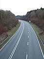
The B1 near queues

The B 1 crosses the A 39 near Cremlingen in Lower Saxony
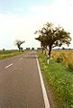
On federal highway 1 in Saxony-Anhalt between Helmstedt and Magdeburg
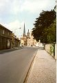
Historical course of the B 1, entrance to Burg (near Magdeburg)

Signpost in the Geltow district of Potsdam-Mittelmark

Road traffic on the B1 east of Berlin


See also
Movies
- Always straight ahead. From Aachen to Königsberg. Shown in: WDR January 1, 2010 (Part 1) and January 2, 2010 (Part 2), each time 6:05 pm - 6:50 pm several times in the RBB . WDR 2009. (Aachen - Berlin section of the B 1, different route conditions from the motorway to the low-traffic single-lane road). Film in 9 parts on YouTube
literature
- Ferdinand Seibt (Ed.): Transit Bruges – Novgorod: A road through European history. Exhibition catalog. Bottrop / Essen 1997, ISBN 3-89355-148-4 .
- Paatricia Clough: Aachen - Berlin - Koenigsberg. A journey through time along the old Reichsstrasse 1. Munich 2007, ISBN 978-3-421-04210-1 .
- Sandra Kuhlmann (Ed.): B1 | A40 - The beauty of the great road. MAP Markus Ambach Projects / StadtBauKultur NRW. JOVIS Verlag, Berlin 2010, ISBN 978-3-86859-077-7 .
Web links
- Website for the exhibition “transit.” Bruges - Novgorod 1997 in Essen
- Motorbike tour along the federal highway 1 between Küstrin and Bruges ( Memento from September 29, 2007 in the Internet Archive )
- Website with photos at the B1
- Website with history and photos of the B 1
- History of the Ruhr Expressway B 1 / A 40
- Description of this sight on the route of industrial culture
Individual evidence
- ↑ UPDATE: A44n: Approval of the north direction between the motorway junctions Jackerath and Holz | Streets.NRW. Retrieved July 31, 2018 .
- ↑ Invitation for journalists: Ceremonial opening of the A44n | Streets.NRW. Retrieved October 16, 2018 .
- ^ Heinrich Bremer: Giant toys on the Ruhr. In: time online. Die Zeit, April 28, 1967, accessed December 9, 2011 (newspaper article).
- ↑ ADAC Jam Balance 2019: Drivers in North Rhine-Westphalia were stuck in traffic jams for longer. In: ADAC press release. February 6, 2020, accessed June 15, 2020 .
- ↑ State Ministry of Transport gives the green light . In: Ruhr-Nachrichten , January 7, 2008
- ↑ Stadtbahnamt Dortmund: Level-free extension of the Stadtbahn into Marsbruchstrasse ( Memento from May 21, 2015 in the Internet Archive )
- ↑ AP: Techno Parade is peaceful and happy. Love Parade. In: focus online. Focus, July 19, 2008, accessed December 9, 2011 (newspaper article).
- ↑ Ferlemann: Aerzen bypass relieves residents of through traffic ( Memento from December 3, 2013 in the Internet Archive )
- ↑ Coppenbrügge / Marienau bypass in the course of Bundesstraße 1 | Nds. State authority for road construction and traffic. In: www.strassenbau.niedersachsen.de. Retrieved January 28, 2016 .
- ↑ B 1 (Coppenbrügge bypass): Construction of the bridge over the B 442 | begins Nds. State authority for road construction and traffic. Retrieved June 12, 2020 .
- ^ Lower Saxony Ministry of Economics, Labor, Transport and Digitization: B 1 - Mehle bypass. Retrieved October 6, 2018 .
- ↑ B 1: Future single-lane traffic routing on the Leineflutbrücke in Burgstemmen. (No longer available online.) In: www.strassenbau.niedersachsen.de. Nds. State authority for road construction and traffic, archived from the original on January 17, 2017 ; accessed on August 29, 2019 .
- ↑ FStrAbG - Law on the expansion of federal highways. Retrieved October 3, 2018 .
- ↑ Statistical information about Braunschweig. In: braunschweig.de. City of Braunschweig, accessed on December 9, 2011 : "Geographical center: (back of the building Rebenring 7)"
- ^ Yvonne Jennerjahn, Christine Xuân Müller: Controversial reconstruction project: preparatory work for the construction of the garrison church tower started . In: Potsdam's latest news . November 20, 2017 ( pnn.de [accessed December 5, 2017]).
- ↑ Approval bypass B 1 Herzfelde | Traffic. Retrieved December 23, 2017 .
- ↑ Irritant topic street line B1
- ↑ ots: WDR television: Always straight ahead. From Aachen to Königsberg. In: presseportal.de. Westdeutscher Rundfunk, December 28, 2009, accessed on December 9, 2011 (press kit).
Visitor center and anchor points (from west to east): Museum of German Inland Shipping | Inner harbor Duisburg | LVR Industrial Museum Oberhausen | Landscape Park Duisburg-Nord | Gasometer Oberhausen | Aquarius Water Museum | St. Antony Hut | Villa Huegel | Nordsternpark | Zeche Zollverein World Heritage Site and Zollverein Coking Plant | Ewald colliery | Marl Chemical Park | Railway Museum Bochum-Dahlhausen | Henrichshütte | Centennial Hall Bochum | Recklinghausen substation | German Mining Museum | Nightingale colliery | Henrichenburg ship lift | DASA | Hansa coking plant | Zeche Zollern II / IV | Hohenhof | Hagen Open Air Museum | Lindenbrauerei Unna | Maximilian Park Hamm
Themed routes (in ascending order by number): 1. Duisburg: City and Harbor | 2. Industrial cultural landscape Zollverein | 3. Duisburg: industrial culture on the Rhine | 4. Oberhausen: Industry makes the city | 5. Krupp and the city of Essen | 6. Dortmund: triad coal, steel and beer | 7. Industrial culture on the Lippe | 8. Erzbahn-Emscherbruch | 9. Industrial culture at Volme and Ennepe | 10. Brine, steam and coal | 11. Early industrialization | 12. The past and present of the Ruhr | 13. On the way to the blue Emscher | 14. Canals and shipping | 15. Lanes in the area | 16. Westphalian mining route | 17. Rhenish mining route | 18. Chemistry, Glass and Energy | 19. Workers' settlements | 20. Entrepreneur villas | 21. Bread, grain and beer | 22. Myth of the Ruhr Area | 23. Parks and Gardens | 24. Industrial nature | 25. Panoramas and Landmarks | 26. Sacred buildings | 27. Iron & Steel | 28. Water: works, towers and turbines | 29. Bochum - industrial culture in the heart of the district | 30. Gelsenkirchen | 31. Industrial Culture and Bauhaus Route | by bike

Lindenbrauerei Unna ![]() |
Old Reichsstrasse 1 |
Historic mining trail Holzwickede |
Emscher spring |
House Opherdicke |
Railway repair shop Schwerte |
Nickel works |
Rohrmeisterei Schwerte |
Formerly mining in Fröndenberg |
Chainsmith Museum |
Wind art and keeper's house |
Gademen range |
Kurpark Königsborn |
Barmer holiday colony | Friedrich Grillo Memorial and Altes Amtshaus |
Königsborn railway station | Porter's house, Koenigsborn 2/5 |
Reinhardstrasse settlement |
Headframe Bönen - East Pole | Backhaus Flierich |
Lenningsen train station |
Kamen train station |
Seseke Bridge |
Monopoly colliery , Grillo shaft |
Monopoly colliery Grimberg shaft 1/2 |
Bergkamen power plant |
Heap of large wood
|
Old Reichsstrasse 1 |
Historic mining trail Holzwickede |
Emscher spring |
House Opherdicke |
Railway repair shop Schwerte |
Nickel works |
Rohrmeisterei Schwerte |
Formerly mining in Fröndenberg |
Chainsmith Museum |
Wind art and keeper's house |
Gademen range |
Kurpark Königsborn |
Barmer holiday colony | Friedrich Grillo Memorial and Altes Amtshaus |
Königsborn railway station | Porter's house, Koenigsborn 2/5 |
Reinhardstrasse settlement |
Headframe Bönen - East Pole | Backhaus Flierich |
Lenningsen train station |
Kamen train station |
Seseke Bridge |
Monopoly colliery , Grillo shaft |
Monopoly colliery Grimberg shaft 1/2 |
Bergkamen power plant |
Heap of large wood ![]() |
Colliery House Aden |
Seepark Lünen with Preußenhalde and pyramid |
Ziethenstrasse settlement
|
Colliery House Aden |
Seepark Lünen with Preußenhalde and pyramid |
Ziethenstrasse settlement ![]() |
Prussia port |
"Am Kanal" settlement |
Hüttenwerke Kayser |
Miners Residential Museum |
Zeche Minister Achenbach Schacht 4, LÜNTEC Tower |
Lünen power plant |
Victoria Settlement |
"Westfalia" canteen |
Brickwork Siegeroth |
Colliery Hermann and " Old Colony " |
Cappenberg Castle |
Werne colliery | Old office building today Karl-Pollender-Stadtmuseum Werne |
Marina Rünthe |
Schacht III cultural center |
Rünthe express train settlement and old colony |
Rünthe-Süd settlement |
Gersteinwerk power plant |
Lark shaft |
East mine , Heinrich Robert shafts |
Kissinger Höhe
|
Prussia port |
"Am Kanal" settlement |
Hüttenwerke Kayser |
Miners Residential Museum |
Zeche Minister Achenbach Schacht 4, LÜNTEC Tower |
Lünen power plant |
Victoria Settlement |
"Westfalia" canteen |
Brickwork Siegeroth |
Colliery Hermann and " Old Colony " |
Cappenberg Castle |
Werne colliery | Old office building today Karl-Pollender-Stadtmuseum Werne |
Marina Rünthe |
Schacht III cultural center |
Rünthe express train settlement and old colony |
Rünthe-Süd settlement |
Gersteinwerk power plant |
Lark shaft |
East mine , Heinrich Robert shafts |
Kissinger Höhe ![]() |
Radbod Colliery Memorial |
Radbod colliery |
Hamm city harbor |
Vogelsang settlement |
Zeche Sachsen today Öko-Zentrum NRW |
Hamm train station | Böhler-Welding, formerly Westphalian Union |
Westphalian wire industry |
Hamm gasworks |
Water towers on Hellweg |
Klostermühle Pohl |
Hamm lock |
Water handover Hamm |
Kurpark Hamm |
Lippe lock Heessen |
Werries lock |
Way to school footbridge |
Westphalia power plant |
Maximilian Park
|
Radbod Colliery Memorial |
Radbod colliery |
Hamm city harbor |
Vogelsang settlement |
Zeche Sachsen today Öko-Zentrum NRW |
Hamm train station | Böhler-Welding, formerly Westphalian Union |
Westphalian wire industry |
Hamm gasworks |
Water towers on Hellweg |
Klostermühle Pohl |
Hamm lock |
Water handover Hamm |
Kurpark Hamm |
Lippe lock Heessen |
Werries lock |
Way to school footbridge |
Westphalia power plant |
Maximilian Park ![]()

Villa Huegel ![]() |
Margarethenhöhe
|
Margarethenhöhe ![]() |
Krupp family cemetery | Association building of the Regionalverband Ruhr |
Become an abbey |
Horster mill |
Headquarters Krupp |
Zeche Zollverein Shaft XII |
Gasometer Oberhausen |
St. Antony Hut
|
Krupp family cemetery | Association building of the Regionalverband Ruhr |
Become an abbey |
Horster mill |
Headquarters Krupp |
Zeche Zollverein Shaft XII |
Gasometer Oberhausen |
St. Antony Hut ![]() |
Eisenheim settlement
|
Eisenheim settlement ![]() |
Landscape Park Duisburg-Nord
|
Landscape Park Duisburg-Nord ![]() |
Old Thyssen headquarters |
Alsumer Berg
|
Old Thyssen headquarters |
Alsumer Berg ![]() |
Haniel Museum |
Rhine orange |
Rheinpreußen settlement
|
Haniel Museum |
Rhine orange |
Rheinpreußen settlement ![]() |
Krupp Hüttenwerke Gate 1 |
Harbor mouth of the factory harbor of Hüttenwerke Krupp Mannesmann |
Kamp Monastery |
Streithof |
Landsberg Castle |
Henrichshütte
|
Krupp Hüttenwerke Gate 1 |
Harbor mouth of the factory harbor of Hüttenwerke Krupp Mannesmann |
Kamp Monastery |
Streithof |
Landsberg Castle |
Henrichshütte ![]() |
Hannover Colliery I / II / V | Bell of the Bochum Association in front of the town hall |
Kortumpark | Grave of Heinrich Kämchen |
Nightingale colliery
|
Hannover Colliery I / II / V | Bell of the Bochum Association in front of the town hall |
Kortumpark | Grave of Heinrich Kämchen |
Nightingale colliery ![]() |
Monument of Minister Stein at Rathaus Wetter |
Castle weather |
House Schede |
House Harkorten |
Hohenhof
|
Monument of Minister Stein at Rathaus Wetter |
Castle weather |
House Schede |
House Harkorten |
Hohenhof ![]() |
Borsigplatz | Mining memorials on the Ostfriedhof | Graves of the Hoesch family in the Ostfriedhof |
Monument to those who fell in March on the north cemetery in Eving ( Ruhr uprising ) |
Zeche Zollern |
Old Reichsstrasse 1 |
Emscher spring |
Radbod Colliery Memorial |
Cappenberg Castle |
Schwerin dump |
House Goldschmieding |
Hammerhead tower Zeche Erin 3 |
Kunstwald Zeche Teutoburgia |
Wanne-Eickel main station |
Halde Haniel |
Dreieck-Siedlung Hochlarmark |
Glückauf-Kampfbahn |
Graf Bismarck colliery 1/4 |
Schurenbachhalde
|
Borsigplatz | Mining memorials on the Ostfriedhof | Graves of the Hoesch family in the Ostfriedhof |
Monument to those who fell in March on the north cemetery in Eving ( Ruhr uprising ) |
Zeche Zollern |
Old Reichsstrasse 1 |
Emscher spring |
Radbod Colliery Memorial |
Cappenberg Castle |
Schwerin dump |
House Goldschmieding |
Hammerhead tower Zeche Erin 3 |
Kunstwald Zeche Teutoburgia |
Wanne-Eickel main station |
Halde Haniel |
Dreieck-Siedlung Hochlarmark |
Glückauf-Kampfbahn |
Graf Bismarck colliery 1/4 |
Schurenbachhalde![]()
![]()
![]()
![]()
![]()