
Westfalendamm
|
Westfalendamm
City of Dortmund
Coordinates: 51 ° 30 ′ 6 ″ N , 7 ° 30 ′ 56 ″ E
|
|
|---|---|
| Height : | approx. 115 m above sea level NHN |
| Residents : | 17,970 (Dec. 31, 2018) |
| Postal code : | 44141 |
| Area code : | 0231 |
| Statistical District : | 80 |
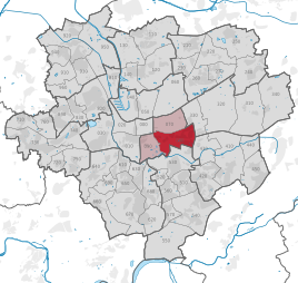  Location of Westfalendamm in Dortmund
|
|
Westfalendamm is the statistical district 80 of the urban city of Dortmund . It is located in the southeast of the city and belongs to the city district Innenstadt-Ost . The statistical district today consists of the statistical sub-districts Gartenstadt-Nord and Gartenstadt-Süd , which together form the Dortmund district of Gartenstadt , as well as the statistical sub-districts Westfalendamm-Nord and Westfalendamm-Süd .


The name of the statistical district is the Westfalendamm , one of the most important main streets in Dortmund . Together with the Rheinland dam to the west , this is part of the federal highway ![]() in Dortmund's urban area.
in Dortmund's urban area.
With the one coming from the west in the direction of Bochum![]() and the one continuing in the east to Kassel
and the one continuing in the east to Kassel![]() , the Westfalendamm not only takes on the role of a country road (
, the Westfalendamm not only takes on the role of a country road ( ![]() ), but also de facto that of a motorway, in addition to its intended function as a residential and inner-city main street . As a six-lane avenue flanked by rows of trees with four lanes, the Westfalendamm is not designed for a daily traffic volume of more than 140,000 vehicles. Large-scale obstructions to congestion occur regularly, particularly during trade fairs and during football matches .
), but also de facto that of a motorway, in addition to its intended function as a residential and inner-city main street . As a six-lane avenue flanked by rows of trees with four lanes, the Westfalendamm is not designed for a daily traffic volume of more than 140,000 vehicles. Large-scale obstructions to congestion occur regularly, particularly during trade fairs and during football matches .
Since the beginning of 2008, there has been a night-time driving ban for trucks on the Westfalendamm and a speed limit of 50 km / h in the inner-city area. This is checked with the help of a speed measuring system , of the type PoliScan Speedtower , between Lübkestrasse and Obere Brinkstrasse.
history
Called Aplerbecker Landstrasse until 1910 , a tram (today: Stadtbahn U47 ) ran on the Westfalendamm between Dortmund and Aplerbeck from 1914 . From 1918 to 1930 an elegant and in large part still well-preserved villa development developed between Märkischer Strasse and the former Nussbaumweg . With the avenue planting ( plane trees ), the single-lane street layout and the bridle paths on both sides, the Westfalendamm was a generously laid out street that was extremely popular with the Dortmund citizens and was a popular stroll on Sundays.
statistics
As of December 31, 2018, 17,970 residents lived in the statistical district of Westfalendamm.
Structure of the population:
- Minor quota: 19.5% [Dortmund average: 19.4% (2016)]
- Old age quota: 41.9% [Dortmund average: 30.0% (2016)]
- Proportion of foreigners: 11.2% [Dortmund average: 18.2% (2018)]
- Unemployment rate: 6.6% [Dortmund average: 11.0% (2017)]
The average income is around 60% above the Dortmund average.
Population development
| year | 1987 | 2003 | 2008 | 2013 | 2016 | 2018 |
|---|---|---|---|---|---|---|
| Residents | 17,621 | 17.169 | 17.051 | 17,547 | 17,712 | 17,970 |
Current plans
In order to relieve the population living on Westfalendamm and in the garden city from long-distance and through traffic, ![]() an additional traffic route in a tunnel is planned between Märkische Strasse and the connection . This
an additional traffic route in a tunnel is planned between Märkische Strasse and the connection . This ![]() motorway tunnel, which will then be part of the motorway tunnel, should have two lanes in each direction and thus enable traffic light-free passage through Dortmund for the first time . With the dismantling of the Westfalendamm located in the tunneled area to two lanes each, plans are also being made to reopen the side streets that are currently tied off. The planning approval decision was made in January 2008, and construction was originally supposed to start in spring 2010. The Higher Administrative Court of Münster, however, overturned the planning approval decision with the judgment issued on August 26, 2009. The Ministry of Building and Transport of the State of North Rhine-Westphalia appealed against this judgment to the Federal Administrative Court. She was rejected in July 2010. In the Federal Transport Infrastructure Plan up to 2030, the tunnel between Märkischer Strasse and Max-Eyth-Strasse is classified as a “further requirement with planning rights”.
motorway tunnel, which will then be part of the motorway tunnel, should have two lanes in each direction and thus enable traffic light-free passage through Dortmund for the first time . With the dismantling of the Westfalendamm located in the tunneled area to two lanes each, plans are also being made to reopen the side streets that are currently tied off. The planning approval decision was made in January 2008, and construction was originally supposed to start in spring 2010. The Higher Administrative Court of Münster, however, overturned the planning approval decision with the judgment issued on August 26, 2009. The Ministry of Building and Transport of the State of North Rhine-Westphalia appealed against this judgment to the Federal Administrative Court. She was rejected in July 2010. In the Federal Transport Infrastructure Plan up to 2030, the tunnel between Märkischer Strasse and Max-Eyth-Strasse is classified as a “further requirement with planning rights”.
In conjunction with the extensions that have already taken place on the Rheinlanddamm (new construction of the Schnettker Bridge and six-lane expansion between the Dortmund-West motorway junction and Wittekindstrasse in the years 2005 to 2012), the planners of the city of Dortmund hope to cope with the greatly increased transit traffic due to the EU expansion to the east .
At the end of 2016, a new light rail tunnel was put into operation, which ![]() enables the U47 light rail traffic to be routed from the median to Marsbruchstrasse without crossing .
enables the U47 light rail traffic to be routed from the median to Marsbruchstrasse without crossing .
In 2018, the expansion of Bundesstraße 1 to the six-lane Autobahn 40 between the Dortmund-Ost intersection and the Dortmund / Unna intersection began and is expected to be completed in 2023.
Web links
- Photos from a walk on the Westfalendamm
- Lot 75 - level-free extension of the tram into Marsbruchstrasse ( memento from October 29, 2013 in the Internet Archive ) at the Dortmund urban railway construction office
- Trees fall start for construction of the B1 tunnel , on Antenne Unna
Individual evidence
- ↑ Population figures in the statistical districts on December 31, 2018 (PDF)
- ↑ Population structures annual report 2016 (PDF file)
- ↑ Population structures annual report 2016 (PDF file)
- ↑ Nationalities in the statistical districts as of December 31, 2018 (PDF file)
- ↑ Unemployment rates by statistical district on June 30, 2017 (PDF file)
- ↑ Federal government has upgraded planning for the B1 tunnel // MdB Bülow calls for "transparent design". Retrieved September 24, 2019 .
- ↑ Oliver Volmerich: Stadtbahn U47 will roll through the tunnel under the B1 from Monday . ( ruhrnachrichten.de [accessed on March 29, 2017]).
- ↑ https://www.wr.de/staedte/dortmund/startuß-zum-ausbau-der-b-1-zur-a-40-in-dortmund-id215023893.html

Aplerbeck :
Aplerbeck (with Aplerbecker Mark ) |
Berghofen (with Berghofer Mark ) |
Stoke |
Sölde |
Sölderholz (with Lichtendorf )
Brackel :
woodlice |
Brackel (with Neuasseln ) |
Wobble |
Wickede
Eving :
Brechte |
Eving (with Kemminghausen ) |
Holthausen |
Lindenhorst
Hombruch :
Barop (with Schönau ) |
Bitter pulp |
Brünninghausen (with Renninghausen ) |
Eichlinghofen (with spreaders ) |
Hombruch |
Kirchhörde-Löttringhausen (with Großholthausen , Kirchhörde , Kleinholthausen , Löttringhausen and Schanze ) |
Menglinghausen |
Persebeck-Kruckel-Schnee (with Kruckel , Persebeck and Schnee ) |
Rombergpark-Lücklemberg (with Lücklemberg )
Hörde :
Benninghofen (with Loh ) |
Hacheney |
Wood (with highest ) |
Hörde (with Clarenberg ) |
Syburg (with Buchholz ) |
Wellinghofen (with Niederhofen ) |
Wichlinghofen
Huckarde :
Deusen |
Huckarde (with whiskers ) |
Jungferntal cream (with Jungferntal and cream ) |
Kirchlinde (with Hangeney )
city center north :
Borsigplatz |
Port |
Nordmarkt
Innenstadt-Ost :
Kaiserbrunnen (with grains ) |
Ruhrallee |
Westfalendamm (with Gartenstadt ) City Center
West :
City |
Dorstfeld |
Dorstfeld Bridge |
Westfalenhalle (with Kreuzviertel )
Lütgendortmund :
Bövinghausen |
Kley |
Lütgendortmund (with Holte-Kreta and Somborn ) |
Marten |
Oespel |
Westrich (with Dellwig )
Mengede :
Bodelschwingh |
Mengede (with Brüninghausen ) |
Nice |
Oestrich |
Schwieringhausen (with Ellinghausen and Groppenbruch ) |
Westerfilde
Scharnhorst :
Alt-Scharnhorst |
Derne |
Hostedde (with Grevel ) |
Kirchderne |
Kurl-Husen (with Fleier , Husen and Kurl ) |
Lanstrop |
Scharnhorst-Ost