
Hombruch
|
Hombruch
City of Dortmund
Coordinates: 51 ° 28 ′ 32 " N , 7 ° 26 ′ 20" E
|
|
|---|---|
| Height : | approx. 110 m above sea level NHN |
| Area : | 2.24 km² |
| Residents : | 11,782 (Dec 31, 2019) |
| Population density : | 5,265 inhabitants / km² |
| Postal code : | 44225 |
| Area code : | 0231 |
| Statistical District : | 65 |
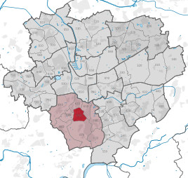  Location of Hombruch in Dortmund
|
|
Hombruch is the Statistical District 65 and also a neighborhood in the same district in the south of the county-level city of Dortmund .
history
Hombruch was first mentioned in a document from Count Dietrich von der Mark in 1395 as "dat Hombroick" ("the high break", the break forest ) (1450: "to dem Hombrocke"). In that year he pledged the Hombruchshof estate, today's restaurant “Lennhof”, for 40 marks, which was named after the pledgee mentioned in 1402, the magistrate Dietrich Lenhoff.
In the local area of Hombruch there was an extensive swampy forest area with a few farms and mills. The Prussian state owned the mills and the forest area . On November 12, 1827, the forest was auctioned off to the public. A large part of the forest went to the industrialist Friedrich Harkort as well as to the mining baron and landowner Freiherr von Romberg . Harkort opened the "Harkorter Eisenhütte" here in 1834, but it went bankrupt in 1838.
Since 1845, today's Dortmund district of Hombruch has belonged to the Hörde district , since 1874 to the Barop district of the Dortmund district and since 1887 to the Barop district in the Hörde district . After the division of the Barop office in 1888, today's center of Hombruch belonged to the Kirchhörde office. In 1929 both parts fell to the city of Dortmund.
Early mining
In the Hombruch domain forest , coal mining was carried out early on in shallow tunnels . B. through the tunnels Clausthal since 1730 and Louise am Rüpingsbach since 1752. In 1809 - probably for the first time in the Ruhr area - in what is now the Eichlinghofen district north of the Chaussee to Witten (today Stockumer Strasse), the water-bearing marl layer was cut through a 20-meter-deep layer by hand pierce the sunk shaft. The first underground mines were sunk from 1844 onwards , first the Louise Tiefbau colliery with the 88-meter-deep Clausthal shaft, in 1848 the Glückauf-Tiefbau colliery with the 234-meter-deep Gotthelf shaft - then the second deepest on the Ruhr - and in 1855 the first shaft of the later one United Wittwe & Barop colliery in today's Barop district.
The von Romberg family had been mining hard coal in Brünninghausen, which is now part of Hombruch, and which is adjacent to the east since 1616. Mining also began in the 18th century in the south of today's urban district, in the districts of Kruckel and Löttringhausen , and in the west, in Menglinghausen and Eichlinghofen . Many small mines have been closed since the 1860s due to low levels of exploitable supplies and a lack of rail connections.
industrialization
After the connection to the Dortmund-Witten-Hagen line of the Bergisch-Märkische Eisenbahn-Gesellschaft in 1848 , which was used to transport the coal (4.86 million quintals of goods left the Barop station in 1866 ), industrial companies were established, such as pig iron processing with attached steel forge and rolling mill from Wilhelm Hammacher sen. Puddle and steel works , which Warstein relocated here. In 1869 270 men produced 7,200 tons of rolled sheet here. The workforce that Warstein brought along formed the starting point for the Catholic community in Hombruch. The Clemenskirche was built in 1871, the Marienhospital in 1873. In the 1870s and 1880s coking plants were built . Louise Tiefbau in particular became an important coke producer thanks to good fat coal . In 1898 the Hörder Kreisbahn was opened and Hombruch was connected to the public transport network of the city of Hörde . In 1872 the Baroper Maschinenbau AG was founded, which built steam engines and steam hammers . Because of the start-up crisis , the steel mill was shut down in 1881; some of the workforce emigrated or was officially returned to Warstein in order to relieve the Dortmund poor. (Until 1867, the unemployed and the poor were returned to their place of birth as far as possible; the so-called home law , which was decisive for the granting of poor relief, was not abolished by moving away.)
In 1884, Hermann Kehl's plant was reopened as a pure rolling mill. In 1905 Siemens-Martin furnaces were put into operation so that the steel could be produced again. The plant ranged from what was then Bahnhofstrasse (now Harkortstrasse), where the furnace hall was built despite popular protests, to the Louise Tiefbau colliery, which was abandoned in 1910 and whose site was taken over by the rolling mill in 1913.
In 1893 there were 3547 miners living in what is now the Hombruch district. Inexpensive cooperative houses have been built in Hombruch since 1896.
20th century
Shortly before the First World War , the peak of coal production was reached. the mines in the south of Hombruch were connected to the Union, AG für Bergbau, Eisen- und Stahl-Industrie plant on Rheinische Strasse with a 5-kilometer cable car to transport coke there. During the war, coke production for the steel industry was intensified again with the help of prisoners of war.
From January 1923 to October 1924 the Ruhr area was occupied by French troops. The occupiers also confiscated restaurants and schools in Hombruch. After that time, the economy recovered only slowly. However, the end of an era was also ushered in. After 1920 mining shifted northwards and the collieries and coking plants were closed. The last mines ceased operations in 1924/25:
- August 16, 1924 - United Wiendahlsbank colliery in Kruckel
- September 1, 1925 - Glückauf-Tiefbau colliery and Kaiser Friedrich colliery
A 40-meter high dump on Gotthelfstrasse, one of the few pointed cone dumps in the Ruhr area, but with capped main peaks , is still reminiscent of the Glückauf Tiefbau colliery .
In 1928, Baroper Maschinenbau AG also ceases operations. The coking plant of the Glückauf-Tiefbau colliery was closed in 1930. The pits of abandoned coal mines were the 1933/34 Reichsarbeitsdienst canceled. The rolling mill was taken over by the Stinnes Group in the 1920s and by Hoesch AG in 1938 . In 1957/58 the production of rolled products was switched to welded spiral tubes. In 1989, this Hoesch tube factory at Barop station was closed. Since then, Hombruch has been an almost industry-free place.
In 1944 Hombruch was hit by bomb attacks. Both churches and the Marienhospital were damaged. With the municipal reform in 1975, the Hombruch district was established.
statistics
On December 31, 2019, there were 11,782 residents in Hombruch.
Structural data of the population of Hombruch:
- Share of the population under 18-year-olds: 13.3% [Dortmund average: 16.2% (2018)]
- Population share of at least 65-year-olds: 23.8% [Dortmund average: 20.2% (2018)]
- Proportion of foreigners: 11.1% [Dortmund average: 18.8% (2019)]
- Unemployment rate: 9.7% [Dortmund average: 11.0% (2017)]
The average income is around 15% below the Dortmund average.
Population development
| year | Pop. |
|---|---|
| 1987 | 12,624 |
| 2003 | 11,927 |
| 2008 | 11,809 |
| 2013 | 11,825 |
| 2016 | 11,773 |
| 2019 | 11,782 |
Economy and tourism
A weekly market takes place in the Hombruch pedestrian zone on Wednesdays and Saturdays. Further attractions are the two churches and the skate park. Other sports facilities with a larger catchment area in Dortmund include a bike park for mountain bikes and the Froschloch natural outdoor pool .
literature
- Tilo Cramm: The Hombruch mining history. Edited on behalf of the Association of Mining Historic Sites Ruhrrevier eV, Dortmund 2017.
Individual evidence
- ↑ Population figures in the statistical districts on December 31, 2019 (PDF)
- ↑ Cramm 2017, p. 40.
- ↑ Cramm 2017, p. 58 ff.
- ^ Nicolaus Hocker: The large-scale industry of Rhineland and Westphalia. Leipzig 1867 online
- ↑ Cramm 2017, p. 16 ff.
- ↑ Cramm 2017, p. 39.
- ↑ Images on www.medienwerkstatt-online. , Accessed March 18, 2017.
- ^ Historical association for Dortmund and the Grafschaft Mark eV
- ↑ Population share of the under 18 year olds Statistical Atlas 2019 (PDF file)
- ↑ Population share of at least 65-year-olds Statistical Atlas 2019 (PDF file)
- ↑ Nationalities in the statistical districts on December 31, 2019 (PDF file)
- ↑ Unemployment rates according to statistical districts on June 30, 2017 ( memento of the original from June 25, 2018 in the Internet Archive ) Info: The archive link was inserted automatically and has not yet been checked. Please check the original and archive link according to the instructions and then remove this notice. (PDF file)

Aplerbeck :
Aplerbeck (with Aplerbecker Mark ) |
Berghofen (with Berghofer Mark ) |
Stoke |
Sölde |
Sölderholz (with Lichtendorf )
Brackel :
woodlice |
Brackel (with Neuasseln ) |
Wobble |
Wickede
Eving :
Brechte |
Eving (with Kemminghausen ) |
Holthausen |
Lindenhorst
Hombruch :
Barop (with Schönau ) |
Bitter pulp |
Brünninghausen (with Renninghausen ) |
Eichlinghofen (with spreaders ) |
Hombruch |
Kirchhörde-Löttringhausen (with Großholthausen , Kirchhörde , Kleinholthausen , Löttringhausen and Schanze ) |
Menglinghausen |
Persebeck-Kruckel-Schnee (with Kruckel , Persebeck and Schnee ) |
Rombergpark-Lücklemberg (with Lücklemberg )
Hörde :
Benninghofen (with Loh ) |
Hacheney |
Wood (with highest ) |
Hörde (with Clarenberg ) |
Syburg (with Buchholz ) |
Wellinghofen (with Niederhofen ) |
Wichlinghofen
Huckarde :
Deusen |
Huckarde (with whiskers ) |
Jungferntal cream (with Jungferntal and cream ) |
Kirchlinde (with Hangeney )
city center north :
Borsigplatz |
Port |
Nordmarkt
Innenstadt-Ost :
Kaiserbrunnen (with grains ) |
Ruhrallee |
Westfalendamm (with Gartenstadt ) City Center
West :
City |
Dorstfeld |
Dorstfeld Bridge |
Westfalenhalle (with Kreuzviertel )
Lütgendortmund :
Bövinghausen |
Kley |
Lütgendortmund (with Holte-Kreta and Somborn ) |
Marten |
Oespel |
Westrich (with Dellwig )
Mengede :
Bodelschwingh |
Mengede (with Brüninghausen ) |
Nice |
Oestrich |
Schwieringhausen (with Ellinghausen and Groppenbruch ) |
Westerfilde
Scharnhorst :
Alt-Scharnhorst |
Derne |
Hostedde (with Grevel ) |
Kirchderne |
Kurl-Husen (with Fleier , Husen and Kurl ) |
Lanstrop |
Scharnhorst-Ost