
Federal motorway 40
| Bundesautobahn 40 in Germany | |||||||||||||||||||||||||||||||||||||||||||||||||||||||||||||||||||||||||||||||||||||||||||||||||||||||||||||||||||||||||||||||||||||||||||||||||||||||||||||||||||||||||||||||||||||||||||||||||||||||||||||||||||||||||||||||||||||||||||||||||||||||||||||||||||||||||||||||||||||||||||||||||||||||||||||||||||||||||||||||||||||||||||

|
|||||||||||||||||||||||||||||||||||||||||||||||||||||||||||||||||||||||||||||||||||||||||||||||||||||||||||||||||||||||||||||||||||||||||||||||||||||||||||||||||||||||||||||||||||||||||||||||||||||||||||||||||||||||||||||||||||||||||||||||||||||||||||||||||||||||||||||||||||||||||||||||||||||||||||||||||||||||||||||||||||||||||||
| |
|||||||||||||||||||||||||||||||||||||||||||||||||||||||||||||||||||||||||||||||||||||||||||||||||||||||||||||||||||||||||||||||||||||||||||||||||||||||||||||||||||||||||||||||||||||||||||||||||||||||||||||||||||||||||||||||||||||||||||||||||||||||||||||||||||||||||||||||||||||||||||||||||||||||||||||||||||||||||||||||||||||||||||
| map | |||||||||||||||||||||||||||||||||||||||||||||||||||||||||||||||||||||||||||||||||||||||||||||||||||||||||||||||||||||||||||||||||||||||||||||||||||||||||||||||||||||||||||||||||||||||||||||||||||||||||||||||||||||||||||||||||||||||||||||||||||||||||||||||||||||||||||||||||||||||||||||||||||||||||||||||||||||||||||||||||||||||||||
 |
|||||||||||||||||||||||||||||||||||||||||||||||||||||||||||||||||||||||||||||||||||||||||||||||||||||||||||||||||||||||||||||||||||||||||||||||||||||||||||||||||||||||||||||||||||||||||||||||||||||||||||||||||||||||||||||||||||||||||||||||||||||||||||||||||||||||||||||||||||||||||||||||||||||||||||||||||||||||||||||||||||||||||||
| Basic data | |||||||||||||||||||||||||||||||||||||||||||||||||||||||||||||||||||||||||||||||||||||||||||||||||||||||||||||||||||||||||||||||||||||||||||||||||||||||||||||||||||||||||||||||||||||||||||||||||||||||||||||||||||||||||||||||||||||||||||||||||||||||||||||||||||||||||||||||||||||||||||||||||||||||||||||||||||||||||||||||||||||||||||
| Operator: |
|
||||||||||||||||||||||||||||||||||||||||||||||||||||||||||||||||||||||||||||||||||||||||||||||||||||||||||||||||||||||||||||||||||||||||||||||||||||||||||||||||||||||||||||||||||||||||||||||||||||||||||||||||||||||||||||||||||||||||||||||||||||||||||||||||||||||||||||||||||||||||||||||||||||||||||||||||||||||||||||||||||||||||||
| Start of the street: |
Straelen ( 51 ° 23 ′ N , 6 ° 13 ′ E ) |
||||||||||||||||||||||||||||||||||||||||||||||||||||||||||||||||||||||||||||||||||||||||||||||||||||||||||||||||||||||||||||||||||||||||||||||||||||||||||||||||||||||||||||||||||||||||||||||||||||||||||||||||||||||||||||||||||||||||||||||||||||||||||||||||||||||||||||||||||||||||||||||||||||||||||||||||||||||||||||||||||||||||||
| End of street: |
Dortmund ( 51 ° 30 ′ N , 7 ° 27 ′ E ) |
||||||||||||||||||||||||||||||||||||||||||||||||||||||||||||||||||||||||||||||||||||||||||||||||||||||||||||||||||||||||||||||||||||||||||||||||||||||||||||||||||||||||||||||||||||||||||||||||||||||||||||||||||||||||||||||||||||||||||||||||||||||||||||||||||||||||||||||||||||||||||||||||||||||||||||||||||||||||||||||||||||||||||
| Overall length: | 108.4 km | ||||||||||||||||||||||||||||||||||||||||||||||||||||||||||||||||||||||||||||||||||||||||||||||||||||||||||||||||||||||||||||||||||||||||||||||||||||||||||||||||||||||||||||||||||||||||||||||||||||||||||||||||||||||||||||||||||||||||||||||||||||||||||||||||||||||||||||||||||||||||||||||||||||||||||||||||||||||||||||||||||||||||||
| of which in operation: | 95.4 km | ||||||||||||||||||||||||||||||||||||||||||||||||||||||||||||||||||||||||||||||||||||||||||||||||||||||||||||||||||||||||||||||||||||||||||||||||||||||||||||||||||||||||||||||||||||||||||||||||||||||||||||||||||||||||||||||||||||||||||||||||||||||||||||||||||||||||||||||||||||||||||||||||||||||||||||||||||||||||||||||||||||||||||
| of which under construction: | 7 km | ||||||||||||||||||||||||||||||||||||||||||||||||||||||||||||||||||||||||||||||||||||||||||||||||||||||||||||||||||||||||||||||||||||||||||||||||||||||||||||||||||||||||||||||||||||||||||||||||||||||||||||||||||||||||||||||||||||||||||||||||||||||||||||||||||||||||||||||||||||||||||||||||||||||||||||||||||||||||||||||||||||||||||
| of which in planning: | 6 km | ||||||||||||||||||||||||||||||||||||||||||||||||||||||||||||||||||||||||||||||||||||||||||||||||||||||||||||||||||||||||||||||||||||||||||||||||||||||||||||||||||||||||||||||||||||||||||||||||||||||||||||||||||||||||||||||||||||||||||||||||||||||||||||||||||||||||||||||||||||||||||||||||||||||||||||||||||||||||||||||||||||||||||
|
State : |
|||||||||||||||||||||||||||||||||||||||||||||||||||||||||||||||||||||||||||||||||||||||||||||||||||||||||||||||||||||||||||||||||||||||||||||||||||||||||||||||||||||||||||||||||||||||||||||||||||||||||||||||||||||||||||||||||||||||||||||||||||||||||||||||||||||||||||||||||||||||||||||||||||||||||||||||||||||||||||||||||||||||||||
| Development condition: | 2 × 2 and 2 × 3 lanes | ||||||||||||||||||||||||||||||||||||||||||||||||||||||||||||||||||||||||||||||||||||||||||||||||||||||||||||||||||||||||||||||||||||||||||||||||||||||||||||||||||||||||||||||||||||||||||||||||||||||||||||||||||||||||||||||||||||||||||||||||||||||||||||||||||||||||||||||||||||||||||||||||||||||||||||||||||||||||||||||||||||||||||
 |
|||||||||||||||||||||||||||||||||||||||||||||||||||||||||||||||||||||||||||||||||||||||||||||||||||||||||||||||||||||||||||||||||||||||||||||||||||||||||||||||||||||||||||||||||||||||||||||||||||||||||||||||||||||||||||||||||||||||||||||||||||||||||||||||||||||||||||||||||||||||||||||||||||||||||||||||||||||||||||||||||||||||||||
| A40 in Essen | |||||||||||||||||||||||||||||||||||||||||||||||||||||||||||||||||||||||||||||||||||||||||||||||||||||||||||||||||||||||||||||||||||||||||||||||||||||||||||||||||||||||||||||||||||||||||||||||||||||||||||||||||||||||||||||||||||||||||||||||||||||||||||||||||||||||||||||||||||||||||||||||||||||||||||||||||||||||||||||||||||||||||||
|
Course of the road
|
|||||||||||||||||||||||||||||||||||||||||||||||||||||||||||||||||||||||||||||||||||||||||||||||||||||||||||||||||||||||||||||||||||||||||||||||||||||||||||||||||||||||||||||||||||||||||||||||||||||||||||||||||||||||||||||||||||||||||||||||||||||||||||||||||||||||||||||||||||||||||||||||||||||||||||||||||||||||||||||||||||||||||||
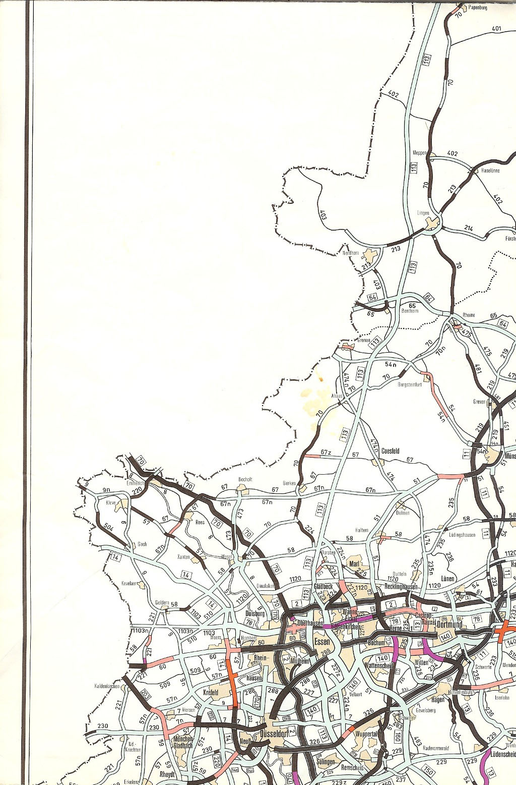
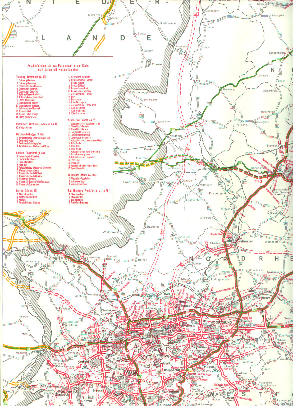
The federal motorway 40 (abbreviation: BAB 40 ) - short form: Autobahn 40 (abbreviation: A 40 ) - runs almost exactly in a west-east direction for a length of currently 95.4 kilometers from the Dutch border at Straelen over the rural left Lower Rhine through the large cities of the Ruhr area Moers , Duisburg , Mülheim an der Ruhr , Essen and Bochum to Dortmund .
The A 40 in the Ruhr area is one of the motorways with the highest traffic volumes in Germany with sometimes more than 100,000 vehicles a day. Between Essen and Dortmund, it is the route with the most traffic jams per kilometer in Germany.
In the 1970s, the number 40 autobahn was the name given to the planning of a new “Lippeschnellweg” through the northern Ruhr area, which was never implemented. In 1992, the number was re-used to merge the then Federal Motorway 430 and what was then the westernmost section of Federal Motorway 2 to form a continuous new motorway.
The A 40, together with the Dutch motorway 67 and the Belgian motorway 21, is the connection from the Ruhr area to the port of Antwerp .
course
The federal motorway 40 begins as a continuation of the Dutch motorway 67 at the Niederdorf border crossing between the cities of Venlo and Straelen . From there it leads almost straight east through the municipalities of Wachtendonk , Kempen , Kerken , Rheurdt and Neukirchen-Vluyn to the Moers motorway junction , where it crosses the A 57 . Via the urban area of Moers , it reaches the Rhine in Duisburg , which it crosses on the Neuenkamp Rhine bridge. Shortly afterwards, the A 40 crosses under the A 59 at the Duisburg junction and the A 3 just 1.5 kilometers behind it at the Kaiserberg junction . The A 40 section from the Dutch border to Kreuz Kaiserberg used to belong to the A 2 and is still part of the European route 34 today .
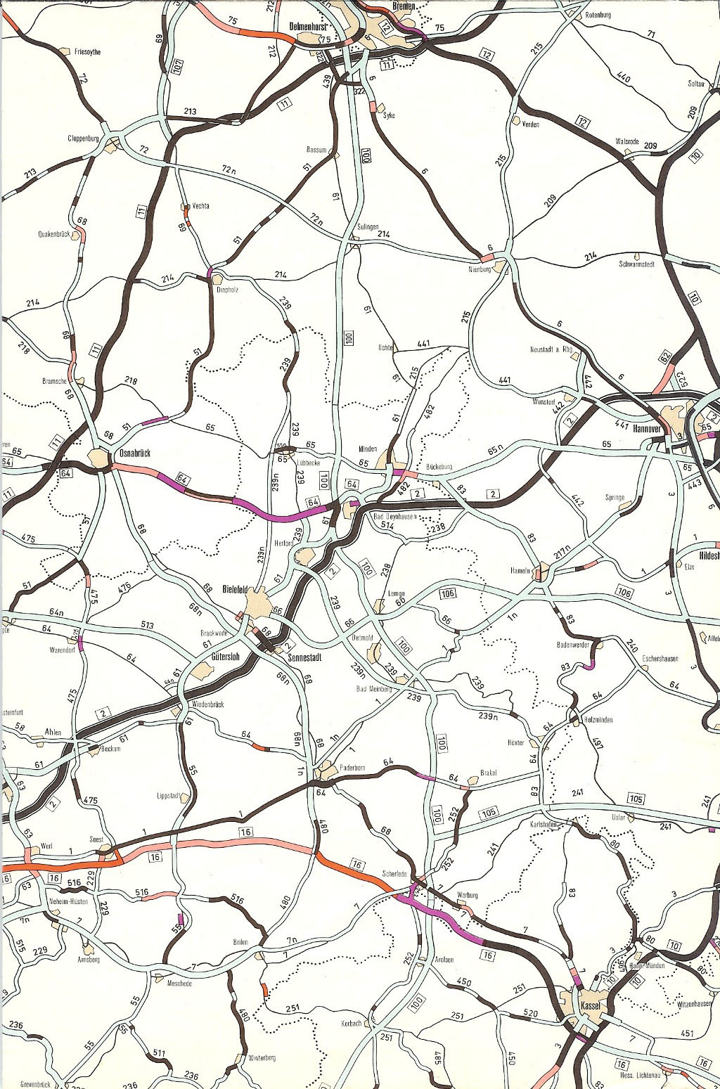
From the Kaiserberg junction, the A 40 runs centrally through the largest cities in the Ruhr area in a west-east direction. The section formerly known as the federal motorway 430 is also called the Ruhr Schnellweg . Through Mülheim an der Ruhr - only a few meters from the city limits of Oberhausen - and the center of Essen , the A 40 crosses under the Essen city center in the Ruhrschnellweg tunnel and behind it reaches the Essen-Ost motorway triangle , where the A 52 joins from the south . On the further route, the Autobahn 40 almost touches Gelsenkirchen - the Gelsenkirchen junction is exactly on the Essen / Bochum city limits, one kilometer from Gelsenkirchen - and then crosses Bochum . In the Bochum-West motorway triangle , traffic is divided into a northern bypass of the Bochum city center on the A 40 and a southern bypass on the A 448 . At the Bochum interchange , the A 40 crosses under the A 43 ; at the Dortmund-West interchange , it crosses the A 45 . After the Schnettker bridge , the A 40 ends shortly before Dortmund city center at the Dortmund-Hombruch junction with Landesstraße 660 (Wittekindstraße). There it turns into Bundesstraße 1 .
A further construction of the A 40 on the current B 1 route up to the connection with the continuing A 44 near Unna has been in planning for decades, the B 1 section is already included in the A 40 route. The B 1 is a six-lane city street ( Rheinlanddamm and Westfalendamm ) from the end of the A 40 expansion for 5.8 kilometers to the motorway-like junction Dortmund-Ost with the federal highway 236 . On the following 9.9 kilometers to the transition to the A 44 at the Dortmund / Unna motorway junction , the B 1 is built like a motorway, six lanes for around 1.5 kilometers, then four lanes. The expansion of this already motorway-like section into a continuous six-lane motorway has meanwhile begun with the first bridge structures.
The A 40 in the Ruhr area is one of the motorways with the highest traffic volumes in Germany. Six sections are counted with more than 100,000 vehicles a day. Due to the cramped spaces in the densely built-up cities, the autobahn is partially six-lane, but over long stretches it is only four-lane. As a result, the load per lane is extraordinarily high. In the ADAC traffic jam balance, the A 40 between Essen and Dortmund is the section of the autobahn with the most jam kilometers per kilometer in Germany. The A 40 between Essen and Duisburg has the fourth most traffic jams per kilometer of motorway in Germany. The autobahn is popularly known as the “Ruhrschleichweg” or the “longest parking lot in the Ruhr area”.

Traffic accident near Moers

Neuenkamp Rhine Bridge in Duisburg
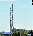
A striking landmark in Duisburg: the Stadtwerketurm

Light rail line in Essen-Holsterhausen
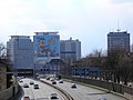
The Evonik headquarters in Essen

Essen-Huttrop at night

The track bus route at the Essen-Ost motorway triangle

Still-Leben Ruhrschnellweg: Visitors near Wattenscheid

Ruhr motorway church in Bochum-Hamme

Between Werne and Lütgendortmund before renovation

Provisional end of expansion: the Schnettker Bridge in Dortmund


Structural features
Tram and track bus in the median
During the construction of the Ruhr Expressway on the route of the former city streets, three tram lines were retained on separate tracks between the directional lanes.
- Between the junctions Essen-Zentrum and Mülheim-Heißen, the route of the normal-gauge U18 light rail line runs in the trough of the motorway.
- A meter-gauge tram line was retained between the Essen-Huttrop and Essen-Kray junctions . The route was converted into a route made of concrete elements for track buses in 1985 as part of a pilot project and is served by the Ruhrbahn bus route 146 .
- In Dortmund, the standard gauge U47 light rail line runs on the A 40 route. It traverses the Westfalendamm above ground almost in the entire section, which is built as a city street, and continues on the motorway-like part to behind the junction Dortmund-Stadtkrone Ost.
Access regulations
At all junction points between Mülheim-Winkhausen and Bochum-Werne, traffic control systems, so-called "gate lights", regulate the flow of traffic onto the motorway.
history
Construction of the Ruhr expressway
The planning for the Ruhr Schnellweg began in 1926, when more than a third of all road users were still using horse-drawn vehicles. In the Ruhr area, the line was equipped with only one signal-controlled intersection in Wattenscheid . In 1934 it was renamed Reichsstrasse 1 ; Its expansion was completed by 1935 and now had a nine-meter-wide cross-section, around twenty centimeters less than the narrowest cross-section today.
After the Second World War , Reichstrasse was renamed Bundesstrasse 1 . In view of the increasing traffic, considerations began in 1952 to expand the road to four lanes, adding a four-meter-wide median. A speed of 80 km / h was assumed. Cycle paths should also be built between Wattenscheid and Dortmund . From 1954 the expansion took place. In November 1955, the first section between Essen-Kray and the city limits of Wattenscheid was opened. In July 1957, a second section was completed in Dortmund-Dorstfeld west of the Schnettker Bridge . In 1958 the sections between Wattenscheid and Bochum and between the Bochum city limits and Dortmund-Lütgendortmund were completed. In 1960 the Ruhrschnellweg was opened in what was then Bochum's urban area.
On October 24, 1961, the first section in Essen was opened to traffic. In November 1962, the section between the Dortmund city limits and was Ruhr tangent A 1 in Unna in Massener cross with a temporary connection to Dortmund Sölde completed. A year later, the last above-ground section was inaugurated in the east of Dortmund between the Marsbruchstrasse exit and Sölde.
The provisional connection via the old R1 in Sölde was never expanded; instead, the connection to the federal motorway 44 at the Dortmund / Unna motorway junction was implemented in the early 1970s on a route further south in the area of the municipality of Holzwickede . From 1967, the cycle paths along the expressway were dismantled in favor of automobile traffic and the road was widened. Gustav Heinemann inaugurated the Ruhr Expressway Tunnel in Essen on September 25, 1970 .
From the A 430 and the A 2 to the A 40
On January 1st, 1977 the federal highway 1 was upgraded to the federal highway 430 only between Bochum - Werne and Mülheim an der Ruhr , and on a new route to the Kaiserberg junction .
In the reorganization of the motorway network in Germany, the A was in April 1992 430 with parts of the previous A 2 combined (Straelen Cross Duisburg-Kaiserberg) to A 40 to the dual leadership of A 2 and A 3 between the crosses Kaiserberg and Oberhausen to avoid and to correspond to the increased traffic importance of the Ruhr Expressway. In the course of this upgrading, numerous junctions were renamed, which previously bore the name of the adjoining city streets, which did not meet the standard, and therefore now have district names (e.g. Essen, Steeler Straße zu Essen- Huttrop , although the junction is in the southeast quarter ).
In parts of politics and in circles of the Rhine-Ruhr economy, reference was made in the 1990s to the expected further increase in traffic in the east-west direction; the Ruhr area is threatened with a "traffic collapse". One of the topics discussed was a privately built and managed tunnel solution between Dortmund and Duisburg that runs parallel to the Ruhr Expressway. This was not pursued further because of the expected costs.
Between March and August 2005, the mandatory blue signs for a federal motorway were set up on the stretch between Bochum- Werne and the Dortmund-West motorway junction . For cost reasons, this section - although it was run as a motorway - was still equipped with the old signs for the B 1 and was signposted as a motor road. From August to October 2004, the median on this section was secured with concrete protective walls. From May 2, 2007 to October 20, 2009, the subsequent section up to the newly established junction 44 Dortmund-Barop was expanded to include six lanes. In the course of widening the route, u. a. the Dortmund-West motorway junction was partially modernized and the rainbow bridge was demolished and replaced by a new building. In December 2009, the section of the route up to junction 45 Dortmund (B1 exit Hombruch / Lindemannstrasse) was upgraded to federal motorway 40. Since the newly built Schnettker Bridge was released on May 31, 2012, it has been continuously accessible with six lanes. Construction costs of 99 million euros were incurred for this section. From April 27 to June 25, 2012, the rest of the renovation work at the Dortmund-West motorway junction was carried out on the weekends. From September 30, 2012 to the end of 2013, the roadway on the motorway section to Bochum, which remains with four lanes, was renovated. In addition, the safety devices and sign gantries were renewed.
Between junction 6 Kerken and 7 Neukirchen-Vluyn , the new Neufelder Heide parking facility was put into operation on May 19, 2011 , which is intended, among other things, to alleviate the shortage of parking spaces for trucks. In 2001, after years of planning, the Neufelder Heide facility was on the verge of implementation - as can be seen from the forest areas cleared on both sides of the autobahn - when the Federal Ministry of Transport re-forecasted the number of truck parking spaces required for all of Germany with considerably more parking space. The system was therefore completely revised in terms of planning. The original planning of a tank and rest area was given up because no operator could be found.
Several months of complete closure for motorway renovation

In the summer of 2012, in an experiment that is unique in Germany, a section of the A 40 was shut down for months for renovation work. On the particularly busy section between the Essen-Zentrum junction and the Essen-Ost motorway triangle, the Ruhr Expressway Tunnel was retrofitted at the same time for around 20 million euros, several bridges were renovated and finally the road surface was renewed. The planning construction company Straßen.NRW wanted to shorten the construction time from an estimated two years to less than three months through the concentrated execution during a full closure . The company expected construction costs to be 2 million euros lower as well as economic savings of 3.5 million euros by avoiding traffic jams. The North Rhine-Westphalian Transport Minister found it better "to move the construction site to the office, then the construction work will be cheaper later". The project received nationwide attention and was discussed a lot. A professor of automotive economics predicted “numerous blockages” and called the planning “bungled and irresponsible”.
The highway was closed on July 7, 2012. In order to ensure diversions via the A 3, A 42, A 43 and A 52 motorways as well as within the city of Essen, around 260 additional traffic signs were set up over a wide area. Traffic lights have also been changed to give priority to through traffic. Contrary to the fears expressed, there were no major traffic jams. A congestion researcher identified as one of the reasons that many motorists avoided the area due to the strong public coverage of the closure. Measurements showed that the traffic on the detour motorways A 42 and A 52 increased sharply by 11 and 50 percent, but the driving speed only decreased by 3 and 20 percent. The renovated route was opened to traffic on September 30, 2012 as planned. The success of the plan was praised from all sides and classified as a model for further renovation projects.
Expansion of the A 40 instead of the parallel A 44 motorway
According to the "plan for the expansion of the federal highways from 1971 to 1985" that came into force in 1971, another motorway was to be built in parallel just a few kilometers south of the Ruhr Expressway. After this route was assigned to Autobahn 44 , it was given the name “DüBoDo” in order to express the goal of a continuous freeway connection from Düsseldorf via Bochum to Dortmund. These plans were not implemented. Only between Bochum and Dortmund was a section built that connects the A 43 and the A 45 . In view of the high costs and the resistance of the population, further construction through the south of Dortmund to Unna was abandoned in the mid-1970s; the route between Velbert and Bochum has not been planned since 2003.
Instead, the connection between the western and eastern sections of the A 44 is to be established via the A 40. Velbert continued to build the A 44 towards the north, where traffic is directed to Essen's city streets and is to continue on to the A 52, which joins the A 40 at the Essen-Ost motorway junction . From the Bochum-West motorway junction to the east, the A 448 was re-established, which runs parallel to the A 40 through the south of Bochum and - by integrating the previous section of the A 44 - continues to the Dortmund / Witten motorway junction .
Between these two motorway triangles, the A 40 should accommodate all motorway traffic. From the east four motorway lanes of the A 40 and the A 448 converge, from the west the traffic of a total of seven motorway lanes of the A 40, the A 44 and the A 52. In between, the A 40 has been expanded to at least three lanes in each direction. The section from Essen to Bochum-Wattenscheid was completed in December 2010 and fully released in November 2011. The following section to the Bochum-West motorway triangle was completed in May 2012. The motorway triangle itself was opened to traffic in June 2015.
The Somborn car park on the Bochum / Dortmund city limits was expanded to become the Beverbach rest area as a replacement for the access roads to two Bochum petrol stations that were no longer available due to expansion. The developed parking lot, which occupies the eastern part of the Dortmund-Kley district , was opened in November 2013, the petrol station and rest area, which is located in the Bochum-Langendreer district , in October 2014. At the eastern entrance to the service area, a round A 16-meter-high observation tower was built in the form of a headframe , which has two observation platforms , of which the lower one can also be reached barrier-free with an elevator .
Following the expansion, the Essen-Frillendorf junction was relocated. The entry and exit lanes of the Essen-Ost motorway triangle and the Frillendorf junction were less than 300 meters apart, which means that the area has been a hot spot for accidents for decades. The construction of the junction around one kilometer to the east took almost a decade overall due to difficulties in acquiring land and building the connecting roads and was completed in May 2020.
Construction projects and planning
New construction of the Rhine bridge in Duisburg
The Neuenkamp Rhine bridge on the A 40 was built from 1966 to 1970 and designed for 30,000 vehicles a day, based on the demand at the time. It is now used by more than 100,000 vehicles every day, and a further increase to 126,500 vehicles is expected by 2030. The bridge is structurally overloaded, has to be repaired again and again and can only be operated with a restriction to four lanes and a blockage for heavy trucks. A completely new construction of the bridge is therefore planned and has already begun. The new bridge will consist of two separate structures, each with four lanes. In line with this, the A 40 between the Duisburg-Homberg and Duisburg-Häfen junctions will be expanded to eight lanes over a total length of 3.5 kilometers. The first bridge structure is to be built between 2020 and 2023 and will begin traffic with six lanes. Then the old bridge will be demolished and replaced by the second bridge structure. Its completion and the release of all eight tracks is planned for 2026. The cost of the entire project is budgeted at 366 million euros.
Expansion of the Moers intersection - Duisburg intersection
In addition to the area around the Rhine Bridge, the Federal Transport Infrastructure Plan 2030 plans to expand the entire 12.0 kilometers between the A 57 and the A 59 to eight lanes. The project was classified as “further needs with planning rights”. For the 7.2 kilometer long western section from the Moers motorway junction to the Duisburg-Homberg junction, the total costs as of 2014 were estimated at 69.5 million euros. For the 4.8 kilometer long eastern section to the Duisburg motorway junction, the total costs including the Rhine bridge were estimated at 275.9 million euros. With the construction of the bridge, 3.5 kilometers of this will now be realized, with 1.3 kilometers remaining between the Duisburg-Häfen junction and the Duisburg junction.
Expansion of the Kaiserberg cross - Essen-Frohnhausen
The A 40 is to be expanded to six lanes over a total of 12.3 kilometers through the entire urban area of Mülheim an der Ruhr. The planning in the Federal Transport Infrastructure Plan 2030 consists of three sub-sections, all of which have been classified in the highest category “Urgent need with removal of bottlenecks”. The total cost of the project is estimated at 253.8 million euros. The environmental impact assessment was completed in 2017. After that, separate planning procedures will be opened for the three sections. The benefit of the construction project is doubted because the traffic from Essen-Frohnhausen is limited to four motorway lanes and is directed into Essen city streets that are already heavily used. The Mülheim member of the Bundestag describes the threatening traffic conditions as a "permanent traffic jam with announcement".
Expansion of Essen-Frohnhausen - Essen-East triangle
There is also planning for the expansion to six lanes for the following section of the motorway up to the junction with the A 52. In the Federal Transport Infrastructure Plan 2030, it is classified in the low category “Additional needs with planning rights”. For the expansion of the 5.9 kilometer long section through the center of Essen, total costs of 409 million euros were estimated in 2014.
In this section, the A 40 runs through the most densely populated districts of Essen. Due to the building history as a former city street, in the districts Frohnhausen , Holsterhausen , Südostviertel and Huttrop there are several kilometers of four-storey rows of houses, mostly in perimeter blocks, directly on the motorway. The expansion to an expressway was carried out from the Essen-Frohnhausen junction to the Ruhrschnellweg tunnel and from the Essen-Huttrop junction to the Essen-Ost motorway triangle in trough location, in order to be able to keep the numerous connected and crossing city streets at the same level. In the city center, the Ruhr Expressway Tunnel, opened in 1970, runs between the main train station, the subway and the high-rise district. In this cramped space, expansion would be associated with numerous complex structures and extraordinarily high costs. In an overview plan, 22 engineering structures alone are listed, one every 250 meters.
Expansion of the Bochum-West triangle - Dortmund-West intersection
Between the connections of the A 448 and the A 43, the expansion from four to six lanes is planned. The project is classified in the Federal Transport Infrastructure Plan 2030 in the highest category “Urgent need with removal of bottlenecks”. For a distance of 8.5 kilometers, total costs of 222.0 million euros were estimated. The subsequent section to the intersection with the A 45 is also to be expanded to include six lanes. The project was classified in the Federal Transport Infrastructure Plan 2030 in the second-highest category, "Urgent Need". For a distance of 8.0 kilometers, total costs of 140.3 million euros were estimated. The expansion of the Bochum motorway junction is currently being planned. Both the A 40 between the Bochum-Harpen and Bochum-Werne junctions and the A 43 are to be expanded to six lanes in one operation. The plan approval procedure is to begin in 2022, and construction is expected to begin in 2025. The other sections are at an early stage of planning. Different reports are obtained in order to be able to work out concrete building proposals.
Further construction Dortmund-Hombruch - Dortmund / Unna junction
In the federal traffic route plan, further construction of the A 40 on the B 1 route up to the connection to the A 1 and A 44 at the Dortmund / Unna motorway junction is planned. Today's B 1 is a six-lane city road for 5.8 kilometers from the Dortmund-Hombruch junction to the Dortmund-Ost motorway-like junction. From the Dortmund-Ost junction to the Dortmund / Unna junction, it has already been developed like a motorway for 9.9 kilometers, six lanes for around 1.5 kilometers, then four lanes.
For the expansion of the B 1 to the A 40 in the section through the densely built-up Dortmund city center, there are plans with two tunnels 1.5 and 1.6 kilometers in length. Even more than the expansion through the Essen city center, this new motorway would be extremely expensive. In the plans of the Federal Transport Infrastructure Plan 2030, total costs of EUR 794.4 million (2014 price) were estimated for 6.2 kilometers of upgraded line, which is almost EUR 130,000 per meter.
The "B 1 tunnel" project, which has been in operation for decades, is controversial in the city. Proponents hope that in the heavily polluted city center of Dortmund, a large part of the car traffic will disappear underground. Opponents fear that additional car traffic will be attracted and that emissions and noise pollution will continue to rise. In 2009 a completed and approved plan was declared illegal by the Münster Higher Administrative Court due to a serious mistake following resident complaints. After that, the planning had to be started all over again, including all the necessary reports. The project does not enjoy any noteworthy support from the federal and state governments. The A 40 construction through the city center was no longer included in the first draft of the 2030 Federal Transport Infrastructure Plan. It was only after a protest from Dortmund politicians that it was subsequently included in the second lowest category, “Additional needs with planning rights”. In the “master plan” presented in 2018 for the construction of trunk roads by the North Rhine-Westphalian Ministry of Transport, planning activities are only provided for the case that planning capacities are available beyond the urgent projects.
The already autobahn-like B 1 section behind the Dortmund-Ost junction is currently being expanded into a continuous six-lane autobahn. The project is classified in the Federal Transport Infrastructure Plan 2030 in the highest category “Urgent need with removal of bottlenecks”. For an upgraded route of 9.5 kilometers, total costs of 96.6 million euros were estimated in 2014. In preparation, the U47 light rail running between the two directional lanes was carried out in a tunnel under the southern directional lane until 2016 so that it can turn off the route without crossing. The planning approval procedure for the extension to the A 40 was completed in 2016. Crossing bridges have been widened and built since 2018. The completion of the expanded motorway is targeted for 2023.
Others
On November 14, 2007, to reduce the noise and exhaust emissions of residents in Dortmund on the eastern extension of the A 40, the Bundesstraße 1 between the B 54 in the west and the B 236 in the east, the maximum permitted speed of 60 km / h or . 70 km / h limited to 50 km / h.
Since February 12, 2008, the Ruhr Schnellweg between the motorway junctions Dortmund-West (as A 40 with the A 45 ) and Dortmund-Unna (as A 44 with the A 1 ) has been closed to truck traffic at night.
On May 30, 2010, the RUHR motorway church ( Epiphany Church ) was inaugurated near the Bochum-Hamme junction (33) .
On July 1, 2019, the Administrative Court of Gelsenkirchen decided to introduce a driving ban for vehicles with particularly high pollutant emissions, especially diesel vehicles, for the section of the BAB 40 leading through the Essen city area . This was the first time in Germany that a driving ban on a motorway was issued for reasons of environmental protection. The state government of North Rhine-Westphalia appealed against the judgment.
The A 40 in art and media

Since May 2009 the A 40 federal motorway has been the scene of several artistic interventions. The Eichbaum Opera by Raumlabor Berlin and the A40 Symphony by Detlev Bruckhoff, Frank Hensel and Karsten Spriestersbach are among the first cultural projects to understand the A 40 as a cultural space and to deal artistically with the transit space.
As part of the RUHR.2010 Capital of Culture year , the A 40 was included in the project on various sections. So are u. a. Numerous large-format pictures have been installed in the Essen area and colored noise protection walls have been installed in Bochum. The highlight of the use of the A 40 as a cultural Ruhr area motorway as part of the presentation by RUHR.2010 GmbH was July 18, 2010. For this day, the Ruhr Schnellweg was 60 km from AS Duisburg-Häfen to Dortmund Märkische Straße (B1) closed to motor traffic. The lane in the direction of Duisburg was used for celebrations with around 20,000 beer tent sets, while the opposite direction was released as a mobility lane for cyclists and inline skiers. On the entire route, both citizens and artists should be able to celebrate and experience the cultural capital of the Ruhr area under the motto Still-Leben Ruhrschnellweg .
Former A 40 planning "Lippeschnellweg"

In the 1970s, a dense network of west-east regional motorways was planned for North Rhine-Westphalia and northern Rhineland-Palatinate. From north to south, the numbers A 40, A 42, A 44, A 46 and A 48 should signal a systematic development. A new "Lippeschnellweg" should be built under the name Bundesautobahn 40 .
The plan for the expansion of federal highways in the years 1971 to 1985 saw first between Aldekerk and Beckum one formed of three main roads through east-west route north of the A 2 before. The transport project was developed into a motorway stretch that should span the entire Ruhr area to the north. The motorway planned as A 40 from 1975 should begin on the left Lower Rhine at Rheurdt and from there lead via Kamp-Lintfort and Rheinberg to the Rhine crossing at Voerde . From there it was supposed to connect the northern Ruhr area cities of Dinslaken , Bottrop , Dorsten , Marl , Recklinghausen , Oer-Erkenschwick , Datteln , Waltrop , Lünen , Werne and Hamm . The motorway on the right bank of the Rhine would have roughly followed the course of the Lippe river . The confluence with the A 2 was planned at Beckum.
With the first law of August 5, 1976 amending the law on the expansion of federal highways from 1971 to 1985 (Federal Law Gazette 1976, Part I, p. 2093), the financing could not be clarified. In the requirement plan of the second law of August 25, 1980 amending the law on the expansion of federal highways from 1971 to 1985 (Federal Law Gazette 1980, Part I, p. 1614), only the Rheinberg – Dinslaken route between A 57 and A was included 3 intended for construction as A 40. The stretch between Dinslaken and Beckum running parallel to the A2 has been canceled. The third law of April 21, 1986 amending the law on the expansion of federal highways (Federal Law Gazette 1986, Part I, p. 557) led to the deletion of the A 40 plan altogether; two-lane federal highways were planned to replace some sections. The 2003 Federal Transport Infrastructure Plan no longer contained a section of the old A 40. The subsequent re-use of the number led to the A 40 being between the A 42 and the A 44 today.
Web links
- Detailed route description of the A 40. In: Autobahnatlas online. Retrieved February 9, 2020 .
- Current projects on the A40. In: Straßen.NRW. Retrieved February 9, 2020 .
References and comments
- ↑ Expansion of the A 40 (today's B 1) between the Dortmund-Ost junction and the Dortmund / Unna motorway junction. In: DEGES project description. Retrieved February 9, 2020 .
- ↑ Manual road traffic census 2015, results on federal motorways. (PDF; 302 kB) In: Federal Highway Research Institute. January 26, 2017, accessed February 9, 2020 .
- ↑ ADAC Jam Balance 2019: Drivers in North Rhine-Westphalia were stuck in traffic jams for longer. In: ADAC press release. February 6, 2020, accessed February 9, 2020 .
- ↑ A40: First go on. In: The time. December 17, 2018, accessed February 9, 2020 .
- ↑ Historical photos: This is how the A 40. Neue Ruhr Zeitung was created, April 17, 2008, accessed on February 10, 2020 .
- ^ History of the Ruhr Schnellweg up to 1964. In: Federal Ministry of Transport, quoted from: Autobahnatlas Online. 1964, accessed February 10, 2020 .
- ↑ Straßen.NRW: Press release of August 3, 2004 ( Memento of August 26, 2004 in the Internet Archive )
- ↑ Straßen.NRW: Press release from October 1, 2009 ( Memento from March 10, 2014 in the Internet Archive )
- ↑ Straßen.NRW: B1, new construction of the Schnettker Bridge ( Memento from July 14, 2006 in the Internet Archive )
- ↑ Straßen.NRW: Press release of September 27, 2012 ( Memento of March 10, 2014 in the Internet Archive )
- ↑ Neufelder Heide. In: eautobahn.de. October 8, 2010, accessed November 22, 2011 .
- ^ Daniel Fröhling: Neufelder Heide: Rolling excavators. In: RP Online . November 19, 2010, accessed April 3, 2018 .
- ↑ Straßen.NRW: Complete closure of the A40 in Essen - 3 instead of 24 months of construction, press release from April 23, 2012 ( Memento from April 23, 2012 in the Internet Archive )
- ^ Full closure of a motorway: The A40 experiment. Spiegel Online, July 11, 2012, accessed May 22, 2020 .
- ↑ A40 experiment: Success for full closure. Spiegel Online, September 28, 2012, accessed May 22, 2020 .
- ↑ A 40 closure lifted - traffic on the A 40 in Essen is rolling again. Neue Ruhr Zeitung, September 30, 2012, accessed on May 22, 2020 .
- ↑ On the A40 near Gelsenkirchen the traffic now rolls in six lanes. Neue Ruhr Zeitung, January 5, 2011, accessed on May 22, 2020 .
- ↑ A40 triangle Bochum-West opened, but not yet completed. Neue Ruhr Zeitung, June 22, 2015, accessed on May 22, 2020 .
- ^ Streets.NRW is planning a new rest area with a gas station for the A40 near Bochum. Neue Ruhr Zeitung, February 16, 2011, accessed on May 18, 2020 .
- ↑ Beverbach service area and headframe in Bochum officially opened. DerWesten Funke Medien NRW, October 27, 2014, accessed on August 5, 2020 .
- ↑ Topographical Information Management, Cologne District Government, Department GEObasis NRW ( Notes )
- ↑ A40 junction Frillendorf-Nord before the start of construction. Neue Ruhr Zeitung, January 15, 2016, accessed on May 18, 2020 .
- ^ A40 in Essen: New junction Frillendorf finally opened. Radio Essen, May 18, 2020, accessed on May 18, 2020 .
- ↑ 1970 the most modern bridge in the world was built in Duisburg. Neue Ruhr Zeitung, December 14, 2019, accessed on February 10, 2020 .
- ↑ A 40: Expansion of the motorway and replacement of the Rhine bridge Duisburg-Neuenkamp. In: DEGES project description. Retrieved February 10, 2020 .
- ↑ A40 bridge becomes "new landmark for Duisburg". Neue Ruhr Zeitung, December 16, 2019, accessed on February 10, 2020 .
- ↑ Project information A40-G11-NW, A 40 AK Moers (A 57) - AK Duisburg (A 59). Project information system of the Federal Ministry of Transport on the Federal Transport Infrastructure Plan 2030, accessed on February 10, 2020 .
- ↑ Project information A40-G30-NW, A 40 AK Kaiserberg - AD Essen-O. Project information system of the Federal Ministry of Transport on the Federal Transport Infrastructure Plan 2030, accessed on February 10, 2020 .
- ↑ A40: Expansion between Kreuz Kaiserberg and Essen-Frohnhausen. Straßen.NRW project description, accessed on February 10, 2020 .
- ↑ Is there a threat of permanent traffic jams at the Rhein-Ruhr-Zentrum in Mülheim? Neue Ruhr Zeitung, March 22, 2016, accessed on February 10, 2020 .
- ^ Project information A40-G30-NW-T4-NW, A 40 AS Essen-Frohnhausen - AD Essen-O. Project information system of the Federal Ministry of Transport on the Federal Transport Infrastructure Plan 2030, accessed on February 10, 2020 .
- ↑ Project no. A40-G30-NW-T4-NW overview map. (PDF; 2.9 MB) Straßen.NRW, August 26, 2013, accessed on February 11, 2020 .
- ↑ Project information A40-G40-NW, A 40 AD Bochum-West (A 448) - AK Bochum (A 43). Project information system of the Federal Ministry of Transport on the Federal Transport Infrastructure Plan 2030, accessed on February 11, 2020 .
- ↑ Project information A40-G50-NW, A 40 AK Bochum (A 43) - AK Dortmund-West (A 45). Project information system of the Federal Ministry of Transport on the Federal Transport Infrastructure Plan 2030, accessed on February 11, 2020 .
- ↑ Bochum motorway junction (A40 / A43). Straßen.NRW project description, accessed on February 11, 2020 .
- ↑ A40: Six-lane expansion between Bochum-West and Dortmund-West. Straßen.NRW project description, accessed on February 11, 2020 .
- ↑ Project information A40-G70-NW, A 40 AS Dortmund (L 660) - AK Dortmund / Unna (A 1 / A 44). Project information system of the Federal Ministry of Transport on the Federal Transport Infrastructure Plan 2030, accessed on February 12, 2020 .
- ↑ Residents stop B1 tunnel. Westfälische Rundschau, local edition Dortmund, August 26, 2009, accessed on June 3, 2020 .
- ↑ B1 tunnel: the city pushes development plans and a new traffic report. Stadtanzeiger Dortmund, January 24, 2012, accessed on June 3, 2020 .
- ↑ The federal government has upgraded planning for the B1 tunnel. Stadtanzeiger Dortmund, July 18, 2016, accessed on June 3, 2020 .
- ↑ Planning for B1 tunnels is still a long time coming. Ruhr Nachrichten, local edition Dortmund, January 9, 2018, accessed on June 3, 2020 .
- ↑ Project information A40-G70-NW-T3-NW, A 40 AS Dortmund-Ost (B 236) - AK Dortmund / Unna (A 1 / A 44). Project information system of the Federal Ministry of Transport on the Federal Transport Infrastructure Plan 2030, accessed on February 12, 2020 .
- ↑ From Monday the U47 tram will roll through the tunnel under the B1. Westfälische Rundschau, Dortmund local edition, November 10, 2016, accessed on February 12, 2020 .
- ↑ Expansion of the A 40 (today's B 1) between the Dortmund-Ost junction and the Dortmund / Unna motorway junction. DEGES project description, accessed on June 15, 2020 .
- ↑ Motorway Church RUHR ( Memento from 23 August 2016 in the Internet Archive )
- ↑ Zonal driving ban including the A 40 in large parts of the Essen city area from July 2019 Press release by the Administrative Court of Gelsenkirchen on November 15, 2018. Accessed on January 6, 2019.
- ↑ Michael Mücke: Land appeals against diesel driving ban in Essen . In: Neue Ruhr Zeitung . December 20, 2018 ( nrz.de [accessed January 8, 2019]).
- ↑ Eichbaumoper ( Memento from September 28, 2012 in the Internet Archive )
- ↑ Mongkok.de - Symphony A40 // From urban landscape to rural soundscape ( Memento from December 6, 2008 in the Internet Archive )
- ↑ RUHR.2010: Still-Leben Ruhrschnellweg. ( Memento from November 2, 2009 in the Internet Archive )
- ↑ Expansion of federal highways from 1971 to 1985. Annex to the road construction report 1972 (map excerpt). Federal Minister of Transport, Road Construction Department, accessed on February 10, 2020 .
- ↑ Expansion of federal highways from 1971 to 1985. Annex to the road construction report 1972 (map excerpt). Federal Minister of Transport, Road Construction Department, accessed on February 10, 2020 .
- ↑ Network of federal motorways and federal highways, status January 1, 1976 (map excerpt). Federal Minister of Transport, Road Construction Department, accessed on February 10, 2020 .
- ↑ Network of federal motorways and federal highways, status January 1, 1976 (map excerpt). Federal Minister of Transport, Road Construction Department, accessed on February 10, 2020 .
- ↑ Detailed route description of the Lippeschnellweg (planned as A 40). In: Autobahnatlas online. Retrieved February 9, 2020 .
