
Kaiserberg motorway junction
| Kaiserberg motorway junction | |
|---|---|
|
|
|
| map | |
 |
|
| location | |
| Country: | Germany |
| State : | North Rhine-Westphalia |
| Coordinates: | 51 ° 26 '31 " N , 6 ° 48' 18" E |
| Height: | 31 m above sea level NN |
| Basic data | |
| Design type: | Spaghetti knot |
| Bridges: | 6 (motorway) / 13 (other) |
| Construction year: | 1966 |
 |
|
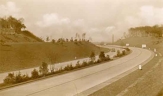
| former signpost on the A3 from Cologne | |
The Kaiserberg motorway junction (abbreviation: AK Kaiserberg ; short form: Kaiserberg cross ) is a motorway junction in North Rhine-Westphalia in the Rhine-Ruhr metropolitan region . It connects the federal motorway 3 (from the Dutch border via Oberhausen , Cologne , Frankfurt am Main , Würzburg to Passau on the Austrian border) with the federal motorway 40 ( Ruhrschnellweg, from the Dutch border via Moers and Essen to Bochum ).
geography
The motorway junction is located in the urban area of the city of Duisburg , in the east of up to 75 m above sea level. NN high Kaiserberg . To the west is the Duissern district and to the south is the Duisburg Zoo . To the north, the Ruhr runs with the upstream Ruhr dike and a high bunker , which is located directly next to the motorway.
Surrounding cities are Mülheim an der Ruhr and Oberhausen . The motorway junction is located about 3 kilometers east of Duisburg city center, about 25 kilometers north of Düsseldorf and about 15 kilometers west of Essen .
The Kaiserberg motorway junction has junction number 14 on both the A 3 and A 40.
history
The motorway junction was built in October 1966, and when it was opened to traffic in sections from April to June 1969, the connection to the Ruhr Schnellweg (until then Bundesstraße 60 ) in the eastern area was also put into operation. In 1974 the western section of the then A 2 and today's A 40 between the Duisburg junction and the new motorway junction was completed.
Until April 1992, the A 40 was run east of the Kaiserberg junction as federal motorway 430 and to the west as federal motorway 2 . To the north, the A3 ran together with the A2 to the Oberhausen motorway junction .
The motorway junction was officially called Duisburg-Kaiserberg until then and was renamed Kaiserberg in 1992. The renaming of the motorways and the motorway intersection was necessary because there should not be any double names (junction Duisburg-Kaiserberg and motorway junction Duisburg-Kaiserberg) and no route sections should be occupied with double route names (A 2 / A 3), as is still the case today, for example . B. is the case with the A 1 / A 61.
design type
The motorway junction, known as the " spaghetti knot ", has an unusual shape. In contrast to motorway junctions in the shape of a cloverleaf , all connections are completely point-to-point connections without any intersection. Due to the limited space and the highways crossing at an acute angle, the connecting ramps were created in a small space with complex and numerous bridge constructions. All ramps are located south of the central bridge structure where the motorways cross.
In the east, the Duisburg-Kaiserberg junction on the A 40 connects directly to the motorway junction. The entry and exit areas and distribution lanes are shared.
In the northern area, two inner-city roads and a total of ten railway bridges (two currently without track) cross the Duisburg – Oberhausen and Duisburg – Mülheim (Ruhr) railway lines , and two further double-track railway lines run west of the cross . Another road crosses between the motorway junction and the junction, and to the south the A3 is crossed by a landscape bridge of the zoo.
State of development
Since the last expansion in 2015, the A 3 has consistently had six lanes in the area of the motorway junction, previously it was only four lanes in the area between the exit and the entrance.
The A 40 has four lanes on the Essen side and six lanes on the Duisburg side. In addition, the A 40 from the Duisburg junction to the Kaiserberg junction (in the direction of Essen) has been expanded to four lanes since 2014, although the hard shoulder is missing. The six-lane expansion of the A 40 on the Essen side is listed as an "urgent need" in the federal transport infrastructure plan.
All connection ramps are single-lane except for the ramps that act as distributors.
The Landesbetrieb Straßenbau NRW plans to extensively expand and partially convert the cross. Early public participation took place in June 2017. The environmental impact assessment is currently being drawn up.
Traffic volume
The cross is used by around 187,000 vehicles every day.
| From | To | Average daily traffic volume |
Share of heavy goods traffic |
||||
|---|---|---|---|---|---|---|---|
| 2005 | 2010 | 2015 | 2005 | 2010 | 2015 | ||
| AS Oberhausen-Lirich (A 3) | AK Kaiserberg | 108,500 | 126,800 | 110,500 | 14.9% | 13.1% | 11.4% |
| AK Kaiserberg | AS Duisburg-Wedau (A 3) | no data | 97,600 | 105,000 | no data | 11.3% | 10.2% |
| AK Duisburg (A 40) | AK Kaiserberg | 92,300 | 101,300 | 101,300 | 11.7% | 12.8% | 12.8% |
| AK Kaiserberg | AS Duisburg-Kaiserberg (A 40) | 93,500 | 85,300 | 56,800 | 9.4% | 8.3% | 8.7% |
Web links
- Picture of the former Reichsautobahn at Schnabelhuck (the place of today's motorway junction), www.lauritzen-hamburg.de
Individual evidence
- ↑ http://www.derwesten.de/staedte/duisburg/bund-verkauf-hochbunker-im-kreuz-kaiserberg-in-duisburg-id11985722.html
- ↑ Andreas Schreiber: Autobahn - Geschichtliches und Philosophisches in: im blickpunkt , Volume 14, Edition 1987 No. 1 Ed. LV Rhineland Cologne
- ↑ A3 / A40: Reconstruction of the Kaiserberg motorway junction. State Office for Road Construction NRW , accessed on December 6, 2017 .
- ↑ Manual road traffic census 2005. (PDF) Results on federal motorways. BASt Statistics, 2005, accessed on July 6, 2020 .
- ↑ Manual road traffic census 2010. (PDF) Results on federal motorways. BASt Statistics, 2010, accessed on July 6, 2020 .
- ↑ Manual road traffic census 2015. (PDF) Results on federal motorways. BASt Statistics, 2015, accessed on August 27, 2017 .
AK Oberhausen | AK Oberhausen-West | AK Kaiserberg | AK Breitscheid | AK Ratingen-Ost | AK Hilden | AK Langenfeld | AK Leverkusen | AK Köln-Ost | AD Cologne-Heumar | AK Bonn / Siegburg | AD Dernbach | Wiesbaden Cross | Mönchhof triangle | Frankfurt Cross | Offenbach Cross | Seligenstadt triangle | AD Würzburg-West | AK Biebelried | AK Fürth / Erlangen | AK Nuremberg | AK Altdorf | AK Regensburg | AK Deggendorf | AK Pocking