
Federal motorway 87
| Bundesautobahn 87 in Germany | |

|
|
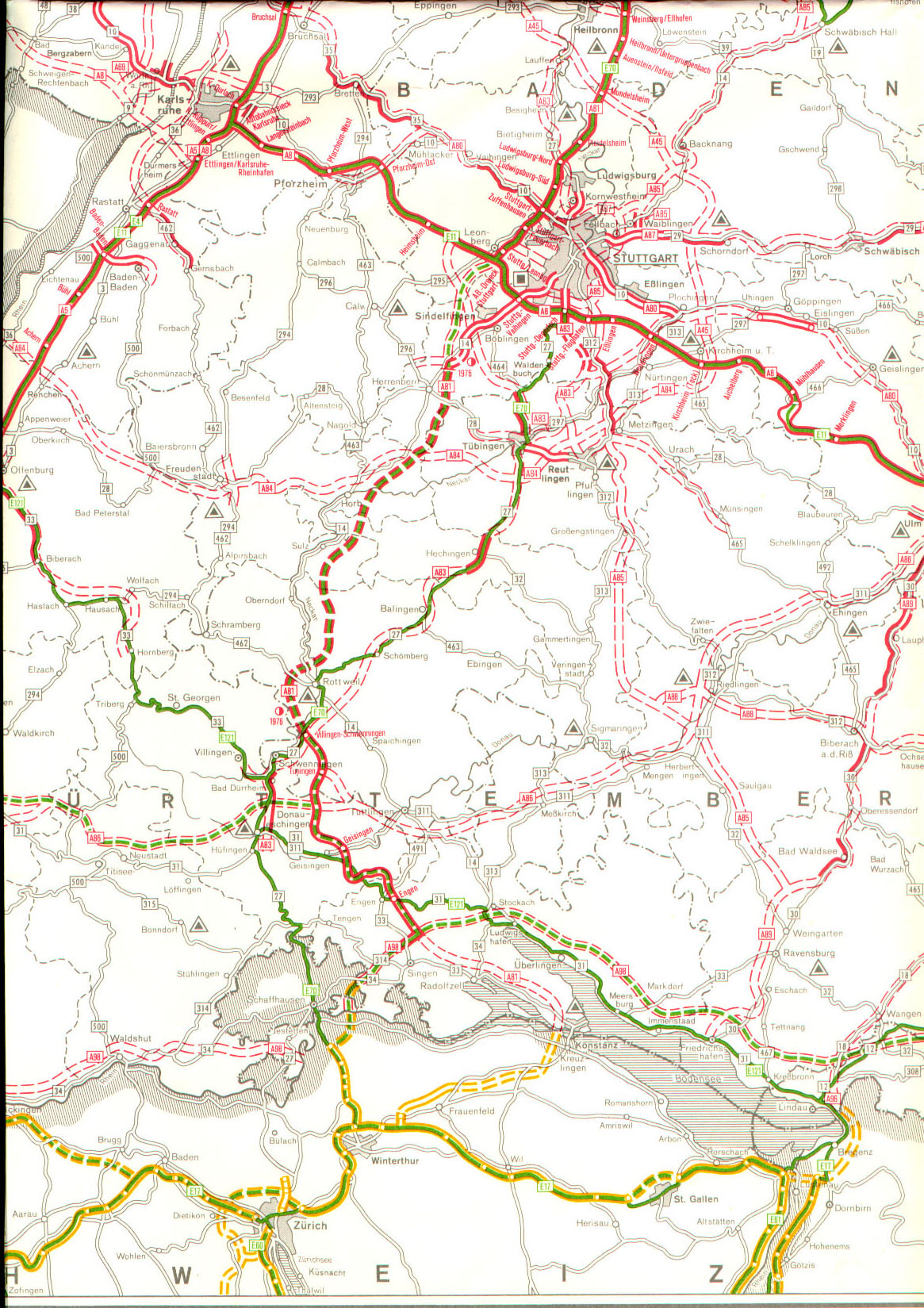
| map | |
 |
|
| Basic data | |
| Operator: |
|
|
State : |
|
| Status: | Planning discarded |
Federal autobahn 87 (abbreviation: BAB 87 ) - short form: Autobahn 87 (abbreviation: A 87 ) - was the project name of a planned autobahn from Stuttgart - Stammheim (planned intersection with the A 80 / A 83 ) via Waiblingen , Schorndorf , Schwäbisch Gmünd , Aalen should lead to the A 7 junction Aalen / Westhausen (Aalen-Nord) to relieve the federal highway 29 and the Stuttgart basin . The planning was given up. Nevertheless, several four-lane sections were completed, which were dedicated as B 29. The odd designation of the route running in east-west direction is also a special feature, because it deviates from the usual nomenclature: odd numbers were usually only given north-south connections.
Planning history
The Stuttgart - Aalen connection was not part of the "top network" planned in the Weimar Republic . The planning of a Reichsautobahn for this route was also not found in the network plans of the National Socialists.
The expansion plan for the federal highways of the law of July 27, 1957 did not yet provide for the construction of a federal highway, but the federal highway 29 between Waiblingen and Aalen was included in the "blue network" of the new or to be expanded federal highways.
The requirement plan of the law on the expansion of federal highways from 1971 to 1985 from June 30, 1971 contained the new four-lane construction of the B 29. The following sub-projects were planned:
| Short name | section | expansion | was standing |
|---|---|---|---|
| B 29 | Kreuz bei Stuttgart- Stammheim ( B 10 / B 27 ) - south Kornwestheim - north Stuttgart- Rot - north Stuttgart- Mühlhausen - south Aldingen - south Neckarrems - north and west Fellbach - Oeffingen - Waiblingen - cross with the B 14 / B 312 | four-lane | Level I) |
| B 29 | Cross with the B 14 / B 312 near Waiblingen - Beinstein (triangle with B 14 to Backnang) - Weinstadt - Großheppach / Weinstadt- Beutelsbach | four to six lanes | completed |
| B 29 | Weinstadt-Großheppach / -Beutelsbach - Remshalden - Grunbach | four-lane | Level I. |
| B 29 | Remshalden-Grunbach - Winterbach (junction with "Autobahn 13", later: A 45 ) | four-lane | 1st lane completed, 2nd lane in urgency level I) |
| B 29 | Winterbach (A 45) - Schorndorf - Schwäbisch Gmünd ( B 298 ) | four-lane | Level I) |
| B 29 | Schwäbisch Gmünd - Aalen to the west | four-lane | 1st carriageway partially completed, otherwise in urgency level I, 2nd carriageway continuously in urgency level II) |
| B 29 | west of Aalen - Westhausen (A 7) | four-lane | Level I. |
With the restructuring of the network of federal motorways, which was introduced with effect from January 1, 1975, the entire route was grouped under the uniform name of "Federal Motorway 87".
The A 87 remained unchanged in the federal government's network map of January 1, 1976.
The requirements plan of the law amending the law on the expansion of federal highways in the years 1971 to 1985 from August 5, 1976 showed the route of federal motorway 87 unchanged. However, the urgency of the individual sections has been modified. The following picture emerged:
| section | expansion | was standing |
|---|---|---|
| Cross near Stuttgart-Stammheim (A 80 / A 83) - south of Kornwestheim | ongoing project | |
| south of Kornwestheim - north of Stuttgart-Rot - north of Stuttgart-Mühlhausen - south of Aldingen - south of Neckarrems - north and west of Fellbach-Oeffingen, Waiblingen - junction with the A 85 | four-lane | possible further need |
| Cross with the A 85 near Waiblingen - Beinstein (triangle with A 85 to Backnang) - Großheppach / Beutelsbach - Grunbach | four to six lanes | completed |
| Grunbach - Winterbach (cross with the A 45) | four-lane | 1st lane completed, 2nd lane in urgency level Ia |
| Winterbach (A 45) - Schorndorf - Urbach | four-lane | Stage Ib |
| Urbach - Plüderhausen - west of Lorch - Waldhausen | four-lane | ongoing project |
| west of Waldhausen - west of Schwäbisch Gmünd | four-lane | Stage Ia |
| OU Schwäbisch Gmünd | four-lane | Stage Ib |
| east of Schwäbisch Gmünd - west of Aalen | four-lane | 1st carriageway almost completely completed, otherwise in urgency level Ib, 2nd carriageway completely as a possible further requirement |
| west of Aalen - Westhausen (A 7) | four-lane | 1st lane in urgency level Ib, 2nd lane as a possible additional requirement |
With the second law amending the law on the expansion of federal trunk roads from 1971 to 1985 from August 25, 1980, the end of the A 87 came. The plans were limited to the construction of new sections and sections of the B 29:
| Short name | section | expansion | was standing |
|---|---|---|---|
| B 29 | Kornwestheim (B 27) - Waiblingen (B 19) | four-lane | Stage II) |
| B 29 | Grunbach - Winterbach | four-lane | 1st carriageway completed, 2nd carriageway as an ongoing project |
| B 29 | Winterbach - Schorndorf - Urbach | four-lane | Level I) |
| B 29 | west of Waldhausen - west of Schwäbisch Gmünd | four-lane | ongoing project |
| B 29 | OU Schwäbisch Gmünd | four-lane, | Level I) |
| B 29 | east of Schwäbisch Gmünd - west of Aalen | four-lane | 1st carriageway completed, 2nd carriageway completely in urgency level I. |
| B 29 | west of Aalen - Westhausen (A 7) | two-lane | Level I. |
The third law amending the law on the expansion of the federal trunk roads of April 21, 1986 did not lead to the re-inclusion of the A 87 in the requirement plan. In addition, with regard to the new construction of sections of the B 29, only:
| Short name | section | expansion | was standing |
|---|---|---|---|
| B 29 | Kornwestheim (B 27) - Waiblingen (B 19) | four-lane | Stage II |
| B 29 | Grunbach - Winterbach | four-lane | ongoing project |
| B 29 | Winterbach - Schorndorf - Urbach | four-lane | Level I) |
| B 29 | OU Schwäbisch Gmünd | four-lane | 1st lane in urgency level I, 2nd lane in urgency level II |
| B 29 | east of Schwäbisch Gmünd - Zimmer | four-lane | 1st carriageway completed, 2nd carriageway in urgency level I. |
| B 29 | Rooms - west of Aalen | four-lane | 1st carriageway completed, 2nd carriageway in urgency level II, in the section Essingen - Aalen in urgency level I) |
| B 29 | west of Aalen - Westhausen (A 7) | two-lane | Level I. |
The A 87 was still not included in the requirements plan of the Fourth Act to Change the Act on the Expansion of the Trunk Road from November 15, 1993. The expansion and new construction of Bundesstraße 29 had the following projects as its subject:
| Short name | section | expansion | was standing |
|---|---|---|---|
| B 29 | Kornwestheim (B 27) - Waiblingen (B 19) | four-lane | Stage II |
| B 29 | Winterbach - Schorndorf - Urbach | four-lane | ongoing project |
| B 29 | OU Schwäbisch Gmünd | four-lane | Level I. |
| B 29 | east of Schwäbisch Gmünd - west of Aalen | four-lane | 1st carriageway completed, 2nd carriageway in urgency level I. |
| B 29 | west of Aalen - Westhausen (A 7) | two-lane | ongoing project |
The requirements plan of the Fifth Act to Change the Highway Expansion Act of October 4, 2004 did not result in any new entries with regard to the A 87. Furthermore, the expansion and construction of the federal highway 29 was undertaken:
| Short name | section | expansion | was standing |
|---|---|---|---|
| B 29 | Kornwestheim (B 27) - Waiblingen (B 19) | four-lane | further need |
| B 29 | OU Schwäbisch Gmünd | two-lane | urgent need or ongoing project |
| B 29 | east of Schwäbisch Gmünd - west of Aalen | four-lane | 1st carriageway completed, 2nd carriageway in urgent need |
| B 29 | west of Aalen - Westhausen (A 7) | two-lane | ongoing project |
List of traffic clearances
As early as the 1930s, with the bypassing of Schorndorf in the course of Reichsstraße 29, the section between Schorndorf-Nord and Schorndorf-Ost / Urbach, which was later used as the first lane, was completed. In the second half of the 1950s, the B 29 was relocated between Großheppach and Schorndorf-West, which later formed the first lane of the four-lane federal road. Between Schwäbisch Gmünd and Aalen, with the exception of a few bypasses, essentially the existing road of the B 29 was intended as the first lane of the four-lane expansion. At Schwäbisch Gmünd- Hussenhofen , the main road was relocated as early as the late 1950s and early 1960s. In the road construction reports of the federal government to the German Bundestag in 1975, only the Schwäbisch Gmünd - Rinderbacher Mühle route was listed as a completed section of the A87, although the route was not a new, four-lane and motorway-like connection, but a two-lane connection Expansion of the B 29. Between 1974 and 1978 the reports contained the section Schorndorf-Ost / Urbach - Waldhausen-Ost - Schwäbisch Gmünd with 17.8 km under the designation "A 87" as under construction. However, this route was also completed as the B 29. The following projects were implemented on the route originally planned for the A 87:
- 1970: Dreieck Waiblingen (B 14) - AS Großheppach (4 km, four lanes, dedicated as B 29)
- 1975: Schwäbisch Gmünd - Schwäbisch Gmünd-Ost / Rinderbacher Mühle (2.2 km, two-lane, dedicated as B 29)
- 1979: AS Schorndorf-Ost / Urbach - AS Waldhausen-Ost (9.0 km, four lanes, dedicated as B 29)
- 1984: AS Großheppach - AS Schorndorf-West, 2nd lane, 1st construction phase (3.0 km, four lanes, dedicated as B 29)
- 1985: AS Großheppach - AS Schorndorf-West, 2nd lane, 2nd construction phase (1.0 km, four lanes, dedicated as B 29)
- 1985: AS Waldhausen-Ost - AS Schwäbisch Gmünd-West (8.5 km, four lanes, dedicated as B 29)
- 1986: AS Großheppach - AS Schorndorf-West, 2nd lane, 3rd construction phase (3.6 km, four lanes, dedicated as B 29)
- 1997: OU Schorndorf (6.2 km, four lanes, dedicated as B 29)
- 1999: OU Aalen, 1st construction phase (4.0 km, two lanes, dedicated as B 29)
- 2001: OU Aalen, 2nd construction phase (8.3 km, two lanes, dedicated as B 29)
- 2001: OU Schwäbisch Gmünd, 1st part of the 1st construction phase (0.8 km, two lanes, dedicated as B 29)
- 2013: OU Schwäbisch Gmünd, remaining stretch (3.3 km, two-lane, dedicated as B 29)
- 2019: OU Mögglingen, new building (6.7 km, four lanes, dedicated as B 29)
Web links
Individual evidence
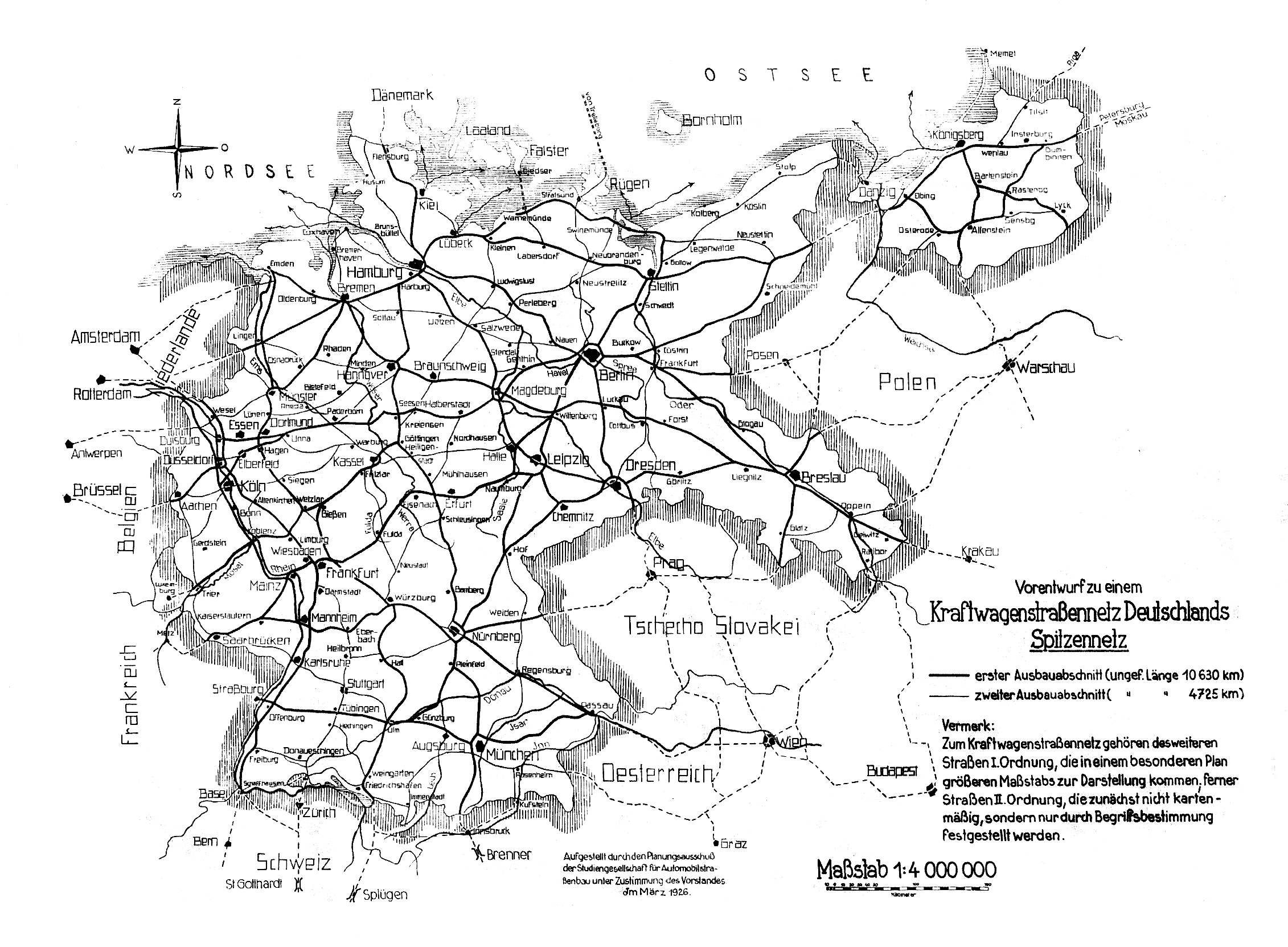
- ↑ Preliminary draft for a motor vehicle road network in Germany - top network
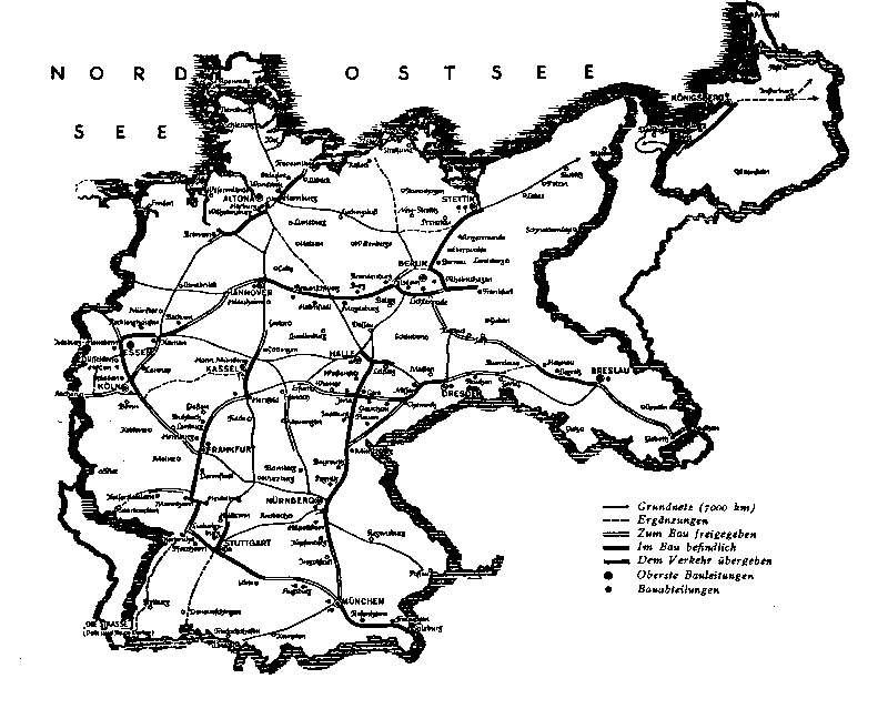
- ↑ Network map from 1938. Retrieved on October 5, 2014 (image file).
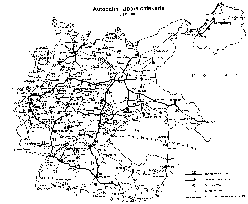
- ↑ Motorway overview map, status: 1940. Retrieved on October 5, 2014 (image file).
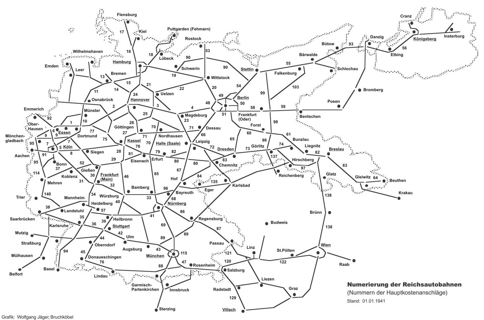
- ↑ Motorway overview map, as of January 1, 1941. Retrieved November 13, 2014 (map).
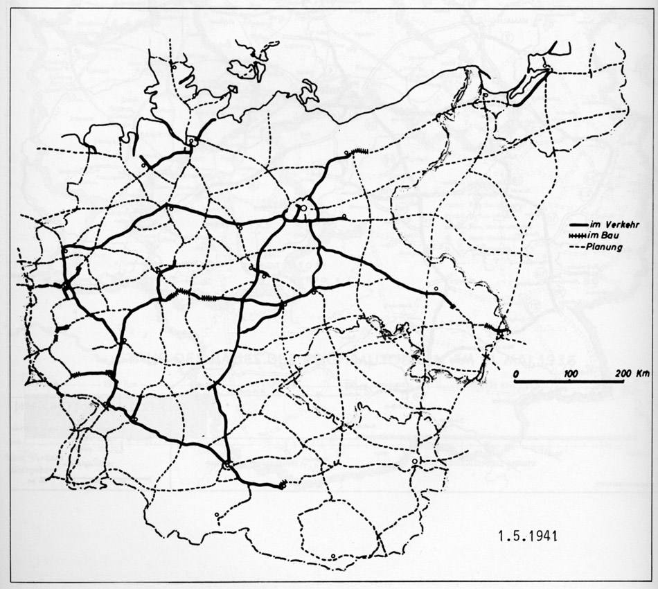
- ↑ Motorway overview map, as of May 1st, 1941. Retrieved November 13, 2014 (map).
- ↑ Bundesgesetzblatt, 1957, Part I, p. 1189
- ↑ Expansion plan for the federal trunk roads. Prepared by the Federal Minister of Transport. Bundesdruckerei, Bonn 1957, Annex 1
- ↑ Federal Law Gazette 1971, Part I, p. 873
- ↑ Construction work on federal trunk roads in 1972. Expansion of federal trunk roads from 1971 to 1985. Annex to the road construction report 1972. Federal Minister of Transport, Road Construction Department, accessed on March 31, 2013 (map excerpt).
- ↑ Construction work on federal trunk roads in 1972. Expansion of federal trunk roads from 1971 to 1985. Annex to the road construction report 1972. Federal Minister of Transport, Road Construction Department, accessed on March 31, 2013 (map excerpt).
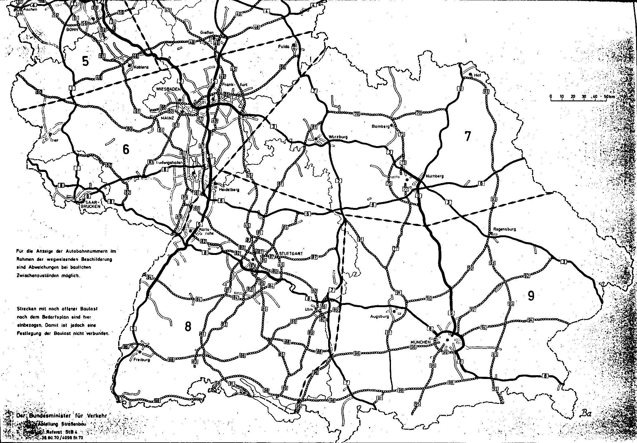
- ^ Structure and numbering of the federal highways. Planned overall network. Federal Minister of Transport, Road Construction Department, June 15, 1974, accessed on September 18, 2013 (map excerpt).
- ↑ Network of federal motorways and federal highways. Status January 1, 1976. Federal Minister of Transport, Road Construction Department, accessed on March 31, 2013 (map excerpt).
- ↑ Network of federal motorways and federal highways. Status January 1, 1976. Federal Minister of Transport, Road Construction Department, accessed on March 31, 2013 (map excerpt).
- ↑ Federal Law Gazette, 1976, Part I, p. 2093
- ↑ Federal Law Gazette 1980, Part I, p. 1614
- ^ Federal Law Gazette 1986, Part I, p. 557
- ↑ Federal Law Gazette 1993, Part I, p. 1877
- ↑ Federal Law Gazette 2004, Part I, p. 2574
- ↑ The Great Conti Atlas for Motorists, Germany 1: 500000, 16th edition, sheet 42, CONTINENTAL CAOUTCHOUC-COMPAGNIE GmbH, Hanover
- ↑ The Great Conti Atlas for Motorists, Germany 1: 500000, 18th edition, pages 43 to 48 (Metz, Stuttgart, Regensburg, Brünn), CONTINENTAL CAOUTCHOUC-COMPAGNIE GmbH, Hanover
- ^ Shell signpost 7.1: 500000. Mainfranken. Mairs Geographischer Verlag, Stuttgart 1955
- ^ Shell signpost 7.1: 500000. Mainfranken. Mairs Geographischer Verlag, Stuttgart 1957
- ^ The Great Shell Atlas, Germany and Europe, 8th edition, Mairs Geographischer Verlag, Stuttgart 1963/64, p. 64
