
Federal motorway 84
| Bundesautobahn 84 in Germany | |

|
|
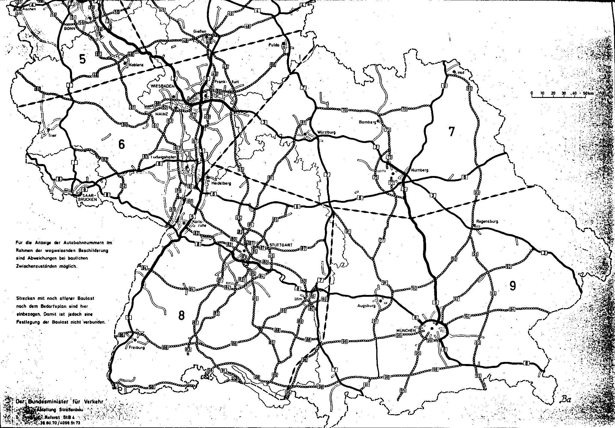
| map | |
 |
|
| Basic data | |
| Operator: |
|
|
State : |
|
| Status: | Planning discarded |
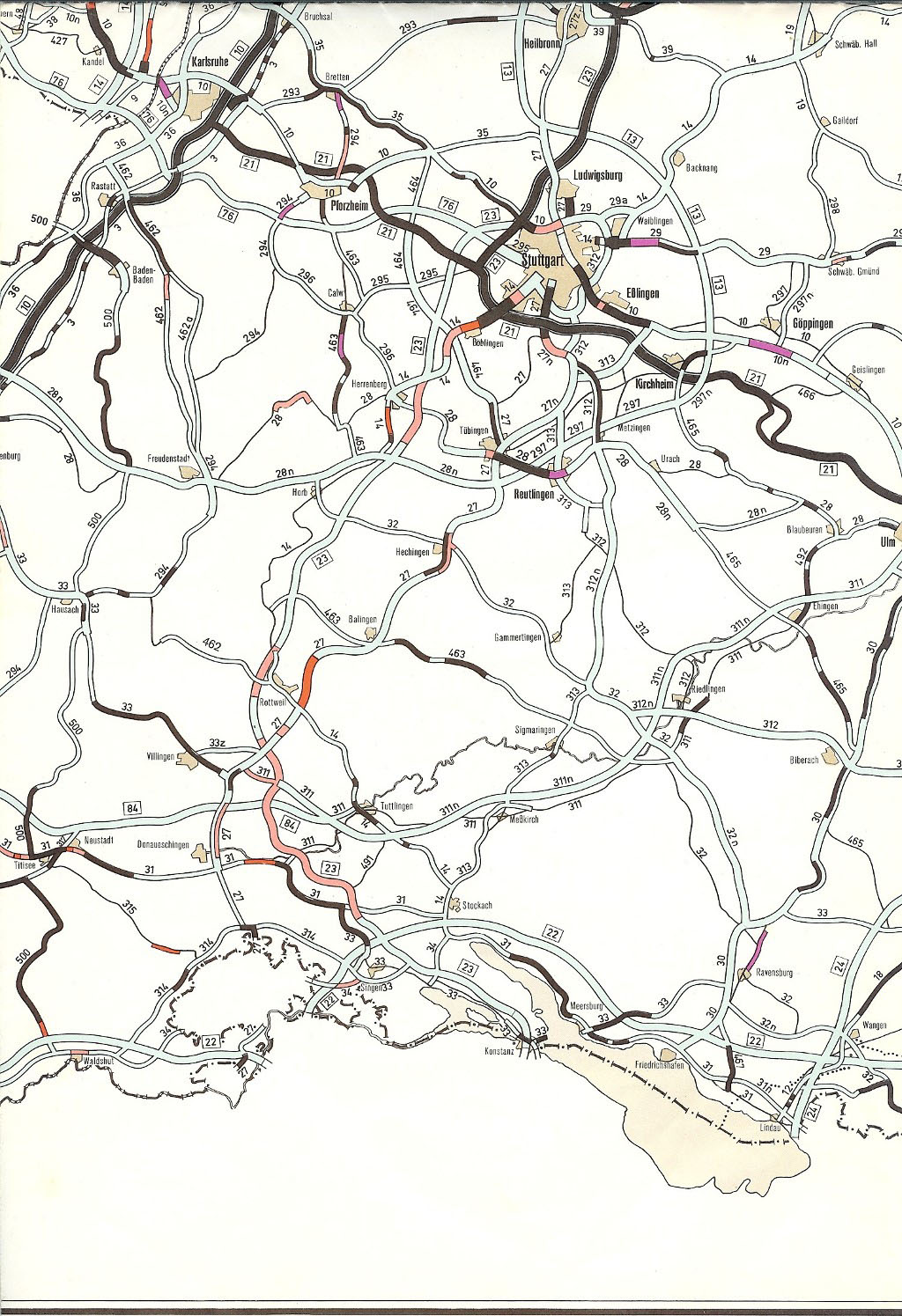
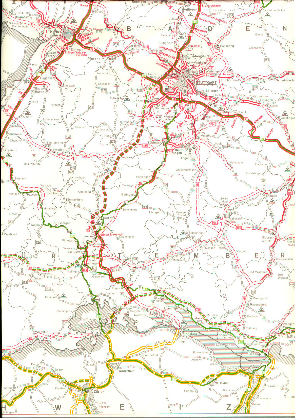
Federal autobahn 84 (abbreviation: BAB 84 ) - short form: Autobahn 84 (abbreviation: A 84 ) - also known as the Black Forest autobahn, was the project name of a planned autobahn in Baden-Wuerttemberg that would run from the area north of Strasbourg via Freudenstadt , Tübingen , Reutlingen to Kirchheim Teck to the A 8 and should thus cross the Black Forest in an east-west direction.
Planning history
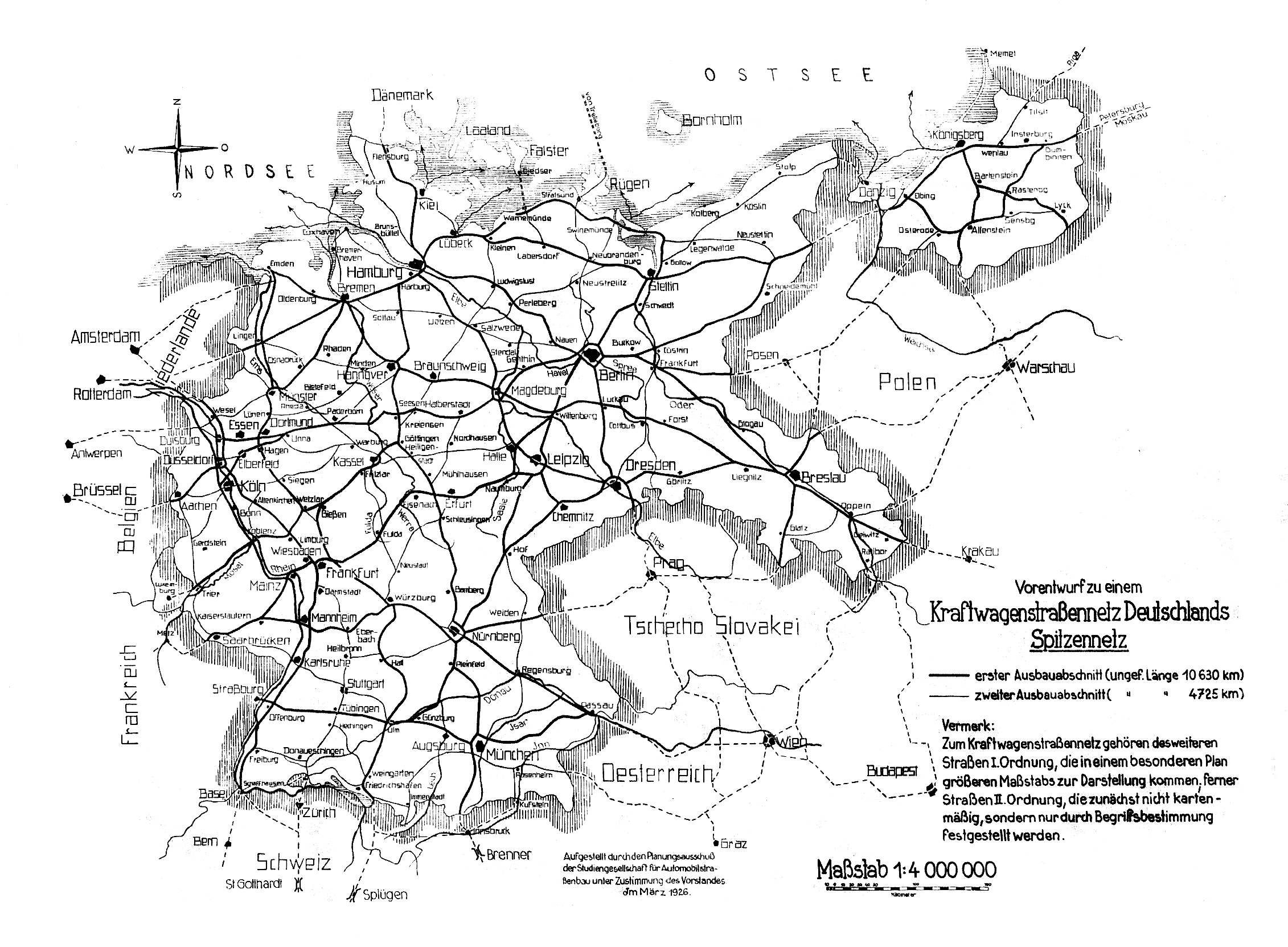
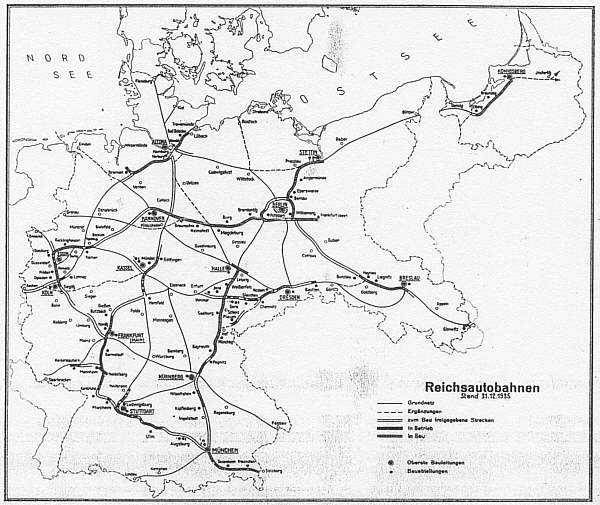
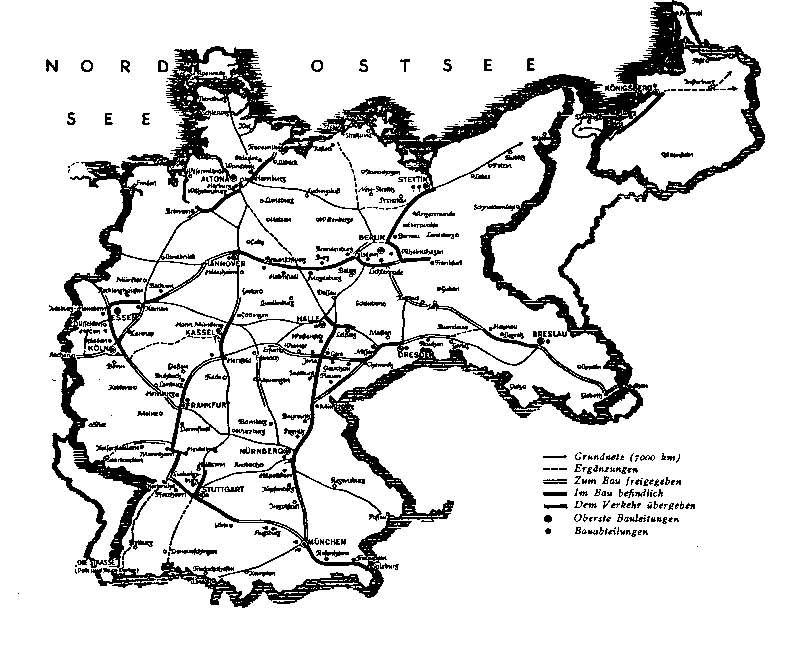
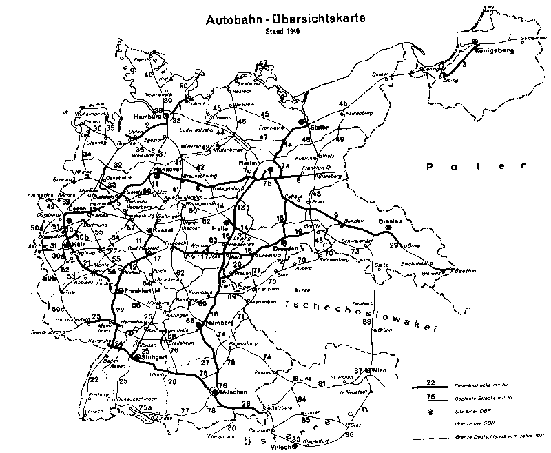
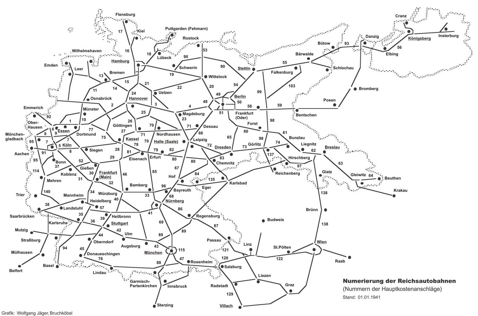
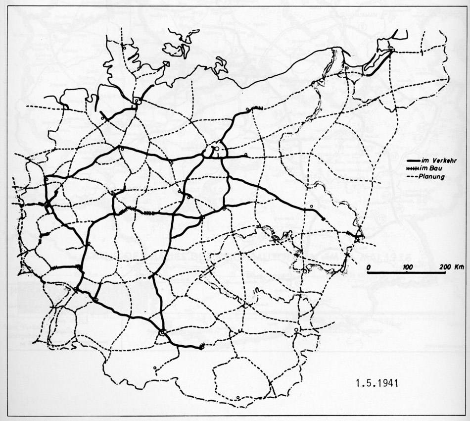
Already during the Weimar Republic , thought was given to crossing the Black Forest near Freudenstadt in the so-called "top network". In the network plans of the National Socialists, however, the planning of a Reichsautobahn for this route was initially not found until the end of 1940. In 1941 this changed: now a Reichsautobahn from Mutzig in Alsace - Strasbourg - Horb am Neckar was considered. In 1941 the route of the Stuttgart - Donaueschingen line was modified so that the motorway should now run over the Freudenstadt area. A branch for the Black Forest crossing to Strasbourg was planned here.
The expansion plan for the federal trunk roads of the law of July 27, 1957 did not yet provide for the construction of a federal freeway. However, the federal road 28 Kehl - Freudenstadt - Herrenberg - Tübingen was included in the blue network of federal roads to be expanded.
The requirement plan of the law on the expansion of federal highways in the years 1971 to 1985 from June 30, 1971 now contained the new four-lane construction of the B 28n and the B 297 from the federal border Germany / France south of Rheinau via Renchen (intersection with the A 5 ), north of Oberkirch , south of Freudenstadt, Dornstetten , north of Horb (intersection with today's A 81 ) route to the AS Rottenburg am Neckar , north of Rottenburg, south of Tübingen (intersection with the B 27 / A 83 ), intersection with the B 28 south Wannweil , north of Reutlingen (junction with the B 312 ), north of Metzingen (junction with the A 85 ) to Kirchheim unter Teck (junction with the A 8 - north continuation as "Autobahn 13" or A 45 to Dortmund ). The project was divided into the following sub-projects:
| Short name | section | expansion | was standing |
|---|---|---|---|
| B 28n | Federal border D / F - southwest Freudenstadt | four-lane | Stage III |
| B 28n | southwest Freudenstadt - Kreuz Rottenburg am Neckar | four-lane | 1st lane in urgency level I, 2nd lane in urgency level III |
| B 28n | Kreuz Rottenburg am Neckar - cross with the B 28 south of Wannweil | four-lane | Stage II |
| B 297 | Cross with the B 28 south of Wannweil - cross with the B 312 north of Reutlingen | four-lane | Stage III |
| B 297 | Cross with the B 312 north of Reutlingen - cross with the A 8 near Kirchheim unter Teck | four-lane, | Stage II |
With the restructuring of the network of federal motorways, which was introduced with effect from January 1, 1975, the route was summarized under the uniform name as "Federal Motorway 84".
The A 84 was included unchanged in the federal government's network map of January 1, 1976.
The requirement plan of the law amending the law on the expansion of federal trunk roads from 1971 to 1985 from August 5, 1976 showed the A 84 unchanged, but the urgency of individual routes was graded:
| section | expansion | was standing |
|---|---|---|
| Federal border D / F - southwest Freudenstadt | four-lane | possible further need |
| southwest Freudenstadt - north Horb | four-lane | 1st lane in urgency level Ib, 2nd lane as a possible additional requirement |
| north of Horb - Bondorf | four-lane | 1st lane in urgency level Ia, 2nd lane as a possible additional requirement |
| Bondorf - Rottenburg am Neckar: | four-lane | 1. lane as an ongoing project, 2. lane as a possible further requirement |
| Rottenburg am Neckar - Kirchheim unter Teck | four-lane | possible further need |
With the second law amending the law on the expansion of federal trunk roads from 1971 to 1985 from August 25, 1980, the A 84 came to an end. The requirements plan also included the following federal road construction projects on the route previously planned for the A 84:
- B 28: southwest of Freudenstadt - Bondorf (two lanes, urgency level I)
- B 28: Rottenburg am Neckar - Tübingen (two-lane, urgency level II)
The third law amending the law on the expansion of the federal trunk roads of April 21, 1986 did not lead to the re-inclusion of the A 84 in the requirement plan. The following federal road construction projects in connection with the abandoned planning for the A 84 were still planned:
| Short name | section | expansion | was standing |
|---|---|---|---|
| B 28 | OU Freudenstadt | ? | modified |
| B 28a | Dornstetten - Schopfloch (modified) | two-lane | Level I. |
| B 28a | Schopfloch - Horb | two-lane, | Stage II |
| B 28a | Horb - Bondorf | two-lane | ongoing project |
| B 28 | Rottenburg am Neckar - Tübingen | two-lane | Stage II |
The A 84 was still not included in the requirements plan of the Fourth Law on the Amendment of the Highway Expansion Act of November 15, 1993. The following federal road construction projects remained from the previous planning:
- B 28a: Aach - Dornstetten - Schopfloch - Horb - Bondorf (partly modified, two-lane, partly ongoing project, partly urgent need)
- B 28n: Rottenburg am Neckar - Tübingen (modified, two-lane, urgent need)
The requirement plan of the Fifth Act on the Amendment of the Highway Expansion Act of October 4, 2004 did not result in any new entries with regard to the A 84. The plans to build new federal roads were almost entirely modified compared to the old A 84 plan. The following were also considered:
| Short name | section | expansion | was standing |
|---|---|---|---|
| B 28a | Schopfloch - Grünmettstetten | two-lane | urgent need |
| B 28a | Grünmettstetten - west of Horb | two-lane | further need |
| B 28a | OU Horb | two-lane | urgent need |
| B 28a | OU Ergenzingen | two-lane | urgent need |
| B 28n | east of Rottenburg am Neckar - Tübingen | two-lane | urgent need |
Web links
Individual evidence
- ↑ Preliminary draft for a motor vehicle road network in Germany - top network
- ^ Reichsautobahnen 1935. Retrieved November 30, 2014 (image file).
- ^ Reichsautobahn as of December 31, 1935. Retrieved November 30, 2014 (image file).
- ↑ Network map from 1938. Retrieved on October 5, 2014 (image file).
- ↑ Motorway overview map, status: 1940. Retrieved on October 5, 2014 (image file).
- ↑ Motorway overview map, as of January 1, 1941. Retrieved November 13, 2014 (map).
- ↑ Motorway overview map, as of May 1st, 1941. Retrieved November 13, 2014 (map).
- ↑ Bundesgesetzblatt, 1957, Part I, p. 1189
- ↑ Expansion plan for the federal trunk roads. Prepared by the Federal Minister of Transport. Bundesdruckerei, Bonn 1957, Annex 1
- ↑ Federal Law Gazette 1971, Part I, p. 873
- ↑ Construction work on federal trunk roads in 1972. Expansion of federal trunk roads from 1971 to 1985. Annex to the road construction report 1972. Federal Minister of Transport, Road Construction Department, accessed on March 31, 2013 (map excerpt).
- ↑ Construction work on federal trunk roads in 1972. Expansion of federal trunk roads from 1971 to 1985. Annex to the road construction report 1972. Federal Minister of Transport, Road Construction Department, accessed on March 31, 2013 (map excerpt).
- ^ Structure and numbering of the federal highways. Planned overall network. Federal Minister of Transport, Road Construction Department, June 15, 1974, accessed on September 18, 2013 (map excerpt).
- ↑ Network of federal motorways and federal highways. Status January 1, 1976. Federal Minister of Transport, Road Construction Department, accessed on March 31, 2013 (map excerpt).
- ↑ Network of federal motorways and federal highways. Status January 1, 1976. Federal Minister of Transport, Road Construction Department, accessed on March 31, 2013 (map excerpt).
- ↑ Federal Law Gazette, 1976, Part I, p. 2093
- ↑ Federal Law Gazette 1980, Part I, p. 1614
- ^ Federal Law Gazette 1986, Part I, p. 557
- ↑ Federal Law Gazette 1993, Part I, p. 1877
- ↑ Federal Law Gazette 2004, Part I, p. 2574
