
Federal motorway 9
| Bundesautobahn 9 in Germany | ||||||||||||||||||||||||||||||||||||||||||||||||||||||||||||||||||||||||||||||||||||||||||||||||||||||||||||||||||||||||||||||||||||||||||||||||||||||||||||||||||||||||||||||||||||||||||||||||||||||||||||||||||||||||||||||||||||||||||||||||||||||||||||||||||||||||||||||||||||||||||||||||||||||||||||||||||||||||||||||||||||||||||||||||||||||||||||||||||||||||||||||||||||||||||||||||||||||||||||||||||||||||||||||||||||||||||||||||||||||||||||||||||||||||||||||||||||||||||||||||||||||||||||||||||||||||||||||||||||||||||||||||||||||||||||||||||||||||||||||||||||||||||||||

|
||||||||||||||||||||||||||||||||||||||||||||||||||||||||||||||||||||||||||||||||||||||||||||||||||||||||||||||||||||||||||||||||||||||||||||||||||||||||||||||||||||||||||||||||||||||||||||||||||||||||||||||||||||||||||||||||||||||||||||||||||||||||||||||||||||||||||||||||||||||||||||||||||||||||||||||||||||||||||||||||||||||||||||||||||||||||||||||||||||||||||||||||||||||||||||||||||||||||||||||||||||||||||||||||||||||||||||||||||||||||||||||||||||||||||||||||||||||||||||||||||||||||||||||||||||||||||||||||||||||||||||||||||||||||||||||||||||||||||||||||||||||||||||||
|
|
||||||||||||||||||||||||||||||||||||||||||||||||||||||||||||||||||||||||||||||||||||||||||||||||||||||||||||||||||||||||||||||||||||||||||||||||||||||||||||||||||||||||||||||||||||||||||||||||||||||||||||||||||||||||||||||||||||||||||||||||||||||||||||||||||||||||||||||||||||||||||||||||||||||||||||||||||||||||||||||||||||||||||||||||||||||||||||||||||||||||||||||||||||||||||||||||||||||||||||||||||||||||||||||||||||||||||||||||||||||||||||||||||||||||||||||||||||||||||||||||||||||||||||||||||||||||||||||||||||||||||||||||||||||||||||||||||||||||||||||||||||||||||||||
| map | ||||||||||||||||||||||||||||||||||||||||||||||||||||||||||||||||||||||||||||||||||||||||||||||||||||||||||||||||||||||||||||||||||||||||||||||||||||||||||||||||||||||||||||||||||||||||||||||||||||||||||||||||||||||||||||||||||||||||||||||||||||||||||||||||||||||||||||||||||||||||||||||||||||||||||||||||||||||||||||||||||||||||||||||||||||||||||||||||||||||||||||||||||||||||||||||||||||||||||||||||||||||||||||||||||||||||||||||||||||||||||||||||||||||||||||||||||||||||||||||||||||||||||||||||||||||||||||||||||||||||||||||||||||||||||||||||||||||||||||||||||||||||||||||
 |
||||||||||||||||||||||||||||||||||||||||||||||||||||||||||||||||||||||||||||||||||||||||||||||||||||||||||||||||||||||||||||||||||||||||||||||||||||||||||||||||||||||||||||||||||||||||||||||||||||||||||||||||||||||||||||||||||||||||||||||||||||||||||||||||||||||||||||||||||||||||||||||||||||||||||||||||||||||||||||||||||||||||||||||||||||||||||||||||||||||||||||||||||||||||||||||||||||||||||||||||||||||||||||||||||||||||||||||||||||||||||||||||||||||||||||||||||||||||||||||||||||||||||||||||||||||||||||||||||||||||||||||||||||||||||||||||||||||||||||||||||||||||||||||
| Basic data | ||||||||||||||||||||||||||||||||||||||||||||||||||||||||||||||||||||||||||||||||||||||||||||||||||||||||||||||||||||||||||||||||||||||||||||||||||||||||||||||||||||||||||||||||||||||||||||||||||||||||||||||||||||||||||||||||||||||||||||||||||||||||||||||||||||||||||||||||||||||||||||||||||||||||||||||||||||||||||||||||||||||||||||||||||||||||||||||||||||||||||||||||||||||||||||||||||||||||||||||||||||||||||||||||||||||||||||||||||||||||||||||||||||||||||||||||||||||||||||||||||||||||||||||||||||||||||||||||||||||||||||||||||||||||||||||||||||||||||||||||||||||||||||||
| Operator: |
|
|||||||||||||||||||||||||||||||||||||||||||||||||||||||||||||||||||||||||||||||||||||||||||||||||||||||||||||||||||||||||||||||||||||||||||||||||||||||||||||||||||||||||||||||||||||||||||||||||||||||||||||||||||||||||||||||||||||||||||||||||||||||||||||||||||||||||||||||||||||||||||||||||||||||||||||||||||||||||||||||||||||||||||||||||||||||||||||||||||||||||||||||||||||||||||||||||||||||||||||||||||||||||||||||||||||||||||||||||||||||||||||||||||||||||||||||||||||||||||||||||||||||||||||||||||||||||||||||||||||||||||||||||||||||||||||||||||||||||||||||||||||||||||||
| further operator: | Via Gateway Thüringen GmbH & Co. KG (between AS Lederhose and state border TH / BY) |
|||||||||||||||||||||||||||||||||||||||||||||||||||||||||||||||||||||||||||||||||||||||||||||||||||||||||||||||||||||||||||||||||||||||||||||||||||||||||||||||||||||||||||||||||||||||||||||||||||||||||||||||||||||||||||||||||||||||||||||||||||||||||||||||||||||||||||||||||||||||||||||||||||||||||||||||||||||||||||||||||||||||||||||||||||||||||||||||||||||||||||||||||||||||||||||||||||||||||||||||||||||||||||||||||||||||||||||||||||||||||||||||||||||||||||||||||||||||||||||||||||||||||||||||||||||||||||||||||||||||||||||||||||||||||||||||||||||||||||||||||||||||||||||
| Start of the street: |
Ferch ( 52 ° 17 ′ N , 12 ° 55 ′ E ) |
|||||||||||||||||||||||||||||||||||||||||||||||||||||||||||||||||||||||||||||||||||||||||||||||||||||||||||||||||||||||||||||||||||||||||||||||||||||||||||||||||||||||||||||||||||||||||||||||||||||||||||||||||||||||||||||||||||||||||||||||||||||||||||||||||||||||||||||||||||||||||||||||||||||||||||||||||||||||||||||||||||||||||||||||||||||||||||||||||||||||||||||||||||||||||||||||||||||||||||||||||||||||||||||||||||||||||||||||||||||||||||||||||||||||||||||||||||||||||||||||||||||||||||||||||||||||||||||||||||||||||||||||||||||||||||||||||||||||||||||||||||||||||||||
| End of street: |
Munich ( 48 ° 11 ′ N , 11 ° 36 ′ E ) |
|||||||||||||||||||||||||||||||||||||||||||||||||||||||||||||||||||||||||||||||||||||||||||||||||||||||||||||||||||||||||||||||||||||||||||||||||||||||||||||||||||||||||||||||||||||||||||||||||||||||||||||||||||||||||||||||||||||||||||||||||||||||||||||||||||||||||||||||||||||||||||||||||||||||||||||||||||||||||||||||||||||||||||||||||||||||||||||||||||||||||||||||||||||||||||||||||||||||||||||||||||||||||||||||||||||||||||||||||||||||||||||||||||||||||||||||||||||||||||||||||||||||||||||||||||||||||||||||||||||||||||||||||||||||||||||||||||||||||||||||||||||||||||||
| Overall length: | 530 km | |||||||||||||||||||||||||||||||||||||||||||||||||||||||||||||||||||||||||||||||||||||||||||||||||||||||||||||||||||||||||||||||||||||||||||||||||||||||||||||||||||||||||||||||||||||||||||||||||||||||||||||||||||||||||||||||||||||||||||||||||||||||||||||||||||||||||||||||||||||||||||||||||||||||||||||||||||||||||||||||||||||||||||||||||||||||||||||||||||||||||||||||||||||||||||||||||||||||||||||||||||||||||||||||||||||||||||||||||||||||||||||||||||||||||||||||||||||||||||||||||||||||||||||||||||||||||||||||||||||||||||||||||||||||||||||||||||||||||||||||||||||||||||||
|
State : |
||||||||||||||||||||||||||||||||||||||||||||||||||||||||||||||||||||||||||||||||||||||||||||||||||||||||||||||||||||||||||||||||||||||||||||||||||||||||||||||||||||||||||||||||||||||||||||||||||||||||||||||||||||||||||||||||||||||||||||||||||||||||||||||||||||||||||||||||||||||||||||||||||||||||||||||||||||||||||||||||||||||||||||||||||||||||||||||||||||||||||||||||||||||||||||||||||||||||||||||||||||||||||||||||||||||||||||||||||||||||||||||||||||||||||||||||||||||||||||||||||||||||||||||||||||||||||||||||||||||||||||||||||||||||||||||||||||||||||||||||||||||||||||||
| Development condition: | 2 × 2, 2 × 3, 2 × 4 lanes | |||||||||||||||||||||||||||||||||||||||||||||||||||||||||||||||||||||||||||||||||||||||||||||||||||||||||||||||||||||||||||||||||||||||||||||||||||||||||||||||||||||||||||||||||||||||||||||||||||||||||||||||||||||||||||||||||||||||||||||||||||||||||||||||||||||||||||||||||||||||||||||||||||||||||||||||||||||||||||||||||||||||||||||||||||||||||||||||||||||||||||||||||||||||||||||||||||||||||||||||||||||||||||||||||||||||||||||||||||||||||||||||||||||||||||||||||||||||||||||||||||||||||||||||||||||||||||||||||||||||||||||||||||||||||||||||||||||||||||||||||||||||||||||
 |
||||||||||||||||||||||||||||||||||||||||||||||||||||||||||||||||||||||||||||||||||||||||||||||||||||||||||||||||||||||||||||||||||||||||||||||||||||||||||||||||||||||||||||||||||||||||||||||||||||||||||||||||||||||||||||||||||||||||||||||||||||||||||||||||||||||||||||||||||||||||||||||||||||||||||||||||||||||||||||||||||||||||||||||||||||||||||||||||||||||||||||||||||||||||||||||||||||||||||||||||||||||||||||||||||||||||||||||||||||||||||||||||||||||||||||||||||||||||||||||||||||||||||||||||||||||||||||||||||||||||||||||||||||||||||||||||||||||||||||||||||||||||||||||
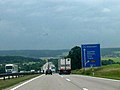
| Federal motorway 9 near Garching | ||||||||||||||||||||||||||||||||||||||||||||||||||||||||||||||||||||||||||||||||||||||||||||||||||||||||||||||||||||||||||||||||||||||||||||||||||||||||||||||||||||||||||||||||||||||||||||||||||||||||||||||||||||||||||||||||||||||||||||||||||||||||||||||||||||||||||||||||||||||||||||||||||||||||||||||||||||||||||||||||||||||||||||||||||||||||||||||||||||||||||||||||||||||||||||||||||||||||||||||||||||||||||||||||||||||||||||||||||||||||||||||||||||||||||||||||||||||||||||||||||||||||||||||||||||||||||||||||||||||||||||||||||||||||||||||||||||||||||||||||||||||||||||||
|
Course of the road
|
||||||||||||||||||||||||||||||||||||||||||||||||||||||||||||||||||||||||||||||||||||||||||||||||||||||||||||||||||||||||||||||||||||||||||||||||||||||||||||||||||||||||||||||||||||||||||||||||||||||||||||||||||||||||||||||||||||||||||||||||||||||||||||||||||||||||||||||||||||||||||||||||||||||||||||||||||||||||||||||||||||||||||||||||||||||||||||||||||||||||||||||||||||||||||||||||||||||||||||||||||||||||||||||||||||||||||||||||||||||||||||||||||||||||||||||||||||||||||||||||||||||||||||||||||||||||||||||||||||||||||||||||||||||||||||||||||||||||||||||||||||||||||||||
The Federal Highway 9 (abbreviation: BAB 9 ) - Short form: Highway 9 (abbreviation: A 9 ) - is a German highway-south north direction runs in the millions and cities Berlin and Munich together. It begins at the Berliner Ring and connects the major cities of Leipzig , Nuremberg and Ingolstadt before it flows into the Mittlerer Ring in the Schwabing district of Munich . With a total length of 530 kilometers, it is one of the longest motorways in Germany.
The route was essentially built as a Reichsautobahn as early as the 1930s at the time of National Socialism and was one of the transit routes from West Germany to West Berlin after the division of Germany . After reunification in 1990, most of the autobahn was renewed in the course of increasing traffic .
Route
On the way from the Berliner Ring to the urban area of Munich, the BAB 9 crosses the federal states of Brandenburg , Saxony-Anhalt and Saxony . Thuringia and Bavaria . With the exception of the main lane at Hermsdorfer Kreuz and the last section at the end of the autobahn in Munich, it has at least three lanes in each direction.
The BAB 9 begins at the Potsdam motorway triangle , which is located around 45 km southwest of downtown Berlin near Ferch , although the main carriageway of the BAB 10 (Berliner Ring) has continued seamlessly to the south from the east since the renovation in the 1990s . First in a southerly, then south-westerly direction, the motorway leads through extensive forest areas and the sparsely populated landscape of the Fläming . The state border from Brandenburg to Saxony-Anhalt is crossed at Klein Marzehns . This is followed by the Elbe crossing at Vockerode , before Dessau, the first larger city, is reached. The route south of Dessau shows a very long straight line, as the motorway here was designed as a racing track and later as a makeshift landing site.
A number of larger industrial parks were built on the Autobahn near Bitterfeld , including the Solar Valley , where companies from the photovoltaic sector have settled. A few kilometers further there is a connection to Halle (Saale) , the second largest city in Saxony-Anhalt , via the B 100 . In this area the motorway changes the state and you are in Saxony . At Schkeuditzer Kreuz , the BAB 14 ( Magdeburg - Dresden ) is crossed, which also connects the Leipzig / Halle Airport, which is located directly to the east of the cross . The Großkugel junction immediately behind the cross connects to the airport's air freight terminal .
On the following section, the motorway runs past Leipzig to the west, crossing the numerous rivers and canals of the Leipzig water junction . The state border between Saxony and Saxony-Anhalt partially coincides with the course of the motorway and is crossed several times. At the Rippachtal junction , the BAB 38 ( Göttingen - Leipzig ) crosses again in Saxony-Anhalt . At Weißenfels the North German Plain is left and the landscape becomes more hilly. The state border from Saxony-Anhalt to Thuringia is crossed at the Droyßig junction . In Eisenberg then a twisty and hilly section through the start Thuringian wood country .

Start of the motorway at the Potsdam triangle

In the Baruther glacial valley between Berlin and Dessau

Elbe bridge near Vockerode

South of Dessau

Schkeuditzer Kreuz and Leipzig / Halle Airport


.jpg)
The Hermsdorfer Kreuz is an important supraregional junction, as it crosses the BAB 4 , which runs from the Polish border via Dresden and Chemnitz along the Thuringian city chain and creates a connection to the Rhein-Main area at the Kirchheimer Dreieck . Behind the Hermsdorfer Kreuz, the winding course, characterized by low mountain ranges , continues on the eastern edge of the Thuringian Forest . At Hirschberg the Saale is crossed and with it the state border from Thuringia to Bavaria. Until 1990 there was also an important border crossing between the Federal Republic and the GDR .
At Hof , the BAB 72 coming from Chemnitz joins the BAB 9 at the Bavarian Vogtland triangle . It then leads past the eastern edge of the Franconian Forest and later the Fichtel Mountains . At Bad Berneck the route descends into the valley of the White Main , after which the BAB 70 to Schweinfurt and Bamberg branches off at the Bayreuth / Kulmbach motorway triangle . At the Bindlacher Berg that follows , the motorway descends into the valley of the Red Main and reaches the urban area of Bayreuth .
After leaving the Bayreuth area, a winding ascent to the Franconian Alb begins . At Pegnitz the Veldensteiner Forest is crossed before the Alb descent follows on separate lanes at Hienberg near Schnaittach and the first suburbs of Nuremberg are reached. In Nuremberg Reichswald is BAB 3 ( Emmerich - Ruhr / Cologne - Frankfurt -Nürnberg- Passau ) crossed. A special feature of the junction is that the main lane of the motorway coming from the direction of Würzburg continues seamlessly into the BAB 9 to the south. Both on the BAB 3 in the direction of Passau and on the BAB 9 in the direction of Berlin you have to leave the main lane in order to stay on the motorway.

Near Weißenfels, south of Leipzig

At the Hermsdorfer Kreuz
Until 2014 there was a four-lane section at Triptis
Bridge rest house Frankenwald at the former border crossing at Hirschberg / Rudolphstein

Descent into the valley of the White Main near Bad Berneck / Himmelkron

Lane separation on Hienberg

.jpg)


The Nürnberg-Fischbach junction connects the city center of the central Franconian city, then the BAB 6 ( Saarbrücken - Heilbronn - Nürnberg - Waidhaus ) crosses at the Nürnberg-Ost motorway junction . At Feucht , the high-speed line Nuremberg – Ingolstadt – Munich meets the motorway and from now on runs largely parallel to it. At the Autobahn triangle Nuremberg / Feucht the BAB 73 joins , via which there is a further connection to the Nuremberg city center from the south. At Allersberg the Reichswald is left before another ascent to the Franconian Alb is reached, which at Kinding has a further road separation. After Denkendorf , the motorway descends again and reaches the Danube plain around Ingolstadt , which is characterized by the vehicle and chemical industries .
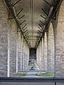
After crossing the Danube in the urban area of Ingolstadt, the hilly Alpine foothills are reached. At the Holledau triangle , the BAB 93 branches off to Regensburg . South of the triangle, the BAB 9 has a temporary hard shoulder release (TSF). Shortly before reaching the metropolitan area around Munich, the BAB 92 from Deggendorf and Munich Airport crosses at the Neufahrn junction . Then the Autobahn runs eight lanes past Garching and reaches the München-Nord junction with the BAB 99 (Münchner Ring). The last stretch in Munich's urban area leads first six lanes, then four lanes past the Allianz Arena over the Freimann high bridge before the motorway joins the middle ring at the Munich-Schwabing junction, which is designed as a motorway triangle. The autobahn originally ended in Munich with today's Munich-Freimann junction (74). It was extended between 1958 and 1960 over the Freimann high bridge to the current end at the Munich-Schwabing junction (76).

Descent into the Danube Valley near Ingolstadt

Eight-lane motorway near Garching

End of the motorway in Munich-Schwabing
.jpg)

history
Plans for a road between Berlin and Munich were drawn up as early as the 1920s with the first construction projects for roads reserved for motor traffic. When the National Socialists came to power, the plans drawn up by the HaFraBa association at the beginning of the 1930s for a coherent network of "car-only roads" were tackled. The Reichsautobahn route Berlin – Munich was completed before the start of the Second World War . After the end of the war and the emergence of the two German states, the autobahn served as a transit route between southern Germany and West Berlin via the Rudolphstein / Hirschberg border crossing . Since the German reunification in 1990, traffic on the autobahn has increased significantly, which is why the route was expanded to consist of six lanes.
First plans
HaFraBa only car roads
The first plans for roads that were to be reserved exclusively for motorized individual traffic came up with the advancement of motorization in the 1920s. The HaFraBa eV association ( association for the construction of a road for express motor vehicle traffic from Hamburg via Frankfurt am Main to Basel ), founded at the end of 1926, initially designed a trunk road from Hamburg via Frankfurt am Main to the Swiss border to Basel under Robert Otzen . Later a northern continuation to Lübeck and a branch to Bremen and an extension through Switzerland to northern Italy were planned. As early as 1927, the association designed an all-German trunk road network. From 1929 on, the term “ autobahn” , coined by Otzen, was used instead of the previously usual name Nur-Autostraße . Numerous other trunk road plans were then drawn up by the early 1930s. Most of the HaFraBa plans included routes from Berlin via Leipzig and Nuremberg to Munich. Sometimes a route from Leipzig via Erfurt as well as via Plauen to Nuremberg was recorded.
MüLeiBerl and trunk road Berlin – Rome
The Berlin-Munich working group, founded on January 11, 1927 and based in Leipzig, planned the implementation of an efficient road connection from Munich via Leipzig to Berlin ( MüLeiBerl ) based on the HaFraBa plans. HaFraBa founder Otzen was also present at the founding ceremony, which was held as a motorways conference , and gave a lecture on guidelines for the construction of only motorways. Members of the working group were representatives of the big cities concerned Berlin, Leipzig and Munich as well as the states of Prussia , Saxony , Thuringia and Bavaria . At the same time, a working group for long-distance traffic routes Berlin- Rome was founded in Munich, which took up the plans of the working group Berlin-Munich and pushed ahead with a continuation of the planned road from Munich over the Alps to Italy. In addition to the AVUS , the Autostrada dei Laghi, built in Italy in 1924 as the first road reserved for car traffic, also served as a model. After only a year, however, the groups disbanded without any results.
Construction of the Reichsautobahn
Due to a lack of support from government agencies, it was planned to finance the road network through user charges ( tolls ), the amount and payment of which was disagreed. The HaFraBa plans could therefore no longer be implemented at the time of the Weimar Republic. The Cologne – Bonn route was the first motorway to be opened in 1932 by the then mayor of Cologne, Konrad Adenauer . However, this project was mainly initiated by the Rhenish provincial government, which wanted to redistribute the then relatively dense traffic in the Rhineland to more modern roads and create jobs at the time of the global economic crisis .
Although the NSDAP, which was represented in the Reichstag , opposed the construction of the highways and described them as “luxury roads for the rich”, after Hitler came to power on January 30, 1933 , it pushed the construction of the autobahn, primarily to create jobs. HaFraBa managing director Willy Hof was appointed chairman of the board of the now renamed GEZUVOR ("Society for the preparation of the Reichsautobahnen eV") before the construction of a road network reserved for car traffic was announced in May of the same year. In September, work began on the first Reichsautobahn between Frankfurt am Main , Darmstadt and Mannheim . Praised by the National Socialists as a “world first”, only the HaFraBa plans, which had been ready for construction since 1932, were implemented and the Cologne – Bonn motorway, which opened a year earlier, was degraded to a country road.
The declared goal of the Nazi regime was the construction of 1000 km of new Reichsautobahn per year - essentially HaFraBa plans, which were recorded in most maps from the 1920s. In mid-1933, the Reichsautobahn was planned to be guided via Plauen, before the route that was later realized on a more direct route via Schleiz was recorded in December 1933 . The construction work for the Berlin – Munich motorway was the first to be tackled in the area of the Gera I and Weißenfels construction departments of the Supreme Construction Management Reichsautobahn (OBR) Halle , which was founded in April 1934 . In July 1934, the Schleiz, Münchberg and Bayreuth construction departments were established in the area of the Nuremberg OBR.
Early planning by the Nuremberg OBR provided for the Berlin – Munich motorway to run over the Franconian Alb to Bamberg and from there via Forchheim in the direction of Nuremberg. Parts of the route should follow the old Ludwig-Danube-Main Canal . Due to the longer and more complex route and the route through the city of Nuremberg, this variant was later abandoned and it was decided to connect Bamberg to the Reichsautobahn network via a route branching off north of Bayreuth.
Between Schkeuditz near Leipzig and Bad Berneck north of Bayreuth, several sections of the motorway were opened to traffic until 1936 - on November 21, 1936 between Schkeuditz and Günthersdorf , on August 17 between Weißenfels and Eisenberg, and on September 27 between Dittersdorf and Bad Berneck and in December between Eisenberg and Dittersdorf. The valley bridge near Tautendorf was only completed in 1937 for both directions of travel, which is why traffic was initially only carried over the bridge in one lane when it opened. A motorway junction with the Reichsautobahn Halle-Leipzig opened in April 1936 was built near Schkeuditz. The Schkeuditzer Cross was at this time the first junction in Europe. At Hermsdorf , a further motorway junction was built as a preliminary service for the Reichsautobahn Kirchheim - Dresden - Breslau, which was still under construction at the time, with a rest area accessible from both motorways. There were also gas stations on the motorway at Leipzig / Günthersdorf and Bad Berneck. The Hermsdorfer Kreuz was structurally completed in December 1936, but the Reichsautobahn to be crossed was not opened until 1938. Another noteworthy structure on the route is the Saale bridge Rudolphstein , which was the first stone arch bridge in the Reichsautobahn network when it was built. The use of stone as a building material should reduce steel consumption.
The further construction from Bad Berneck in a southerly direction to Nuremberg began in autumn 1935. In time for the Bayreuth Festival , the section from Bad Berneck to the Bayreuth-Nord junction was built and opened to traffic on July 15, 1937. The continuation from Bayreuth to Nürnberg-Fischbach followed on September 4, 1937. The alignment of the motorway, which crosses the Franconian Alb in this area , was very complex to build, which is why only one lane was initially completed on the Hienberg between Hormersdorf and Schnaittach . According to the landscape staging according to National Socialist propaganda, the route was adapted to the surrounding terrain, which resulted in numerous curves and longitudinal inclines of up to 7%. In October 1939, a rest area with a gas station was built on the summit of the Hienberg. Although a larger facility of this type was planned a few kilometers further south near Lauf, preference was given to the smaller facility on Hienberg due to the panoramic view and the surrounding landscape. In addition to the facility on the Hienberg, other rest houses were built near Bayreuth, Feucht and Greding . The second carriageway in the direction of the Hienberg was not built until October 1940, which is separate from the first carriageway due to the mountainous terrain.
Between the Berliner Ring and the Schkeuditzer Kreuz, the motorway was completed on November 5, 1938, with a length of 117 km. 44 km were in the area of responsibility of the OBR Berlin, 73 km in that of the OBR Halle. A special feature is the 14.6 km long, largely straight section between the Dessau and Bitterfeld rivers, which was designed as a race track when it was built. For this purpose, a concrete median strip 9 m wide was used, giving the motorway a total width of 29 m. The model was the Frankfurt – Darmstadt autobahn, which was opened in 1935 as the first Reichsautobahn and had an almost consistently straight and level course, which provided favorable conditions for racing at record speeds. All overpasses in this area are listed as arched bridges in order to prevent collisions with bridge piers - the racing driver Bernd Rosemeyer was killed in such a collision during a world record drive between Frankfurt and Darmstadt in January 1938. In February 1939, the racing driver Rudolf Caracciola actually set some speed records here. The Reichsautobahnbad Mildensee with changing rooms and catering facilities existed near Dessau since 1939 . For this purpose, a gravel pit, from which building material for the motorway and access roads was obtained, was renatured, which is still used today as the Adria lido for local recreation.
The Vockerode Elbe Bridge was built from 1937 to 1938 and should have a 40 m high observation tower on the northern abutment. However, this was no longer completed and remained as a tower stump, which is why it was never used as a lookout tower for the public.
Most of the route from Nuremberg to Munich was also built by 1938. On September 3, 1938, the 100 km long section from Nuremberg-Fischbach to Bratzhof south of Ingolstadt was completed. On November 4th, another 43 km followed from Bratzhof to Dirnismaning just before Munich, including a shell of a motorway junction for the planned Reichsautobahn Augsburg-Regensburg. Immediately to the south of the cross, the Holledau viaduct was initially still accessible with one lane, the second carriageway was opened in August 1939. The last stretch from Dirnismaning to Munich-Freimann built before the war was completed in November 1940, which meant that the autobahn from Berlin to Munich could be used continuously on two lanes.

Traffic on the Reichsautobahn near Dessau

Distance table 1938


Post-war period and division of Germany
As on many other completed routes, the Reichsautobahn Berlin – Munich also had buildings blown up by the Wehrmacht in the last months of the war in order to make it more difficult for Allied troops to advance. On April 13, 1945, the Saale bridge near Rudolphstein fell victim to such a demolition, and on April 28, the Holledau bridge between Ingolstadt and Munich. The Vockerode Elbe bridge was also destroyed at the end of the war.
With the surrender of the Wehrmacht in May 1945 and the establishment of the two German states - the FRG on the territory of the British, French and American and the GDR on the territory of the Soviet occupation zone - in 1949, the separate economic development began in the market- oriented West and the communist eastern part. While the Holledau viaduct was already navigable again in 1947 and 1949, the Rudolphstein bridge on the Saale, located directly on the border between the American and Soviet occupation zones, was initially not rebuilt. After the Berlin blockade in 1948, the Soviet occupation zone and later GDR were increasingly sealed off from the west, and the building was neglected anyway. The climax of this isolation was the construction of the Berlin Wall in 1961 and the fortification of the inner-German border. The interzonal traffic between Bavaria and (West) Berlin had over the former National Highway 2 and the border crossing Juchhöh dodge.
Reconstruction of the Saale Bridge

After the border between the Soviet and Western zones of occupation was closed on June 30, 1946, after the two German states were founded in 1949, the zone border was increasingly closed off, which finally resulted in the construction of the Berlin Wall and the simultaneous fortification of the inner-German border between FRG and GDR reached its peak from 1961.
The Saale bridge near Rudolphstein, which was destroyed by the Wehrmacht in the last days of the war, lay exactly on the zone boundary and was therefore initially not rebuilt after 1945, unlike the remaining overpasses along the route, which had all been restored by 1955. Most of the bridge was on the territory of the Soviet occupation zone or, in 1949, the GDR, only a small part in Bavaria. Traffic to and from Berlin had to leave the autobahn at Hof and use a short stretch of the Hof – Chemnitz autobahn (today's BAB 72 ), which was also interrupted after a few kilometers due to the zone boundary. From there it went through Plauen and Schleiz until 1951 , from 1951 on the B 2 via Töpen to the Juchhöh border crossing and along the winding country road via Gefell and Zollgrün back onto the motorway.
Despite the strong ideological opposition of the respective political systems, especially in the 1960s, it was possible to negotiate a contract between the Nuremberg Motorway Office (new name of the Nuremberg OBR from 1954, today the North Bavaria Motorway Directorate ) and the Ministry of Transport of the GDR, the destroyed Saale bridge in To rebuild the framework of a joint commission and to set up a motorway border crossing. The construction work for this began at the end of 1963 after the Federal Republic promised to provide 5.5 million DM to pay the construction workers provided by the GDR for the bridge construction. This treaty contradicted the Hallstein Doctrine , which was valid until 1969 , according to which the aim of West German policy was to isolate the GDR in foreign policy: the negotiated treaty could be interpreted as an international agreement between two sovereign states. Only after the FRG had promised another loan in the three-digit million range did the representatives of the GDR abandon the claim to interpret the contract as an expression of state sovereignty vis-à-vis the FRG.
The construction site directly on the strongly secured zone boundary was laborious to secure: In order to prevent workers from fleeing to the west, the construction workers were selected by the SED leadership itself. A fence was allowed to be erected on West German territory and secured with East German guards - albeit unarmed. The West German part of the bridge construction site was thus effectively subject to the control of the GDR. At Christmas 1966, the rebuilt bridge was completed after around two years of construction.
Transit traffic through the GDR


The part of the motorway north of Hof was used as one of four transit routes between West Germany and West Berlin until German reunification .
The Rudolphstein / Hirschberg border crossing was established between 1964 and 1966 to the north-east of the rebuilt Saale bridge . It was one of four passable border crossings in GDR transit traffic between West Germany and West Berlin. The three other possible routes led from Hamburg via trunk road 5 or, from 1982, a newly built transit highway, from the Ruhr area or Hanover via the Helmstedt / Marienborn border crossing (Checkpoint Alpha) of the Reichsautobahn Ruhrgebiet-Berlin, the later BAB 2 and from Frankfurt am Main via the Wartha / Herleshausen border crossing of the Reichsautobahn Kirchheim – Dresden, the later BAB 4 . Both from the direction of Frankfurt and from the direction of Munich, the transit route led from the Hermsdorfer Kreuz northwards via Leipzig and Dessau to the Berliner Ring . There the traffic from the direction of Hanover also met the route and followed a short distance the Berliner Ring to the then Drewitz junction , where a motorway slip road led to the Dreilinden checkpoint (Checkpoint Bravo).
While most of the transit traffic was handled via the Helmstedt / Marienborn border crossing due to its relative proximity to West Berlin (approx. 150 km), Rudolphstein / Hirschberg was always a smaller crossing with relatively little traffic. Since in northern Bavaria at that time basically only today's federal highways 3 (Frankfurt – Nuremberg – Regensburg) and 9 (Berlin – Nuremberg – Munich) were completed, it was only possible for traffic from Bavaria to Berlin. On the West German side, after the border crossing went into operation, a motorway service station in the form of a walkable bridge was built over the roadways immediately south of the Saale bridge in order to provide a view of the border facilities and the border crossing. The recovery in the course of the waiting times before entering the GDR was also decisive for the operation of the bridge rest house in Frankenwald .
The Transit Agreement of 1971 in the wake of détente Willy Brandt facilitated the traffic between West Germany and West Berlin by East German territory enormous. Travelers now had to cover the distance from the border crossing to the FRG to the border crossing to West Berlin within a certain time, for which the visa was issued directly in the vehicle and no luggage checks were carried out. In addition, the FRG paid an annual amount to pay for the maintenance of the transit highways and the visa fees. Nevertheless, most of the autobahn section in the GDR was in poor condition. The motorway was originally constructed from concrete slabs and there was generally no structural separation between the two lanes. Between the Rodaborn service area and the Schleiz exit , the roadway was partly made of cobblestone, which was only covered with asphalt in GDR times . It was not until the mid-1980s that the asphalt was removed again and the road surface made of concrete.
In the GDR, there were therefore additional yellow signs with the blue writing “Transit Westberlin” or in the opposite direction with “Transit BRD Grenzübergang Hirschberg” in the blue route signs. On the other hand, distance signs generally read “Berlin - Capital of the GDR”, which referred to the route over the Schönefelder Kreuz to East Berlin, so that the transit travelers had to calculate the shorter distance to West Berlin themselves.
In August 1976, the Italian truck driver Benito Corghi was killed at the Hirschberg / Rudolphstein border crossing after he was shot to death by a border police officer while crossing the border to collect entry papers.
Introduction of the name Bundesautobahn 9
On January 1, 1975, a new, uniform numbering scheme was introduced for the motorways in the Federal Republic of Germany and West Berlin. Initially, only internally managed numbering was used and only the numbers of the European roads running along the route were indicated on the signposts, but the new national numbering was brought forward. A previously in demand plan national highways 1971-1985 described system, the by Berliner Ring the digit numbers A 1 zuordnete branching routes to A 6, could, also in view of the then still existing German division , not prevail.
Internally, the route in the Federal Republic in official documents and road atlases was a few years as by then A3 been designated, this number was never recorded at the track. The term went back to the counterclockwise extending digit numbering of the branching off from the Berliner Ring highways, in which the distance between Berlin and Hamburg as A 1 was started.
With the introduction of the current system, which assigned single-digit numbers to the most important long-distance routes, most of which were already planned as main routes during the Weimar Republic , the number BAB 9 was selected for the easternmost north-south connection ). A great advantage of the system, which also assigned the leading number of two- and three-digit motorways to a specific region, was that, in the event of reunification, it could easily assign numbers for the motorway routes in the former GDR . Essentially, these were the numbers in the 10 range that were previously assigned for the West Berlin city highways, as well as the sections of the federal highways 2, 4 and 9 in the former GDR.
The Munich city entrance of the BAB 9 was planned in earlier years as the BAB 990 from the München-Nord junction.
After the opening of the border
The turning point and peaceful revolution in the GDR led to the opening of the inner-German border in November 1989 and thus to a sudden change in conditions. On the evening of November 9th, numerous GDR citizens drove to the border crossing after the Secretary for Information Günter Schabowski announced the immediate issue of visas for permanent exit at a press conference . The Bavarian Red Cross was prepared for this onslaught and set up supply tents on the West German side. In order to relieve the border crossing from the strong increase in traffic, the previously fallow section of the motorway between the Hof / Töpen junction and the inner-German border near Heinersgrün was provisionally made accessible again. The section was part of the Hof – Chemnitz Reichsautobahn built before the Second World War, and was called the BAB 722 from 1975 and the BAB 72 from 1992 . On November 19, 1989, just ten days after the opening of the border, this section was opened to traffic.
The former border crossing point was demolished and the parking spaces on the eastern side of the road were converted into a serviced rest area ( Hirschberg Rasthof ). This is only 3 km further north of the Frankenwald rest area , but in contrast to this has a motel .
List of traffic clearances
| section | year | km |
|---|---|---|
| AD Potsdam - Schkeuditz Cross | 1938 | 117 km |
| Schkeuditzer Kreuz - AS Bad Berneck | 1936 | 164 km |
| AS Bad Berneck - AS Nürnberg-Fischbach | 1937 | 88 km |
| AS Nürnberg-Fischbach - Dirnismaning | 1938 | 143 km |
| Dirnismaning - AS Munich-Freimann | 1940 | 4.2 km |
| AS Munich-Freimann - AS Munich-Schwabing | 1960 | 3 km |
Traffic volume
As an important north-south connection between the largest and the third largest German city, the BAB 9 takes up a lot of long-distance traffic - sections near Munich are among the most heavily frequented roads in Germany due to the additional heavy commuter traffic with over 120,000 vehicles daily. The section between the Garching-Süd junction and the Munich-Nord motorway junction is the busiest section of the motorway with an average of 153,100 vehicles per day.
Sections with DTV in excess of 120,000 per day
| section | DTV |
|---|---|
| Cross Neufahrn - Eching | 124,100 |
| Eching - Garching-Nord | 139,800 |
| Garching-Nord - Garching-Süd | 146,700 |
| Garching-Süd - Kreuz München-Nord | 153,100 |
| Kreuz München-Nord - München-Fröttmaning-Nord | 121,900 |
Six-lane expansion Berlin – Nuremberg

After the reunification in 1990, the continuous six-lane expansion of the northern part of the BAB 9 - from the beginning at the Potsdam triangle to the Nuremberg intersection - was tackled as the German Unity Transport Project (VDE) No. 12. With a traffic load of up to 50,000 vehicles per day near Bayreuth in 1990, the old, four-lane route was already close to capacity.
When the Deutsche Einheit Fernstraßenplanungs- und -bau GmbH (DEGES) was founded in October 1991, all VDE projects were scheduled to be completed by the year 2000. Since the route, especially between Hof and Nuremberg, with gradients of over seven percent in some cases and tight curve radii, dates back to the 1930s and has hardly been changed over time, it was decided to create a new route in sections with a maximum gradient of 4, 5% to be realized. In some cases this resulted in the construction of long viaducts.
Although most sections of the 371 km long upgraded line were in operation shortly before the turn of the millennium or with some delay until the end of 2003, the expansion in Thuringia in particular was delayed and lasted until 2014. The only section along the motorway that has not yet been expanded is currently still the Hermsdorfer Kreuz , as the main carriageway of the BAB 9 still only has four lanes here.
Brandenburg, Saxony-Anhalt

The section located in the state of Brandenburg between the Potsdam triangle and the state border with Saxony-Anhalt south of the Klein Marzehns junction (6) was expanded by October 1998. The Potsdam autobahn triangle (called Leipzig junction in GDR times ) was changed in its design, instead of a left-hand trumpet a triangle with tangent solutions was created. Since the main traffic flows from the south to the BAB 10 in the east (a few kilometers further there is a connection to Berlin city center via the BAB 115), the main carriageway from the BAB 9 was tied with six lanes into the BAB 10 in the east. East of the motorway triangle, the latter has meanwhile been expanded to 8 lanes due to the high volume of traffic.
The Hagenbrücke, a brick-built, listed arched bridge from 1936, was supplemented on the eastern side (direction Berlin) by a modern structure. A rest area (Rasthof Fläming ) was built between the junction at Brück (4) and Niemegk (5 ). The Elbe bridge Vockerode was replaced by a new building from 1996 to 2000, whereby the striking tower on the northern abutment was retained. The expansion from the Elbe bridge to the Bitterfeld / Wolfen junction (12) was completed in 1995. The expansion between the Leipzig-West (17) and Droyßig (21b) junctions was also completed before 2000 .
The remaining sections (state border Brandenburg / Saxony-Anhalt - Elbe bridge and Bitterfeld / Wolfen - Leipzig-West) were expanded from 2000 to November 2003. The Köckern service station near Bitterfeld-Wolfen was replaced by a new building. The Schkeuditzer Kreuz near Leipzig was renewed between 2000 and 2003, with the connection from BAB 14 from the east to BAB 9 to the south as a semi-direct ramp (overfly). At the same time, the BAB 14 between the Halle / Peißen and Leipzig-Mitte junctions was also expanded to include six lanes. The Weißenfels junction (20) was subsequently converted into a trefoil cross in order to connect the four-lane B 91 . The Weißenfels bypass has been completed in this area since 1997.
Bavaria
First, between 1993 and 1995, the section at the southern end between the Schnaittach junction (47) and the Nuremberg junction (50) was carried out. The construction work here was already completed in 1995, before construction began in 1994 at a few more and in 1996 at most points along the rest of the route. Other short sections, which were completed in 1995, lay between the Bavarian Vogtland triangle and the Hof-West junction (as part of the new construction of the motorway triangle and the restoration of the BAB 72 towards Chemnitz) and between the Münchberg-Süd and Gefrees junctions. In 1996 the Weidensees – Hormersdorf section was completed.
The area on the border with Thuringia with the Saale bridge near Rudolphstein was released in June 1997. At the end of September 1997 the sections Hof-West (35) - Münchberg-Nord (36) and south of the dryau junction (43) - Weidensees (45) followed, in November 1997 finally between Marktschorgast (38) and the Bayreuth / Kulmbach triangle (40a ). Since the old route had numerous tight curves in the course of the descent into the valley of the White Main and also led through the middle of the village of Lanzendorf , the route was changed to the extent that the motorway is led over the more than 1000 m long Lanzendorf viaduct to the east past Lanzendorf . In the course of this, the connection point Bad Berneck in the Fichtelgebirge was also relocated to the east and renamed Bad Berneck / Himmelkron (39). Before the expansion, the Himmelkron motorway church was built directly on the old roadway and consecrated on October 6, 1996 - the church building is therefore now a little off the new route. The old route through the village of Lanzendorf can still be traced on aerial photographs.
The ascent and descent from the Franconian Alb between the Hormersdorf (47) and Schnaittach (48) junctions already had separate lanes when it was built in the 1930s. Between 1996 and 1998, this section was rebuilt by compensating for the longitudinal inclines of over seven percent by building the Schnaittach viaduct, but maintaining the separate guidance of the directional lanes on the western and eastern side of the slope. In addition to the Sophienberg service station between Bayreuth and Trockau, the Hienberg service station, located directly northeast of the lane separation, was also abandoned due to insufficient capacity in the course of the six-lane expansion. In 1999, roughly halfway between the two locations, a new rest area with a large capacity was built, the Fränkische Schweiz / Pegnitz rest area . The former service station Sophienberg was converted into an unmanaged rest area with toilet. In the course of the expansion, numerous smaller rest areas also disappeared, which were replaced by a few larger facilities. To the north of the Pegnitz junction, there was a monument in the form of a bronze bell at one of these parking spaces, commemorating those who died in accidents on the German autobahn. Since this parking lot no longer exists, the monument is now a few kilometers south at the Fränkische Schweiz / Pegnitz service area .

Monument at the Fränkische Schweiz-Pegnitz service area

Inscription: "I greet the men, women and children whose lives have died out on the street. As often as you hear my voice, remember them in prayer"
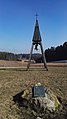
Bronze bell


The Bayreuth / Kulmbach motorway triangle was converted from a left-hand trumpet into a complete triangle with semi-direct ramps and merged with the Bindlacher Berg junction (40b) in the north direction . Before the expansion until 1999, the latter was not a public junction, but rather as a military connection reserved for the US armed forces stationed on Bindlacher Berg until March 1992 . Up to the following junction at Bayreuth-Nord (41), the route used to be one of the last freeway avenues in Germany.
After following a fog bank, between junctions on October 19, 1990 Münchberg -North (35) and Münchberg-Süd (36) a heavy pile-up occurred with ten dead who Taldurchfahrt was replaced by an almost 500 m long viaduct from 1998 to 2000. At the beginning of November 1999 the western half of the bridge was completed, followed by the eastern half in November 2000. At the end of November 1999, the section between the Berg / Bad Steben junction (32) and the Bavarian Vogtland triangle was expanded.
South of Bayreuth, the section south of the Bayreuth-Süd junction (42) to the north of the Trockau junction (43) was completed in November 2000 . The route was changed in the area of the Trockau junction . The route running to the east with the 600 m long Trockau viaduct was used between 1998 and 2001 to defuse the mountain, which is very steep and extremely curvy, with a gradient of up to seven percent.
Since the completion of the Trockau Viaduct in 2001, there has only been one undeveloped section in Bavaria: the 120 million DM expensive conversion between the Bayreuth-Nord junction and the Sophienberg rest area dragged on until 2006. Elaborate noise protection precautions were taken, next to noise barriers a 320 meter long enclosure was built near Laineck .
Four-lane motorway near Bayreuth in 1986, today the Laineck noise protection enclosure is located here

Access towards Nuremberg at the Bayreuth-Nord junction, in the background the exit of the enclosure towards Berlin


Thuringia

The road between the state border with Saxony-Anhalt near Droyßig and the Hermsdorfer Kreuz was already open to six lanes before 2000. Although the Hermsdorfer Kreuz itself was modernized from 1989 to 1992 and the noise protection improved, it has not yet been converted. This work was planned and started in GDR times, shortly before the fall of the Wall, in order to make the junction more efficient.
The section between the Hermsdorfer Kreuz and the state border with Bavaria was the last to be expanded. From the Hermsdorfer Kreuz to the Triptis junction (26), the expansion took place in two stages by the end of 2002 and between November 2004 and 2007. The new Tautendorfer Bridge was released at the end of 2002 and was built parallel to the structure from the 1930s. In the course of the expansion, the Rodaborn service area near Triptis was closed on June 30, 2004. It was opened in 1928 as an excursion restaurant for the citizens of Triptis and became Germany's first motorway service station in 1936 with the completion of the Reichsautobahn. During the GDR era, it was closed in the 1970s and only reopened in 1986 for transit travelers by the Mitropa catering company. After the closure, an unmanaged parking lot was built at the same location. The new Lederhose junction (25b) was built in this area in May 2009 .
From the Wisentatalbrücke north of the Schleiz junction (28) to the Bad Lobenstein junction (29), where the expansion has been completed since 1999, the route was opened to traffic in two sections at the end of 2002 and November 2004, respectively.
Since 2007, there has only been a longer section of the BAB 9 with four lanes and no hard shoulder . It was the 19 km long section south of the Triptis junction at operating kilometer 205 to the north of the Schleiz junction at operating kilometer 224. One reason for the delay was the fact that new ways of financing were being tried out and private investors were being invited to tender wanted to refinance themselves through the truck toll (so-called A-model). It is hoped that this will result in a higher quality road surface and faster completion. According to a notification dated August 4, 2011, the A9SixLanes consortium made up of VINCI Concessions (47.5%), BAM PPP (47.5%) and Reinhold Meister GmbH (5%) was awarded the contract for the expansion. The construction work was carried out by a construction consortium led by Eurovia , Wayss & Freytag (subsidiary of Royal BAM) and Reinhold Meister and began in 2012. The section was released on September 5, 2014, and the last work was completed in November 2014. The expansion of the BAB 9 therefore took around 25 years.
Despite the six-lane expansion, some structures on the original route have been preserved, such as B. the bridge in the Holledau at the Holledau service area, the Saale bridge in the direction of Munich between Bad Lobenstein (29) and Rudolphstein (30) and the Tautendorfer bridge in the direction of Berlin between Hermsdorf-Süd (25a) and Lederhose (25b). Between the Rippachtal junction (19) and the Naumburg exit (21a) there are still three original bridges over the motorway.
Further expansion
Relocation of the Bayreuth-Nord junction
The Bayreuth-Nord junction (41) was moved north in the early 1970s as part of the expansion of the B 2 . Until then, the junction on the west side went from Eremitagestrasse just above Hölzleinsmühle and was very steep. In the triangle of the junction there was a road maintenance building that has been preserved, but can no longer be seen from the motorway due to the new housing. The junction on the east side led directly to Bindlacher Allee shortly before the new bridge. The former route was still visible in the fields until the new Knoll company built. Both interchanges had no acceleration and deceleration lanes, there was a petrol station with “refreshment service” on both sides near the interchanges. The acceleration lane of the driveway in the direction of Nuremberg lies within the Laineck enclosure, which was built between 2002 and 2006 . It is secured by a set of traffic lights with a barrier , the narrow driveway curve may only be driven on at 40 km / h.
Six-lane expansion Nuremberg – Munich
As early as the late 1970s, the entire section between the Nuremberg motorway junction and the Munich-Frankfurter Ring junction was continuously expanded to six lanes. In addition to the BAB 3 between Cologne and Frankfurt, this was one of the first motorway sections in Germany when it was completed to have six lanes over a longer stretch.
Since the time of the German division during the 1970s, the major route of Munich in a northerly direction from the BAB to the BAB 3 in direction 9 Würzburg , proceeded from which one, either in the direction of the Ruhr area and Frankfurt or via the BAB 7 via Hannover by Hamburg , the Nuremberg Cross was rebuilt. The Würzburg – Munich relation was implemented as a continuous main lane, which means that in order to come on the BAB 3 from Würzburg or on the BAB 9 from Munich, you have to leave the main lane to stay on the respective motorway ( TOTSO ). All other relationships in the cross were retained, as was the now superfluous loop for the Munich – Würzburg connection, which was only released for operational service. The cobblestones from the 1930s were still there until 2018, when the ramp was paved. Together with the BAB 9, the BAB 3 was also extended to six lanes to the Fürth / Erlangen junction.
The ascent from the Altmühltal to the Franconian Alb on the so-called Kindinger Berg could not be extended in the existing route due to the location on the mountain slope. The direction of travel in Munich was therefore given a carriageway with three lanes and a hard shoulder, which was separated from the existing route, and ran over a hillside bridge and had a lower gradient than the route from the 1930s. The latter was set up after the completion of the new Munich lane in the area of the lane separation on both of the former lanes for the Berlin / Nuremberg direction. Car traffic drives on two lanes of the former directional lane Munich, truck traffic on one lane of the former directional lane Nuremberg. Only the latter also has a hard shoulder.
The listed Holledau viaduct south of the motorway triangle of the same name has not been replaced by a new parallel building. Since the structure already consisted of two individual structures before the expansion, the gap between the two structures was closed by installing a prestressed concrete bridge between 1978 and 1979, so that the wider superstructure could accommodate three lanes.

Original plaster in the Nuremberg AK
Holledau bridge with widening on the inside


Eight-lane expansion and hard shoulder release Holledau – Munich
The section between the Neufahrn and Munich-Nord motorway junctions, which was last heavily used in 2008 with an average of 143,000 and on peak days with up to 184,000 vehicles, was expanded to eight lanes between 2004 and 2006. The Neufahrn was rebuilt 2009-2011 from clover to a power cross with connecting ramp (so-called Overfly). From 2007 to 2010 the section of the motorway in Munich between Frankfurter Ring and Schwabing ( Freimann high bridge ) was renewed. The over 30-year-old bridges at the entrance and exit of the Frankfurter Ring junction ( popularly known as “Tatzelwurm”) and the high bridge itself were demolished and renewed in the direction of travel. From the year 2000 until the beginning of the eight-lane expansion, the section between the crosses Munich-North and Neufahrn was one of the first in Germany on which the hard shoulder was released as an additional lane at peak times. Since the eight-lane expansion between Neufahrn and the Holledau triangle is still not foreseeable, a similar system has been located on this section since 2016. The originally planned and partially implemented expansion of the Holledau triangle into a motorway junction has been under discussion since 2006 . The aim is no longer to extend the A 93 to Augsburg , but to develop the Pfaffenhofen district .
Test track for autonomous driving
.jpg)
Sections in Bavaria are intended to serve as a test field for innovations in the field of autonomous driving and assistance systems. The Digital Testfeld Autobahn project was initiated in September 2015. At the end of 2016, special landmark signs were set up between Pfaffenhofen and Kreuz Holledau. These round signs with black and white patterns are used to determine your position with centimeter precision using camera-assisted navigation. In particular, the position accuracy in regular traffic can be measured using independent fixed points.
Planning
- Expansion of the Hermsdorfer Kreuz to six lanes (in planning)
- Widening to eight lanes between AK Nürnberg and AK Nürnberg-Ost (further requirements with planning rights)
- Widening to eight lanes between AD Holledau and AK Neufahrn (further requirements with planning rights)
- Widening to six lanes between AS München-Frankfurter Ring and AS München-Schwabing (further requirements)
particularities
Course in the border area
Between the Halle (13) and Bad Dürrenberg (18) junctions, the motorway crosses the state border between Saxony-Anhalt and Saxony twelve times over a distance of less than 30 km , which partially corresponds to the route. However, a sign that you are in Saxony is missing on the entire route.
Military expedition
Only around 800 meters north of today's Pegnitz (44) junction, which was also called Pegnitz / Grafenwöhr at times, was an exit that led directly to the B2 , which crosses the motorway at this point on a bridge , until the early 1980s . Junction 44 was then called Grafenwöhr. It was set up as a driveway to the Grafenwöhr military training area . The B 85 crosses under the motorway there, heavy military equipment could not have used the bridge at the Pegnitz exit.
Weidensees junction
The junction Weidensees (45) was called Veldensteiner Forst until the 1970s and was probably built during the Nazi era at the instigation of Hermann Göring , who hunted in the forest area. Goering had bought the local Veldenstein Castle in nearby Neuhaus an der Pegnitz , where he had spent parts of his youth, and stayed there often. The small town of Weidensee itself could easily have been supplied via the Pegnitz or Plech exits.
ICE high-speed line and motorway
The new Ingolstadt - Nuremberg line operated by Deutsche Bahn AG runs parallel to the A 9 for long stretches. It is the continuation of the new and upgraded Berlin - Nuremberg axis ( German Unity Transport Project No. 8 ).
Junction and service area Holledau
The Holledau service area is located between the Holledau triangle (AS 65) and the Pfaffenhofen ad Ilm junction (66). Formally only signposted as a service area, this is actually an exit and an entrance (without AS number) to Geisenhausen (Schweitenkirchen) with a connection to Geroldshausen (Wolnzach) and Walkersbach (Pfaffenhofen) . The rest stop is on the west side (driving south) of the motorway; Rest area visitors heading north use the country roads to get to the other side and back again.
Berlin bears

At the level of the Munich-Fröttmaning junction (73), on the median between the lanes, there is a bronze statue of a Berlin bear with the inscription “MÜNCHEN BERLIN” on a small base . It was designed by the sculptor Renée Sintenis and on June 6, 1962 and as part of the Friendship Week Berlin in Munich by Willy Brandt ( Governing Mayor of Berlin ), Hans-Jochen Vogel (Lord Mayor of Munich), Alfons Goppel (Bavarian Interior Minister), Otto Friedrich Bach (President of the Berlin House of Representatives ) and Ernst Lemmer (Federal Minister for All-German Issues) revealed. In addition to the memory of Friendship Week, the statue was also intended to serve as a reminder for the city, which was divided by the construction of the Wall a year earlier, as well as the cordoning off of the inner-German border, over which the motorway leads on its way to Berlin. A counterpart to the Munich statue was in West Berlin at today's BAB 115 just before the former Dreilinden border crossing.
Further sculptures showing a Berlin bear were erected after the war since 1954 at numerous points in the then existing West German motorway network - essentially that of the Reichsautobahn of the National Socialists - in the median. They consisted of a stone on which a Berlin bear was carved and a kilometer indication underneath. These were also designed by Renée Sintenis. Such milestones were located along the BAB 9
- north of the Lenting junction (Berlin 500 km)
- in the area of the Hormersdorf junction (Berlin 400 km)
- in the area of the junction Berg / Bad Steben (Berlin 300 km)
The two last-mentioned stones were moved to the edge of the road in the course of the six-lane expansion, the stone north of the Lenting junction is now on the acceleration lane of the Köschinger Forst service station in the north direction.
Serious traffic accidents
- On the afternoon of February 11, 1985, near Reichertshofen - Langenbruck in Bavaria, a British double-decker bus drove onto a braking tanker truck with 6000 liters of aviation fuel. 18 British soldiers in a military band were killed.
- On May 23, 1987, an overturned truck on the well-developed but considered dangerous section near Allershausen in poor visibility and drizzle resulted in the largest pile-up in Germany to date with 183 vehicles, killing two people and injuring 84.
- On October 19, 1990, one of the worst road accidents in German history happened in the Münchberger Senke . In the fog there was a pile-up with ten dead, 120 injured and 170 damaged vehicles. To remedy this source of the accident (fog valley), the roadway was relocated in 2000 for almost 70 million euros as part of the six-lane expansion on a 500-meter-long viaduct, 18 meters higher than before.
- In the summer of 1996, a tanker truck crashed on a Friday afternoon near the Elbe crossing not far from Dessau . The following traffic could only be diverted to a limited extent because the bypass routes had not yet been restored. The at Coswig (reference) The preferred reaction ferry in the course of the former B 107 was not for the surge. There were delays of over seven hours. The flow of traffic only normalized towards evening.
- On April 11, 2003, excessive speed caused by snowfall and simultaneous sunshine in the Münchberger Senke caused another pile-up in which more than 180 cars collided. As a result, in 2005 the motorway was equipped with a route control system in both directions between the Münchberg-Süd and Münchberg-Nord junctions .
- On July 3, 2017, around 7 a.m., 18 people died in a serious rear-end collision between the Münchberg-Süd and Gefrees junctions in the direction of Nuremberg. 30 others were injured, mostly seriously or critically. A coach from the Dutch manufacturer VDL (built in 2013) of the Reimann bus company from Löbau in Saxony hit a truck loaded with beds. The area of the driver's seat was moved back by about 1.50 to 2.00 meters, thereby destroying the batteries installed in the front left, a 300-liter diesel tank and compressed air tanks. This immediately caused a major fire. The coach and truck trailer burned out completely.
Others
- On August 9, 1968, a British Eagle International Airlines passenger plane crashed on the motorway near Langenbruck . All 48 inmates were killed.
- On the evening of December 21, 2001, there was heavy snowfall in Upper Franconia . Between Bayreuth and the border with Thuringia, the cars jammed in both directions at minus 13 degrees for about 100 kilometers. Probably 100,000 people were stuck in their vehicles on the A 9. The next morning at 6:34 AM the called district of Bayreuth the disaster from. To reach those trapped, snowmobiles from the mountain rescue service and soldiers from the German armed forces were used. 1800 people were cared for in gyms in nearby locations. The disaster could only be lifted on the evening of December 22nd.
Movie
- Autobahn Ost , documentary by Gerd Kroske , Germany 2004.
See also
literature
- Roland Gabriel, Wolfgang Wirth: Right through the middle or around the outside? The long planning history of the Munich motorway ring. Verlag Franz Schiermeier, Munich 2013, ISBN 978-3-943866-16-2 .
Web links
- Detailed route description of the federal motorway 9
- Detailed route description of the section of the motorway that was previously planned as the Federal Motorway 990
Individual evidence
- ^ Website of Via Gateway Thuringia , accessed on September 20, 2018.
- ↑ [1]
- ^ Section 46: History ; Thomas Noßke: Autobahn construction in Germany - prehistory and start of construction
- ↑ Archive for motorway and road history: MÜLEIBERL. Retrieved January 19, 2020 .
- ↑ Marion Hombach and Joachim Telgenbüscher: Das Märchen von der Autobahn, p. 85. In: GEO EPOCHE No. 57 - 10/12 - Germany under the swastika - Part 1 . September 27, 2012, archived from the original on November 9, 2012 ; accessed on March 19, 2019 .
- ^ Stadtlexikon Darmstadt: Autobahn / Reichsautobahn. Retrieved January 23, 2020 .
- ↑ Ulli Kulke: How Hitler stole the idea with the Autobahn. In: The world . May 1, 2016, accessed December 4, 2018 .
- ^ Archives for Autobahn and Road History: The development of the network of motorways and trunk roads in Germany according to contemporary maps and plans. Retrieved January 19, 2020 .
- ↑ a b c d Dipl.-Ing. Gottlieb Pfeifer: 50 years of motorways in Franconia. Retrieved March 15, 2020 .
- ↑ Archive for Autobahn and Road History: Events of 1936. Retrieved January 23, 2020 .
- ↑ Bernd Mayer : Bayreuth in the twentieth century . Nordbayerischer Kurier, Bayreuth 1999, p. 71 .
- ^ Archives for Motorway and Road History: Events of 1937. Retrieved January 23, 2020 .
- ^ A b Archive for Autobahn and Road History: Events of 1938. Retrieved January 23, 2020 .
- ↑ Association motorway history (AGAB) eV: 28th meeting of the members of the AGAB eV in Wolnzach from September 26 to 28, 2013. Accessed February 15, 2020 .
- ↑ http://www.autobahn-online.de/a72geschichte.html
- ↑ World: Germany's scariest motorway bridge. Retrieved November 25, 2013 .
- ↑ https://www.fotos-reiseberichte.de/innerdeutsche-strich/rudolphstein-hirschberg.htm Pictures from the inner German border: From Rudolphstein to Hirschberg
- ↑ see route number A 3 on www.autobahn-online.de
- ↑ Network plan 1972
- ↑ https://www.wir-waren-so-frei.de/index.php/Detail/Object/Show/object_id/6797/set_id/434 border opening Rudolphstein / Hirschberg, November 9 and 10, 1989
- ↑ List of traffic clearances
- ^ Report of the Federal Highway Research Institute .
- ↑ Motorway A9: The Hagen or "Million Bridge" in Fläming. Retrieved July 22, 2015 .
- ↑ VDE No. 12 A 9 Berlin - Nuremberg at autobahn-online.de, accessed on March 15, 2020
- ↑ AS Lauf / Hersbruck - Hienberg - AS Hormersdorf towards Berlin at webreichsautobahn.de, accessed on March 15, 2020
- ^ Archives for Motorway and Road History: Events in 1995. Retrieved April 2, 2020 .
- ^ Archives for Motorway and Road History: Events in 1996. Retrieved April 2, 2020 .
- ↑ Archive for Autobahn and Road History: Events of 1999. Retrieved on April 2, 2020 .
- ↑ Horror accident Münchberger Senke: Escape from Hell at frankenpost.de from October 18, 2015, accessed on November 21, 2015
- ^ Archives for Autobahn and Road History: Events of the Year 2000. Retrieved April 2, 2020 .
- ^ The eye of the needle in German unity in: Nordbayerischer Kurier from 2, / 3. / 4. October 2015, p. 15
- ↑ VDE No. 12 A 9 Berlin - Nuremberg section between the Hermsdorf motorway junction and the Thuringia / Bavaria border at deges.de, accessed on March 15, 2020
- ↑ Arno Kröniger : Bareith - where you look! 1st edition. Akron, Bayreuth 2007, ISBN 3-9808215-4-4 , pp. 92 .
- ↑ Autobahn Directorate South Bavaria: Freimann High Bridge , leaflet April 2008 (PDF; 710 kB)
- ↑ Dobrindt starts digital test field Autobahn Press release of the BMVI from September 4th, 2015
- ↑ Test route on the A9 receives new signs for automated driving Press release of the BMVI dated December 13, 2016
- ↑ milestones with the Berlin bear on highways , eAUTOBAHN.de
- ↑ Berlin Bear as a warning , Die Zeit from January 21, 1954
- ↑ K. Dahmen, AC. Zimmer, S. Schmidbauer: What makes the Allershausen – Munich motorway so dangerous? An actuarial analysis of accidents from 1983–1986. In: Zeitschrift für Verkehrssicherheit 2/35 1989, pp. 69–75 ISSN 0044-3654 .
- ↑ A generation mutilates itself , Der Spiegel 25/1987 of June 15, 1987.
- ↑ Ois there. Der Spiegel 31/1987 of July 27, 1987.
- ^ Christiane Grefe , Joachim Riedl , Michael Sontheimer : "Nowhere no way out". The time 38/1987 from September 11, 1987.
- ↑ No real rescue lane in the event of a bus fire with 18 dead , derwesten.de , July 3, 2017
- ↑ Construction details of the VDL coach. Retrieved August 4, 2017 .
- ↑ Police report on the course of the accident and technical details. Archived from the original on July 12, 2018 ; accessed on August 4, 2017 .
- ↑ A nightmare all in white at spiegel.de, accessed on April 20, 2016.
