Altmuehltal
The Altmühltal begins with the Altmühlquelle on the Frankenhöhe northwest of Leutershausen and ends in Kelheim an der Donau near Regensburg . The upper three quarters of the valley are in the Bavarian administrative district of Middle Franconia . The Altmühl flows part of the way through the district of Eichstätt in the administrative district of Upper Bavaria . A small part belongs to the administrative region of Upper Palatinate , the confluence with Lower Bavaria . For some authors, it is considered the cradle of geotourism in Europe. The Altmühltal is particularly well-known for the fossils (e.g. Archeopteryx ) that can be found in the limestone .


landscape
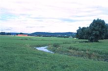
Above Treuchtlingen , the valley is a wide depression that extends between not very high, wooded ridges from northwest to southeast. Now and then, when the Altmühl floods, larger arable areas are flooded, sometimes also parts of the Altmühltalradweg . Place names such as Herrieden and Grossenried indicate the wetlands. Here, between Ornbau and Gunzenhausen, the Altmühlsee was created as a water reservoir for the Main-Danube Canal , which is also used as a leisure area and is an important bird sanctuary. The water branched off here is directed through a tunnel towards the Swabian Rezat . The natural valley of that river branches off from the Altmühltal near Treuchtlingen. So there is a valley watershed there . Charlemagne had already tried to build a shipping canal, the Fossa Carolina , on it. Between Ornbau ( district of Ansbach ) and Treuchtlingen ( district of Weißenburg-Gunzenhausen ) the river only drops a few meters in altitude; This makes it one of the slowest rivers in Europe.
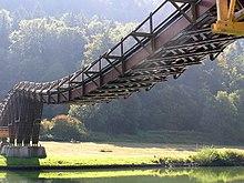
The A 9 crosses the valley at Kinding . The parallel ICE line from Ingolstadt to Nuremberg runs here largely in tunnels. From Dietfurt an der Altmühl to the confluence of the Altmühl into the Danube, the character of the valley was greatly changed by the controversial construction of the Main-Danube Canal . Large parts of the Altmühltal are nature reserves in the Altmühltal Nature Park .
tourism
Franconian Lake District
The Franconian Lake District, including the Altmühlsee , is an area with man-made lakes that is of great importance for tourism in the region.
water sports
Because of their cleanliness and low flow rate there Altmuhl, such as in Ornbau , river pools . The use of the Altmühl as a canoeing area is temporarily impaired by low water, as the water supply of the Main-Danube Canal has priority.
Climbing sport
In the lower part of the Altmühltal, near Dollnstein and Essing , there are well-known sport climbing areas. With the routes The Face and Kanal in the back, climbing history was written here. These were the first routes with difficulty level X or X (UIAA).
Altmühltal cycle path
The now 250 km long Altmühlweg and the Altmühltalradweg run through the whole valley. The route, which was opened in 1984, connects Rothenburg ob der Tauber with Kelheim an der Donau. The long-distance cycle path is one of the most popular cycle routes in Germany.
Limes hiking trail
By Altmühltal extending Limes trail , a section of the German Limes trail .
Awards
In 2002, several geotopes in the Altmühltal were awarded the official seal of approval "Bavaria's most beautiful geotopes" by the Bavarian Ministry of the Environment: the Jura profile on the Arzberg, the Burgstein near Dollnstein , the Twelve Apostles Rock and the Solnhofen limestone . In 2006 it was included in the list of 77 awarded national geotopes in Germany.
See also
literature
- Franz X. Bogner: The valley of the ancient mill. Tümmels, Nuremberg 2003, ISBN 3-921590-98-1 .
- Hans Gercke: The Altmühltal: Culture and landscape between Ansbach and Kelheim. (= DuMont art travel guide ). Cologne 1991, ISBN 3-7701-2510-X .
- Martin Röper, Monika Rothgaenger: Altmühltal In the realm of Archeopteryx. Quelle & Meyer Verlag, Wiebelsheim 2013, ISBN 978-3-494-01488-3 .
- Ulrike Klugmann (Red.): Altmühltal (= outside . Issue 6). HB-Verlagsgesellschaft, Hamburg 1980.
- Johann Schrenk: Altmühltal and Franconian Lake District. 7th edition. Michael-Müller-Verlag, Erlangen 2007, ISBN 978-3-89953-144-2 .
- Franz X. Bogner: In the ancient Danube valley of the Altmühl. Tümmels, Nuremberg 2001, ISBN 3-921590-88-4 .
- Franz X. Bogner, The valley of the ancient mill. Aerial photo tape. 144 pages, Tümmels, Nuremberg, 2003, ISBN 3-921590-98-1 .
- Franz X. Bogner, The Altmühl Nature Park from the air. Schwarze Laber Foundation, Parsberg 2018, ISBN 978-3982026107 .
Individual evidence
- ↑ Bavarian State Office for the Environment: Earth (ge) histories - Jura-Leitprofil am Arzberg. In: Hundred Masterpieces - The Most Beautiful Geotopes in Bavaria. Augsburg 2012, ISBN 978-3-936385-89-2 , pp. 134f.
- ↑ Bavarian State Office for the Environment: A great stone! Burgstein Dollnstein. In: Hundred Masterpieces - The Most Beautiful Geotopes in Bavaria. Augsburg 2012, ISBN 978-3-936385-89-2 , pp. 136f.
- ↑ Bavarian State Office for the Environment: The stubborn dozen - Twelve Apostle rocks. In: Hundred Masterpieces - The Most Beautiful Geotopes in Bavaria. Augsburg 2012, ISBN 978-3-936385-89-2 , pp. 138f.
- ↑ Bavarian State Office for the Environment: Kalke Platte! Solnhofen fossils. In: Hundred Masterpieces - The Most Beautiful Geotopes in Bavaria. Augsburg 2012, ISBN 978-3-936385-89-2 , pp. 142f.
- ^ Stefan Glaser, Martina Bach, Martin Röper, Martina Kölbl-Ebert: A journey through time in the history of the earth. In: Ernst-Rüdiger Look, Ludger Feldmann (Ed.): Fascination Geology. The important geotopes of Germany. E. Schweizerbart'sche Verlagsbuchhandlung, Stuttgart 2006, ISBN 3-510-65219-3 , pp. 142f.
Web links
Coordinates: 48 ° 54 ′ 0 ″ N , 11 ° 10 ′ 0 ″ E

