Dietfurt an der Altmühl
| coat of arms | Germany map | |
|---|---|---|

|
Coordinates: 49 ° 2 ' N , 11 ° 35' E |
|
| Basic data | ||
| State : | Bavaria | |
| Administrative region : | Upper Palatinate | |
| County : | Neumarkt in the Upper Palatinate | |
| Height : | 365 m above sea level NHN | |
| Area : | 78.79 km 2 | |
| Residents: | 6167 (Dec. 31, 2019) | |
| Population density : | 78 inhabitants per km 2 | |
| Postal code : | 92345 | |
| Area code : | 08464 | |
| License plate : | NM, PAR | |
| Community key : | 09 3 73 121 | |
| City structure: | 37 districts | |
City administration address : |
Main street 26 92345 Dietfurt ad Altmühl |
|
| Website : | ||
| First Mayor : | Bernd Mayr (UFW / FW-UPW) | |
| Location of the city of Dietfurt ad Altmühl in the Neumarkt district in the Upper Palatinate | ||
Dietfurt an der Altmühl (officially: Dietfurt adAltmühl ) is a town in the Neumarkt district in the Upper Palatinate .
The name "Dietfurt" is made up of the parts "diet" and "furt". The word part “diet” comes from ahd. Diot = people, crowd. The term “German” is also derived from it. Ford denotes a flat spot in the river where it was possible to cross it. Dietfurt therefore means “ford of the people”.
geography
location
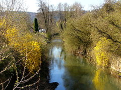
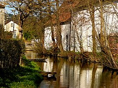
The city is located about 30 kilometers north of Ingolstadt and 40 kilometers west of Regensburg at an altitude of 364 m above sea level. NN . The eponymous capital is located opposite a small north arch of the Altmühl on the widened north-west bank of a valley spider . This is also where the Weißer Laber , which runs to the northeast, flows into the Altmühl and from the southwest the Sulz reaches the so-called Ottmaringer valley of the river, which has been expanded to become the Main-Danube Canal . The city is also located in the Altmühltal Nature Park and is a state-approved resort .
City structure
There are 37 parish parts:
|
The following districts exist : Arnsdorf, Dietfurt adAltmühl, Eichelhof, Eutenhofen, Griesstetten, Grögling, Gundelshofen, Hainsberg (with Ödenburg ruins), Hebersdorf, Mallerstetten, Muttenhofen, Mühlbach, Ottmaring, Pestenrain, Predlfing, Schweinkofen, Staadorf, Töging, Unterbürg, Vogelthal , Wildenstein and Zell.
Neighboring communities
The city borders in a clockwise direction from the north on the following communities: Breitenbrunn , Hemau , Riedenburg , Beilngries , Berching .
history
Until the 20th century
The town, first mentioned in a document in 1109 and designated as a town as early as 1416, came to the Wittelsbachers in 1305 when the Grögling-Hirschberg counts died out . After the death of Emperor Ludwig IV, it became part of the Wittelsbach sub-duchy of Straubing-Holland through the division of inheritance from 1353 to 1425 . Dietfurt an der Altmühl was a nursing office before 1800 and belonged to the Straubing Rent Office of the Electorate of Bavaria . Dietfurt had a city court with extensive magistrate rights.
The coat of arms has been known since the 14th century. The blazon reads: In red a silver sloping bar, which is covered with a red heraldic rose with a golden lug.
The Bavarian original cadastre from 1808 records over 200 small and very small properties in the city. In the 1840s the Ludwig-Danube-Main Canal brought another economic revival.
From 1909 the Dietfurt (Altmühl) station was on the Neumarkt – Dietfurt railway line , which has been closed since 1967 .
Incorporations
On January 1, 1972, the formerly independent communities Eutenhofen, Griesstetten, Hainsberg, Mallerstetten, Mühlbach, Staadorf, Unterbürg and Wildenstein were incorporated. On July 1, 1972, Ottmaring, Töging and Vogelthal were added from the dissolved district of Beilngries .
Population development
Between 1988 and 2018, the city grew from 5,241 to 6,139 by 898 inhabitants or 17.1%.
| year | 1970 | 1987 | 1991 | 1995 | 2000 | 2003 | 2006 | 2009 | 2012 | 2015 |
| Residents | 5061 | 5257 | 5487 | 5862 | 6019 | 6142 | 6071 | 6054 | 5991 | 6084 |
politics
City council
The city council consists of 20 elected and honorary city councilors as well as the first mayor. The local elections on March 15, 2020 produced the following results:
| Party / list | Share of votes | +/-% p | Seats | +/- | |
| CSU | 22.3% | - 4.9 | 4th | - 1 | |
| SPD | 9.8% | - 10.6 | 2 | - 2nd | |
| Christian Voter Union (CWU) | 20.6% | + 0.8 | 4th | ± 0 | |
| Independent Free Voters Dietfurt (UFW) | 22.8% | + 4.8 | 5 | + 1 | |
| Free Voters-Independent Party Free Voters (FW-UPW) | 18.2% | + 3.7 | 4th | + 1 | |
| Green | 6.2% | +6.2 | 1 | + 1 | |
| total | 100% | 20th | |||
| Turnout: 69.1% (2014: 73.46% ) | |||||
mayor
In the 2020 local elections, Bernd Mayr (UFW / FW-UPW) was elected first mayor with 57.5% of the valid votes and thus prevailed against the candidate Helga Huber (CSU / CWU, 37.6%). The candidate of the Greens, Angeliki Gleixner, received 4.9% of the valid votes. Mayr's predecessor was Carolin Braun (SPD). In the runoff election on March 30, 2014, she prevailed with 67.1% of the vote against Christian Linz (CSU / CWU, 32.9%).
coat of arms
| Blazon : "In red a slanting silver bar, which is covered with a red heraldic rose with golden lugs." | |
Education, culture and sights
- Two kindergartens with a total of 187 kindergarten places and 190 children
- Two primary schools with a total of 18 teachers and 344 students (school year 2012/13)
- Museums: Museum in the Hollerhaus, local history museum, Altmühltaler Mühlenmuseum, Obermühle Mühlbach
Buildings
- Town hall from 1479
- Franciscan monastery , built in 1660, with a work by Sebastian Mutzl in the Antonius Chapel (1870 Antonius von Padua frescoes)
- Baroque pilgrimage church to the Three Wretched Saints in Griesstetten
- City parish church of St. Giles (Gothic origin, built in 1733/34 under Giovanni Domenico Barbieri , expanded under Gabriel de Gabrieli in the 18th century and modified in Baroque style, mighty high altar, 60 meter high tower)
Nature reserves
Natural monuments
The Mühlbachquellhöhle , a widely branched cave system that is not open to the public. Since September 2006 there has been a speleological path above the cave, which offers insight into the subject of caves , geology , sinkholes , etc. on 15 information boards. Since 2016 there has been a permanent exhibition in the barn of the Obermühle, which provides information about the Mühlbachquellhöhle, among other things.
Regular events
The Dietfurt Chinese Carnival on Nonsensical Thursday , the Thursday before Rose Monday , is well known .
economy
In 2012 there were six in the field of agriculture and forestry, 1113 in the manufacturing sector and 299 in the trade, transport and hospitality sector at the place of work. In other economic sectors, 303 people were employed at the place of work subject to social security contributions. There were a total of 2349 employees at the place of residence subject to social security contributions. There were six companies in the manufacturing sector and 16 companies in the construction sector. In 2010 there were also 117 farms with a total of 3674 ha of agricultural land. 2810 ha of this were arable land and 864 ha were permanent green space. The Lände Dietfurt industrial park is located in the south of Dietfurt between the State Road 2230 and the Main-Danube Canal. The Dietfurt hydropower plant is located nearby .
traffic
Dietfurt is accessible via the state roads St 2230 and St 2234 as well as the district roads NM 15 and NM 23 .
The public transport operated Dietfurt with seven bus lines. These clocked to Neumarkt, Beilngries and Parsberg.
Personalities
- Argula von Grumbach (1492–1568), Protestant journalist and reformer, lived and worked from 1516 in Dietfurt
- Balthasar Werner (civil: Georg Werner, 1887–1943), Franciscan brother , grew up in Dietfurt
- Laurentius Justinianus Ott (civil: Joseph Marcellinus Ott, 1748–1805), Augustinian chorister, composer and chronicler at Weyarn Abbey , born in Dietfurt
- Benedikt Werner , from 1786 to 1803 important abbot of the Benedictine monastery Weltenburg , born in Dietfurt
- Petrus von Hötzl (1836–1902), pastor in the Franciscan monastery in Dietfurt
- Michael Wittmann (1914–1944), tank commander and Hauptsturmführer of the Waffen SS, born in the Vogelthal district
- Josef Bayer (* 1950), linguist, born in Dietfurt
- Matthias Schlüter (* 1952), German visual artist , lives in Dietfurt
Web links
Individual evidence
- ↑ "Data 2" sheet, Statistical Report A1200C 202041 Population of the municipalities, districts and administrative districts 1st quarter 2020 (population based on the 2011 census) ( help ).
- ↑ Mayor. City of Dietfurt an der Altmühl, accessed on June 7, 2020 .
- ^ City of Dietfurt an der Altmühl in the local database of the Bavarian State Library Online . Bayerische Staatsbibliothek, accessed on December 12, 2017.
- ↑ Dietfurt on Bayernatlas Klassik
- ^ Wilhelm Volkert (ed.): Handbook of Bavarian offices, communities and courts 1799–1980 . CH Beck, Munich 1983, ISBN 3-406-09669-7 , p. 557 .
- ^ Website City of Dietfurt ad Altmühl: City Council election 2020, final result
- ^ Result of mayoral election 2020, City of Dietfurt adAltmühl
- ^ Entry on the coat of arms of Dietfurt an der Altmühl in the database of the House of Bavarian History
- ↑ Dietfurterin supported Martin Luther . In: Mittelbayerische.de . October 30, 2015. Accessed October 31, 2015.


