Mühlbachquellhöhle
| Mühlbachquellhöhle
|
||
|---|---|---|
|
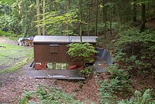
Locked access to the cave |
||
| Location: | Franconian Alb | |
| Height : | 380 m above sea level NN | |
|
Geographic location: |
49 ° 1 '21.5 " N , 11 ° 37' 6.4" E | |
|
|
||
| Cadastral number: | H 100 | |
| Geology: | Upper marl limestone | |
| Type: | Water cave | |
| Overall length: | 9273 m | |
The Mühlbach Spring Cave is a water-active river cave in Dietfurt in the Franconian Alps in the Upper Palatinate . One of the largest karst springs in northern Bavaria , the Mühlbach spring, has its source .
The Mühlbachquellhöhle is registered in the cave cadastre Fränkische Alb (HFA) as H 100 and with a measured length of 9,273 m it is the 6th longest cave in Germany (status 12/2019).
Research work
Speleologists have been researching the region's caves since the 1930s . After many years of preparatory work, members of the “Karstgruppe Mühlbach eV” (KGM) cave association finally managed to break through the Mühlbachquell cave in 2001. They discovered the first river cave in the Franconian Alb . This water-active and spacious cave system with a measured length of 9,273 meters has since been scientifically researched by the cave researchers of the Karst Group Mühlbach (KGM).
Before this discovery, the region's caves were primarily seen as sites of Ice Age fossils and prehistoric artifacts, and they were used as tourist attractions. Since then, it has come to the fore that they are also archives of geological knowledge, have played a major role in landscape development and play a decisive role in the groundwater balance.
An end to the diverse research work in the Mühlbachquellhöhle, which is carried out on a voluntary basis in cooperation with various institutes, is not yet in sight. Again and again there are diving expeditions to the remote end siphons . The cave is only accessible to experienced and suitably equipped specialists due to the narrow passages filled with water in places. Touristic tours do not take place for the same reason.
Hikes on the cave route
The access to the cave is locked. In cooperation with the city of Dietfurt, the KGM organizes guided hikes at regular intervals on the specially created "Speleological Path". On this eight-kilometer hiking trail, which follows the course of the Mühlbachquell cave on the plateau above, information boards provide information on various topics related to cave and karst studies .
In addition, there are multimedia lectures for the public at regular intervals , which report on the status of research underground.
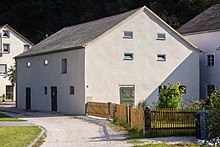
The vault in the stone barn of the Obermühle in Mühlbach (Dietfurt an der Altmühl) shows a permanent exhibition about the Mühlbachquellhöhle.
Web links
Individual evidence
- ↑ Plan and length of the Mühlbachquellhöhle. Karst Group Mühlbach, December 2019, accessed on December 22, 2019 (German).
- ↑ The hiking trail | The Mühlbachquellhöhle. Retrieved December 22, 2019 .
- ↑ The exhibition: Stone, Water, Cave. Retrieved December 22, 2019 .


