
Berg near Neumarkt in the Upper Palatinate
| coat of arms | Germany map | |
|---|---|---|

|
Coordinates: 49 ° 20 ' N , 11 ° 26' E |
|
| Basic data | ||
| State : | Bavaria | |
| Administrative region : | Upper Palatinate | |
| County : | Neumarkt in the Upper Palatinate | |
| Height : | 406 m above sea level NHN | |
| Area : | 65.14 km 2 | |
| Residents: | 7900 (Dec. 31, 2019) | |
| Population density : | 121 inhabitants per km 2 | |
| Postal code : | 92348 | |
| Primaries : | 09189, 09187, 09181 | |
| License plate : | NM, PAR | |
| Community key : | 09 3 73 113 | |
| LOCODE : | DE BNO | |
| Community structure: | 35 districts | |
| Address of the municipal administration: |
Herrnstrasse 1 92348 Berg near Neumarkt idOPf. |
|
| Website : | ||
| First Mayor : | Peter Bergler (List of Citizen-Oriented Municipal Policies, Berg) | |
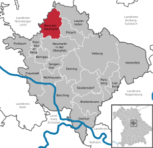
| Location of the municipality of Berg near Neumarkt idOPf. in the district of Neumarkt in the Upper Palatinate | ||
  |
||

Berg bei Neumarkt in der Oberpfalz (officially: Berg b.Neumarkt idOPf. ) Is a municipality in the district of Neumarkt in Oberpfalz in Bavaria .

geography
Geographical location
The village is located in the mountain Upper Palatinate Jura , called the Bohemian part of the Franconian Jura and Franconian Alb . It is located between the Schwarzach in the east and the Ludwig-Danube-Main Canal in the west. The Ottenberg rises about 3.5 km east-southeast .
Community structure
There are 35 officially named municipal parts:
|
history
From 1128 to 1848 there were two castles in Berg in the hands of different owners. Berg was first mentioned in a document on November 12, 1129, during a ten-year dispute between the Fürnried provost and the Kastl monastery , in which a local priest was named "Heinricus de Perge". In 1224, Berg became a ducal Bavarian office. In 1236, the Reichsministerial "Wernher von Paerge" was the first aristocrat to be found on the mountain. In 1280 in a palatine is Urbar an office "pärn" listed. In 1318 a Heinrich von Berg appears in a document as an "honorable knight", which of the two knight seats cannot be explained. This also applies to some other nobles at Berg. In any case, Heinrich der Streitberger sat at the ducal castle in 1360, Otto Senft in 1370, Heinrich von (Burg-) Thann in 1381 , and Hans Strupperger as ducal officials from 1390 to at least 1406. When the Count Palatine acquired the Haimburg Fortress in 1388, they combined the Berg Office with the newly established Haimburg Office. In 1390 Heinrich der Smid sat on the other aristocratic seat; the Smide ministerial family had large estates in the Berg area. 1339 is a Cuntz called Smid zu Perge. In 1325, the Eichstatt Bishop Gebhard incorporated the parish church in "Perg" into the Pettendorf monastery .
In the Hussite Wars in 1432 the aristocratic seats in Berg were destroyed by the Hussites , Kurt Voit von Rosenberg (probably in the ducal seat) and Ulrich Pöllinger (in the other seat) were killed and their sons were "taken prisoner", as can be seen from the parish registers . In 1438, in connection with an early measurement foundation in Berg, the Pöllingers named Conrat as the nurse of Helfenberg, Niklas as the nurse of "Rotenburgk" and Fritz as the nurse of Hainberg (= Haimburg). In 1450 the people of Nuremberg destroyed the Pöllinger seat of the Berger family. They no longer rebuilt it, but rebuilt a small seat, which they sold to Gnadenberg Monastery in 1454 , which turned it into an economic asset. One hears of the Voit again only in 1539 with the mention of Hans Voit, called the elder, who bought the deserted Pöllinger seat in 1558 and left it to his son Hans Voit the younger as an inheritance in 1567 . Through his son Gilg Sebastian Voit von Berg, the property passed to the last Voit in 1651, Max Christoph Voit zu Berg.
As a result of the Landshut War of Succession , Berg became Nuremberg in 1504. but came back to the Electoral Palatinate in 1521. In 1542 the Electoral Palatinate introduced the Reformation , in 1625 the old faith was reintroduced under the Bavarian Duke Maximilian . During this evangelical phase a school was set up around 1602/08, as was an alms office. In the Thirty Years' War in 1639, the offices of the ducal government in Amberg had to report how many of their farms could be occupied with regard to the upcoming winter quarters for the troops; the Haimburg office reported the number of 26 farms for Berg. The other farms were probably deserted due to the war. The population of Berger had shrunk to a tenth due to the war. In 1655, Duke Philipp Wilhelm von Neuburg left the Pettendorf monastery, including the affiliations, including the right of patronage over the Berg parish, to the Kaisheim monastery ; with the consent of the duke, the Kaisheim monastery transferred this property to the Dominican monastery in Regensburg in 1670 . In 1676 it was sold to the Pielenhofen monastery .
According to the Voit, the Senser, court chamber officials in Munich, held the Landsassengut Berg from 1702, after them the Sandizell and in 1750 the Bavarian personal physician Fuchs, who sold the estate to the Upper Palatinate Renthrat Kaspar Weiß, who inherited it to his daughter Veronika Weiß zu Neumarkt . Towards the end of the 18th century, this "Hofmark Berg" consisted of the small castle in Berg, four half yards, eight eighth yards and eight sixteenth yards at Berg, one half yard at Meilenhofen and one eighth yard at Riebling. At the end of the Old Kingdom around 1800 , Berg consisted of 96 properties that belonged to six manors. Most of the farms were owned by the Haimburg caste office, 18 by the Neumarkt caste office, two by the monastery judge Gnadenberg and the Widumshof by pastors Berg. The ducal care office of Pfaffenhofen exercised the highest jurisdiction .
In the new Kingdom of Bavaria (1806) the Berg tax district was formed, to which Berg and the neighboring Meilenhofen belonged. When the municipality was formed around 1818/20, the municipality of Berg in addition to Meilenhofen also included Oberwall and Unterwall from the Haimburg tax district. After Haimburg became a community, the towns of Oberwall and Unterwall, which only came back to Berg in 1939, were also part of it. The municipality of Berg belonged to the district court Kastl, first in the district office Velburg, then in the district office Neumarkt, which became the district Neumarkt.
In 1845 the "ancient image of the Virgin Mary from Rasch " was acquired for the parish church of Berg and ceremoniously transferred. In 1887 a new school building was built; In 1741 the old schoolhouse "originally" had an ossuary on the lower floor . Around 1937 the Berger School had two classes with two teachers, one female and one male. Mileshofen, Kettenbach and Unterwall were trained. In 1896 the remaining “small” castle, a three-storey residential tower with a surrounding wall and moat, was demolished due to its disrepair. In 1917 the parish church of St. Vitus burned down with its tower, bells and inventory; The reconstruction took place in 1919 under the architect Von Werden-Behringer in Nuremberg. In 1935 Berg received a nursing station from the local nursing association, which was run by two Niederbronn sisters .
Incorporations
On April 1, 1939, the previously independent community of Haimburg was dissolved. A part came to Neumarkt. On January 1, 1972, Hausheim was incorporated. Loderbach, Oberölsbach, Sindlbach with the rest of the dissolved community of Haimburg and Stöckelsberg with Häuselstein, which was incorporated on January 1, 1972, were added on May 1, 1978.
Population of the place Berg
- 1836: 594 (86 houses)
- 1871: 591 (199 buildings; livestock: 9 horses, 456 head of cattle)
- 1900: 589 (113 residential buildings)
- 1937: 749 (745 Catholics 4 Protestants).
- 1950: 1087 (169 residential buildings; rural police posts)
- 1961: 1176 (211 residential buildings)
- 1970: 1345
- 1987: 1818 (482 residential buildings, 584 apartments)
- 2015: 2878
Population of the municipality of Berg
- 1871: 643 (Berg with Meilenhofen; 638 Catholics, 5 Protestants; 160 households)
- 1900: 662 (656 Catholics, 6 Protestants; 123 residential buildings; livestock: 18 horses, 530 head of cattle, 511 pigs, 34 goats)
- 1937: 817 (Berg with Meilenhofen).
- 1950: 1260 (4 places: Berg, Meilenhofen, Oberwall and Unterwall; 199 residential buildings; 1087.56 ha)
- 1961: 1331 (4 places: Berg, Meilenhofen, Oberwall and Unterwall; 241 residential buildings; 1087.41 ha)
- 1970: 2016 (10 locations: Berg, Meilenhofen, Oberwall, Unterwall, Gspannberg, Haslach, Hausheim, Kettenbach, Kleinvoggenhof, Rührersberg)
- 1987: 5739 (35 districts; 65.12 km² area; 1568 residential buildings, 1858 apartments)
- 2015: 7575 (34 districts)
Between 1988 and 2018 the municipality grew from 5,880 to 7,823 by 1,943 inhabitants or by 33%.
politics
Municipal council
Since the local elections on March 15, 2020 , the local council has been composed as follows (with comparative figures from the two previous elections):

| Party / list | 2020 | 2014 | 2008 | |
| CSU | 7th | 6th | 6th | |
| SPD | 5 | 7th | 7th | |
| Green | 1 | - | - | |
| LBG (List of Citizens' Community Policies, Berg) | 4th | 4th | 4th | |
| FWG | 3 | 3 | 3 | |
| total | 20th | 20th | 20th |
mayor
The first mayor is Peter Bergler (LBG). In the runoff election on March 29, 2020, he was able to prevail against Johannes Hierl (CSU, 41.2%) with 58.8% of the valid votes.
coat of arms
Blazon: “Slanted left split; above under a black battlement a golden wall; below in black a standing, red crowned and armored golden lion ”.
Partnerships
The municipality of Berg has had partnerships with Walce (Walzen) in Poland since May 1997 and with Berg bei Rohrbach in Upper Austria since October 1998 .
Transport and infrastructure
Berg is located directly on the A3 , approx. 30 km from Nuremberg and approx. 70 km from Regensburg. Due to this preferred location, the two industrial areas of Berg are developing very well and many Nuremberg residents are settling in the region. The immediate vicinity of the district town of Neumarkt in the Upper Palatinate also has a positive effect . Berg is only 6 km north of it.
The Ludwig-Danube-Main Canal flows through the municipality of Berg. The surrounding area is a popular recreational area and is ideal for hiking and cycling. The apex of the canal runs close to the town center.
Attractions

- Berg Castle
- Rohrenstadt Castle
- Haimburg castle ruins
- Birgittenkloster Gnadenberg monastery ruins
- Irleshof flour mill
- The Catholic parish church of St. Jakobus in the Sindlbach district with a ceiling painting with scenes from the life of St. James the Elder from 1758 by the Eichstatt court painter Johann Michael Franz
Personalities
- Johann Nepomuk Mederer (1734–1808), historian and Jesuit, born in the Stöckelsberg district
Web links
- Website of the municipality of Berg
- Berg near Neumarkt in the Upper Palatinate: Official statistics of the LfStat
Individual evidence
- ↑ "Data 2" sheet, Statistical Report A1200C 202041 Population of the municipalities, districts and administrative districts 1st quarter 2020 (population based on the 2011 census) ( help ).
- ↑ Mayor. Berg bei Neumarkt in der Oberpfalz, accessed on May 30, 2020 .
- ^ Municipality of Berg near Neumarkt in the Upper Palatinate in the local database of the Bavarian State Library Online . Bavarian State Library, accessed on October 25, 2017.
- ↑ a b c d e Buchner I, p. 84, digitized
- ↑ Heinloth, p. 172, digitized version
- ↑ Heinloth, p. 173 f., Digitized
- ↑ Heinloth, p. 174 f., Digitized
- ^ Josef Breinl: Chronicle of the Grossgmeinde Berg. With the local history of all districts , Berg 1996, p. 24 f.
- ↑ Buchner I, pp. 85 f., Digitized
- ^ Negotiations of the Historical Association of Upper Palatinate and Regensburg, 84th volume (1934), p. 136, digitized, there p. 136 ( page no longer available , search in web archives ) Info: The link was automatically marked as defective. Please check the link according to the instructions and then remove this notice.
- ↑ Breinl, p. 29
- ↑ Buchner I, p. 86 f., Digitized
- ↑ Heinloth, p. 175, digitized
- ↑ Heinloth, p. 290, digitized version
- ↑ Heinloth, p. 321, digitized version
- ↑ Buchner I, pp. 87-92, digitized
- ^ Wilhelm Volkert (ed.): Handbook of Bavarian offices, communities and courts 1799–1980 . CH Beck, Munich 1983, ISBN 3-406-09669-7 , p. 533 .
- ^ Federal Statistical Office (ed.): Historical municipality directory for the Federal Republic of Germany. Name, border and key number changes in municipalities, counties and administrative districts from May 27, 1970 to December 31, 1982 . W. Kohlhammer GmbH, Stuttgart and Mainz 1983, ISBN 3-17-003263-1 , p. 649 .
- ↑ Popp, Th. D. (Ed.): Matrikel des Bissthumes Eichstätt , Eichstätt: Ph. Brönner, 1836, p. 39
- ↑ Kgl. Statistical Bureau (ed.): Complete list of localities of the Kingdom of Bavaria. According to districts, administrative districts, court districts and municipalities, including parish, school and post office affiliation ... with an alphabetical general register containing the population according to the results of the census of December 1, 1875 . Adolf Ackermann, Munich 1877, 2nd section (population figures from 1871, cattle figures from 1873), Sp. 971 , urn : nbn: de: bvb: 12-bsb00052489-4 ( digitized version ).
- ↑ a b K. Bayer. Statistical Bureau (Ed.): Directory of localities of the Kingdom of Bavaria, with alphabetical register of places . LXV. Issue of the contributions to the statistics of the Kingdom of Bavaria. Munich 1904, Section II, Sp. 869 ( digitized version ).
- ↑ Buchner I, p. 89, digitized
- ↑ a b Bavarian State Statistical Office (ed.): Official place directory for Bavaria - edited on the basis of the census of September 13, 1950 . Issue 169 of the articles on Bavaria's statistics. Munich 1952, DNB 453660975 , Section II, Sp. 741 ( digitized version ).
- ↑ a b Bavarian State Statistical Office (ed.): Official city directory for Bavaria, territorial status on October 1, 1964 with statistical information from the 1961 census . Issue 260 of the articles on Bavaria's statistics. Munich 1964, DNB 453660959 , Section II, Sp. 547 ( digitized version ).
- ↑ a b Bavarian State Statistical Office (Hrsg.): Official local directory for Bavaria . Issue 335 of the articles on Bavaria's statistics. Munich 1973, DNB 740801384 , p. 126 ( digitized version ).
- ↑ a b Bavarian State Office for Statistics and Data Processing (Ed.): Official local directory for Bavaria, territorial status: May 25, 1987 . Issue 450 of the articles on Bavaria's statistics. Munich November 1991, DNB 94240937X , p. 257 ( digitized version ).
- ↑ As of December 31, 2015; Bulletin of the Berg municipality , February 2016, p. 8
- ^ Results of the census in the Kingdom of Bavaria from December 1, 1871 by individual communities (community directory) , (XXVIIIth issue of the contributions to the statistics of the Kingdom of Bavaria), Munich: EA Fleischmann's Hof-Buch- und Kunsthandlung, 1873, p. 106 , Digitized
- ↑ Buchner I, p. 89, digitized
- ↑ As of December 31, 2015; Bulletin of the Berg municipality , February 2016, p. 8
- ↑ Election of the municipal council, municipality of Berg near Neumarkt idOPf. - overall result
- ↑ Ballot for the mayor, municipality of Berg near Neumarkt idOPf. - overall result
- ↑ Entry on the coat of arms of Berg near Neumarkt in the Upper Palatinate in the database of the House of Bavarian History

Berching | Berg near Neumarkt in the Upper Palatinate | Berngau | Breitenbrunn | Deining | Dietfurt an der Altmühl | Freystadt | Hohenfels | Lauterhofen | Lupburg | Mulhouse | Neumarkt in the Upper Palatinate | Parsberg | Pilsach | Postbauer-Heng | Pyrbaum | Sengenthal | Seubersdorf in the Upper Palatinate | Velburg
Beckenhof | Berg near Neumarkt in the Upper Palatinate | Bischberg | Burkertshof | Gebertshof | Gnadenberg | Gspannberg | Haimburg | Haslach | Häuselstein | House home | Irleshof | Kadenzhofen | Kettenbach | Kleinvoggenhof | Klostermühle | Langenthal | Loderbach | Wall mill | Mileshofen | Mitterrohrenstadt | Oberölsbach | Oberrohrenstadt | Oberwall | Reicheltshofen | Rich wood | Richtheim | Riebling | Rührersberg | Sindlbach | Stöckelsberg | Unterölsbach | Unterrohrenstadt | Unterwall | Wish