
Upper Palatinate
| Upper Palatinate | |||
|---|---|---|---|
|
|||
| State : | Germany | ||
| State : | Bavaria | ||
| Administrative headquarters : | regensburg | ||
| Biggest cities: |
1. Regensburg 2. Weiden 3. Amberg 4. Neumarkt |
||
| Area : | 9,691.03 km² | ||
| Residents : | 1,112,102 (December 31, 2019) | ||
| Population density : | 115 inhabitants per km² | ||
| District President: | Franz Löffler ( CSU ) | ||
| District President: | Axel Bartelt | ||
| Website : | |||
  Location in Bavaria and Germany |
|||

The Upper Palatinate is an administrative district and also a district of the same area (third municipal level) in the northeast of the Free State of Bavaria . It borders on the Czech Republic and on the Bavarian administrative districts of Upper Bavaria , Lower Bavaria , Middle Franconia and Upper Franconia . The administrative seat of the Upper Palatinate district and the seat of the Upper Palatinate government is Regensburg . Until 1954, the administrative districts of Lower Bavaria and Upper Palatinate were administered jointly.
structure
The administrative region of Upper Palatinate comprises three independent cities and seven districts :
One district cities
Counties
- Amberg-Sulzbach district
- Cham district
- District of Neumarkt in the Upper Palatinate
- Neustadt an der Waldnaab district
- Regensburg district
- Schwandorf district
- Tirschenreuth district
Before the district reform
From 1939 to 1945, Lower Bavaria-Upper Palatinate also included areas that had been separated from Czechoslovakia after the Munich Agreement of 1938 with the Sudetenland . It was the three districts:
In addition, in 1940/45 11 communities from the former Czechoslovak state were allocated to the Waldmünchen district.
Before the district reform on July 1, 1972, the administrative district of Upper Palatinate had five independent cities and nineteen districts.

One district cities:
- On the mountain
- Neumarkt in der Oberpfalz (today a large district town in the district of the same name)
- regensburg
- Schwandorf (today a large district town in the district of the same name)
- Willows in the Upper Palatinate
Counties:
- Amberg district
- Beilngries district
- Burglengenfeld district
- Cham district
- District of Eschenbach in the Upper Palatinate
- Kemnath district
- Nabburg district
- District of Neumarkt in the Upper Palatinate
- District of Neunburg vorm Wald
- Neustadt an der Waldnaab district
- District of Oberviechtach
- Parsberg district
- Regensburg district
- Riedenburg district
- Roding district
- District of Sulzbach-Rosenberg
- Tirschenreuth district
- Vohenstrauss district
- Waldmünchen district
Population development
| Population development | ||||||||||||||
|---|---|---|---|---|---|---|---|---|---|---|---|---|---|---|
| year | 1840 | 1871 | 1900 | 1925 | 1939 | 1950 | 1961 | 1970 | 1987 | 2004 | 2016 | 2018 | ||
| Residents | 459.571 | 501.950 | 558.394 | 636.845 | 694.742 | 905.822 | 898.580 | 963.833 | 969.858 | 1,090,289 | 1,098,378 | 1,109,269 | ||
The statistics reflect steady growth; but that should not be overstated. There were sometimes serious differences locally. The city and district of Regensburg are currently growing dynamically, while in the north of the Upper Palatinate the population has been declining for 20 years. The proportion of foreigners is currently (2018) at 8.75% and thus well below the Bavarian average (13.20%). A death surplus of 2,960 people contrasted with an increase in migration of 12,138 people in 2015. In 2017, the death surplus was 1,963 people out of 9,982 births. Only the city of Regensburg showed positive natural population growth (2017) (+201 people).
language
The entire Upper Palatinate, with the exception of the Franconian language enclave Neustadt am Kulm , belongs to the Bavarian language area .
Northern Bavarian is spoken in the north and in the middle of the Upper Palatinate, in the south of the Upper Palatinate, from Waldmünchen and Burglengenfeld , a broad linguistic mix between Northern and Central Bavarian begins. In the Cham basin the dialects tend towards Lower Bavarian and in the Regensburg area they tend towards Upper Bavaria. There is a clear difference between speakers from Regensburg and Straubing, although Straubing still belongs to this mixed zone.
Northern Bavarian is an original variant of Bavarian, which still retains many archaisms that have already died out in the central Middle Bavarian language area. It has many phonetic peculiarities, some of which it shares with the neighboring East Franconian dialects . Northern Bavarian is particularly characterized by the "fallen diphthongs" (preceded by mhd. Uo, ië and üe ) and the diphthonged Middle High German long vowels â, ô, ê and œ ; For example, the standard German words brother, letter and tired ( monophthonged vowels) correspond here to Brouda, Brejf and mejd (first monophthonged, then again diphthonged ) instead of Bruada, Briaf and miad (preserved diphthongs) as in Middle Bavarian south of the Danube. Furthermore, for example, the German standard corresponds sheep here Schòuf (mittelbair. Schoof ), red here Rout / rout (mittelbair. Red / rout ), snow here Schnèj (mittelbair. Snow ), or angry here Bey (mittelbair. Bees ).
In the dialects in the west and north-west of the northern Bavarian language area, a characteristic elevation of the vowels e (and ö after rounding) and o to i and u is recorded, for example Vuugl and Viigl, in contrast to the more southern forms Voogl and Veegl for standard language Bird and birds. This elevation is also considered a characteristic (East) Franconian feature. In the northeast of the language area these sounds are the diphthongs , among others , and in general, so Vuagl and Viagl .
The plural forms of diminutive and pet forms usually end in - (a) la, in the singular with - (a) l, for example Moidl = girls, d 'Moi (d) la = girls. The ending -en after k, ch and f has been retained as a consonant in the northern northern Bavarian dialects, for example hockn, stechn, hoffn, Soifn (= soap ). In the more southern northern Bavarian dialects, as in the central Bavarian dialects further south, it has become -a , i.e. hocka, stecha, hoffa, Soifa. The form niad for Middle Bavarian net and the various forms of the personal pronoun for the 2nd person plural are also characteristic: enk, enks, ees, èts, deets, diits, diats, etc.
Largest cities in the Upper Palatinate
| city | district | Residents 1 | image |
|---|---|---|---|
| regensburg | circular | 150,894 |

|
| Pastures | circular | 42,543 |

|
| On the mountain | circular | 42,248 |

|
| Neumarkt | Neumarkt in the Upper Palatinate | 40.002 |

|
| Schwandorf | Schwandorf | 28,828 |

|
geography
The Upper Palatinate is a landscape with low mountain ranges and in the flatter regions with numerous ponds and lakes . Compared to other regions in Germany, it has a more rural character, is less populated and borders (clockwise from the north) on Upper Franconia , the Czech Republic , Lower Bavaria , Upper Bavaria and Central Franconia .
Notable landscapes are:
- Stiftland , former imperial monastery and domain of the Waldsassen monastery with the market town of Konnersreuth , the Fockenfeld monastery , the town of Waldsassen and around 150 other localities.
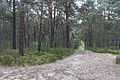
- Upper Palatinate Forest with deep valleys and many castles
- Upper Palatinate Lake District with the large Steinberger See
- Upper Palatinate Jura , part of the Franconian Jura
- Steinwald with the Teichelberg and Armesberg
- Waldnaab / Wondrebsenke
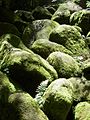
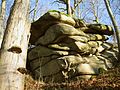
- Bavarian Forest , together with the Bohemian Forest, an extensive nature reserve. A rock bar west of the summit cross of the Großer Arber ( 1455.5 m above sea level ) is the highest point in the Upper Palatinate at 1439.6 m .
- Naabtal
- Vilstal
- Danube lowlands, western part of the Gäuboden
- Lower Bavarian hill country south of the Danube
The Upper Palatinate is a volcanic area that was active in the Tertiary with around 150 volcanoes. Together with the Czech West Bohemia , a more recent volcanic activity took place in the Pleistocene on the Eisenbühl , the Kammerbühl and the Neualbenreuther Maar .
Protected areas
In the administrative district there are 62 nature reserves , 86 landscape protection areas , 95 FFH areas , 14 EU bird protection areas and at least 570 geotopes (as of March 2017). The largest nature reserve in the district is the Regentalaue between Cham and Pösing.
See also:
- List of nature reserves in the Upper Palatinate
- List of landscape protection areas in the Upper Palatinate
- List of FFH areas in the Upper Palatinate
- List of EU bird sanctuaries in the Upper Palatinate
- List of geotopes in the Upper Palatinate
- Nature reserves
Doost Nature Reserve
Neumarkt sand dunes

At the Keilstein Regensburg

NSG Pfatterer Au
Schlossberg saddle pillars


history
Historically, the Upper Palatinate is identical to the Bavarian Nordgau from the 7th to 14th centuries. The name of the administrative district of Upper Palatinate is directly related to the term “ Königspfalz” and the name of the Electoral Palatinate derived from it (see also Palatinate (Bavaria) ).
After the death of Ludwig II the Strict , the House of Wittelsbach was divided into the older, Palatinate and the younger, Bavarian line in 1329 ( house contract of Pavia ), with the Palatinate line receiving part of the areas in northern Bavaria, which later became the Upper Palatinate towards Bavaria were called. The name Upper Palatinate arose from this designation at the beginning of the 19th century as part of the reorganization of the Kingdom of Bavaria. The Upper Palatinate was ruled from Heidelberg since 1329 ; she became Protestant in the 16th century . After the defeat of Elector Frederick V in the Battle of the White Mountain near Prague on November 8, 1620, the Upper Palatinate was occupied by Bavaria in 1621, re-Catholicized and annexed in 1628. The relocation of the trade routes to Prague and Nuremberg, the devastation of the Thirty Years' War and the expulsion of Protestants who did not want to convert to the Catholic Church caused an economic decline in the Upper Palatinate.
From 1806 to 1808 the Kingdom of Bavaria was divided into 15 districts, the names of which were based on rivers. The Regenkreis initially comprised 13 regional courts and, since 1809, the district-direct city of Straubing. In 1810 it was enlarged considerably, including by the Principality of Regensburg . Thereafter Regensburg became the seat of the General District Commissioner. The Regenkreis also gave areas to the Unterdonaukreis .
During the territorial reform initiated by King Ludwig I on November 29, 1837, in which the historical state names were used, the name was changed to the Oberpfalz and Regensburg districts and parts of the Obermainkreis were expanded . April 1, 1932, the administrative districts were Lower Bavaria and Upper Palatinate and Regensburg as part of a program to state simplifying the administrative district of Lower Bavaria and Upper Palatinate merged with the seat of government in Regensburg. In 1939 the administrative district of Niederbayern-Oberpfalz was expanded to include the districts of Bergreichenstein , Markt Eisenstein and Prachatitz , which belonged to Czechoslovakia until the Munich Agreement in 1938 and returned to it in 1945 . With the entry into force of the Bavarian Constitution of 1946 (BV) , the administrative districts (districts) were restored in accordance with Art. 185 BV in the form from before 1932/33. The addition and Regensburg for the Upper Palatinate were omitted.
traffic
Railway lines
The administrative district of Upper Palatinate is crossed by the following railway lines :
- Regensburg - Schwandorf - Weiden - Marktredwitz - Hof - Bad Steben
- Weiden - Bayreuth - Bad Rodach → Agilis
- Nuremberg - Neukirchen - Weiden - Neustadt an der Waldnaab
- Nuremberg - Neumarkt in the Upper Palatinate - Regensburg
- Nuremberg - Pegnitz - Kirchenlaibach - Immenreuth - Neusorg - Marktredwitz - Eger
- Regensburg - Straubing - Passau
- Schwandorf - Amberg - Nuremberg
- Schwandorf - Cham - Furth im Wald - Czech Republic (as part of the long-distance route Munich - Prague)
- Cham - Bad Kötzting - Lam
- Nuremberg - Ingolstadt - Munich ICE new line runs through the municipality of Pyrbaum .
In addition, there are a number of sub-routes such as B. the railway line Regensburg – Ingolstadt
Trunk roads
Federal highways
The following highways run across the Upper Palatinate region:
- A 3 ( Nuremberg - Neumarkt in der Oberpfalz - Regensburg - Passau ) '
- A 6 ( Nuremberg - Amberg - Schmidgaden - Waidhaus - Prague )
- A 9 ( Nuremberg - Ingolstadt ) (It runs for almost 2 km through the municipality of Pyrbaum .)
- A 93 (Dreieck Holledau - Regensburg - Schwandorf - Weiden - Marktredwitz - Hof )
Federal highways
economy
The economy of the Upper Palatinate went through a change between 1994 and 2004. In this period , the number of people in employment in the primary sector ( agriculture and forestry / fishing ) decreased, and the number of people in employment in the manufacturing sector also fell. However, the number of people employed in the service sector increased by 18.8%. Since this is the determining sector with a share of approx. 64% of gross value added, the number of people in employment increased by a total of 5.6%. Today the unemployment rate has fallen to 4.6% due to the positive economic development. In terms of GDP , the Upper Palatinate is one of the wealthier regions of the EU with an index of 130 (EU27: 100, Germany: 123) (2011). The economic power of the administrative district varies relatively strongly between the northern and southern Upper Palatinate.
The economy as a whole is characterized by small and medium-sized companies, some of which are among the leaders in their industry. Well is tourism a major economic factor. Agriculture and pond management, which occur mainly in the northern regions of the Upper Palatinate, play a rather small role in macroeconomic terms. Industrial structures are most strongly represented in the greater Regensburg area , which has developed considerable economic dynamism over the past 25 years. In addition to BMW, Krones AG , Infineon and Continental, a number of other companies produce in and around Regensburg. After Munich, Regensburg is the second strongest biotechnology location in Bavaria (5th place nationwide).
At the district level, the Schwandorf district in the Upper Palatinate comes first in terms of tax revenue. There are 300 industrial companies with around 16,000 jobs. The most well-known companies include MEILLERGHP GmbH, Benteler Automobiltechnik GmbH and Nabaltec AG in Schwandorf, Innovationspark Wackersdorf (BMW), Läpple AG with a plant in Teublitz , F.EE GmbH in Neunburg vW and Heidelberg Cement AG in Burglengenfeld .
The intensive mining in the Upper Palatinate caused a strong economic upswing and made the region a center for iron ore extraction and smelting in Europe. Even later, until the 1980s, the region's ore deposits were economically exploited. Until around 1990 and 2002, the iron and steel industry ( Maxhütte with the locations Sulzbach-Rosenberg and Maxhütte-Haidhof ; the Luitpoldhütte in Amberg is a remaining heavy industry ) in connection with significant deposits of iron ore (in Auerbach in the Upper Palatinate ) and lignite (in Wackersdorf ) a decisive economic factor.
Due to its peripheral location on the Iron Curtain , the Upper Palatinate has been a focus of the US Army and the newly founded Bundeswehr since the 1950s . Since then, the military presence has been an important economic factor in the structurally weak area, even if the end of the Cold War resulted in a significant reduction in troops since the early 1990s.
Tourist attractions are the Upper Palatinate Forest , the Stiftland and the Steinwald in the north, the lake landscape near Schwandorf in the middle, the Jura heights in the west and the lower Naab Valley and the district capital Regensburg in the south. Near Nabburg, the district operates the Upper Palatinate Open Air Museum .
The Bavarian Forest , which is located in the Upper Palatinate as well as in neighboring Lower Bavaria, is better known in national and international tourism . There is an old tradition of glassblowing , which is also used for tourism in Zwiesel , Bayerisch Eisenstein and neighboring places. An important role in Eastern Bavaria play the Natural Park Upper Palatinate Forest , the Natural Park Upper Bavarian Forest and the Bavarian Forest . The Upper Palatinate region is known as one of the cheapest German holiday regions; the prices of restaurants and accommodation are at a comparatively low level.
The market town of Plößberg is characterized by the high density of industrial branches. These include the companies Ziegler Holzindustries KG, Erdenwerk Gregor Ziegler, Kartonagenwerk Liebenstein and Horn Glas Industries AG. The company Ziegler Holzindustries KG, the Erdenwerk Ziegler and the company Horn Glas Industries AG were honored from 2004 to 2010 by the Bavarian Minister of State Otto Wiesheu and Martin Zeil as one of Bavaria's best 50 companies.
tourism


- With more than 600 castles and palaces, some of which have only survived as ruins, the Upper Palatinate is an area rich in castles in Northern Bavaria and testifies to an eventful past.
- The Upper Palatinate Lake District around Schwandorf
- Felsenkeller labyrinth in Schwandorf
- Upper Palatinate Fisheries Museum in Tirschenreuth
- Open air museum Upper Palatinate
- German Button Museum in Bärnau
- Bärnau-Tachov History Park in Bärnau
- The Glasstraße connects the current and historical glassworks locations in the Upper Palatinate and Bavarian Forests
- The Bavarian Porcelain Route runs through the northern part of the Upper Palatinate
- The Bavarian Iron Road between Pegnitz, Amberg and Regensburg
- Waldsassen in Stiftland with the Waldsassen Monastery
- Fockenfeld Castle in the Fockenfeld Monastery
- Continental deep drilling near Windischeschenbach
- Monte Kaolino near Hirschau
- Mining and Industry Museum in East Bavaria in Theuern
- Erbendorf Mining and Local History Museum
- Mining museum in Auerbach in the Upper Palatinate
- Centrum Bavaria Bohemia Cross-border cultural center in Schönsee
- School museum in Sulzbach-Rosenberg
- Archaeological Museum in Amberg
- Historic old town of Amberg
- Historic old town in Regensburg (World Heritage Site)
- Historic old town in Weiden in the Upper Palatinate
- Historic old town in Neumarkt in the Upper Palatinate
- Museum Lothar Fischer in Neumarkt in the Upper Palatinate
- Old canal from Neumarkt to Regensburg
- International Ceramic Museum Weiden
- District capital Regensburg
- Hall of Fame Walhalla
- Wörth Castle on the Danube
- Northern Upper Palatinate Forest Nature Park
- Upper Palatinate Forest Nature Park
- Upper Bavarian Forest Nature Park
- Front Bavarian Forest
- Deer Forest Nature Park
- Geotop basalt cone park stone
- The Bavarian Forest Zoo in Lohberg
- Wildlife Park Höllohe in Teublitz
- The historic silver and fluorspar mine "Fürstenzeche" in Lam
- Steinwald Nature Park with the Teichelberg and Pechbrunn
- Altmühltal Nature Park in the southwest of the Upper Palatinate
Personalities from the Upper Palatinate
.jpg)


- Bertha von Sulzbach (around 1110–1158 / 60), byzantine empress under the name Irene
- Ruprecht von der Pfalz (1352–1410), Roman-German king
- Christopher III. (1416–1448), King of Norway, Sweden and Denmark
- Erasmus Grasser (1450–1518), sculptor
- Heinrich Stromer (1476–1542), Leipzig university professor and founder of Auerbachs Keller
- Albrecht Altdorfer (1480–1538), painter
- Christoph Mendel von Steinfels (died 1508), Bishop of Chiemsee, first rector of the University of Ingolstadt, which was newly founded in 1472 (today Ludwig Maximilians University of Munich)
- Friedrich V (1596–1632), Elector Palatinate and King of Bohemia
- Erhard Weigel (1625–1699), philosopher and mathematician
- Franz Ferdinand von Rummel (1644–1716), Prince-Bishop of the Diocese of Vienna (1706–1716)
- Johann Andreas Eisenbarth (known as Doctor Eisenbarth; 1663–1727), craft surgeon, surgeon and star engraver
- Johann Michael Fischer (1692–1766), master builder
- Christoph Willibald Gluck (1714–1787), composer
- Nikolaus Graf Luckner (1722–1794), Marshal of France
- Ignaz Günther (1725–1775), sculptor
- Franz Troglauer (1754–1801), a well-known and feared robber captain during his lifetime
- Johann Andreas Schmeller (1785–1852), language scholar a. Dialect researcher
- Kaspar von Steinsdorf (1797–1879) First Mayor of Munich (1854–1870) and member of the state parliament
- Johann Friedrich Franz Burgmüller (1806–1874) composer
- Franz Xaver von Schönwerth (1810–1886), folklorist
- Konrad Max Kunz (1812–1875), composer of the Bay. National anthem
- Ignatius of Senestrey (1818-1906), bishop
- Gustav von Schlör (1820–1883), politician
- Franz Xaver Witt (1834–1888), church musician, composer, founder of the Cäcilienverein
- Josef Feller (1839–1915), Bavarian dialect poet
- Ernst Schweninger (1850–1924), doctor
- Johann Flierl (1858–1947), missionary in New Guinea
- Wolfgang Bauernfeind (1859–1938), politician and local researcher
- Dietrich Eckart (1868–1923), right-wing national writer and pioneer of the Nazi movement
- Josef Friedrich Schmidt (1871–1948), founder of Schmidt Spiele
- Max Reger (1873–1916), composer, pianist and conductor
- Johannes Stark (1874–1957), physicist and Nobel Prize winner
- Josef Witt (1884–1954), founder of Witt (mail order business) , known today as Witt Weiden
- Georg Britting (1891–1964), poet
- Theobald Schrems (1893–1963), cathedral music director at Regensburg Cathedral
- Anton Wurzer (1893–1955), local poet
- Johann Reichhart (1893–1972), the last Bavarian executioner
- Rosl Mayr (1896–1981), Bavarian folk actress
- Therese Neumann (called Resl von Konnersreuth ; 1898–1962), allegedly the stigmatized daughter of a tailor and farmer's maid
- Alfons Goppel (1905–1991), politician of the CSU, former Bavarian Prime Minister
- Alois Grillmeier SJ (1910–1998), cardinal deacon from Pechbrunn
- Martin Wiesend (1910–2003), Auxiliary Bishop of Bamberg
- Hermann Höcherl (1912–1989), politician of the CSU; Federal Minister of the Interior and Agriculture
- Karl Flügel (1915-2004), Auxiliary Bishop of Regensburg
- Walter Höllerer (1922–2003), writer
- Johannes von Thurn and Taxis (1926–1990), entrepreneur
- Margret Hölle (* 1927), poet
- August Lang (1929–2004), politician of the CSU; Justice, Interior and Economy Minister of Bavaria
- Willy Harlander (1931–2000), Bavarian folk actor
- Albert von Schirnding (* 1935), writer
- Wilhelm Schraml (* 1935), Bishop of Passau
- Enzi Fuchs (* 1937), actress
- Eckhard Henscheid (* 1941), writer
- Charles Schumann (* 1941), bartender
- Ludwig Stiegler (* 1944), deputy SPD chairman
- Hans Schwemmer (1945–2001), Apostolic Nuncio and Titular Archbishop
- Walter Röhrl (* 1947), former world rally champion
- Bernhard M. Baron (* 1947), cultural manager
- Gundi Ellert (* 1951), actress and author
- Heribert Prantl (* 1953), journalist
- Klaus Eder (* 1953), DFB physiotherapist
- Reinhard Pappenberger (* 1958), Auxiliary Bishop of Regensburg
- Wolfgang M. Heckl (* 1958), biophysicist and general director of the Deutsches Museum
- Werner Fritsch (* 1960), playwright
- Norbert Neugirg (* 1960), actor and cabaret artist, commandant of the Altneihauser Feierwehrkapell'n
- Lizzy Aumeier (* 1964), music cabaret artist and double bass player
- Dorothee Hartinger (* 1971), actress
- Christa Mayer , (* 1971/72), opera and concert singer
- Dietmar Hamann (* 1973), footballer
- Uli Grötsch (* 1975), General Secretary of the Bavarian SPD
- Alexander Bugera (* 1978), footballer
district
The Upper Palatinate district , together with the other Bavarian districts, forms the third municipal level in the state. The core tasks of the district are in the social and cultural area. The organs of the district are the district assembly , the district committee and the district assembly president ( Art. 21 District Code - BezO ).
history
The Kingdom of Bavaria was still to Prussia divided into circles its territory 1806th From 1828 to 1919 the Upper Palatinate ( Regenkreis until 1837) was represented by a district administrator (h), from 1919 to 1945 the corresponding term was district council (from 1932 amalgamation with Niederbayern as the district council of Lower Bavaria and the Upper Palatinate ). During the Nazi era, however, the designation "district" was adjusted to the Prussian designation "district" and in 1939 the "district offices" were renamed uniformly throughout the empire to "districts", which the constitution of the Free State of Bavaria ignored shortly after the Second World War. The local parliaments, called district days despite the provisions in the constitution, were re-elected in 1954 for the first time after the Second World War .
- District assembly president since 1954
- Johann Pösl 1954–1978 (CSU)
- Alfred Spitzner , 1978–1992 (CSU)
- Hans Bradl , 1992–1999 (CSU)
- Rupert Schmid , 1999-2008 (CSU)
- Franz Löffler , since 2010 (CSU)
District day
composition
| choice | CSU | SPD | FW | Green | FDP | NPD | BP | GB / BHE | ÖDP | left | AfD | total |
|---|---|---|---|---|---|---|---|---|---|---|---|---|
| 2018 | 7th | 2 | 3 | 2 | 1 | 1 | 2 | 18th | ||||
| 2013 | 8th | 3 | 2 | 1 | 1 | 1 | 16 | |||||
| 2008 | 9 | 4th | 2 | 1 | 1 | 17th | ||||||
| 2003 | 11 | 4th | 1 | 1 | 17th | |||||||
| 1998 | 11 | 7th | 1 | 19th | ||||||||
| 1994 | 11 | 7th | 1 | 19th | ||||||||
| 1990 | 12 | 6th | 1 | 19th | ||||||||
| 1986 | 11 | 7th | 1 | 19th | ||||||||
| 1982 | 12 | 6th | 1 | 19th | ||||||||
| 1978 | 13 | 6th | 19th | |||||||||
| 1974 | 14th | 5 | 19th | |||||||||
| 1970 | 13 | 6th | 19th | |||||||||
| 1966 | 11 | 7th | 1 | 19th | ||||||||
| 1962 | 13 | 7th | 20th | |||||||||
| 1958 | 12 | 6th | 1 | 1 | 20th | |||||||
| 1954 | 10 | 6th | 1 | 2 | 1 | 20th |
In the incumbent district assembly (since 2018) there is an overhang mandate for the CSU and a compensation mandate for the left.
District President
Franz Löffler ( CSU ) has been president of the district assembly since 2008 . His deputies are Lothar Höher (CSU) and Thomas Thumann (Free Voters).
coat of arms
 |
Blazon : “Split by a rising and curled red tip, inside two diagonally crossed silver keys; in front in black a left-turning, red armored and red crowned golden lion, behind the Bavarian diamonds . "
The coat of arms has been around since 1960 (draft of 25 August 1960) |
| Reasons for the coat of arms: The rising golden lion is the Palatinate lion , the silver-blue (white-blue) diamond pattern is the Bavarian diamond . The diagonally crossed silver keys in the red curved tip represent the coat of arms of the city of Regensburg. It replaces the orb as a sign of the electoral dignity of the regional prince (as arch trustee ) in the original seal of the Upper Palatinate estates of the 16th century, from which the Upper Palatinate coat of arms comes. This also reminds of the original designation of the administrative districts of Upper Palatinate and Regensburg and of the incorporation of the former imperial city of Regensburg into the Kingdom of Bavaria in 1810 . So that the coat of arms symbolizes the to the Middle Ages-reaching historical tradition of the resulting from the Palatine territory in Bavaria kurbayerischen Principality of "Upper Palatinate", because after the investiture of the Bavarian Duke Ludwig I of Kelheimers from the house of Wittelsbach in 1214 with the County Palatine it served for centuries as a common heraldic symbol of the old Bavarian and Palatinate Wittelsbacher . |
District facilities
- Medical facilities in the Upper Palatinate district (medbo)
- Open air museum Upper Palatinate
- Sudeten German Music Institute
- Vocational school for music in Sulzbach-Rosenberg
- Vocational school for nursing in Regensburg
- Upper Palatinate student residence in Regensburg
- Expert advice for fishing and pond management example farm in Wöllershof
- Waldmünchen youth education center with regional relevance
Administrative district
The administrative region of Upper Palatinate is geographically identical to the Upper Palatinate district. It is the area of responsibility of the state middle authority
.JPG)
Government of the Upper Palatinate .
District President

literature
landscape
- Franz X. Bogner: The Upper Palatinate from the air . Pustet, Regensburg 2010, ISBN 978-3-7917-2249-8 .
- Radu Chinta: Old mining areas for lignite in the Fichtelgebirge and in the northern Upper Palatinate , Geologische Blätter für Nordost Bayerns, Volume 33, Issue 3-4, Erlangen 1983.
- Günter Moser, Bernhard Setzwein : Wide country, wide views. The Upper Palatinate (picture-text volume). Buch- und Kunstverlag Oberpfalz, Amberg 2008, ISBN 978-3-935719-46-9 .
- Ursula Pfistermeister: Heavenly Views. Upper Palatinate in the air . Buch & Kunstverlag Oberpfalz, Amberg 1998, ISBN 3-924350-69-8 .
history
- Sigfrid Färber: Important Upper Palatinate . Pustet, Regensburg 1981. ISBN 3-7917-0723-X .
- Gerhard Köbler : Historical lexicon of the German countries. The German territories from the Middle Ages to the present. 7th, completely revised edition. CH Beck, Munich 2007, ISBN 978-3-406-54986-1 .
- Günter Moser, Bernhard Setzwein, Mathias Conrad: Upper Palatinate castles. A journey to the witnesses of the past (picture-text-volume). 2004; 2., revised. Edition, Buch- und Kunstverlag Oberpfalz, Amberg 2009, ISBN 3-935719-25-6 .
- Günther Rambach: Swastika and Martinskirche. Fateful years in the Upper Palatinate 1933–1959 . Ensdorf 2010, ISBN 978-3-00-031635-7 .
- Anna Schiener: A short history of the Upper Palatinate . Pustet, Regensburg 2011. ISBN 978-3-7917-2325-9 .
- Georg Schrott, Christian Malzer, Manfred Knedlik (eds.): ARMARIUM. Book culture in monasteries in Upper Palatinate . Provincial Library, Amberg 2016, ISBN 978-3-9817968-0-3 .
- Tobias Appl, Manfred Knedlik (Hrsg.): Upper Palatinate monastery landscape. The monasteries, monasteries and colleges of the Upper Palatinate. Regensburg 2016, ISBN 978-3-7917-2759-2 .
Language and literature
- Bernhard M. Baron : literary tour through the Upper Palatinate . In: 50 Years of the East Bavarian Tourism Association. From advertising to the Internet (Festschrift), Regensburg 1999, pp. 83–86, ISBN 3-928755-38-2 .
- Martin Stangl: Dictionary of Upper Palatinate-German / German-Upper Palatinate . Verlag Stangl & Taubald , Weiden 2004, ISBN 3-924783-33-0 .
- Martin Stangl: Nei's dictionary of Upper Palatinate-German / German-Upper Palatinate . Verlag Stangl & Taubald , Weiden 2004, ISBN 978-3-924783-36-5 .
- Ernst Schwarz : Language and Settlement in Northeast Bavaria (Erlangen Contributions to Linguistics and Art Studies 4), Nuremberg 1960.
- Hubert Treml: Hawadehre - Upper Palatinate in 50 × 2 minutes . Verlag Stangl & Taubald , Weiden 2009, ISBN 978-3-924783-46-4 .
Web links
- Website of the government of the Upper Palatinate
- Website of the Upper Palatinate district
- Upper Palatinate: Official statistics of the LfStat
Individual evidence
- ↑ "Data 2" sheet, Statistical Report A1200C 202041 Population of the municipalities, districts and administrative districts 1st quarter 2020 (population based on the 2011 census) ( help ).
- ↑ Administrative region Oberpfalz 2018. A selection of important statistical data. State Statistical Office of Bavaria
- ↑ Immigration slows the demographic downward trend. More residents in Bavaria. 15th July 2016 .
- ↑ Where to find Werschdala and Wirschtln in: Der neue Tag from March 18, 2004
- ↑ Landscape profile 6401: Danube lowland between Regensburg and Vilshofen. BfN, March 1, 2012 .
- ↑ The Upper Palatinate volcanic area. "Blick Aktuell", September 29, 2017, accessed on August 31, 2018 .
- ↑ Geo-Newsletter Bavaria No. 28 / LfU-Bohr confirms recent volcanism in northeast Bavaria. (PDF) Bavarian State Office for the Environment, August 29, 2015, accessed on August 31, 2018 .
- ^ District Upper Palatinate - District Day
- ↑ District of Upper Palatinate - election results 2018 / seat calculation
- ↑ Entry on the coat of arms of the Upper Palatinate administrative region in the database of the House of Bavarian History , accessed on August 6, 2020 .
Coordinates: 49 ° 26 ' N , 12 ° 11' E