
Kemnath district
| coat of arms | Germany map | |
|---|---|---|

|
Coordinates: 49 ° 52 ' N , 11 ° 53' E |
|
| Basic data (as of 1972) | ||
| Existing period: | 1862-1972 | |
| State : | Bavaria | |
| Administrative region : | Upper Palatinate | |
| Administrative headquarters : | Kemnath | |
| Area : | 315.52 km 2 | |
| Residents: | 23,000 (Dec. 31, 1971) | |
| Population density : | 73 inhabitants per km 2 | |
| License plate : | KEM | |
| Circle key : | 09 3 36 | |
| Circle structure: | 36 municipalities | |
| Address of the district administration: |
8584 Kemnath | |
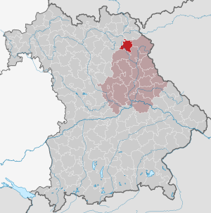
| Location of the district of Kemnath in Bavaria | ||
  |
||

The district of Kemnath belonged to the Bavarian administrative district of Upper Palatinate . Before the beginning of the regional reform in the early 1970s, the district comprised 36 communities, most of which came to the Tirschenreuth district .
geography
Important places
The most populous communities were Kemnath , Kulmain and Immenreuth .
Neighboring areas
In 1972 the district bordered clockwise to the north, starting with the districts of Wunsiedel , Tirschenreuth , Neustadt an der Waldnaab , Eschenbach in the Upper Palatinate and Bayreuth .
history
District Office
The district office of Kemnath was formed in 1862 through the merger of the district courts of the older order of Erbendorf and Kemnath .
On March 22, 1871, the Kemnath District Office ceded the Voithenthan community to the Tirschenreuth District Office.
On the occasion of the reform of the layout of the Bavarian district offices, the Kemnath district office ceded the municipalities to the Neustadt an der Waldnaab and Tirschenreuth district offices on January 1, 1880.
On January 1, 1931, other communities were ceded: Altenstadt b. Erbendorf, Bernstein , Burggrub , Erbendorf , Grötschenreuth , Hauxdorf, Krummennaab , Naabdemenreuth , Neuenreuth, Pfaben , Reuth bei Erbendorf , Röthenbach , Siegritz, Thumsenreuth , Trautenberg , Wetzldorf and Wildenreuth to the District Office Neustadt an der Waldnaab , Hohenhard , Friedenfels and Helnhöhe , Friedenfels and Poppenreuth to the Tirschenreuth district office.
district
On January 1, 1939, the uniform designation Landkreis was introduced in the German Reich . So the district office became the district of Kemnath.
In 1946 the community of Schadenreuth was incorporated into Erbendorf in the Neustadt an der Waldnaab district.
On July 1, 1972, the district of Kemnath was dissolved as part of the regional reform in Bavaria :
- The communities of Guttenthau, Heidenaab, Mehlmeisel , Plössen, Ramlesreuth, Speichersdorf and Wirbenz came to the Upper Franconian district of Bayreuth .
- The community of Mockersdorf came to the district of Neustadt an der Waldnaab .
- All other communities were added to the Tirschenreuth district.
On January 1, 1978, the municipality of Hessenreuth was incorporated into Pressath in the Neustadt an der Waldnaab district.
Population development
| year | Residents | source |
|---|---|---|
| 1864 | 24.202 | |
| 1885 | 23,577 | |
| 1900 | 22,673 | |
| 1910 | 23,757 | |
| 1925 | 24,297 | |
| 1939 | 16,558 | |
| 1950 | 23,175 | |
| 1960 | 21,000 | |
| 1971 | 23,000 |
Communities
Before the beginning of the Bavarian regional reform, the district comprised 36 municipalities in the 1960s:
Several poorly populated municipalities were incorporated on January 1, 1946:
- Berndorf , Eisersdorf and Fortschau to the city of Kemnath
- Dechantsees in the municipality of Pullenreuth
- Göppmannsbühl am Berg in the municipality of Haidenaab
- Höll and Haid to the community of Langentheilen
- Kaibitz and Reuth in the municipality of Löschwitz
- Oberbruck in the municipality of Kulmain
- Punreuth in the municipality of Ahornberg
- Wolframshof in the municipality of Kastl
- Zeulenreuth in the municipality of Speichersdorf
License Plate
On July 1, 1956, the district was assigned the distinctive sign KEM when the vehicle registration number that is still valid today was introduced . It was issued until August 3, 1974. Since July 10, 2013 it has been available again in the districts of Bayreuth and Tirschenreuth due to the license plate liberalization .
literature
- Günther U. Müller (Ed.): Our district of Kemnath. Publishing house Bild + Druck, Munich 1969.
- Heribert Sturm : Kemnath. Landrichteramt Waldeck-Kemnath with sub-office Pressath (= Historical Atlas of Bavaria. Part of Old Bavaria. Issue 40). Laßleben , Kallmünz 1975, ISBN 3-7696-9902-5 (reprint. Bodner, Pressath 1991, ISBN 3-926817-03-8 ).
Individual evidence
- ↑ Bavarian State Statistical Office (ed.): Official city directory for Bavaria, territorial status on October 1, 1964 with statistical information from the 1961 census . Issue 260 of the articles on Bavaria's statistics. Munich 1964, DNB 453660959 , Section II, Sp. 537 ( digitized version ).
- ^ Wilhelm Volkert (ed.): Handbook of Bavarian offices, communities and courts 1799–1980 . CH Beck, Munich 1983, ISBN 3-406-09669-7 , p. 494 .
- ↑ Bavarian State Statistical Office (Hrsg.): Historical municipality register: The population of the municipalities of Bavaria in the period from 1840 to 1952 (= contributions to Statistics Bavaria . Issue 192). Munich 1954, DNB 451478568 , p. 109–110, 115, 116, 126, 127 , urn : nbn: de: bvb: 12-bsb00066439-3 ( digital copy ).
- ^ Wilhelm Volkert (ed.): Handbook of Bavarian offices, communities and courts 1799–1980 . CH Beck, Munich 1983, ISBN 3-406-09669-7 , p. 97 .
- ^ Federal Statistical Office (ed.): Historical municipality directory for the Federal Republic of Germany. Name, border and key number changes in municipalities, counties and administrative districts from May 27, 1970 to December 31, 1982 . W. Kohlhammer, Stuttgart / Mainz 1983, ISBN 3-17-003263-1 , p. 646 .
- ^ Eugen Hartmann: Statistics of the Kingdom of Bavaria . Ed .: Royal Bavarian Statistical Bureau. Munich 1866, population figures of the district offices 1864 ( digitized version ).
- ↑ K. Bayer. Statistical Bureau (Ed.): Localities directory of the Kingdom of Bavaria. According to government districts, administrative districts, ... then with an alphabetical register of locations, including the property and the responsible administrative district for each location. LIV. Issue of the contributions to the statistics of the Kingdom of Bavaria. Munich 1888, Section II, p. VI ( digitized version ).
- ↑ a b www.gemeindeververzeichnis.de
- ^ Localities directory for the Free State of Bavaria, based on the census of June 16, 1925
- ↑ Statistical Yearbook for the German Reich 1940
- ↑ Statistical Yearbook for the Federal Republic of Germany 1952
- ↑ Statistical Yearbook for the Federal Republic of Germany 1961
- ↑ Statistical Yearbook for the Federal Republic of Germany 1973
- ^ Official register of places for Bavaria 1964
Aichach | Alzenau i.UFr. | Amberg | Bad Aibling | Bad Neustadt adSaale | Bad Toelz | Beilngries | Berchtesgaden | Bow | Brückenau | Burglengenfeld | Dingolfing | Dinkelsbühl | Donauwörth | Ebermannstadt | Boars | Eggenfelden | Erlangen | Eschenbach idOPf. | Feuchtwangen | Friedberg | Feet | Gemünden a.Main | Gerolzhofen | Grafenau | Griesbach i.Rottal | Gunzenhausen | Hammelburg | Hassfurt | Hersbruck | Hilpoltstein | Höchstadt adAisch | Hofheim i.UFr. | Illertissen | Ingolstadt | Karlstadt | Kaufbeuren | Kemnath | Kempten (Allgäu) | Königshofen i.Grabfeld | Kötzting | Krumbach (Swabia) | Landau adIsar | Lauf adPegnitz | Running | Lohr a.Main | Mainburg | Mallersdorf | Marktheidenfeld | Marktoberdorf | Mellrichstadt | Memmingen | Mindelheim | Münchberg | Nabburg | Naila | Neuburg adDonau | Neunburg vorm Wald | Neustadt adAisch | Nordlingen | Nuremberg | Obernburg am Main | Oberviechtach | Ochsenfurt | Parsberg | Pegnitz | Parish churches | Rehau | Riedenburg | Roding | Rothenburg ob der Tauber | Rottenburg adLaaber | Scheinfeld | Schongau | Schrobenhausen | Schwabach | Schwabmünchen | Sonthofen | Stadtsteinach | Staffelstein | Straubing | Sulzbach-Rosenberg | Uffenheim | Viechtach | Vilsbiburg | Vilshofen | Vohenstrauss | Waldmünchen | Wasserburg a.Inn | Wegscheid | Weilheim i.OB | Weißenburg i.Bay. | Wertingen | Wolfratshausen | Wolfstein
1939–1945 affiliated districts: Bergreichenstein | Eisenstein market | Prachatitz