
Riedenburg district
| coat of arms | Germany map | |
|---|---|---|

|
Coordinates: 48 ° 58 ' N , 11 ° 41' E |
|
| Basic data (as of 1972) | ||
| Existing period: | 1908-1972 | |
| State : | Bavaria | |
| Administrative region : | Upper Palatinate | |
| Administrative headquarters : | Riedenburg | |
| Area : | 337.9 km 2 | |
| Residents: | 18,198 (May 27, 1970) | |
| Population density : | 54 inhabitants per km 2 | |
| License plate : | RID | |
| Circle key : | 09 3 44 | |
| Circle structure: | 46 municipalities | |
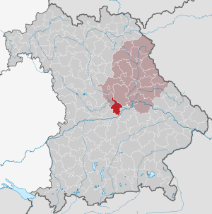
| Location of the Riedenburg district in Bavaria | ||
  |
||

The district of Riedenburg belonged to the Bavarian administrative district of Upper Palatinate . The former area of the district is now part of the Eichstätt district in Upper Bavaria , the Kelheim district in Lower Bavaria and the Neumarkt district in Upper Palatinate
geography
Important places
The most populous places were the district town of Riedenburg , the city of Dietfurt as well as Altmannstein and Mindelstetten .
Neighboring areas
In 1972 the district bordered clockwise in the northeast on the districts of Parsberg , Kelheim , Ingolstadt , Eichstätt and Beilngries .
history
Before 1908
The Riedenburg Regional Court, created in 1803, existed until 1862. From 1862 to 1879 the area belonged to the Hemau District Office , then to the Beilngries District Office .
District Office
In 1908, the Riedenburg District Office was formed from 53 communities from the Beilngries district office .
district
On January 1, 1939, the uniform imperial designation Landkreis was introduced. The district office of Riedenburg became the district office. The last district administrator was Franz Lang from 1952 to 1972 († December 12, 2017).
When the district was dissolved in 1972, there were still 46 parishes.
On July 1, 1972, the Riedenburg district was dissolved:
- The communities Altmannstein , Berghausen , Bettbrunn , Forchheim, Hagenhill , Hexenagger , Hiendorf , Hüttenhausen , Laimerstadt , Lobsing , Mendorf , Mindelstetten , Neuenhinzenhausen , Pondorf , Sandersdorf , Schafshill , Schamhaupten , Steinsdorf , Tettenwang , Winden and Wolfsbuch came to the district of Eichernstätt in Oberbayernstätt.
- the town of Riedenburg and the communities of Baiersdorf, Buch, Eggersberg, Hattenhausen, Jachenhausen, Meihern, Otterzhofen, Perletzhofen, Prunn, Schaitdorf and Thann came to the Kelheim district in Lower Bavaria.
- The city of Dietfurt an der Altmühl and the communities of Eutenhofen , Gimpertshausen , Griesstetten , Hainsberg, Mallerstetten , Mühlbach , Premerzhofen, Staadorf, Unterbürg, Wildenstein and Zell came to the Neumarkt district in the Upper Palatinate.
Population development
| year | Residents | source |
|---|---|---|
| 1910 | 15,609 | |
| 1925 | 15,532 | |
| 1939 | 14,906 | |
| 1950 | 20,632 | |
| 1960 | 16,700 | |
| 1971 | 18,300 |
Communities
Before the start of the Bavarian regional reform, the Riedenburg district comprised 46 communities in the 1960s:
The following municipalities lost their independence between 1928 and 1949:
| former parish | Incorporation after | Date of incorporation |
today's parish | today's district |
|---|---|---|---|---|
| Breitenhill | Winches | April 1, 1949 | Altmannstein | District of Eichstätt |
| Deising | Flour | January 1, 1946 | Riedenburg | District of Kelheim |
| Echendorf | book | April 1, 1949 | Riedenburg | District of Kelheim |
| Offendorf | Huettenhausen | 1939 | Mindelstetten | District of Eichstätt |
| Predlfing | Eutenhofen | 1938 | Dietfurt ad Altmühl | District of Neumarkt in the Upper Palatinate |
| Schwabstetten | Schwabstetten itself to Hagenhill , parts of the community to Mindelstetten |
June 1, 1928 |
Altmannstein , Mindelstetten |
District of Eichstätt |
| Sollern | Neuenhinzenhausen , Mendorf | April 1, 1929 | Altmannstein | District of Eichstätt |
License Plate
On July 1, 1956, the district was assigned the distinguishing sign RID when the vehicle registration number that is still valid today was introduced . It was issued until April 30, 1973. Since July 10, 2013 it has been available again in the Kelheim district due to the license plate liberalization .
Individual evidence
- ↑ a b Wilhelm Volkert , Richard Bauer (Ed.): Handbook of the Bavarian offices, communities and courts. 1799-1980. CH Beck, Munich 1983, ISBN 3-406-09669-7 , p. 557.
- ↑ Page about the Riedenburg district on gemeindeververzeichnis.de (accessed on November 8, 2010)
- ^ Wilhelm Volkert (ed.): Handbook of Bavarian offices, communities and courts 1799–1980 . CH Beck, Munich 1983, ISBN 3-406-09669-7 , p. 97 .
- ↑ Eichstätter Kurier of December 13, 2017, p. 29
- ^ Ordinance on the reorganization of Bavaria into rural districts and independent cities of December 27, 1971
- ↑ www.gemeindeververzeichnis.de
- ^ Localities directory for the Free State of Bavaria, based on the census of June 16, 1925
- ↑ Statistical Yearbook for the German Reich 1940
- ↑ Statistical Yearbook for the Federal Republic of Germany 1952
- ↑ Statistical Yearbook for the Federal Republic of Germany 1961
- ↑ Statistical Yearbook for the Federal Republic of Germany 1973
- ^ Official register of places for Bavaria 1964
Aichach | Alzenau i.UFr. | Amberg | Bad Aibling | Bad Neustadt adSaale | Bad Toelz | Beilngries | Berchtesgaden | Bow | Brückenau | Burglengenfeld | Dingolfing | Dinkelsbühl | Donauwörth | Ebermannstadt | Boars | Eggenfelden | Erlangen | Eschenbach idOPf. | Feuchtwangen | Friedberg | Feet | Gemünden a.Main | Gerolzhofen | Grafenau | Griesbach i.Rottal | Gunzenhausen | Hammelburg | Hassfurt | Hersbruck | Hilpoltstein | Höchstadt adAisch | Hofheim i.UFr. | Illertissen | Ingolstadt | Karlstadt | Kaufbeuren | Kemnath | Kempten (Allgäu) | Königshofen i.Grabfeld | Kötzting | Krumbach (Swabia) | Landau adIsar | Lauf adPegnitz | Running | Lohr a.Main | Mainburg | Mallersdorf | Marktheidenfeld | Marktoberdorf | Mellrichstadt | Memmingen | Mindelheim | Münchberg | Nabburg | Naila | Neuburg adDonau | Neunburg vorm Wald | Neustadt adAisch | Nordlingen | Nuremberg | Obernburg am Main | Oberviechtach | Ochsenfurt | Parsberg | Pegnitz | Parish churches | Rehau | Riedenburg | Roding | Rothenburg ob der Tauber | Rottenburg adLaaber | Scheinfeld | Schongau | Schrobenhausen | Schwabach | Schwabmünchen | Sonthofen | Stadtsteinach | Staffelstein | Straubing | Sulzbach-Rosenberg | Uffenheim | Viechtach | Vilsbiburg | Vilshofen | Vohenstrauss | Waldmünchen | Wasserburg a.Inn | Wegscheid | Weilheim i.OB | Weißenburg i.Bay. | Wertingen | Wolfratshausen | Wolfstein
1939–1945 affiliated districts: Bergreichenstein | Eisenstein market | Prachatitz