
District of Kelheim
| coat of arms | Germany map |
|---|---|

|

Coordinates: 48 ° 49 ' N , 11 ° 52' E |
| Basic data | |
| State : | Bavaria |
| Administrative region : | Lower Bavaria |
| Administrative headquarters : | Kelheim |
| Area : | 1,065.97 km 2 |
| Residents: | 123,058 (Dec. 31, 2019) |
| Population density : | 115 inhabitants per km 2 |
| License plate : | KEH, MAY , PAR , RID, ROL |
| Circle key : | 09 2 73 |
| NUTS : | DE226 |
| Circle structure: | 24 municipalities |
| Address of the district administration: |
Donaupark 12 93309 Kelheim |
| Website : | |
| District Administrator : | Martin Neumeyer ( CSU ) |
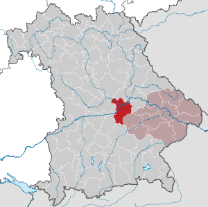
| Location of the Kelheim district in Bavaria | |
  |
|

The district of Kelheim is the westernmost district of the Bavarian administrative district of Lower Bavaria .
geography
location
The Kelheim district is traversed by the Danube from southwest to northeast . She divides it into two different sized parts. The smaller northern part, to the left of the Danube, is called the Altmühlalb , named after the Altmühl , which reaches the district in the northwest and then flows in a southeastern direction to flow into the Danube at Kelheim. The Altmühl is canalised throughout the district and is thus part of the Main-Danube Canal , via which the ships can enter the Danube at Kelheim. The southern part of the district, to the right of the Danube, is the hilly landscape of the Hallertau , which is mainly used for agriculture.
Neighboring areas
Neighboring districts are the district of Regensburg in the north and east , the district of Landshut in the south-east, the district of Freising in the south, the districts of Pfaffenhofen an der Ilm and Eichstätt in the west and the district of Neumarkt in the Upper Palatinate in the northwest .
Belonging to planning regions
The district of Kelheim is, besides the district of Tirschenreuth, the only district in Bavaria that has a regional border . Most of it belongs to the Regensburg planning region , only the Mainburg middle center in the south of the district with the five communities Aiglsbach , Attenhofen , Elsendorf , Mainburg and Volkenschwand belongs to the Landshut planning region .
history
Regional courts
In 1803, the Abensberg , Kelheim and Riedenburg regional courts were formed in what is now the Kelheim district . The first two belonged to the Regenkreis , the Riedenburg District Court initially to the Altmühlkreis , and from 1810 also to the Regenkreis. In 1838 the regional courts of Abensberg and Kelheim came to Lower Bavaria , which until then was called the Lower Danube District . Riedenburg remained with the Regenkreis, which was then referred to as Upper Palatinate . In 1854 the Kelheim district court handed some communities over to the Stadtamhof and Regensburg (both Upper Palatinate) courts . In 1857, 17 municipalities of the Abensberg regional court and some municipalities of the neighboring Moosburg and Pfaffenhofen regional courts formed a separate Mainburg regional court .
District Offices
This district court Mainburg formed in 1862 with the district court Rottenburg an der Laaber established in 1838 the district office Rottenburg an der Laaber. The district court of Riedenburg came to the Hemau district. The two regional courts Abensberg and Kelheim henceforth formed the Kelheim District Office. In 1879 the area around Riedenburg was assigned to the Beilngries district office. In 1901 the area around Mainburg was detached from the Rottenburg an der Laaber district office and its own Mainburg district office was established. In 1908 a separate district office was formed in Riedenburg.
On April 1, 1927, the Kelheim district office handed over the municipalities of Laaberberg , Obereulenbach and Rohr in Lower Bavaria to the Rottenburg an der Laaber district office.
Counties
On January 1, 1939, the designation district was introduced as everywhere else in the German Reich . The district offices became the districts of Kelheim, Mainburg , Riedenburg and Rottenburg an der Laaber .
District of Kelheim
As part of the Bavarian district reform , today's Kelheim district was formed on July 1, 1972. Joined the old Kelheim district
- the city of Mainburg and the communities of Aiglsbach , Appersdorf , Attenhofen , Berghausen , Ebrantshausen , Großgundertshausen , Holzmannshausen, Leibersdorf , Lindkirchen , Meilenhofen , Mitterstetten, Oberempfenbach, Oberpindhart , Oberwangenbach, Pötzmes , Ratzenhofen , Sandelzhausen , Steinbach , Volkenschwand and Walkertshofen from the Mainburg district
- the communities Neulohe and Painten from the dissolved district of Parsberg
- the city of Riedenburg and the communities of Baiersdorf , Buch, Eggersberg, Hattenhausen, Jachenhausen, Meihern , Otterzhofen, Perletzhofen, Prunn , Schaitdorf and Thann from the dissolved Riedenburg district
- the municipalities of Adlhausen , Herrngiersdorf , Laaberberg , Langquaid , Leitenhausen , Niederleierndorf , Obereulenbach , Oberleierndorf , Paring , Rohr in Niederbayern, Sandsbach , Semerskirchen , Sittelsdorf and Wildenberg from the dissolved district of Rottenburg an der Laaber.
The Kelheim district in turn gave the Bergmatting community to the Regensburg district.
Population development
The Kelheim district gained almost 22,000 inhabitants between 1988 and 2008 or grew by around 24%. He benefited from the proximity to the growth regions of Ingolstadt and Regensburg. In the period from 1988 to 2018, the population increased from 91,274 to 122,258 by 30,984 inhabitants or 34%.
The population figures from 1840 onwards refer to the territorial status on May 25, 1987.
| year | 1840 | 1871 | 1900 | 1925 | 1939 | 1950 | 1961 | 1970 | 1987 | 1991 | 1995 | 2000 | 2005 | 2010 | 2015 |
| population | 40,961 | 48,563 | 53,522 | 58,474 | 61,456 | 87,187 | 79,373 | 85,370 | 90.040 | 96,999 | 104.063 | 109,510 | 113.237 | 113.147 | 118.965 |
politics
District administrators
- January 1, 1939–1945: Friedrich Abert
- May 14, 1945–1946: Franz Klenner
- June 6, 1946–1958: Ludwig Berger ( CSU )
- May 1, 1958–1966: Josef Bauer (CWG)
- March 8, 1967–1978: Rudolf Faltermeier ( SPD )
- May 1, 1978–1986: Ludwig Kreitmeyr (CSU)
- December 17, 1986–1992: Manfred Kreitczick (CSU)
- November 1, 1992–2016: Hubert Faltermeier ( FW )
- since November 1, 2016: Martin Neumeyer (CSU)
District council
The district council consists of 60 members with the following distribution of seats ( as of March 2014 ):
| Party / list | Seats |
|---|---|
| CSU | 21st |
| FW | 10 |
| SPD | 9 |
| Urban-rural union | 5 |
| GREEN | 4th |
| ÖDP | 4th |
| Boy list | 3 |
| FDP | 2 |
| BP | 2 |
| total | 60 |
badges and flags
|
|
Blazon : “Splitunder the shield head with the Bavarian diamonds ; divided in front by silver and blue with three, two to one, heraldic roses in mixed up colors; at the back diagonally divided by silver and black. " |
| Reasons for the coat of arms: The elements come from the family coat of arms of the Wittelsbach family , the lords of Sittling , von Stein and Wöhr , von Riedenburg and von Abensberg . |
A white and blue flag with the county coat of arms is used as the unofficial county flag ; the blue-white-blue flag adopted in 1975 and approved by the government of Lower Bavaria is not used.
Economy and Infrastructure
In the Future Atlas 2016 , the Kelheim district was ranked 100th out of 402 districts, municipal associations and independent cities in Germany, making it one of the regions with “future opportunities”.
traffic
Road traffic
The A 93 (Munich-Regensburg) runs through the district from southwest to northeast . At Saalhaupt, a motorway-like main road branches off with the B 15n , which in the final stage will lead via Landshut to Rosenheim. The following federal highways cross the district: B 16 in the south-west-north-east direction and almost parallel to the A 93, B 299 in the north-west-south-east direction and B 301 coming from the south.
The Munich airport is 25 kilometers as the crow flies from the county border. The Kelheim / Saal inland port is located in Kelheim.
Rail transport
In 1874 the Bavarian State Railways opened the Regensburg – Ingolstadt railway line following the Danube Valley , from which a branch line branched off from 1875 in Saal to the district town of Kelheim .
The following local railway lines led into the district from the neighborhood:
- 1895: Wolnzach Bahnhof – Enzelhausen – Mainburg
- 1903: Eggmühl – Langquaid
- 1904: Ingolstadt Nord – Riedenburg
All these local railways and the branch line to Kelheim have been closed for passenger traffic, so that of the original 79 kilometers of rail, only 40 kilometers are now used by passenger trains. However, some of the branch lines are still used for freight traffic today (2006).
- 1968: Eggmühl – Niederleierndorf – Langquaid (6 km), only freight traffic
- 1969: Wolnzach Bahnhof – Puttenhausen – Mainburg (23 km), freight traffic on a section
- 1972: Ingolstadt Nord – Schambach – Riedenburg (4 km), dismantled
- 1988: Saal – Kelheim (6 km)
The numbers in brackets refer to the length of the route in the district.
Communities
(Residents on December 31, 2019)
Other communities
Unregulated areas (79.24 km²)
|
  |
Municipalities of the Altlandkreis
Before the beginning of the Bavarian regional reform, the Kelheim district comprised 56 communities in the 1960s:
|
|
Several municipalities had already lost their independence by 1946 and had been incorporated:
- Affecking , on October 1, 1937 in Kelheim
- Altessing , 1938 to Essing
- Aunkofen , in Abensberg on April 1, 1939
- Gronsdorf , on January 1, 1946 in Kelheim
- Grub , joined Schneidhart before 1928
- Klosterrohr , to Rohr on January 1st, 1910
- Walls , on January 1st, 1946 in Neustadt
- Neuessing , 1938 to Essing
- Neukelheim , on January 1, 1935 in Ihrlerstein
- Peterfecking , to Mitterfecking
- Randeck , 1924 to Altessing
- Schambach , 1938 to Einmuß
- Staudach , on January 1, 1946 in Siegenburg
- Tollbach , in Siegenburg on January 1, 1946
- Walddorf , on January 1, 1935 in Ihrlerstein
Protected areas
The district has 13 nature reserves , nine landscape protection areas , 17 FFH areas and at least 48 geotopes designated by the Bavarian State Office for the Environment (as of February 2017).
See also
- List of nature reserves in the Kelheim district
- List of landscape protection areas in the Kelheim district
- List of FFH areas in the Kelheim district
- List of geotopes in the Kelheim district
License Plate
On July 1, 1956, the district was assigned the distinctive sign KEH when the vehicle registration number that is still valid today was introduced . It is still issued today. Since July 10, 2013, the license plate liberalization has also made the distinctive signs MAI (Mainburg), PAR (Parsberg), RID (Riedenburg) and ROL (Rottenburg an der Laaber) available.
Individual evidence
- ↑ "Data 2" sheet, Statistical Report A1200C 202041 Population of the municipalities, districts and administrative districts 1st quarter 2020 (population based on the 2011 census) ( help ).
- ^ Wilhelm Volkert (ed.): Handbook of Bavarian offices, communities and courts 1799–1980 . CH Beck, Munich 1983, ISBN 3-406-09669-7 , p. 493 .
- ^ Wilhelm Volkert (ed.): Handbook of Bavarian offices, communities and courts 1799–1980 . CH Beck, Munich 1983, ISBN 3-406-09669-7 , p. 97 .
- ^ Ordinance on the reorganization of Bavaria into rural districts and independent cities of December 27, 1971
- ↑ Statistics for the district , accessed on January 7, 2011
- ↑ Entry on the coat of arms of the district of Kelheim in the database of the House of Bavarian History , accessed on September 5, 2017 .
- ↑ Entry on the district of Kelheim on the website kommunalflaggen.eu
- ↑ Future Atlas 2016. (No longer available online.) Archived from the original on October 2, 2017 ; accessed on March 23, 2018 . Info: The archive link was inserted automatically and has not yet been checked. Please check the original and archive link according to the instructions and then remove this notice.
- ↑ "Data 2" sheet, Statistical Report A1200C 202041 Population of the municipalities, districts and administrative districts 1st quarter 2020 (population based on the 2011 census) ( help ).
- ^ Official register of places for Bavaria 1964
Web links
- Web presence of the district of Kelheim
- Literature from and about the district of Kelheim in the catalog of the German National Library
- Entry on the coat of arms of the district of Kelheim in the database of the House of Bavarian History
Districts:
Aichach-Friedberg |
Altötting |
Amberg-Sulzbach |
Ansbach |
Aschaffenburg |
Augsburg |
Bad Kissingen |
Bad Toelz-Wolfratshausen |
Bamberg |
Bayreuth |
Berchtesgadener Land |
Cham |
Coburg |
Dachau |
Deggendorf |
Dillingen on the Danube |
Dingolfing-Landau |
Danube Ries |
Ebersberg |
Eichstätt |
Erding |
Erlangen-Höchstadt |
Forchheim |
Freising |
Freyung-Grafenau |
Fürstenfeldbruck |
Fürth |
Garmisch-Partenkirchen |
Gunzburg |
Hatred Mountains |
Yard |
Kelheim |
Kitzingen |
Kronach |
Kulmbach |
Landsberg am Lech |
Landshut |
Lichtenfels |
Lindau (Lake Constance) |
Main-Spessart |
Miesbach |
Miltenberg |
Mühldorf am Inn |
Munich |
Neuburg-Schrobenhausen |
Neumarkt in the Upper Palatinate |
Neustadt an der Aisch-Bad Windsheim |
Neustadt an der Waldnaab |
Neu-Ulm |
Nuremberg Country |
Oberallgäu |
Ostallgäu |
Passau |
Pfaffenhofen an der Ilm |
Rain |
Regensburg |
Rhön-Grabfeld |
Rosenheim |
Roth |
Rottal-Inn |
Schwandorf |
Schweinfurt |
Starnberg |
Straubing Arch |
Tirschenreuth |
Traunstein |
Unterallgäu |
Weilheim-Schongau |
Weißenburg-Gunzenhausen |
Wunsiedel in the Fichtel Mountains |
Wurzburg
Independent cities:
Amberg |
Ansbach |
Aschaffenburg |
Augsburg |
Bamberg |
Bayreuth |
Coburg |
Erlangen |
Fürth |
Hof (Saale) |
Ingolstadt |
Kaufbeuren |
Kempten (Allgäu) |
Landshut |
Memmingen |
Munich |
Nuremberg |
Passau |
Regensburg |
Rosenheim |
Schwabach |
Schweinfurt |
Straubing |
Willows in the Upper Palatinate |
Wurzburg