District of Ostallgäu
| coat of arms | Germany map |
|---|---|

|

Coordinates: 47 ° 46 ' N , 10 ° 38' E |
| Basic data | |
| State : | Bavaria |
| Administrative region : | Swabia |
| Administrative headquarters : | Marktoberdorf |
| Area : | 1,394.91 km 2 |
| Residents: | 141,182 (Dec 31, 2019) |
| Population density : | 101 inhabitants per km 2 |
| License plate : | OAL, FÜS, MOD |
| Circle key : | 09 7 77 |
| NUTS : | DE27B |
| Circle structure: | 45 parishes |
| Address of the district administration: |
Schwabenstrasse 11 87616 Marktoberdorf |
| Website : | |
| District Administrator : | Maria Rita Zinnecker ( CSU ) |
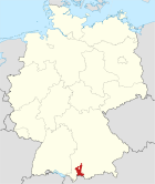
| Location of the Ostallgäu district in Bavaria | |
The Ostallgäu district is located in the southeast of the Bavarian administrative district of Swabia . The independent city of Kaufbeuren is completely surrounded by the Ostallgäu district.
geography
location
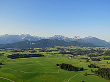
The area of the Ostallgäu district includes the Alps and their foreland in the south. The Swabian-Bavarian plateau joins in the north. This is the lowest point in the district near Lamerdingen at 578 m. The alpine area stretches up to the Hochplatte ( 2082 m ) in the Ammergau Alps . The foothills of the Alps have a number of ponds and lakes at an altitude of around 800 m, of which the Forggensee , a reservoir through which the Lech flows, is the largest with around 16 km². The Lech flows through the southeastern district area. In the middle, the Wertach , a left tributary of the Lech, which flows into Augsburg , runs through the Ostallgäu district from south to north. In the far west, the western and eastern Günz and Mindel , which flow into the Danube near Günzburg, arise on the elongated Riedel plateaus .
Neighboring areas
The district borders clockwise to the west, beginning with the districts of Oberallgäu , Unterallgäu , Augsburg , Landsberg am Lech , Weilheim-Schongau and Garmisch-Partenkirchen . In the south it borders on the Reutte district in the Austrian state of Tyrol .
history
Regional courts
Until 1803, large parts of the Ostallgäu belonged to the Augsburg bishopric . After the area fell to Bavaria, the regional courts of Buchloe , Füssen , Kaufbeuren , Oberdorf and Obergünzburg were established in 1804 . In 1809 Kaufbeuren became a city in the immediate vicinity of a district. Like the regional courts, this initially belonged to the Illerkreis , from 1817 to the Oberdonaukreis , which was renamed Swabia and Neuburg in 1838 (later just Swabia ).
District Offices
In 1862 the district courts of Kaufbeuren and Buchloe were combined to form the district office of Kaufbeuren and the district courts of Oberdorf and Obergünzburg to form the district office of Oberdorf (later Marktoberdorf), and the district office of the same name emerged from the district court of Füssen.
Counties
On January 1, 1939, the designation district was introduced as everywhere else in the German Reich . The district offices became the districts of Füssen, Kaufbeuren and Marktoberdorf.
District of Ostallgäu
As part of the regional reform in Bavaria , a new district of Marktoberdorf was formed on July 1, 1972 from the following components :
- All communities of the old district Marktoberdorf except the municipality Ingenried that the Weilheim-Schongau in the district of Upper Bavaria came
- All communities in the district of Füssen
- All municipalities in the Kaufbeuren district with the exception of the Hirschzell and Oberbeuren municipalities , which were incorporated into the independent city of Kaufbeuren, the Asch , Denklingen , Dienhausen , Ellighofen , Leeder , Oberdießen , Seestall and Unterdießen municipalities , which came to the Landsberg am Lech district in Upper Bavaria and the community of Schlingen , which came to the district of Unterallgäu .
The new district was renamed the Ostallgäu district on May 1, 1973 . Marktoberdorf remained the seat of the district administration and thus the district capital.
Population development
The Ostallgäu district, newly established in 1972, gained over 28,000 inhabitants by 2005 (= 26.6%). From 1988 to 2008 it grew by over 18,000 inhabitants or around 16%. From 2006 the number of inhabitants decreased slightly; it stagnated at around 134,000 between 2008 and 2013. Since then it has risen again significantly to over 140,000 inhabitants. Between 1988 and 2018 the district grew from 115,954 to 140,316 by 24,362 inhabitants or 21% (corresponds to the Swabian average in the period mentioned). After the Garmisch-Partenkirchen district, the Ostallgäu district is the most sparsely populated district in southern Bavaria. A third of the district population lives in the three cities of Buchloe (9%), Füssen (11%) and Marktoberdorf (13%), two thirds in the 42 rural communities. The proportion of foreigners is 5.1%.
The following figures refer to the territorial status on May 25, 1987.
| Population development | |||||||||||||||||
|---|---|---|---|---|---|---|---|---|---|---|---|---|---|---|---|---|---|
| year | 1840 | 1900 | 1939 | 1950 | 1961 | 1970 | 1972 | 1979 | 1987 | 1990 | 1995 | 2000 | 2005 | 2010 | 2015 | ||
| Residents | 47,366 | 59,033 | 68.901 | 107.029 | 99.038 | 105,135 | 106.414 | 109,542 | 114,547 | 121,743 | 127.068 | 131,546 | 134,766 | 133,881 | 137,709 | ||
politics
District council
The local elections in 2008 , 2014 and 2020 led to the following allocation of seats in the district council :
| Party / list | 2008 | 2014 | 2020 |
|---|---|---|---|
| CSU | 26th | 26th | 24 |
| Free voters Ostallgäu | 15th | 11 | 11 |
| SPD | 6th | 7th | 4th |
| GREEN | 6th | 7th | 11 |
| BP | 2 | 4th | 2 |
| FDP | 2 | 1 | 1 |
| Young Ostallgäu | 2 | 2 | 2 |
| ÖDP | 1 | 2 | 2 |
| AfD | - | - | 3 |
| total | 60 | 60 | 60 |
coat of arms
| Blazon : "Under a blue shield head, inside a striding, golden crowned and golden armored silver lion, split from red and silver, in front a fallen silver sword, behind a growing red abbot's staff." | |
|
Justification of the coat of arms: The coat of arms should symbolize the emergence of the new regional authority; so there are symbols of the coat of arms of the earlier districts of Kaufbeuren, Marktoberdorf and Füssen.
The silver lion of the former Benedictine Abbey of Irsee and the Margrave of Ronsberg stands for the district of Kaufbeuren . The Martinsschwert comes from the former district coat of arms of Marktoberdorf and refers to the seat of the administration of the Ostallgäu district. Saint Martin of Tours is the local and church patron of Marktoberdorf. The abbot stands for Füssen, it refers to the former Benedictine monastery of St. Mang , the former rule of the Hochstift Augsburg , which was mainly represented around Buchloe and Füssen, is represented by the field colors red and silver. |
Finances
The district budget for 2018 amounts to € 139.6 million (including € 35.1 million for social issues, € 20.8 million for education, € 5.5 million for roads). The per capita debt in 2018 was € 216.
Economy and Infrastructure
According to the magazine Focus Money 2014, the district ranks 8th among 387 examined districts and cities in Germany in terms of economic strength. In the “Future Atlas ” by Prognos , the Ostallgäu is among the top 20% of 402 districts and urban districts.
Important companies in the district are the automobile manufacturer Alpina Burkard Bovensiepen GmbH + Co. KG and the Karwendel-Werke in Buchloe, as well as the tractor manufacturer AGCO Fendt in Marktoberdorf, a branch of Nestlé SA in Biessenhofen, the Otto Bihler Maschinenfabrik GmbH & Co KG in halch and Füssen and the company Deckel Maho in Pfronten.
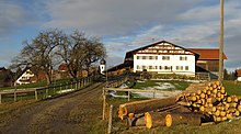
While tourism (“ Königswinkel ”) plays a major role in the southern district , the center and north are characterized by numerous medium-sized businesses and even more agriculture ( dairy farming ).
Unemployment is traditionally low (October 2018: 1.9%).
Communities
The Ostallgäu district has 45 municipalities, including 3 cities and 7 markets.
(Residents on December 31, 2019)
Other communities
|
|
traffic
Road traffic
The district of Ostallgäu is connected to the German motorway network via the federal highway 7 , which has been extended in several construction phases through the district to Füssen since 1992. The federal highway 96 also crosses the district in the north near Buchloe. Other main traffic arteries are the federal highway 12 and the federal highway 16 . Other federal highways are federal road 17 and federal road 310 in the southern district. The federal road 472 , which leads from Irschenberg via Miesbach, Bad Tölz and Schongau into the Allgäu, also ends in Marktoberdorf . The former federal road 309 from Kempten to the federal border near Pfronten was downgraded to state road 2520 on January 1, 2016 .
Rail transport
As early as 1847 the Ludwigs-Süd-Nord-Bahn ran its route from Augsburg south to Kaufbeuren and in 1852 on to Kempten. The east-west line of the Bavarian State Railway from Munich to Memmingen was added in 1872/74 and made Buchloe an important junction.
A branch line to the district town of Marktoberdorf has been branching from the south-north railway in Biessenhofen since 1876 , which continued to Lechbruck in 1899 . Another branch line into the foothills of the Alps, from Marktoberdorf on to Füssen, had already been put into operation in 1889 by the local railway company Munich.
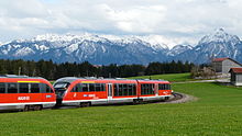
In the extreme south of the district is the Ausserfernbahn Kempten – Reutte of the Bavarian State Railway, which reached Pfronten-Ried in 1895 and was led across the border into Tyrol in 1905. In 1913 this connection was extended to Garmisch-Partenkirchen in Upper Bavaria .
A connection between the terminus in Füssen and the Ulrichsbrücke-Füssen stop just four kilometers away on the Ausserfernbahn has been planned over and over again, but never built.
A final addition to the rail network was made in 1922/23 by the Deutsche Reichsbahn, the Kaufbeuren – Schongau connection . This line was closed again in 1972, while the Marktoberdorf – Lechbruck line had disappeared from the timetable as early as 1963. The network, which had covered a maximum of 153 km, had been reduced by almost a third to still 111 km.
Today a popular cycle path, the 80 km long “ steam locomotive circuit ”, runs on the former railway lines Marktoberdorf – Lechbruck and Kaufbeuren – Schongau .
Architectural monuments
See architectural monuments in the Ostallgäu district

dialect
The district is located on the south-eastern edge of the Alemannic- speaking area. The south- east Swabian or Ostallgäu dialect in the middle and south is characterized by the fact that mhd. Ou has developed into closed oo (e.g. glooba - believe - or Oog - eye). Within the district, clear differences can be heard from north to south and from north-west to south-east.
Protected areas
Nature and landscape protection areas
There are 6 nature reserves and 18 landscape protection areas in the district .
Geotopes
In the district there are 43 (September 2013) from the Bavarian State Office for Environment reported geotopes .
License Plate
The MOD , which was introduced on July 1, 1956 for the Marktoberdorf district , was to act as the official distinguishing mark of this new district . The license plate of the district of Füssen ( FÜS ) remained valid for a few years after the dissolution of this district on July 1, 1972, particularly because of violent protests. Only since August 1, 1979 has the OAL license plate, introduced on February 12, 1979, been fully valid for the entire district .
Since July 10, 2013, the distinctive signs FÜS and MOD are available again in the Ostallgäu district.
See also
Web links
- Entry on the coat of arms of the Ostallgäu district in the database of the House of Bavarian History
- Link catalog on the topic of Ostallgäu at curlie.org (formerly DMOZ )
- Literature from and about the Ostallgäu district in the catalog of the German National Library
- District Ostallgäu: Official statistics of the LfStat
Individual evidence
- ↑ a b sheet "Data 2", Statistical Report A1200C 202041 Population of the municipalities, districts and administrative districts 1st quarter 2020 (population based on the 2011 census) ( help ).
- ^ Wilhelm Volkert (ed.): Handbook of Bavarian offices, communities and courts 1799–1980 . CH Beck, Munich 1983, ISBN 3-406-09669-7 , p. 97 .
- ^ Ordinance on the reorganization of Bavaria into rural districts and independent cities of December 27, 1971
- ↑ Election page of the district ( page no longer available , search in web archives ) Info: The link was automatically marked as defective. Please check the link according to the instructions and then remove this notice.
- ↑ Entry on the coat of arms of the Ostallgäu district in the database of the House of Bavarian History , accessed on September 5, 2017 .


