
Lengenwang
| coat of arms | Germany map | |
|---|---|---|

|
Coordinates: 47 ° 42 ' N , 10 ° 36' E |
|
| Basic data | ||
| State : | Bavaria | |
| Administrative region : | Swabia | |
| County : | Ostallgäu | |
| Management Community : | Seeg | |
| Height : | 807 m above sea level NHN | |
| Area : | 19.62 km 2 | |
| Residents: | 1490 (Dec. 31, 2019) | |
| Population density : | 76 inhabitants per km 2 | |
| Postal code : | 87663 | |
| Area code : | 08364 | |
| License plate : | OAL, FÜS, MOD | |
| Community key : | 09 7 77 149 | |
| Community structure: | 15 parts of the community | |
| Address of the municipal administration: |
Bahnhofstrasse 8 87663 Lengenwang |
|
| Website : | ||
| Mayor : | Josef Keller ( Free Association of Voters ) | |
| Location of the municipality of Lengenwang in the Ostallgäu district | ||
  |
||


Lengenwang is a municipality in the Swabian district of Ostallgäu . She is a member of the Seeg administrative association .
geography
Lengenwang is located in the Allgäu region at an altitude of between 768 (Lobach) and 865 m above sea level (at Pflaubauten). There is only the Lengenwang district . The municipality has 15 officially named parts of the municipality (the type of settlement is given in brackets ):
|
|
Bethlehem has only been an officially named part of the community since February 8, 2001, before that it was part of Ried.
history
Until the church is planted
The first mention of the late medieval clearing settlement dates from 1386 as "Lengewank". The place belonged to the barons of Freyberg and the Hochstift Augsburg . The rights of the various legal entities were very mixed and fell to Bavaria at different times: 1803 from the Hochstift, 1805 from Austria (for Hohenfreyberg ), 1806 from the Freiherren von Freyberg . In the course of the administrative reforms in the Kingdom of Bavaria , today's municipality was created with the municipal edict of 1818 .
District affiliation
Lengenwang belonged to the district of Füssen until 1879 , then to the district of Marktoberdorf until the regional reform in 1972 .
Population development
- 1970: 1131 inhabitants
- 1987: 1226 inhabitants
- 1991: 1296 inhabitants
- 1995: 1338 inhabitants
- 2000: 1330 inhabitants
- 2005: 1385 inhabitants
- 2010: 1366 inhabitants
- 2015: 1439 inhabitants
Lengenwang grew by 119 inhabitants or around ten percent from 1988 to 2008. Between 1988 and 2018 the municipality grew from 1246 to 1459 by 213 inhabitants or 17.1%.
politics
mayor
The office of 1st mayor has been held by Josef Keller since 2008. He replaced Lorenz Fischer (Free Voting Association).
coat of arms
The description of the coat of arms reads: Above a golden shield base, in it three two-to-one blue balls, in red a golden post, covered by an obliquely crossed silver hatchet and a silver feather.
Architectural monuments

Enisried

Lengenwang from above

Lengenwang from the south

Landscape near Lengenwang
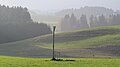
November mood at Lengenwang
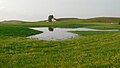
Lush meadows


Economy and Infrastructure
Economy including agriculture and forestry
In 1998 there were 58 in agriculture and forestry, 744 in manufacturing and 501 in trade and transport at the place of work. In other economic sectors 1040 people were employed at the place of work subject to social security contributions. There were 2,792 employees at the place of residence subject to social security contributions. There were three in manufacturing (as well as mining and quarrying of stones and earth) and 34 in the main construction trade. In 1999 there were also 133 farms with an agricultural area of 3414 hectares, of which 3406 hectares were permanent green space.
traffic

Lengenwang has a train station on the Biessenhofen – Füssen railway line . There are connections to Augsburg and Munich. The train crossing usually takes place in Lengenwang station.
education
In 2009, 46 children attended the local kindergarten (50 places). The elementary school had four teachers and 63 students.
Web links
- Entry on Lengenwang's coat of arms in the database of the House of Bavarian History
- Lengenwang: Official statistics of the LfStat (PDF; 1.05 MB)
Individual evidence
- ↑ "Data 2" sheet, Statistical Report A1200C 202041 Population of the municipalities, districts and administrative districts 1st quarter 2020 (population based on the 2011 census) ( help ).
- ^ Municipality of Lengenwang in the local database of the Bavarian State Library Online . Bavarian State Library, accessed on September 14, 2018.
Albisried | Aleuthen | Ausserlengenwang | Bethlehem | Bichels | Enisried | Frödenberg | Hennenschwang | Lengenwang | Luttenried | Plum tree | Reuthe | Ried | Sigratsbold | path

Aitrang | Baisweil | Bidingen | Biessenhofen | Buchloe | Eggenthal | Eisenberg | Friesenried | Feet | Germaringen | Görisried | Günzach | Halbch | Hopferau | Irsee | Jengen | Kaltental | Kraftisried | Lamerdingen | Lechbruck am See | Lengenwang | Marktoberdorf | Mauerstetten | Nesselwang | Obergünzburg | Oberostendorf | Osterzell | Pforzen | Pfronten | Rettenbach am Auerberg | Vineyards | Vineyards on the Forggensee | Ronsberg | Roßhaupten | Backwood | Ruderatshofen | Schwangau | Seeg | Stötten am Auerberg | Stöttwang | Unterthingau | Untrasried | Waal | Forest | Westendorf