
Hopferau
| coat of arms | Germany map | |
|---|---|---|

|
Coordinates: 47 ° 37 ' N , 10 ° 38' E |
|
| Basic data | ||
| State : | Bavaria | |
| Administrative region : | Swabia | |
| County : | Ostallgäu | |
| Management Community : | Seeg | |
| Height : | 811 m above sea level NHN | |
| Area : | 13.16 km 2 | |
| Residents: | 1205 (Dec. 31, 2019) | |
| Population density : | 92 inhabitants per km 2 | |
| Postal code : | 87659 | |
| Area code : | 08364 | |
| License plate : | OAL, FÜS, MOD | |
| Community key : | 09 7 77 135 | |
| Community structure: | 21 parts of the community | |
| Address of the municipal administration: |
Main street 8 87659 Hopferau |
|
| Website : | ||
| Mayor : | Rudi Achatz ( Free Association of Voters ) | |
| Location of the community of Hopferau in the Ostallgäu district | ||
  |
||


Hopferau is a municipality in the Swabian district of Ostallgäu . The place of the same name is both the capital and the seat of the municipal administration.
geography
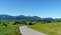
The community borders on the Hopfensee (west bank) and is about ten kilometers away from the city center of Füssen and Pfronten .
There is only the Hopferau district .
There are 21 officially named municipal parts (the type of settlement is given in brackets ):
|
|

Hopferau from above
Hopferau from the north

Homes

Ostallgäu farmhouse in Heimen

Wiedemen


history
Until the church is planted
Before 1800 Hopferau was the seat of an upper and lower court of the same name and belonged to the Barons Freyberg-Eisenberg zu Hopferau . With the Rhine Confederation Act 1806, the place came to the Kingdom of Bavaria . In the course of the administrative reforms in Bavaria, today's municipality was created with the municipal edict of 1818 .
Population development
- 1961: 699 inhabitants
- 1970: 724 inhabitants
- 1987: 972 inhabitants
- 1991: 1072 inhabitants
- 1995: 1078 inhabitants
- 2000: 1062 inhabitants
- 2005: 1074 inhabitants
- 2010: 1080 inhabitants
- 2015: 1126 inhabitants
Hopferau grew by 91 inhabitants or approx. 9% from 1988 to 2008. Between 1988 and 2018 the municipality grew from 999 to 1206 by 207 inhabitants or by 20.7%.
politics
The community is a member of the Seeg administrative community .
mayor
Rudolf Achatz (Free Association of Voters) has been First Mayor since March 17, 2019. The retired police officer received 51.7 percent of the vote. He replaced Gregor Bayrhof (CSU / non-partisan voter community / Free voter community), who headed the community for 29 years.
Municipal council
The municipal council consists of twelve municipal councils:
| FWG | CSU | Non-partisan voter community | total | |
| 2014 | 5 | 4th | 3 | 12 seats |
(As of: local elections on March 16, 2014)
coat of arms
|
|
Blazon : “Divided; Above under the silver shield head in blue three two-to-one set golden balls, below in gold a black, black-horned bull's head (grind) with a hanging red tongue. " |
Culture and sights


- Lehern dairy
- A show dairy can be visited in the district of Lehern . In the "Information Center for Allgäu Dairy Industry and Cheese Crafts" a film is shown about cheese production in the Allgäu. The entire company can then be visited and cheese is tasted at the end.
- The restored castle of the Freyberg-Eisenberg zu Hopferau family is located in the village. It was built in 1468 and has been privately owned since 1803, of which 1846–1910 belonged to the Barons of Ponickau . Today it is used as a hotel and event center.
Soil monuments
Economy and Infrastructure
Economy including agriculture and forestry
In 1998 there were four in the field of agriculture and forestry , 148 in the manufacturing sector and 28 in the trade and transport sector at the place of work. In other economic sectors, 87 people were employed at the place of work subject to social security contributions. There were a total of 828 employees at the place of residence subject to social security contributions. There were two in manufacturing (as well as mining and quarrying of stones and earth) and four in the construction industry . In addition, in 1999 there were 41 farms with an agricultural area of 1052 hectares. All farms are specialized dairy farms that exclusively cultivate permanent grassland. Arable farming - including maize cultivation - is uneconomical due to the climatic conditions. The milk produced is mainly processed into hard cheese ( Emmental , mountain cheese ) in cheese factories .
Eleven farms have joined together to form a dairy cooperative that produces cheese for direct marketing in the Lehern district. The Emmental cheese produced here meets the requirements of the Allgäu Emmentaler (PDO).
traffic
The station Weizern-Hopferau is located on the railway line Biessenhofen-feet . There are connections to Augsburg and Munich.
education
The following institutions exist (as of 2012):
- Day care center for children : 50 places, all occupied (including eight children under three years of age, seven children from six years of age)
Personalities

From 1946 to 1949 Konrad Zuse lived with his family in Wiedemen near Hopferau. From 1946 to 1949 he was able to place the fully automatic Z4 calculating machine in a former flour warehouse of the Martin bakery in Hopferau and make it work.
Web links
- Local government
- Hopferau: Official statistics of the LfStat (PDF; 1.05 MB)
Individual evidence
- ↑ "Data 2" sheet, Statistical Report A1200C 202041 Population of the municipalities, districts and administrative districts 1st quarter 2020 (population based on the 2011 census) ( help ).
- ↑ Mayor & City Councils . Hopferau community, accessed on 23 August 2020 .
- ^ Hopferau community in the local database of the Bavarian State Library Online . Bayerische Staatsbibliothek, accessed on August 17, 2019.
- ^ Hellmut Fritz: Hopferau community .
- ↑ Allgäuer Zeitung of March 18, 2019, No. 65
- ↑ Local elections in Bavaria on March 16, 2014. Bavarian State Office for Statistics (LfStat), 2014, accessed on September 24, 2017 .
- ^ Entry on the coat of arms of Hopferau in the database of the House of Bavarian History

Aitrang | Baisweil | Bidingen | Biessenhofen | Buchloe | Eggenthal | Eisenberg | Friesenried | Feet | Germaringen | Görisried | Günzach | Halbch | Hopferau | Irsee | Jengen | Kaltental | Kraftisried | Lamerdingen | Lechbruck am See | Lengenwang | Marktoberdorf | Mauerstetten | Nesselwang | Obergünzburg | Oberostendorf | Osterzell | Pforzen | Pfronten | Rettenbach am Auerberg | Vineyards | Vineyards on the Forggensee | Ronsberg | Roßhaupten | Backwood | Ruderatshofen | Schwangau | Seeg | Stötten am Auerberg | Stöttwang | Unterthingau | Untrasried | Waal | Forest | Westendorf