
Obergünzburg
| coat of arms | Germany map | |
|---|---|---|

|
Coordinates: 47 ° 51 ' N , 10 ° 25' E |
|
| Basic data | ||
| State : | Bavaria | |
| Administrative region : | Swabia | |
| County : | Ostallgäu | |
| Management Community : | Obergünzburg | |
| Height : | 737 m above sea level NHN | |
| Area : | 46.7 km 2 | |
| Residents: | 6357 (Dec. 31, 2019) | |
| Population density : | 136 inhabitants per km 2 | |
| Postal code : | 87634 | |
| Area code : | 08372 | |
| License plate : | OAL, FÜS, MOD | |
| Community key : | 09 7 77 154 | |
| LOCODE : | DE OUG | |
| Market structure: | 56 parts of the community | |
Market administration address : |
Marktplatz 1 87634 Obergünzburg |
|
| Website : | ||
| Mayor : | Lars Leveringhaus ( CSU ) | |
| Location of the Obergünzburg market in the Ostallgäu district | ||
  |
||

Obergünzburg is a market in the Swabian district of Ostallgäu and the seat of the administrative community Obergünzburg .
geography
location
The place is in the Allgäu region . It is traversed by the Eastern Günz , into which the Tobelbach, the Wifelsbach and the Salabach flow in the local area. The community has an altitude of 707 m above sea level (eastern Günz) to 891 m above sea level (southwest of Ebersbach).
Community structure
The municipality has 56 officially named parts of the municipality (the type of settlement is given in brackets ):
|
|
There are the districts of Burg, Ebersbach, Obergünzburg and Willofs.
- Districts Burg with Becherer (connected to Habersburg), Berg, Bichtholz, Burgstall, Freien, Greggen, Habersberg, Hartmannsberg, Liebenthann (Ziegler), Liebenthann-Mühle, Litzen, Schoner, Seesen and Wolfartsberg
- District Ebersbach with Algers, Barteler, Bergammer, Burker, Christler, Feurer, Fink, Galger, Gfung, G Cards, Glaser, Grötzer (Glögler), Hauptrecht, Heißen, Hofmanns, Kasperle, Maier (Maierle), Obermelden, Pfänder, Reichholz, Rufen , Schweizer, Stanis, Thanner, Untermelden, Wegmacher, Wiedebauer and Wielands
- District of Obergünzburg
- Willofs district with Binkenhofen, Eglofs, Hengeler, Kaltenbrunn, Klauser, Lohbauer, Mautis, Mindelberg, Mindelmühle, Scheutler and Veiter (Veiten)

history
Until the church is planted
Obergünzburg can trace its roots back to Roman times. In 1407 it received from Rupert of the Rhine , the market law with important natural rights conferred and was in 1688 the seat of a Pflegamtes the prince pin Kempten . Since the Reichsdeputationshauptschluss of 1803 the place belongs to Bavaria . In 1818 the community came into being.
19th and 20th centuries
Until 1879, Obergünzburg was the seat of a regional court . The remaining district court was moved to Marktoberdorf in 1959 .
The place survived the Second World War unscathed. After the war, Obergünzburg was captured by American troops and assigned to the American zone of occupation . Almost 1000 refugees and displaced persons, especially from the Sudetenland , Silesia and East Prussia , were resettled to Obergünzburg, which is why the population jumped from 2000 to almost 3000 after the end of the war.
Incorporations
On January 1, 1972, the previously independent municipality of Burg and most of the dissolved municipality of Willofs were incorporated. Ebersbach joined them on July 1, 1972.
Population development
The population figures from 1840 onwards relate to today's municipality area (as of 1987). The proportion of foreigners in 2005 was around 4%.
| year | 1840 | 1900 | 1939 | 1950 | 1961 | 1970 | 1987 | 1991 | 1995 | 2000 | 2005 | 2010 | 2015 |
| Residents | 2712 | 3086 | 3198 | 5343 | 4754 | 5006 | 5476 | 5868 | 6063 | 6279 | 6471 | 6316 | 6295 |
Between 1988 and 2008, Obergünzburg grew by 811 inhabitants or around 15%. Between 1988 and 2018 the community grew from 5566 to 6362 by 796 inhabitants or 14.3%.


religion
In 2005, 75% of the population were Roman Catholic, 10% Evangelical Lutheran and 15% belonged to another religion or were non-denominational.
politics
Municipal council
After the local elections on March 15, 2020 , the local council will be composed as follows:
| list | Share of votes | Seats |
| CSU | 40.85% | 8th |
| Free voters | 39.06% | 8th |
| Green | 20.08% | 4th |
The mayor is an additional member of the council.
mayor
Lars Leveringhaus (CSU) has been mayor since January 30, 2007. In the mayoral election on December 2, 2012, he was confirmed in office with 57.3% of the valid votes and re-elected on March 15, 2020 with 83.3% of the votes (turnout 60.0%).
Its predecessors were
- 1972–1994 Helmut Schreck (CSU)
- 1994-2007 Herbert Schmid (FWO).
coat of arms
Description : Split and divided in front by red and blue; behind in silver over three blue wavy bars, the black clad, golden crowned breastplate of St. Hildegard looking forward .
The lost memory of Hildegard led to a massive misinterpretation in the creation of the coat of arms in 1813. The head of the Kemptic Hildegard was thought to be a Moor . The basis of the argument was the origin of the Lords of Ronsberg from the Counts of Mohrenstetten - Mehrenstetten was actually meant.
Community partnerships
Obergünzburg's partner communities are Třešť in the Czech Republic and Visegrád in Hungary.
Attractions
- Historic market square with Mohrenbrunnen
- St. Martin's Church from the 15th century
- South Sea Museum
- Geotop Teufelsküche
Ebersbach from the east

Eglofs from the north

Upper Mindeltal

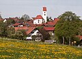
Obergünzburg from the east

Obergünzburg in winter
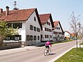
Upper market

Lower market

Willofs from the south


Economy and Infrastructure
economy
The municipal tax receipts in 2012 amounted to the equivalent of around € 2,385,000.00.
In 1998 there were 105 employees in the agricultural and forestry sector, 1,162 in the manufacturing sector and 1,246 in the trade and transport sector. In other economic sectors, 1,576 people were employed at the place of work subject to social security contributions. There were a total of 3,590 employees at the place of residence subject to social security contributions. In the manufacturing industry (as well as mining and quarrying of stone and earth) there were seven, in the construction industry 19 companies.
The largest resident company is the "Gabler-Saliter milk works" (today part of Ehrmann AG ). Above all, coffee cream, condensed milk , mixed milk drinks , dry milk products and preliminary products for baby and hospital food from other manufacturers are produced here. The Gabler-Saliter banking business is also located here.
traffic
The main roads of the municipality are the state roads St 2012, St 2055 and the district road OAL 11, which all meet in the main town.
education
In 2008 the following institutions existed:
- Kindergartens: 175 kindergarten places with 179 children
- Primary schools: 1 with 29 classes and 723 students
- Realschulen: 1 with 22 classes and 634 students
Personalities
Born in Obergünzburg
- Johann Georg von Werdenstein (1542–1608), canon, cantor in Eichstätt, collector of books and music
- Johannes Kaspar (1822–1885), painter
- Ludwig Skell (1842–1905), landscape, genre, portrait a. Caricature painter, lithographer
- Karl Nauer (1874–1962), South Seas explorer and captain
- Eduard Hindelang (1923–2016), museum director
- Helga van Beuningen (* 1945), translator
- Franz Loquai (* 1951), Germanist, literary scholar and university lecturer
- Barbara Lochbihler (* 1959, grew up in Ronsberg), member of the European Parliament , Secretary General of Amnesty International Germany until 2009
- Max Weber (* 1964), German handbiker
- Michael Miebach (* 1968), German manager
Personalities related to Obergünzburg
- Dominikus Ringsisen (1835–1904), Roman Catholic. Clergyman, as a beneficiary founder of the Obergünzburg hospital, later founder of a facility for the disabled in Ursberg named after him
- Armin Kreiner (* 1954), professor of theology in Munich , now lives in the town
literature
- Obergünzburg - a walk through the old market town , 2nd revised. Ed., Horb am Neckar: Geiger, 1996, ISBN 3-89570-155-6
- Franz Xaver Gutbrod: History of the parish Obergünzburg , Kempten: Kösel, 1889-1891
- Annual books of the Heimatlergemeinde Obergünzburg, Obergünzburg (series published since 1990)
- Werner Gebhardt: The special Gravamina of the community Obergünzburg before the peasant war , in: Allgäuer Geschichtsfreund, 82 (1982), pp. 5-15
- Toni Nessler: Castles in the Allgäu, vol. 2. Castle ruins in the West Allgäu and in the neighboring Vorarlberg, in the Württemberg Allgäu, in the northern Allgäu around Memmingen, in the northeast Allgäu around Kaufbeuren and Obergünzburg, as well as in the eastern Allgäu and in the adjacent Tyrol , Kempten: Allgäuer Zeitungsverlag , 1985, ISBN 3-88006-115-7
- Theodor Roppel : The geology of the area around Obergünzburg in the Allgäu with sediment petrographic investigations of the glacial deposits , Munich, Techn. Univ., Diss., 1988
- Jürgen Schätzthauer, Bernd Remiger, Brüne Harms, Stanislaus von Korn: Flora, vegetation and fauna in the valley of the Eastern Günz between Obergünzburg and Ronsberg, district of Ostallgäu / Bavaria: surveys as part of the implementation of the Bavarian species and biotope protection program , Nürtingen, University of Applied Sciences, Dipl .-Arb., WS 1998/99
- Hermann Epplen (Ed.): Over 1900 dialect expressions from Obergünzburg and its surroundings. Market town of Obergünzburg / Allgäu, Obergünzburg 1974
- Hermann Epplen: Obergünzburger Chronik. A home book from the upper Günztal , (Allgäuer Heimatbücher Volume 72), Kempten / Allgäu: Verlag für Heimatpflege, 1968
- JM Gabler-Saliter-Milchwerke (Ed.): 275 years Gabler-Saliter in Obergünzburg. 1713–1988 , Obergünzburg: JM Gabler-Saliter, 1988
Web links
- Entry on the coat of arms of Obergünzburg in the database of the House of Bavarian History
- Info page about the "Local Museum and South Sea Collection"
- Obergünzburg: Official statistics of the LfStat (PDF; 1.05 MB)
Individual evidence
- ↑ "Data 2" sheet, Statistical Report A1200C 202041 Population of the municipalities, districts and administrative districts 1st quarter 2020 (population based on the 2011 census) ( help ).
- ^ Community of Obergünzburg in the local database of the Bavarian State Library Online . Bayerische Staatsbibliothek, accessed on August 17, 2019.
- ↑ Ebersbach im Allgäu The teams Portal
- ^ Wilhelm Volkert (ed.): Handbook of Bavarian offices, communities and courts 1799–1980 . CH Beck, Munich 1983, ISBN 3-406-09669-7 , p. 519 .
- ↑ Election of the market town council - local elections 2020 in the market town of Obergünzburg - overall result. Retrieved April 19, 2020 .
- ^ Farewell to the former mayor Schmid in January 2007 , accessed on May 24, 2020
- ↑ Birgit Kata and a. (Ed.): More than 1000 years: The Kempten Abbey between founding and releasing 752–1802. Allgäu research on archeology and history , No. 1. Likias, Kempten 2006, ISBN 3-9807628-6-6 , p. 146.
- ↑ Our partner municipality Visegrad in Hungary ( Memento from April 12, 2013 in the Internet Archive )
- ↑ Teufelsküche Obergünzburg Bavarian State Office for the Environment

Aitrang | Baisweil | Bidingen | Biessenhofen | Buchloe | Eggenthal | Eisenberg | Friesenried | Feet | Germaringen | Görisried | Günzach | Halbch | Hopferau | Irsee | Jengen | Kaltental | Kraftisried | Lamerdingen | Lechbruck am See | Lengenwang | Marktoberdorf | Mauerstetten | Nesselwang | Obergünzburg | Oberostendorf | Osterzell | Pforzen | Pfronten | Rettenbach am Auerberg | Vineyards | Vineyards on the Forggensee | Ronsberg | Roßhaupten | Backwood | Ruderatshofen | Schwangau | Seeg | Stötten am Auerberg | Stöttwang | Unterthingau | Untrasried | Waal | Forest | Westendorf