
Vineyards (near Kaufbeuren)
| coat of arms | Germany map | |
|---|---|---|

|
Coordinates: 47 ° 57 ' N , 10 ° 39' E |
|
| Basic data | ||
| State : | Bavaria | |
| Administrative region : | Swabia | |
| County : | Ostallgäu | |
| Management Community : | Pforzen | |
| Height : | 659 m above sea level NHN | |
| Area : | 8.41 km 2 | |
| Residents: | 1302 (Dec. 31, 2019) | |
| Population density : | 155 inhabitants per km 2 | |
| Postal code : | 87668 | |
| Area code : | 08346 | |
| License plate : | OAL, FÜS, MOD | |
| Community key : | 09 7 77 164 | |
| Community structure: | 2 parts of the community | |
| Address of the municipal administration: |
Saalfeldstrasse 4a 87668 Rieden |
|
| Website : | ||
| Mayoress : | Inge Weiß ( Free Association of Voters ) | |
| Location of the municipality of Rieden in the Ostallgäu district | ||
  |
||


Rieden is a municipality in the Swabian district of Ostallgäu and a member of the Pforzen administrative community .
geography
Rieden lies on the edge of the Allgäu .
The municipality from the Rieden district has two officially named municipality parts (the type of settlement is indicated in brackets ):
- Rieden ( parish village )
- Zellerberg (parish village)
history
Until the church is planted
The first written mention of Rieden comes from the year 1242. Rieden belonged to the imperial abbey of Irsee . Honorius Grieninger , abbot from 1784 to 1802, built the castle in Rieden in 1793. During his reign, Rieden became an independent parish again. With the Reichsdeputationshauptschluss of 1803, the place came to Bavaria. In the course of the administrative reforms in Bavaria, today's municipality was created with the municipal edict of 1818.
Population development
From 1988 to 2008 Rieden lost 153 or about eleven percent of its population. The trend continued: Rieden was the only municipality in the Ostallgäu district to lose inhabitants between 1988 and 2018, namely 184 from 1455 to 1271 or 12.7%.
| was standing | Residents |
|---|---|
| December 31, 2016 | 1291 |
| December 31, 2015 | 1305 |
| December 31, 2014 | 1324 |
| December 31, 2013 | 1323 |
| December 31, 2012 | 1321 |
| December 31, 2011 | 1345 |
| December 31, 2010 | 1265 |
| December 31, 2009 | 1294 |
| December 31, 2008 | 1302 |
| 12/31/2007 | 1318 |
| December 31, 2006 | 1323 |
| December 31, 2005 | 1343 |
| December 31, 2004 | 1339 |
| 12/31/2003 | 1366 |
| December 31, 2002 | 1381 |
| December 31, 2001 | 1383 |
| December 31, 2000 | 1375 |
| December 31, 1999 | 1390 |
| December 31, 1998 | 1377 |
| December 31, 1997 | 1369 |
| December 31, 1995 | 1400 |
| December 31, 1993 | 1466 |
| December 31, 1991 | 1479 |
In 1970 1442 and 1987 then 1431 inhabitants were counted on the territory of the municipality.
politics
mayor
Ludwig Landwehr (Free Association of Voters) was the mayor until 2014. Ludwig Landwehr did not stand for re-election. On May 1, 2014, Inge Weiß (joint nomination by free voter groups) was elected to succeed. It was confirmed on March 15, 2020 with 95.5% of the vote for a further six years.
Municipal council
For the election on March 15, 2020 , only the joint nomination of the Free Voters' Association Zellerberg, Free Voters' Association Rieden-Zellerberg and Young Voters' Community Rieden-Zellerberg with 20 applicants was available. The twelve applicants for this nomination with the highest number of votes form the municipal council for May 2020 to April 2026 together with the mayor. The turnout was 65.6%.
coat of arms
Blazon : “Divided by red and blue by a silver wavy bar; above a silver dove with a silver twig in its beak, below half a silver mill wheel. "
Culture and sights

The Ridmonument is a tower-like, square Marienkapelle, which was built in 1884 by the landowner Johann Martin Rid from the proceeds of the forced transfer of land for the construction of the railway on the Lindenberg.
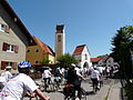
Allgäu cycling tour 2012 in Rieden

Zellerberg


Economy and Infrastructure
Economy including agriculture and forestry
In 1998, according to official statistics, there were 90 people in the manufacturing sector and no employees in the trade and transport sector at the place of work. In other economic sectors 36 people were employed at the place of work subject to social security contributions. There were a total of 483 employees at the place of residence subject to social security contributions. There was one company in the manufacturing sector and no company in the main construction sector. In addition, in 1999 there were 19 farms with an agriculturally used area of 549 ha, of which 84 ha were arable land and 465 ha were permanent green space.
education
The following institutions exist (as of 1999):
- Kindergarten: 50 kindergarten places with 50 children
The elementary school (1999 with eight teachers and 136 students) has been closed since the 2007/08 school year.
Web links
- Entry on the coat of arms of Rieden (near Kaufbeuren) in the database of the House of Bavarian History
- Rieden (near Kaufbeuren): Official statistics of the LfStat (PDF; 1.05 MB)
- Archaeological Tour Wertachtal (PDF) Time travel by bike
Individual evidence
- ↑ "Data 2" sheet, Statistical Report A1200C 202041 Population of the municipalities, districts and administrative districts 1st quarter 2020 (population based on the 2011 census) ( help ).
- ^ Community Rieden in the local database of the Bavarian State Library Online . Bayerische Staatsbibliothek, accessed on August 17, 2019.
- ^ Community of Rieden
- ↑ http://www.rieden-zellerberg.de/bildergalerie/impressionen/impressionen-1/ridmonument/
- ^ City and district of Kaufbeuren Tillmann Breuer Deutscher Kunstverlag p 178
- ↑ http://www.pforzen.de/gemeinde-pforzen/chronik/beispiel-ereignisse/

Aitrang | Baisweil | Bidingen | Biessenhofen | Buchloe | Eggenthal | Eisenberg | Friesenried | Feet | Germaringen | Görisried | Günzach | Halbch | Hopferau | Irsee | Jengen | Kaltental | Kraftisried | Lamerdingen | Lechbruck am See | Lengenwang | Marktoberdorf | Mauerstetten | Nesselwang | Obergünzburg | Oberostendorf | Osterzell | Pforzen | Pfronten | Rettenbach am Auerberg | Vineyards | Vineyards on the Forggensee | Ronsberg | Roßhaupten | Backwood | Ruderatshofen | Schwangau | Seeg | Stötten am Auerberg | Stöttwang | Unterthingau | Untrasried | Waal | Forest | Westendorf