
Oberostendorf
| coat of arms | Germany map | |
|---|---|---|

|
Coordinates: 47 ° 57 ' N , 10 ° 45' E |
|
| Basic data | ||
| State : | Bavaria | |
| Administrative region : | Swabia | |
| County : | Ostallgäu | |
| Management Community : | Westendorf | |
| Height : | 674 m above sea level NHN | |
| Area : | 21.04 km 2 | |
| Residents: | 1479 (Dec. 31, 2019) | |
| Population density : | 70 inhabitants per km 2 | |
| Postal code : | 86869 | |
| Area code : | 08344 | |
| License plate : | OAL, FÜS, MOD | |
| Community key : | 09 7 77 155 | |
| Community structure: | 5 parts of the community | |
| Address of the municipal administration: |
Angerstrasse 12 86869 Oberostendorf |
|
| Website : | ||
| Mayor : | Helmut Holzheu (voter group) | |
| Location of the municipality of Oberostendorf in the Ostallgäu district | ||
  |
||

Oberostendorf is a municipality in the Swabian district of Ostallgäu and a member of the Westendorf administrative community .
Community structure
The municipality has five officially named municipal parts (the type of settlement is given in brackets ):
- Gutenberg (parish village)
- Krämoos ( wasteland )
- Lengenfeld (parish village)
- Oberostendorf (parish village)
- Unterostendorf ( Kirchdorf )
The following districts exist : Gutenberg, Lengenfeld, Oberostendorf, Unterostendorf.
history
Until the church is planted
The community was first mentioned in a document in 890 as an eastern village and is one of the oldest towns in the area along with Waal . In today's municipality, the Augsburg bishopric shared rulership with the Free Imperial City of Kaufbeuren and Messrs. Hörmann von und zu Gutenberg . With the Reichsdeputationshauptschluss of 1803, the place came to Bavaria . In 1818 the community came into being.
Incorporations
On July 1, 1972, the previously independent community of Unterostendorf was incorporated. On May 1, 1978 Gutenberg and Lengenfeld were added.
Population development
- 1961: 1108 inhabitants
- 1970: 1033 inhabitants
- 1987: 1158 inhabitants
- 1991: 1224 inhabitants
- 1995: 1238 inhabitants
- 2000: 1256 inhabitants
- 2005: 1289 inhabitants
- 2010: 1311 inhabitants
- 2015: 1372 inhabitants
Oberostendorf grew by 130 inhabitants or about eleven percent from 1988 to 2008. Between 1988 and 2018 the municipality grew from 1166 to 1425 by 259 inhabitants or by 22.2%.
politics


mayor
Mayor is Helmut Holzheu (electoral group).
coat of arms
The description of the coat of arms reads: A silver dove sitting in red on a silver tip, with a six-pointed golden star in its beak.
Culture and sights
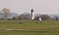
The former pilgrimage church of the Assumption of Mary (Oberostendorf) from the 15th century is well worth seeing . In the Gutenberg parish church of St. Margareta there is a crypt of the Kaufbeur patrician family Hörmann, from 1543 to 1803 landlord of Gutenberg. There is a local museum in Gutenberg. The parish church in Unterostendorf is an originally Gothic, Baroque-style hall church from 1753 with a rococo-influenced interior.

Chapel of the Holy Trinity near Gutenberg
Gutenberg from the west

Lengenfeld from the south

Church tower in Unterostendorf


Economy and Infrastructure
Economy including agriculture and forestry
In 1998 there were no employees in the field of agriculture and forestry, none in the manufacturing industry and no employees subject to social insurance contributions in the field of trade and transport. There were a total of 516 employees at the place of residence subject to social security contributions. There were no companies in the manufacturing sector and one company in the main construction sector. In addition, in 1999 there were 27 farms with an agricultural area of 784 hectares. Of this, 612 hectares were arable land and 172 hectares were permanent green areas.
traffic
Oberostendorf is located directly on State Road 2035.
The Buchloe station (twelve kilometers) is the hub of railway lines Munich-Kempten (Allgäu) -Lindau ( "Allgäu Railway") , Augsburg Buchloe and Buchloe-Memmingen-Lindau with IC port and EC -Direktverbindungen in Switzerland .
education
The following institutions exist (as of 2013):
- Kindergarten: 43 kindergarten places with 35 children
Personalities
The Catholic moral theologian Jakob Danzer (1743–1796) comes from Lengenfeld, municipality of Oberostendorf .
Web links
- Entry on the coat of arms of Oberostendorf in the database of the House of Bavarian History
- Oberostendorf: Official statistics of the LfStat (PDF; 1.05 MB)
Individual evidence
- ↑ "Data 2" sheet, Statistical Report A1200C 202041 Population of the municipalities, districts and administrative districts 1st quarter 2020 (population based on the 2011 census) ( help ).
- ^ Municipality of Oberostendorf in the local database of the Bavarian State Library Online . Bayerische Staatsbibliothek, accessed on August 17, 2019.
- ^ Wilhelm Volkert (ed.): Handbook of Bavarian offices, communities and courts 1799–1980 . CH Beck, Munich 1983, ISBN 3-406-09669-7 , p. 492 .
- ↑ a b c Federal Statistical Office (ed.): Historical municipality directory for the Federal Republic of Germany. Name, border and key number changes in municipalities, counties and administrative districts from May 27, 1970 to December 31, 1982 . W. Kohlhammer, Stuttgart / Mainz 1983, ISBN 3-17-003263-1 , p. 779 .
- ^ Karl Prestele: 750 Years of Gutenberg 1238 - 1988 (Festschrift, 1988)
- ↑ http://www.oberostendorf.de/oeffuxe-einrichtungen/heimatmuseum/

Aitrang | Baisweil | Bidingen | Biessenhofen | Buchloe | Eggenthal | Eisenberg | Friesenried | Feet | Germaringen | Görisried | Günzach | Halbch | Hopferau | Irsee | Jengen | Kaltental | Kraftisried | Lamerdingen | Lechbruck am See | Lengenwang | Marktoberdorf | Mauerstetten | Nesselwang | Obergünzburg | Oberostendorf | Osterzell | Pforzen | Pfronten | Rettenbach am Auerberg | Vineyards | Vineyards on the Forggensee | Ronsberg | Roßhaupten | Backwood | Ruderatshofen | Schwangau | Seeg | Stötten am Auerberg | Stöttwang | Unterthingau | Untrasried | Waal | Forest | Westendorf