List of municipalities in the Ostallgäu district
The list of municipalities in the Ostallgäu district gives an overview of the 45 smallest administrative units in the district . Three of the communities are small towns , Buchloe , Füssen and the district town of Marktoberdorf . Seven parishes are markets .
In its current form, the Ostallgäu district was created in the course of the Bavarian territorial reform carried out in 1972 . The district was formed from the districts of Füssen , Marktoberdorf and most of the district of Kaufbeuren . The current church structure was completed in 1979. In the case of the municipalities, it is noted to which district the main town of the municipality belonged before the regional reform. The year in which they joined the municipality is noted for the suburbs of the municipalities. This is also noted for the suburbs that belonged to a different district than the main town of today's municipality before the regional reform.
description
The district can be further subdivided into ten administrative communities (VG):
- VG Biessenhofen : with the communities of Biessenhofen , Aitrang , Bidingen and Ruderatshofen ;
- VG Buchloe : with the city of Buchloe , the municipalities of Jengen and Lamerdingen and the market in Waal ;
- VG Eggenthal : with the communities of Eggenthal , Baisweil and Friesenried ;
- VG Obergünzburg : with the market Obergünzburg and the communities of Günzach and Untrasried ;
- VG Pforzen : with the communities of Pforzen , the Irsee marketand Rieden ;
- VG Roßhaupten : with the communities of Roßhaupten and Rieden a.Forggensee ;
- VG Seeg : with the communities of Seeg , Eisenberg , Hopferau , Lengenwang , Rückholz and Wald ;
- VG Stötten am Auerberg : with the communities of Stötten a.Auerberg and Rettenbach a.Auerberg ;
- VG Unterthingau : with the Unterthingau marketand the communities of Görisried and Kraftisried ;
- VG Westendorf : with the communities Westendorf , the market Kaltental , Oberostendorf , Osterzell and Stöttwang ;
The cities of Füssen and Marktoberdorf , like the markets of Nesselwang and Ronsberg and the communities of Germaringen , halch , Lechbruck am See , Mauerstetten , Pfronten and Schwangau, are not members of an administrative association.
The district has a total area of 1,395.09 km 2 . The largest area within the district is the half-lch community with 125.5 km 2 . This is followed by the town of Marktoberdorf with 95.25 km 2 and the municipality of Schwangau with 76.06 km 2 . Each municipality has an area larger than 60 or 50 km 2 . Four municipalities are larger than 40 km 2 , including the city of Füssen , and seven municipalities have an area of over 30 km 2 , including the city of Buchloe . Thirteen municipalities are over 20 km 2 , 15 over and one under 10 km 2 . The smallest areas have the municipalities of Westendorf with 11.93 km 2 , Osterzell with 10.82 km 2 and Rieden bei Kaufbeuren with 8.41 km 2 .
The district town of Marktoberdorf with 18,725 inhabitants has the largest proportion of the district's population of 141,182 inhabitants, followed by the cities of Füssen with 15,508 inhabitants and Buchloe with 13,273 inhabitants. The municipality of Pfronten has over 7,000 inhabitants, the market in Obergünzburg over 6,000 and the municipality of Biessenhofen over 4,000. Five municipalities have over 3,000 inhabitants, seven over 2,000 and 23 over 1,000. The remaining four communities have less than 1,000 inhabitants, i.e. the communities Rückholz with 878 inhabitants, Rettenbach a.Auerberg with 886 inhabitants, Kraftisried with 846 and Osterzell with 714 inhabitants.
The entire Ostallgäu district has a population density of 101 inhabitants per km 2 . The cities of Buchloe with 367 inhabitants per km 2 , Füssen with 356 and Marktoberdorf with 197 have the greatest population density within the district. Nine municipalities have a population density of over 100, the remaining 33 of less than 100. Of these 33 municipalities, 32 have a population density lower than the district average of 101. The most sparsely populated communities are Kraftisried with 52, Stötten a.Auerberg with 46, Schwangau with 44 and halch , the largest community in terms of area, with 28 inhabitants per km 2 .
Legend
- Municipality : Name of the municipality or city and information about the district to which the eponymous place of the municipality belonged before the regional reform
- Subsites : Enumerated are the formerly independent municipalities of the administrative unit. The year of incorporation is also given. This is also noted for the suburbs that belonged to a different district than the main town of today's municipality before the regional reform
- VG : Indicates membership in one of the administrative communities
- Coat of arms : coat of arms of the municipality or city
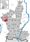
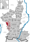
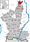
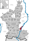
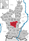
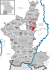
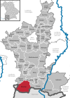
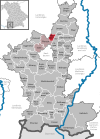
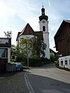
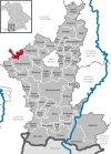
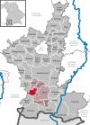
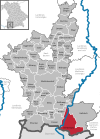
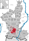
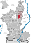
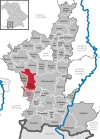
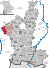
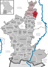
- Map : Shows the location of the municipality or city in the district
- Area : Area of the city or municipality, given in square kilometers
- Population : number of people living in the municipality or city (as of December 31, 2019)
- Population density : The population density is given, calculated on the area of the administrative unit, given in population per km 2 (as of December 31, 2019)
- Altitude : Altitude of the eponymous town or town in meters above sea level
- Image : Image from the respective municipality or city
Communities
| local community | Sub-locations | VG | coat of arms | map | surface | Residents | EW density |
height | image |
|---|---|---|---|---|---|---|---|---|---|
| District of Ostallgäu |  |
 |
1,395.09 | 141.182 | 101 |

|
|||
|
Aitrang (belonged to the Marktoberdorf district before the regional reform) |
Aitrang Huttenwang (1978) |
VG Biessenhofen |
 |
 |
30.71 | 2,035 | 66 | 745 |

|
|
Baisweil (belonged to the Kaufbeuren district before the regional reform) |
Baisweil Lauchdorf (1976) |
VG Eggenthal |
 |
 |
26.28 | 1,300 | 49 | 677 |

|
|
Bidingen (belonged to the district of Marktoberdorf before the regional reform) |
Bidingen Bernbach (1978) |
VG Biessenhofen |
 |
 |
36.33 | 1,786 | 49 | 768 |

|
|
Biessenhofen (belonged to the district of Marktoberdorf before the regional reform) |
Biessenhofen (the municipality was called Altdorf until the regional reform) Ebenhofen (1971) |
VG Biessenhofen |
 |
 |
27.02 | 4.117 | 152 | 700 |

|
|
Buchloe (town) (belonged to the Kaufbeuren district before the regional reform) |
Buchloe Honsolgen (1972) Lindenberg (1971) |
VG Buchloe |
 |
 |
36.16 | 13,273 | 367 | 615 |

|
|
Eggenthal (belonged to the Kaufbeuren district before the regional reform) |
Eggenthal Bayersried (1978; belonged to the Marktoberdorf district before the regional reform) |
VG Eggenthal |
 |
 |
28.1 | 1,357 | 48 | 714 |

|
|
Eisenberg (belonged to the district of Füssen before the regional reform) |
Eisenberg | VG Seeg |
 |
 |
13.63 | 1,180 | 87 | 818 |

|
|
Friesenried (belonged to the district of Marktoberdorf before the regional reform) |
Friesenried Blöcktach (1978) |
VG Eggenthal |
 |
 |
22.24 | 1,580 | 71 | 736 |

|
|
Füssen (city) (belonged to the district of Füssen before the regional reform) |
Füssen Eschach Hopfen am See (1978) Weißensee (1978) |
 |
 |
43.52 | 15,508 | 356 | 808 |
 
|
|
|
Germaringen (belonged to the Kaufbeuren district before the regional reform) |
Obergermaringen Untergermaringen Ketterschwang (merger 1978) |
 |
22.88 | 3,872 | 169 | 655 |
|
||
|
Görisried (belonged to the district of Marktoberdorf before the regional reform) |
Gorisried | VG Unterthingau |
 |
 |
23.14 | 1,316 | 57 | 803 |

|
|
Günzach (belonged to the Marktoberdorf district before the regional reform) |
Günzach (was called Immenthal until 1977) | VG Obergünzburg |
 |
 |
23.48 | 1,446 | 62 | 787 |

|
|
Halch (belonged to the district of Füssen before the regional reform) |
Buching Trauchgau (merger 1976) |
 |
 |
125.5 | 3,520 | 28 | 815 |

|
|
|
Hopferau (belonged to the district of Füssen before the regional reform) |
Hopferau | VG Seeg |
 |
 |
13.19 | 1,205 | 91 | 814 |

|
|
Irsee (market) (belonged to the Kaufbeuren district before the regional reform) |
Irsee | VG Pforzen |
 |
 |
17.47 | 1,532 | 88 | 724 |

|
|
Jengen (belonged to the Kaufbeuren district before the regional reform) |
Jengen Beckstetten (1978) Eurishofen (1978) Ummenhofen (1978) Weicht (1978) Weinhausen (1972) |
VG Buchloe |
 |
 |
33.75 | 2,491 | 74 | 636 |

|
|
Kaltental (market) (belonged to the Kaufbeuren district before the regional reform) |
Aufkirch Blonhofen Frankenhofen (merger 1972) |
VG Westendorf |
 |
 |
22.14 | 1,694 | 77 | 710 |

|
|
Kraftisried (belonged to the Marktoberdorf district before the regional reform) |
Kraftisried | VG Unterthingau |
 |
16.22 | 846 | 52 | 822 |

|
|
|
Lamerdingen (belonged to the Kaufbeuren district before the regional reform) |
Lamerdingen Dillishausen Großkitzighofen Kleinkitzighofen |
VG Buchloe |
 |
 |
34.24 | 2,035 | 59 | 596 |

|
|
Lechbruck a.See (belonged to the district of Füssen before the regional reform) |
Lechbruck a.See |  |
 |
17.25 | 2,718 | 158 | 737 |

|
|
|
Lengenwang (belonged to the Marktoberdorf district before the regional reform) |
Lengenwang | VG Seeg |
 |
 |
19.62 | 1,490 | 76 | 806 |

|
|
Marktoberdorf (district town) (belonged to the district of Marktoberdorf before the regional reform) |
Marktoberdorf Bertoldshofen (1972) Geisenried (1972) Leuterschach (1978) Rieder (1972) Sulzschneid (1972) Thalhofen adWertach (1972) |
 |
 |
95.25 | 18,725 | 197 | 758 |

|
|
|
Mauerstetten (belonged to the Kaufbeuren district before the regional reform) |
Mauerstetten Frankenried (1978) |
 |
 |
16.55 | 3,173 | 192 | 716 |

|
|
|
Nesselwang (market) (belonged to the district of Füssen before the regional reform) |
Nesselwang |  |
 |
29.53 | 3,753 | 127 | 867 |

|
|
|
Obergünzburg (Markt) (belonged to the district of Marktoberdorf before the regional reform) |
Obergünzburg Castle (1972) Ebersbach (1972) Willofs (1972) |
VG Obergünzburg |
 |
46.69 | 6,357 | 136 | 737 |

|
|
|
Oberostendorf (belonged to the Kaufbeuren district before the regional reform) |
Oberostendorf Gutenberg (1978) Lengenfeld (1978) Unterostendorf (1972) |
VG Westendorf |
 |
21.04 | 1,479 | 70 | 674 |

|
|
|
Osterzell (belonged to the Kaufbeuren district before the regional reform) |
Osterzell | VG Westendorf |
 |
 |
10.82 | 714 | 66 | 729 |

|
|
Pforzen (belonged to the Kaufbeuren district before the regional reform) |
Pforzen Ingenried (1971) |
VG Pforzen |
 |
23.69 | 2,321 | 98 | 656 |

|
|
|
Pfronten (belonged to the district of Füssen before the regional reform) |
Pfronten Pfronten-Berg Pfronten-Steinach |
 |
 |
62.22 | 8,348 | 134 | 853 |
 
|
|
|
Rettenbach a.Auerberg (belonged to the district of Marktoberdorf before the regional reform) |
Rettenbach a.Auerberg (was part of the municipality of Stötten a.Auerberg from 1978 to 1993) | VG Stötten a.Auerberg (exists since 1994) |
 |
 |
12.92 | 886 | 69 | 832 |

|
|
Rieden near Kaufbeuren (belonged to the district of Kaufbeuren before the regional reform) |
Rieden near Kaufbeuren | VG Pforzen |
 |
 |
8.41 | 1,302 | 155 | 659 |

|
|
Rieden a.Forggensee (belonged to the district of Füssen before the regional reform) |
Vineyards a.Forggensee | VG Roßhaupten |
 |
 |
13.17 | 1,324 | 101 | 814 |
|
|
Ronsberg (Markt) (belonged to the Marktoberdorf district before the regional reform) |
Ronsberg |  |
 |
16.53 | 1,734 | 105 | 700 |

|
|
|
Roßhaupten (belonged to the district of Füssen before the regional reform) |
Horseheads | VG Roßhaupten |
 |
 |
39.1 | 2.234 | 57 | 815 |

|
|
Rückholz (belonged to the district of Füssen before the regional reform) |
Backwood | VG Seeg |
 |
 |
17.21 | 878 | 51 | 879 |

|
|
Ruderatshofen (belonged to the district of Marktoberdorf before the regional reform) |
Ruderatshofen Apfeltrang (1978; belonged to the Kaufbeuren district before the regional reform) |
VG Biessenhofen |
 |
 |
33.52 | 1,763 | 53 | 727 |

|
|
Schwangau (belonged to the district of Füssen before the regional reform) |
Schwangau |  |
 |
76.06 | 3,331 | 44 | 796 |
 
|
|
|
Seeg (belonged to the district of Füssen before the regional reform) |
Seeg Enzenstetten |
VG Seeg |
 |
 |
50.06 | 2,997 | 60 | 854 |

|
|
Stötten a.Auerberg (belonged to the district of Marktoberdorf before the regional reform) |
Stötten a.Auerberg Remnatsried Steinbach Rettenbach a.Auerberg (1978 to 1993) |
VG Stötten a.Auerberg (exists since 1994) |
 |
 |
40.75 | 1,890 | 46 | 733 |

|
|
Stöttwang (belonged to the Kaufbeuren district before the regional reform) |
Stöttwang Linden (1971) Reichenbach (1971) Thalhofen adGennach (1971) |
VG Westendorf |
 |
 |
19.79 | 1,873 | 95 | 720 |

|
|
Unterthingau (Markt) (belonged to the Marktoberdorf district before the regional reform) |
Unterthingau Oberthingau (1978) Reinhardsried (1978) |
VG Unterthingau |
 |
 |
45.23 | 2,891 | 64 | 773 |

|
|
Untrasried (belonged to the district of Marktoberdorf before the regional reform) |
Untrasried Hopferbach (1974) |
VG Obergünzburg |
 |
 |
25.75 | 1,584 | 62 | 819 |

|
|
Waal (market) (belonged to the Kaufbeuren district before the regional reform) |
Waal Bronnen (1972) Emmenhausen (1971) Waalhaupten (1978) |
VG Buchloe |
 |
 |
27.94 | 2,342 | 84 | 636 |

|
|
Forest (belonged to the district of Marktoberdorf before the regional reform) |
Forest | VG Seeg |
 |
 |
17.97 | 1,156 | 64 | 800 |

|
|
Westendorf (belonged to the Kaufbeuren district before the regional reform) |
Westendorf Dösingen (1978) |
VG Westendorf |
 |
 |
11.93 | 1,826 | 153 | 688 |

|
See also
Individual evidence
- ↑ "Data 2" sheet, Statistical Report A1200C 202041 Population of the municipalities, districts and administrative districts 1st quarter 2020 (population based on the 2011 census) ( help ).
- ↑ "Data 2" sheet, Statistical Report A1200C 202041 Population of the municipalities, districts and administrative districts 1st quarter 2020 (population based on the 2011 census) ( help ).
- ↑ BayernViewer of the Bavarian Surveying Administration (accessed on November 5, 2010)
