List of municipalities in the Fürstenfeldbruck district
The list of municipalities in the Fürstenfeldbruck district gives an overview of the 23 smallest administrative units in the district . Two of the municipalities, Fürstenfeldbruck and Germering , are medium- sized towns and large district towns .
The Fürstenfeldbruck district was established as the Bruck district court as early as 1823 . In 1862 the Bruck District Office was created . In 1908 it was renamed the Fürstenfeldbruck District Office , and in 1939 it was renamed the Fürstenfeldbruck District . There have been only a few changes to the area to date. The district received its current expansion in the course of the Bavarian territorial reform carried out in 1972 . In this case, the district in the west was reduced by a few communities, which were assigned to the neighboring districts of Aichach-Friedberg , Dachau and Landsberg am Lech . The current church structure was completed in 1979. The year in which they joined the municipality is noted for the suburbs of the municipalities.
description
The district can be further subdivided into two administrative communities (VG):
- VG Grafrath : with the communities Grafrath , Kottgeisering and Schöngeising ;
- VG Mammendorf : with the communities Mammendorf , Adelshofen , Althegnenberg , Hattenhofen , Jesenwang , Landsberied , Mittelstetten and Oberschweinbach ;
The towns of Fürstenfeldbruck and Germering , like the communities of Alling , Egenhofen , Eichenau , Emmering , Gröbenzell , Maisach , Moorenweis , Olching , Puchheim and Türkenfeld, are not members of an administrative community.
The district has a total area of 434.78 km 2 . The largest area within the district is in the municipalities of Maisach with 53.45 km 2 , Moorenweis with 46.45 km 2 and Egenhofen with 33.4 km 2 , followed by the town of Fürstenfeldbruck with 32.53 km 2 . Four municipalities have an area larger than 20 km 2 , including the city of Germering . Ten municipalities have an area of over and five an area of less than 10 km 2 . The smallest areas have the municipalities of Hattenhofen with 7.17 km 2 , Eichenau with 6.98 km 2 and Gröbenzell with 6.36 km 2 .
The major district towns of Germering with 40,399 inhabitants, Fürstenfeldbruck with 37,004 inhabitants and the municipality of Olching with 27,985 inhabitants have the largest share of the district's population of 219,311 inhabitants. Two municipalities have over 19,000 and one municipality each has over 12,000, 11,000, 6,000 and 4,000 inhabitants, respectively. Five municipalities have over 3,000 inhabitants and the remaining nine municipalities have over 1,000 inhabitants. The three smallest communities in terms of population are Jesenwang with 1571 inhabitants, Landsberied with 1613 and Hattenhofen with 1547 inhabitants.
The entire Fürstenfeldbruck district has a population density of 504 inhabitants per km 2 . The largest population density within the district has the municipality of Gröbenzell with 3149 inhabitants per km 2 , the city of Germering with 1869 and the municipality of Eichenau with 1708. Each municipality has a population density of over 1,500, 1,000 (city of Fürstenfeldbruck ), 800 and 500 inhabitants per km 2 . All other municipalities have a lower population density than the district average of 504. Five of these municipalities have a population density of over 200 and in eight the population density is over or exactly 100 inhabitants per km 2 . In the three most sparsely populated municipalities there are less than 100 inhabitants per km 2 , that is the municipalities of Egenhofen with 105, Mittelstetten with 92 and Moorenweis with 90 inhabitants per km 2 .
Legend
- Municipality : Name of the municipality or city
- Subsites : Enumerated are the formerly independent municipalities of the administrative unit. The year of incorporation is also given
- VG : Indicates membership in one of the administrative communities
- Coat of arms : coat of arms of the municipality or city
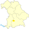
- Map : Shows the location of the municipality or city in the district
- Area : Area of the city or municipality, given in square kilometers
- Population : number of people living in the municipality or city (as of December 31, 2019)
- Population density : The population density is given, calculated on the area of the administrative unit, given in population per km 2 (as of December 31, 2019)
- Altitude : Altitude of the eponymous town or town in meters above sea level
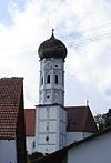
- Image : Image from the respective municipality or city
Communities
| local community | Sub-locations | VG | coat of arms | map | surface | Residents | EW density |
height | image |
|---|---|---|---|---|---|---|---|---|---|
| Fürstenfeldbruck district |  |
 |
434.78 | 219.311 | 504 | ||||
| Adelshofen |
Adelshofen Luttenwang (1978) |
VG Mammendorf |
 |
 |
13.28 | 1,749 | 132 | 556 | |
| Alling |
Alling Biburg Holzhausen Wagelsried (1978; part of the municipality of Emmering before the regional reform) |
 |
 |
21.04 | 3,941 | 187 | 553 |

|
|
| Althegnenberg |
Althegnenberg Hörbach (1972) |
VG Mammendorf |
 |
 |
16.09 | 2,062 | 128 | 536 |

|
| Egenhofen |
Egenhofen Aufkirchen (1978) Oberweikertshofen Unterschweinbach (1978) Wenigmünchen (merger of Oberweikertshofen and Wenigmünchen to form the municipality of Oberweikertshofen-Wenigmünchen in 1972; this became part of the Egenhofen municipality in 1978) |
 |
 |
33.4 | 3,498 | 105 | 509 |

|
|
|
Eichenau (independent municipality since 1957, previously part of the Alling municipality) |
Eichenau |  |
 |
6.98 | 11,922 | 1,708 | 523 |

|
|
| Emmering | Emmering |  |
 |
10.94 | 6,782 | 620 | 515 |

|
|
| Fürstenfeldbruck (large district town) |
Fürstenfeldbruck Aich (1978) Puch (1978) |
 |
 |
32.53 | 37.004 | 1,138 | 534 |
 
|
|
| Germering (large district town) |
Germering Unterpfaffenhofen (1978) |
 |
 |
21.61 | 40,399 | 1,869 | 541 |

|
|
| Grafrath |
Unteralting Wildenroth (merged 1972) |
VG Grafrath |
 |
 |
14.43 | 3,875 | 269 | 535 |

|
|
Gröbenzell (independent municipality since 1952) |
Groebenzell |  |
 |
6.36 | 20,029 | 3.149 | 508 |

|
|
| Hattenhofen | Hattenhofen | VG Mammendorf |
 |
 |
7.17 | 1,547 | 216 | 556 |

|
| Jesenwang |
Jesenwang Pfaffenhofen (1972) |
VG Mammendorf |
 |
15.3 | 1,571 | 103 | 558 |

|
|
| Kottgeisering | Kottgeisering | VG Grafrath |
 |
 |
8.21 | 1,608 | 196 | 542 | |
| Landsberied | Landsberied | VG Mammendorf |
 |
 |
10.54 | 1,613 | 153 | 556 | |
| Maisach |
Maisach Germerswang (1978) Malching (1978) Rottbach (1978) Überacker (1978) |
 |
 |
53.45 | 14,293 | 267 | 514 | ||
| Mammendorf |
Mammendorf Nannhofen (1978) |
VG Mammendorf |
 |
 |
21.21 | 4,830 | 228 | 535 |

|
| Mittelstetten |
Mittelstetten Oberdorf (1972; part of the municipality of Baierberg before the regional reform) Tegernbach (1978) |
VG Mammendorf |
 |
 |
18.62 | 1,713 | 92 | 514 |

|
| Moorenweis |
Moorenweis Dünzelbach Eismerszell Grunertshofen Purk Steinbach |
 |
 |
46.45 | 4.159 | 90 | 556 |

|
|
| Oberschweinbach |
Oberschweinbach Günzlhofen (1972) |
VG Mammendorf |
 |
 |
7.23 | 1,718 | 238 | 550 | |
| Olching (city) |
Olching Esting (1978) Geiselbullach (1978) |
 |
 |
29.91 | 27,985 | 936 | 504 |

|
|
| Puchheim (city) | Puchheim |  |
 |
12.23 | 21,417 | 1,751 | 535 |

|
|
| Schöngeising | Schöngeising | VG Grafrath |
 |
 |
12.86 | 1,907 | 148 | 530 |

|
| Turk field |
Türkenfeld Zankenhausen (1972) |
 |
 |
15.95 | 3,689 | 231 | 599 |

|
See also
Individual evidence
- ↑ "Data 2" sheet, Statistical Report A1200C 202041 Population of the municipalities, districts and administrative districts 1st quarter 2020 (population based on the 2011 census) ( help ).
- ↑ "Data 2" sheet, Statistical Report A1200C 202041 Population of the municipalities, districts and administrative districts 1st quarter 2020 (population based on the 2011 census) ( help ).
- ↑ BayernViewer of the Bavarian Surveying Administration
