List of municipalities in the Landsberg am Lech district
The list of municipalities in the Landsberg am Lech district gives an overview of the 31 smallest administrative units in the district . The city of Landsberg am Lech , the only city in the district, is a medium-sized town . Two communities, Dießen a.Ammersee and Kaufering , are markets.
The Landsberg am Lech district was created in its current form as part of the Bavarian territorial reform carried out in 1972 . The district was formed from the district of Landsberg am Lech , the independent city of Landsberg am Lech , two communities in the district of Fürstenfeldbruck , eight communities in the district of Kaufbeuren and four communities in the district of Schongau . The current church structure was completed in 1979. In the case of the municipalities, it is noted to which district the main town of the municipality belonged before the regional reform. The year in which they joined the municipality is noted for the suburbs of the municipalities. This is also noted for the suburbs that belonged to a different district than the main town of today's municipality before the regional reform.
description
The district can be further divided into seven administrative communities (VG):
- VG Fuchstal : with the municipalities of Fuchstal and Unterdießen ;
- VG Igling : with the communities of Igling , Hurlach and Obermeitingen ;
- VG Prittriching : with the communities of Prittriching and Scheuring ;
- VG Pürgen : with the communities of Pürgen , Hofstetten and Schwifting ;
- VG Reichling : with the communities Reichling , Apfeldorf , Kinsau , Rott , Thaining and Vilgertshofen ;
- VG Schondorf a.Ammersee : with the communities Schondorf a.Ammersee , Eching a.Ammersee and Greifenberg ;
- VG Windach : with the municipalities of Windach , Eresing and Finning ;
The city of Landsberg am Lech , like the markets in Dießen a.Ammersee and Kaufering and the communities of Denklingen , Egling adPaar , Geltendorf , Penzing , Utting a.Ammersee and Weil, is not a member of an administrative community.
The district has a total area of 804.49 km 2 . The largest area within the district is the market of Dießen a.Ammersee with 82.64 km 2 . This is followed by the city of Landsberg am Lech with 57.89 km 2 and the communities of Denklingen with 56.76 km 2 and Weil with 44.48 km 2 . Three municipalities have an area larger than 30 km 2 , nine an area of over 20 km 2 , ten an area of over 10 km 2 and five municipalities are smaller than 10 km 2 . The smallest areas are in the municipalities of Greifenberg with 8.21 km 2 , Schondorf am Ammersee with 6.56 km 2 and Eching am Ammersee with 6.15 km 2 . The Ammersee , which belongs to the district as a non-parish area, has an area of 47.42 km 2 .
The large district town of Landsberg am Lech has the largest share of the population of the district of 120,302 inhabitants with 29,228 inhabitants, followed by the two markets of Dießen am Ammersee with 10,526 inhabitants and Kaufering with 10,251 inhabitants. Each municipality has over 5,000 or over 4,000 inhabitants and six municipalities have over 3,000 or over 2,000 inhabitants. Twelve parishes have over and two have under 1,000 inhabitants. The three smallest municipalities in terms of population are Kinsau with 1043 inhabitants, Thaining with 1044 and Schwifting with 1030 inhabitants.
The entire Landsberg am Lech district has a population density of 150 inhabitants per km 2 . The largest population density within the district is in the municipality of Schondorf a.Ammersee with 603 inhabitants per km 2 , the Markt Kaufering with 579 and the city of Landsberg am Lech with 505. Three municipalities have a population density of over 200. Another eleven have a population density of over 100. Of these, seven have a population density lower than the district average of 150. In the remaining fourteen municipalities, the population is below 100. The most sparsely populated municipalities are Finning with 84, Reichling with 73 and Denklingen with 50 inhabitants per km 2 .
Legend
- Municipality : Name of the municipality or city and information about the district to which the eponymous place of the municipality belonged before the regional reform
- Subsites : Enumerated are the formerly independent municipalities of the administrative unit. The year of incorporation is also given. This is also noted for the suburbs that belonged to a different district than the main town of today's municipality before the regional reform.
- VG : Indicates membership in one of the administrative communities
- Coat of arms : coat of arms of the municipality or city
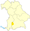
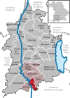
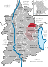
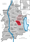
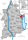
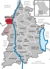
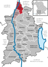
- Map : Shows the location of the municipality or city in the district
- Area : Area of the city or municipality, given in square kilometers
- Population : number of people living in the municipality or city (as of December 31, 2019)
- Population density : The population density is given, calculated on the area of the administrative unit, given in population per km 2 (as of December 31, 2019)
- Altitude : Altitude of the eponymous town or town in meters above sea level
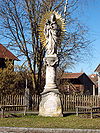
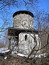
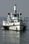
- Image : Image from the respective municipality or city
Communities
| local community | Sub-locations | VG | coat of arms | map | surface | Residents | EW density |
height | image |
|---|---|---|---|---|---|---|---|---|---|
| Landsberg am Lech district |  |
 |
804.49 | 120,302 | 150 |

|
|||
|
Apfeldorf (belonged to the district of Schongau before the regional reform) |
Apple village | VG Reichling |
 |
 |
12.31 | 1,144 | 93 | 658 |

|
|
Denklingen (belonged to the Kaufbeuren district before the regional reform) |
Denklingen Dienhausen Epfach (belonged to the district of Schongau before the regional reform) |
 |
 |
56.76 | 2,836 | 50 | 685 |
|
|
|
Dießen a.Ammersee (Markt) (belonged to the Landsberg am Lech district before the regional reform) |
Dießen am Ammersee Dettenhofen Dettenschwang (1972) Obermühlhausen Rieden am Ammersee (1978) |
 |
 |
82.64 | 10,526 | 127 | 544 |
 
|
|
|
Eching a.Ammersee (belonged to the Landsberg am Lech district before the regional reform) |
Eching am Ammersee | VG Schondorf a.Ammersee |
 |
 |
6.15 | 1,709 | 278 | 541 |

|
|
Egling adPaar (belonged to the Landsberg am Lech district before the regional reform) |
Egling adPaar Heinrichshofen |
 |
 |
20.77 | 2,357 | 113 | 552 |

|
|
|
Eresing (belonged to the Landsberg am Lech district before the regional reform) |
Eresing | VG Windach |
 |
 |
14.22 | 1.933 | 136 | 596 |

|
|
Finning (belonged to the Landsberg am Lech district before the regional reform) |
Oberfinning Unterfinning Entraching (merger 1971) |
VG Windach |
 |
 |
23.33 | 1,949 | 84 | 632 |

|
|
Fuchstal (belonged to the Kaufbeuren district before the regional reform) |
Asch Leeder (Markt) Seestall (merger 1972) |
VG Fuchstal |
 |
 |
39.73 | 3,990 | 100 | 659 |

|
|
Geltendorf (belonged to the Fürstenfeldbruck district before the regional reform) |
Geltendorf Hausen near Geltendorf Kaltenberg (belonged to the Landsberg am Lech district before the regional reform) Walleshausen (belonged to the Landsberg am Lech district before the regional reform) |
 |
 |
34.81 | 5,593 | 161 | 602 |
 
|
|
|
Greifenberg (belonged to the Landsberg am Lech district before the regional reform) |
Greifenberg Beuern (1978) |
VG Schondorf a.Ammersee |
 |
 |
8.21 | 2.263 | 276 | 582 |

|
|
Hofstetten (belonged to the Landsberg am Lech district before the regional reform) |
Hofstetten Hagenheim (1972) |
VG Pürgen |
 |
 |
17.02 | 1,886 | 111 | 674 |

|
|
Hurlach (belonged to the Landsberg am Lech district before the regional reform) |
Hurlach | VG Igling |
 |
 |
17.15 | 1,942 | 113 | 584 |

|
|
Igling (belonged to the Landsberg am Lech district before the regional reform) |
Oberigling Unterigling (merger 1971) Holzhausen near Buchloe (1978) |
VG Igling |
 |
 |
26.37 | 2,488 | 94 | 594 |

|
|
Kaufering (Markt) (belonged to the Landsberg am Lech district before the regional reform) |
Kaufering |  |
 |
17.7 | 10,251 | 579 | 606 |

|
|
|
Kinsau (belonged to the district of Schongau before the regional reform) |
Kinsau | VG Reichling |
 |
 |
11.44 | 1,043 | 91 | 664 |

|
|
Landsberg am Lech (large district town) (was an independent town before the regional reform) |
Landsberg am Lech Ellighofen (1972 to Erpfting; belonged to the Kaufbeuren district before the regional reform) Erpfting (1978; belonged to the Landsberg am Lech district before the regional reform) Pitzling (1972; belonged to the Landsberg am Lech district before the regional reform) Reisch (1972; belonged to before the regional reform of the Landsberg am Lech district) |
 |
 |
57.89 | 29,228 | 505 | 587 |
 
|
|
|
Obermeitingen (belonged to the Landsberg am Lech district before the regional reform) |
Obermeitingen | VG Igling |
 |
 |
9.93 | 1,755 | 177 | 575 |

|
|
Penzing (belonged to the Landsberg am Lech district before the regional reform) |
Penzing Epfenhausen Oberbergen Ramsach Untermühlhausen |
 |
 |
33.79 | 3,622 | 107 | 609 |

|
|
|
Prittriching (belonged to the Landsberg am Lech district before the regional reform) |
Prittriching Winkl (1971) |
VG Prittriching |
 |
 |
25.37 | 2,517 | 99 | 536 |

|
|
Pürgen (belonged to the Landsberg am Lech district before the regional reform) |
Pürgen Lengenfeld (1972) Stoffen (1972) Ummendorf (1972) |
VG Pürgen |
 |
 |
21.99 | 3,552 | 162 | 648 |

|
|
Reichling (belonged to the district of Schongau before the regional reform) |
Reichling Ludenhausen (1978; belonged to the Landsberg am Lech district before the regional reform) |
VG Reichling |
 |
 |
23.27 | 1,701 | 73 | 737 |

|
|
Rott (belonged to the Landsberg am Lech district before the regional reform) |
Red | VG Reichling |
 |
 |
19.73 | 1,651 | 84 | 702 |
|
|
Scheuring (belonged to the Landsberg am Lech district before the regional reform) |
Scheuring | VG Prittriching |
 |
 |
21.35 | 1,945 | 91 | 564 |
|
|
Schondorf am Ammersee (belonged to the Landsberg am Lech district before the regional reform) |
Oberschondorf Unterschondorf (merger 1970) |
VG Schondorf a.Ammersee |
 |
 |
6.56 | 3,954 | 603 | 568 |

|
|
Schwifting (belonged to the Landsberg am Lech district before the regional reform) |
Schwifting | VG Pürgen |
 |
 |
11.45 | 1,030 | 90 | 632 |

|
|
Thaining (belonged to the Landsberg am Lech district before the regional reform) |
Thaining | VG Reichling |
 |
 |
8.7 | 1,044 | 120 | 688 |

|
|
Unterdießen (belonged to the Kaufbeuren district before the regional reform) |
Unterdießen Oberdießen (1972) |
VG Fuchstal |
 |
 |
12.79 | 1,453 | 114 | 645 |

|
|
Utting am Ammersee (belonged to the Landsberg am Lech district before the regional reform) |
Utting a.Ammersee Achselschwang |
 |
 |
19.03 | 4,551 | 239 | 553 |

|
|
|
Vilgertshofen (belonged to the district before the regional reform) |
Issing Mundraching Pflugdorf Stadl (merger of Pflugdorf and Stadl: 1969; Issing and Mundraching were added in 1972; (the pilgrimage site from which the pilgrimage is named Vilgertshofen belonged to the municipality of Stadl before the regional reform)) |
VG Reichling |
 |
 |
27.14 | 2,721 | 100 | 714 |

|
|
Weil (belonged to the Landsberg am Lech district before the regional reform) |
Weil Beuerbach (1972) Geretshausen (1972) Pestenacker (1972) Petzenhausen (1972) Schwabhausen near Landsberg (1972) |
 |
 |
44.48 | 3,854 | 87 | 587 |

|
|
|
Windach (belonged to the Landsberg am Lech district before the regional reform) |
Windach Hechenwang Schöffelding |
VG Windach |
 |
 |
24.85 | 3.814 | 153 | 599 |

|
| Unregulated areas | Ammersee (47.42 km 2 ) |  |
47.42 |
|
See also
Individual evidence
- ↑ "Data 2" sheet, Statistical Report A1200C 202041 Population of the municipalities, districts and administrative districts 1st quarter 2020 (population based on the 2011 census) ( help ).
- ↑ "Data 2" sheet, Statistical Report A1200C 202041 Population of the municipalities, districts and administrative districts 1st quarter 2020 (population based on the 2011 census) ( help ).
- ↑ BayernViewer of the Bavarian Surveying Administration (accessed on July 30, 2010)
