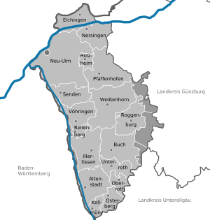
List of municipalities in the Neu-Ulm district
The list of municipalities in the Neu-Ulm district gives an overview of the 17 smallest administrative units in the district . It consists of 17 parishes , five of which are cities . Neu-Ulm and Senden are medium- sized towns , the other three, Illertissen , Vöhringen and Weißenhorn , are small towns . In 1939 the district offices of Neu-Ulm and Illertissen were renamed the district . From 1891 to 1940 and 1948 to 1972 Neu Ulm was an independent city . In its current form, the district was formed after the Bavarian regional reform in 1972 from the Neu-Ulm district - with the exception of two municipalities - the independent city of Neu-Ulm and part of the Illertissen district . The current church structure was completed in 1979. The year in which they joined the municipality is noted for the suburbs of the municipalities.
description
The district can be further divided into three administrative communities (VG):
- VG Altenstadt : with the markets Altenstadt and Kellmünz adIller and the municipality of Osterberg ;
- VG Buch : with Markt Buch and the communities of Oberroth and Unterroth ;
- VG Pfaffenhofen an der Roth : with the market in Pfaffenhofen adRoth and the community of Holzheim ;
The towns of Illertissen , Neu-Ulm , Senden , Vöhringen and Weißenhorn , like the municipalities of Bellenberg , Elchingen , Nersingen and Roggenburg, are not members of an administrative community.
The district has a total area of 515.34 km 2 . The city of Neu-Ulm has the largest area within the district with 80.5 km 2 . This is followed by the town of Weißenhorn with 53.69 km 2 and the Markt Pfaffenhofen adRoth with 42.66 km 2 . Three municipalities have an area larger than 30 km 2 and five municipalities are over 20 km 2 . Two municipalities reach an area of over 10 km 2 , which, however, is not exceeded by four municipalities. The smallest areas have the municipalities of Kellmünz adIller with 8.52 km 2 , Holzheim with 7.6 km 2 and Bellenberg with 5.07 km 2 . The area of the four community-free areas , which are located in the district, is 44.79 km 2 and is therefore relatively large.
The major district town of Neu-Ulm with 58,978 inhabitants has the largest proportion of the district's population of 175,204, followed by the cities of Senden with 22,529 and Illertissen with 17,482. The other two cities, Vöhringen and Weißenhorn each have a population of over 13,000. Two parishes have a population of over 9,000, and another has over 6,000. Another two municipalities have over 4,000 inhabitants. With over 3,000 and over 2,000 residents there is only one municipality each, with over 1,000 there are two. The three smallest municipalities in terms of population have less than 1,000 residents. These are Unterroth with 1112, Osterberg with 918 and Oberroth with 909 inhabitants.
The entire district of Neu-Ulm has a population density of 340 inhabitants per km 2 . The largest population density within the district has the smallest municipality in terms of area - Bellenberg - with 894 inhabitants per km 2, followed by the cities of Senden with 895 and the city of Neu-Ulm with 733. The city of Vöhringen has over 500 inhabitants per km 2 , the city of Illertissen over 400. Two municipalities have over 300 inhabitants per km 2 , the city of Weißenhorn and another municipality have over 200, three municipalities over 100 and five under 100. The most sparsely populated municipalities are Buch with 101, Oberroth with 91 and Osterberg and Unterroth with 62 inhabitants per km 2 .
Since the area of the district slopes from south to north, towards the Danube , the municipality of Osterberg is the highest and Elchingen is the lowest.
A special feature is that the Elchingen community does not have a coat of arms.
Legend
- Municipality : Name of the municipality or city and information about the district to which the eponymous place of the municipality belonged before the regional reform
- Subsites : Enumerated are the formerly independent municipalities of the administrative unit. The year of incorporation is also given. This is also noted for the suburbs that belonged to a different district than the main town of today's municipality before the regional reform.
- VG : Indicates membership in one of the three administrative communities
- Coat of arms : coat of arms of the municipality or city
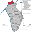
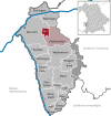
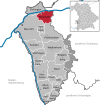
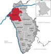
- Map : Shows the location of the municipality or city in the district
- Area : Area of the city or municipality, given in square kilometers
- Population : number of people living in the municipality or city (as of December 31, 2019)
- Population density : The population density is given, calculated on the area of the administrative unit, given in population per km 2 (as of December 31, 2019)
- Altitude : Altitude of the eponymous town or town in meters above sea level
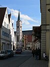
- Image : Image from the respective municipality or city
Communities
| local community | Sub-locations | VG | coat of arms | map | surface | Residents | EW density |
height | image |
|---|---|---|---|---|---|---|---|---|---|
| District of Neu-Ulm |  |
 |
515.34 | 175.204 | 340 | ||||
| Markt Altenstadt (belonged to the district of Illertissen before the regional reform) |
Illereichen-Altenstadt Bergenstetten (1978) Dattenhausen (1972) Filzingen (1978) Herrenstetten (1972) Untereichen (1976) |
VG Altenstadt |
 |
 |
31.3 | 5.141 | 164 | 534 |

|
|
Bellenberg (belonged to the district of Illertissen before the regional reform) |
Bellenberg |  |
 |
5.07 | 4,531 | 894 | 503 | ||
| Markt Buch (belonged to the district of Illertissen before the regional reform) |
Book Christertshofen (1978) Dietershofen near Illertissen (1971) Gannertshofen (1978) Nordholz (1978) Obenhausen (1978) Rennertshofen (1978) Ritzisried (1978) |
VG book |
 |
 |
39.88 | 4,024 | 101 | 539 |

|
|
Elchingen (belonged to the Neu-Ulm district before the regional reform) |
Oberelchingen Thalfingen Unterelchingen Merged into today's municipality in 1978 |
 |
 |
24.87 | 9,543 | 384 | 465 |

|
|
|
Holzheim (belonged to the Neu-Ulm district before the regional reform) |
Holzheim Neuhausen (1970) |
VG Pfaffenhofen an der Roth |
 |
 |
7.6 | 1.952 | 257 | 475 |

|
| City of Illertissen (belonged to the district of Illertissen before the regional reform) |
Illertissen Au (1978) Betlinshausen (1971) Every home (1978) Tiefenbach (1978) |
 |
 |
36.45 | 17,482 | 480 | 513 |

|
|
| Markt Kellmünz adIller (belonged to the district of Illertissen before the regional reform) |
Kellmünz adIller | VG Altenstadt |
 |
 |
8.52 | 1,421 | 167 | 541 | |
|
Nersingen (belonged to the Neu-Ulm district before the regional reform) |
Nersingen Leibi Oberfahlheim Straß Unterfahlheim |
 |
 |
24.27 | 9,512 | 392 | 466 |

|
|
|
Large district town of Neu-Ulm (was a district-free town before the regional reform) |
Neu-Ulm all incorporated places belonged to the district of Neu-Ulm before the regional reform: Burlafingen Finningen Gerlenhofen Hausen Holzschwang Pfuhl Reutti Steinheim (all incorporated between 1972 and 1977) |
 |
 |
80.5 | 58,978 | 733 | 470 |

|
|
|
Oberroth (belonged to the district of Illertissen before the regional reform) |
Oberroth | VG book |
 |
 |
9.95 | 909 | 91 | 536 | |
|
Osterberg (belonged to the district of Illertissen before the regional reform) |
Osterberg Weiler (1978) |
VG Altenstadt |
 |
 |
13.79 | 918 | 67 | 588 |

|
| Markt Pfaffenhofen adRoth (belonged to the district of Neu-Ulm before the regional reform) |
Pfaffenhofen adRoth Balmertshofen (1972) Berg (1972) Beuren (1978) Biberberg (1972) Erbishofen (1969) Kadeltshofen (1978) Niederhausen (1978) Raunertshofen (1978) Roth (1978) Volkertshofen (1972) |
VG Pfaffenhofen an der Roth |
 |
 |
42.66 | 7,243 | 170 | 488 | |
|
Roggenburg (belonged to the district of Neu-Ulm before the regional reform; was called the municipality of Biberach) |
Biberach Ingstetten Meßhofen shooting |
 |
 |
27.41 | 2,758 | 101 | 548 |

|
|
| City of Senden (belonged to the Neu-Ulm district before the regional reform) |
Senden Aufheim (1978) Ay (1971) Hittistetten (1970) Witzighausen (1978) Wullenstetten (1970) |
 |
 |
25.17 | 22,529 | 895 | 498 | ||
|
Unterroth (belonged to the district of Illertissen before the regional reform) |
Unterroth | VG book |
 |
 |
15.37 | 1,112 | 72 | 527 |

|
| City of Vöhringen (belonged to the district of Illertissen before the regional reform) |
Vöhringen all incorporated places belonged to the district of Neu-Ulm before the regional reform: Illerberg Illerzell Thal (all incorporated between 1972 and 1977) |
 |
 |
23.63 | 13,630 | 577 | 499 |

|
|
| City of Weißenhorn (belonged to the Neu-Ulm district before the regional reform) |
Weißenhorn Attenhofen (1972) Biberachzell Bubenhausen Emershofen Grafertshofen Hegelhofen Oberhausen Oberreichenbach Wallenhausen |
 |
 |
53.69 | 13,521 | 252 | 501 |
|
|
| Unregulated areas | Alluvial forest (4.96 km 2 ) Oberroggenburger Wald (6.43 km 2 ) Stoffenrieder Forest (15.79 km 2 ) Unterroggenburger Wald (17.62 km 2 ) |
   
|
44.79 |
See also
Individual evidence
- ↑ "Data 2" sheet, Statistical Report A1200C 202041 Population of the municipalities, districts and administrative districts 1st quarter 2020 (population based on the 2011 census) ( help ).
- ↑ "Data 2" sheet, Statistical Report A1200C 202041 Population of the municipalities, districts and administrative districts 1st quarter 2020 (population based on the 2011 census) ( help ).
- ↑ BayernViewer of the Bavarian Surveying Administration
