
Unterroth
| coat of arms | Germany map | |
|---|---|---|

|
Coordinates: 48 ° 12 ' N , 10 ° 10' E |
|
| Basic data | ||
| State : | Bavaria | |
| Administrative region : | Swabia | |
| County : | New Ulm | |
| Management Community : | book | |
| Height : | 524 m above sea level NHN | |
| Area : | 15.38 km 2 | |
| Residents: | 1112 (Dec. 31, 2019) | |
| Population density : | 72 inhabitants per km 2 | |
| Postal code : | 89299 | |
| Area code : | 07343 | |
| License plate : | NU, ILL | |
| Community key : | 09 7 75 161 | |
| LOCODE : | DE FR8 | |
| Community structure: | 2 parts of the community | |
| Address of the municipal administration: |
Schulweg 1 89299 Unterroth |
|
| Website : | ||
| Mayor : | Norbert Poppele (village community) | |
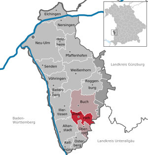
| Location of the community Unterroth in the district of Neu-Ulm | ||
  |
||

Unterroth is a municipality in the Swabian district of Neu-Ulm and a member of the Buch administrative association .
geography
Geographical location
The parish village is located in the Donau-Iller region in Central Swabia in the Roth valley , 30 km southeast of Ulm and 30 km north of Memmingen .
Community structure
The municipality has two officially named parts of the municipality (the type of place is given in brackets ):
- Matzenhofen ( hamlet )
- Unterroth ( parish village )
history
Until the church is planted
Unterroth belonged to the bishopric of Augsburg . Since the Reichsdeputationshauptschluss of 1803 the place belongs to Bavaria. Parts of Unterroth belonged to the rule of the Prince Schwarzenberg , who only came to the Kingdom of Bavaria in 1806 . In the course of the administrative reforms in Bavaria, today's municipality was created with the municipal edict of 1818 .
Population development
| year | 1961 | 1970 | 1987 | 1991 | 1995 | 2000 | 2005 | 2010 | 2015 | 2016 | 2019 |
|---|---|---|---|---|---|---|---|---|---|---|---|
| Residents | 737 | 788 | 833 | 902 | 950 | 938 | 956 | 985 | 1025 | 1046 | 1112 |
Between 1988 and 2019 the community grew from 831 to 1,112 by 281 inhabitants or by 33.8% - the highest percentage increase in the Neu-Ulm district in the period mentioned.
politics
Municipal council
The municipal council had eight members plus the mayor in the 2014–2020 term; By exceeding the 1000-inhabitant mark, the municipal council has twelve members plus the mayor since May 1, 2020. In the municipal council election on March 15, 2020, all twelve seats went to the village community , which had submitted the only nomination with 20 applicants.
mayor
Norbert Poppele (village community) has been the mayor since May 1, 2020; he was elected on March 15, 2020 as the only candidate with 89.3% of the vote. Its predecessors were:
- Gerhard Struve (village community) from 2002 to 2020 and
- Günter Steinmüller (* 1939; † 2016; village community) from 1996 to 2002.
coat of arms
|
|
Blazon : "Split of red and silver with two turned away soaring lions in confused colors." |
| Reasons for the coat of arms: The coat of arms is made up of elements of the two most important former rulers: the division into red and silver comes from the coat of arms of the Principality of Augsburg , the lions from that of Rechberg . |
Culture and sights


- Catholic parish church St. Gordian and Epimachus , Unterroth
- Catholic pilgrimage church of Our Lady of Sorrows in the Matzenhofen district (with baroque furnishings, including frescoes by Franz Martin Kuen )
Economy and Infrastructure
In 2014, the municipal tax revenue was € 740 thousand, of which the equivalent of € 176 thousand (net) was trade tax income .
traffic
In Unterroth, the state road St 2020 and the district road NU 5 intersect . This connects Unterroth with the A 7 motorway - Illertissen exit (AS 124) about five kilometers to the northwest. The nearest airport is Memmingen Airport, about 30 kilometers south.
Economy including agriculture and forestry
In 2014 there were 66 jobs subject to social security contributions in the municipality. Of the resident population, 417 people had an employment relationship subject to compulsory insurance, so that the number of out-commuters was 351 more than that of in-commuters. For 2010 the statistics show 18 farms. 410 hectares of the communal corridor were used for agriculture, 219 hectares of which as grassland and 191 hectares as arable land.
Well-known companies
The Butzbach company, manufacturer of doors and facades, operates a plant in Unterroth.
education
In 2015 there was a day-care center for children in Unterroth with 75 places and 44 visitors.
Born in Unterroth
- Valentin Thalhofer (1825–1891), Provost in Eichstätt , pastoral theologian at the University of Munich
- Alphons Maria Rathgeber (1888–1964), Catholic pastor and author
Web links
Individual evidence
- ↑ "Data 2" sheet, Statistical Report A1200C 202041 Population of the municipalities, districts and administrative districts 1st quarter 2020 (population based on the 2011 census) ( help ).
- ^ Community Unterroth in the local database of the Bavarian State Library Online . Bavarian State Library, accessed on August 21, 2019.
- ↑ https://www.citypopulation.de/de/germany/bayern/09775__neu_ulm/
- ↑ http://www.augsburger-allgemeine.de/illertissen/Trauer-um-ehemaligen-Buergermeister-id37165407.html
- ^ Entry on the coat of arms of Unterroth in the database of the House of Bavarian History

Altenstadt | Bellenberg | Book | Elchingen | Holzheim | Illertissen | Kellmünz on the Iller | Nersingen | Neu-Ulm | Oberroth | Osterberg | Pfaffenhofen an der Roth | Roggenburg | Send | Unterroth | Voehringen | Weissenhorn
Unregulated areas: Auwald | Oberroggenburg Forest | Stoffenrieder Forest | Unterroggenburg Forest