List of municipalities in the Oberallgäu district
The list of municipalities in the Oberallgäu district gives an overview of the 28 smallest administrative units in the district . Two of the parishes are cities . The district town of Sonthofen is a medium- sized town , Immenstadt im Allgäu is a small town .
In its current form, the district was created in the course of the Bavarian territorial reform carried out in 1972 . The district was formed from almost all communities in the districts of Kempten (Allgäu) and Sonthofen ; only the communities Sankt Mang and Sankt Lorenz from the district of Kempten, which were incorporated into the independent city of Kempten , and the community of Stiefenhofen from the district of Sonthofen, which today belongs to the district of Lindau (Lake Constance) , differ from this. The current church structure was completed in 1979.
description
The district can be further subdivided into two administrative communities (VG):
- VG Hörnergruppe : with the communities of Fischen im Allgäu , Balderschwang , Bolsterlang , Obermaiselstein and Ofterschwang ;
- VG Weitnau : with the Weitnau marketand the Missen-Wilhams community ;
The cities of Immenstadt im Allgäu and Sonthofen are like the markets Altusried , Bad Hindelang , Buchenberg , Dietmannsried , Oberstaufen , Oberstdorf , Sulzberg , Wertach and Wiggensbach and the communities of Betzigau , Blaichach , Burgberg im Allgäu , Durach , Haldenwang , Lauben , Oy-Mittelberg , Rettenberg , Waltenhofen and Wildpoldsried are not members of an administrative community.
The district has a total area of 1,527.97 km 2 . The largest area within the district has the Oberstdorf markets with 229.74 km 2 , Bad Hindelang with 159.41 km 2 and Oberstaufen with 125.84 km 2 . The Altusried market has over 90 km 2 , the city of Immenstadt im Allgäu over 80 km 2 . Three municipalities cover an area of over 60 km 2 , four over 50 km 2 and four over 40 km 2 , including the city of Sonthofen . Two municipalities have over 30 km 2 , six over 20 km 2 , three over and one municipality under 10 km 2 . The smallest areas have the municipalities Burgberg im Allgäu with 15.99 km 2 , Fischen im Allgäu with 13.6 km 2 and Lauben with 8.41 km 2 . The community-free area of Kempter Wald has a size of 12.03 km 2 .
The district town of Sonthofen with 21,619 inhabitants, the city of Immenstadt im Allgäu with 14,314 inhabitants, followed by the markets of Oberstdorf with 9696 inhabitants and Altusried with 10,149 inhabitants have the largest share of the population of the district of 156,008 inhabitants. A municipality has over 8,000 inhabitants, two over 7,000, one over 6,000, two over 5,000, five over 4,000 and 3,000, four over 2,000, two over and two under 1,000. The three smallest municipalities in terms of population are Bolsterlang with 1135 inhabitants, Obermaiselstein with 1010 and Balderschwang with 366 inhabitants.
The entire Oberallgäu district has a population density of 102 inhabitants per km 2 . The largest population density within the district has the district town Sonthofen with 464 inhabitants per km 2 , followed by the communities Lauben with 409, Durach with 349 and Fischen im Allgäu with 235. Eleven communities have a population density of over 100, including the town of Immenstadt in the Allgäu . The remaining thirteen communities have a lower population density than the district average of 102. The most sparsely populated communities are Obermaiselstein with 40, Bad Hindelang with 32 and Balderschwang with 9 inhabitants per km 2 .
Legend
- Municipality : Name of the municipality or city and information about the district to which the eponymous place of the municipality belonged before the regional reform
- Subsites : Enumerated are the formerly independent municipalities of the administrative unit. The year of incorporation is also given. This is also noted for the suburbs that belonged to a different district than the main town of today's municipality before the regional reform
- VG : Indicates membership in one of the administrative communities
- Coat of arms : coat of arms of the municipality or city
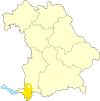
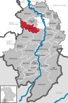
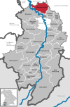
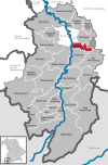
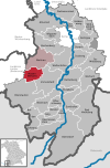
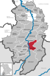
- Map : Shows the location of the municipality or city in the district
- Area : Area of the city or municipality, given in square kilometers
- Population : number of people living in the municipality or city (as of December 31, 2019)
- Population density : The population density is given, calculated on the area of the administrative unit, given in population per km 2 (as of December 31, 2019)
- Altitude : Altitude of the eponymous town or town in meters above sea level
- Image : Image from the respective municipality or city
Communities
| local community | Sub-locations | VG | coat of arms | map | surface | Residents | EW density |
height | image |
|---|---|---|---|---|---|---|---|---|---|
| District of Oberallgäu |  |
 |
1,527.97 | 156.008 | 102 |
 
|
|||
| Markt Altusried (belonged to the Kempten district before the regional reform) |
Altusried Frauenzell (1972) Kimratshofen (1972) Krugzell (1972) Muthmannshofen (1972) |
 |
 |
91.68 | 10.149 | 111 | 722 |
 
|
|
| Markt Bad Hindelang (belonged to the district of Sonthofen before the regional reform) |
Bad Hindelang Unterjoch |
 |
 |
159.41 | 5,176 | 32 | 820 |

|
|
|
Balderschwang (belonged to the Sonthofen district before the regional reform) |
Balderschwang | VG horn group |
 |
 |
41.56 | 366 | 9 | 1,044 |

|
|
Betzigau (belonged to the Kempten district before the regional reform) |
Betzigau |  |
 |
29.27 | 2,939 | 100 | 728 |

|
|
|
Blaichach (belonged to the district of Sonthofen before the regional reform) |
Blaichach Gunzesried |
 |
 |
50.19 | 5,818 | 116 | 733 |

|
|
|
Bolsterlang (belonged to the district of Sonthofen before the regional reform) |
Bolsterlang | VG horn group |
 |
 |
20.33 | 1,135 | 56 | 892 |
|
| Markt Buchenberg (belonged to the district of Kempten before the regional reform) |
Buchenberg Kreuzthal (1971) |
 |
 |
58.11 | 4.157 | 72 | 895 |

|
|
|
Burgberg im Allgäu (belonged to the Sonthofen district before the regional reform) |
Burgberg in the Allgäu |  |
 |
15.99 | 3,301 | 206 | 752 |

|
|
| Markt Dietmannsried (belonged to the Kempten district before the regional reform) |
Dietmannsried Probstried Reicholzried Schrattenbach Überbach |
 |
 |
53.67 | 8,260 | 154 | 682 |

|
|
|
Durach (belonged to the Kempten district before the regional reform) |
Durach |  |
 |
20.74 | 7,244 | 349 | 714 |

|
|
|
Fischen im Allgäu (belonged to the district of Sonthofen before the regional reform) |
Fishing in the Allgäu | VG horn group |
 |
13.6 | 3,194 | 235 | 761 |

|
|
|
Haldenwang (belonged to the Kempten district before the regional reform) |
Haldenwang |  |
 |
26.69 | 3.814 | 143 | 757 |

|
|
| City of Immenstadt im Allgäu (belonged to the district of Sonthofen before the regional reform) |
Immenstadt im Allgäu Akams (1972) Bühl a.Alpsee (1972) Diepolz (1972) Eckarts (1972) Rauhenzell (1972) Stein i.Allgäu (1972) |
 |
 |
81.41 | 14,314 | 176 | 728 |

|
|
|
Lauben (belonged to the Kempten district before the regional reform) |
Arbors |  |
 |
8.41 | 3,439 | 409 | 660 |

|
|
|
Missen-Wilhams (belonged to the Sonthofen district before the regional reform) |
Miss Wilhams |
VG Weitnau |
 |
 |
34.96 | 1,442 | 41 | 860 |

|
|
Obermaiselstein (belonged to the Sonthofen district before the regional reform) |
Obermaiselstein | VG horn group |
 |
 |
25.02 | 1.010 | 40 | 859 |

|
| Markt Oberstaufen (belonged to the district of Sonthofen before the regional reform) |
Oberstaufen Aach i.Allgäu (1972) Thalkirchdorf (1972) |
 |
 |
125.84 | 7,822 | 62 | 791 |

|
|
| Markt Oberstdorf (belonged to the district of Sonthofen before the regional reform) |
Oberstdorf Schöllang (1972) Tiefenbach near Oberstdorf (1972) |
 |
 |
229.74 | 9,696 | 42 | 813 |
 
|
|
|
Ofterschwang (belonged to the Sonthofen district before the regional reform) |
Often swing | VG horn group |
 |
 |
19.54 | 2,068 | 106 | 864 |

|
|
Oy-Mittelberg (belonged to the Kempten district before the regional reform) |
Mittelberg Petersthal (1976) |
 |
 |
60.24 | 4,706 | 78 | 929 |

|
|
|
Rettenberg (belonged to the district of Sonthofen before the regional reform) |
Rettenberg Untermaiselstein (1978) Vorderburg (1978) |
 |
 |
60.08 | 4,458 | 74 | 805 |

|
|
| District town Sonthofen (belonged to the district of Sonthofen before the regional reform) |
Sonthofen old towns (1976) |
 |
 |
46.62 | 21,619 | 464 | 743 |

|
|
| Markt Sulzberg (belonged to the district of Kempten before the regional reform) |
Sulzberg Moosbach (1978) Ottacker (1972; belonged to the district of Sonthofen before the regional reform) |
 |
 |
41.0 | 4,949 | 121 | 712 |

|
|
|
Waltenhofen (belonged to the Kempten district before the regional reform) |
Waltenhofen Martinszell i.Allgäu Memhölz Niedersonthofen (belonged to the district of Sonthofen before the regional reform) |
 |
 |
59.82 | 9,482 | 159 | 721 |

|
|
| Markt Weitnau (belonged to the district of Kempten before the regional reform) |
Weitnau Rechtis-Hellengerst (1963) Wengen (1972) |
VG Weitnau |
 |
 |
65.22 | 5,328 | 82 | 797 |

|
| Markt Wertach (belonged to the district of Sonthofen before the regional reform) |
Wertach |  |
 |
45.63 | 2,516 | 55 | 915 |

|
|
| Markt Wiggensbach (belonged to the Kempten district before the regional reform) |
Wiggensbach |  |
 |
31.83 | 5,039 | 158 | 857 |

|
|
|
Wildpoldsried (belonged to the Kempten district before the regional reform) |
Wildpoldsried |  |
 |
21.35 | 2,567 | 120 | 724 |

|
|
| Unregulated area | Kempter Forest |  |
12.03 |

|
See also
Individual evidence
- ^ Michael Rademacher: German administrative history from the unification of the empire in 1871 to the reunification in 1990. Districts of Kempten and Sonthofen. (Online material for the dissertation, Osnabrück 2006).
- ↑ "Data 2" sheet, Statistical Report A1200C 202041 Population of the municipalities, districts and administrative districts 1st quarter 2020 (population based on the 2011 census) ( help ).
- ↑ "Data 2" sheet, Statistical Report A1200C 202041 Population of the municipalities, districts and administrative districts 1st quarter 2020 (population based on the 2011 census) ( help ).
- ↑ BayernViewer from the Bavarian Surveying Administration (accessed on June 13, 2010)
