List of the municipalities in the Bad Tölz-Wolfratshausen district
The list of municipalities in the Bad Tölz-Wolfratshausen district gives an overview of the 21 smallest administrative units in the district . Three of the municipalities are cities . Geretsried is a medium-sized town , the other two, Bad Tölz and Wolfratshausen , are small towns .
In its current form, the Bad Tölz-Wolfratshausen district was created in the course of the Bavarian territorial reform carried out in 1972 . The district was made up of the Bad Tölz district , most of the Wolfratshausen district and a municipality in the Weilheim i.OB. educated. The current church structure was completed in 1979. In the case of the municipalities, it is noted to which district the main town of the municipality belonged before the regional reform. The year in which they joined the municipality is noted for the suburbs of the municipalities. This is also noted for the suburbs that belonged to a different district than the main town of today's municipality before the regional reform.
description
The district can be further divided into three administrative communities (VG):
- VG Benediktbeuern : with the communities Benediktbeuern and Bichl ;
- VG Kochel a.See : with the communities Kochel a.See and Schlehdorf ;
- VG Reichersbeuern : with the communities Reichersbeuern , Greiling and Sachsenkam ;
The cities of Bad Tölz , Geretsried and Wolfratshausen , like the municipalities of Bad Heilbrunn , Dietramszell , Egling , Eurasburg , Gaißach , Icking , Jachenau , Königsdorf , Lenggries , Münsing and Wackersberg, are not members of an administrative community.
The district has a total area of 1,110.67 km 2 . The largest municipalities in the district are Lenggries with 242.88 km 2 , Jachenau with 128.93 km 2 and Dietramszell with 96.78 km 2 . Each municipality has an area larger than 80 km 2 , 70 km 2 , 60 km 2 or 50 km 2 . Three municipalities have an area of over 40 km 2 , another three are over 30 km 2 , including the city of Bad Tölz . Two municipalities are over 20 km 2 , including the city of Geretsried , four municipalities are over 10 km 2 and two municipalities are smaller than 10 km 2 . The smallest areas have the municipality of Bichl with 13.92 km 2 , the city of Wolfratshausen with 9.13 km 2 and the municipality of Greiling with 7.65 km 2 . The community-free areas have a size of 7.99 km 2 .
The cities of Geretsried with 25,438 inhabitants, Wolfratshausen with 19,033 inhabitants and Bad Tölz with 19,155 inhabitants, followed by the municipality of Lenggries with 10,048 inhabitants, have the largest share of the population of the district of 127,917 inhabitants. Two municipalities have over 5,000 inhabitants, three over 4,000, four over 3,000 and 2,000 respectively. Three municipalities have over and one under 1,000 inhabitants. The three smallest communities in terms of population are Sachsenkam with 1288 inhabitants, Schlehdorf with 1295 and Jachenau with 861 inhabitants.
The entire Bad Tölz-Wolfratshausen district has a population density of 115 inhabitants per km 2 . The largest population density within the district have the cities Wolfratshausen with 2085 inhabitants per km 2 , Geretsried with 1032 and Bad Tölz with 622, followed by the community Icking with 217. Four communities have a population density of over 100. In three of these four communities is the Population density higher than the county average of 115, in a lower. Ten of the remaining municipalities have a population density between 50 and 100. In the three most sparsely populated municipalities, the population density is below 50 inhabitants per km 2 , that is Schlehdorf with 51, Lenggries with 41 and Jachenau with 7 inhabitants per km 2 .
Legend
- Municipality : Name of the municipality or city and information about the district to which the eponymous place of the municipality belonged before the regional reform
- Subsites : Enumerated are the formerly independent municipalities of the administrative unit. The year of incorporation is also given. This is also noted for the suburbs that belonged to a different district than the main town of today's municipality before the regional reform.
- VG : Indicates membership in one of the administrative communities
- Coat of arms : coat of arms of the municipality or city
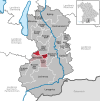
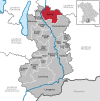
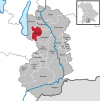
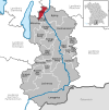
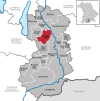
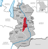
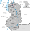
- Map : Shows the location of the municipality or city in the district
- Area : Area of the city or municipality, given in square kilometers
- Population : number of people living in the municipality or city (as of December 31, 2019)
- Population density : The population density is given, calculated on the area of the administrative unit, given in population per km 2 (as of December 31, 2019)
- Altitude : Altitude of the eponymous town or town in meters above sea level
- Image : Image from the respective municipality or city
Communities
| local community | Sub-locations | VG | coat of arms | map | surface | Residents | EW density |
height | image |
|---|---|---|---|---|---|---|---|---|---|
| Bad Tölz-Wolfratshausen district |  |
 |
1,110.67 | 127.917 | 115 |
 
|
|||
|
Bad Heilbrunn (belonged to the Bad Tölz district before the regional reform) |
Bad Heilbrunn Oberbuchen (1978) |
 |
 |
40.32 | 3,961 | 98 | 682 |

|
|
|
Bad Tölz (city) (belonged to the Bad Tölz district before the regional reform) |
Bad Toelz Kirchbichl |
 |
 |
30.8 | 19,155 | 622 | 657 |
 
|
|
|
Benediktbeuern (belonged to the Bad Tölz district before the regional reform) |
Benediktbeuern | VG Benediktbeuern |
 |
 |
37.86 | 3,602 | 95 | 631 |

|
|
Bichl (belonged to the Bad Tölz district before the regional reform) |
Bichl | VG Benediktbeuern |
 |
 |
13.92 | 2,261 | 162 | 623 |

|
|
Dietramszell (belonged to the Wolfratshausen district before the regional reform) |
Dietramszell Ascholding (1972) Baiernrain (1972) Föggenbeuern (1972) Linden (1972) Manhartshofen (1972) |
 |
 |
96.78 | 5,505 | 57 | 684 |

|
|
|
Egling (belonged to the Wolfratshausen district before the regional reform) |
Egling Deining (1978) Endlhausen (1978) Ergertshausen (1973) Moosham (1973) Neufahrn (1973) Thanning (1973) |
 |
 |
74.06 | 5,466 | 74 | 608 |
 
|
|
|
Eurasburg (belonged to the Wolfratshausen district before the regional reform) |
Eurasburg Beuerberg (1978) Herrnhausen (1978) |
 |
 |
40.9 | 4,283 | 105 | 584 |

|
|
|
Gaißach (belonged to the Bad Tölz district before the regional reform) |
Gaissach |  |
 |
38.55 | 3,097 | 80 | 740 |

|
|
|
Geretsried (town) (belonged to the Wolfratshausen district before the regional reform) |
Geretsried Gelting (1978) |
 |
 |
24.65 | 25,438 | 1,032 | 606 |

|
|
|
Greiling (belonged to the Bad Tölz district before the regional reform) |
Greiling | VG Reichersbeuern |
 |
 |
7.65 | 1,474 | 193 | 706 |

|
|
Icking (belonged to the Wolfratshausen district before the regional reform) |
Icking Dorfen (1978) |
 |
 |
16.99 | 3,688 | 217 | 666 |

|
|
|
Jachenau (belonged to the Bad Tölz district before the regional reform) |
Jachenau |  |
 |
128.93 | 861 | 7th | 790 |
 
|
|
|
Kochel a.See (belonged to the Bad Tölz district before the regional reform) |
Kochel a.See | VG Kochel a.See |
 |
 |
80.12 | 4,099 | 51 | 605 |

|
|
Königsdorf (belonged to the Wolfratshausen district before the regional reform) |
Königsdorf Osterhofen Schönrain (belonged to the Bad Tölz district before the regional reform) |
 |
 |
45.69 | 3.132 | 69 | 625 |

|
|
|
Lenggries (belonged to the Bad Tölz district before the regional reform) |
Lenggries |  |
 |
242.88 | 10,048 | 41 | 679 |
 
|
|
|
Münsing (belonged to the Wolfratshausen district before the regional reform) |
Münsing Degerndorf (1979) Holzhausen a.Starnberger See |
 |
 |
52.2 | 4,277 | 82 | 666 |
 
|
|
|
Reichersbeuern (belonged to the Bad Tölz district before the regional reform) |
Reichersbeuern | VG Reichersbeuern |
 |
 |
15.41 | 2,452 | 159 | 717 |

|
|
Sachsenkam (belonged to the Bad Tölz district before the regional reform) |
Sachsenkam | VG Reichersbeuern |
 |
 |
15.93 | 1,288 | 81 | 713 |
 
|
|
Schlehdorf (belonged to the district of Weilheim i.OB. before the regional reform) |
Schlehdorf | VG Kochel a.See |
 |
 |
25.39 | 1,295 | 51 | 609 |

|
|
Wackersberg (belonged to the Bad Tölz district before the regional reform) |
Wackersberg Oberfischbach (1978) Unterfischbach (1972 to Oberfischbach) |
 |
 |
64.83 | 3,502 | 54 | 748 |

|
|
|
Wolfratshausen (city) (belonged to the Wolfratshausen district before the regional reform) |
Wolfratshausen Weidach (1978) |
 |
 |
9.13 | 19,033 | 2,085 | 577 |
 
|
|
| Unregulated areas |
Pupplinger Au (3.72 km 2 ) Wolfratshauser Forst (4.27 km 2 ) |
|
7.99 |
 
|
See also
Individual evidence
- ↑ "Data 2" sheet, Statistical Report A1200C 202041 Population of the municipalities, districts and administrative districts 1st quarter 2020 (population based on the 2011 census) ( help ).
- ↑ "Data 2" sheet, Statistical Report A1200C 202041 Population of the municipalities, districts and administrative districts 1st quarter 2020 (population based on the 2011 census) ( help ).
- ↑ BayernViewer of the Bavarian Surveying Administration (accessed on August 1, 2010)
