List of municipalities in the Berchtesgadener Land district
The list of municipalities in the Berchtesgadener Land district gives an overview of the 15 smallest administrative units in the district . Three of the parishes are small towns .
The Berchtesgadener Land district was created in its current form as part of the Bavarian territorial reform carried out in 1972 . The district was formed from the Berchtesgaden district , parts of the Laufen district and the independent city of Bad Reichenhall . The current church structure was completed in 1979. Bad Reichenhall is the district town of the district; to compensate for the loss of district freedom, the city was elevated to the status of a major district town . In the district no municipalities have come together to form administrative communities. In the case of the municipalities, it is noted to which district the main town of the municipality belonged before the regional reform. The year in which they joined the municipality is noted for the districts of the municipalities. This is also noted for the districts (municipality parts) that belonged to a different district than the main town of today's municipality before the regional reform.
description
The district has a total area of 839.97 km 2 . The largest area within the district has the municipalities Schönau a.Königssee with 131.68 km 2 , Ramsau b.Berchtesgaden with 129.18 km 2 , Schneizlreuth with 97.63 km 2 and the market Teisendorf with 86.77 km 2 . One municipality has an area larger than 40 km 2 and six municipalities have an area of over 30 km 2 including the cities of Bad Reichenhall and Laufen . The remaining four municipalities are over 10 km 2 in size. The smallest areas have the municipality of Piding with 17.55 km 2 , the city of Freilassing with 14.79 km 2 and the municipality of Bayerisch Gmain with 11.4 km 2 . The total area of the two remaining municipality-free areas , which are located in the district, is 29.61 km².
The major district town of Bad Reichenhall with 18,443 residents has the largest share of the district's population of 105,929, followed by the city of Freilassing with 17,147, and the communities of Ainring with 9791 and Teisendorf with 9320 inhabitants. Two communities, Berchtesgaden and Bischofswiesen have over 7,000 inhabitants, the city of Laufen has over 6,000 inhabitants. Three municipalities have over 5,000 inhabitants, one municipality each has over 4,000 or 2,000 inhabitants and the three smallest municipalities have over 1,000 inhabitants. The latter are the communities of Marktschellenberg with 1757 inhabitants, Ramsau b.Berchtesgaden with 1700 and Schneizlreuth with 1284 inhabitants.
The entire district of Berchtesgadener Land has a population density of 126 inhabitants per km 2 . The cities of Freilassing with 1159 inhabitants per km 2 and Bad Reichenhall with 468 have the highest population density within the district , followed by the communities Piding with 310 and Ainring with 297. Three communities have a population density of over 200, another four of over 100. Two of these communities, including the city of Laufen, have a higher population density than the district average of 126. In the remaining four communities, the population density is below 100. The most sparsely populated communities are Schönau a.Königssee with 42, Schneizlreuth with 13 and Ramsau b.Berchtesgaden with 13 inhabitants per km 2 .
Legend
- Municipality : Name of the municipality or city and information about the district to which the eponymous place of the municipality belonged before the regional reform
- Municipality parts : The formerly independent municipalities of the administrative unit are listed. The year of incorporation is also given. This is also noted for the districts (municipality parts) that belonged to a different district than the main town of today's municipality before the regional reform
- Coat of arms : coat of arms of the municipality or city
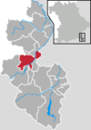
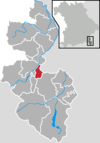
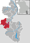
- Map : Shows the location of the municipality or city in the district
- Area : Area of the city or municipality, given in square kilometers
- Population : number of people living in the municipality or city (as of December 31, 2019)
- Population density : The population density is given, calculated on the area of the administrative unit, given in population per km 2 (as of December 31, 2019)
- Altitude : Altitude of the eponymous town or town in meters above sea level
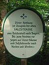
- Image : Image from the respective municipality or city
Communities
| local community | Parish parts | coat of arms | map | surface | Residents | EW density |
height | image |
|---|---|---|---|---|---|---|---|---|
| District of Berchtesgadener Land |  |
 |
839.97 | 105,929 | 126 |
 
|
||
|
Ainring (belonged to the district of Laufen before the regional reform) |
Ainring Strass (1970) |
 |
 |
32.97 | 9,791 | 297 | 461 |

|
|
Anger (belonged to the Berchtesgaden district before the regional reform) |
Anger (municipality was called Stoißberg until 1937) Aufham (1978) Högl (1978; partly - other part today belongs to the municipality of Piding) |
 |
 |
45.91 | 4,528 | 99 | 560 |

|
| Large district town Bad Reichenhall (was a district-free town before the regional reform) |
Bad Reichenhall all incorporated communities belonged to the district of Berchtesgaden before the regional reform: Karlstein (1978) Marzoll (1978) |
 |
 |
39.44 | 18,443 | 468 | 473 |
 
|
|
Bayerisch Gmain (belonged to the district of Berchtesgaden before the regional reform) |
Bayerisch Gmain |  |
 |
11.4 | 3,056 | 268 | 540 |

|
| Markt Berchtesgaden (belonged to the district of Berchtesgaden before the regional reform) |
Berchtesgaden Au (1972) Maria Gern (1972) Salzberg (1972) |
 |
 |
35.61 | 7,698 | 216 | 571 |

|
|
Bischofswiesen (belonged to the district of Berchtesgaden before the regional reform) |
Bischofswiesen |  |
 |
34.46 | 7,341 | 213 | 615 |

|
| City of Freilassing (belonged to the district of Laufen before the regional reform) |
Freilassing |  |
 |
14.79 | 17,147 | 1,159 | 418 |

|
| City of Laufen (belonged to the district of Laufen before the regional reform) |
Laufen Heining (1970) Leobendorf (1978) Triebenbach (1970) |
 |
 |
35.31 | 7,316 | 207 | 404 |

|
| Market Marktschellenberg (belonged before the regional reorganization to the district of Berchtesgaden) |
Marktschellenberg Landschellenberg (1969) Scheffau (1969) |
 |
 |
17.66 | 1,757 | 99 | 478 |

|
|
Piding (belonged to the district of Berchtesgaden before the regional reform) |
Piding Högl (1978; partly - other part today belongs to the municipality of Anger) |
 |
 |
17.55 | 5,444 | 310 | 455 |

|
|
Ramsau near Berchtesgaden (belonged to the district of Berchtesgaden before the regional reform) |
Ramsau near Berchtesgaden |  |
129.18 | 1,700 | 13 | 670 |
 
|
|
|
Saaldorf-Surheim (belonged to the district of Laufen before the regional reform) |
Saaldorf Surheim (merger of the two communities in 1978; community name Saaldorf-Surheim since 1994) |
 |
 |
39.09 | 5,519 | 141 | 449 |

|
|
Schneizlreuth (belonged to the district of Berchtesgaden before the regional reform) |
Schneizlreuth Weißbach adAlpenstrasse (1978) |
 |
 |
97.63 | 1,284 | 13 | 516 |

|
|
Schönau a.Königssee (belonged to the district of Berchtesgaden before the regional reform) |
Schönau a.Königssee Schönau (1978) Königssee (1978) |
 |
 |
131.68 | 5,585 | 42 | 630 |

|
| Markt Teisendorf (belonged to the district of Laufen before the regional reform) |
Teisendorf Freidling (1971) Holzhausen (1972) Neukirchen a.Teisenberg (1978) Oberteisendorf (1978) Roßdorf (1972) |
 |
 |
86.77 | 9,320 | 107 | 500 |

|
| Eck (unincorporated area) | - |  |
 |
12.60 |

|
|||
|
Schellenberger Forst ( community-free area ) |
- |  |
 |
17.01 |

|
See also
Individual evidence
- ^ Michael Rademacher: German administrative history from the unification of the empire in 1871 to the reunification in 1990. Districts of Berchtesgaden and Laufen. (Online material for the dissertation, Osnabrück 2006).
- ↑ "Data 2" sheet, Statistical Report A1200C 202041 Population of the municipalities, districts and administrative districts 1st quarter 2020 (population based on the 2011 census) ( help ).
- ↑ "Data 2" sheet, Statistical Report A1200C 202041 Population of the municipalities, districts and administrative districts 1st quarter 2020 (population based on the 2011 census) ( help ).
- ↑ BayernViewer of the Bavarian Surveying Administration (accessed on June 26, 2010)
