List of communities in the Aichach-Friedberg district
The list of municipalities in the Aichach-Friedberg district gives an overview of the 24 smallest administrative units in the Aichach-Friedberg district . Five of the parishes are markets and two are cities ; both cities, Aichach and Friedberg are medium-sized towns .
The district of Aichach-Friedberg was created in its present form as part of the Bavarian territorial reform carried out in 1972 . The district was formed from the districts of Aichach and Friedberg and parts of the districts of Fürstenfeldbruck and Neuburg ad Donau and a community of Schrobenhausen . The current structure of the parish was not completed until 1994. In that year, the municipality of Baar , which belonged to the Thierhaupten market ( Augsburg district ) from 1978 to 1994 , became independent again and moved to the Aichach-Friedberg district. In the case of the municipalities, it is noted to which district the main town of the municipality belonged before the regional reform. The year in which they joined the municipality is noted for the suburbs of the municipalities. This is also noted for the suburbs that belonged to a different district than the main town of today's municipality before the regional reform.
description
The district can be further divided into five administrative communities (VG):
- VG Aindling : with the market Aindling and the communities Petersdorf and Todtenweis ;
- VG Dasing : with the communities Dasing , Adelzhausen , Eurasburg , Obergriesbach and Sielenbach ;
- VG Kühbach : with the market Kühbach and the community of Schiltberg ;
- VG Mering : with the market Mering and the communities Schmiechen and Steindorf ;
- VG Pöttmes : with the market Pöttmes and the municipality of Baar ;
The cities of Aichach and Friedberg , like Markt Inchenhofen and the communities of Affing , Hollenbach , Kissing , Merching , Rehling and Ried, are not members of an administrative community.
The district has a total area of 783.09 km 2 . The district town of Aichach has the largest area within the district with 92.97 km 2 . This is followed by Markt Pöttmes with 82.58 km 2 and Friedberg with 81.2 km 2 . Two municipalities each have an area larger than 40 or 30 km 2 . Ten municipalities have an area of over 20 km 2 and seven municipalities are over 10 km 2 in size. The smallest areas are in the communities of Steindorf with 16.19 km 2 , Schmiechen with 13.5 km 2 and Obergriesbach with 10.32 km 2 .
The cities Friedberg with 29,979 inhabitants and Aichach with 21,470 inhabitants have the largest share of the population of the district of 134,655 inhabitants , followed by Markt Mering with 14,852 inhabitants and the municipality Kissing with 11,621 inhabitants. One municipality has over 6,000 inhabitants and two municipalities each have over 5,000 and 4,000 inhabitants, respectively. There is a municipality in the district with over 3,000 residents. Four municipalities have over 2,000 inhabitants, nine over and one under 1,000 inhabitants. The three smallest communities in terms of population are Schmiechen with 1,373 inhabitants, Baar with 1,188 and Steindorf with 976 inhabitants.
The entire district of Aichach-Friedberg has a population density of 172 inhabitants per km 2 . The largest population densities within the district have the communities Mering with 553 inhabitants per km 2 and Kissing with 503, followed by the cities Friedberg with 369 and Aichach with 231. Six communities have a population density of over 100. Five of these communities have a population density lower than the district average of 172. In the remaining fourteen communities the population density is below 100. The most sparsely populated communities are Todtenweis with 70, Schiltberg with 66 and Steindorf with 60 inhabitants per km 2 .
Legend
- Municipality : Name of the municipality or city and information about the district to which the eponymous place of the municipality belonged before the regional reform
- Subsites : Enumerated are the formerly independent municipalities of the administrative unit. The year of incorporation is also given. This is also noted for the suburbs that belonged to a different district than the main town of today's municipality before the regional reform
- VG : Indicates membership in one of the administrative communities
- Coat of arms : coat of arms of the municipality or city
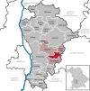
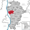
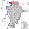
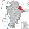
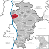
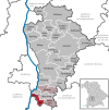
- Map : Shows the location of the municipality or city in the district
- Area : Area of the city or municipality, given in square kilometers
- Population : number of people living in the municipality or city (as of December 31, 2019)
- Population density : The population density is given, calculated on the area of the administrative unit, given in population per km 2 (as of December 31, 2019)
- Altitude : Altitude of the eponymous town or town in meters above sea level
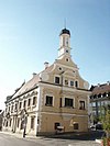
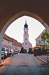
- Image : Image from the respective municipality or city
Communities
| local community | Sub-locations | VG | coat of arms | map | surface | Residents | EW density |
height | image |
|---|---|---|---|---|---|---|---|---|---|
| Aichach-Friedberg district |  |
 |
783.09 | 134,655 | 172 |

|
|||
|
Adelzhausen (belonged to the Aichach district before the regional reform) |
Adelzhausen Burgadelzhausen (belonged to the Friedberg district before the regional reform) Heretshausen |
VG Dasing |
 |
 |
16.97 | 1,726 | 102 | 492 | |
|
Affing (belonged to the Aichach district before the regional reform) |
Affing Anwalting (belonged to the Friedberg district before the territorial reform) Aulzhausen (belonged to the Friedberg district before the territorial reform ) habenhofen (belonged to the Friedberg district before the territorial reform) Haunswies Mühlhausen (belonged to the Friedberg district before the territorial reform) |
 |
44.86 | 5,498 | 123 | 466 |

|
||
|
Aichach (district town) (belonged to the district of Aichach before the regional reform) |
Aichach Algertshausen Ecknach Edenried Gallenbach Griesbeckerzell Klingen Oberbernbach Obermauerbach Oberschneitbach Oberwittelsbach Sulzbach Untergriesbach Unterschneitbach Unterwittelsbach Walchshofen |
 |
 |
92.97 | 21,470 | 231 | 446 |

|
|
|
Aindling (market) (belonged to the Aichach district before the regional reform) |
Aindling Binnenbach (1971) Gaulzhofen (1971) Hausen (1971) Pichl (1971) Stotzard (1971) |
VG Aindling |
 |
 |
31.43 | 4,485 | 143 | 467 |
|
|
Baar (before the regional reform it belonged to the district of Neuburg adDonau; from 1978 to 1994 it belonged to the Thierhaupten district - district of Augsburg ) |
Oberbaar Unterbaar Heimpersdorf |
VG Pöttmes |
 |
 |
16.94 | 1,188 | 70 | 431 |

|
|
Dasing (belonged to the Friedberg district before the regional reform) |
Dasing Laimering Rieden Taiting Wessiszell |
VG Dasing |
 |
 |
40.91 | 5,812 | 142 | 483 |
|
|
Eurasburg (belonged to the Friedberg district before the regional reform) |
Eurasburg Freienried (1972) |
VG Dasing |
 |
 |
23.96 | 1,743 | 73 | 514 | |
|
Friedberg (town) (belonged to the Friedberg district before the regional reform) |
Friedberg Bachern Derching Haberskirch Harthausen Ottmaring Couple Rederzhausen Rinnenthal Rohrbach Stätzling Wiffertshausen Wulfertshausen |
 |
 |
81.2 | 29,979 | 369 | 514 |
|
|
|
Hollenbach (belonged to the Aichach district before the regional reform) |
Hollenbach Igenhausen (1971) Mainbach (1971) Motzenhofen (1971) Schönbach (1971) |
 |
 |
26.12 | 2,401 | 92 | 456 | ||
|
Inchenhofen (Markt) (belonged to the Aichach district before the regional reform) |
Inchenhofen Oberbachern (1972) Sainbach (1978) |
 |
 |
27.55 | 2,647 | 96 | 468 |

|
|
|
Kissing (belonged to the Friedberg district before the regional reform) |
Kissing |  |
 |
23.12 | 11,621 | 503 | 523 |
 
|
|
|
Kühbach (Markt) (belonged to the Aichach district before the regional reform) |
Kühbach Haslangkreit (1978) Oberschönbach (1972) Stockensau (1972) Unterbernbach (1978) |
VG Kühbach |
 |
 |
37.57 | 4,326 | 115 | 456 | |
|
Merching (belonged to the Friedberg district before the regional reform) |
Merching Hochdorf (1980) Steinach near Mering (1980) |
 |
 |
24.83 | 3,218 | 130 | 529 | ||
|
Mering (market) (belonged to the Friedberg district before the regional reform) |
Mering Baierberg (belonged to the Fürstenfeldbruck district before the regional reform) |
VG Mering |
 |
 |
26.87 | 14,852 | 553 | 527 |

|
|
Obergriesbach (belonged to the Aichach district before the regional reform) |
Obergriesbach Zahling (1972) |
VG Dasing |
 |
 |
10.32 | 1.963 | 190 | 479 | |
|
Petersdorf (belonged to the Aichach district before the regional reform) |
Petersdorf Alsmoos Schönleiten Willprechtszell |
VG Aindling |
 |
19.51 | 1,694 | 87 | 461 |

|
|
|
Pöttmes (market) (belonged to the Aichach district before the regional reform) |
Pöttmes Ebenried Echsheim (belonged to the district of Neuburg adDonau before the regional reform) Grimolzhausen (belonged to the district of Schrobenhausen before the regional reform) Gundelsdorf Handzell Immendorf (1971) Kühnhausen (belonged to the district of Neuburg adDonau before the regional reform) Osterzhausen Reicherstein (belonged to the district of Neuburg adDonau before the regional reform adDonau) Schnellmannskreuth Schorn (belonged to the district of Neuburg adDonau before the regional reform ) Wiesenbach (belonged to the district of Neuburg adDonau before the regional reform) |
VG Pöttmes |
 |
82.58 | 6,853 | 83 | 407 |
|
|
|
Rehling (belonged to the Aichach district before the regional reform) |
Rehling |  |
 |
26.26 | 2,581 | 98 | 497 |

|
|
|
Ried (belonged to the Friedberg district before the regional reform) |
Ried Baindlkirch Eismannsberg Hörmannsberg Sirchenried Zillenberg |
 |
 |
29.21 | 3.131 | 107 | 526 | ||
|
Schiltberg (belonged to the Aichach district before the regional reform) |
Schiltberg Allenberg (1972) Aufhausen (1972) Rapperzell (1972) Ruppertszell (1972) |
VG Kühbach |
 |
 |
29.81 | 1,966 | 66 | 455 | |
|
Schmiechen (belonged to the Friedberg district before the regional reform) |
Schmiechen Unterbergen |
VG Mering |
 |
 |
13.5 | 1,373 | 102 | 539 |

|
|
Sielenbach (belonged to the Aichach district before the regional reform) |
Sielenbach Tödtenried (1972) |
VG Dasing |
 |
 |
17.87 | 1,732 | 97 | 467 |

|
|
Steindorf (belonged to the Fürstenfeldbruck district before the regional reform) |
Steindorf Eresried (1978) Hausen near Hofhegnenberg (1978) Hofhegnenberg (1978) |
VG Mering |
 |
 |
16.19 | 976 | 60 | 538 |

|
|
Todtenweis (belonged to the Aichach district before the regional reform) |
Wise to death | VG Aindling |
 |
 |
20.28 | 1,420 | 70 | 449 |

|
See also
Individual evidence
- ↑ "Data 2" sheet, Statistical Report A1200C 202041 Population of the municipalities, districts and administrative districts 1st quarter 2020 (population based on the 2011 census) ( help ).
- ↑ "Data 2" sheet, Statistical Report A1200C 202041 Population of the municipalities, districts and administrative districts 1st quarter 2020 (population based on the 2011 census) ( help ).
- ↑ BayernViewer of the Bavarian Surveying Administration
