List of communities in the district of Neuburg-Schrobenhausen
The list of municipalities in the district of Neuburg-Schrobenhausen gives an overview of the 18 smallest administrative units in the district of Neuburg-Schrobenhausen . Two of the communities are cities , the district town of Neuburg adDonau is a medium- sized town , and Schrobenhausen is a small town . Another two communities are markets.
In its current form, the district of Neuburg-Schrobenhausen was created in the course of the Bavarian territorial reform carried out in 1972 . The district was formed from the main parts of the districts of Neuburg adDonau and Schrobenhausen , two communities in the district of Donauwörth and the independent city of Neuburg adDonau . The current church structure was completed in 1979. In the case of the municipalities, it is noted to which district the main town of the municipality belonged before the regional reform. The year in which they joined the municipality is noted for the suburbs of the municipalities. This is also noted for the suburbs that belonged to a different district than the main town of today's municipality before the regional reform.
description
The district can be further subdivided into two administrative communities (VG):
- VG Neuburg adDonau : with the communities Bergheim and Rohrenfels ;
- VG Schrobenhausen : with the communities Berg im Gau , Brunnen , Gachenbach , Langenmosen and Waidhofen ;
The cities of Neuburg adDonau and Schrobenhausen , as well as the markets of Burgheim and Rennertshofen , like the communities of Aresing , Ehekirchen , Karlshuld , Karlskron , Königsmoos , Oberhausen and Weichering, are not members of an administrative community.
The district has a total area of 739.75 km 2 . The Rennertshofen market has the largest area within the district with 93.07 km 2 . This is followed by the cities of Neuburg adDonau with 81.32 km 2 and Schrobenhausen with 75.31 km 2 . One municipality has an area larger than 60 km 2 , two municipalities are over 40 km 2 , four over 30 km 2 , seven over 20 km 2 and the smallest municipality is over 10 km 2 . The smallest municipalities in terms of area are Langenmosen with 23.89 km 2 , Berg im Gau with 22.61 km 2 and Rohrenfels with 17.52 km 2 .
The large district town of Neuburg adDonau with 29,793 inhabitants has the largest share of the district's population of 97,303, followed by the city of Schrobenhausen with 17,226 inhabitants and the municipality of Karlshuld with 5,927 inhabitants. The two markets and two municipalities have over 4,000 inhabitants, one municipality has over 3,000 inhabitants and five municipalities have over 2,000 inhabitants. The remaining five municipalities have over 1,000 inhabitants. The three smallest communities in terms of population are Rohrenfels with 1548 inhabitants, Langenmosen with 1591 and Berg im Gau with 1305 inhabitants.
The entire district of Neuburg-Schrobenhausen has a population density of 132 inhabitants per km 2 . The cities of Neuburg adDonau with 366 inhabitants per km 2 and Schrobenhausen with 229 have the highest population density within the district , followed by the municipality of Karlshuld with 204. All other municipalities have a lower population density than the district average of 132. Two of these municipalities have a population density between 100 and the district average and in the remaining thirteen municipalities the population density is below 100. The most sparsely populated municipalities are Berg im Gau with 58, the largest municipality in terms of area, the Rennertshofen market with 53 and Brunnen with 53 inhabitants per km 2 .
Legend
- Municipality : Name of the municipality or city and information about the district to which the eponymous place of the municipality belonged before the regional reform
- Subsites : Enumerated are the formerly independent municipalities of the administrative unit. The year of incorporation is also given. This is also noted for the suburbs that belonged to a different district than the main town of today's municipality before the regional reform
- VG : Indicates membership in one of the administrative communities
- Coat of arms : coat of arms of the municipality or city
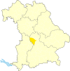
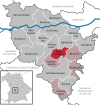
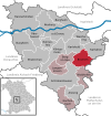
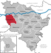
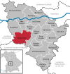
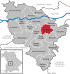
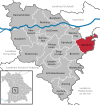
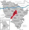
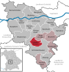
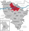
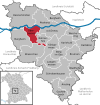
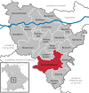
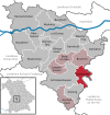
- Map : Shows the location of the municipality or city in the district
- Area : Area of the city or municipality, given in square kilometers
- Population : number of people living in the municipality or city (as of December 31, 2019)
- Population density : The population density is given, calculated on the area of the administrative unit, given in population per km 2 (as of December 31, 2019)
- Altitude : Altitude of the eponymous town or town in meters above sea level
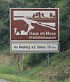
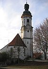
- Image : Image from the respective municipality or city
Communities
| local community | Sub-locations | VG | coat of arms | map | surface | Residents | EW density |
height | image |
|---|---|---|---|---|---|---|---|---|---|
| District of Neuburg-Schrobenhausen |  |
 |
739.75 | 97,303 | 132 |

|
|||
|
Aresing (belonged to the district of Schrobenhausen before the regional reform) |
Aresing Lauterbach (1972) Rettenbach (1972) Weilenbach (1972) |
 |
 |
29.89 | 2,852 | 95 | 426 |

|
|
|
Berg im Gau (belonged to the district of Schrobenhausen before the regional reform) |
Mountain in the Gau | VG Schrobenhausen |
 |
 |
22.61 | 1,305 | 58 | 416 | |
|
Bergheim (belonged to the district of Neuburg adDonau before the regional reform) |
Bergheim Attenfeld (1978) Unterstall (1978) |
VG Neuburg adDonau |
 |
 |
28.95 | 1,878 | 65 | 388 |

|
|
Brunnen (belonged to the district of Schrobenhausen before the regional reform) |
Hohenried fountain (1978) |
VG Schrobenhausen |
 |
 |
32.12 | 1,714 | 53 | 392 | |
|
Burgheim (Markt) (belonged to the district of Neuburg adDonau before the regional reform) |
Burgheim Dezenacker Illdorf Kunding Leidling Moos Ortlfing Straß Wengen |
 |
 |
49.73 | 4,551 | 92 | 406 |

|
|
|
Ehekirchen (belonged to the district of Neuburg adDonau before the regional reform) |
Ehekirchen Ambach (1978) Bonsal (1975) Book (1973) Dinkelshausen (1978) Fernmittenhausen (1978) Haselbach (1976) Hollenbach (1978) Schöneberg (1972) Seiboldsdorf (1978) Walda (1978) Weidorf (1978) |
 |
 |
62.79 | 3,822 | 61 | 416 |

|
|
|
Gachenbach (belonged to the district of Schrobenhausen before the regional reform) |
Gachenbach Peutenhausen (1978) Sattelberg Weilach (1978) |
VG Schrobenhausen |
 |
 |
30.24 | 2,537 | 84 | 452 | |
|
Karlshuld (belonged to the district of Neuburg adDonau before the regional reform) |
Karlshuld Grasheim (1978) |
 |
 |
29.09 | 5,927 | 204 | 377 |
|
|
|
Karlskron (belonged to the district of Neuburg adDonau before the regional reform) |
Karlskron Adelshausen (belonged to the district of Schrobenhausen before the regional reform) Pobenhausen (belonged to the district of Schrobenhausen before the regional reform) |
 |
 |
38.45 | 4,983 | 130 | 372 |
|
|
|
Königsmoos (belonged to the district of Neuburg adDonau before the regional reform) |
Klingsmoos Ludwigsmoos Untermaxfeld (merger 1975) |
 |
 |
40.97 | 4,825 | 118 | 385 | ||
|
Langenmosen (belonged to the district of Schrobenhausen before the regional reform) |
Langenmosen Malzhausen (1972) |
VG Schrobenhausen |
 |
 |
23.89 | 1,591 | 67 | 404 | |
|
Neuburg adDonau (large district town) (was an independent city before the regional reform) |
Neuburg adDonau All communities that were incorporated into Neuburg adDonau belonged to the district of Neuburg adDonau Bergen (1976) Bittenbrunn (1978) Bruck (1976) Feldkirchen (1978) Heinrichsheim (1972) Joshofen (1976) Ried (1976) Zell ( before the regional reform ) 1976) |
 |
 |
81.32 | 29,793 | 366 | 403 |
 
|
|
|
Oberhausen (belonged to the district of Neuburg adDonau before the regional reform) |
Oberhausen Sinning (1972) Unterhausen (1972) |
 |
 |
31.94 | 3,017 | 94 | 434 | ||
|
Rennertshofen (Markt) (belonged to the district of Neuburg an der Donau before the regional reform) |
Rennertshofen Ammerfeld (belonged to the district of Donauwörth before the regional reform ) Bertoldsheim (1978) Emskeim (belonged to the district of Donauwörth before the regional reform) Erlbach Hatzenhofen Hütting Mauern Riedensheim (1975) Rohrbach Stepperg Trugenhofen |
 |
 |
93.07 | 4,966 | 53 | 394 |
 
|
|
|
Rohrenfels (belonged to the district of Neuburg adDonau before the regional reform) |
Rohrenfels Ballersdorf (1978) Wagenhofen (1978) |
VG Neuburg adDonau |
 |
 |
17.52 | 1,548 | 88 | 393 | |
|
Schrobenhausen (town) (belonged to the district of Schrobenhausen before the regional reform) |
Schrobenhausen Edelshausen (1978) Hörzhausen (1971) Mühlried (1978) Sandizell (1972) Steingriff (1971) |
 |
 |
75.31 | 17,226 | 229 | 411 |
 
|
|
|
Waidhofen (belonged to the district of Schrobenhausen before the regional reform) |
Waidhofen Diepoltshofen (1971) Wangen (1971) |
VG Schrobenhausen |
 |
 |
27.32 | 2,323 | 85 | 405 |

|
|
Weichering (belonged to the district of Neuburg adDonau before the regional reform) |
Weichering Lichtenau (1978) |
 |
 |
24.6 | 2,445 | 99 | 373 |

|
See also
Individual evidence
- ↑ "Data 2" sheet, Statistical Report A1200C 202041 Population of the municipalities, districts and administrative districts 1st quarter 2020 (population based on the 2011 census) ( help ).
- ↑ "Data 2" sheet, Statistical Report A1200C 202041 Population of the municipalities, districts and administrative districts 1st quarter 2020 (population based on the 2011 census) ( help ).
- ↑ BayernViewer of the Bavarian Surveying Administration
