
Fountain (bavaria)
| coat of arms | Germany map | |
|---|---|---|
.svg)
|
Coordinates: 48 ° 38 ' N , 11 ° 18' E |
|
| Basic data | ||
| State : | Bavaria | |
| Administrative region : | Upper Bavaria | |
| County : | Neuburg-Schrobenhausen | |
| Management Community : | Schrobenhausen | |
| Height : | 391 m above sea level NHN | |
| Area : | 32.14 km 2 | |
| Residents: | 1714 (Dec. 31, 2019) | |
| Population density : | 53 inhabitants per km 2 | |
| Postal code : | 86564 | |
| Area code : | 08454 | |
| License plate : | ND, SOB | |
| Community key : | 09 1 85 123 | |
| Community structure: | 9 parts of the community | |
| Association administration address: | Herzoganger 1 86529 Schrobenhausen |
|
| Website : | ||
| Mayor : | Thomas Wagner ( CSU and Free Voting Community ) | |
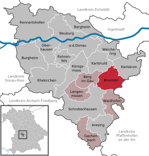
| Location of the community of Brunnen in the district of Neuburg-Schrobenhausen | ||
  |
||

Brunnen is a municipality in the Upper Bavarian district of Neuburg-Schrobenhausen and a member of the Schrobenhausen administrative community .
geography
The community is located in the Ingolstadt planning region .
There are nine officially named municipal parts (the type of settlement is given in brackets ):
|
|
There are the districts of Brunnen and Hohenried.
history
Until the church is planted
Brunnen, located on the edge of the tertiary hill country to the Donaumoos , is a place with 4000 to 6000 years of settlement history, which has been confirmed by various excavations. Located between the moated castles of Oberarnbach and Niederarnbach, on the road links between Hohenwart and Neuburg, Pöttmes and Reichertshofen, Brunnen was a customs post in the 13th century. Brunnen was part of the Electorate of Bavaria , so the Bavarian Moosamt also had a seat in Brunnen. Brunnen was part of the closed Hofmark Niederarnbach of the Barons von Pfetten . In the course of the administrative reforms in Bavaria , today's municipality was created with the municipal edict of 1818 .
Religions
The community is predominantly Catholic.
Population development
Between 1988 and 2018, the community grew from 1,450 to 1,695 by 245 inhabitants or 16.9%.
- 1961: 1292 inhabitants
- 1970: 1297 inhabitants
- 1987: 1440 inhabitants
- 1991: 1485 inhabitants
- 1995: 1493 inhabitants
- 2000: 1549 inhabitants
- 2005: 1600 inhabitants
- 2010: 1577 inhabitants
- 2015: 1656 inhabitants
- 2016: 1672 inhabitants
politics
mayor
Thomas Wagner (CSU / Free Voting Association) was elected 1st Mayor on July 15, 2012. On March 15, 2020 , he was confirmed in office for another six years with 80.9%. Wagner is the successor to Johann Wenger (Free Association of Voters, in office from May 1996 to July 2012). Its predecessor was Willhelm Kopold.
Municipal council
In the municipal council, the Free Community of Voters Brunnen has seven seats and the CSU / Free Community of Voters Hohenried has five seats. As of: Local election on March 15, 2020 , term of office May 2020 to April 2026.
coat of arms
The blazon of the municipal coat of arms adopted in 1967 reads: “Divided by silver and black; above a striding, looking, red armored black lion, below a silver potato blossom with golden stamens. "
Coat of arms history: The lion is taken from the coat of arms of the von Pfetten family. The Barons von Pfetten acquired the Hofmark Niederarnbach in 1665, which largely coincides with the later municipal area of Brunnen. The area of the Hohenried community, which was independent until 1978, had also been in the possession of the Pfetten family since 1665. Since 1838 the patrimonial courts at the court and administrative seat in Niederarnbach were merged. Until the abolition of patrimonial jurisdiction in 1848, the von Pfetten family exercised sovereign rights in what is now the municipality of Brunnen.
Culture and sights

societies
- Sports club DJK Brunnen
- Hohenrieder Musibuam
Attractions
- Church of St. Michael in Brunnen
- St. Margaretha Church in Hohenried
- Niederarnbach moated castle
Architectural monuments
Economy and Infrastructure
Economy including agriculture and forestry
In 1998, according to official statistics, there were eleven employees in the field of agriculture and forestry, 114 in the manufacturing sector and 34 in the field of trade and transport at the place of work. In other economic areas, 17 people were employed at the place of work subject to social security contributions. There were a total of 553 employees at the place of residence subject to social security contributions. There were none in the manufacturing sector and two in the construction sector. In addition, in 1999 there were 104 farms with an agricultural area of 2309 ha, of which 2025 ha were arable land and 279 ha were permanent green space.
traffic
The Paartalbahn has been running on the western edge of the village since 1875 without a stop in Brunnen. In 2009 the Bayerische Regiobahn (BRB) took over the operation on the route from Augsburg to Ingolstadt. This year, demands were made in the community to set up a breakpoint in Brunnen. The municipality then initiated the necessary procedural steps and also decided to build a P + R facility. After a delay of several years, the construction and commissioning of the stop is expected to take place in 2019.
education
There are the following institutions (as of 2015):
- Kindergartens: two facilities with 80 kindergarten places and 72 supervised children
Web links
Individual evidence
- ↑ "Data 2" sheet, Statistical Report A1200C 202041 Population of the municipalities, districts and administrative districts 1st quarter 2020 (population based on the 2011 census) ( help ).
- ^ Greetings from First Mayor Thomas Wagner. Community of Brunnen, accessed on May 31, 2020 .
- ^ Community of Brunnen in the local database of the Bavarian State Library Online . Bayerische Staatsbibliothek, accessed on September 13, 2019.
- ↑ Entry on the coat of arms of Brunnen (Bavaria) in the database of the House of Bavarian History
- ↑ Brunnen municipal council: Railway stopping point is further delayed. In: Schrobenhausener Zeitung . April 13, 2018. Retrieved May 28, 2018 .