
Burgheim
| coat of arms | Germany map | |
|---|---|---|

|
Coordinates: 48 ° 42 ' N , 11 ° 1' E |
|
| Basic data | ||
| State : | Bavaria | |
| Administrative region : | Upper Bavaria | |
| County : | Neuburg-Schrobenhausen | |
| Height : | 404 m above sea level NHN | |
| Area : | 49.73 km 2 | |
| Residents: | 4551 (Dec. 31, 2019) | |
| Population density : | 92 inhabitants per km 2 | |
| Postal code : | 86666 | |
| Area code : | 08432 | |
| License plate : | ND, SOB | |
| Community key : | 09 1 85 125 | |
| LOCODE : | DE UIM | |
| Market structure: | 17 parts of the community | |
Market administration address : |
Marktplatz 13 86666 Burgheim |
|
| Website : | ||
| First Mayor : | Michael Boehm (CSU) | |
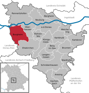
| Location of the Burgheim market in the district of Neuburg-Schrobenhausen | ||
  |
||


Burgheim is a market in the Upper Bavarian district of Neuburg-Schrobenhausen .
geography
The place is in the planning region Ingolstadt .
Community structure
There are 17 officially named parts of the municipality (population figures as of January 1, 2017 in brackets):
|
|
Neighboring communities
- Rennertshofen
- Oberhausen
- Marriage churches
- Rain ( Donau-Ries district )
- Niederschönenfeld (district of Donau-Ries)
- Marxheim (Donau-Ries district)
history
Prehistory and early history
Human settlement in and around Burgheim goes back to the early and prehistory of the Mesolithic Age . The discovery of a notched blade allows it to be dated to around 7000 BC. The exhibit is in the Burgheim Local History Museum and was found near Dezenacker, a part of the municipality of today's Burgheim market.
Four settlements in the districts of Dezenacker, Illdorf, Kunding and Wengen go back to the New Stone Age (Neolithic), the period from 5000 to 2300 BC. A shoe last wedge, the chisel of the time, was found in the Illdorf district of Burgheim and is now also in the local history museum. The wedge is made of amphibolite, so it is not a domestic material and probably a barter item. Sheep farming already prevailed and with it the extraction of sheep's wool, as shown by parts of a 6000 year old loom. Grain was grown and ground, and a stone mill is one of the other museum pieces in Burgheim. Pottery was also produced, and clay was common in the Burgheim area. Exhibited fragments of Neolithic pottery such as stitching ceramics or vessels from the Oberlautbacher Group were dated around 4,000 to 5,000 BC and are now in the Burgheim Local History Museum; the site was again Dezenacker.
The next epoch of human activity was the Bronze Age from 2200 to 800 BC. The main settlement in the area around Burgheim took place predominantly during the tumulus culture from 1600 to 1300 BC, the urn field culture from 1300 to 800 BC, but also in the early Bronze Age. Two Bronze Age settlements in the form of fortified defenses date from this time; probably also the ramparts at Felsenspitz near the Moos district.
The Hallstatt Period , a period of the older Iron Age, was from around 800 to 650 BC . A grave field between Biding, Ortlfing and Straß with around 200 graves with grave goods dates from this era . Ceramics made of black-colored clay were characteristic at this time, as the finds near Burgheim show. Burgheim in the period from the 7th to the 10th century is significant from today's archaeological point of view: With the so-called "Burgheimer Ware", which can be traced back to finds at the "Hitzipoint" in Burgheim in 1949, the place name Burgheim achieved national fame, known to every archeology student.
The later Roman name Parrodunum probably found its origin in the Celtic period (Latène period): a castle on the river Paar. Otherwise nothing is known from this period, no findings are available. Life at the time may have been concentrated in the Oppidum Manching, a huge Celtic settlement from around 300 BC.
The Roman fort Parrodunum was located in today's Burgheim on today's Kirchberg. The fortress had a size of about 0.4 hectares and housed the "Cohors I Herculae Reatorum". The important Danube bridge at Stepperg was presumably monitored and protected from the fort. Another fort was found during excavations about 500 meters east of the Kirchberg. The find situation is characterized by a wood and earth fort that housed auxiliary troops, presumably Syrian archers.
A Burgus near the so-called Mühlhartsfurt was probably in the context of the Roman Bridge and perhaps also served as a connection to today's Neuburg ad Donau, once Venaxamodurum. It can be assumed that the area around Parrodunum was used for regional food production for the troops stationed north of the Danube. For example, in the nearby Wengen district, a main building of a Roman Villa Rustica from the 2nd century AD is documented by aerial archaeological evidence.
Until the church is planted
Burgheim was first mentioned in a document in 1093. Around 1100 the Counts of Lechsgemünd built a castle on the church hill. Presumably in the 11th century the place received market rights . Burgheim was first referred to as a market in 1326 . In 1505 it fell to the Young Palatinate and became Protestant from 1542 to 1617. Since 1685 the place belonged to Electoral Palatinate and in 1778 to Pfalz-Baiern . In 1818 today's political community was established.
20th century
The community was partially destroyed in World War II and occupied by the Americans on April 27, 1945 .
Incorporations
On January 1, 1972, the previously independent municipality of Ortlfing was incorporated. On July 1, 1972, Dezenacker , Moos , Illdorf and Wengen were added. Straß followed on October 1, 1973 . On July 1, 1975, Leidling became part of the Burgheim market. With Kunding on July 1, 1976 the series of incorporations was completed.
Population development
Between 1988 and 2019 the market grew from 4,139 to 4,551 by 412 inhabitants or by 10.0%.
religion
The Catholic parish of St. Cosmas and Damian Burgheim is the seat of the Burgheim parish community and belongs to the dean's office in Neuburg-Schrobenhausen in the diocese of Augsburg . The parish also includes Oggermühle and Grasmühle, the Schnödhof and the St. Ottilia branch church in Wengen.
The parishes of St. Cosmas and Damian in Burgheim, St. Johannes Baptist in Illdorf , St. Georg in Leidling , St. Stephanus in Ortlfing and Mariä Himmelfahrt in Straß belong to the parish community of Burgheim .
The Dezenacker parish with its St. Elisabeth parish church is part of the Sinning parish community , a place in the neighboring parish to the east of Oberhausen. The Kunding parish is a branch of the Gempfing parish and me part of the Bayerdilling parish community .
politics
mayor
Michael Böhm (CSU) has been the first mayor since May 2014; he was elected on March 15, 2020 with 57.5% for a further six years. His predecessors were Manfred Ludwig (CSU, until 1996) and Albin Kaufmann (1996–2014, Free Voters Citizens' Block).
Municipal council
The municipal council has 16 members:
- CSU / JBB: 7 seats (45.7%)
- Free voters civic bloc : 6 seats (33.6%)
- SPD : 3 seats (20.7%)
(Status: local election on March 15, 2020 )
badges and flags
The city coat of arms shows a red crenellated tower in silver with a crenellated wall on both sides and an open gate on green ground. On various official representations, the year 1336 can be found under the coat of arms, the year of the first documentary mention as a market. The coat of arms has been used since the middle of the 14th century.
A white and blue flag with the municipality 's coat of arms is used as the unofficial municipal flag .
Culture and sights
On September 21, 2011, the eight municipalities of Dollnstein , Wellheim , Nassenfels , Egweil , Oberhausen , Burgheim, Rennertshofen and Neuburg an der Donau formed ARGE Urdonautal , a working group whose purpose is to promote and coordinate tourism in the Urdonautal .
In 2018 the seven municipalities of Burgheim, Wellheim , Oberhausen , Ehekirchen , Rohrenfels , Rennertshofen and Bergheim (Upper Bavaria) merged into a joint municipal company and founded the iKommZ Mittlere Donau gKU .
Economy and Infrastructure

The beverage company Brunnthaler Mineralbrunnen Brassler oHG , founded in 1931, is based in Burgheim .
schools
- Burgheim elementary and middle school
Sons and Daughters of the Market
- Simprecht Lenk zu Burgkhaim and Gansshaim, Palatinate-Neuburg Chamber Council († 1564)
- Franz Mayr (1890–1952), lawyer, SA leader, police chief in Munich, district president of Upper Bavaria
- Heinz Schilcher (1930–2015), pharmacist and university professor
- Heinz Paula (* 1951), German politician and Member of the Bundestag (SPD)
- Bernd Meier (1972–2012), professional soccer player and goalkeeping coach
literature
- Chronicle of the market town of Burgheim on the occasion of the 650th anniversary celebration in 1986
- Rainer Christlein, Otto Braasch : The underground Bavaria . Konrad Theiss Verlag, Stuttgart 1990. ISBN 3-8062-0855-7 .
- Ludwig Wamser (Ed.): The Romans between the Alps and the North Sea . Patmos Verlag, Düsseldorf 2004. ISBN 3-491-96108-4
- Bavarian Society for Underwater Archeology (Hrsg.): Archeology of the bridges. Prehistory, antiquity, middle ages, modern times . Verlag Friedrich Pustet, Regensburg 2011. ISBN 978-3-7917-2331-0
Web links
- City administration
- Burgheim: Official statistics of the LfStat
- Burgheim in the location database of the Bayerische Landesbibliothek Online . Bavarian State Library
Individual evidence
- ↑ "Data 2" sheet, Statistical Report A1200C 202041 Population of the municipalities, districts and administrative districts 1st quarter 2020 (population based on the 2011 census) ( help ).
- ↑ 1st Mayor. City administration Burgheim, accessed on June 3, 2020 .
- ^ Community Burgheim in the local database of the Bavarian State Library Online . Bayerische Staatsbibliothek, accessed on September 13, 2019.
- ↑ Key data :: Municipality data :: Municipality - Markt Burgheim. (No longer available online.) Archived from the original on February 15, 2017 ; accessed on February 15, 2017 . Info: The archive link was inserted automatically and has not yet been checked. Please check the original and archive link according to the instructions and then remove this notice.
- ^ Wilhelm Volkert (ed.): Handbook of Bavarian offices, communities and courts 1799–1980 . CH Beck, Munich 1983, ISBN 3-406-09669-7 , p. 532 .
- ^ Federal Statistical Office (ed.): Historical municipality directory for the Federal Republic of Germany. Name, border and key number changes in municipalities, counties and administrative districts from May 27, 1970 to December 31, 1982 . W. Kohlhammer, Stuttgart / Mainz 1983, ISBN 3-17-003263-1 , p. 601 .
- ^ Entry on the coat of arms of Burgheim in the database of the House of Bavarian History
- ↑ Entry on Burgheim on the Kommunalflaggen.eu page
- ↑ side of iKommZ Central Danube gku
- ^ Brunnthaler - family business for 4 generations , brunnthaler-mineralbrunnen.de; Accessed December 25, 2017