List of municipalities in the Unterallgäu district
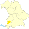
The list of municipalities in the Unterallgäu district gives an overview of the 52 smallest administrative units in the district . It consists of 52 communities , two of which are small towns , the district town of Mindelheim and Bad Wörishofen . In its current form, the district was formed after the Bavarian territorial reform in 1972 from the district of Mindelheim , most of the district of Memmingen , parts of the district of Illertissen , two communities in the district of Krumbach and one municipality in the district of Kaufbeuren . The current church structure was completed in 1979. In the case of the municipalities, it is noted to which district the main town of the municipality belonged before the regional reform. The year in which they joined the municipality is noted for the suburbs of the municipalities. This is also noted for the suburbs that belonged to a different district than the main town of today's municipality before the regional reform.
description
The district can be further divided into eleven administrative communities (VG):
- VG Babenhausen with the market Babenhausen and the communities Egg an der Günz , Kettershausen , Kirchhaslach , Oberschönegg and Winterrieden ;
- VG Bad Grönenbach with the market Bad Grönenbach and the communities Wolfertschwenden and Woringen ;
- VG Boos with the communities Boos , Fellheim , Heimertingen , Niederrieden and Pleß ;
- VG Dirlewang with the Dirlewang marketand the communities of Apfeltrach , Stetten and Unteregg ;
- VG Erkheim with the market in Erkheim and the communities of Kammlach , Lauben and Westerheim ;
- VG Illerwinkel with the Legau marketand the communities of Kronburg and Lautrach ;
- VG Kirchheim in Swabia with the Kirchheim market in Swabia and the municipality of Eppishausen ;
- VG Memmingerberg with the communities Memmingerberg , Benningen , Holzgünz , Lachen , Trunkelsberg and Ungerhausen ;
- VG Ottobeuren with the market Ottobeuren and the communities Böhen and Hawangen ;
- VG Pfaffenhausen with the Pfaffenhausen marketand the communities of Breitenbrunn , Oberrieden and Salgen ;
- VG Türkheim with the Türkheim marketand the communities of Amberg , Rammingen and Wiedergeltingen ;
The cities of Mindelheim and Bad Wörishofen , like the Markt Rettenbach , Markt Wald and Tussenhausen markets and the communities of Buxheim , Ettringen and Sontheim, are not members of an administrative community.
The district has a total area of 1230.24 km 2 . The city of Bad Wörishofen has the largest area within the district with 57.80 km 2 . This is followed by the city of Mindelheim with 56.44 km 2 and the markets Ottobeuren with 55.85 km 2 and Markt Rettenbach with 51.45 km 2 . Four municipalities have an area larger than 40 km 2 , six are larger than 30 km 2 and fourteen municipalities are larger than 20 km 2 . 18 municipalities reach an area of over 10 km 2 , which, however, is not exceeded by six municipalities. The smallest areas have the municipalities of Memmingerberg with 6.09 km 2 , Fellheim with 5.08 km 2 and Trunkelsberg with 1.90 km 2 . The area of the community-free areas in the district is 3.26 km 2 .
The district town of Mindelheim with 15,137 inhabitants has the largest proportion of the district's population of 145,341 , followed by the city of Bad Wörishofen with 16,328 and the Ottobeuren market with 8416. One municipality has a population of over 6,000, two others have over 5,000. With over 3,000 residents there are four, with over 2,000 there are eleven and with over 1,000 there are 26 municipalities in the district. The five smallest municipalities in terms of population have less than 1,000 inhabitants. The three smallest are Winterrieden with 959, Pleß with 859 and Böhen with 772 inhabitants.
The entire district of Unterallgäu has a population density of 118 inhabitants per km 2 . The largest population density within the district has the smallest municipality in terms of area - Trunkelsberg - with 898 inhabitants per km 2, followed by the municipalities of Memmingerberg with 520 and Buxheim with 317. Four other municipalities also have a population density of over 200 inhabitants per km 2 , including the two Towns in the district, Mindelheim and Bad Wörishofen . Fourteen municipalities have more than 100 inhabitants per km 2 , eleven of which are above the district average of 118 inhabitants per km 2 . The remaining 31 municipalities have a population density of less than 100 inhabitants per km 2 . The most sparsely populated communities are Eppishausen with 47, Kirchhaslach with 41 and Böhen with 38 inhabitants per km 2 .
Legend
- Municipality : Name of the municipality or city and information about the district to which the eponymous place of the municipality belonged before the regional reform
- Subsites : Enumerated are the formerly independent municipalities of the administrative unit. If known, the year of incorporation is also given. This is also noted for the suburbs that belonged to a different district than the main town of today's municipality before the regional reform
- VG : Indicates membership in one of the eleven administrative communities
- Coat of arms : coat of arms of the municipality or city
- Map : Shows the location of the municipality or city in the district
- Area : Area of the city or municipality, given in square kilometers
- Population : number of people living in the municipality or city (as of December 31, 2019)
- Population density : The population density is given, calculated on the area of the administrative unit, given in population per km 2 (as of December 31, 2019)
- Altitude : Altitude of the eponymous town or town in meters above sea level
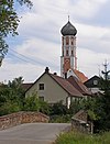
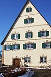
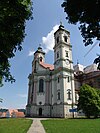
- Image : Image from the respective municipality or city
Communities
| local community | Sub-locations | VG | coat of arms | map | surface | Residents | EW density |
height | image |
|---|---|---|---|---|---|---|---|---|---|
| District of Unterallgäu |  |
 |
1,230.24 | 145.341 | 118 |

|
|||
|
Amberg (belongedto theMindelheimdistrictbefore the regional reform) |
On the mountain | VG Türkheim |
 |
 |
10.95 | 1,473 | 135 | 610 |

|
|
Apfeltrach (belongedto theMindelheimdistrictbefore the regional reform) |
Apfeltrach Köngetried Saulengrain |
VG Dirlewang |
 |
 |
15.03 | 950 | 63 | 622 |

|
| Markt Babenhausen (belonged to the district of Illertissen before the regional reform ) |
Babenhausen Klosterbeuren (1978) |
VG Babenhausen |
 |
 |
27.23 | 5,611 | 206 | 562 |

|
| Markt Bad Grönenbach (belonged to the district of Memmingen before the regional reform ) |
Bad Groenenbach Zell (1972) |
VG Bad Grönenbach |
 |
 |
42.03 | 5,675 | 135 | 716 |

|
| City of Bad Wörishofen (belonged to the Mindelheim district before the regional reform ) |
Bad Wörishofen Dorschhausen (1978) Kirchdorf Schlingen (belonged to the district of Kaufbeuren before the regional reform ) Stockheim |
 |
 |
57.80 | 16,328 | 282 | 631 |

|
|
|
Benningen (belonged to thedistrict ofMemmingenbefore the regional reform) |
Benningen | VG Memmingerberg |
 |
 |
11.17 | 2,042 | 183 | 606 |

|
|
Böhen (belonged to thedistrict ofMemmingenbefore the regional reform) |
Boom | VG Ottobeuren |
 |
 |
20.53 | 772 | 38 | 784 |

|
|
Boos (belonged to thedistrict ofMemmingenbefore the regional reform) |
Boos Reichau (belonged to the district of Illertissen before the regional reform ) |
VG Boos |
 |
 |
17.66 | 2.014 | 114 | 573 |

|
|
Breitenbrunn (belongedto theMindelheimdistrictbefore the regional reform) |
Breitenbrunn Bedernau Loppenhausen |
VG Pfaffenhausen |
 |
 |
41.92 | 2,361 | 56 | 554 |

|
|
Buxheim (belonged to thedistrict ofMemmingenbefore the regional reform) |
Buxheim |  |
 |
10.25 | 3,245 | 317 | 589 |

|
|
| Markt Dirlewang (belonged to the Mindelheim district before the regional reform ) |
Dirlewang Altensteig (1972) Helchenried (1972) |
VG Dirlewang |
 |
 |
23.30 | 2,193 | 94 | 632 |

|
|
Egg an der Günz (belonged to thedistrict ofMemmingenbefore the regional reform) |
Egg an der Günz Engishausen (belonged to the district of Illertissen before the regional reform ) Inneberg (belonged to the district of Illertissen before the regional reform ) |
VG Babenhausen |
 |
 |
20.65 | 1,176 | 57 | 580 |

|
|
Eppishausen (belongedto theMindelheimdistrictbefore the regional reform) |
Eppishausen Haselbach Koenghausen Mörgen |
VG Kirchheim in Swabia |
 |
 |
39.50 | 1,875 | 47 | 560 |

|
| Markt Erkheim (belonged to the district of Memmingen before the regional reform ) |
Erkheim Arlesried Daxberg Schlegelsberg |
VG Erkheim |
 |
 |
32.18 | 3,148 | 98 | 598 |

|
|
Ettringen (belongedto theMindelheimdistrictbefore the regional reform) |
Ettringen Siebnach (1978) Traunried (1978) |
 |
 |
41.5 | 3,492 | 84 | 582 |

|
|
|
Fellheim (belonged to thedistrict ofMemmingenbefore the regional reform) |
Fellheim | VG Boos |
 |
 |
5.08 | 1,152 | 227 | 568 |

|
|
Hawangen (belonged to thedistrict ofMemmingenbefore the regional reform) |
Hawangen | VG Ottobeuren |
 |
 |
14.50 | 1,315 | 91 | 637 |

|
|
Heimertingen (belonged to thedistrict ofMemmingenbefore the regional reform) |
Heimertingen | VG Boos |
 |
 |
13.88 | 1,811 | 130 | 578 |

|
|
Holzgünz (belonged to thedistrict ofMemmingenbefore the regional reform) |
Holzgünz Schwaighausen |
VG Memmingerberg |
 |
 |
12.10 | 1,364 | 113 | 602 |

|
|
Kammlach (municipality area belongedto theMindelheimdistrictbefore the regional reform) |
Oberkammlach Unterkammlach |
VG Erkheim |
 |
 |
26.73 | 1,837 | 69 | 605 |
|
|
Kettershausen (belonged to thedistrict ofIllertissenbefore the regional reform) |
Kettershausen Bebenhausen (1978) Mohrenhausen (1972) Tafertshofen (1972) Zaiertshofen (1972) |
VG Babenhausen |
 |
 |
26.73 | 1,754 | 66 | 545 |

|
|
Kirchhaslach (belonged to thedistrict ofIllertissenbefore the regional reform) |
Kirchhaslach Greimeltshofen Herretshofen Olgishofen |
VG Babenhausen |
 |
 |
32.04 | 1,298 | 41 | 553 |

|
| Markt Kirchheim in Swabia (belonged to the Mindelheim district before the regional reform ) |
Kirchheim in Schwaben Derndorf Hasberg (belonged to the district of Krumbach before the regional reform ) Spöck Tiefenried (belonged to the district of Krumbach before the regional reform ) |
VG Kirchheim in Swabia |
 |
 |
31.95 | 2,689 | 84 | 581 |
 
|
|
Kronburg (belonged to thedistrict ofMemmingenbefore the regional reform) |
Kronburg Kardorf (1977) |
VG Illerwinkel |
 |
 |
20.19 | 1,770 | 88 | 693 |

|
|
Lachen (belonged to thedistrict ofMemmingenbefore the regional reform) |
Laugh | VG Memmingerberg |
 |
 |
13.34 | 1,688 | 127 | 650 |
|
|
Lauben (belonged to thedistrict ofMemmingenbefore the regional reform) |
Lauben Frickenhausen |
VG Erkheim |
 |
 |
18.83 | 1,372 | 75 | 595 |

|
|
Lautrach (belonged to thedistrict ofMemmingenbefore the regional reform) |
Lautrach | VG Illerwinkel |
 |
 |
8.07 | 1,278 | 158 | 630 |

|
| Markt Legau (belonged to the district of Memmingen before the regional reform ) |
Legau Maria Steinbach (1977) |
VG Illerwinkel |
 |
 |
36.35 | 3,290 | 91 | 668 |

|
|
Markt Rettenbach (Markt) (belonged to thedistrict ofMemmingenbefore the regional reform) |
Markt Rettenbach Engetried (1978) Eutenhausen (1978; belonged to the Mindelheim district before the regional reform ) Frechenrieden (1978) Gottenau (1978) Lannenberg (1972) Mussenhausen (1978; belonged to the Mindelheim district before the regional reform ) Wineden (1972) |
 |
 |
51.45 | 3,859 | 75 | 679 |

|
|
|
Markt Wald (market) (belongedto theMindelheimdistrictbefore the regional reform) |
Markt Wald Anhofen (1978) Immelstetten (1978) Oberneufnach (1978) |
 |
30.82 | 2,189 | 71 | 634 |

|
||
|
Memmingerberg (belonged to thedistrict ofMemmingenbefore the regional reform) |
Memmingerberg | VG Memmingerberg |
 |
 |
6.09 | 3.164 | 520 | 603 |

|
| District town Mindelheim (belonged to the district of Mindelheim before the regional reform ) |
Mindelheim Gernstall (1971) Heimenegg (1965) Mindelau (1976) Nassenbeuren (1978) Oberauerbach (1978) Unterauerbach (1976) Westernach (1976) |
 |
 |
56.44 | 15,137 | 268 | 603 |

|
|
|
Niederrieden (belonged to thedistrict ofMemmingenbefore the regional reform) |
Depressed | VG Boos |
 |
 |
13.90 | 1,443 | 104 | 533 |

|
|
Oberrieden (belongedto theMindelheimdistrictbefore the regional reform) |
Oberrieden Unterrieden (197) |
VG Pfaffenhausen |
 |
 |
20.82 | 1,208 | 58 | 578 |

|
|
Oberschönegg (belonged to thedistrict ofIllertissenbefore the regional reform) |
Oberschönegg Dietershofen b. Babenhausen Weinried |
VG Babenhausen |
 |
 |
18.28 | 978 | 54 | 624 |

|
| Markt Ottobeuren (belonged to the district of Memmingen before the regional reform ) |
Ottobeuren Betzisried Guggenberg (1972) Haitzen (1972) Ollarzried |
VG Ottobeuren |
 |
 |
55.85 | 8,416 | 151 | 660 |
|
| Markt Pfaffenhausen (belonged to the Mindelheim district before the regional reform ) |
Pfaffenhausen Egelhofen Schöneberg (1974) Weilbach (1972) |
VG Pfaffenhausen |
 |
 |
21.11 | 2,626 | 124 | 563 |

|
|
Pleß (belonged to thedistrict ofMemmingenbefore the regional reform) |
Pleas | VG Boos |
 |
 |
15.38 | 859 | 56 | 558 |

|
|
Rammingen (municipalityarea waspart of theMindelheimdistrict before the regional reform) |
Oberrammingen (1973) Unterrammingen (1973) |
VG Türkheim |
 |
 |
19.27 | 1,542 | 80 | 593 |

|
|
Salgen (belongedto theMindelheimdistrictbefore the regional reform) |
Salgen Bronnen (1978) Hausen |
VG Pfaffenhausen |
 |
 |
23.30 | 1,441 | 62 | 557 |

|
|
Sontheim (belonged to thedistrict ofMemmingenbefore the regional reform) |
Sontheim Attenhausen |
 |
 |
26.53 | 2,698 | 102 | 620 |

|
|
|
Stetten (belongedto theMindelheimdistrictbefore the regional reform) |
Stetten Erisried |
VG Dirlewang |
 |
 |
15.71 | 1,421 | 90 | 613 |

|
|
Trunkelsberg (belonged to thedistrict ofMemmingenbefore the regional reform) |
Trunkelsberg | VG Memmingerberg |
 |
 |
1.90 | 1,707 | 898 | 625 |

|
| Markt Türkheim (belonged to the Mindelheim district before the regional reform ) |
Türkheim Irsingen (1978) |
VG Türkheim |
 |
 |
23.52 | 7,332 | 312 | 598 |

|
| Markt Tussenhausen (belonged to the Mindelheim district before the regional reform ) |
Tussenhausen Mattsies (1978) Zaisertshofen (1978) |
 |
 |
41.79 | 3,047 | 73 | 575 |

|
|
|
Ungerhausen (belonged to thedistrict ofMemmingenbefore the regional reform) |
Ungerhausen | VG Memmingerberg |
 |
 |
7.02 | 1,121 | 160 | 619 |

|
|
Unteregg (belongedto theMindelheimdistrictbefore the regional reform) |
Unteregg Oberegg (1972) Warmisried (1972) |
VG Dirlewang |
 |
 |
23.70 | 1,387 | 59 | 717 |

|
|
Westerheim (belonged to thedistrict ofMemmingenbefore the regional reform) |
Westerheim Günz |
VG Erkheim |
 |
21.17 | 2,219 | 105 | 602 |

|
|
|
Wiedergeltingen (belongedto theMindelheimdistrictbefore the regional reform) |
Again | VG Türkheim |
 |
11.61 | 1,443 | 124 | 611 |

|
|
|
Winterrieden (belonged to thedistrict ofIllertissenbefore the regional reform) |
Winter peace | VG Babenhausen |
 |
 |
9.79 | 959 | 98 | 575 |

|
|
Wolfertschwenden (belonged to thedistrict ofMemmingenbefore the regional reform) |
Wolfertschwenden Dietratried (1972) Niederdorf (1972) |
VG Bad Grönenbach |
 |
 |
14.26 | 2,070 | 145 | 677 |

|
|
Woringen (belonged to thedistrict ofMemmingenbefore the regional reform) |
Woringen | VG Bad Grönenbach |
 |
 |
17.54 | 2,102 | 120 | 632 |
|
| Unregulated areas | Ungerhauser Forest (3.26 km 2 ) |  |
3.26 |
See also
Individual evidence
- ^ Michael Rademacher: German administrative history from the unification of the empire in 1871 to the reunification in 1990. Districts Illertissen, Kaufbeuren, Krumbach, Memmingen and Mindelheim. (Online material for the dissertation, Osnabrück 2006).
- ↑ "Data 2" sheet, Statistical Report A1200C 202041 Population of the municipalities, districts and administrative districts 1st quarter 2020 (population based on the 2011 census) ( help ).
- ↑ "Data 2" sheet, Statistical Report A1200C 202041 Population of the municipalities, districts and administrative districts 1st quarter 2020 (population based on the 2011 census) ( help ).
- ↑ BayernViewer from the Bavarian Surveying Administration (accessed February 14, 2010)
