
District of Unterallgäu
| coat of arms | Germany map |
|---|---|

|

Coordinates: 48 ° 2 ' N , 10 ° 23' E |
| Basic data | |
| State : | Bavaria |
| Administrative region : | Swabia |
| Administrative headquarters : | Mindelheim |
| Area : | 1,230.06 km 2 |
| Residents: | 145,341 (Dec. 31, 2019) |
| Population density : | 118 inhabitants per km 2 |
| License plate : | MN |
| Circle key : | 09 7 78 |
| NUTS : | DE27C |
| Circle structure: | 52 municipalities |
| Address of the district administration: |
Bad Wörishofer Strasse 33 87719 Mindelheim |
| Website : | |
| District Administrator : | Alex Eder ( FW ) |
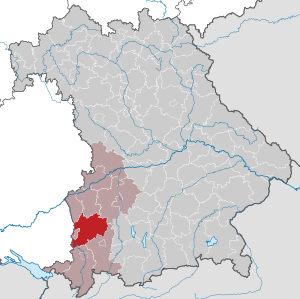
| Location of the district of Unterallgäu in Bavaria | |
  |
|


The district of Unterallgäu is centrally located in the Bavarian administrative district of Swabia . It belongs to the Danube-Iller planning region . The seat of the district administration is the district town Mindelheim , the largest city (as of June 30, 2011) is Bad Wörishofen . The district was founded in 1972 from large parts of the former districts of Mindelheim and Memmingen and some communities in the former districts of Illertissen, Kaufbeuren and Krumbach. On May 1, 1973 it was given the new name Landkreis Unterallgäu . The district area extends to the north beyond the actual Allgäu area, part of the district belongs to Central Swabia in terms of landscape . Above all, the areas around the villages of Bad Grönenbach , Legau and Böhen can be attributed to the Allgäu.
The Buxheim exclave in the west is separated from the rest of the district by the city of Memmingen .
geography
location
The southern district area belongs to the grassland area of the pre-alpine hill country ; the northern part belongs to the Iller- Lech -Platte of the Swabian-Bavarian hill country. With the Iller in the west and the Wertach in the east, the district has two natural borders, which as border rivers roughly indicate the boundaries of the area. Two communities in the Unterallgäu ( Amberg and Wiedergeltingen ) lie east of the Wertach.
The area of the district covers 1,230.24 km². It consists of 52 cities, markets and communities. The largest north-south expansion in the medium-sized district is 54 km ( Haselbach - Legau ), the largest east-west expansion 44 km ( Heimertingen - Amberg ). The only area still free of municipalities is the Ungerhauser Forest with an area of 3.26 km². The northernmost village of the Unterallgäu is Kettershausen , the southernmost is Legau. The westernmost village is Lautrach , the easternmost Amberg .
Neighboring areas
The district borders in a clockwise direction in the northwest on the Bavarian districts of Neu-Ulm , Günzburg , Augsburg , Ostallgäu and Oberallgäu as well as the Baden-Württemberg districts of Ravensburg and Biberach . It also borders the independent Bavarian city of Memmingen in the west.
Landscape and climate
The district is crossed by the four long valleys of Iller , Günz , Mindel and Wertach . In between there are mostly forested terminal moraines from the Ice Age. The country opens up from north to south from broad plains to a varied hilly landscape. In the southern part of the district, the landscape belongs to the pronounced pre-alpine grassland area. At the northern edge of the district in the Günztal north of Zaiertshofen 510 and in the Mindeltal north of Tiefenried about 520 meters in altitude are measured. The terrain rises to the south and reaches its highest point at 849 meters above Oberwarlins (municipality of Böhen) on the border with the Oberallgäu district. The difference in altitude is therefore more than 300 meters. The climate of the individual district parts also fluctuates in a similar relationship. The climate is pre-alpine, with Atlantic influences predominating. In the southern district area, the climate is influenced by foehn and congested weather conditions in the Eastern Alps. Precipitation and temperature depend on the altitude. The amount of annual precipitation is between 900 mm in the north and 1,200 mm in the south of the district. This makes the Unterallgäu one of the rainiest areas in Germany.
With an average annual temperature of 6.8 to 7.3 ° C and 13 to 15 ° C in the main growing season from May to July, the temperatures can be classified as "moderately cool" or "cool". The southern district counts to the cooler zone due to the altitude of up to 845 meters. This “ climate line ” runs from Legau via Bad Grönenbach, Ottobeuren, Wineden to Warmisried.
Nature, nature and landscape protection
→ Main article: Nature conservation and protected areas in the Unterallgäu district

The Augsburg - Western Forests Nature Park , which extends to Türkheim in the south and includes the perennial area, is around 1/10 of its area in the district.
In order to preserve ecologically valuable areas and to protect endangered animal species, the district endeavors to buy up areas worthy of protection in order to be able to maintain them in a near-natural state and thus to secure the ecological balance in the subregions. Nature reserves in the district are the Benninger Ried (22 ha), the Hundsmoor (21 ha) and the Pfaffenhauser Moos (approx. 51 ha) as well as the "Kettershauser Ried" (44 ha).
The landscape protection areas in the district are: On both sides of the Iller (from the district border Oberallgäu to Lautrach, 800 ha), Untere Iller near Kardorf (from Lautrach to the city limits of Memmingen, 80 ha), south and east of the Iller (west from Volkratshofen to Buxheim, 170 ha), Illerauen north of Buxheim (from Buxheim to the district border Neu-Ulm, 400 ha), Mühlbachtal (south of Wolfertschwenden, 700 ha), Hochfirst (west of Erisried, 600 ha) and the Wertachauen (from the district border Ostallgäu to the District border Augsburg, 800 ha).
Almost 500 designated biotopes guarantee the preservation of ecological compensation zones in the midst of agricultural cultivated land and for the development of unused and planned settlement areas. The list of natural monuments contains more than 100 other natural monuments , the most important of which are:
- Aurikelschlucht (Markt Rettenbach, district Engetried)
- Blumenwiese Goßmannshofen (municipality and district Lachen, owned by the district)
- Geological organs near Bossarts (Wolfertschwenden community, Dietratried district)
- Leinhang (community and district Heimertingen)
- Weiherbrunner Quellen (Markt Bad Grönenbach, district Zell)

history
Rulership and administrative history
At the beginning of the 19th century, the district courts of Grönenbach , Ottobeuren , Mindelheim and Türkheim were established in today's district area in 1804 . In 1808 the Memmingen City Court was formed. The city of Memmingen became a district immediate city through the appointment of a police commissioner in 1809. All administrative districts initially belonged to the Lechkreis , from 1810 to the Illerkreis and from 1817 to the Oberdonaukreis , which was renamed Swabia and Neuburg (later just Swabia ) in 1838 .
In 1862 the district office of Memmingen was formed from the district courts of Grönenbach and Ottobeuren as well as the district of the city and district court of Memmingen. The latter was established from 14 municipalities of the district court Grönenbach and Ottobeuren. Furthermore, the Mindelheim District Office was created from the Mindelheim and Türkheim regional courts. In 1880 some communities in this district were transferred to the districts of Kaufbeuren, Augsburg and Krumbach.

On January 1, 1939, the designation district was introduced as everywhere else in the German Reich . So the district offices became the districts of Memmingen and Mindelheim.
In 1940 the independent city of Memmingen was incorporated into the district of Memmingen, but it became independent again in 1948.

As part of the regional reform in Bavaria , a new district of Mindelheim was formed on July 1, 1972 from the following components :
- All communities of the old district of Mindelheim except for the municipality of Traun Ried , which for the district of Augsburg came
- All municipalities in the district of Memmingen with the exception of the municipalities Amendingen and Buxach , which were incorporated into the independent city of Memmingen
- The communities of Babenhausen , Dietershofen near Babenhausen , Engishausen , Greimeltshofen, Herretshofen, Inneberg , Kirchhaslach , Klosterbeuren , Oberschönegg , Olgishofen, Reichau, Weinried , Winterrieden and Zaiertshofen from the Illertissen district
- The community of Schlingen from the Kaufbeuren district
- The communities Hasberg and Tiefenried from the Krumbach district (Swabia)
On May 1, 1973, the district was given its current name Landkreis Unterallgäu . The most important rulers of the numerous sovereign territories that previously existed in the area of the district were the Upper Swabian Imperial Abbey of Ottobeuren , the Swabian Fuggers and the Memminger Unterhospitalstiftung .
On July 1, 1976, the Unterallgäu district ceded the communities of Dickenreishausen , Eisenburg and Steinheim to the independent city of Memmingen, and on May 1, 1978 also the community of Volkratshofen with Ferthofen . On May 1, 1978, the district received the Traunried community from the Augsburg district, which was incorporated into the Ettringen community , and the communities Bebenhausen and Kettershausen from the Neu-Ulm district.
Development of the population
From 1987 to 2013 the Unterallgäu district grew by around 21,700 inhabitants. At the beginning of the 21st century, the population stagnated at around 136,000, before rising steadily again from around 2010. As of December 31, 2013, 137,484 people lived in the district. Between 1988 and 2018 the district grew from 117,139 to 144,041 by 26,902 inhabitants or 23%.
The following figures refer to the territorial status on May 25, 1987.
| Population development | ||||||||||||||
|---|---|---|---|---|---|---|---|---|---|---|---|---|---|---|
| year | 1840 | 1900 | 1939 | 1950 | 1961 | 1970 | 1987 | 1990 | 1995 | 2000 | 2005 | 2010 | 2015 | |
| Residents | 58,780 | 69,170 | 78.132 | 117,358 | 104,927 | 111,531 | 115,770 | 121,157 | 130.166 | 133,709 | 135,708 | 135,366 | 140.419 | |
politics
List of district administrators

| Term of office | District Administrator | Political party | Others |
|---|---|---|---|
| July 1, 1972 to April 30, 1978 | Otto Weikmann | FWV | 1967–1972 District Administrator in the Mindelheim district |
| May 1, 1978 to July 31, 2006 | Hermann Haisch | CSU | |
| August 1, 2006 to April 30, 2020 | Hans-Joachim Weirather | FW | |
| From May 1st, 2020 | Alex Eder | FW |
In an early district election on July 16, 2006, Hans-Joachim Weirather prevailed against his competitors Klaus Holetschek (CSU), Michael Helfert (SPD) and Doris Kienle (GRÜNE) in the first ballot. He was confirmed in office in the 2012 district election. Deputies of the district administrator are Stefan Winter (CSU), Helmut Koch (SPD) and Marlene Preisinger (FW).
Alex Eder was only 14 votes short of an absolute majority among four applicants in the election on March 15, 2020; in the runoff election on March 29, 2020, he received 80.1% of the vote.
District council
The distribution of seats in the district council for the last local elections:
| Party / list | 2020 election | Election 2014 | ||
|---|---|---|---|---|
| % | Seats | % | Seats | |
| CSU | 31.3 | 19th | 42.0 | 25th |
| Free voters | 24.9 | 15th | 23.6 | 14th |
| GREEN | 13.7 | 8th | 8.5 | 5 |
| Young Voters Union (JWU) | 8.2 | 5 | 8.0 | 5 |
| AfD | 7.4 | 5 | - | - |
| SPD | 6.9 | 4th | 10.3 | 6th |
| ödp / citizens for the environment | 4.9 | 3 | 6.1 | 4th |
| FDP | 2.1 | 1 | 1.5 | 1 |
| left | 0.5 | 0 | - | - |
| total | 100 | 60 | 100 | 60 |
| voter turnout | 61.0% | 58.9% | ||
Coat of arms, flag and logo
|
|
Blazon : “With a curved, lowered point with the Bavarian diamonds split by black and gold; in front a golden rosette, behind a blue lily. " |
|
Justification of the coat of arms: In the southern part of the district, the old Ottobeuren abbey dominates historically, the heraldic figure of which is the golden rosette on a black background.
The house of the Fuggers with its centers in Kirchheim and Babenhausen should be mentioned among the secular rulers . The Fugger lily represents this part of the district's history. The dominions of Mindelheim and Türkheim had a close relationship with Bavaria since the 17th century. The Bavarian diamonds indicate this and also symbolize the Bavarian administration in Swabia since the early 19th century. The design of the coat of arms comes from the monastery archivist and district home administrator Aegidius Kolb and the design was done by Rudolf Mussgnug from Nördlingen. |
The flag has blue, yellow and blue stripes with and without a circular coat of arms.
The district logo consists of the lettering Unterallgäu Landkreis and a curved line in which the colors blue, green and yellow alternate. The word Allgäu in the word Unterallgäu is written in bold and testifies to the policy of the district administrator Hans-Joachim Weirather of the further progress of the generalization of the actually Central Swabian district.
Partner circles
The partner county is the Polish powiat Gostyński ; the sponsoring district is Nordhausen .
Economy and Infrastructure
With an animal population of 70,000 cows, the district is Bavaria's most milk-rich district. In the past few decades, the formerly predominantly agricultural district has undergone major economic change and is now home to a diverse range of industries from all sectors. Thanks to the willingness of the local companies to invest, the relocation of future-oriented companies and, last but not least, the diligence of the citizens, the Unterallgäu presents itself today as a solid and crisis-proof economic area with great future potential. In the Future Atlas 2016, the district was ranked 115th out of 402 districts, municipal associations and independent cities in Germany, making it one of the regions with “future opportunities”.
Important employers in the Unterallgäu district include Ehrmann AG in Oberschönegg , Multivac Sepp Haggenmüller in Wolfertschwenden , Grob-Werke in Mindelheim and Wanzl Metallwarenfabrik in Kirchheim .

The unemployment rate in November 2017 in the Unterallgäu district was 1.6%.
traffic

Streets
The federal highways 7 and 96 run through the district area and intersect the Memmingen interchange on the district area . Other federal highways are the B 16 and B 300 .
rails
Since no railway construction was initially planned for public transport, the city of Memmingen took the initiative and built the Illertalbahn in 1862/63 , which follows the river from Ulm to Kempten from north to south.
In 1874 the Bavarian State Railroad opened a line from Buchloe via Mindelheim to Memmingen , which was extended in 1889 to the Württemberg State Railroad in the direction of Leutkirch - Kißlegg .
In the following years local railways supplemented the line network:
- 1894: Kellmünz - Babenhausen
- 1900: Ungerhausen - Ottobeuren
- 1904: Memmingen - Legau
- 1908: Türkheim train station - Ettringen, which was extended to Gessertshausen via Markt Wald in 1911/12
- 1909: Mindelheim - Pfaffenhausen - Kirchheim, which was connected to Krumbach - Günzburg in 1910.
A special feature was the line from Türkheim-Bahnhof - Bad Wörishofen, opened by the local railway company Wörishofen in 1896, which was operated electrically until 1939.

Passenger traffic was shut down on more than a third of the total network of 156 km between 1960 and 1991:
- 1960: Pfaffenhausen - Kirchheim 6.9 km
- 1964: Kellmünz - Winterrieden - Babenhausen 10.3 km
- 1972: Ungerhausen - Ottobeuren 10.7 km and Memmingen - Kronburg - Legau 16.9 km
- 1982/91: Türkheim train station - Ettringen - Markt Wald - Oberneufnach - Gessertshausen 42.4 km
The regular network today covers exactly 100 km. The Staudenbahn also offers tourist trains from Markt Wald in the direction of Augsburg.
Airport
The district is also connected to air traffic via Memmingen Airport .
Bike paths
The signposted Iller cycle path as a tourist offer for cyclists runs through the Unterallgäu district from south to north. Furthermore, the Allgäu cycle tour runs through the district.
Educational institutions
There are several primary and secondary schools in the district. There are also four secondary schools and four grammar schools. The Maristenkolleg in Mindelheim (grammar school and secondary school) and the grammar school of the Augsburger Schulwerk, the Marianum Buxheim, are known nationwide .
Clinics
There are two clinics in the district in Mindelheim and Ottobeuren .
Culture and sights


The Upper Swabian district is known for its many sights. The west was originally shaped by the imperial city of Memmingen and the surrounding monasteries, while the east of today's district with the rule of Mindelheim was a Bavarian exclave in Upper Swabia for a long time . The biggest sights include the large baroque monastery complex that dominates Ottobeuren, the Ottobeuren Benedictine abbey . This testifies to the wealth of the former imperial monastery, which shaped the entire area and had rich property. The former Carthusian monastery of Buxheim , also a free imperial monastery, acquired little contiguous land ownership outside the monastery area around Buxheim, but with its three carpenter churches, like Ottobeuren, is one of the highlights of the Upper Swabian Baroque Route .
The north of today's district, like a small part of the east, was shaped by the Fuggers . They built the Fugger Castle in Babenhausen in Swabia and the Fugger Castle in Kirchheim in Swabia . The district town of Mindelheim impresses with the small old town with the Jesuit church and the area around St. Stephan as well as three gates from the Middle Ages. The Mindelburg towers over the city and testifies to the former rule. For example, the "father of the mercenaries", Georg von Frundsberg, resided there . Emperor Maximilian I often visited him in his castle.
Numerous other architectural monuments in the Unterallgäu district testify to the rich history of Central Swabia.
Communities
(Residents on December 31, 2019)
Other communities
|
|
 
|
License Plate
On 5 August 1974 the district was the since July 1, 1956 valid for the county Mindelheim distinguishing marks MN assigned. It is still issued today.
Until the 1990s, vehicles from the old district of Memmingen received license plates with the letter pairs AA to DZ and the numbers from 100 to 999.
The introduction of the new UA license plate failed at the time due to massive popular protests.
See also
literature
- District Unterallgäu (Hrsg.): Our district Unterallgäu - in the heart of Bavarian Swabia . 4th edition. Heinrichs, Bamberg 2005, p. 160 .
- Hermann Haisch (Ed.): Landkreis Unterallgäu . 2 volumes. Memminger Zeitung Verlagsdruckerei GmbH, Memmingen 1987, ISBN 3-9800649-2-1 .
Web links
- Official website of the district
- Literature from and about the Unterallgäu district in the catalog of the German National Library
- Entry on the coat of arms of the Unterallgäu district in the database of the House of Bavarian History
Individual evidence
- ↑ a b sheet "Data 2", Statistical Report A1200C 202041 Population of the municipalities, districts and administrative districts 1st quarter 2020 (population based on the 2011 census) ( help ).
- ^ Otto Merkt and border border Allgäu (after Otto Merkt). (No longer available online.) Archived from the original on March 7, 2014 ; Retrieved March 24, 2009 . Info: The archive link was inserted automatically and has not yet been checked. Please check the original and archive link according to the instructions and then remove this notice.
- ↑ The locality map of the district. (No longer available online.) Archived from the original on March 15, 2008 ; Retrieved April 21, 2008 . Info: The archive link was inserted automatically and has not yet been checked. Please check the original and archive link according to the instructions and then remove this notice.
- ^ Wilhelm Volkert (ed.): Handbook of Bavarian offices, communities and courts 1799–1980 . CH Beck, Munich 1983, ISBN 3-406-09669-7 , p. 97 .
- ^ Ordinance on the reorganization of Bavaria into rural districts and independent cities of December 27, 1971
- ^ Federal Statistical Office (ed.): Historical municipality directory for the Federal Republic of Germany. Name, border and key number changes in municipalities, counties and administrative districts from May 27, 1970 to December 31, 1982 . W. Kohlhammer, Stuttgart / Mainz 1983, ISBN 3-17-003263-1 , p. 734 .
- ^ Federal Statistical Office (ed.): Historical municipality directory for the Federal Republic of Germany. Name, border and key number changes in municipalities, counties and administrative districts from May 27, 1970 to December 31, 1982 . W. Kohlhammer, Stuttgart / Mainz 1983, ISBN 3-17-003263-1 , p. 764 .
- ^ Federal Statistical Office (ed.): Historical municipality directory for the Federal Republic of Germany. Name, border and key number changes in municipalities, counties and administrative districts from May 27, 1970 to December 31, 1982 . W. Kohlhammer, Stuttgart / Mainz 1983, ISBN 3-17-003263-1 , p. 782 .
- ^ Federal Statistical Office (ed.): Historical municipality directory for the Federal Republic of Germany. Name, border and key number changes in municipalities, counties and administrative districts from May 27, 1970 to December 31, 1982 . W. Kohlhammer, Stuttgart / Mainz 1983, ISBN 3-17-003263-1 , p. 790 .
- ↑ Population in the Unterallgäu district (PDF). Retrieved April 5, 2015 .
- ↑ a b Bavarian State Office for Statistics and Data Processing
- ↑ District election 2020 in Unterallgäu , accessed on March 17, 2020
- ↑ 2014 municipal elections in Unterallgäu , accessed on February 7, 2019
- ↑ Entry on the coat of arms of the Unterallgäu district in the database of the House of Bavarian History , accessed on September 5, 2017 .
- ↑ a b coat of arms, flag and logo of the district. Retrieved April 5, 2014 .
- ↑ Partnerships of the Unterallgäu. (No longer available online.) Archived from the original on September 15, 2008 ; Retrieved November 7, 2008 . Info: The archive link was inserted automatically and has not yet been checked. Please check the original and archive link according to the instructions and then remove this notice.
- ↑ Landratsamt Unterallgäu: From the Veterinary Office 2009.
- ↑ Future Atlas 2016. (No longer available online.) Archived from the original on October 2, 2017 ; accessed on March 23, 2018 . Info: The archive link was inserted automatically and has not yet been checked. Please check the original and archive link according to the instructions and then remove this notice.
Districts:
Aichach-Friedberg |
Altötting |
Amberg-Sulzbach |
Ansbach |
Aschaffenburg |
Augsburg |
Bad Kissingen |
Bad Toelz-Wolfratshausen |
Bamberg |
Bayreuth |
Berchtesgadener Land |
Cham |
Coburg |
Dachau |
Deggendorf |
Dillingen on the Danube |
Dingolfing-Landau |
Danube Ries |
Ebersberg |
Eichstätt |
Erding |
Erlangen-Höchstadt |
Forchheim |
Freising |
Freyung-Grafenau |
Fürstenfeldbruck |
Fürth |
Garmisch-Partenkirchen |
Gunzburg |
Hatred Mountains |
Yard |
Kelheim |
Kitzingen |
Kronach |
Kulmbach |
Landsberg am Lech |
Landshut |
Lichtenfels |
Lindau (Lake Constance) |
Main-Spessart |
Miesbach |
Miltenberg |
Mühldorf am Inn |
Munich |
Neuburg-Schrobenhausen |
Neumarkt in the Upper Palatinate |
Neustadt an der Aisch-Bad Windsheim |
Neustadt an der Waldnaab |
Neu-Ulm |
Nuremberg Country |
Oberallgäu |
Ostallgäu |
Passau |
Pfaffenhofen an der Ilm |
Rain |
Regensburg |
Rhön-Grabfeld |
Rosenheim |
Roth |
Rottal-Inn |
Schwandorf |
Schweinfurt |
Starnberg |
Straubing Arch |
Tirschenreuth |
Traunstein |
Unterallgäu |
Weilheim-Schongau |
Weißenburg-Gunzenhausen |
Wunsiedel in the Fichtel Mountains |
Wurzburg
Independent cities:
Amberg |
Ansbach |
Aschaffenburg |
Augsburg |
Bamberg |
Bayreuth |
Coburg |
Erlangen |
Fürth |
Hof (Saale) |
Ingolstadt |
Kaufbeuren |
Kempten (Allgäu) |
Landshut |
Memmingen |
Munich |
Nuremberg |
Passau |
Regensburg |
Rosenheim |
Schwabach |
Schweinfurt |
Straubing |
Willows in the Upper Palatinate |
Wurzburg