List of landscape protection areas in the Unterallgäu district
In the district of Unterallgäu there are eight protected landscapes . (As of November 2018)
(As of November 2018)
Notes on the information in the table
- Area name : Official designation of the protected area
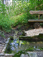
- Image / Commons : Image and link to other images from the protected area
- LSG-ID : Official number of the protected area
- WDPA-ID : Link to the World Database on Protected Areas database of the protected area
- Wikidata : Link to the Wikidata entry for the protected area
- Designation : Date of designation as a protected area
- Municipality (s) : Municipalities in which the protected area is located
- Location : geographical location
- Area : total area of the protected area in hectares
- Area share : Proportionate areas of the protected area in counties / municipalities, given in% of the total area
- Comment : Special features and comments
Except for the Position column , all columns can be sorted.
| Territory name | Image / Commons | LSG ID | WDPA ID | Wikidata | Expulsion | Parish (noun) | location | Area ha | Area share | comment
|
|---|---|---|---|---|---|---|---|---|---|---|
| Augsburg - Western forests |
 |
LSG-00417.01 | 395925 | Q59608104 | 1988 | position | 69892.76 | Augsburg (2.2%), Augsburg district (61.1%), Dillingen an der Donau district (10.0%), Günzburg district (15.7%), Unterallgäu district (10.1%), Donau- Ries (0.9%) | ||
| Hochfirst |
 |
LSG-00426.01 | 395934 | Q59608106 | 1988 | position | 605.28 | District of Unterallgäu (100%) | ||
| Illerauen north of Buxheim |
 |
LSG-00491.01 | 395999 | Q59614164 | 1995 | position | 590.72 | District of Unterallgäu (100%) | ||
| Mühlbachtal |
 |
LSG-00454.01 | 395962 | Q59608107 | 1991 | position | 684.11 | District of Unterallgäu (71%), District of Oberallgäu (29.0%) | ||
| Protection of parts of the landscape on both sides of the Iller in the districts of Legau, Maria Steinbach, Grönenbach and Kronburg |
 |
LSG-00262.01 | 395740 | Q59608102 | 1973 | position | 888.49 | District of Unterallgäu (99.9%) | ||
| Protection of parts of the landscape south and east of the Iller | LSG-00259.01 | 395737 | Q59608100 | 1973 | position | 142.87 | Memmingen (83.7%), Unterallgäu district (16.3%) | |||
| Lower Iller near Kardorf |
 |
LSG-00352.01 | 395860 | Q59608103 | 1983 | position | 65.52 | District of Unterallgäu (99.9%) | ||
| Wertachauen in the district of Unterallgäu |
 |
LSG-00460.01 | 395968 | Q59608109 | 1992 | position | 692.07 | District of Unterallgäu (100%) |
Individual evidence
- ↑ Green List of Landscape Protection Areas in Swabia , accessed on April 28, 2015.
- ↑ Green List of Landscape Protection Areas in Swabia , accessed on April 26, 2015.
Web links
Commons : Protected landscape areas in the Unterallgäu district - Collection of images, videos and audio files