List of landscape protection areas in the Berchtesgadener Land district
In the district of Berchtesgaden , there are 20 landscape conservation areas . (As of November 2018)
Notes on the information in the table
- Area name : Official designation of the protected area
- Image / Commons : Image and link to other images from the protected area
- LSG-ID : Official number of the protected area
- WDPA-ID : Link to the World Database on Protected Areas database of the protected area
- Wikidata : Link to the Wikidata entry for the protected area
- Designation : Date of designation as a protected area
- Municipality (s) : Municipalities in which the protected area is located
- Location : geographical location
- Area : total area of the protected area in hectares
- Area share : Proportionate areas of the protected area in counties / municipalities, given in% of the total area
- Comment : Special features and comments
Except for the Position column , all columns can be sorted.
| Territory name | Image / Commons | LSG ID | WDPA ID | Wikidata | Expulsion | Parish (noun) | location | Area ha | Area share | comment |
|---|---|---|---|---|---|---|---|---|---|---|
| LSG Ainringer and Peracher Moos |
 |
LSG-00487.01 | 395995 | Q59643608 | 1995 | position | 401.96 | District of Berchtesgadener Land (100%) | Ainringer moss | |
| LSG Aschau, Bischofswiesen community | LSG-00441.01 | 395949 | Q59643536 | 1989 | position | 57.2 | District of Berchtesgadener Land (100%) | |||
| LSG on the Tumpen and the Krumbichl, Marzoll municipality |
 |
LSG-00224.01 | 395702 | Q59643454 | 1971 | position | 81.23 | District of Berchtesgadener Land (99.9%) | ||
| LSG Barmstein, district Scheffau, Marktschellenberg market |
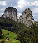 |
LSG-00347.01 | 395855 | Q59643802 | 1983 | position | 148.5 | District of Berchtesgadener Land (99.9%) | Barmsteine | |
| LSG Burgergraben, Bischofswiesen community | LSG-00348.01 | 395856 | Q59643430 | 1983 | position | 9.91 | District of Berchtesgadener Land (100%) | |||
| LSG Höglwörther See, municipality of Anger |
 |
LSG-00219.01 | 395697 | Q59651246 | 1971 | position | 123.28 | District of Berchtesgadener Land (100%) | Höglwörther See | |
| LSG Kirchholz, City of Bad Reichenhall and the municipality of Bayerisch Gmain |
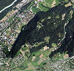 |
LSG-00394.01 | 395902 | Q59643798 | 1986 | position | 152.29 | District of Berchtesgadener Land (100%) | Kirchholz | |
| LSG Kulbinger Filz, City of Laufen |
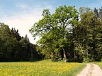 |
LSG-00349.01 | 395857 | Q59643429 | 1983 | position | 90.19 | District of Berchtesgadener Land (100%) | ||
| LSG Lattengebirge |
|
LSG-00220.01 | 395698 | Q59643675 | 1971 | position | 2946.27 | District of Berchtesgadener Land (100%) | Lattengebirge | |
| LSG Upper Saalachtal with Wendelberg and Kienberg, municipality of Schneizlreuth |
 |
LSG-00430.01 | 395938 | Q59643461 | 1989 | position | 783.7 | District of Berchtesgadener Land (100%) | Saalachtal | |
| LSG upper reaches of the Kleine Sur | LSG-00488.01 | 395996 | Q59643474 | 1995 | position | 77.2 | District of Berchtesgadener Land (100%) | |||
| LSG Ortelbach in the area of the municipality of Bayerisch Gmain | LSG-00321.01 | 395808 | Q59643567 | 1981 | position | 51.15 | District of Berchtesgadener Land (100%) | |||
| LSG Rostwald / Stanggaß |
 |
LSG-00383.01 | 395891 | Q59643654 | 1986 | position | 326.2 | District of Berchtesgadener Land (100%) | ||
| LSG Saalachauen north of Bad Reichenhall |
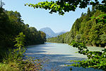 |
LSG-00226.01 | 395704 | Q59643549 | 1971 | position | 533.51 | District of Berchtesgadener Land (99.9%) | ||
| LSG Taubensee, municipality of Ramsau near Berchtesgaden |
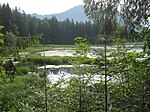 |
LSG-00346.01 | 395854 | Q59651182 | 1983 | position | 28.7 | District of Berchtesgadener Land (100%) | Pigeon lake | |
| LSG Thumsee, City of Bad Reichenhall and the municipality of Schneizlreuth |
 |
LSG-00385.01 | 395893 | Q59643840 | 1986 | position | 1074.66 | District of Berchtesgadener Land (100%) | Thumsee | |
| LSG Untersberg with outlying areas, the community of Bischofswiesen, Markt Berchtesgaden and Marktschellenberg as well as the community-free area Schellenberger Forst |
 |
LSG-00442.01 | 395950 | Q59643633 | 1989 | position | 3595.47 | District of Berchtesgadener Land (99.9%) | Untersberg | |
| Saalach-Salzachauen |
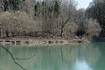 |
LSG-00497.01 | 396005 | Q59643568 | 1996 | position | 504.93 | District of Berchtesgadener Land (100%) | Saalachauen (city of Freilassing) and Saalach-Salzachauen (city of Laufen) | |
| Protection of the Abtsdorfer See and the surrounding landscape |
 |
LSG-00303.01 | 395782 | Q19964654 | 1979 | position | 551.62 | District of Berchtesgadener Land (100%) | ||
| Protection of Ulrichshögl, Ainring community |
 |
LSG-00070.01 | 395495 | Q59643464 | 1956 | position | 78.66 | District of Berchtesgadener Land (100%) |
See also
- List of nature reserves in the Berchtesgadener Land district
- List of FFH areas in the Berchtesgadener Land district
- List of geotopes in the Berchtesgadener Land district
- List of natural monuments in the Berchtesgadener Land district
Individual evidence
- ↑ Green List of Landscape Protection Areas in Upper Bavaria , accessed on May 1, 2015.
- ↑ District Office Berchtesgadener Land: Landscape protection areas in the district of Berchtesgadener Land , accessed on October 11, 2015.
Web links
Commons : Protected landscape areas in the Berchtesgadener Land district - collection of images, videos and audio files