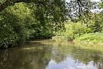
List of landscape protection areas in the city of Nuremberg
There are 19 landscape protection areas in Nuremberg (as of November 2018).
Notes on the information in the table
- Area name : Official designation of the protected area
- Image / Commons : Image and link to other images from the protected area
- LSG-ID : Official number of the protected area
- WDPA-ID : Link to the World Database on Protected Areas database of the protected area
- Wikidata : Link to the Wikidata entry for the protected area
- Designation : Date of designation as a protected area
- Municipality (s) : Municipalities in which the protected area is located
- Location : geographical location
- Area : total area of the protected area in hectares
- Area share : Proportionate areas of the protected area in counties / municipalities, given in% of the total area
- Comment : Special features and comments
Except for the Position column , all columns can be sorted.
| Territory name | Image / Commons | LSG ID | WDPA ID | Wikidata | Expulsion | Parish (noun) | location | Area ha | Area share | comment |
|---|---|---|---|---|---|---|---|---|---|---|
| Royal court |
 |
LSG-00536.01 | 396069 | Q59527015 | 2000 | position | 823.47 | Nuremberg (99.9%) | ||
| Fischbach |
 |
LSG-00536.02 | 396070 | Q59527016 | 2000 | position | 55.62 | Nuremberg (99.7%) | ||
| Worzeldorfer Berg - Glasersberg |
 |
LSG-00536.03 | 396071 | Q59527019 | 2000 | position | 57.02 | Nuremberg (99.6%) | ||
| Rednitztal - middle |
|
LSG-00536.04 | 396072 | Q59527021 | 2000 | position | 280.75 | Nuremberg (99.7%) | ||
| Pegnitztal East |
 |
LSG-00536.05 | 396073 | Q59527022 | 2000 | position | 261.16 | Nuremberg (99.9%) | ||
| Wöhrder See |
 |
LSG-00536.06 | 396074 | Q59527570 | 2000 | position | 115.22 | Nuremberg (100%) | ||
| Pegnitztal West |
 |
LSG-00536.07 | 396075 | Q59527026 | 2000 | position | 59.38 | Nuremberg (100%) | ||
| Eichenwaldgraben - Stockweiher |
 |
LSG-00536.08 | 396076 | Q59527027 | 2000 | position | 343.32 | Nuremberg (100%) | ||
| Holzheim |
|
LSG-00536.09 | 396077 | Q59527028 | 2000 | position | 79.87 | Nuremberg (99.7%) | ||
| Rednitz Valley - North | LSG-00536.10 | 396078 | Q59527030 | 2000 | position | 41.39 | Nuremberg (99.6%) | |||
| Brunn - net stall |
 |
LSG-00536.11 | 396079 | Q59527031 | 2000 | position | 310.4 | Nuremberg (99.8%) | ||
| Pearwood |
 |
LSG-00536.12 | 396080 | Q59527033 | 2000 | position | 30.4 | Nuremberg (99.4%) | ||
| Gründlachtal - east |
 |
LSG-00536.13 | 396081 | Q59527035 | 2000 | position | 352.47 | Nuremberg (99.8%) | ||
| Kraftshofer forest |
 |
LSG-00536.14 | 396082 | Q59528003 | 2000 | position | 356.56 | Nuremberg (99.3%) | ||
| Tiefgraben and Kohlbuck |
 |
LSG-00536.15 | 396083 | Q59527039 | 2000 | position | 119.61 | Nuremberg (99.9%) | ||
| Schmausenbuck |
 |
LSG-00536.16 | 396084 | Q59528120 | 2000 | position | 134.36 | Nuremberg (99.9%) | ||
| Rednitz Valley - South |
 |
LSG-00536.17 | 396085 | Q59527042 | 2000 | position | 261.97 | Nuremberg (99.7%) | ||
| Kornburg |
 |
LSG-00536.18 | 396086 | Q59527045 | 2000 | position | 265.18 | Nuremberg (99.8%) | ||
| Long water |
 |
LSG-00536.19 | 396087 | Q59527047 | 2000 | position | 460.36 | Nuremberg (99.9%) |
See also
- List of nature reserves in the city of Nuremberg
- List of protected landscape components in Nuremberg
- List of natural monuments in Nuremberg
- List of FFH areas in the city of Nuremberg
- List of geotopes in Nuremberg
- List of nature reserves in the district of Nürnberger Land
- List of landscape protection areas in the district of Nürnberger Land
- List of FFH areas in the district of Nürnberger Land
- List of protected landscape components in the district of Nürnberger Land
- List of natural monuments in the district of Nürnberger Land
- List of geotopes in the district of Nürnberger Land
Individual evidence
- ↑ Green List of Landscape Protection Areas in Middle Franconia , accessed on April 9, 2015.
- ↑ Nuremberg Environment Agency: Landscape Protection Areas , accessed on October 1, 2015.
Web links
Commons : Protected landscape areas in Nuremberg - Collection of images, videos and audio files